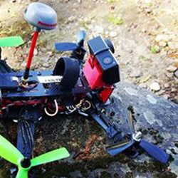
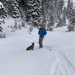
There was some flagging to mark the early part of the trail. This track begins where the flagging ends. Lots of bushwhacking. Without Gaia it’s impossible...pretty area though
★
★


This was a great hike w Kate and Kayleen. Some flowers and we were in and out of the sun.
★
★
★
★


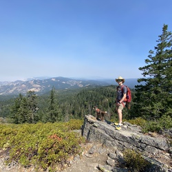
From Sherrard Point it’s downhill so it’s uphill on the way back. If you’re lucky great views from the Point. Flowers were good but not a lot. Notice trails which cross the loop. If you go on the wrong one you can end up at Multnomah Falls.
★
★
★

Lots of different wildflowers, great views of falls from above and below. Easy hike. Most elevation on spur to elowah.
★
★
★
★

This trail is and has been closed. Sad to see GaiaGPS not living up to their responsibility of safety.
★

Snowshoe trail approx. 5 miles with additional spur. Good viewpoints of Mt. Hood and relatively mild elevation gain
★
★
★
★


Mazama hike from Multnomah parking to Wahkeena falls trail to angels rest trail to devils fork to she‘s devil to devils rest and back looping to Multnomah falls
★
★
★
★
★

Probably my last hike in mt hood meadows before the snow. Fun to walk the slopes. Started up top just past the lodge and ended at umbrella falls into parking lot with gorgeous view of Hood.
★
★
★
★
Probably my last hike in mt hood meadows before the snow. Fun to walk the slopes. Started up top just past the lodge and ended at umbrella falls into parking lot with gorgeous view of Hood.
★
★
★
★

Epic day. Rode bikes with pack, skis, poles, and boots up to Cloud Cap. Then donned skins and headed up the Snow Dome. Ski down back to Cloud Cap, the. Rode back to car for a beer and drive back to Portland. Total time was over 10 hours.
★
★
★
★
★

Road hike through burn area to devils overlook back to Franklin Ridge(?) all burn area. Down to Multnomah creek, hike up on larch trail, bridge out on creek!!! Long trek across talus slope. Beautiful old growth once up on Larch trail.
★
★
★
Tunnel falls. While not challenging it is long with constant up and down with consistent elevation gain/decline.
★
★
★
★
★

Cute little hike. Really appreciated that it was right off the CAT (Columbia Area Transit) bus line. There weren’t many people, we were the only people at the waterfall! There was a campsite close too. Would def do again as a quick one close to town!
★
★
★
★

Amazing views at every turn. Truly a magical place. 10 out of 10, minus the uphill but it’s worth it
★
★
★
★
★
Wildflowers at every turn and Mt. Hood in the background. Saw the sunset and sunrise. Everything was perfect. Minus forgetting to pack my tent poles. Wont make that mistake again. But it somehow became one of my favorite parts of the trip. Sleeping under the stars in my tent with no poles was close to perfect
★
★
★
★
★

Excellent short hike with wonderful views at the summit. Tree cover for everything but the top 100ft. Steep on the western side, but passable and solid. Well constructed trail
★
★
★
★

Water crossings, road wash-outs, great views, good hardpack, baby heads, large ruts, paved twisties, etc…
★
★
★
★
★

This is an incredibly special trail with perhaps the best views I’ve ever seen in 8 years of hiking around Mt Hood. The final 2 miles make the challenging lead-up more than worth it.
But be warned the trail is in bad shape when breaking off the main trail shortly after Ramona Falls. Dozens of downed trees and sections of the trail that have been damaged/ destroyed.
The best spot for water before camp sites is a stream to the right as you hike up - shortly after a stagnant pond on the left. The stream’s water taste amazing (after filtering) and is a delightfully cool temperature. It’s still several miles from camp spots, so be prepared to fill and carry 4+ liters from the creek as you likely won’t get another water source until you come back down to that stream.
All-in-all, this is an amazing and grueling hike that requires some planning to avoid injury or dehydration. Well worth it
It would be 5 stars with just a bit more trail maintenance
★
★
★
★

Great views of the mtn, flowering meadows galore, lots of water but nothing hard to cross. This is an easy out and back for a dayhike or overnight with pretty easy gradients. The only bit of challenge is the ascent from Zigzag cyn eastbound if you’re in mediocre shape.
★
★
★
★
★

One of my favorite hikes. The portion of the hike near Multnomah falls is often crowded.
★
★
★
★

Hiking the Bagby Trail south, past Bagby Hot Springs, and into the Bull of the Woods Wilderness. Then past Shower Creek Falls about a mile to Peggy Creek.
★
★
★
★
★

Fantastic skin and ski above the Palmer chair. Who knew we would spring ski conditions in February!? Time for more winter!
★
★
★
★
★

Great skate skiing at Tcup Nordic. Excellent grooming and very fast snow.
★
★
★
★
★
I think this is such a great River hike. It feels like a mountain hike, once you get past the falls, you are immersed in this gorge and it’s quiet. No one else is there either! There is no burn in the higher parts either! The trail has a few minor stream crossings and some downed trees. Loved it! Want to come back!
★
★
★
★
★

 stars
stars
Stunning sunset from our Dollar Lake camp. Beautiful early fall hike.
★
★
★
★
★
stars
Unfortunately, just not a very interesting hike. The lookout is interesting but can be reached via a closer TH.
We encountered a sketchy person talking/yelling at himself near the trailhead upon our return. He slunk away when he saw us. No idea how he got there, no car. Often target shooting sounds nearby.
★
★
★
stars
Completed this hike as a loop along School Canyon, Little Badger, Tygh Creek cutoff and Tygh Creek trails. Great mid-October hike larch and big-leaf maples.
★
★
★
★
★

Great hike not really for kids. Long beautiful and worth it!!
★
★
★
★
★
Difficult due to the large altitude gain of almost 4K feet, but otherwise well doable. Scenic from top although views are not great on this hike as too obstructed all the way through
★
★
★
★

Very hazy/smoky and windy so I turned back just above the shelter. Ash leaves have beautiful fall colors.
★
★
★
★
★


Gorgeous understory with paintbrush, aster, and huckleberries and other wildflowers blooming even this late in August! Best part was going back and forth from woods into open meadows with vistas along the Umbrella Falls trail. The Sahale Falls trail was less scenic, more rooty and difficult to walk in a gully for much of the way.
★
★
★
★
★

Convenient to Portland with easy access. Popular route with lots of people. Well maintained and shady.
★
★
★
Convenient to Portland with easy access. Popular route with lots of people. Well maintained and shady.
★
★
★
Convenient to Portland with easy access. Popular route with lots of people. Well maintained and shady.
★
★
★
Convenient to Portland with easy access. Popular route with lots of people. Well maintained and shady.
★
★
★


We had a great hike. It was beautiful and lush. Oh and don’t forget the cold babbling creeks they were AMAZING! We loved every minute of and also loved the changing scenery. We loved the green. So over all we had a pretty great time.
★
★
★
★


It’s a difficult hike and the trail is pretty tough in places. Once you get past the waterfalls the crowds thin out. Following the streams you steadily rise 4000 ft in 6.7 miles. We stopped 2 miles short of the summit for the time.
★
★
★
★


Fantastic trail. Very entertaining and beautiful even with the Burn. You can actually see the rock formations that the trees had hidden. Highly recommended. Lots of wildflowers & waterfalls. Still snow patchs and waters running high. Sturdy shoes w/ankle support for the rocky patches.
★
★
★
★
★

Just finished a ski tour of Tom Dick and Harry Mountain south of Hood. Lots of fresh wet snow out there. By the time we got to the top it looked like we both had taken a swim with all the snow being knocked off the trees. Although the avy forecast was “green” at lower elevations, all the hazards were concentrated on the main drop-in points to the bowl (wind loaded slopes, fresh snow, cornices, very large rollerballs) so we continued over the ridge and skied down into the Ski Bowl resort. Saw a few other folks out there who did the same.
★
★
★
★
★

Nice gradual hike with beautiful views of snow covered trees and hills in the gorge. Plenty of parking at the trailhead.
★
★
★
★

Nice trail from the White River parking lot to the Timberline Lodge. It was cloudy and raining, will have to try it on a better weather day!
★
★
★
★
★


Beautiful hike with bright fall colors. 10 in lot
at 9am. 23 in lot that holds 12 at 3:00. Very busy trail. Went left at lollipop where there is plenty of water to filter Then onto McNiel shelter and retracted trail to avoid scrambling. I recommend going on the north side of Bald hill on the outbound and south side returning because the light will allow much better photos
★
★
★
★
★


road to get to camp pretty rough. pot holes and rock. 1 hr 10Mile drive from hwy
wonderful views. make tie-in rock your destination. up on ridge. can almost see at switch backs. hike they say is difficult. not really. as long as your legs are in shape
probably have to wait mid summer for road closure to open. 2 dry pay camps near trail heads
★
★
★
★
★

No trees left. Slippery and steep in mud. If anything cross bridge and hike wacauna viewpoint :/. Sad
★
★

Not for first timers! This hike can be extremely difficult. Many river and creek crossings that are be dangerous. The views are indescribable, pure beauty. This hike is the one I am most proud of to date.
★
★
★
★
★

Beautiful time of year with sweeping views and little to no smoke. Last 9 miles of road are bad and get worse as you go. I have 8in clearance and that was great. 12 cars at trailhead at 1pm.
★
★
★
★
★
A few improvements sense my last visit. Brought the wife this time. An enjoyable afternoon.
★
★
★
★


Rough road going to the lake. The road along Still Creek was great for a Forrest road.
★
★
★

Gradual ascent to great views of N side Mt Hood. Kind of the perfect hike. Started late which put us in fully exposed area at heat of day on first day of heat wave. Only made it 3mi in before had to turn around. Dog was really struggling in the heat. Otherwise, great hike.
★
★
★
★
★


There were TONS of people here. The amount cars parked on either side of the trailhead was kind of unbelievable.
Most people were friendly. One antisocial person was smoking a cigarette on the trail (boo). Someone else left a #2 and TP off a side trail (don’t do that!).
It was quite hot and dry and there were a million flies.
Overall, I enjoyed it, especially the view of Hood from Bald Mountain, but I might suggest avoiding summer weekends, especially on sunny days.
★
★
★
★
Very good spot to spend 1 night on dispersed area with 1 obstacle for high clearance and at least AWD.
Next to Barlow creek but not much to do around. Just a quiet place to enjoy and have a break.
Lots of shade on camping site.
There’s a little area clear enough to deploy a Starlink antena. Prepare for a solid 70 ft distance from campsite.
★
★
★
★
★

Great training hike, not to much elevation gain but enough to get the blood pumping. In and out for an overnighter.
★
★
★
★

**TRAIL CLOSED UNTIL FURTHER NOTICE**
You can walk along the gorge 400 trail all the way up to the ascent of munra, but right once you get to the trail it will show a trail closed sign
★


Absolutely fantastic! So characteristic of the Pacific NW!
★
★
★
★
★
stars
Hiked at the end of April up to Twister Falls. Beautiful hike. Waterfalls were raging from recent rain and snow melt. Early flowers in bloom.
★
★
★
★
★

The trail has many charred trees, sporadic down trees & snow about about 2,500 feet as of 4/22/23. Post holed above 3,000 but was able to summit. Experienced rockfall at about 2,000 feet on the way down. They hurled down the hillside and probably fell 1,000 feet. One microwave size rock & one that was slightly larger than a basketball. We missed them by about 30 seconds on the trail. There was evidence of other recent rock slides as well. Saw only one other small group on the trail. Nice views of the gorge on the way down.
★
★
★

Fairly intense climb and descent. Saw several inches of snow, proud of the view from devils rest. Angels rest view is much larger with zero snow.
★
★
★
★
★
One of my favorite trails in the gorge. Easy to get to, accesible year-round, with beautiful views at the top, and just the right distance and elevation gain for a moderate-level hike. It is long enough to feel like a good workout; short enough to casually do on a Sunday morning and still have a whole day ahead of you.
Best time to hike is in late fall / winter, as in the summertime it can get very busy.
★
★
★
★
★

Hiked on Sunday 2/12/23. Beautiful views on this popular hike on a windless bluebird morning. Most of the North facing trails still frozen but starting to melt after 10:00 AM. No serious ice like some of the trails (Multnomah Falls) close to water the prior weekend. Best to hike early as now the weekend traffic on this and other trails is fairly busy by 10:00 AM.
★
★
★
★

Somewhat crowded. The main road to the campground is the hike. Plenty of spur trails leading into the woods. Lake was frozen and was pretty cool to see. Well groomed trail.
★
★
★

Pleasant ski up the Cloud Cap Road to a good view and lunch spot at Inspiration Point (which is really just a switchback on the road). The return uses a delightful trail through the woods instead of the road.
★
★
★
★
★

This is a popular area for sledders, but there was literally no one in the XC trail! It was amazing, would love to do again!!
★
★
★
★
★
Timberline Trail around Mt. Hood with Matt Mason. Paradise on earth.
★
★
★
★
★
It’s always surprising how wild this loop feels, even though it’s so close to town. A good start-of-season ski.
★
★
★
★
A good safe workout. However is was very firm.almost ice. About an hour drive from the VRBO in Lyle. Kanyon, Sara, Amber and i skinned to the top of Palmer lift and skied back down. Laurie and Brooke and the dogs walked around in microspiks. Toured the timberland lodge. And we went to the Mt Hood brewery and had very good pizza. Great d’y
★
★


Complete waste of time to hike from Elk Meadow trailhead to the parking lot and bridge at Sahalie Falls. Save your time for a hike that will take you to a place you can’t drive to.
★

A great loop that takes you through a variety of landscape and skill levels. Not sure how anyone can rate this hike one star - there are a few - maybe wanting a Disneyland experience but didn’t get it.
★
★
★
★
★

Some BIG trees to look at. In burn recovery mode. View point at Devil’s Rest is …. lacking. Water falls and creeks are beautiful. Has one of the steepest walled canyons I’ve been in.
★
★
★
★
Spectacular views. All uphill at start, but switchbacks were somewhat gradual and in the woods on soft ground.
★
★
★
★
★
As always, Mt. Defiance delivers. Wonderful hike up defiance down starvation.
★
★
★
★
★

A classic Mt. Hood hike. I started from the McGhee Creek trailhead (much less crowded than Top Spur). The trail is pretty overgrown until it meets up with the Timberline Trail 1.7 miles in but no problem following it. I chose to go up the more direct "McNeil Point Scramble Trail" to the shelter. That cuts off about 1.5 miles but it's called a scramble for a reason. It is steep and exposed in a couple spots. I definitely wouldn't want to go down the scramble trail, so I didn't. I took the conventional route down making a loop out to the north by Gilsan Creek. The wildflowers were still in full bloom and I sat by the creek amongst the flowers for lunch. A beautiful hike.
★
★
★
★
★

Great hike up to Pony tail falls because you get to go behind the falls, but the remaining part to Triple Falls was brutal on a hot day because all the tree cover had burned away as a result of the fire. Sad because I used to love all of this trail.
★
★
★

Such a great hike. Tunnel falls is a great turn around. Stop at the spot by the middle bridge and take a dip. Hike back and take a dip in Punchbowl. Great on hot day.
★
★
★
★

Today was overcast and cool after a string of hot days. The wild flowers were beautiful and the greens were excellent. Dusty as one would expect.
A perfect day for so many reasons
★
★
★
★
★

Not too hard, lots of shade, lake w comfortable water temp and stunning view of mt hood.
★
★
★
★
★

So much diversity in 10 miles, up river canyons, along shear dry sandy, grassy, lush & varied treed ridges. Wildflowers, meadows and waterfalls galore. And wonderfully different epic views of Mt Hood and areas East.
★
★
★
★
★

We hiked to Ho Rock as part of our day from Lolo Pass trailhead. I definitely wouldn’t call the section easy, though it’s not very long it is quite steep with some slick sandy areas. Definitely not for someone with vertigo! Great views though!
★
★
★
★

Long but not extremely difficult. The way back to the parking was actually the most strenuous given how long it is. Nice varied scenery.
★
★
★
★

Did this as part of the Timberline Trail previously and wanted to see it again. The only real challenge was the river crossing. Beautiful.
★
★
★
★
★

Absolutely loved this hike! Our new favorite. Perfectly challenging, beautiful start to finish. Loved it!
★
★
★
★
★

This is a quick and easy hike to
Do with great views of 5 mountains. It couples well with a weekend stay a Wahtum lake campground and a swim in the lake after.
★
★
★
★
★

A few good views of the mountains, with Mt. Hood esp. prominent along with Jefferson, St. Helens, Rainier and Adams, and abundant and varied wildflowers. Unfortunately, dozens of deadfall to maneuver over/under/around, plus long stretches of heavy brush, took away much of the enjoyment. High degree of solitude, though - we didn’t see any other hikers despite it being a beautiful sunny Saturday.
★
★
Tough but beautiful hike! Went counter clockwise. Overgrown on miles 2-3. Steep ledges with drop offs in certain areas, but not too precarious overall. Completed in just over 2 hours. Highly recommend!
★
★
★
★
★

Great hike, not very busy for July (only encountered 2 parties on my way back and none on the way in). The further in you go the worse trail maintenance gets. At some points it’s impassable without without scrambling over some very large felled trees.
If you want to summit The Pinnacle, I high recommend approaching from the south. There’s no trail leading up to it so it’s a hard slog over fields of rock shale and dense rotting or rotted trees. The north approach is the most direct but 50-75 ft from the summit it’s almost a straight vertica climb up volcanic rock. From the south it’s much more gradual, though the inclines still far exceed 45 degrees. Then the final 20 is a scramble over some boulders.
Amazing views from the top though.
★
★
★
★

Frog butte has good views of mount hood we were only ones on trail during Friday
★
★
★
★

Straight up. Straight down. Pass by a small waterfall early on the hike. Thimble berries in July. Great view from the top.
★
★
★
★

Wow there is some beautiful sections of trail but there were a lot of blowdowns. Badger Lake is beautiful too.
★
★
★
★

Amazing hike and views! Google may try and navigate you to get on FS 20 but the bridge is closed that connects it to Still Creek Road.
★
★
★
★
★

Trail was recently maintained and the area was open from a fire. Easy incline with a good waterfall at the end.
★
★
★
★

Beautiful hike through old growth forest, quiet. Views of Mt Hood are screened by trees even at the top
★
★
★
★
★

The trailhead is across the road from the bathroom. The trail to the falls was very easy, although there are some fallen trees and at the beginning you need to cross a small stream. If you have any mobility issues it may make it a bit harder.
The falls was very beautiful but if you want to get down to them it is VERY steep.
★
★
★

Busy but easy and beautiful trail (even midweek). Boardwalk on W side of Mirror Lake is still under water; it’s passable if you are willing to remove your shoe’s and socks and wade.
Note that the trsilhead is now adjacent to SkiBowl.
★
★
★
★
★
stars
Beautiful forest hike along well maintained and gradually ascending trail. The highlight are the views from the summit, south to Mt Jefferson and Sisters and north to Mt Rainier, Adams and St Helens.
★
★
★
★


Beautiful waterfalls down low, large burnt area, choss rail up top with lots of snow- about a mile to the top. 5k in 5 miles
★
★
★
★
★
Casey creek portion of the hike was on no trail and a lot of blown down trees. I think this trail was not beaten in 5 years since the fire from 2017… and hour descent was done in 3 hours :-)
★
★
★
★
★
Can be easy if you take your time and traverse rather than take fall line or stick strictly to the trail finding stream crossing can be difficult
★
★
★
★


Don’t do the loop, as it goes through ski bowl not next to it. Beautiful hike up to the peak though. You need gps, micro spikes, and poles.
★
★
★
★
★


Not too long of a slog to some really good spring conditions today
★
★
★
★

Beautiful day clear skies on the east side of the mountain when it was drizzly and gray on the west side. Totally worth snow showing up along Newton Creek where there’s a couple of great views
★
★
★
★
★
This is a great snowshoe trek requiring some off trail navigation skills to get to a great Mt Hood view on a clear day.
★
★
★
★
★

Nice 6.2 mile ski & snowshoe loop (not groomed/tracked) with opportunities to explore further. Beautiful views of Mt Hood in a few spots and pretty Pocket Creek to keep you company.
★
★
★
★


nice waterfall. people are allowed to swim. nothing amazing
★
★
really beautiful hike, was very long and sunny but worth seeing the waterfall at the end. it was nice to use our filter and drink some clean glacier water. was an overall really fun and beautiful experience.
★
★
★
★
★

I’ve done numerous hikes in the gorge, southern WA and Portland area and I thought this trail was one of the best.
★
★
★
★
★


Did the route counter clockwise to get steep section done first. Trail to steep section is unmarked and would be hard to follow without GPS. Encounter snow on steep section up to McNeil Point and halfway down going back to trailhead. Did not go to Ho rock because of snow. Saw a Bear track in snow on the down.Great views. This will definitely be one of my repeat hikes.
★
★
★
★
Beautiful hike. Did the loop counter clockwise to get the really steep section done. The trail to steep section is unmarked and without GPS would be hard to follow. The rest of the trail is good. Snow starting on rocky section to McNeil Point and halfway down returning to TH. Did not go up to Ho Rock because of snow. Will definitely be redoing this hike.
★
★
★
★
stars
Hiked this from the Zigzag Trailhead, north to the Dog River crossing. Great fall hike! Hiked on a weekday, so only saw two mountain bikers.
★
★
★
★
stars
Crystal clear day brought amazing views of the surrounding mountains, including Mt Jefferson to the south. We day hiked on Friday and the parking lot was nearly full when we left with backpackers heading to Burnt Lake for the weekend, even in late Sept.
★
★
★
★
★


The iconic views out over the lake toward Mt Hood are part of our currency. In so many ways. This is a super easy yet strikingly beautiful hike that are suitable for a wide variety of hikers.
★
★
★
★
★

Complete Timberline route imported from HikingGuy.Com gpx file. Actual total elevation however is ~10k feet, not 15k as listed on the route data… not sure where the 5k difference came from. Total loop in 42 miles, not 40. This file includes the necessary reroutes from the 2020 Labor Day storm (which are not very obviously marked on trail signage).
★
★
★
★
★
Beautiful old growth forest by Salmon River. Kinzel lake is a jewel clean water but not one you can get in… soft muddy, marshy type lake but if you backpack you can get clean water from it.
We did this hike at the end of a dry summer - I will definitely do it again once the rain starts.
★
★
★
★
★

This hike was beautiful! It had everything I look for in a hike. It had beautiful views of Mt Hood and the waterfall. It also had nice forest on the way back from the loop with nice water sources. We even saw a fish swimming in the creek. The water crossing was not bad at all either.
★
★
★
★
★

This is a great hike! Very scenic the whole way and tons of nature. The ascent is gradual and easy. The waterfall is beautiful and well worth the trek.
★
★
★
★
★


Though short, this is a great hike through a very old second-growth forest, ending in a ridge with magnificent rock towers. A catwalk "trail" across two parallel ridges is the frosting on the cake. The first ridge encountered is good, but don't miss the second ridge, reached via a side trail at the upper part of the first ridge.
The trail continues a couple hundred feet farther north but soon becomes a rock scramble.
Gaia rates this as "easy" due to distance and elevation gained but it's a bit more that that.
★
★
★
★
★

Great hike. Be mindful of the water crossing at Newton Creek. The mosquitos and flies were plentiful around Elk Meadow.
★
★
★
★
★

The toughest part was the first mile- good elevation gain- but not bad! Very pleasant, with wild berries and waterfalls everywhere. One of my favorites!
★
★
★
★
★

My partner and I hiked this loop the weekend of July 9/10/11. 2 nights.
Highlights:
- So many huckleberries, red and oval-leafed!
- Old growth.
- Owl sighting, either northern spotted or barred owl.
- Solitude, solitude, solitude.
- Cool, shaded temperatures along Eagle Creek.
Route:
Hiked in Friday evening from South Harvey TH along Eagle Creek trail #501, found several nice impacted sites along the creek beginning ~2 miles in. The early miles along Eagle Creek were our favorite of the entire loop.
Saturday, hiked from Eagle Creek via Eagle Creek Cutoff/Old Baldy/Plaza trails to directly south of Cheeney Creek, gaining lots of elevation to climb out of Eagle Creek. Big day ~ 13 miles, and Eagle Creek Cutoff and much of the trails a mile or two away from trailheads haven't received much maintenance in a while. Lots of downed trees and overgrown vegetation. Also, once we left Eagle Creek, the only reliable water sources we found were the spring feeding Plaza Creek and another feeder spring into Cheeney Creek, which isn't marked on Gaia but there's a trail marker and a small social trail leading to a clear pool of water. We had carried a drom expecting to dry camp.
Sunday, hiked from our camp south of Cheeney Creek back to South Harvey TH via Douglas Trail, stopping at Wildcat Mountain and the several viewpoints along the way. Ran into two day hikers near the Douglas TH. Other than that, we pretty much had the place to ourselves.
Not sure we'd do it again. But the sites and old-growth along Eagle Creek were worth it. Such a gem.
★
★
★
 stars
stars
Views of Mt Hood at the top are fantastic! It is a very busy hike to Mirror Lake, but once you get past the lake, there isn't as many people. Get to the trailhead early! The parking lot fills quickly.
★
★
★
★
★
stars
Trail is in pretty good condition. Green Canyon is a bit of a grind getting up to the top. Some blowdown to hop over and under at times. Devil's Lookout makes for a good lunch spot. We continued to the lake and ended up camping near Kinzel Creek. The Rhodies were spectacular as well as good showings of beargrass. Salmon River Trail was in great shape and had lots of open campspots for backpacking.
★
★
★
★
★

Amazing waterfall loop! Heavy traffic nearer to start and finish. Much less after a mile or so at either end. Incredible wildflowers at the time we went.
★
★
★
★
★

This was a difficult hike but great for not seeing many other people and getting in shape. The bear grass was stunning and Warren Lake was beautiful .
★
★
★
★
★

A bit busy at beginning and end so start early! Top section beautiful with flowers in early June.
★
★
★
★

Just a touch of snow at the top of the route. Shooting Stars out on High Prairie.
★
★
★
★
Nice old growth could do loop but this was the best part actually went a bit further but did not turn on tracking until part way back
★
★
★
★

Hike is easy, the waterfall at the end is great. And you can stand right under the waterfall to feel the water falling on your head
★
★
★
★
★

Track from the 424-425 junction high in Oneonta Canyon, down to Triple Falls. Lots of brush and down timber. One area needing drainage. One 50 yard section which has slid almost into the creek will need a lot of imaginative wirk
★
★
★
★
★


I usually do an easy hike along the tail end of the sandy river. Usually see lots of wild life and there are many trails to hike
★
★
★
★

Had to stay on low angle, explored into the woods, a bit touch and go for enough angle to move.
★
★
★
 stars
stars
This was an excellent cross country ski in delightful snow conditions. Note that there is a short section of off trail travel in the last 1/4 of the GPS track. I believe this is marshy ground in the summer.
★
★
★
★
Great hike. Great view. Super crowded with like <40% of people actually wearing masks. And on top of that, someone broke in to a bunch of the cars at the trailhead while we were there. Glass everywhere. Some people suck.
★
★
★
★

This gorge hike has it all! Decent views, forest, creek crossing, waterfalls and cool rock formations at the end. Gentle grade and a delightful hike
★
★
★
★

Skied from the Bennett Pass trailhead almost to Windy Pass. Great drifts and cornices nice 4 inches of snow and whoop ty do drifts in a number of places.
★
★
★
★
★
Great snowshoeing. Beautiful views of Mt. Hood. On clear days great views looking north toward mounts Adams, Rainier, and St. Helens.
★
★
★
★
★

A great alternative to Teacup Lake Snow Park, four high quality cross country skiing. Well groomed trails, good variety and easy parking!
★
★
★
★
★

This is one short and beautiful snow shoe to do. I love the bridges and the the frozen falls in the end.
★
★
★
★
★

If you’re going past the look out, bring snowshoes. We also had the dogs and they weren’t very happy about post-holing. Stopped on top of Dick and returned. Lol we’ll be back snowshoes and no dogs! 😛
★
★
★
★

We went out and back for a total of 3.2 miles. You could have gone a lot further. Shortly into the hike you could decide level of difficulty: easy or more difficult. We chose easy. We saw no other hikers. We saw 3 people on mountain bikes. We crossed 2 streams over well built bridges. There is a bathroom at the trailhead. Great hike.
★
★
★
★
★

 stars
stars
Nice loop hike to a lake. Only able to have views of Mount Hood on the initial climb.
★
★
★


This is a pretty cool hike good elevation pretty consistent. Not a lot of people once you get up to Palmer base. And you can go pretty high up as long as the winds aren’t that strong. Just pay attention to the weather because it changes by the second.
★
★
★
★
★


Challenging stream crossings at Eliot and Coe branches, and long stretches of switchbacks getting to them, balanced out by amazing views of Mt Adams, St. Helens and Rainier.
★
★
★
★

A beautiful hike during the summer months. Trails are usually busy but not so much that it impedes progress. Some downed trees over the trail in certain sections but nothing impassible
★
★
★
★
★

Really pretty trail through the woods. Umbrella Falls are beautiful. Tried to hike to Elk Meadow but too tricky to cross the river.
★
★
★
★

This hike was great but often hard to recognize where the trail was. A few logs to climb over and walk across to cross the rushing waters.
★
★
★
stars
Backpacked this loop at the end of July. Flowers were in bloom and sunset views amazing.
★
★
★
★
★
Janet and Beau hiked on Labor Day. Beautiful as usual. Old Growth is spectacular.
★
★
★
★
★

Great trail and views. Running water in Zigzag River in early September. Was just a bit crowded.
★
★
★
★
Beautiful hike make sure to check out the cabin great views of Jefferson even on a Smokey day
★
★
★
★
★


Trail was very well maintained, a nice stroll through the forest until you climb up to the lookout. We had fire smoke so didn’t get a view of Jefferson.
★
★
★
★

Mid August most of the flowers have withered in the heat, but not all! The trail is not without great variety to see in the tree and shrub species and there are many boggy or creek crossings that are cool and refreshing. The real reason for hiking at this time is for the huckleberries and wild blueberries which are abundant and delicious.
★
★
★
★
Very easy river crossing. There’s a log with another log for hand rails. Come back on the PCT side to avoid the only “climb” of the hike if you don’t mind the downhill. Otherwise it’s a very easy hike.
★
★
★
★
★


This was a pretty mellow and nice hike. Only drawback was it was really crowded.
★
★
★
Hiked on 8/8/20. Trailhead still closed. Started from Wyeth street. Gravel forest road. Then Off to the right, is a path that will get you to the trail. From car to split of loop is about 1.5miles or so. Clocked about 11 (23,000 steps anyway lol) miles RT. Did a lot of “lookouts”. I did the little peak and also climbed to the top of Indian point. Just be careful. Went right at the split. Took me 3.5hrs to get to “top”, including the 3100 peak. Could t get through the deadman part of loop. Trail is overgrown. But way overgrown there. Pretty views. The route back down was way less steep. Or more gradual anyway. Ran back to car. Took me an hour. Only saw 1 other person.
★
★
★

Wonderful hike in the forest of Mount Hood, with a beautiful view across at the mountain and the reservoir down below. As you like along the top of the ridge in July/August, the forest has been thinned and there’s a plethora of huckleberry bushes, ripe for the picking. Enjoy!
★
★
★
★

Just linked some features together on the east side of Mt Hood. Wanted to do Cooper Spur in addition, but I was pressed for time. The wildflowers are beautiful right now, would recommend hitting it early, there’s no shade on the Timberline Trail as you can expect.
★
★
★
★

Since you are parking where everyone else is going to bald mountain, it is extra great to be alone on this trail. Beautiful views of hood along the ridge line and cool breezes in the shade of the forest.
★
★
★
★


Amazing hike with rewarding views of Mt. Hood. Nice trail with some blow down causing some issues. But very easy to navigate around them. Wild flowers all over making for some beautiful pictures. Just a little bit of snow to cross if heading all the way up the Mississippi head wall, well worth the climb. A hike to be placed on your to do list!
★
★
★
★
★

Great hike. Rough trail. Best view around. Highest point between Hood and Jefferson.
★
★
★
★
Sherard point is probably the single best view point for pacific NW mountain viewing. This was a good, clear day and all mountain including Jefferson, Hood, Adams, Rainier and St.Helens were clear and beautiful.
★
★
★
★
★

Kid friendly, Ezra only fell once 100m from finish :) no bugs and amazing views of hood
★
★
★
★
★

This hike was lovely and the falls were gorgeous, but the falls is definitely not a place for solitude in the summer - even on a Monday we passed a TON of people. It was hard to find a place to relax at the falls there were so many people. We lasted about 5 minutes before deciding to call it.
Only about half wear wearing masks during COVID and some didn’t even step to the side of the (narrow in places) trail.
Overall, it was nice and we will totally try this one again in fall when the crowds dissipate.
★
★
★
★
★
This hike was lovely and the falls were gorgeous, but the falls is definitely not a place for solitude in the summer - even on a Monday we passed a TON of people. It was hard to find a place to relax at the falls there were so many people. We lasted about 5 minutes before deciding to call it.
Only about half wear wearing masks during COVID and some didn’t even step to the side of the (narrow in places) trail.
Overall, it was nice and we will totally try this one again in fall when the crowds dissipate.
★
★
★
Beautiful, butt kicker hike with lovely views of Mt. Hood. Wasn’t too busy for a Saturday. A few blown down trees to navigate, but not bad at all. The trail is narrow in some spots, so it was nice to see most people covering up their faces when passing by. Road 20 is closed. Take Still Creek Rd instead. Happy hiking!
★
★
★
★
★
 stars
stars
This is one of those trails offering incredible views for a moderate effort. Because of the new trailhead located near Ski Bowl. This hike can now be more easily done as a loop. A counterclockwise direction seems to be more interesting because hikers achieve Mirror Lake and its glorious views within the first two miles of the hike. From Mirror Lake the trail continues about 1.5 miles to a "summit" that affords amazing views to the north - Mt. Hood and Mt. Adams and to the south - Mt. Jefferson. Continuing eastward another half mile along the summit ridge, hikers ascend the final few steps to the true summit of Tom Dick Harry. At this point, hikers can retrace their steps or continue the loop down into the Mt. Hood Ski Bowl and then back to the trailhead and parking lot.
★
★
★
★
stars
The Yocum Falls trailhead has now been abandoned with a new trailhead and parking located a few hundred yards east near the Ski Bowl parking lot. From this new trailhead the trail ascends gently on a new, well-graded trail joining the existing Mirror Lake trail a half mile below Mirror Lake. A trail circumnavigates the lake and there are several scenic areas for a stop or picnic. At the west side of the Lake is the continuation of the trail which continues steadily upward for 1.5 miles to a spectacular rocky perch affording amazing views of nearby Mt Hood as well as more distant Mt. Adams to the north. To the south is the alp like summit of Mt. Jefferson.
★
★
★
★


Started at parking lot and came 9.5 miles so we are close to falls, but at great campsite. We were hiking in the clouds for a few hours so we couldn’t see Mt Hood, but absolutely beautiful scenery. The water crossings were easier than many suggest. Yes, you need to be careful at one, but look around and you’ll find a spot. Camp site is stunning. We went to the second one out of the three areas and it is closer to river. I could see in high water times that it could be swampy though. Excellent hike, glad we came!
★
★
★
★
★
stars
A strenuous hike due to route finding and cross country bushwhacking from Barlow Butte to the Barlow Road. The trail along the ridge is often lost in blow down and completely indiscernible on the descent.
Barlow road walk back was pleasant, only one vehicle passed us and nice forest.
★
★
★
★

Steep! Your quads may be sore. Took green canyon to hunchback then over to devils peak, just a bit under 11 miles. In late June there was a small amount of running water you cross on hunchback trail. I took 2 liters and was fine. A little grown over on portions of hunchback but green canyon was mostly clear. 1-2 blow downs but nothing crazy. I’d recommend everyone do this trail once, it’s punishing though so I may not repeat it unless I’m in the mood for a training hike.
★
★
★
★
An absolutely amazing hike. The falls, river, mountain truly showed their beauty. Went as far as we could due to crummy conditions. Just shy of making it all the way. Would highly recommend to anyone looking for a hike to challenge themselves with miles. Elevation gain was not bad all. Beware of numerous fallen trees in the path. Some junction signs are in need of replacement and could be deceptive to hikers not familiar with the are.
★
★
★
★
We had to park near the road as the entrance to the campground was closed, which was no biggie. It’s a short jaunt to the trail. The trail begins near the outhouses. This was our first time hiking this portion of the Clackamas River. It didn’t disappoint. It’s a very rich area. Lots of old growth firs and cedars. We saw a huge salamander, a beautiful lily, blooming rhododendrons and lots of other cool things. The hike follows the river and has beautiful views and soothing sounds. We didn’t see many people, but it was drizzly and not real warm, which may have kept some folks away. We started at Rainbow Campground and went to Riverside Campground. This was an out and back hike..
★
★
★
★
★
Isolated. Reasonable grade for climbing. Ultimately views of both sides. On a clear day, I could see everything from Mount Jefferson to Mount Adams, Mount Hood to Mount Saint Helens.
The high Prairie Meadow at the top is filled with tiny wildflowers. Shooting stars and other tiny varieties.
The descent has pretty good flow.
★
★
★
★
★

This is a hike from the Herman Creek TH to the Dry Creek Falls via Herman Creek Trail, Herman Creek Bridge Trail, and PCT. Overall, the trails were in good conditions with some overgrown vegetation in a few spots. Not much views on the hike. The Dry Creek Falls were nice with a lot of water going over the top.
★
★
★
 stars
stars
This was a beautiful hike in mid June. The rhodies were in full bloom and very showy. The Pioneer Bridal trail is flat and in pretty good shape. From Tolgate Trailhead to Still Creek campground had some of the best rhodies pink blossoms I've seen in awhile. The forest was lush and with so many kinds of green! Gorgeous hike.
★
★
★
★

A hike with rewarding views. Enjoyed this one on a Wednesday & only saw 3 other people. Great view of Mt Jefferson and a cute cabin at the top.
★
★
★
★
★

Very lush, rain forest terrain. Nice incline hiking south. Many flowers & birds. Traffic/train noise for almost 2 miles, as this route almost parallels the highway. Dry Creek waterfall beautiful.
★
★
★
★
This was our first time hiking in this area. It was fairly easy due to minimal elevation gain. The trail was is great shape. A few blown down trees to hop or duck under. Nothing major. Two beautiful lakes to check out. We lucked out with no rain today. Started to sprinkle just as we left. Felt like someone was watching out for us.
★
★
★
★
stars
This trip gets you above the falls. It is a super snowshoe hike in the winter!!
★
★
★
★
★
stars
An amazing hike year-round! Be sure to check this hike out in the autumn when the leaves are turning and in the winter when the falls are frozen.
★
★
★
★
★

Nice hike and start from Polallie trailhead. A bit steep at the start and rocky near the waterfall, but the secluded walk back on Elk Meadows Trail is great!
★
★
★
★

Difficult but fun! Expect lots of snow (5+ feet) during winter months.
★
★
★
★
★
 stars
stars
This trail has one of the best views in the gorge, but is also one of my least favorite. There is absolutely no escape or serenity on this trail. It is completely overrun and overused to the point that makes me feel guilty about treading on the path. I believe this trail should be closed to allow it to recover. I would recommend checking out Forest Park or Multnomah Falls for the folks in the city interested in doing this hike.
★
★
stars
The end of this hike you are rewarded with a beautiful vista at a fire lookout. Be careful on this thing, as it's been decommissioned and now inhabited by copious amounts of wasps.
★
★
★
★
★
stars
The water was flowing pretty good a couple of weeks back. Surprisingly few people out. Fungi starting to show up.
★
★
★
★
★
stars
Started in the Multnohma falls parking lot but went up the Wahkeena falls side. No snow on the trails. It was muddy in places but great hike. Took the quick out of route stop to the Wahkeena springs, watching the water flow from the earth is awesome it just pours out. There was a fair amount of people throughout the trail. The weather was perfect, started with long sleeves and was able to get to short sleeves.
★
★
★
★

This place is beautiful, but be so cautious if there has been rain/snow. I was caught in a rockslide last winter caused by thawing snow and the fire from a couple years ago, and now I have a tree to thank for my life.
★
★
★
★
stars
This trail is one of the most crowded trails in the gorge. There are more people on this trail than you would find in Forest Park, and that’s in February. Summer time can have even more.
It’s over-hiked, so the path is extremely muddy.
That said, the view at the top is awesome.
★
★
★

Quick and easily accessible hike. Will get your blood pumping with the decent climb over a short distance. Views are top notch.
★
★
★
★
★
Enjoyable day in the woods. Did the main hike and then some exploring.
★
★
★
★
★

Lots of elevation gain along the ski trail to timberline lodge. Makes a nice snow shoe, but crosses dangerously across the ski slopes.
★
★
stars
Parking has only room for two at the trailhead and will require you to back up or backdown as turning around is tough, so turnaround and park at the wide portion of of the one lane road. Difficult climb (up, up and up) but you are rewarded by a phenomenal view of Mt Hood off the trail (Mt Adams though trees as well) as you make your way to the old lookout on West Zigzag. View is southern, down to Hwy 26 and back towards the west.
★
★
★
★
 stars
stars
Nice fall colors which are quickly blowing away due to high winds. Not crowded. Almost no road noise. The water level was high and river raging.
★
★
★
★
★

Trail in good condition with few blowdowns. Gorgeous views up the Salmon River Valley, then, from Devil’s Peak, of Mts Hood and Jefferson. Wonderful fall colors. Would be a nice, easy two-night backpack trip.
★
★
★
★
stars
Hiked up to Bald Mtn from Lolo Pass, east on the Timberline a couple of miles and then back down McGee Creek Trail. While likely not the best season for this hike, it was a beautiful forested hike with great views. The trail was in good shape and easy grade. There are many huckleberry bushes, so a late summer hike might find these fruiting. Due to clouds, our view of the Mt Hood peak was blocked.
★
★
★
★
★

2nd best hike of the vacation.
If you go to the top of the falls (we all know that’s never the best place to view it) you might as well make the climb worthwhile by adding 3-4 more falls. It’s not much more climbing but well worth the effort.
A couple places are a little scary if you are afraid of heights like I am, but are generally fine unless you need to pass people.
★
★
★
★
A great hike. A little wetness. Some rocks and slippery spots but overall a pretty easy and well worth it hike. Amazing view. Saw some dogs and children in backpacks only on the trail.
★
★
★
★
If you go up, I suggest enjoying part of the creek trail. It’s better than the top of the falls.
If you aren’t up to the whole thing, the seating area by the 4th switchback - that switchback above it is your last great view.
★
★
★

This is a moderately difficult trail with 11 switchbacks. 1 mile each way out and back. The trail is paved for nearly the entire distance. There are very steep drop-offs off the side of the trail for part of the way so those with children should be careful. There are several look out spots which afford nice views of the falls and of the Columbia River Gorge looking westward.
★
★
★
★
★
On the first day of fall, the lower 1/4-1/3 mile is a little muddy and some of the scree areas are slippery. Near the top, about 2 miles in, there’s a gauntlet of poison oak. Otherwise, just a beautiful, iconic Gorge hike. Do it during the week and avoid the traffic jams!
★
★
★
★
stars
Able to all of the nearby Peaks given the clear skies, there were people but not a ton and not everyone hit the top due some snow.
★
★
★
★
★

A historic trail. Trail head begins at Timberline Lodge.
Trail takes you around the mountain for 57 miles at the 6,000 foot level in Wilderness country
★
★
★
★
★
Pretty trail. Lots of mountain bikes coming down, but you can hear/see them coming in time to get out of the way. Labor Day weekend but actually not as busy as I expected. Made it to iconic Timberline Lodge for a welcome cold beer and gorgeous view. Took the shuttle down for $2 each.
★
★
★
★

I’d rate this 4.5 if I could. Parking at Timberline lodge was easy. There were many hikers on the trail. If you use All Trails for trail discovery and research—it’s very good for that—their info is way off, as usual. This particular hike is not yet listed in Gaia (not sure why, it’s a popular hike). I used two GPS devices and measured approximately 13 miles (not including long walk from and to the parking lot). And, measured ~3,100 ft elevation gain. Also, this hike is not that hard, don’t be intimated by the All Trails description. I’ve done hard trails before, and this is not hard. On a difficulty scale of 5, I’d rate it 3.5 due only to length and moderate elevation gain. This definitely is not an easy hike, but it’s also not hard. There are some muddy, slippery spots, some steep drop offs, and one creek/river crossing that may challenge some people—my balance isn’t great, but with the help of hiking poles, I made it across both times with little problem and without taking off shoes. Overall, this is a great hike, very scenic. I’m a fairly fast hiker, it took me about 4.5 hours, and I stopped multiple times for pics and several times for water and food. If you’re concerned with the distance or elevation gain, start early and give yourself plenty of time. It’s worth it!
★
★
★
★

Quintessential PNW beauty. Walked along the PCT right below the timber line, then looped around above the trees thru Paradise Valley - an area of alpine meadows full of spectacular wildflowers. Waterfalls and creek crossings so there’s available water. Challenging in distance but overall not too difficult.
★
★
★
★
★
We enjoyed this hike. There was one overgrown area on the trail near Badger Lake that was about a mile or so long that scratched up our lower legs, but it wasn’t horrible. We also missed an unmarked turn/hard to see trail at the southern end of the hike (see track). The west portion of the loop was definitely the best. Great views of Mt. Hood. You definitely need a high clearance vehicle for the last 1.5 miles of the road.
Here’s a great link to the hike:
https://www.oregonhikers.org/field_guide/Gunsight_Butte-Badger_Lake_Loop_Hike
★
★
★
★
★


Lovely hike. I hiked alone, and for a few sections was the only hiker on the trail, and then I’d sporadically pass a few groups. A easy few creek crossings.
★
★
★
★

The hike is excellent with good view but the final segment at Skibowl might be improved. The route as shown seems to go down the Skibowl ski slopes which were steep and dusty and shared with mountain bikers. I suggest using the longer but less steep and better trails to the east side of Skibowl to make the descent from the top to the warming hut.
★
★
★
★

Loved this hike. We’re training for Mt.Baker and wanted some elevation gain. This gave us 3,000 feet in relatively short hike. We went counter clockwise as the ground was more dirt and pine needles which made it easier on the knees. The summit to Nick Eaton was no view at all. So many trees everywhere. Overall nice hike but tough for anyone not used to going straight up.
★
★
★
★

This trail has lots of views and is maintained up to the first “summit”. It’s a lot of uphill but it is a lot of fun and worth it!
★
★
★
★
★


Tried to go further up Nick Eaton, but it was extremely overgrown. Recommend sticking to the smaller loop.
★
★
★
★

The snow melted earlier than usual and our hike 7-22 was just after most of the snow was gone. The flowers were in full bloom with meadows filled with Alpine lilies, lupine, paint brush and at least 30 different types of flowers. Good patches of tiger lilies and Washington lilies. The trails were clear and with a sunny day the views were excellent.
★
★
★
★
★

Beautiful hike. Started at LoLo Pass. One draw back was the potty stop on the woods across from the trailhead was full of paper. Please if you must use paper put it in a zip lock bag and deal with it appropriately.
★
★
★
★
★

Lovely moderate hike. Quiet and serene. Didn’t see one other person even on a busy July 4th weekend. ,Fret Creek pristine and babbles along much of the way. Pinnacle point definitely vertiginous! Tons of huckleberries and wildflowers. Berries will be ready for picking in early August.
Early August.
★
★
★
★
 stars
stars
One of my all time favorite hikes. Can be a little difficult to find the trail when you really start ascending but its well worth it!
★
★
★
★
★
A trail that does not see a lot of use. It’s a long uphill climb under trees, with a view of Mt Hood on an open slope just beyond 5 miles. Continue on to Cast Lake for camping or to the East Zigzag peak for great views.
★
★
★
★

It was cloudy out, but still a very enjoyable hike. The beginning of the trail was wide with a park like vibe. As we climbed to the lake the trail crossed many small streams in forest and meadow settings. There were a few muddy areas, but they were easily crossed by rock hopping. Near the first large stream crossing we met a backpacker (with a shotgun strapped to the top of his pack!) that warned us of a bear in the area moving upstream. No sign of a bear, but we were on high alert through the area. Burnt Lake itself was wrapped in low clouds that obscured Mt. Hood when we arrived and we chose to push on to the top of East Zi-Zag for our lunch break. The climb went by quickly with views opening up at the saddle near the summit. To treat ourselves for the climb we enjoyed cups of rosé and cold(-ish) pizza in the clouds. The way back down was mostly uneventful, but still enjoyable.
★
★
★
★
Herman Creek Trail #406 to Gorton Creek Trail #408 to Ridge Cutoff Trail #437 to Nick Eaton Trail #447.
Took us approx. 5 hrs round trip with breaks and hanging out at the point. Beautiful color/texture contrast with burnt trees and new foliage/wildflowers. Amazing gorge views throughout. Fairly challenging for us novice hikers, but nothing undoable for newbs. Going up on the steep, switchback-y Nick Eaton might save your knees vs going down it.
★
★
★
★
★
Took us approx 5 hr round trip via the Ridge Cutoff Loop. Beautiful contract of burnt trees and new foliage/wildflowers. Amazing gorge views throughout. Fairly challenging for a couple of novice hikers, going up Nick Eaton to start the loop might save your knees.
★
★
★
★

Super challenging hike. Great if you want a challenge and to cross Mt Defiance off the bucket list. We did is as a training hike for a longer backpacking trip. There are better view hikes around and the TV antenna campus at the top is not the tranquil, wilderness experience I was looking for. Trail surface is very loose and coming down was precarious. But super satisfying to have done.
Note: the very bottom of the Starvation creek trail was closed due to a slide, so you can either do an out and back on Mt defiance trail, or we cut across to rejoin trail above slide.
★
★
★
★

Easy route with a good view of the mountain at mirror lake. Once we reached the lake we went on to the first viewpoint near Tom Dick and Harry mountain. Worth the extra effort for an even more spectacular view!
Lot’s of people and dogs around in the afternoon, would recommend going earlier in the day.
Don’t forget to buy a park pass!
★
★
★
★
 stars
stars
 stars
stars
Did this hike 5/13/19 Cell reception is sporadic for Verizon here, nothing in lower areas. Parked at West Salmon River Trailhead (lots of break-ins must happen here, lots of broken glass in the parking areas) at 3:42am, two other cars in the lot. Road is paved until the last bridge on east salmon river road. 2 porta potties that smelled clean in the am, no TP though. Took Green Canyon Way trail to Hunchback trail to get to Devils Peak Fire Lookout. 14.14 miles and 3588 elevation gain moving time 8.5hrs total time 11hrs. From west salmon walk down to green canyon campground, straight across from the campground is Green Canyon Way trailhead. Green Canyon camground is closed at this time, but there is day use parking available here when open, need a NW forrest pass or america the beautiful pass to park in this area of Mt. Hood.
Green Canyon Way trail is a very steep tiny trail, you climb quickly in a short (3.5 miles to hunchback) amount of miles. There are a couple of really sketchy areas on Green Canyon, but most of the logs have been cut that were on the trail. Trail is in decent condition with good trail signs. Hunchback trail section I did was nice, mostly flat with some steep sections, couple areas where you could loose the trail due to blow-down debris. There is a water trail marker on hunchback and a neat little camp site. 3 miles from hunchback to devils peak. Snow starts when you here running water and there are a couple of big snowy areas, but mostly sporadic snow covering the trail. Follow the boot path or make sure you have some sort of navigation as you can loose your way. Cool creek trail is still snow covered near the top, not sure about the lower area, but as far as I could see there was at least a foot of snow. Devils Peak Fire Lookout was really cool! Well worth the hike to get there. I did not check out the top or inside as people were staying there when I went. No stunning views at the lookout, but some space to have a seat and take a break. Returned hike on the same trails as I did not know what to expect on the other trails. This is most definitely a difficult hike, be prepared.
★
★
★
★
 stars
stars
Hiked up to Green Point Mountain summit on May 12, 2019 from the Herman Creek trailhead and continuing on #406 until forking off onto the Nick Eaton Trail #447. As was the case last year, much of the trail on Nick Eaton ridge is filled with dry needles, burnt bark, and downed limbs making the trail easy to lose if you're not focused. Once you hit the Gorton Creek trail #408, you enter the unburnt forest which has preserved much of the trail until you get to around 4,200' of elevation. At that point, it's snow up to the summit.
The depth of the snow varies from 2'-3' all the way to the top - all of it a hard, rippled snow. There is no trace of a trail to be found, so have GPS ready if you plan to do this hike since it's roughly 2 miles of snow crushing to the top. You'll also encounter bear tracks along the way although I did not spot any black bear on this day's adventure. Most of the climb is gradual until you get to the final 100' climb where you'll need to just find the safest way up to the top. Once at the summit, it's nice and clear of snow since it's been exposed to the sun for some time now. The view was spectacular and all mountains in the area were clearly visible including Mt. Ranier.
On the way down I completed the loop by taking the Herman Creek trail all the way back to the trailhead. Fortunately, going downhill in the snow wasn't too bad since the descent was gradual. After about three quarters of a mile down from the summit at the Wahtum Lake Road junction all snow was gone. The rest of the hike down included rushing creeks and waterfalls from the season's snow melt.
Awesome hike which will give your legs a good workout, especially once you start up the Nick Eaton trail. Would give this hike 5 stars if it wasn't for the condition of the trail from Nick Eaton ridge to the summit. Still, if you have a GPS unit, this is definitely a hike to put on your list.
★
★
★
★
stars
Hiked 5/6/19 13.6 miles with 5249 elevation gain. Did a loop hike starting with Defiance trail, to Mt. Defiance summit, to Warren Lake, to Mitchel Point, to Starvation Ridge trail and back on Mt. Defiance. Took us over 14hrs to complete. I was the first car in the lot at Starvation Creek State Park at 4:15am. Mt. Defiance was a great steep switchback trail with some flat sections in the forrest up high. Lots of downed trees on the trail. There is snow right after the scree field trail junction which we opted out of and crossed the snow instead (we used our microspikes in the snow). 2 to 4ft of snow in places. 2 miles or more of snow. Views were amazing the day we went. Couple good camp spots at Warren Lake. Mitchell point had OK views. Starvation Trail was super hard with very few switchbacks, so you're almost always going straight down. Poison oak on the trail, so make sure you cover up your skin. Lots of beautiful flowers and amazing view points.
Visited 12/8/18. Beautiful area to stop at for hiking, sightseeing and a great lunch spot with a couple picnic tables next to Viento falls. Paved trails look very new. Bathrooms were flushing toilets and very clean inside, but only have air dryers, no paper towels for drying your hands. I've seen this place a bunch of other times while visiting the gorge and have always wanted to stop by and check it out. I came here to hike mt defiance trail. The trailheads are easy to find. Mt defiance, starvation ridge and a couple others are on the 14 going west when you walk on the paved path. Starvation ridge from historic trail paved path is closed but you can reach it on mt defiance trail. I did not complete trails because there were creek crossings on both mt defiance and starvation ridge that had no bridges, I was wearing my summer hiking boots (not wanting to get them wet in the water), it was cold out and I was hiking alone. This area is a must stop if you have the time to check it out. I will definitely be back to hike again. Counted 4 waterfalls.
★
★
★
★
★
stars
First one on the trail and in the parking lot at 7:05am on 12/24/18. Hiked 8.9 miles counterclockwise from Herman Creek to Gorton Creek to Nick Eaton trail and back to Herman Creek. ( I had a pre recorded map, very helpful to have.)
I tried this trail a couple of years ago before I got into shape and I could not finish it, it was brutal and I was, barely move sore for days after. I've been hiking practically every weekend this year and I finally was able to finish this trail!!!
I did this trail counterclockwise, starting with Gorton creek was long (when you get close to the top the snow begins and much of the flat trail on Nick Eaton is covered in snow, it was not icy, so no microspikes needed 12/24/18.), with lots of switchbacks and a creek crossing and on the way down on Nick Eaton trail was brutal, my toes were smashed against the tips of my boots with every step, there are steep switchbacks on the tail end for me of this hike. My feet were so sore when I got to the Herman Creek, Pct trail, otherwise I would have gone down to check out the Herman Creek Bridge (next time!). Finished the hike at 1pm and was hiking for around 6hrs. Most of the trail is really steep so be prepared! When I got back to my car there were 4 other cars in the lot. The parking lot holds 10 cars. You must have a NW forrest pass or pay $5 day use fee. There is a pay box here. The campground when I came here is closed. The bathroom is vaulted toilet and was clean when I got there in the am, but on the smelly side when I left in the PM. I saw 6 people on the trail and all were on my descent, so after 11:30am or so. All of this trail above the power line road was affected by the eagle creek fire.
★
★
★
★
★


It was my first time snowshowing so I wanted to make sure we had more than enough time. We went started earlier in the day (about 8 am) on Thursday and it was the perfect weather. Clear and sunny with fresh powder. We snowshoed across the actual lake (accidentally) since the paths weren't clear, but the landscape was beautiful and totally worth the trip. The route started to get busier as we headed back so i would suggest going earlier to have it to yourself.
★
★
★
★
★
 stars
stars
This hike is a great option for an overnight (or two) backpacking trip. There are a number of primitive camping sites along Badger Creek that you can set up at. The weather at the lake can be hit or miss. Was there during July and along the trail it was nice but at the lake it was extremely windy and cold.
★
★
★
★
The trail from Multnomah Lodge to Larch Mountain was just opened early November 2018 after the fire damage was cleared from a year ago. The fire damage was extensive to the lower half of the trail.
The trail was mostly cleared of rock slides and fallen trees with just a short area after the bridge at 2 miles from the lodge. This was mostly small trees and shrubs blocking the trail to pick your way through or go around. It was nice to see all of the falls again but many of the views were altered by the burned trees and fallen debris.
★
★
★
★
★
We did this about a year after the fire at Eagle Creek and had a good look at the damage done as well as how the forest is recovering. The trails showed evidence of maintenance and there was only one small tree on the trail to go over. It was impressive how far up the tree the fire went yet how many of the larger trees survived.
★
★
★
★


 stars
stars


 stars
stars