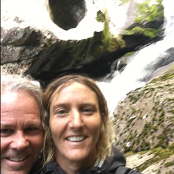
Lovely lollipop hike. Two waterfalls. First one is especially beautiful; can be reached by a challenging track down to the base of the waterfall. Worth it to go down.
Trail is well signed. Follow the easier option (noted on signs) or go the harder way which will mean a tough climb on the first half of the hike
★
★
★
★
★

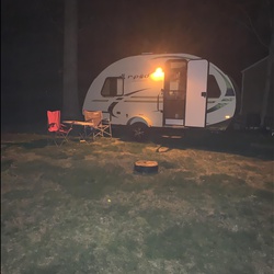
We started from the parkway and went down to an amazing little campsite at the bottom of the Mtn then a seemingly endless climb out of there
★
★
★
★

Back open to post Helene. Grateful for the crews of people who have worked to clear the roads. New gravel yet to be packed down. Not for casual riders or the faint of heart. Peak fall leaves. 🍂🧡🦃
★
★
★
★
★


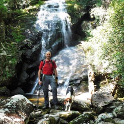
A very rigorous 11 miles carrying my 50lb backpack, but so much beauty to explore!
★
★
★
★
★

Sept 21, 25
To be fair, I didn’t do it. The forest service road is closed just as it becomes paved for the final approximately 2 miles. Walking up was very steep and started below 3000 feet so it was hot and gnatty. My wife got whiney and we turned around. So this might be a great hike, but add two miles of very steep road walking at the beginning and end.
★

Laurel Log trail is now non-existent. Ended up climbing down the river for miles due to overwhelming downed trees and the creek having eaten the trail.
★


 stars
stars
A nice loop in the town nature preserve. Lots of interpretive signage. There are restricted views when the leaves are down, and it might be good for spring flowers. It was worth hiking once but I don’t think I’d do it again.
★
★
★

3000+ black prisoners and slaves in 1875 carved 7 tunnels out of solid rock and laid 9.4 miles of track along this incredible hike.
It was against the law to hike it because it is so dangerous with trains regularly using it. The longest tunnel is 1/3 of a mile long, with very little space to avoid a train.
Hurricane Hellene demolished most of this track and trains simply cannot use the 9 mile stretch. Hence removing the danger of being hit by a train.
★
★
★
★
★


I really had a nice time on this hike. The beginning is the most difficult and the waterfall is beautiful. Check it out.
★
★
★
★

Nice hike, lots of different scenery. Multiple waterfalls along the way and some smaller water features too. Very shady throughout the whole trip. Approx 5.5miles total.
★
★
★
★
★


I did this hike yesterday solo. It was definitely worth the effort and distance. I actually hiked a half mile more, for a total of 10 miles, because I parked on Black Balsam Road and had to road walk back to my car. I definitely recommend hiking this counterclockwise, saving the much easier Ivestor Gap trail for your return. This is one of my top 3 hikes - views are almost constant, and while the views along Ivestor Gap aren't quite as spectacular as the first 3 miles on Art Loeb, they are still impressive, and in August (when I went), there are lots of blueberries and blackberries to snack on! After over 4 miles of up and down, rolling hiking on Art Loeb (no super steep ascents, but the descent down the backside of Tennent is quite steep and rocky, though with spectacular views to the south and east), you will finally reach the white quartz boulders (you have to turn onto the Old Butt Knob trail, which will be on the right), and it is truly surreal to see them up against the dark green of the evergreen forest around them. There are lots of side trails at the various gaps, and they aren't always marked, so bringing a map or GPS is definitely a must if you don't know this area.
A word of caution - if you go in summer, the Art Loeb is a bit overgrown and even bushwhacky in spots, especially once you're past the wilderness sign, so wear long pants- or wait until a different season. There are also a couple of spots where the trail seems to disappear. The Ivestor Gap trail is well maintained and always easy to follow, but is also very wet, with numerous seeps that cross over it.
All in all, I can't recommend this hike enough. There's a little bit of everything here, and the views are probably the most spectacular I've seen outside of the Roan Highlands.
★
★
★
★
★


Great hike from Davidson River Campground. Starts off along the river, then swings back up on a trail above the campground. You turn left before you take the trail to Art lobe
★
★
★
★
★

Very rocky and rough downhill after the steep uphill. I shuttled this to cut off the road section.
★
★
★
Great hike from Davidson River Campground. Starts off along the river, then swings back up on a trail above the campground. You turn left before you take the trail to Art lobe
★
★
★
★
★

Took my wife and Dog. The views are amazing and we kept the elevation gain to a minimum by driving up to park at the TableRock parking lot. It was very busy as it was perfect weather. Our parking space was taken as soon as I pulled out, so go early.
★
★
★
★
★

Hardly any water first half, very challenging trail. Beyond worth it views on the knobs. Gorgeous trail!
★
★
★
★
★

Started before daylight at Wolf Pit, hiked to almost the Chimneys, and then back. Used the red light when I arrived to the camping locations so I didn’t disturb sleeping campers. Rugged terrain at many parts, such as rocky paths, steep steps sometimes, and also connected by sections of very flat pathway. The entire trail is well marked, white circles either tacked to the trees, or painted on, to help keep you directed down the right path. There are occasional signs early in the hike but once you’re on top of the mountain then I don’t recall seeing any. Very steep portions of trail at times. Flat camping areas along the path at times. It was dry this day with very little mud. Wonderful location. Beautiful scenery. Challenging hike from this direction but rewarding on a clear day.
★
★
★
★
★

Went North to South for 3 days, 2 nights in late March. I knew it was a tough hike but it was harder than expected. Overall loved the experience but wish there were more blazes, especially the first 10 miles or so from the North terminus.
Saw some volunteers keeping the trail up - THANK YOU to everyone who works on the trail and for those that built the new shelters. The shelters were perfect!
Great hike, tough but worth the experience. The views are spectacular.
★
★
★
★
★
Nice hike with a spectacular view. It’s a 6 mile up and back. Almost exactly 3 miles each way.
★
★
★
★
★

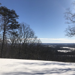
Beautiful hike with long range winter views. Mountain bikes use this trail so be careful.
Surface is hard pack do need extra cushion for feet
★
★
★
★
★


This hike turned out better than expected yet I underestimated the difficulty and distance over terrain during cold temps. The trail is very well marked. First half seemed to be on the high end of a moderate level and the second half was difficult due to ice, wind, chillier temps at altitude. Micro spikes are a must on the trail just past half way point. Lots of ice on the rocks and frozen standing water. Started the trail at 9:00 am in 17*F and warmed up when the sun came out yet cloud cover and wind toward the top made for lower temps. Be aware of footing on the way back down as lots of rock and tree roots spread along the trail over a great distance and your legs are pretty smoked. Hiked with a 35 lb backpack in under 7 hours round trip and my Garmin showed 13.50 miles.
★
★
★
★
★

Probably the hardest 3 day trip most people will ever do, especially in the rain, but completely worth it.
★
★
★
★
★
This was a nice loop hike with slight ups and downs. It is pretty rooty, and in wetter weather I can see where it would be muddy. On a chilly, but clear November day, it was lovely to get out, breath the fresh air. I also like the visibility with all the leaves off the trees. If you want an easy hike, this is one for you.
★
★
★
★

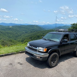
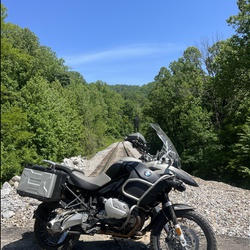
This is a great ride starting at Lake James go on over to John‘s river Wilson Creek Edgemont Roseboro Road then south on the parkway down 105.
★
★
★
★
★

Great hike the water fountains at the top where off at because of freezing temps. So you had to fill water bottles in the bathroom sinks. Not fun since there motion sensor ones.
★
★
★
★
Gorgeous day, amazing weather, height of leaf change. The trail is clear and not too difficult. We didn’t start until after 12:00 pm and the parking lot and roadsides were pretty full; we saw lots of people coming down and when we got to the lookout, it was perfect. There were some people up there, but not too bad. This hike is worth it! The fall leaves are beautiful, but it is also beautiful in the spring — just a little different.
★
★
★
★
★

Favorite fall hike for beautiful color, and scenic views.
★
★
★
★
★
Favorite fall hike for beautiful color, and scenic views.
★
★
★
★
★

This section of the Pisgah National Forest called Big Ivy is a vast area of trails that borders the Blue Ridge Parkway. I began the hike around noon and was the only vehicle parked at the Trailhead. Took Walker Creek to Perkins. Caught In a thunderstorm and decided to take Laurel Gap to Bear Pen and loop back to Walker. Added some miles but much easier plateau to traverse in rain.
★
★
★
★
★

As others have noted this is a solid 7mi round trip hike. The last mile is the toughest with lots of step ups, rock ledges etc to negotiate. It is worth the view for sure. Recommend hiking boots and poles.
★
★
★
★
★

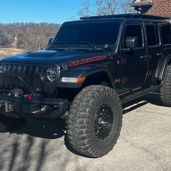
We went up this trail in a 4x4 long wheel base. It was extremely washed out and we wouldn’t have made it without the winch. It is not one way and there are very few places for two vehicles to pass. It was a very dangerous trail. Some ruts and obstacles were 3’ deep. The front of the truck slid off the trail and over the mountain side at one point.
This is also a trail listed on the Trans American Trail and a biker was headed down. He got 1-1/2 miles and had dumped his bike 8 times and was thrown over the edge, down the mountainside several times. We managed to load his bike and gear in the back off our truck and haul him out. There was no way he could have made it down on his own.
I would only recommend this trail for experienced drivers and shorter wheelbase vehicles. Check conditions before you go. Even the experienced drivers were saying it has never been this washed out and difficult before. We went in late August and it had not rained in quite a while. Took us 4 hours.
★

Super nice trail. Mostly downhill. Several bridge water crossings.
★
★
★
★

I guess this would be a moderate hike. No real views, but a nice hike.
★
★
★
★
★

This was really fun! There are some steep rocky climbs to get to the scenic views. Beautiful view from Lover’s Leap (minus the ill-placed solar farm across the river) and other rocks jutting out the mountainside. Watch out for falling acorns as they Plinko down the mountainside! One might get whacked in the head. Signs of bears taking food bags are posted, so there is a chance to see bears.
When you park in the small parking lot by the river you can start the trail by the French Broad River and go counterclockwise. I recommend walking down the road a bit to the trailhead and go clockwise so you finish the loop along the river. The loop intersects with the larger A.T. But it is signed so you don’t end up on a 1,000 mile hike you didn’t intend.
★
★
★
★
★
This was a fun loop. Mostly easy but the campground is closed (not sure how long it has been closed but the camp site is overgrown) and the trail has become a little more challenging. Several trees are lying across the trail that need to be traversed. Nothing impassible though. Lots of chances to see wildlife here: bears, deer, fox, snakes, birds, bugs, fungi, etc. We came across a chill black and blue rat snake that was lying across the path. When you get to Spring Creek there are some amazing views as you are able to walk out on the rocks in the middle of the creek. Highly recommend taking the time to do this. There is a locked gate at the front of the campsite so you have to park and walk down to the site to start the trail.
★
★
★
★
★
An easy going hike with beautiful panoramic views of the surrounding mountains when you get to the top. Highly recommend taking the time to visit. Went on a Thursday morning and only came across 3 other hikers. The drive to the parking lot is a fun one up the mountain with a chance to see black bears. No such luck for us but did come across some white tailed deer.
★
★
★
★
★

Absolutely gorgeous! Amazing 360 views from multiple balds.
★
★
★
★
★
First half was very shallow with lots of walking/pushing our tubes,. Second half has some better deeper water pockets where we could really slow and just have a good time. Lots of areas to access the trail on the side and just make groups of various sizes on this run.
Water was warm and very comfortable. Depth was too shallow overall.
★
★
★
Very chill loop hike, 2/3 on wooded trail, 1/3 on gravel trails. Sunday morning lots of people, but didn’t see too many out on the actual trails.
★
★
★
★


A very pretty, level hike through laurel, pines , and meadow. Lots of stream crossings with well maintained bridges. Not crowded on a Saturday in August. The picnic area looks pleasant and ample, though the supposed toilets were not in evidence.
★
★
★
★

More like 7 miles there and back. I clocked 1776.08ft elevation gain. Terrain gets fairly muddy after a rain. Go when dry.
★
★
★
★
★
Nice hike; no great views but trails were not over grown, a big plus right now in the middle of summer. This is a combo on trails and gravels roads, but mostly trail.
★
★
★
★


It’s a simple hike of about 950ft elevation gain over 2.5miles. Great for little kids and family. A good intro to the Smoky Mountains. Older kids may not like like the lack of challenge here.
★
★
This hike was about a 3.5-3.75…we walked the loop to see Caney Bottom Falls (meh), and ended at Cove Creek Falls, which was lovely and made the hike. There were a few places in the trail that were a bit overgrown, but not bad. Best things were: Cove Creek Falls, the quiet, just being outside on a beautiful day (temp about 72). If you want a decent workout and walk of 5+ miles, do this, but go right at the Y (counter clockwise) and end with Cove Creek Falls.
★
★
★
★

Accurate route for Stone Depot. Don't forget your approach shoes for the 4th/low 5th scramble up the slab.
★
★
★
★
A fun ride - a little rooty in some places, so had to walk 😂, but overall good and a great workout!
★
★
★
★
This was a great hike. We went counter-clockwise at the loop bc I had read going clockwise was super steep, and it def minutely felt that way coming down. Great view from the overlook, good, challenging hike. Lots of Mountain Laurel blooming. We did see a copperhead, though, about 1/4 Mi from the lookout. 😬
★
★
★
★


Nice easy loop. Trails well marked, and well maintained. Got to see the mountain laurel blooming (end of May).
★
★
★
★
This was a nice walk close-in. Some trail, some gravel roads in Bent Creek Experimental Forest. There were lots of cars (Saturday morning) but we didn’t see a TON of people in our walk. I’d definitely walk this route again.
★
★
★
★
We never made it to the base of the falls as you had to take a rope ladder. We never made it to the top of the falls. We did see some smaller Falls along the way not a very well marked hike.
★
★
★
★

Short and easy. Low ascent and easy for my small children.
★
★
★
★
★

Just wanted to point out that this is better known as Hurricane Creek trail.
★
★
★
★
★

Perfect hike, only3 climbs not too bad. Not too steep up or downhill
★
★
★
★
★

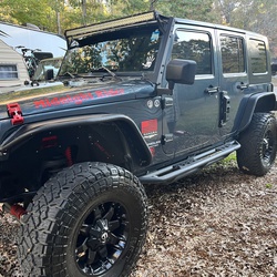
As a hike this can be moderate. As a drive it is difficult. Previous posts that say it's easy are either not referring to the right road or something drastic has changed with recent rains. I do not recommend this road without short wheelbase, lift, and at the very least 33" tires with that size vehicle. Drove this road with a Jeep Commander Limited, Hemi, 2.25 lift, and 32" tires along with a Ford F-150 FX4, super cab, 5.5 bed, 3.5 twin turbo V6, 33", full skid plates up front. Very steep approach and departure angles, heavily rutted, off camber with ruts. Would not have made it without the generic traction boards and extreme heavy duty ladder/traction boards by Crux. Some drop-offs in to puddles so steep and no other line that yanking rear bumper on truck inevetible. Heavily damaged bumper. Side steps on truck (not meant for wheeling) trashed because of long breakover angle of truck. Hence recomending short wheelbase or at least more mods for full size vehicle. Heavy pinstriping as well on full size. While Commander was not heavily damaged there were still really heavy drops, some pretty tippy areas and difficult approaches not possible without the traction and ladder combo mentioned.
★
★
★
★
Make sure you go Mid to Late February to see peak Daffodil Blooms! You can also see the river through the vegetation at the end of Winter.
Hard hike. It's down the mountain in the beginning and since it's out and back, that means it's up the mountain to leave.
★
★
★
★
★

Very easy, very beautiful. Probably average 10% grade. Stay on trail, keep this area beautiful.
★
★
★
★
★
Very easy, very beautiful. Probably average 10% grade. Stay on trail, keep this area beautiful.
★
★
★
★
★
Very easy, very beautiful. Probably average 10% grade. Stay on trail, keep this area beautiful.
★
★
★
★
★
Lots of elevation change. Good to hike in winter so you can see out. Good 360 views for most, since it follows the ridge. Without views, it is just a hike in the woods and no reason to fight your way up and down the ridge.
★
★
★

The John Rock loop is a great hike with some challenging elevation gain to a rocky overlook. Great views at the outcropping including Looking gGass Rock. The trail itself offers a wide variety of landscapes - streams and cascades, Davidson River, and mature coves.
★
★
★
★
★

Awesome trail for beginners and advanced riders. Great exercising trail for horses! Beautiful views all around!! One of my new favorite places to do!
★
★
★
★
★

Trail wet with light rain. 3 Rock hops due to rain but easy. Davidson River running strong with impressive cascades having developed after Hurricane Fred. Course of the River changed with several swim holes.
★
★
★
★
★

Just ran this trail early Dec 2022 in a stock Timberline Ford Expedition with no issues. Great trail for those that are just getting into wheeling and looking for some fun obstacles that aren’t too crazy. A few free camp sites are peppered throughout.
★

Fun little drive through the woods. Ran this with a 98 Nissan Frontier (bone stock). No issues. Several stream crossings and lots of light rocky eroded road bed. Was followed by a Subaru GL wagon with oversized tires. Wagon bottomed a couple times. Good fishing in the branches (N.C.Wildlife General trout waters).
★
★
★
★
★

The trail could have been more well maintained. It was covered over with leaves and fallen down trees so it was often very hard to follow. It is only marked on the way back as well making it very difficult to navigate. The time estimate here is very inaccurate it took about 4 hours one way without even reaching the top. The trail is very deep in the woods with few spots where you can see the view. There were signs of recent bear sightings as well. Overall, probably wouldn’t do it again.
★
★
★

I don’t have a Garmin to track, but it appears to be around 6 miles round trip. Terrific View as the Reward.
★
★
★
★
★

Parkway to Old NC 105 to look at the fall colors. Beautiful ride. Only 20ish miles on dirt but a great date trip.
★
★
★
★
★

Tough 7 mile gravel road today to parking area. Final very steep 1.5 miles is beautifully paved.
Taking the side trail to the Devils Cellar is well worth the extra steps.
At the top it is worth the scrambling to get to the end of the trail where I took a 360 degree panoramic video.
★
★
★
★
★


Gingercake roads are on private property. The trail head to access the Jonas Ridge Trail originates at the Sitting Bear trailhead off of Table Rock Road/Forest Service Road 210.
★

I hiked this yesterday and the gnats are intense! Some of the double log foot bridges are washed away. I had to cross through at least 6 inches of water twice and over a foot right off the bat. I covered myself in mosquito spray but the gnats didn’t seem to care. I had to keep moving to keep them off my face. Had the gnats not been so bad it would have been very enjoyable. The water fall was really pretty and so was the narrow wooded trail. It was quite muddy but passable. Will hike it again in early fall.
★
★
★
This is not an EASY hike. This is labeled wrong. I hiked this trail a few years back and it was very difficult for me. I’m a little short and had to climb spot with my hands. The trail is very washed out leaving large rocks and roots to navigate. Very rough terrain in a lot of spots and the elevation gain is challenging. 1,700 feet in less than 4 miles is intense if you aren’t use to high elevation. With all that said; it was beautiful and fun. I started the hike in the wee hours of the morning so I had it almost to myself. I stopped and took many pictures, had a little lunch and then trail ran back down most of the way. I would highly recommend. Just don’t be fooled by that “easy” label.
★
★
★
★

This was the best section of AT I’ve done so far. Not that I’ve done much outside of PA though. There weren’t many views though except for Max Patch.
★
★
★
★
★

Beautiful hike with lots of creeks and scenic view from John’s Rock.
★
★
★
★

Great hike on a beautiful day. Few people up and back along with a few snakes. One black snake but two rattlers on trail. Got a little more challenging after the helicopter clearing but overall an exceptional hike.
★
★
★
★
★

Lots of rocks!! Last half mile to tower is all rock but doable. Great 360 view from observation deck. Our route is from Pisgah Inn and back.
★
★
★
★
★
I left to take this hike at 3 PM in the afternoon. I spent way too long during the first third of the trip marveling how beautiful it was and taking in the scenery and snapping photos and thinking “this isn’t too difficult at all”… only to turn a corner at one point and realize the rest of the hike is pure elevation gain and scrambling, with rocks and ropes… I was tired and worried that dusk was going to fall so I really had to push myself and put my survival brain into action to get out in time! I was definitely worried at one point… I was tired and it was tough… I was so exhausted that I kind of just wanted to lay down… instead I pushed myself like A gazelle flying up the mountain…… it was up snd up.. my legs were shaky every time I rested… If I hadn’t had my GPS guide with me I definitely would not have made it out as I ventured off the trail a couple of times and was able to notice that immediately… luckily I made it in time to enjoy a beautiful golden-hour drive back to Asheville. Apart from the heart pumping sensation of having made a rookie mistake and not observed the map properly to anticipate the elevation gain, this was probably one of my favorite hikes ever and I would love to do it again. There are some beautiful camping spots along the way as well. (If I hadn’t been worried about darkness approaching and would not have minded the difficult hike I would’ve been able to do it without much stress… But having to do it unexpectedly and before nightfall was a whole different story😆.)
★
★
★
★
★

Took alt FS road to Art Loeb Tr because of washouts then to N Slope tr to River and Ranger Sta
★
★
★
★

Steep climbing for first 15 minutes, then levels out. Very nice with 2 falls, tree tunnels, flat lands, hardwood & clearings
★
★
★
★

Great relatively flat out and back with beautiful views of Laurel Creek rapids the whole way.
★
★
★
Completed in early February with a 2018 Tundra (2.5" lift, 33" M/Ts, no lockers). I would definitely say 4x4 is required. I ran in 4-Lo the whole time with tires at 18 psi going about 5-10 mph. Seemingly small mud holes are deeper than expected, so enter and exit with caution. Lots of scrapes on my skids and sliders. Scraped rear diff at least once. VERY ROCKY. Lots of deep ruts. Picking a good line is important. Unfortunately I was alone, so I had to do the best I could. Lots of pinstriping (large truck), probably would be less with a smaller vehicle. Only got hung up on one spot, there's a steep rut with tree roots. Rear diff locker would have made a difference here. I was able to get through with traction boards. Overall a very fun trail. Excited to return. Saw several good camping spots. A good spotter or front camera (if you're alone) would definitely be beneficial, especially if you're in a large vehicle. Skids, sliders, some degree of suspension lift, and aired down tires would also be in your best interest. Lockers not necessary but would be helpful. Only, the first mile or so will have cell service.
★
★
★
★
★
Looking Glass Summitt is one of my favorite trails in Pisgah. The summit trail veers off well before you get to Looking Glass Rock. There aren’t any markers or blazes. You’ll find access to the trail when you reach the top, on the left, where there is a huge rock face. But the unmarked trail snakes around to access to the summit rock face. The serenity and views are fantastic. Once you visit the summit, you’ll never want to hike to the overcrowded and anticlimactic Looking Glass Rock.
★
★
★
★
★

I didn’t hike it but my family and I went off-roading and it was nice. Good obstacles. 4x4 required for sure (for those thinking otherwise). Went ask the way through and let the kiddos play in the creek.
★
★
★
★
★

Start out with a long incline followed by a flat top. Later a long downhill. Round trip
★
★
★
★
★
First time driving the trail. I have a stock 2015 jeep Cherokee trail hawk and it was like it was nothing. Some areas worse than others
★
★
★
★
★

This is a lovely hike up a trail that switchbacks through a heavily forested trail filled with a ton of old native rhododendrons and azaleas, which must be amazing in the spring!it’s actually a fairly hike except the last 0.3 miles which is moderate at most. The view from the top of Looking Glass Rock is killer, just don’t get too close to the edge😂😉
★
★
★
★


The parking area at Daniel Boone is unavailable. The hike was spectacular! Challenging and rewarding!
★
★
★
★
★

This was another great beginner “offroad” trail that a good FWD vehicle could have accomplished. It was very heavy on gravel and had many bumps and small ruts in the road giving it a little “rougher feel” to it. It offers many designated smaller campsites accessible to vehicles, some of which offer great views. Took just over an hour to complete driving at moderate speeds between 10-15mph.
★
★
★
★
July 31, 2021 - Started at the south end of Hurricane Creek Road entering from I-40 and drove up to Max Patch. The trail was a lot of fun with 3-4 small creek crossings and 3-4 pretty technical parts. 4WD is necessary but a lift would recommend. Trail took a couple of hours to finish before hitting gravel roads up to Max Patch.
★
★
★
★
 stars
stars
This is a great family hike. Easy to get to the trailhead which has good parking and restroom facilities.
The hike is easy at the beginning and becomes steeper and more rocky as one approaches the falls.
There are many places to hike down to the river and get a closer look. Lots of hikers cooled off in the pools at the falls.
It’s about a 3 mile round trip, depending on how far you go or how many side trips you do.
There is a small stream one must cross, not difficult or deep the day I was there.
At the very end, the trail was quite step and rocky. Was on hands and feet to make the climb.
Would definitely return with out of town guests.
★
★
★
★
★

Babel Tower is an amazing hike, but I would not describe it as easy. There’s a saying about Linville Gorge, “What goes down into the gorge, must come back up.” -(can’t remember who’s quote it is)
★
★
★
★
Easy and beautiful. Heart shape in rock. No one else there. Water was perfect coolness. ❤️
★
★
★
★
★
A great hike, just hard enough but not too hard. Do not understand why it is not on maps.
★
★
★
★

This is NOT a moderate hike, look at the elevation at bmc(3000ish) and green knob is just over 5k. There are a couple places where you think switchbacks werent invented yet. View at closed firetower was great though. Not what my group was expecting, but we all made it...minus Tina. We ate her.
★
★
★

There is a lot of history here. This was the most western outpost of America for a very long time. Unsettled areas to the west, Davidson Fort (Named Old Fort now) to the east. Easy walk to the lower falls, strenuous to the upper falls.
★
★
★
★
★

Challenging and beautiful loop with gorgeous views, stream crossings, and open meadows. Highly discourage hikers from doing the RoundTop Ridge trail. Still recovering from a forest fire five years ago, the trail is in disarray and overgrown. Our family removed several ticks after passing through overgrowth. The AT is always well groomed and a wonderful stretch
★
★
★
★

Fairly difficult for about a mile of the hike closest to the Linville Gorge. Lots climbing of rocks in that section.
★
★
★

Beautiful hike. Don’t take the trail on the left down to the river — it’s very overgrown and steep. Much better to cut down to the road past outward bound then head down to the river. Great swimming hole but the bridge is out at the bottom. Saw some people cliff jumping into the water but it was a little too shallow for me to trust it.
★
★
★
★
Good hike on FS74 and Douglas Fall trail. Good views and wildflowers. 9.4 miles round trip.
★
★
★
★

 stars
stars
Parking is very limited. The trail offer gorgeous view after view. Bring your sunscreen.
★
★
★
★

A nice drive off the pavement with incredible views. Lots of places to camp off the road. The road was easily done in my factory 2009 Honda Pilot EX-L and only used VTM-4 for the steep uphill climbs although I didn’t need it.
★
★
★
★
★

This was a good and moderate hike. 2.3 miles to enjoy the cool air, sun and well maintained trail. I would hike here again.
★
★
★

A fantastic hike that follows Hickory Branch and features waterfalls and cascades. The trail gets steep toward the end and climbs to the Lead Mine Gap Trail.
★
★
★
★
★

This trip was on Old Nc Highway 105. Great trip... we went after it snowed. Minor ice, some more advance climbs but all in all this is a great trip to take with a group of people! Great places to stop and take pictures as well as to pull off and camp for the night. It has a little bit of everything! Mud, snow, ice, rocks, big climbs and steep descents.
★
★
★
★
★

We took our twin 4 year olds. This was a great hike and they were able to do it. Took us 4 hrs but we stopped for lunch.
★
★
★
★
★


This is a easy going trail that is easily traversed in a stock 4WD vehicle. Deeper into the trail, the camp sites get more serene as the creek opens up, and makes for a great spot to explore, fish and camp.
★
★
★
★
★

It was a beautiful day, the hike was arduous but well worth the effort.
★
★
★
★
★
 stars
stars
Did this hike 10/31/2020, except we returned on Roundtop Ridge Trail to make it a loop. Excellent hike, and the views from the fire tower are stunning. In the past, Roundtop Ridge Trail has been terribly overgrown, but somebody has recently done extensive work to clear it. We paid it forward by clearing numerous downed branches and small trees from the hurricane remnants that came through last week. Hopefully this trail will get enough use to remain clear.
★
★
★
★
★

Didn’t do the whole loop. Started over near big lost cove cliffs, hiked up there for first camping spot, moved over to lower part of this loop counter clockwise. Swim spot at hunt fish falls 2nd day then camping near Gragg prong (not many tent spots up that way but needed to get back to the car in good time on the 3rd day) Could have been a 2 day instead of 3 day but we were hoping for better weather/more swim time.
★
★
★
★
My go-to for swimming and view. Difficult enough of a trail to get away from crowds and families. Continue straight over the rocks to access a ladder-like path to the top of the “tower” for a view of both directions of the river below.
★
★
★
★
stars
Led this hike for a group on 10/17, and the weather was perfect. The colors near the parkway were pretty, but appeared to be a little past peak.
We did have 1 experienced hiker injure an ankle coming down Pilot Rock Trail.
★
★
★
★

Super easy/accessible trail with a couple campsites. Campsites might require 4x4 to get to.
★
★
★
★
★

Was a nice hike after rafting 5 miles on the French Broad River. Great views but is a bit of a steep incline and decline to get to the views.
★
★
★
★
Stop at looking glass rock overlook and cross the street to find the trail head.
★
★
★
★

I took a stock JLU on trail 1 and it was a blast. I went almost 4 miles in before turning around only due to time constraints. Here are a few tips I gathered from my excursion:
1. Go with others - You shouldn't do this trail alone, at least not without proper lift/tires and even then, it's way more fun with friends.
2. Radios/walkies are a must
3. There are some difficult parts that require a spotter - back to point number 1
4. 4-low is your friend. I used this on difficult parts when ascending. Make sure you can easily get into 4 - low as climbing these obstacles is so much easier in 4-low. I used 4-High for all other areas of the trail.
5-Have fun & be safe
I'm adding some pictures and videos here. I made a much more in-depth video on youtube so feel free to check that out if you're curious. I also explored some forest service roads while in the area - those are always a good time as well.
https://youtu.be/7Su5rjiwRPg
★
★
★
★
★

Beautiful early autumn day. Led by Zimmer’s with Em and Kathleen.
★
★
★
★
★

Varying conditions along this hike made it challenging and mental the whole way up and down.. not a lot of flats.. constant foot chess.. the conditions on the mountain were probably great with all the water, but that water made most of the trail a tributary and had me wishing I brought my swim fins and floaties.. happy to be jon top of North Carolina.. views were clear and awesome
★
★

Fairly easy 4x4 trail for Jeep Wranglers. Be prepared for side by sides , bikes and 4 wheelers.
★
★
★
★
Varying conditions along this hike made it challenging and mental the whole way up and down.. not a lot of flats.. constant foot chess.. the conditions on the mountain were probably great with all the water, but that water made most of the trail a tributary and had me wishing I brought my swim fins and floaties.. happy to be on top of North Carolina.. views were clear and awesome 👏🏻
★
★

This trail is very well maintained. I assume the Boy Scouts have a lot to do with this. Hiked this directly after Hurricane Sally remnants and trail was not “sloppy” like most in Pisgah area. Easily navigated plenty of water along way. Lots of fungus especially some nice reishi growing off an oak blowdown that trail maintenance had sawn thru. Wildflowers in abundance as well but not so many blueberries. I have 11.5 miles for distance. With a clear trail the whole way I would rate as moderate.
★
★
★
★

Great trail with an amazing payoff at the summit. The climb of 2700’ is significant, but not terrible. Very enjoyable day out.
★
★
★
★
★

Hiked on 16 Aug 20. Had a great time on this hike with challenges. I think Kathryn's review has good points, but think it was her mood that put her off. I should say, this trail is rugged, parts a little overgrown (where's my machete?) but you can still see the trail with a little effort.
1. Spiders do make a lot of webs. I've been hiking more this summer than ever, usually a dry fall hiker. This was a Sunday and i think Saturday had lots of rain. With the trail somewhat overgrown all the leaves etc with water on them = you get wet. Also about 20 minutes in I grabbed a stick and held it in front of me to hit the cobwebs first.
2. Off and on the trail is narrow and very sloped. So this in addition to the rugged overgrown part, makes it slow going, you will be at a slower pace, About 2/3rd way a tree has fallen on the trail parallel, you have to cut up the mountain about 10 yards, then forward 10ish yards, then back down to the trail. Also about 3/4 way i got on a sidetrack - it looked like the trail but was either a trail to a cool rock area/pee spot. I half slid down on hands etc and popped back on the trail. Think on the way back i saw where i got off the path.
3. I didn't see any orange tags at all on trail. At end you cross a small section of water, i did not need water shoes, was able to rock hop. As soon as you cross an open are and fire pit are there. Go to the right about 20 yards, you'll see the falls sorta, there's trees branches vines in way, but you see it, and hear it. Go down to the water, then you have to work your way up rocks to it. I did not see any type of trail left or right of falls to get to it. I got there at maybe 4p on a sunday, left at 5p maybe. No one was there, and no one on trail.
4. On way back about halfway point there is a set of smaller falls/ really cool rock water area. I had to shimmy down, and slid about 5' almost to water. Was able to carefully walk around on rocks. Going back up had to use shrub branches to get up to a point for footing to get back to trail.
5. Probably only 10 minutes from parking theres a cool area to walk off trail to, just 100', makeshift camp area, cool spot.
6. I would recommend a single trek pole or walking stick. Since a good part of the hike is at an angle and rock hopping etc, i was glad i had the stick. I'm an avid hiker, used trek poles before. Normally don't. Like i say this hike have one, or a stick. (also for the spider webs)
★
★
★
★
Tough hike but amazing views from each of the peaks. Tough terrain—-be prepared.
★
★
★
★
★

Nice hike along Laurel Creek to French Broad River. Some private property when you start trail. No issues as long as you stay on trail. There is no trespassing on the private property.
★
★
★
★

Good challenging hike with Bob—-Excellent leader as always!
★
★
★
★
★


We hike up Joel Branch frequently. It is not far from town, there’s no trouble finding parking, there’s challenge in it being uphill, and it’s a pretty hike. We seldom see anyone, so it is especially good for walking the dog. We usually have it to ourselves. It does intersect with Art Loeb, so the two used together can make a loop.
Since it’s a road, it’s wider than a trail and there are no rocks or roots for us senior hikers to trip over
★
★
★
★
★

Hike along a beautiful clear rocky river. Trail has rocks and roots so poles recommended. Shady all the way. Elevation not much greater than Asheville so expect about the same temperature.
★
★
★
★

June 2020 trip. Good conditions, not impossible but you need to pick the right lines. 4x4 required, high clearance recommended.
★
★
★
★
★
The 1st mile and a half down to the old Hendersonville reservoir is just a gravel road. It is mostly shady but still gravel and hilly. After you cross the bridge at the reservoir (see photo) onto the big creek trail you walk along big creek on a real forest trail that is nice and level and very shady.
★
★
★
Pretty moderate/difficult hike— a lot of going up, had to step off the trail about 4 times for mountain bikers, but then a quick descend back down. Thought there would be some sort of overlook once nearing Cooper Mtn. but there wasn’t. Took a nice dip in the creek before leaving— a nice attribute to the hike.
★
★
★

Moderate hike. Climbs climbs are modest. Beautiful trail. Highly recommended.
★
★
★
★
★
Very easy hike. Definitely should not rated as difficult. Beautiful trail!
★
★
★
★
★
Easy hike with Rhododendrum‘s in bloom during mid to late June. Nice view at Roan bluff. Interesting old cloud hotel site. Can make more difficult if you hike up from Carvers gap or hike on AT over to bear town mountain
★
★
★
★
stars
Did this hike yesterday with a small group, and it was beautiful. We did it in the other direction, going up Shining Creek Path, which is nicer in some ways, since you get a better view of the waterfalls along the creek going up.
We did see two large rattlesnakes at a sunny, rocky spot along Old Butt Knob trail, so be careful!
★
★
★
★
★

Best suggestion we had was to hike from Max Patch to Hot Springs! It is mostly downhill and the altitude goes from higher to lower! Amazing views from every angle!
★
★
★
★
★

Decent trail. Good camping and fishing. Some rocky spots but no too bad.
★
★
★
★


Lots of uphill, but not extremely so. Joel Branch is a FS road so it’s wider than trails. Don’t meet many people. Very pretty!
★
★
★
★

Second time doing this hike. You can go counter clockwise and have the views towards the end of the hike or go clockwise and get to Slate Rock near the beginning. We went counter clockwise both times. That direction provides a cardio climb over 600ft then you level off towards the lookout. Slate Rock views are awesome. Many people hike to Slate Rock clockwise and return same way. Depends on your fitness level. Parking area is about 6.6 miles on right from where the gravel forest road begins.
★
★
★
★
★

This is definitely a beautiful hike and quite a journey. Gorgeous waterfalls throughout the hike up and down and once on the Art Loeb, the Mountain View’s are breathtaking. Shining Rock is a large area of quartzite that is so cool! Definitely unexpected in a forest of evergreens. This was the hardest hike we’ve done in a day- it was long but also very strenuous. We were required to cross the stream several times, basically climb up rocks in some areas and steep declines were also a big element. Shining creek is the hardest of the entire hike- it’s worth getting that one over with in the beginning as the Big East Fork is much flatter.
★
★
★
★
★

Beautiful hike with lots of laurel and rhododendron. Distance might be an issue for some hikers, but I would in no way rate this as difficult. Relatively little elevation change.
★
★
★


Most of the trail can be done with any 4 wheel drive vehicle but there is about 10% that is really difficult. Overall a fun and beautiful trail.
★
★
★
★
★

Blue ridge parkway was closed so we made a loop hiking mtn seas to trail then back on blue ridge parkway. Would not recommend hiking blue ridge parkway when there’s traffic.
★
★
★
★
★

Hiked this on New Years Day, which may have attributed to a crowded trail. The hike starts and ends steep, but the trail is well-maintained. There is a gravel road that also leads to the tower, so you may encounter non-hikers at the top. The view from the tower is fantastic on a clear day.
★
★
★

Great OHV trail. Made it relatively easy in a Raptor but full flex in some areas. Would recommend going when it’s been dry for at least a few days.
★
★
★
★
★
We were closing the MST from 276 to the Arboretum. Beautiful hike on a beautiful day with a beautiful woman.
★
★
★
★
★

Trail was great! Getting to the trail from the interstate I-40 was a little odd. You’ll be traveling 40 west and when you see the Harmon Den sign the trail starts at the end of the guardrail so get into the emergency lane on the right. After you turn in there are a few houses just about 300 yds in. After that you’ll hit the first campsite and water crossing. Beautiful scenery through the entire trail. Only a couple of sections that you’ll need to be cautious through. Other than that most vehicles can make it. A few narrow places along the trail. Would certainly help to have 4wd and mud tires.
★
★
★
★
★

Great AT hike with John from Blue Ridge Hiking Co. Allen Gap to Davenport Gap.
★
★
★
★
★

Actually a 3-mile hike (2.95 on Garmin and iPhone). First two mikes a moderate climb. Then a bit more rocky and rigorous. Nothing too bad. I’m 65 with an arthritic knee. View is tremendous!
★
★
★
★
★


Great hike, close to town, easy to navigate, with a rewarding view. There are toilets and hand washing in the camp right past the bridge just beyond the trail head. Not great for running, since it's covered, moderately rocky, slick, steep, and with downed trees. Many streams en route, bring a steri-pen. Glad we used Gaia- we got a few hundred feet down a trail offshoot on the way down and had to backtrack. Some bushwhacking near the summit but underneath a clear path. Is the view to the SE an old volcano crater?
★
★
★
★
★


This hike is not for the faint of heart. Had to end up calling emergency services for an assist. The rim trail on the east is worth the trip but unless you really want a challenge avoid the gorge trail. Lots of steep descents and ascents around stream crossings, lots of rocks on the trail and trail easy to lose in places.
★
★
★

Excellent hike through Rhododendron‘s,mountain laurel,fields of ferns along streams. Relatively flat. Some beautiful areas. Not much elevation changes
★
★
★
★
★

Great scenic drive completely gravel. Saw plenty of 2wd cars. Not sure how cars make it as there are lots of exposed rocks and deep ruts! Definitely worth an overnight.
★
★
★
★
★
Great scenic drive completely gravel. Saw plenty of 2wd cars. Not sure how cars make it as there are lots of exposed rocks and deep ruts! Definitely worth an overnight.
★
★
★
★
★

The difference between this hike and the identically named trail marked as “easy” is that this one includes the Johns Rock Loop. Even with that included I wouldn’t rate this as hard, maybe moderate. I’m not in great shape and didn’t think it was that tough. Well worth doing. Cool river views, waterfalls, and the lookout on Johns Rock is awesome.
★
★
★
★
★


This trail was seriously tough with the high elevation change, and actually its 3 miles in 3 miles out not 2.7. However this trail was also very cool. I did it on a cool, wet and foggy day and it made for some spectacular views of the mountains in the fog. The higher up the mountains i got, the foggier it got! Near zero visibility at the top! Made trying to look out off of looking glass rock at the top impossible but thats also what made it cool! Sloughed my cooler up the mountain with me and had lunch as i stared out into the foggy abyss. 10/10 would do it again, just on a dryer day. Since it was so wet, it was a mudhole going up the mountain and made some of the fallen trees difficult to navigate without slipping off the face of the trail. I was pretty muddy by the time i got down.
★
★
★
★
★


This is a good walk for some exercise but not much in the way of scenery hence the four star rating. It starts an ends at the Davidson River Campground parking lot and is 5.6 miles long. Across the bridge the left onto the exercise trail along the Davidson River for a mile then right at the Art Loeb trailhead. The trail is initially steep and steadily uphill before it moderates somewhat after about half a mile. The Art Loeb section is 1.7 miles and intersects FR 5002 where you turn right and head downhill for a pleasant stroll that will bring you to a gate across the road at the Schenk job corps property. There's a sign depicting a hiker with No Throughfare written on it. Through the gate take an immediate right onto a grassy road which almost immediately becomes dirt and gravel and follow that until you see a trail on your right that will reconnect with the exercise trail on the Davidson and then left and return to the parking lot. There are a few trails connecting to the exercise trail from the Schenk property so if you miss the first one you'll still have a few more opportunities. This is a pleasant walk with a nice up and then a gradual downhill and good trail conditions throughout with no stream crossings or obstacles.
★
★
★
★


10.8 miles, 3000 foot elevation gain, very steep climbs/descents, tough terrain, very remote - no cell service, beautiful scenery and views of river and gorge. Recommend counter-clockwise route. Take GPS map, free download availabe from Avenza maps app. Can be occassionally easy to lose trail if not careful and have GPS.
★
★
★
★

Hiked on 10-7-18. Was hoping for more fall color but it is a little later this year. Hiked this same hike a few years back on first Friday of October and colors were at peak. Easy hike. Mostly flat. Very muddy after any rain at all. A lot of secondary trails have been made by hikers to go around the bigger mud holes. Falls had much less water on this trip compared to a few years back. Can get crowded on weekends. I hiked out to falls about 4:30 PM and passed more people than I could even count who were returning from the falls. When I arrived there were only two couples at the base and a few people above the falls. Within 10 minutes they were all gone and I had it to myself.
★
★
★
 stars
stars
This is a very pretty waterfall, and a nice, short walk from the parking area. On this trip, we went at too busy of a time, and it was nearly impossible to get a photo without other people in it. Still, make a point to take the user trail over to Little Moore Cove Falls, which is much less crowded.
★
★
★
★


 stars
stars


 stars
stars


 stars
stars


 stars
stars


 stars
stars