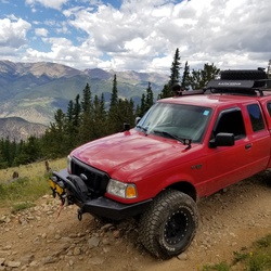
United States
›
North Carolina
›
Wolf Pit Road

Wolf Pit Road(edit)

based on 59 tracks & routes   |   |  
EASY
   #590 hike out of 616 in   |   
EASY
link Copy Link email Email directions Driving Directions
  • GPX
  • KML

2.9 mi
Distance

1 hrs 41 min
Time
terrain
341 ft
Elev Gain

Overview

This is a easy one way trail in North Carolina.


    Rate this Hike

    ★★★★★

    user_profile
    StillFalls9907 5 years, 2 months ago
    ★


Public Tracks

user_profile
Dhx2 11 years, 8 months ago
Linville Gorge / WPWest Rd
nbsp;
user_profile
Dhx2 11 years, 8 months ago
Linville Gorge / WPWest Rd
nbsp;
user_profile
Will McPherson 5 years, 5 months ago
Wolf Pit Detour
user_profile
Dhx2 10 years, 5 months ago
WPWest Rd

Elevation Profile

Seasonal Popularity

Nearby Hiking Trails

  1. Faulkner Flats
    ★ ★ ★ ★ ★ EASY 1.5 mi
  2. Shortoff Mountain
    ★ ★ ★ ★ ★ MODERATE 5.7 mi
  3. Shortoff Mountain via Wolf Pit
    ★ ★ ★ ★ ★ MODERATE 5.0 mi
  4. Dogback Mountain Loop via Kistler Memorial highway
    ★ ★ ★ ★ ★ DIFFICULT 9.0 mi
  5. Wolf Pit
    ★ ★ ★ ★ ★ EASY 1.6 mi
  6. Campsite Loop via Wolf Pit
    ★ ★ ★ ★ ★ DIFFICULT 20.6 mi
  7. Shortoff Mountain via Table Rock Summit Trail
    ★ ★ ★ ★ MODERATE 6.1 mi
  8. Shortoff Mountain via Wolf Pit and Olson
    ★ ★ ★ ★ EASY 2.4 mi
  9. Shortoff Mountain
    ★ ★ ★ ★ EASY 4.7 mi
  10. Build a Fairy House Loop
    ★ ★ ★ ★ ★ DIFFICULT 15.7 mi