meta

Pisgah Inn from Hwy 276 via the Mountains to Sea Trail

based on 23 tracks & routes #174 hike out of 231 in
4.6 mi
Distance
2 hrs 12 min
Time
terrain
1,097 ft
Elev Gain

Overview

This is a moderate one way trail near the Blue Ridge Parkway in Pisgah Ranger District.

The trail begins at the Buck Springs Trailhead on Hwy 276 near the BRP. At around 1 mile in, the trail joins the Mountains to Sea Trail (MST). (Note: the track shown currently begins at this intersection a mile into the described hike.)

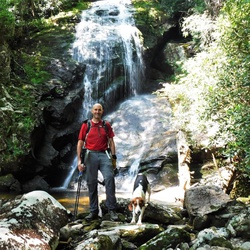
Most of the hike is a gentle climb through very scenic forest, with a few rock-hop crossings of small streams. It does get a bit steeper toward the end, finishing with a set of switchbacks climbing up to The Pisgah Inn.

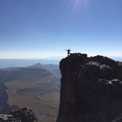
The views from the top are phenomenal, and this is a perfect place to rest after the climb. When the Pisgah Inn is open for the season, there are many Adirondack chairs to sit and enjoy the view, as well as a restaurant, restrooms, grab-and-go cafe, and other facilities.

Getting Started

The Buck Springs TH is located here: https://goo.gl/maps/65MhhGvQfZzcGgKM7
There is a small parking area on the side of Hwy 276 near the Blue Ridge Parkway. There is parking for around 4-5 cars.

Taking Children

This is a pleasant, safe trail to take children. Young children may need assistance at some of the creek crossings.


    Rate this Hike

    user_profile
    1 week, 2 days ago
    ★ ★ ★ ★ ★

    user_profile stars
    1 year, 9 months ago
    ★ ★ ★ ★ ★


Public Tracks

user_profile
CheapCigarMan 6 years, 2 months ago
Mountains to Sea Section 2
trail_hike_comments: **Waterrock Knob to Pisgah Inn** From Waterrock Knob to Flat Gap, the trail follows the Blue Ridge Parkway closely at most times. It gains some distance from the motor road on the southwest slope of the ridge line from there to Haywood Gap. From Haywood Gap to Beech Gap (NC 215), the trail enters the higher elevations of the Middle Prong Wilderness and encounters sections of beautiful spruce-fir forest. It passes the Green Mountain trail which and then a high waterfall on Mount Hardy, before entering some wildlife meadows. This segment of the Mountains to Sea Trail, combined with the Green Mountain trail to Green Knob, is [one of the best hikes in the region](http://www.hikewnc.info/besthikes/middle-prong-wilderness/green-knob). Portions of the trail in designated wilderness are unblazed, but generally easy to follow. From Beech Gap (NC 215), BRP mp 423.2, to Pisgah Inn at BRP mp 408.6: this portion of the trail travels through some of the higher mountains along the Pisgah Ridge. The trail ascends to Silvermine Bald through a moist mixed northern hardwood/spruce-fir forest, then levels out and passes through a forest of predominantly spruce until reaching Black Balsam Road. It skirts Black Balsam Knob and then the Graveyard Fields area via Graveyard Ridge, before descending significantly to cross the Yellowstone Prong at Skinny Dip Falls. It ascends again toward the Blue Ridge Parkway., trail_bike_comments: None
user_profile
bhamdans 8 years, 6 months ago
Mountains to Sea Section 02: Waterrock Knob to Pisgah Inn
Properties:, name: Mountains to Sea Section 02: Waterrock Knob to Pisgah Inn, segment: Mountains to Sea Trail - Barnett Branch Trail to Pisgah Inn, mapid: 20, type: trail
user_profile
bhamdans 8 years, 6 months ago
Mountains to Sea Section 02: Waterrock Knob to Pisgah Inn
Properties:, name: Mountains to Sea Section 02: Waterrock Knob to Pisgah Inn, segment: Mountains to Sea Trail - Barnett Branch Trail to Pisgah Inn, mapid: 20, type: trail
user_profile
gwen.kuhns 3 years, 9 months ago
user_profile
gailk14 4 years, 7 months ago
user_profile
Libert 4 years, 10 months ago
user_profile
Max Evans 7 years, 2 months ago