Shortoff Mountain via Wolf Pit and Olson
Overview
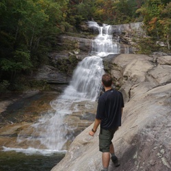
This is a moderate one way trail to Shortoff Mountain in Linville Gorge Wilderness. This trail offers many incredible views. The view is awesome for most of the entire trail. You will have views of Lake James, Table Rock, and Linville Gorge. Really, you have excellent views for most of the trail. The trail has some long stretches of strenuous parts followed by relatively flat stretches to catch your breath. Once you make it to about an 1100 elevation gain, the trail flattens out and become very easy. At the top of the trail, there is a small pond on your left that marks about the top of the trail. The trail continues to at least table rock, which is about another 6 miles. In the summer time, be sure that you bring your sunscreen, as much of this trail will be in direct sunlight. If you happen to hike this trail after a large rain, there will be a lot of water on the trail, so prepare for running water on the trail, and some mud and slick rocks. Also, proper foot ware is a requirement on this trail. From the parking lot to the small pond is about a 4 mile out and back.
Getting Started
From Interstate 40, take Exit 100 and make your way to I-126. Turn onto Wolf Pit road from I-126. This is about a 2 mile dirt road. Be mindful of your speed as this is a private maintained road, and they do grant access to the public for access to the trailhead. Be respective of the property owners please. Follow Wolf Pit Road until it dead ends. The parking area is the end of the road. Parking is extremely limited, so come early to get a spot. The trail head is easily visible from the turn around at the end of the road.
Taking Children
There are portions of the trail that is extremely rocky, with loose rocks that you could easily slip on. If it has been raining, plan on getting muddy and wet. Older kids can make this if they are made of stern stuff, but for smaller kids, it would be best to find another trail.
Rate this Hike
★★★★★

Public Tracks


 stars
stars


 stars
stars