United States
›
California
›
Angeles National Forest

Best Hiking Trails in Angeles National Forest

1824 reviews


link Copy Link email Email directions Driving Directions

Seasonal Popularity

Overview

Angeles National Forest is a national forest in Southern California that encompasses the San Gabriel Mountains and Sierra Pelona Mountains. It was the first national forest designated in the state. Known for its recent wildfires, the dry but diverse landscape of shrubs and trees make the terrain a hiker's destination for a day trip away from the Los Angeles metropolitan area.

Getting Started

Before you go, check out the current roads and trail information. Make the short drive from the city to the national forest and pick one of the popular hikes. Get familiar with the park by stopping at one of the visitor centers.

Mount San Antonio, or Mount Baldy, is Angeles's highest peak at 10,064 feet. Get rewarded with stunning views by taking the Devils Backbone Trail to the top. The peak's open year round—in the winter months, it turns into a ski area.

While this is a popular spot for LA dayhikers, there are opportunities for longer trips. About 176 miles of the Pacific Crest Trail wind through Southern California. Pick up a section of the trail in Angeles National Forest and go as far as you have time for.

Want something shorter? Try the popular Sturtevant Falls or Echo Mountain.

Extend your stay at one of the first-come, first-serve campgrounds.

When to Go

The forest is open for adventure all year-round, but the most popular times are during the summer months. Be sure to check out the wildfire alerts and notices before committing to a hike.

Permits

Use an Interagency Annual Pass within the forest and other national parks. If you don't frequent forests or parks regularly, a better option may be the regional recreation Adventure Pass. You'll need one of these passes to park and access various areas within the boundaries. Learn more here.

Dog Info

Like in most national forests, dogs are permitted as long as you keep them on a leash and pick up after them.


Resources

  • fs.usda.gov
  • wikipedia

  • Hiking Trails (396)
  • Reviews (1,824)
  1. 1
    Bridge to Nowhere or East Fork Trail
    ★ ★ ★ ★ ★ DIFFICULT 10.2 mi
  2. 2
    Bear Canyon Trail and Gabrielino NRT
    ★ ★ ★ ★ ★ EASY 3.3 mi
  3. 3
    Mount Wilson Loop via Sturtevant trail
    ★ ★ ★ ★ ★ DIFFICULT 14.1 mi
  4. 4
    Mount Zion Loop via Sturtevant trail and Lower Winter Creek Trail
    ★ ★ ★ ★ ★ DIFFICULT 8.4 mi
  5. 5
    Echo Mountain via Sam Merrill Trail
    ★ ★ ★ ★ ★ DIFFICULT 5.5 mi
  6. 6
    Mount Islip via Pacific Crest Trail
    ★ ★ ★ ★ ★ MODERATE 5.4 mi
  7. 7
    Mount Lowe Motorway Loop
    ★ ★ ★ ★ ★ DIFFICULT 8.0 mi
  8. 8
    Mount Baden-Powell via Pacific Crest Trail
    ★ ★ ★ ★ ★ MODERATE 3.7 mi
  9. 9
    Hoegee's camp Loop via Upper Winter Creek Trail
    ★ ★ ★ ★ ★ MODERATE 4.9 mi
  10. 10
    Mount San Antonio via Bear Canyon Trail
    ★ ★ ★ ★ ★ DIFFICULT 11.4 mi
    user_profile
    RareSwimCap5403 2 weeks ago
    Bridge to Nowhere Saturday
    Bridge to Nowhere is any easy hike. Only do this hike when the river lower because you have to cross the river multiple times. If you are camping, go past the bridge and around the bend. You can find numerous spots on the far bank.
    ★ ★ ★ ★ ★

    user_profile
    FullReef3662 2 months ago
    Saturday Chapman Trail to Icehouse Cyn Trail
    This is a gem of a trail - lots of water springs, sequoias and shady spots. Beware it is strenuous. The trail bobs and weaves through rock flows and mostly on a single track shale or rock floor.
    ★ ★ ★ ★ ★

    user_profile
    Matthew Halls 3 months, 4 weeks ago
    San Francisquito Dam
    Nice easy hike/ walk. The historical aspect was a bonus learning about the San francisquito dam.
    ★ ★ ★ ★

    user_profile
    HardFalls7913 8 months ago
    Hoyt Mountain Loop via Telephone Trail and Firebreak
    We really enjoyed this hike in the fog today. Got to the trailhead around 10 am. The scramble up to Hoyt Peak at the beginning of the trail was brutal. Very loose rock. Not recommended for the faint of heart. Easy to lose the trail coming off Hoyt Peak. After you reach the marked trail, it's a straightforward and pleasant hike with great views. The switchbacks at the end were a bit tougher than I expected.
    ★ ★ ★ ★ ★

    user_profile
    Paul Okada 8 months, 3 weeks ago
    Hoegee's camp Loop via Upper Winter Creek Trail and Lower Winter Creek Trail
    Be careful at the junction near Hoagee’s. We took the wrong trail and were halfway up Mt. Zion before we realized it.
    ★ ★ ★ ★

    user_profile
    CraftyWatch8834 11 months, 1 week ago
    Sunday Morning Activity
    We took the clockwise loop and back, after the last saddle point its extremely over grown, fire road is almost cover with yuccas, doable. There are couple short segments before summit road is almost washed off “class 4”. Overall is a great hike with an interesting summit.
    ★ ★ ★ ★ ★

    user_profile
    FrostyJetboil6891 11 months, 3 weeks ago
    Sunday Mt Baldy Hike( workout)
    I have issues with my quads when hiking. I cramp up usually around the 5-6 mile distance. I hydrate and have electrolytes w me during my hikes. So it usually takes about 2 warmup hikes before I rid myself of these cramps and then I’m able to complete the whole trail ok.
    ★ ★ ★

    user_profile
    Michelle Dolan 11 months, 3 weeks ago
    Mount Wilson loop
    19 switchbacks counter clockwise. Need hat, sunscreen and umbrella for parts. Lots of shade. At the falls you can cut up to the trail instead of going back to starting point. Great camp to stay at see pics.
    ★ ★ ★ ★ ★

    user_profile
    Sal Sandate 11 months, 4 weeks ago
    Trail Canyon Falls Day Hike
    A nice afternoon hike on a partially cloudy summer day helped beat the heat. I wore a 40lb weighted vest and was able negotiate everything fine. Getting down to the bottom of the falls can be tricky, but there are set ropes to assist. Multiple stream crossings and a mix of exposure and tree coverage on the 5 mile out and back.
    ★ ★ ★ ★

    user_profile
    noah 1 year, 2 months ago
    Sunday Morning Activity
    Timber peak- amazing
    ★ ★ ★ ★ ★

    user_profile
    MistySail6988 1 year, 2 months ago
    Wednesday Morning Activity
    F ). S se c x
    ★ ★ ★ ★

    user_profile
    Pat Yuan 1 year, 5 months ago
    Dawn Mine Via Millard Canyon
    Trailhead: 40434 Chaney Trail, Altadena CA 91001
    ★ ★ ★ ★ ★

    user_profile
    EarthyTrail5465 1 year, 7 months ago
    Saturday Morning Activity
    It. I try ok s es t cede. Con m Eric d rerrk Nov f
    ★ ★ ★

    user_profile
    EarthyTrail5465 1 year, 8 months ago
    Mt. Lowe campground Loop via Lower Sam Merrill Trail
    T by
    ★ ★

    user_profile
    wdjorth 1 year, 9 months ago
    Cloudburst Parking to Unnamed Peak and over Winston Peak
    This is a terrific day trip with great views of the high desert from both the farthest point, unnamed peak, and the highest point, Winston Peak. Someone left a painted can with small note pad inside on the unnamed peak. No pencil was left and I didn’t have a writing instrument. The last comment was merely 2 days ago. Weather was perfect. Staring at 7:30 AM, a cold breeze was blowing thankfully restraining the growing midsummer heat from this hike. The trail is pretty easy to follow, especially the PCT section, though nearly all of it is covered by undisturbed leaves and pine needles. This makes for a wonderful experience on the Monday morning in late August 2024.
    ★ ★ ★ ★ ★

    user_profile
    wdjorth 1 year, 9 months ago
    Horse Flat toward Sulphur Spring back via PCT
    Looking for something of a loop, I created this track including an out-and-back section toward Sulphur Spring, with a loop around the Angeles Christian Camp. This hike used a good amount of the PCT. Mid August 2024 and early morning starting at 7:30, the weather was perfect. The last section paralleling the dirt road was exposed but enjoyed nice breezes up the canyons. The rest of the route was also beautiful though plagued by clouds of small flies and swarming mosquitoes. Both were particularly heavy in the creases of the trail holding dry stream beds. Apparently there is enough moisture nearby to sustain these bothersome pests. The section where the route passed through and around the camp was uphill until finally reaching the paved road entrance to the camp. From there, the PCT/Silver Moccasin trail was an easy track back to the Three Points parking area at Horse Flat. The trail out to Sulphur Spring seems to be maintained and used enough for the trail to be clear and easy to follow. The trail around and through the camp was harder to follow. Pink tags on branches helped. The last section back to the car was nice though a bit overgrown that would be annoying for backpacking. With trekking poles and a smallish daypack passing through the growth was not difficult.
    ★ ★ ★ ★

    user_profile
    FitThunder2178 1 year, 9 months ago
    Switzer Falls via Gabrielino Trail
    Lots of people here and lots to do. People were swimming in the waterfalls and barbecuing at the campsites. A very fun, energetic vibe. But HOT. Despite lots of shady, forest-y areas, there are also some exposed moments. It’s an out and back hike with a bit of ascent/descent each way. Bring lots of water, have a park pass, and go early!!
    ★ ★ ★ ★

    user_profile
    Temecula Dan 1 year, 9 months ago
    Cucamonga Peak
    Solo hiked Thurs 8/8/2024 – Cucamonga-Icehouse-Etiwanda-8386-Alta Loma peaks. Trail out to Cucamonga Peak was in good shape except for the scree slide area where it traverses the east side of Bighorn. This section is totally doable, just requiring a little extra focus on foot placement unless you’re up for scree skiing. From Cucamonga Peak to the wilderness border near Alta Loma, the trail will get you there with some cairns/ducks marking the more obscured parts where using gps really helps. Some scree slide areas here as well. Recommend leaving the trail right at the Cucamonga/SB Forest border to start the direct descent to the Alta Loma Saddle, followed by the direct ascent up Alta Loma. First time hitting Icehouse, 8386 and Alta Loma Peaks, all worth climbing up. Etiwanda & Alta Loma were the only peaks with registers. Very nice weather but much warmer than forecasted. Last water source going up is Columbine Spring which is trailside, 2.4 miles from the trail head (34.24326, -117.60459) and flowing nicely right now. I carried and finished 5L water and 2 half liters of electrolyte for this trek but would have taken a 2.5 - 3L bladder for just doing an out and back to Cucamonga Peak. Took frequent breaks in the shade for the Alta Loma leg and never felt too hot. Views off the peaks were awesome and coming back down Icehouse Canyon in the afternoon was as beautiful as ever. Occasionally ran into bug swarms the entire way, almost putting on a head net a few times but just spit out several and relied on insect repellent. Filtered a few liters from Icehouse Creek on the way out to enjoy on the weekend. Really glad the Forest Service reopened Baldy/Icehouse-good decision.Logged 18.8 miles / 6002 vertical ft with Gaia
    ★ ★ ★ ★ ★

    user_profile
    BraveCedar4489 1 year, 10 months ago
    Pacifico Mountain Loop
    🐻🍑✅
    ★ ★ ★ ★

    user_profile
    BraveCedar4489 1 year, 10 months ago
    Mount Disapointment Road Loop
    🐻🍑✅
    ★ ★ ★

    user_profile
    TinyFish1156 1 year, 10 months ago
    East Fork Trail
    Good hike. The parking situation is pretty bad. I showed up at 5:30 to secure a decent spot. The lot quickly filled up. Make sure you get there early if you don’t want to add distance to your hike. Hike itself was good. Leaving on the other hand was quite the challenge with how people park.
    ★ ★ ★ ★
    user_profile
    Daniel W. 1 year, 10 months ago
    Josephine Peak
    Second time hiking this trail. Did it as part of training for Mount Whitney. Started in the morning so that we’d be done before it got too hot as most of the trail is exposed.
    ★ ★ ★

    user_profile
    Temecula Dan 2 years ago
    Mount Baden-Powell via Pacific Crest Trail
    Solo hiked Fri 5/17/2024 – Too bad that Dawson Saddle is still closed but Islip Saddle is accessible using the Upper Big Tujunga Canyon Road Detour to Hwy 2. This span of the PCT (miles 381-386) is in fine shape with a few boot-packed snow patches remaining on the northern aspects. I’ve always enjoyed this scenic trail when ice free, as it offers so many peaks to pick and choose from, starting with Mt. Islip and ending with Mt. Baden-Powell. I decided to head up Mt Hawkins on this trek to follow the south-southeast Copter Ridge which takes you to a vantage point overlooking the interior of the Sheep Mountain Wilderness. The close up views of the Mt. San Antonio ridgeline, Iron Mountain and Rattlesnake Peak are some of the standouts. Hiking the ridge between Mt Hawkins and Copter Ridge Point is a direct route and will not test your navigation skills. Climbed up Peak 8426 on the way back on which I found both east and west use trails which made it easy to leave and then rejoin the PCT trail. Met several, very nice PCT through hikers and backpackers on shorter treks, all of whom appeared to be in good spirits. Now is a great time for this trail area with the great weather and no crowds since the Tujunga detour is not well known. I did bring micro spikes for Pk 8426 but they weren’t necessary as there was only a small amount of ice in the early morning that melted by mid-day. There are a handful of fallen trees on this route but all are easy to climb over or bypass. The bugs were out in force so repellent and/or head netting is recommended (I used both). Logged 13.2 miles/3524 vertical ft with Gaia.
    ★ ★ ★ ★ ★

    user_profile
    Temecula Dan 2 years ago
    Pallett via Burkhart Trail
    Solo hiked Thurs 5/2/2024 - It’s been many years since I’ve been on the Burkhart Trail and forgot how nice it is along Little Rock Creek, especially Cooper Canyon Falls which is flowing strongly right now. The upper part to Burkhart Saddle is another story as it recovers from the 2020 Bobcat fire and the 2023 Hilary storm. You get to see that things are recovering but with many decades to go. The upper scree slide and deadfall areas are best traversed with poles but not too bad like others have said. There is only one area on the trail where a thicket of Poodle Dog bush must be widely bypassed to avoid “paying the price.” Will Thrall, Pleasant View Ridge and Pallett Mtn peaks had great panoramic views, especially Antelope Valley to the north and the snow-capped San Gabriel’s (Baden-Powell, Throop, 3 Hawkins peaks) to the south. Going out to Box Car Ridge to visit the 1966 C-119 plane crash site was more for a solemn observation, given my prior time in aviation. I was very surprised to run into a few steep snowfield problems on the way to the Peak 7520 and Goodykoontz summits with hard snow and a little ice on the northern slopes of the Mt Williamson ridgeline. After trying to traverse the first without crampons or micros and a long runout, I opted to go further down the west-southwest drainage and then up on patchy snow which worked well. After Goodykoontz, I followed a west running ridge to Bobcat Knob and then headed south-southwest on a cross country trek which brought me directly down and back to the Little Rock Creek Log Crossing. From there it was back on the Burkhart Trail to Cooper Canyon Falls for a food break which was the most beautiful stop of the day. Got back in time to see a nice sunset from lower Angeles Crest to wrap up a nice day. Highly recommend the lower Burkhart Trail to the falls/Little Rock Creek and the upper part to those looking for the peaks. Logged 16.4 miles/5241 vertical ft with Gaia.
    ★ ★ ★ ★ ★

    user_profile
    NobleBamboo3686 2 years ago
    Track (5/4/24, 6:12:37AM)
    Nice weather and beautiful view
    ★ ★ ★ ★ ★

    user_profile
    Temecula Dan 2 years, 2 months ago
    Mount Baden-Powell via Pacific Crest Trail
    Solo hiked Thurs 3/28/2024 – Northeast Couloir climb up to Mt Baden Powell, up and down ridge line/peaks to Ross Mountain, back up to Baden summit, down the Silver Moccasin Trail to Vincent Gap (more or less). Great snow for crampons, never unpacked my snowshoes. Northeast Couloir was fun except for one ice problem to slowly work up. 40 mph wind gusts on Baden ridge/summit in the morning but decreasing significantly on the way out to Ross Mtn. Firm snow and little ice up and down the Ross ridge routes but some axe assist on 2 climbs. Beautiful weather and very pleasant once the winds decreased. Didn’t let the repetitive elevation gains/losses to Ross get the better of me and that made for a very nice trek on a good day. Clouds rolled in just before summiting Baden-Powell for the second time, followed by a 30 minute white out coming down the north side to join the Silver Moccasin Trail. Not a lot of mileage but a fair amount of snow climbing made for a good leg burning workout with outstanding views along the entire route. Spent a little more time enjoying the views on this trek, again thankful for the wind speed drop early in the day! Logged 10.2 miles/5204 vertical ft with Gaia.
    ★ ★ ★ ★ ★

    user_profile
    RockyGloves1792 2 years, 2 months ago
    Track (3/17/24, 9:13:05AM)
    Happy times climbing to a 6,000ft elevation. March is the best time of the year for this hike!!!
    ★ ★ ★ ★ ★

    user_profile
    AdmiralSnaxbar 2 years, 2 months ago
    Mt Lukens from Deukmejian Wilderness Park
    Hot during the first part and cooled down. Nice hike with not too many steep parts.
    ★ ★ ★ ★
    user_profile
    Patrick Morgan 2 years, 2 months ago
    Monroe-Mystic Run
    Lots of stream crossings and the water was flowing fast and cold. This is one of the best running trails in the area.
    ★ ★ ★ ★ ★

    user_profile
    DandyYoga5238 2 years, 3 months ago
    Track (2/17/24, 6:14:36AM)
    We went up the mountaineers route!! Not easy!! Make sure you have the proper equipment! Always check the weather ahead of time. Try to get up there earlier that way the snow is still nice and packed!
    ★ ★ ★ ★ ★

    user_profile
    Temecula Dan 2 years, 3 months ago
    Rattlesnake Peak Loop via Shoemaker Canyon Road
    Solo day hiked Fri 2/9/2024 – Wow! I really underestimated this week’s snowfall at the lower elevations and paid dearly for it. Started up Rattlesnake using the Eastern side HPS Route 2 through the tunnels and then up to 4500 ft snow free. The snow solidly blanketed the trail at 4600 ft but postholing was only 8-14 inches. Fortunately, several paws marked the trail through the snow up to 4800 feet. By the time I reached 5000 ft, the snow was up to knee level on the steep slopes which really slowed things down. On the positive side, it was unconsolidated and great for kick stepping, just a lot of work. The horizontal ridge sections were up to waist level, hiding the yuccas and buckthorn like land mines. I dropped in one section up to my arm pits. But it was a nice day and so I just powered through it and was glad that I did. Was walking around the Rattlesnake summit through deep snow and just happened to kick the summit box – a lucky find. After descending from Rattlesnake to Peak 5030 on the HPS Route 1/All Trails Route, I was back on dry ground and had a very pleasant return trip to Shoemaker Cyn Road. Views off the Rattlesnake summit were fantastic with the high cloud level. Was quite an adventure for a short hike. Logged 9.9 miles/3547 vertical ft. with Gaia.
    ★ ★ ★ ★ ★

    user_profile
    ToughPath5528 2 years, 4 months ago
    Baden Powell (8/25/23, 8:52:50AM)
    The view for the top was incredible and breathtaking!
    ★ ★ ★ ★ ★

    user_profile
    Temecula Dan 2 years, 4 months ago
    Iron Mountain
    Solo day hiked Thurs 1/25/24 – Nice trail very similar to the Bear Canyon and Register Ridge trails on Baldy. Rained on the drive in but was just a heavy, humid feeling mist halfway up in weather warm enough to layer down early at Bonita Peak. Trail was in good shape after this week’s rain allowing for good traction on the dirt and scree. Thanks to the folks that have trimmed off the Yucca tips on the plants closest to the trail - most of the remaining sharp ones can be avoided. Took up a full 30L pack and never got snagged on anything when on the main trail. Snow on the last 200 feet up but easily passed with boots alone right now. Awesome panoramic views off the Iron summit which was above the clouds today, especially of Mount Baldy and Baden-Powell. Like others have said, the trail is easy to follow with a little extra spotting required at some of the rock areas. 5 hours up at a very comfortable pace and 3 hours back to the junction for Peak 3529. Bushwhacked my way up the southwest ridge of Peak 3529 which was not too bad to reach its overgrown summit. Decided to make a direct ascent down its north face which was a bad choice. Tried to bushwhack for an hour through the very dense overgrowth which brought me to a crawl (literally) so I traversed to a drainage/wash on the topo map that would make for a better trip down and then up to rejoin the Heaton Flats Trail. Recommend the southwest ridge route up and down this peak! Took too much extra time and effort for this peak after a nice day on the Heaton Flats Trail. Drank 3L of water of the 4 brought but would only bring 2-3 for Iron when we finally get real winter weather! Logged 14.9 miles/6721 vertical ft. with Gaia.
    ★ ★ ★ ★ ★

    user_profile
    Temecula Dan 2 years, 4 months ago
    South Fork via Manzanita Trail
    Solo day hiked Mon 1/15/24 – As the Dawson Saddle TH to Mt Lewis has been closed since August, I used the Manzanita Trail to approach the north base of Lewis and make a direct ascent up it. The trail is a nicely routed, narrow side hill trail with some damage from the Hilary storm like many Cal trails. As others have said, there are several washout areas and fallen trees along the trail that can be carefully bypassed without too much effort. There are a few spots with eye level branches to be careful of. Was interesting to see decent water flows at all 3 stream crossings in January. Did my part to clear branches off the trail that appears to be lightly trafficked and virtually litter free (only picked up a single balloon). After the next significant snowfall, micro spikes will definitely be required for going along the narrow sidehill areas. The direct route up Lewis was along the steep, westernmost northern ridge that had a lot of very loose talus and scree fields to traverse. Tried to climb the larger rocks along the ridge spine to lessen time spent on loose stuff which worked well. Used the segments of a very faint and steep trail that paws and hooves were still using. The snow on the last quarter of the ascent offered great traction for bare boots. Nice summit views of the San Gabriel peaks to the south and Antelope Valley to the north. Used micro spikes to speed up the first part of the descent and then had to boot ski, plunge step across the lower scree traverses. The steepness added some real speed on a few of the traverses that were like being caught in a downhill river. The trail back to Vincent Gap was all uphill but gradual so not too bad. Gave the Manzanita Trail 4 stars for the extra attention required but it was still a nice, scenic route worth taking. Nice to see fellow hikers putting up cairns to help navigate the washouts - thanks! Logged 11.5 miles/4547 vertical ft. with Gaia.
    ★ ★ ★ ★

    user_profile
    Gai Mai 2 years, 4 months ago
    Mt Waterman Truck Trail- Track (1/7/24, 9:22:51AM) Navigators
    Nice and off the beaten path. A little overgrown but not bad at all if you have your Gaia track ready. Road noise still present but fun for young kids to see the “race cars” drive by in the distance aka speeding roadsters that love the windy HWY 2 on weekends!
    ★ ★ ★ ★

    user_profile
    Temecula Dan 2 years, 4 months ago
    Inspiration Point via Pacific Crest Trail
    Solo day hiked Sun 12/31/23 – Great snow and decent weather for the final trek of 2023. Started from Inspiration Point on PCT instead of the Acorn Trail to add some distance and take in some fantastic views along Blue Ridge. Found about this great route from the Hiking Guy site (https://hikingguy.com/hiking-trails/los-angeles-hikes/hike-wright-mountain-from-inspiration-point/) and highly recommend it. Great sunrise and views of Wrightwood/Antelope Valley from the north side of the Wright Mtn summit. Only used micro spikes to take a detour on the North Backbone trail and climb Peak 8555 which was the most fun of the day with calf-deep powder and a little ice. Stopped just short of it earlier in the year coming from Manker Flat so it was nice to close the loop! Stopped at the Jodi & Jerry PCT Memorial and brushed the snow off the stone plaque. While Blue Ridge Pk has a large antenna complex on top, it’s still worth the quick trip up for the fantastic views of the San Gabriel Range to the south and west. Managed to find the Frost Benchmark up there with some GPS help and snow clearing (geocache challenge of the day). Stopped to watch snowboarding at Mtn High West from PCT on the way back after crossing the 2 Mtn High East runs. Easy to do right now as both runs are closed until the next major snowfall. Would definitely do this hike again! Logged 15.6 miles/2735 vertical ft. with Gaia.
    ★ ★ ★ ★ ★

    user_profile
    Patrick Morgan 2 years, 5 months ago
    Track (12/13/23, 6:46:52AM)
    Great trail. Really well maintained and well graded.
    ★ ★ ★ ★ ★

    user_profile
    GreatBasin6403 2 years, 5 months ago
    Sunset Peak Trail (12/9/23, 6:40:12AM)
    Amazing views and wide easy trail to follow.
    ★ ★ ★ ★

    user_profile
    TrueRose7755 2 years, 5 months ago
    Colby trail to Eastern Cross
    Started up Colby at 10:30 AM. Got to GMR and took the road to the next turn out to continue up the ridge. The climb from there is quite taxing. Came Ava great set of lion mountain tracks. Stopped at the top to survey the trek to the cross on Glendora Mountain. Continued another two miles east. This trail is very undefined and did a lot of stomping through the brush. Nevertheless made it to the cross and rested for thirty minutes before descending. Found an ASB card from KW school in WA.
    ★ ★ ★

    user_profile
    ZestBelay7877 2 years, 7 months ago
    8N04
    Fun little drive in a standard electric vehicle.
    ★ ★ ★ ★ ★

    user_profile
    TrueRose7755 2 years, 7 months ago
    Cabin Flat hike with Jess
    First time in this part of the San Gabriels out of Wrightwood. Nine mile Jeep ride to campground, then another 2.75 to Cabin Flat. Water still running out of the back side of Pine Mountain. Hard to notice the slight descent until we had to return, about 1150 feet. Several hunters tromping around. Great views on the way out. Stopped to drop a couple of weary hunters off at their vehicle. Jess stopped to get a sandwich in town. Nice day of exploring.
    ★ ★ ★

    user_profile
    TrueRose7755 2 years, 7 months ago
    Solo hike to Sunset Peak
    Warm day, but clear. Had the summit to myself. Went down the ridge whiling looking for a side trail. Could not find the entry point to the side trail. Lots of lizards a couple of small horned toads, Redtail hawk, a few crows. Nice views of surrounding mountains and various trails. Still curious about Brown’s Flat.
    ★ ★ ★

    user_profile
    TrueRose7755 2 years, 7 months ago
    Baldy summit
    About 10.5 miles with nearly 3700 elevation gain. The Devils Backbone is a little sketchy in some places. Last half mile about 700 elevation gain. Quite a push. Met some nice hikers throughout the day.
    ★ ★ ★ ★

    user_profile
    TrueRose7755 2 years, 7 months ago
    Lytle Creek to the Notch w/Dave
    Nice hike with Dave from North Fork of Lytle Creek gate to Baldy Notch. Great hiking weather. The Jeep ride to the gate was a bit bumpy due to recent storms. Cool in the morning, mild in the return trip. Still some wildflowers along the trail. One washed out area on the trail about half mile up that will need repair. Water still running in canyon south of the trail. Enjoyable hike.
    ★ ★ ★ ★

    user_profile
    EarlyPack5004 2 years, 8 months ago
    Track (9/23/23, 3:18:00PM)
    This is a good easy hike. More of a walk in the forest. The falls are still flowing.
    ★ ★ ★ ★ ★

    user_profile
    ClearTrail2752 2 years, 8 months ago
    Switzer Falls - with Regi
    Nice proximity to LA — a bit buggy in the summer, and packed during the weekends, but worth the weekday hike
    ★ ★ ★ ★

    user_profile
    LXFam 2 years, 8 months ago
    Coarse Gold Road fire trail. (9/3/23, 4:57:51PM)
    This is a fun trail for a nice relaxing day trip. If you live in the Los Angeles area I would recommend it.
    ★ ★ ★ ★ ★

    user_profile
    Temecula Dan 2 years, 9 months ago
    Thunder Mountain via Three Ts Trail and Icehouse Canyon Trail
    Solo hiked Fri 08/18/2023 Up Bear Canyon Trail - West/East Baldy Peaks -Mt Harwood - down Devil’s Backbone Trail – up 3 T’s Trail (Thunder Mtn - Telepraph Pk - Timber Mtn) - Cucamonga Saddle - Icehouse Canyon Trail. Parked early at Icehouse Canyon and walked down Baldy Road to Baldy Village before traffic. Nice to finally go up the Bear Canyon Trail after putting it off for years - well worth the effort. The trail is unrelenting like a good drill sergeant, giving you a good workout the entire way. The narrows at the top of Cattle Canyon resemble Devil’s Backbone with great views off each side. Forgot how panoramic Telegraph Peak is on a clear day. Another nice loop of alternating ascending/descending hiking to keep things interesting. Besides the great views, the very cool breezes at each saddle were really NICE on a warm day. Went out to Cucamonga Saddle but hit my turn around time before going up the rest of Cucamonga Peak. Going down Icehouse Canyon is always a rocky end to a hike but also a beautiful exit in the afternoon along the shadowed stream. Met a lot of nice people on both sides of Baldy Notch as well as the exploding lizard population. Not too many bugs along the way. Careful with your head going under some of the Bear Canyon tree falls - hit the top of my head on one a mile up! Brought 4.5L water knowing things are dry until Icehouse (didn’t want to stop at the Notch). Logged 23.7 miles/8185 vertical ft. with Gaia
    ★ ★ ★ ★ ★

    user_profile
    Temecula Dan 2 years, 9 months ago
    Bear Canyon Trail
    Solo hiked Fri 08/18/2023 Up Bear Canyon Trail - West/East Baldy Peaks -Mt Harwood - down Devil’s Backbone Trail – up 3 T’s Trail (Thunder Mtn - Telepraph Pk - Timber Mtn) - Cucamonga Saddle - Icehouse Canyon Trail. Parked early at Icehouse Canyon and walked down Baldy Road to Baldy Village before traffic. Nice to finally go up the Bear Canyon Trail after putting it off for years - well worth the effort. The trail is unrelenting like a good drill sergeant, giving you a good workout the entire way. The narrows at the top of Cattle Canyon resemble Devil’s Backbone with great views off each side. Forgot how panoramic Telegraph Peak is on a clear day. Another nice loop of alternating ascending/descending hiking to keep things interesting. Besides the great views, the very cool breezes at each saddle were really NICE on a warm day. Went out to Cucamonga Saddle but hit my turn around time before going up the rest of Cucamonga Peak. Going down Icehouse Canyon is always a rocky end to a hike but also a beautiful exit in the afternoon along the shadowed stream. Met a lot of nice people on both sides of Baldy Notch as well as the exploding lizard population. Not too many bugs along the way. Careful with your head going under some of the Bear Canyon tree falls - hit the top of my head on one a mile up! Brought 4.5L water knowing things are dry until Icehouse (didn’t want to stop at the Notch). Logged 23.7 miles/8185 vertical ft. with Gaia
    ★ ★ ★ ★ ★

    user_profile
    Temecula Dan 2 years, 9 months ago
    Mount San Antonio via Bear Canyon Trail
    Solo hiked Fri 08/18/2023 Up Bear Canyon Trail - West/East Baldy Peaks -Mt Harwood - down Devil’s Backbone Trail – up 3 T’s Trail (Thunder Mtn - Telepraph Pk - Timber Mtn) - Cucamonga Saddle - Icehouse Canyon Trail. Parked early at Icehouse Canyon and walked down Baldy Road to Baldy Village before traffic. Nice to finally go up the Bear Canyon Trail after putting it off for years - well worth the effort. The trail is unrelenting like a good drill sergeant, giving you a good workout the entire way. The narrows at the top of Cattle Canyon resemble Devil’s Backbone with great views off each side. Forgot how panoramic Telegraph Peak is on a clear day. Another nice loop of alternating ascending/descending hiking to keep things interesting. Besides the great views, the very cool breezes at each saddle were really NICE on a warm day. Went out to Cucamonga Saddle but hit my turn around time before going up the rest of Cucamonga Peak. Going down Icehouse Canyon is always a rocky end to a hike but also a beautiful exit in the afternoon along the shadowed stream. Met a lot of nice people on both sides of Baldy Notch as well as the exploding lizard population. Not too many bugs along the way. Careful with your head going under some of the Bear Canyon tree falls - hit the top of my head on one a mile up! Brought 4.5L water knowing things are dry until Icehouse (didn’t want to stop at the Notch). Logged 23.7 miles/8185 vertical ft. with Gaia
    ★ ★ ★ ★ ★

    user_profile
    HighSquall5318 2 years, 9 months ago
    Glendora Ridge Motorway
    An easy hike along the top of the mountains above Glendora. Spectacular views over LA County as well as breathtaking views into the San Gabriel Mountains. When it snows in the San Gabriels, do what we it takes to get up here and behold the snow-covered mountains. It’s insanely beautiful.
    ★ ★ ★ ★ ★

    user_profile
    Temecula Dan 2 years, 10 months ago
    Dawson Peak via North Backbone Trail and Acorn Trail
    Solo hiked Fri 07/28/2023 – Early trip up Baldy Bowl trail to the summit in time to share the sunrise with a small herd of Bighorns. Down the north face (North Backbone) and up Dawson Peak. Continued on the ridge to go up Pine Mountain. Pleasant weather, thanks to a nice breeze all day. Back up Mt Baldy, across Mt. Harwood and down the Devil’s Backbone trail to Manker Flat. . Hard to believe we’re still stepping across snow on the north face this late in the year. Another great day for hiking this summer before the weather changes. Highly recommend the North Backbone Trail out to Dawson, Pine and Wright summits. Last water available to fill up is just past Ski Hut and dry after that. Surprised there were not more people out on the trail on a Friday. Like everyone else says – start early for maximum enjoyment, bring plenty of water (went through 4L) and use insect repellent and/or a mosquito net! Logged 15.5 miles/6716 vertical ft. with Gaia
    ★ ★ ★ ★ ★

    user_profile
    Temecula Dan 2 years, 10 months ago
    Mount San Antonio via North Backbone Trail
    Solo hiked Fri 07/28/2023 – Early trip up Baldy Bowl trail to the summit in time to share the sunrise with a small herd of Bighorns. Down the north face (North Backbone) and up Dawson Peak. Continued on the ridge to go up Pine Mountain. Pleasant weather, thanks to a nice breeze all day. Back up Mt Baldy, across Mt. Harwood and down the Devil’s Backbone trail to Manker Flat. . Hard to believe we’re still stepping across snow on the north face this late in the year. Another great day for hiking this summer before the weather changes. Highly recommend the North Backbone Trail out to Dawson, Pine and Wright summits. Last water available to fill up is just past Ski Hut and dry after that. Surprised there were not more people out on the trail on a Friday. Like everyone else says – start early for maximum enjoyment, bring plenty of water (went through 4L) and use insect repellent and/or a mosquito net! Logged 15.5 miles/6716 vertical ft. with Gaia
    ★ ★ ★ ★ ★

    user_profile
    Temecula Dan 2 years, 10 months ago
    Mount San Antonio via Devils Backbone Trail
    Solo hiked Fri 07/28/2023 – Early trip up Baldy Bowl trail to the summit in time to share the sunrise with a small herd of Bighorns. Down the north face (North Backbone) and up Dawson Peak. Continued on the ridge to go up Pine Mountain. Pleasant weather, thanks to a nice breeze all day. Back up Mt Baldy, across Mt. Harwood and down the Devil’s Backbone trail to Manker Flat. . Hard to believe we’re still stepping across snow on the north face this late in the year. Another great day for hiking this summer before the weather changes. Highly recommend the North Backbone Trail out to Dawson, Pine and Wright summits. Last water available to fill up is just past Ski Hut and dry after that. Surprised there were not more people out on the trail on a Friday. Like everyone else says – start early for maximum enjoyment, bring plenty of water (went through 4L) and use insect repellent and/or a mosquito net! Logged 15.5 miles/6716 vertical ft. with Gaia
    ★ ★ ★ ★ ★

    user_profile
    SweetThicket2020 2 years, 10 months ago
    Inspiration Point to Vincent Gulch to Fire Road (7/12/23, 8:20:03AM)
    Beautiful, buggy, and bushwhacking. Definitely would do again.
    ★ ★ ★ ★

    user_profile
    ChipperValley3737 2 years, 10 months ago
    Mount Wilson Observatory Museum Loop via Sturtevant trail
    🐻🍑✅
    ★ ★ ★ ★ ★

    user_profile
    SimpleTent1733 2 years, 10 months ago
    Timber Mountain via Icehouse Canyon
    Total mileage includes parking on Mt. Baldy Rd. which added extra 0.5 mile. Vault toilets at trailhead. Decent amount of shade. Well traveled on a Sunday morning at 8:00am until the saddle. After that, nobody. Rocky trail. Plenty of water in the creek. Camping allowed.
    ★ ★ ★ ★

    user_profile
    QuickMarsh3195 2 years, 10 months ago
    Lake Hughes truck trail
    This was my first off road trail and it was a lot of fun with great views. I have a stock 98 Toyota pre runner with a factory lift. Should be easy for trucks and suvs with a bit of clearance
    ★ ★ ★ ★ ★

    user_profile
    ChipperValley3737 2 years, 10 months ago
    Mount Wilson Loop via Sturtevant trail
    🐻🍑
    ★ ★ ★ ★ ★

    user_profile
    Jack Urich 2 years, 10 months ago
    Baden - Powell
    Great hike. Road finally open to trailhead from Wrightwood. Mosquitoes all over bring your bug spray. Views are amazing. No snow. Life is good
    ★ ★ ★ ★ ★

    user_profile
    ThickGrove2931 2 years, 11 months ago
    Cucamonga Peak
    My wife and I’s first real hiking adventure. Only saw a few other hikers total. Still enough snow in early June ‘23 to hide the trail near the top. About 7 hours round trip. Awesome.
    ★ ★ ★ ★

    user_profile
    HighMarsh1804 2 years, 11 months ago
    Forest Road 6N18
    We did it! On 6/25/2023. So it says, DIFFICULT, it is no lie.The path took a good 4×, a seasoned driver, and non-screaming passenger to get through this very exciting, rich in nature and scenery path.Whew!
    ★ ★ ★ ★ ★

    user_profile
    DarkKayak8797 2 years, 11 months ago
    Track (6/25/23, 10:45:42AM)
    Good training hike, great views, water fountain about halfway, easy access
    ★ ★ ★ ★ ★
    user_profile
    David Cuddy 2 years, 11 months ago
    Track (6/18/23, 8:42:22AM)
    Started the hike around 8:45 am, and the day was sunny and breezy, which kept things pleasant and the bugs away. Bagged two peaks and got to see some pine woods fritillary in bloom (rare treat).
    ★ ★ ★ ★

    user_profile
    Caroline Aptaker 2 years, 11 months ago
    Dawn Mine to Tom Sloan Saddle out and back
    Beautiful hike and lots of shade until you climb out toward Tom Sloane Saddle. Lots of water and water crossings but the crossings are easy to maneuver and stay dry.
    ★ ★ ★ ★ ★

    user_profile
    BraveHelmet3828 2 years, 11 months ago
    Switzer to Bear Canyon TC
    25+ stream crossings was a little much, but we didn’t get our shoes wet! Warm day, not a lot of people, lots of bugs. Fun! Totally dog friendly (some rock climbs though).
    ★ ★ ★ ★ ★

    user_profile
    FrostyGlade3078 2 years, 11 months ago
    Track (6/13/23, 9:21:43AM)
    Great hike ,, intended to do the Mt Wilson and was only able to do Lake Trail to 2 miles into Mt Wilson Trail ,,, will recommend lots of rocks in Mt Wilson Trail.
    ★ ★ ★ ★

    user_profile
    Eubanjo 2 years, 11 months ago
    Sunset peak
    Nice alternative to Icehouse Canyon and much less crowded. Everything still green and flowers blooming plus nice views of the LA basin and mountains.
    ★ ★ ★ ★

    user_profile
    WildHaven4536 2 years, 11 months ago
    Pacifico Mountain via Pacific Crest Trail
    This could be considered a moderate hike, sharing the route with PCT hikers along the way. Scenic views with beautiful boulders at the top of the ridge. And those pine cones (with sharp claw-like petals) are as big as your head. Nice picnic area with fire pits at the summit without the crowds. Even the fire road route has great open views.
    ★ ★ ★ ★ ★

    user_profile
    JumpyStone9513 3 years ago
    Switzer Falls
    Really simple hike all along the creek with multiple nice picnic areas
    ★ ★ ★

    user_profile
    CrispSky8200 3 years ago
    Iron Mountain 💪
    This was by far one of the toughest hikes, but it was amazing
    ★ ★ ★ ★ ★

    user_profile
    CrispSky8200 3 years, 1 month ago
    Track (4/8/23, 6:08:38AM)
    A bit harder than I thought but made it to the top and back. Some areas with a bit of mud, loose terrain but overall great trail
    ★ ★ ★ ★ ★

    user_profile
    ZanyThunder6339 3 years, 1 month ago
    Mount Pacifico (4/7/23, 9:45:48AM)
    Hiked April 7 with my husky Lark. Trail: from mile 2 snow starts showing up on trail, more and more covering it completely the 1/2 or so to the saddle. From saddle, trail/dirt road is almost fully covered with sections of several feet high. Sun, causes one to sink in on & off. At some point I was with one leg deep to my hip. Took the firebreak to the summit. Steep, with bare areas & snow patches on the initial ascent, but higher is totally covered with snow. I used micro spikes & hiking poles. I could have not made it otherwise. Today, weather was perfect! I checked the PCT & my advice is not to attempt it . Snow covered & could be a potential hazard right now. We descended the same way. Trail on the was back was in poor shape, due to sun, it was way more sinking! Even my dog who’s only. 40 lbs. was sinking on & off. We finished without injuries & totally pooped 😜 Loved that my dog got to play in the snow. See photos of our hike & other hiking adventures IG @msmariapreda Happy Hiking!
    ★ ★ ★ ★ ★

    user_profile
    Sabrina Derrington 3 years, 1 month ago
    Strawberry Peak
    Fun, relatively strenuous but short hike. The views are great all around! The scramble up to Mt. Lawson at the beginning is not pleasant- it’s basically a gigantic manmade scar in the hillside (a fire break I’m assuming). But the rest was pretty.
    ★ ★ ★ ★

    user_profile
    TrueRose7755 3 years, 2 months ago
    Stoddard Peak with Dave Scott. (3/17/23, 9:23:03AM)
    Hike with Dave. Creek was running swiftly with a few waterfalls and creeks from canyons running I have never seen. Made peak, only one other couple at the peak. Would like to get up there again.
    ★ ★ ★ ★

    user_profile
    Temecula Dan 3 years, 2 months ago
    Mount Wilson Trail
    Hiked Weds 03/08/23 – The main trail is in great shape (thanks to the work of some very diligent caretakers) and the elevation gain steady, making it easier to pace. The numerous view points along the trail are definitely worth the effort. Geared up with a full pack for the snow on top and started early with the weather warmer than expected. Was a nice change to hike on bare ground for the first time this winter after forfeiting my San Gorgonio/San Jacinto permits due to the recent forest closures. Hiking on snow didn’t start until about the 5 mile mark before but icy enough to warrant putting on micro spikes for several slippery uphill patches. The trail from the mahogany bench on Manzanita Ridge to the Mt. Wilson summit is well boot packed but with several downed tree crossings to keep things interesting. Since it was early morning, I was able to avoid postholing while passing plenty of 3 foot deep misery marks left by some less-fortunate hikers. There were a few people working up top on the antennas and observatory but it was closer to a ghost town. On the way from Mt. Wilson to Mt. Harvard, the snow softened and I had to use my snowshoes to avoid post holing on the way up Harvard. After a couple of snow shoe slides coming down the side of Mt Harvard, I switched to crampons to get back to the bench and then micro spikes for miles 5 to 4 on the way out. Nice to hear the roar of water going down Little Santa Anita Creek on the way out! Logged a little over 18 miles and 5221 vertical feet by Gaia.
    ★ ★ ★ ★ ★

    user_profile
    Glen I 3 years, 3 months ago
    Rowher ST loop
    Good practice loop for a quick half day ride. Some tricky single track climbs and cobbly in places. I would say beginners beware.
    ★ ★ ★ ★

    user_profile
    HumidCaving2253 3 years, 3 months ago
    Sunset Ridge to Dawn Mine Loop
    Beautiful scenery with a great elevation gain.
    ★ ★ ★ ★ ★

    user_profile
    TrueRose7755 3 years, 3 months ago
    Sunset Peak w/Dave (2/3/23, 8:26:37AM)
    Hiked Sunset with Dave. Road to trailhead was gated so added an additional 1.9 miles to the hike. Cool morning with only one other hiker visible on the way up. At the halfway point all the north facing sloped trails were covered in 3 to 4 inches of snow. Enjoyed the summit for a bit and explored a little of the east slope with its outcrops. Walked over to the reflection spot then returned.
    ★ ★ ★

    user_profile
    CrispSky8200 3 years, 4 months ago
    Nice hike under the rain
    This is one of my favorite hiking areas, there’s many ways you can go explore or just go to Baldy or cucamonga peak. Today was a hike under the rain
    ★ ★ ★ ★ ★

    user_profile
    Temecula Dan 3 years, 4 months ago
    Thunder Mountain Loop via Three Ts Trail
    Solo day hiked 6/05/25 – Rode my bike up Mt Baldy Road at 2 AM to start this one and it was, by far, the hardest part of the day, although it meant cooler weather and only a few cars to deal with. Walking the last bit of Mt Baldy/San Antonio Falls roads to the Baldy Bowl trailhead was a good recovery stretch and erased my regret over opting for the steep uphill ride before the hike. I planned to do this 6 peak loop clockwise so that I could enjoy coming down scenic Icehouse Canyon in the early afternoon and it turned out to be a good choice. The Baldy Bowl Trail was in good shape all the way up with a few streams suitable for water filtering (marked on my gps track). I brought a 3L water bladder and another 1L bottle for the 22 mile loop but 1L and a filter would have been more than adequate for Baldy Bowl itself with the warm but not hot weather. The views off of West Baldy, Mt San Antonio and Mt Harwood were great, especially of Mt Baden-Powell to the northwest and Etiwanda-Cucamonga peaks to the southeast. The silhouettes of San Gorgonio and San Jacinto were easy to discern through the light haze. The only snow left was one sizeable patch holding out on Mt Harwood with a bighorn sheep track running through it. After going down Devil’s backbone to cross the Notch and then climbing back up on the 3 Ts trail, Thunder Mountain was a nice place to take a break with great views of the Baldy peaks and the Baldy Resort, but also providing a clear look at the work ahead to go up Telegraph. As usual, looking up the switchbacks at a towering summit makes things more ominous than they really are and the trek up Telegraph seemed to go by very quickly. After leaving Telegraph and heading to Timber Mountain, things warmed up a bit but not long after, a cool breeze started up and it was nice. Descending from Telegraph and contouring around Telegraph Wash to the Timber Mountain summit, the trail has a few minor slide/washout areas that require more careful footing but are not difficult to traverse (focusing on not stepping on hundreds of 2 inch lizards darting on the trail seemed like more work). Of the 6 peaks, Timber Mountain had the only summit register intact, most likely because it’s camouflaged quite well and not easily smashable. The trip down Icehouse Canyon was as nice as always with a few streams crossing the trail, downhill from Columbine Spring which was on the dry side. The shaded rocks next to Icehouse Creek were a great place to take one last break to filter some nice cold water before getting back to the trailhead. It was unexpected and a real plus to see the Baldy trails relatively trash free. Logged 20.8 mi /33.5 km & 7382 ft / 2250.0 m with Gaia
    ★ ★ ★ ★ ★

    user_profile
    CrispSky8200 3 years, 5 months ago
    Track (12/31/22, 6:26:27AM)
    Great hike today…met some hikers who encouraged me to go to Mt Lowe, it was really nice, the light rain made it fresh
    ★ ★ ★ ★ ★

    user_profile
    CrispSky8200 3 years, 5 months ago
    Track (11/20/22, 1:28:43PM)
    This is always a great trail to do over and over again. I don’t get tired of it
    ★ ★ ★ ★ ★

    user_profile
    EpicRain6712 3 years, 5 months ago
    Mount Wilson Observatory Museum Loop via Sturtevant trail
    Huntington Beach New Year's Eve Hike
    ★ ★ ★ ★ ★

    user_profile
    Temecula Dan 3 years, 5 months ago
    Burkhart Saddle Loop via Pacific Crest Trail
    Hiked eastern half of this loop on 12/28/22 from Hwy 2 PCT junction closest to tunnels. Put on micro spikes for some of the steeper sloped, snow covered parts of the trail going up to the southeast summit of Mt Williamson. Some parts of the trail in the burn area were washed out by debris flows and then recently covered in snow. Once on Pleasant View Ridge, we had great packed powder snow conditions for the whole hike on a day of very clear but windy weather. We followed the ridgeline to the northeast summit of Mt. Williamson (official HPS peak) and then to the Pleasant View Ridge Summit east high point (8248 ft). Had to put on crampons to descend to the saddle before Peak 8160 and then continue climbing straight up the ridgeline up to its summit. Next was the steepest part of the hike, the straight line backbone descent of Peak 8160 towards Box Car Ridge where the snow held crampon points well, decreasing the chances of a long slide for life ride down either the partly iced NW face or the shaded NE chute. From here up to the summit of Pallet Mountain was back to boots only, very scenic hiking with spectacular views of the desert from the summit. Returned to the trailhead the same way at sunset with good snow, stopping at several great vista points. A great ridgeline hike with a little work required - tracked just under 11 miles and 3800 ft. Definitely want to come back for the western peaks on this trail before spring!
    ★ ★ ★ ★ ★

    user_profile
    Temecula Dan 3 years, 5 months ago
    Mount Williamson via Pacific Crest Trail
    Hiked on 12/28/22 from Hwy 2 PCT junction closest to tunnels. Put on micro spikes for some of the steeper sloped, snow covered parts of the trail going up to the southeast summit of Mt Williamson. Some parts of the trail in the burn area were washed out by debris flows and then recently covered in snow. Once on Pleasant View Ridge, we had great packed powder snow conditions for the whole hike on a day of very clear but windy weather. We followed the ridgeline to the northeast summit of Mt. Williamson (official HPS peak) and then to the Pleasant View Ridge Summit east high point (8248 ft). Had to put on crampons to descend to the saddle before Peak 8160 and then continue climbing straight up the ridgeline up to its summit. Next was the steepest part of the hike, the straight line backbone descent of Peak 8160 towards Box Car Ridge where the snow held crampon points well, decreasing the chances of a long slide for life ride down either the partly iced NW face or the shaded NE chute. From here up to the summit of Pallet Mountain was back to boots only, very scenic hiking with spectacular views of the desert from the summit. Returned to the trailhead the same way at sunset with good snow, stopping at several great vista points. A great ridgeline hike with a little work required - tracked just under 11 miles and 3800 ft. Definitely want to come back for the western peaks on this trail before spring!
    ★ ★ ★ ★ ★

    user_profile
    FreshPeak8973 3 years, 5 months ago
    Track (12/18/22, 07:05:22)
    This a nice strenuous hike, with a good distance and elevation gain. Unfortunately the antennas at the top have warnings that made me quite aware that this is not a particularly safe place to be hiking.
    ★ ★

    user_profile
    CrispSky8200 3 years, 5 months ago
    Track (11/20/22, 1:28:43PM)
    This is always a great trail to do over and over again. I don’t get tired of it
    ★ ★ ★ ★ ★

    user_profile
    Temecula Dan 3 years, 5 months ago
    Twin Peaks Loop via Waterman Mountain Trail
    Hiked the loop clockwise on 12/17/22 – Great weather to take in the views of Baldy, San Gorgonio, Wilson, etc. on the way out to Twin Peaks. Went up West Twin after (the official)Twin Peaks using snow buried use trails and then picking a more direct route back down to Twin Peaks Saddle based on sets of fresh deer/bear tracks which was a fun way to come down with micro spikes instead of crampons/ice axe. The snow was firm enough on most of the route to lessen the work but then slushy climbing back to the Waterman/Twin Peaks Junction. After going up to the Waterman Summit, it was all downhill back to the Buckhorn day use area. On the way down, the sunset reflecting off the ocean in the distance was spectacular. Didn’t have to chain up and the bears at the day use area left the car alone! Quite an adventurous day with an after dark finish. Logged 13.92 miles/4094 feet (a few side excursions between the Twin Peaks to see the valleys).
    ★ ★ ★ ★ ★

    user_profile
    Temecula Dan 3 years, 5 months ago
    Mount Baden-Powell via Pacific Crest Trail
    Hiked out and back on 12/10/22 – Islip Saddle to Throop, Burnham, Baden-Powel peaks and Mt Hawkins on the return to the saddle. Still some snow and ice patches best done with micro spikes- nice snow to walk up WNW face of Baden-Powel without using an ice axe. Peak views of the desert and Mt Baldy range were spectacular before the afternoon weather change with the wind and incoming clouds. Hiking through the upward cloud blasts at a few of the several saddles was epic. The only people we saw all day came up Baden-Powel from Vincent Gap, even though Caltrans said Hwy 2 was closed at Big Pines on the Wrightwood side. Maybe Angeles Crest Hwy 2 is open to Vincent Gap from the Hwy 138 side (didn't ask as we left the summit when they were still coming up). Islip Saddle Trailhead is a good but long drive from the La Canada side of Hwy 2 and is where the highway gates are closed (after the trail head parking lot). A fun hike on the PCT Trail with small ridge runs to each summit. Tracked a little over 16 miles with some side excursions to take in the views and about 4100 feet of total ascent. This weekend’s snow will certainly make this a real winter hike.
    ★ ★ ★ ★ ★

    user_profile
    Temecula Dan 3 years, 5 months ago
    Mount San Antonio Loop via Register ridge
    Hiked 12/07/22 – Went up Register Ridge route early to Mts Harwood/Baldy/West Baldy and down on Baldy Bowl Trail (tracked 9 mi/4400 ft). Register Ridge was free of ice and snow but still a good workout that required good pole plants to power up the scree. Windy and very cold on all three peaks but fantastic views above the cloud layer. Had to put on micro spikes after Baldy to West Baldy and then descended Baldy Bowl which had a fair amount of ice on the upper half. Great Hike - met a lot of nice people on the way down including Kevin Lee and Bill Burke, the 2x Everest/8 continent climber who has a peak named after him (Burke Khang). Would recommend bringing micro spikes and cold weather clothing/gloves at the minimum, especially after this weekend’s likely snow fall. Helpful to check “mountain-forecast” site to see summit temps/wind speeds before going up.
    ★ ★ ★ ★ ★

    user_profile
    Temecula Dan 3 years, 5 months ago
    Mount Islip Loop via Islip Wawona Trail
    Hiked 11/30/22 – Did the loop clockwise to catch the sunrise and early peak views and it did not disappoint. Ridge trail up was in great shape and currently free of ice/snow. The only challenge on the descent is on the Windy Gap Trail with one of several washout areas between Windy Gap and the Hawkins Lookout Road. If you take a higher route around it (20 feet above), you can find rock footholds and traverse it using poles without sliding. After passing that, it’s nice all the way down. Saw a herd of deer in the closed Deer Flat Campground when starting the Lost Ridge Trail to finish the loop. This section of the trail goes through high bush growth and then the oaks but is in good shape and was a great way to finish this scenic hike. Parked in the dirt lot on the side of Crystal Lake Road across from the locked gate for the service road to the Islip Wawona Trailhead which added a couple of minutes to the hike. Didn’t see anybody all day.
    ★ ★ ★ ★ ★

    user_profile
    Temecula Dan 3 years, 6 months ago
    Telegraph Peak via Three Ts Trail
    Solo hiked Fri 08/18/2023 Up Bear Canyon Trail - West/East Baldy Peaks -Mt Harwood - down Devil’s Backbone Trail – up 3 T’s Trail (Thunder Mtn - Telepraph Pk - Timber Mtn) - Cucamonga Saddle - Icehouse Canyon Trail. Parked early at Icehouse Canyon and walked down Baldy Road to Baldy Village before traffic. Nice to finally go up the Bear Canyon Trail after putting it off for years - well worth the effort. The trail is unrelenting like a good drill sergeant, giving you a good workout the entire way. The narrows at the top of Cattle Canyon resemble Devil’s Backbone with great views off each side. Forgot how panoramic Telegraph Peak is on a clear day. Another nice loop of alternating ascending/descending hiking to keep things interesting. Besides the great views, the very cool breezes at each saddle were really NICE on a warm day. Went out to Cucamonga Saddle but hit my turn around time before going up the rest of Cucamonga Peak. Going down Icehouse Canyon is always a rocky end to a hike but also a beautiful exit in the afternoon along the shadowed stream. Met a lot of nice people on both sides of Baldy Notch as well as the exploding lizard population. Not too many bugs along the way. Careful with your head going under some of the Bear Canyon tree falls - hit the top of my head on one a mile up! Brought 4.5L water knowing things are dry until Icehouse (didn’t want to stop at the Notch). Logged 23.7 miles/8185 vertical ft. with Gaia ______________________________________________________________________________________________________________________ Hiked 11/22/22 solo. Started early at Icehouse Canyon and went up Timber, Telegraph, Thunder and North Thunder in absolutely awesome weather with no wind. Some ice but mainly snow to Timber so no micro spikes, just careful poled steps where necessary. Put on micro spikes on the way to Telegraph with very little post holing but then had to break out the ice axe because of semi-frozen snow sluffs taking out the trail up/down Telegraph. There just wasn’t a trail on the steeper slope traverses. Didn’t need to break out the crampons but if you don’t use an axe, you’re going to need them with poles. Once off Telegraph, bare hiking boots/shoes are good enough. Completed the loop by walking down the Baldy Ski access road and then Mount Baldy Road back to Icehouse Canyon. Very adventurous and fun hike!
    ★ ★ ★ ★ ★

    user_profile
    CalmSquall3026 3 years, 6 months ago
    Mount Williamson via Pacific Crest Trail
    Roads closed due to snow ❄️ no entry
    ★ ★

    user_profile
    Temecula Dan 3 years, 6 months ago
    South Mount Hawkins Loop via Hawkins Ridge Trail and Pacific Crest Trail
    Hiked 11/10/22 after storm – Went up all four Hawkins Summits (Hawkins, Middle Hawkins, Sadie and South Hawkins). Trail to windy gap had several washouts that were easily bypassed with careful rock footing. Windy Gap was cold enough to require insulated gloves. Last two northern switchbacks and summit of Mount Hawkins were iced over and not fun with micro spikes and carbide poles – had to self-arrest one time. Better to wait on Hawkins for either more snow or ice melt – definitely dangerous even with an ice axe and crampons as the pitch and lack of an alternate snow route work against you. Other 3 Hawkins peaks had great snow conditions and were an absolute blast to go up. Followed deer tracked use trails up Middle and Sadie from the main trail. Lots of big ice dropping from the trees but was able to avoid going under most. After mid-morning the weather was absolutely awesome, no wind and crystal clear views of the valleys. Didn’t cheat on South Hawkins ascent, opting for the alpine approach but did take the old use road back down to get back to the Windy Gap trail. Did the loop clockwise as Hawkins was the hardest and South the easiest. Didn’t see anyone all day but lots of deer and bear tracks. Quite an adventure to start the winter!
    ★ ★ ★ ★ ★

    user_profile
    EdgyBrook5886 3 years, 6 months ago
    Baldy 7-30-22
    The hike itself is great whether you take the Ski Hut (4 steep miles) or Baldy Notch (6 miles with the final 2 being steep) trail. But it will always be crowded on the weekends. And a lot of those people are not exactly polite or follow trail etiquette. I got there at 6:30am on a Saturday and there were already about 40 cars. There is very little shade, so be prepared.
    ★ ★ ★
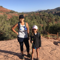
    user_profile
    Kevin La Pyrne 3 years, 7 months ago
    Track (10/30/22, 08:30:34)
    A lot of climbing on this trail. Pretty much always going up all the way to the ski hut. Makes the destination that much more enjoyable when you get there!
    ★ ★ ★ ★ ★

    user_profile
    Temecula Dan 3 years, 7 months ago
    Mount Harwood Loop via Devils Backbone Trail and Baldy Road
    10/21/2022 Early Hike - clockwise loop. Great weather, nice people. Baldy Bowl up without stops is the cardio workout while Devil's Backbone down is the orthopedic challenge (trekking poles in the ski run rubble will make it much easier). Beautiful views the whole way.
    ★ ★ ★ ★ ★

    user_profile
    BraveQuarry2782 3 years, 7 months ago
    Track (10/1/22, 5:11:05AM)
    Great intermediate hike
    ★ ★ ★ ★ ★

    user_profile
    paige.m.peter 3 years, 8 months ago
    MT BALDY W LISA PEAK #3
    Started 6:30am on a weekday at the end of September. Still hot but not bad in morning. Beautiful day. Only a small breeze at the summit. Great hike. Be sure to take your time and make lots of stops so you can enjoy the beautiful views
    ★ ★ ★ ★ ★

    user_profile
    TrueRose7755 3 years, 8 months ago
    Icehouse Canyon Loop, 9/1/22
    Left trailhead at 6:30 with Dave Scott. Actually traveled closer to 9 miles and 2500 elevation gain, started navigation late. Up via stream to Icehouse Saddle, down via Cedar Glen Camp, an additional two miles. The way down travels on a south facing slope well above the canyon. Very different terrain and plants. Great hike except for a twisted ankle with about one third a mile to complete hike. Soaked ankle in the stream.
    ★ ★ ★ ★

    user_profile
    TrueRose7755 3 years, 9 months ago
    Baldy Summit via Ski Hut (8/3/22, 9:51:50AM)
    Planned to hike to the Ski Hut, but kept going and made it to the summit. Very steep. Just over 3700 in four miles. Going up was mostly in cover of cloud which helped. Sub was out fully on the way down. Saw the wreckage of military planes on west slope. Met Conrad senior at Texas AM. Mom is the president of Redlands University. Best spot on the trail was the Cree next to the Ski Hut.
    ★ ★ ★ ★

    user_profile
    SimpleTent1733 3 years, 10 months ago
    Baldy Resort Lot to Devil’s Backbone to Mt. Baldy Peak
    Started from the Baldy Ski resort parking lot and took Mt. Baldy Rd. to the Notch, then Devil’s Backbone to the peak. It was 70F at 7am and very lightly wind at the summit. Clouds kept the heat away, but you could definitely feel the warmth. Took the chair lift down. Total hiking time was 2:15.
    ★ ★ ★ ★

    user_profile
    TrueRose7755 3 years, 10 months ago
    Baldy Notch near Thunder Mountain (7/12/22, 11:11:04AM)
    Hiked from ski lift parking lot, cutting off about a mile if starting from Manker Flats. Left at 11:10 am, too late for this warm day about 86. Hiked to the notch and explored. Ate lunch near ski lift number 2 (I think). Walked north to get a view of the desert. Hiked about half mile towards Thunder Mountain then took a ridge line back toward to water collection pool. Back to the Notch. Took a quick shortcut straight down to cut off about .65 mile. Returned to Jeep at 3:50. Only took 59 minutes to get down.
    ★ ★ ★ ★

    user_profile
    DryCreek4523 3 years, 10 months ago
    Track (5/30/22, 12:16:06PM)
    There is a lot of trash and graffiti. Please leave your dog at home. There is a ton of broken glass and innocent paws could be severely cut.
    ★ ★ ★

    user_profile
    HotStone5407 3 years, 10 months ago
    Mount Harwood Loop via Devils Backbone Trail
    Make sure to use gps. It’s fairly straightforward, but there are a couple points that are confusing/easy to get lost. Would have been in a tough spot without the help of gps.
    ★ ★ ★ ★

    user_profile
    Harvey Armbrust 3 years, 10 months ago
    Track (7/15/22, 2:33:25PM)
    Beautiful well maintained trail. Moderate sun exposure. A lot of uphill from the very beginning. Tappers off once and a while. Mostly soft trail with intermittent rocks. Great views all the way.
    ★ ★ ★ ★

    user_profile
    FullHarbor6455 3 years, 10 months ago
    Mt. Baden-Powell & Burnham
    This is a good training hike for legs. I like the choices of steep uphills and switchbacks. I get a lot out of this trail. Great view of the backside of Baldy. Excellent geology and structure. I’m gonna come back and do some mapping. Lovely place to eat lunch, too. Bring lots of energy bars or Bloks.
    ★ ★ ★ ★ ★

    user_profile
    CrispSky8200 3 years, 10 months ago
    Cucamonga Peak
    This was a very beautiful hike, lots of people, love all the different type of terrain you go through, tough but doable. Enjoy the creeks, waterfall, all the trees and birds singing
    ★ ★ ★ ★ ★

    user_profile
    CrispSky8200 3 years, 10 months ago
    Mount Wilson Trail
    Well I started around 6:17am started heading up and already can feel it a bit. Very few people, it was really nice, quiet, fresh on the way up, but the way down felt like a desert finished my water supply at mile 12 but it was worth the trip. I recommend it on fresher months if you and the heat are not friends
    ★ ★ ★ ★

    user_profile
    TallVista2444 3 years, 10 months ago
    Track (7/9/22, 5:54:18AM)Mt Baden-Powell
    Steady climb from parking lot to summit. Trail in great shape. Great views. 2 hours 10 minutes from parking lot to summit. Good training hike for Whitney.
    ★ ★ ★ ★

    user_profile
    SimpleBinos1407 3 years, 10 months ago
    Track (7/9/22, 7:17:54AM)
    Fun trail hike with Troop 188.
    ★ ★ ★ ★ ★

    user_profile
    MistyTri9398 3 years, 11 months ago
    Mount Harwood Loop via Devils Backbone Trail
    ★

    user_profile
    SimpleTent1733 4 years ago
    Icehouse Canyon to Cucamonga Peak
    Was able to find parking along Baldy Rd. at 8:15am on a Saturday. Icehouse Canyon was crazy busy...multiple groups 30 people deep 👎🏽 Cucamonga Peak Trail was much better with just a few people who were considerate and would let you pass. Cucamonga Trail was quite rocky with some super narrow sections that could be sketchy for those who are afraid of heights. But the views on this trail are amazing! Total hike time with a potty break, 2 snack breaks, and parking 1/2 mi from the trailhead was 6 hours. Vault toilets at the trailhead. Adventure Pass required at the actual parking lot.
    ★ ★ ★ ★

    user_profile
    TrueRose7755 4 years ago
    Track (5/12/22, 12:39:55PM)
    Only hiker on this route today. Good variety of wildflowers. Four miles to Sunset Peak, two miles return via the ridge. Walked through recent burn area. Sat on top for about 35 minutes. Tuna lunch. This one wore me out. Struggled on inclines. Only one slip on steep ridge recently cut by dozer.
    ★ ★ ★ ★
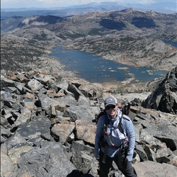
    user_profile
    VastHelmet7194 4 years ago
    Mt Islip via Crystal Lake trailhead (5/7/22, 7:10:49AM)
    Pretty scenery. Parts reminded me of the San Bernardino hike. Large parking lot with bathrooms.
    ★ ★ ★ ★

    user_profile stars
    Gordon Alexander 4 years ago
    Track (5/1/22, 7:46:50AM)
    Great training hike thru bobcat burn area. Nice wildflowers. Vigorous trail with big ups and down’s. Added Mt Waterman for a two peak day toget to 12 miles.
    ★ ★ ★ ★

    user_profile
    VastHelmet7194 4 years ago
    Echo Mtn, Inspiration Point, San Gabriel Peak (5/1/22, 6:11:00AM)
    Good amount of climbing. We too a pretty steep shortcut from Inspiration Point to San Gabriel Peak. Pretty exposed so it got hot on the way down. Pretty view of the mountains at the top. We could’ve done this much faster, but we took too many breaks and too many long stories were told. We still went at a good pace and ran during some portions of the hike.
    ★ ★ ★
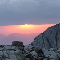
    user_profile
    CalmSquall3026 4 years, 1 month ago
    Slide Mountain
    Cool hike really liked it trail in great Knick also easy route up to the Tower with stunning views all round,I recommend cycling to the trail head 🙂 stash your bike in the bushes and then get on trail,a lot easier on the return with the wind on your back,overall worth it only bummer is the walk on the road ( on your bike mate )
    ★ ★ ★ ★

    user_profile
    CalmSquall3026 4 years, 1 month ago
    Slide Mountain Trail
    Great hike and easy trail to the Tower,cycle to the trailhead. Great views and worth it.
    ★ ★ ★ ★

    user_profile
    Nicole Ricci 4 years, 1 month ago
    Sunset Peak
    Amazing shade . Started at 515pm and finished exactly at dark around 8pm . Watch out for ticks , keep your dog leashed .
    ★ ★ ★ ★

    user_profile
    Dana Guidice 4 years, 1 month ago
    Mount Wilson Trail
    Challenging but very doable. Almost 5000ft of Elevar gain to the summit. Well marked and well maintained. Fairly crowded at lower elevations but sparse higher up. Just a walk up with no scrambling. Really nice views throughout hike. Decent shade after first mile or so. Can get hot so bring plenty of water…none available along the way. Water & bathrooms available at the summit. Sometimes the restaurant is open too.
    ★ ★ ★ ★ ★

    user_profile
    ToughStone4703 4 years, 2 months ago
    Mount Wilson Loop via Sturtevant trail
    One of my favorites. Scenery changes often. Lots of variety.
    ★ ★ ★ ★ ★

    user_profile
    ToughStone4703 4 years, 2 months ago
    Mount Baden-Powell via Pacific Crest Trail
    Buggy, not my favorite. Because it’s literally switchbacks from the car to the top, the scenery doesn’t change much.
    ★ ★ ★
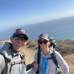
    user_profile
    OptoCC 4 years, 2 months ago
    Dawn Mine. Chaney Trail, Altadena to Millard, Los Angeles County, CA, USA
    Nice hike but pretty busy trail. Lots of shade and some small easy creek crossings. It’s an up and back (down) that is pretty technical with a lot of step ups (and downs).
    ★ ★ ★ ★

    user_profile
    VastHelmet7194 4 years, 2 months ago
    Mt Lukens via Stone Canyon (3/19/22, 7:09:22AM)
    Trail is completely exposed, so wouldn’t do it in the summer, however there are pretty view of the mountains. This is a very clear and well maintained trail. There’s just one trail so you can’t make a wrong turn. I like this trail more than the one from Deukmejian- more challenging, and prettier. Also, very isolated and ran into only 3 people the entire time. It’s a steady climbing all the way up, but not super steep. Parked right before the gate on a dirt lot because the gate was closed.
    ★ ★ ★ ★

    user_profile
    KerryScott 4 years, 3 months ago
    Inspiration Point and Echo Mountain vis Cobb Estate
    The trail is nicely maintained. Nice path to get some good elevation gain and then levels off if you take the fire road. Watch out for the mountain bikers.
    ★ ★ ★ ★

    user_profile
    KerryScott 4 years, 3 months ago
    Mount Lowe, Disappointment, Deception, Markham, San Gabriel Peak via Eaton Canyon
    Parking fills fast on weekends. Great spot to start to grab 5 peaks in less then 10 miles. All the trails are easy to follow. Both Deception and Markham are steeper but very doable. Mount Lowe was crowded at summit but the other 4 were empty.
    ★ ★ ★ ★ ★

    user_profile
    TinySwamp1448 4 years, 3 months ago
    Track (2/26/22, 10:16:00AM)
    Lovely trail steady climb with a beautiful creek for the first mile. Water still running today. Some snow still on the shady side of the climb up to Josephine peak (5,500 ‘)
    ★ ★ ★ ★

    user_profile
    WiseGloves5078 4 years, 3 months ago
    Rattlesnake Peak via Shoemaker Canyon Road
    Mid February, nothing out of the ordinary. Steep then not steep.. lol I like the challenge. If I start early enough I can see the wonderful colors about 6:15 am. Mo snow when I went but I think it might have some from todays rain. The first mile of fire road is a nice way to get warmed up but not so great on the way back when it has warmed up. Lol Have fun and take mini breaks along the way not to tire too much.
    ★ ★ ★

    user_profile
    SlimClover2728 4 years, 3 months ago
    Mount Baden-Powell via Pacific Crest Trail
    I love this trail, ones you get to the top of the peak the view is one of the best.
    ★ ★ ★ ★ ★

    user_profile
    Lisa Ouillette 4 years, 4 months ago
    Strawberry Peak (1/25/22, 11:21:51AM)
    My friend and I finished this one today. Nice hike. I loved how cool it was (low 60’s). No snow or ice anymore. Breezy in sections up top but it was nice. We started at 11:20 and finished about 4:45. We spent about an hour at the peak eatin and enjoying the view. Everyone is pretty accurate when they say the last 1.25 miles is rough….. got pretty cold coming down near the bottom. Was 55 in the parking lot.
    ★ ★ ★ ★

    user_profile
    E5h7I3DC 4 years, 4 months ago
    Baldy ski hut
    Fun hike up to the hut! I like it in winter when you get to hike in the snow
    ★ ★ ★ ★ ★

    user_profile
    HillyBeach7387 4 years, 4 months ago
    Mount Lowe Hike
    A moderate hike with wonderful views of Los Angeles basin. The ruins at the top of the railway and house are very well described with plaques and pictures.
    ★ ★ ★ ★ ★

    user_profile
    LushSwimCap3525 4 years, 4 months ago
    Castle Canyon Trail Loop
    Don't really recommend this hike. The first three miles up to the peak are quite steep, and the trail is poorly maintained. I didn't see a single person between the trailhead and Muir peak, and understandably so. The trail is steep, hard to find in a few places, and a bit dicey in a few others. If you want to check out Muir peak, much better to hike up to Inspiration Point from Cobb Estate, then hike over to Muir, and then backtrack.
    ★ ★ ★

    user_profile
    SoftElm6607 4 years, 5 months ago
    Lightning Trail
    First ever hike in the snow storm. We were prepared but lacks of experience, much more to learn. First thing first, should not try to hike in the snow storm.
    ★ ★ ★ ★ ★

    user_profile
    VastHelmet7194 4 years, 5 months ago
    Mt Lukens (12/11/21, 8:06:47AM)
    Fair amount of free parking with a bathroom. Trail is totally exposed and a decent amount of climbing up dirt, scree, and talus. There are views of Glendale, but nothing spectacular. Going down, there are a couple of turn offs that are marked by a post but would be easy to miss. Small sections are fairly steep. Decent workout, but for sure would not want to do on a hot summer day because there is absolutely no shade.
    ★ ★ ★

    user_profile
    Erin Clerico 4 years, 6 months ago
    Track (10/30/21, 8:20:22AM)
    Great view from up there, and a good conditioner. Leave early enough and you’ll get some shade on the way up.
    ★ ★ ★ ★ ★

    user_profile
    FreeTree1968 4 years, 6 months ago
    Track (11/27/21, 2:05:22PM)
    Steep and loose but rewarding views.
    ★ ★ ★

    user_profile
    EasyOasis1535 4 years, 7 months ago
    Mt Baldy Hike 9/29/18 6:27:34 AM
    I had a great hike with Rich & Julie Sumner, up the Bowl trail to the top of Mt Baldy, then down the Devil’s Backbone trail.
    ★ ★ ★ ★

    user_profile
    bearbear 4 years, 7 months ago
    Ruby Canyon Hike
    Another Tuesday, another hike! This time we took on the Ruby Trail, a 6 mile out and back trail to Canyon Butte. The first mile is along Ruby Creek, with the first stream crossing being the large Daisy Creek. There are a few campsites along the trail with limited services. Mile 2 is an ascent to the butte, not much shade and some steep sections. Lots of wildflowers right now, not much grass. The butte is amazing, a bit of prominence. Repeat the same steps for the way back. Location: 7/10 Difficulty: 4/10 Scenery: 9/10 Trail Conditions: Graded road for 2.8 miles, the rest is a old road grade to the butte. Rating: 9.5/10 Weather: Cloudy and windy. with rain near the end. 40 degrees
    ★ ★ ★ ★ ★

    user_profile
    BrightField5047 4 years, 7 months ago
    Monrovia Canyon Park Waterfall (10/16/21, 8:59:15AM)
    Easy trail, lots of trees/foliage, creek runs along trail, man made damns
    ★ ★ ★

    user_profile
    Justslm 4 years, 10 months ago
    Mill Creek Summit Picnic Ground to Pacifico Mountain, Los Angeles County, CA, USA
    The gate was open so we drove up. Nice views!
    ★ ★ ★

    user_profile
    SoftElm6607 4 years, 10 months ago
    Throop Peak via Pacific Crest Trail
    For experts this maybe easy hike but for us, it was good distance and incline. Nice hike for us to build up stamina for longer hikes and navigate through Angeles National Forest.
    ★ ★ ★ ★ ★

    user_profile
    LongSki8686 4 years, 10 months ago
    Pinyon Ridge Truck Trail
    This was our first trail we went on with our Jeep and we had a really good time.
    ★ ★ ★ ★ ★

    user_profile
    dukeside 4 years, 11 months ago
    Mount Wilson 11-2019
    Too many damn gnats
    ★ ★ ★ ★

    user_profile
    DustyBoulder3006 4 years, 11 months ago
    Mt Baden-Powell
    Switchbacks to Heaven. My Monday afternoon freed up so I figured why not tackle Mt Baden-Powel. Set out from Vincent Gulch around 2:20 and largely had the mountain to myself with the exception of a few folks descending. Met a lovely woman on the top who had come up from the other side, who was kind enough to take my pic at the summit. Had an awesome encounter with a deer on the ascent, and detoured out to Lamel Spring on the descent. I’m sure that spring comes in handy when you are through hiking enroute to Canada on the PCT. just a beautiful day and it all happened on a whim!
    ★ ★ ★ ★ ★

    user_profile
    Richard Barry 4 years, 11 months ago
    Mount Baden-Powell with Carlos!
    Fantastic hike - not too tough but an incredible view from the 9400’ summit! Cool and breezy walk through gorgeous pine forests and an amazing view of the desert and all around below.
    ★ ★ ★ ★ ★

    user_profile
    DustyBoulder3006 4 years, 11 months ago
    Gabrielino Trail East to Red Box Picnic Area, Los Angeles County, CA, USA
    First peak I bagged in the 2021 Six Pack of Peaks challenge. Temps soared into the low 90’s when I got to the summit ridge. Definitely leave before 8a on a hot day. Would have been much easier had I departed Red Box at 6/6:30a. Beautiful hike, none the less! Had the summit to myself until a couple guys emerged from the Mountaineer’s route. Generally felt strong. Gearing up for the bigger climbs ahead. 💥✌️
    ★ ★ ★ ★

    user_profile
    Maeve Reston 4 years, 11 months ago
    Mt. Wilson Trailhead
    Plan a full day to the top because the ascent is very steep and pretty relentless. The gates to the picnic area were locked at the top but if you can find a way in, there is a water station near the (closed) restaurant at the summit. Shoes with grip are a must.
    ★ ★ ★ ★ ★

    user_profile stars
    Gordon Alexander 4 years, 11 months ago
    Big Horn Baden Powell (6/6/21)
    Popular hike to the top of a a peak with some of the best views around. Added to that was a fun mine walk and exploration
    ★ ★ ★ ★ ★

    user_profile
    Peter Hewitt 4 years, 11 months ago
    6/5/21 Helen Luong Ice House Trail
    Helen, Lilly the dentist and Regina Le Nguyen the accountant hiked up to the Ice House saddle, ascending on a very densely used trail. Carried D7500 camera. Descended on a much less-used trail to the north.
    ★ ★ ★ ★

    user_profile
    WarmPaddle3513 4 years, 11 months ago
    Red Box Picnic Area to Firebreak, Los Angeles County, CA, USA
    Very nice hike. Some steep areas but nothing super hard
    ★ ★ ★ ★ ★
    user_profile
    Rick Rivera 5 years ago
    Baldy from The Notch
    Beautiful day above the clouds
    ★ ★ ★ ★

    user_profile
    FullWBottle4104 5 years ago
    Track (5/22/21, 11:52:12AM)
    A true SoCal classic. Lots of terrain variety, fun creek crossings, swimming holes, and if your lucky big horn sheep sightings.
    ★ ★ ★ ★ ★

    user_profile
    OptoCC 5 years ago
    Bridge to Nowhere, Azusa
    The trail is beautiful and diverse. Busy trail especially with big groups of Boy Scouts and those heading to the bridge to bungee jump. Saw some big horn sheep, lots of water crossings, beautiful flowers. The trail is technical, wore my trail runners because they dry quick but would have liked boots for the rocks. Pretty much flat with just some climbs here and there but no real elevation gains. Coming back was clearer than going out as far as getting off trail, especially around the water crossings.
    ★ ★ ★ ★

    user_profile
    Nijessia 5 years ago
    Track (4/24/21, 7:52:45AM)
    Beautiful hike! They’re giving tickets to anyone parking outside the parking lot... $40
    ★ ★ ★ ★ ★

    user_profile
    QuietCypress3322 5 years ago
    Icehouse Canyon Trail to Icehouse Creek
    We had very lucky weather. High of 64 and sunny. When we got up to the top we were the only ones there and were above the clouds. We only saw a few people. Started at 9:40pm and finished at 6.
    ★ ★ ★ ★ ★
    user_profile
    LuckySequoia6796 5 years ago
    Blue ridge
    H
    ★ ★ ★

    user_profile
    LuckySequoia6796 5 years ago
    Blue ridge
    H
    ★ ★ ★

    user_profile
    CuteVista7971 5 years, 1 month ago
    Ice house saddle (4/10/21, 10:30:02AM)
    Temp at the trail head: 75 f Water, 1.25 - 1.5 liters
    ★ ★ ★ ★ ★

    user_profile
    EarlySwimCap6737 5 years, 1 month ago
    trail canyon falls
    this is a nice easy trail for a seasoned hiker, and may be a good lil challenge for people who aren’t use to hiking in general. always love this views on this trail it’s a pretty hike all the way through.
    ★ ★ ★ ★ ★

    user_profile
    HugeRidge4065 5 years, 1 month ago
    Mt Baldy via Mankar flats (4/8/21, 6:42:41AM)
    Headed up towards the mt baldy hut. After the hut, we hit some snow and it made it difficult to find the path for about 1mile. Was a bit windy up the path. Once we got to the top, it was windy and chilly. We decided to come down the same way because the winds were extremely strong going towards Devil’s Backbone. Was a great day to hike!
    ★ ★ ★ ★ ★

    user_profile
    Alex Wimmer 5 years, 1 month ago
    Mt. Baldy
    Great overall hike.
    ★ ★ ★ ★

    user_profile
    MistyBoulder9213 5 years, 1 month ago
    Angeles Crest Highway to Josephine Peak Road
    I enjoyed this hike for a fire road, which given the days of covid are my go to hikes. I loved the views and solitude. Only encountered three different people on the hike. It’s so quiet at the top, it’s sooo good that way.🙏🏻
    ★ ★ ★ ★

    user_profile
    SimpleExplore8527 5 years, 2 months ago
    Cienega Flats old Camground
    Nice introduction back country hike within short distance from Santa Clarita. Abandoned campground makes a perfect wilderness site.
    ★ ★ ★ ★

    user_profile
    TinyGlade3940 5 years, 2 months ago
    Iron Mountain
    Hardest hike I’ve ever done super difficult this mountain is a Beast amazing views at the top breathtaking jaw dropping happy yo conquered it
    ★ ★ ★ ★ ★

    user_profile
    TinyGlade3940 5 years, 2 months ago
    Jones Peak via Bailey Canyon Trail
    Great hike this reminded me of Echo Mountain lots of switchbacks great butt kicker loved it
    ★ ★ ★ ★ ★

    user_profile
    SturdySky6342 5 years, 2 months ago
    Strawberry Peak Loop via Firebreak
    Starts off easy and escalates in the second mile and then the last mile is a challenging class 2 hike to the peak. Lots of elevation gain over a short distance and you have to use your hands a bit. But it’s totally worth it, and never too risky. Beautiful views throughout the entire hike, and crisp mountain air is abundant. Love this one.
    ★ ★ ★ ★ ★

    user_profile
    GMAN1966 5 years, 2 months ago
    Track (3/20/21, Rowher cyn run w/On The Rocks 4x4 Club
    My first 4x4 run. A Little too advance for fist time wheeling but I made it.
    ★ ★ ★ ★

    user_profile
    FaintSpring8618 5 years, 2 months ago
    East Fork Trail
    Fun hike but a lot of traffic.
    ★ ★ ★ ★ ★

    user_profile
    Paulo Panaligan 5 years, 2 months ago
    Baldy Ridge
    Great lines at top, should start it earlier, take skis off and hike down past the ski hut Started at 8:45 got to top around 12:30
    ★ ★ ★

    user_profile
    simon chen 5 years, 2 months ago
    Mt Lukens
    Long, steady climbing. Pace yourself
    ★ ★ ★ ★

    user_profile
    BraveJetboil9137 5 years, 2 months ago
    Rowher Flats OHV (2/27/21, 9:46:17AM)
    First OHV trail in a stock 21 Willys Wrangler, had a lot of fun. And a great trail for some experience building.
    ★ ★ ★ ★ ★

    user_profile
    Jaime Navarro 5 years, 2 months ago
    Bear Divide to Fire Camp 9 / May Canyon to Veterans Park
    Mountain Bike Ride: Start @ Bear Divide for 3.5 miles, paved road and steep on some areas, great workout and great views.
    ★ ★ ★ ★

    user_profile
    John Murphy 5 years, 3 months ago
    3 miler to church
    Runs up Highway 2 and then back though the residential area
    ★ ★ ★

    user_profile
    CalmSquall3026 5 years, 3 months ago
    Condor Peak Loop via Trail Canyon Trail
    Pretty fun hike a bit of bushwhacking plus the scramble is a pain in the ass,pretty steep ,loose soil a few branches to grab a hold off 🙂 lots of rivers running plenty of water which is a change,Kudos to all Bro Hikers for the Cairns,stunning views didn’t bump heads with anyone on the Trail,Focus on the trail,it’s disappears once or twice before some of the stream crossings. Be safe,Happy Hiking
    ★ ★

    user_profile
    John Murphy 5 years, 3 months ago
    Track (2/13/21, 10:30:23)
    Up the wash off of Lone Pine then up the ridge behind Twin Lakes. Gorgeous. Strenuous.
    ★ ★ ★ ★

    user_profile
    kasey.hosp 5 years, 3 months ago
    Hoyt Mountain Loop via George’s Gap, Telephone Trail, and Firebreak
    5 stars with a caveat—expect to scramble.
    ★ ★ ★ ★

    user_profile
    BusyBay8996 5 years, 3 months ago
    Cucamonga Peak
    The scenery is otherworldly. The streams, greenery, rock, etc. Moreover, the landscape itself changes as you continue to summit. The view at the top is worth the strife. Highly recommend, even if you’re just doing a mile in.
    ★ ★ ★ ★ ★

    user_profile stars
    CurryHurry77 5 years, 3 months ago
    Mount Wilson Trail
    Trail was in good condition, especially considering the all the recent rainfall. Some sections were rutted or slightly washed away but most of the trail was well constructed and reinforced.
    ★ ★ ★ ★

    user_profile
    LightThicket6416 5 years, 3 months ago
    San Antonio Loop
    This trail is incredible. We traversed up the Devil’s Backbone trail from the East (first tracks after a snowstorm, we postholed through up to 6 foot drifts) and descended the baldy bowl route, even sliding down a few sections, luge style. Incredible scenery from pre-dawn to dusk and insanely nice weather, including almost no wind on the summit.
    ★ ★ ★ ★ ★

    user_profile
    aberg857 5 years, 4 months ago
    Glendora Motorway to Garcia Cross
    Simple walk on a fire road, with lots of up and down. The west end of the trail is a relatively steep incline. The road was smooth, having been graded within the last year. Enjoyable on a cool day, but beware hot days.
    ★ ★ ★ ★

    user_profile
    SlowLedge8109 5 years, 4 months ago
    Mount San Antonio via Bear Canyon Trail
    I started very early and it’s quite an adventure! Hard on the knees and feet coming down. Don’t forget to re-lace / tighten your shoes prior to coming down. Bring plenty of food and water! Perfect training for Mt. Whitney!
    ★ ★ ★ ★ ★

    user_profile
    EarlySwimCap6737 5 years, 4 months ago
    Colby canyon to josephine peak!
    This was an amazingly beautiful hike! so many plants that were lively and views for days. Loved it and it was the perfect challenge not too much not too little :)
    ★ ★ ★ ★ ★

    user_profile
    SimpleBoots1644 5 years, 4 months ago
    Iron Mountain
    Great hike today, tough as hell on the last 3 miles. Lots of vm loose rocks and very steep. Spectacular views!
    ★ ★ ★ ★

    user_profile
    HighRappel2558 5 years, 4 months ago
    Mount Wilson Loop via Sturtevant trail
    This was my challenging hike so far. It was also one of the most rewarding as I encountered various terrain and steep inclines in completing it. The views at the summit were amazing!
    ★ ★ ★ ★ ★

    user_profile
    PL0QRuHc 5 years, 4 months ago
    Muir Peak with Carlos.
    Muir peak is a really tough 5-6 mile hike with expansive views of the LA Basin and surrounding mountains. Avoid the crowds at Echo and inspiration point. About 3000 ft of elevation gain in about 2.5 miles. Some steep sections with lots of sliding rocks. Take your time on your way down.
    ★ ★ ★ ★

    user_profile
    Jonathon 5 years, 4 months ago
    Track (1/9/21, 6:49:53AM)
    Started at 7:00 am there was some patches of snow heading up to the ski hut after that there was more snow micro spikes were required made it up to Mt Baldy there was a bit of wind not to bad then we started making our way down via register ridge a bit steep but managed to make it down.
    ★ ★ ★ ★

    user_profile
    MajorThunder7503 5 years, 4 months ago
    Track (1/3/21, 14:02:30)
    Short rewarding hike with great views at the top.
    ★ ★ ★ ★ ★

    user_profile
    SharpAspen8162 5 years, 4 months ago
    Track (1/3/21, 9:11:37AM)
    Lewis falls. Nice to say hike.
    ★ ★ ★ ★

    user_profile
    TinyGlade3940 5 years, 5 months ago
    East Fork Trail
    Great hike, not many people today at the trail this is my third time and I enjoyed more than the first time I will definitely do it again in the summer, water was too cold, follow the red or yellow arrows, just be prepared for some difficulties overall amazing trail.
    ★ ★ ★ ★ ★

    user_profile
    BrightMaple2218 5 years, 5 months ago
    201226 Baldy
    Went up/down Baldy Bowl Trail, with Craig Hoover. Bumped into Dan Jonasen, doing his 1,302nd ascent on Baldy. Was cold and windy. Lost Craig in Hellcat ravine.
    ★ ★ ★ ★

    user_profile
    SlowRose8072 5 years, 5 months ago
    Cucamonga Peak (12/25/20, 11:16:44AM)
    Loved the view when getting up there!! Make sure you bring crampons, the trail gets icy when passed the icehouse saddle. Recommended.
    ★ ★ ★ ★ ★

    user_profile
    GrandGale3079 5 years, 5 months ago
    Three points to East Twin
    I’ve been up twin peaks before but from the other side of waterman, never from this trailhead. Since the bobcat fire has the road closed around here, this is the best option to get to twin peaks. The trail is mostly forested with great views down into devils canyon. There look to be some great places to camp on benches a little further down from the trail.
    ★ ★ ★ ★

    user_profile
    JovialKnoll1962 5 years, 5 months ago
    East Fork Trail
    Really enjoyed this hike, first timer on this trail. Arrived about 8am on Monday morning, and there were only a couple of cars there. Hardly anybody on the trail. The river level was low, no more than knee high at the deepest parts, but easy to find places to cross that were only ankle deep. Water wasn't too cold in the morning and felt great by late morning/early afternoon. Weather was great, plenty of shade throughout the trail until the last mile or so as you climb in elevation to reach the bridge.
    ★ ★ ★ ★ ★

    user_profile
    EarlySwimCap6737 5 years, 5 months ago
    Jones Peak via Bailey Canyon Trail
    I loved this hike so much. the air smelled amazing and I enjoyed the challenge going up hill. it wasn’t SO hard but def had to take a few breaks up the way. took us 1hr & 45 min to get up but not so long coming down. will def be doing this again and again.
    ★ ★ ★ ★ ★

    user_profile
    CannyDelta5779 5 years, 5 months ago
    Green Gate Trail (12/6/20, 1:50:17PM)
    This was a easy hidden hike that lead to an over look Morris dam. Trail continues but becomes unpassable.
    ★ ★ ★

    user_profile
    CalmSquall3026 5 years, 5 months ago
    Cucamonga Peak
    Great hike all round 👍
    ★ ★ ★ ★ ★

    user_profile
    CalmSquall3026 5 years, 5 months ago
    Mount San Antonio via Bear Canyon Trail
    Definitely not a walk in the park,mostly uphill pace yourself slow and steady,it’s a true trail very picturesque,amazing views,boulders,Easy trail to follow,be prepared with the essentials,4 L of water was fine,layer up it gets Windy and Nippy on the ascend, Positive is very very few hikers on the Trail,only bumped into 3 hikers earlier.watch your footing on the downhill ,a small trail of ice before the narrows but nothing major. be safe Happy Hiking
    ★ ★ ★ ★ ★

    user_profile
    CrispTornado3717 5 years, 5 months ago
    Track (12/6/20, 11:49:09AM)
    There are some good hill climbs here. Rubicon with 33s did it no problem but there are some steep moments that get the adrenaline going.
    ★ ★ ★ ★ ★

    user_profile
    Tucker Folsom 5 years, 6 months ago
    Lukens via western ridge walk
    Hard ridge walk with great views. Very exposed, not a good idea during hot months.
    ★ ★ ★ ★ ★

    user_profile
    WarmPaddle4155 5 years, 6 months ago
    San Antonio Falls (11/22/20, 10:14:12AM)
    Hiking Mt. Baldy via Ski hut with a hangover is not a good 💡 idea! 😹😸😹 When all else fails, San Antonio Falls is always there for reclusion.
    ★ ★ ★ ★ ★

    user_profile
    smith.gffry 5 years, 6 months ago
    Icehouse TH to Ontario peak and back via Icehouse Canyon
    This hike starts on the normally high traffic Icehouse Canyon trail. After a 1/4 mile or so we leave the trail and go off trail and head up Falling Rock canyon. Yes, I don’t like the name either. Steep, lots of debris but very manageable. An obviously scree field presents itself at the top of Falling Rock. Head to the right and up the scree field to gain a saddle. From there follow the ridge to the top of Ontario’s Peak!
    ★ ★ ★ ★ ★

    user_profile
    John Fisher 5 years, 6 months ago
    Condor Peak
    Tough but enjoyable. Lowelife’s are making some headway in improving the trail.
    ★ ★ ★ ★

    user_profile
    CalmSquall3026 5 years, 6 months ago
    East Fork Trail
    Fun hike nice bit of exploring that day 3 or 4 river crossing,friendly bunch on the trail, know were your going your route and crossing to the ridge etc bring 5 liters of water back up protein bars,can’t beat a PBJ 🙂 might want boots and rouge Merrill sandals if you want to stay dry.fun moderate hike,My dog also loved it.
    ★ ★

    user_profile
    EarlyRainbow1037 5 years, 7 months ago
    Cucamonga Peak via Chapman Trail to Icehouse Canyon Trailhead
    This hike was epic. I started at the Icehouse Trailhead, but forgot to hit “record” on the GAIA app. Doh. I did not realize it until the top at Cucamonga Peak. Oh well. At least I recorded the descent. At the top, there was very light wind, warmer than normal, it was around 80 degrees at the peak. There was just enough breeze to cool things off in the shade. Chapman Trail in the afternoon is hot and difficult due to the narrow trail and rock-slide traverses. It is not for beginners. After reaching Cedar Glen campground, the 2.5 mile hike to the trailhead was amazing. It had all the features: rock slide traverse, oak and pine forest, stream crossing twice, thick scrub brush maze-like narrow trail, switchbacks, and finally the last mile of Icehouse Canyon to the trailhead.
    ★ ★ ★ ★ ★

    user_profile
    FullLaurel6309 5 years, 8 months ago
    Mount Zion Loop via Sturtevant trail and Lower Winter Creek Trail
    One of the better hikes in the area! We first hiked to Sturtevant Falls, then backtracked to hike up to Mount Zion. There are some cool historic cabins at the Sturtevant campsite and a swing! The trail wasn’t very crowded and mostly shaded although on the way down there were some exposed areas. I’d say this was moderately difficult.
    ★ ★ ★ ★ ★

    user_profile
    HugeRidge4065 5 years, 9 months ago
    Baden-Powell Summit
    Excellent hike! Started at 5:30am and made the climb in 1:40. Lots of switch backs and the views are amazing! American flag at the top to take cute pics with the sign. I brought 2 liters of water and was plenty for the hike with minimal snacks. The hike down was not too bad on the knees. Overall a beautiful hike and knocked it pit quick in about 3hrs round trip!!
    ★ ★ ★ ★ ★

    user_profile
    SnowyCamp6781 5 years, 9 months ago
    Mount Baden-Powell via Pacific Crest Trail
    Felt very long. Lots of switchbacks. Totally worth it to make it to the top though!
    ★ ★ ★ ★

    user_profile
    SnowyCamp6781 5 years, 9 months ago
    Cedar Glen Campground via Chapman Trail and Icehouse Canyon Trail
    Not too difficult. Beautiful views throughout. Good workout.
    ★ ★ ★ ★

    user_profile
    FrostyLeaf8960 5 years, 9 months ago
    Mount San Antonio via Devils Backbone Trail
    I took the trail that goes right under the ski lift. That plus Devil’s Backbone all the way up and it was difficult for me. I liked it, but I wouldn’t recommend it for casual hikers. It was more of a test for myself to see if I’m getting back in shape. It took about 7 hours, but i didn’t take the ski lift trail down. I took the fire road because my knees were kind of hurting. Lots of great views, but be prepared. I did this 08-16-20, where there were fires in the distance and a heat warning. A great day, and it ended up being almost exactly 9 miles.
    ★ ★ ★
    user_profile
    SweetThyme3548 5 years, 9 months ago
    Cucamonga peak
    It was cool. A little crowded and brutal at some points. When we got back to the car temp said 106°F.
    ★ ★ ★ ★

    user_profile
    Allieemay 5 years, 9 months ago
    Mount San Antonio via Bear Canyon Trail
    Bring more than 3 liters of water, lots of sunscreen, and snacks. Oh, and a hat.
    ★ ★ ★

    user_profile
    MistyHarness7935 5 years, 9 months ago
    Track (8/8/20, 7:30:14AM)
    Truck to summit in 2:45. My best time yet on this beast. Great day with Steve. No beers at the Notch today. Too early for me.
    ★ ★ ★ ★ ★

    user_profile
    Thomas Weber 5 years, 9 months ago
    Mount Baden-Powell via Pacific Crest Trail
    This trail is quite nice. It has enough elevation gain to get your legs and heart a workout. We went from Dawson Saddle, to the top of Throop Peak, then Burnham Peak and finally Mount Baden-Powell. Much of the trail is gentle up and down following contour lines with scrambles up to the top of the peaks. The weather was perfect and most of the trail is shaded. Definitely recommend it.
    ★ ★ ★ ★

    user_profile
    CrispWild9030 5 years, 9 months ago
    Cobb State Trailhead to Tunnels and Back
    Best part of the trail is the Sam Merrill Trail before reaching inspiration point
    ★ ★ ★ ★ ★

    user_profile
    CrispWild9030 5 years, 9 months ago
    Baden Powell From Crystal Lake
    One of the most beautiful trails along the sheep mountain wilderness. With views of the dessert and also the coast.
    ★ ★ ★ ★ ★
    user_profile
    ZippyWatch2077 5 years, 10 months ago
    Islip Saddle to Mt Hawkins
    Little Jimmy is one of the best camp grounds in the area. Due to the COVID shutdown, the mountains are very popular on the weekends. Week days offer a little more quiet time. I highly recommend hiking to Mount Hawkins at a minimum. Wonderful view!!! If your fit enough, go all the way to Baden Powell. Really enjoyed it.
    ★ ★

    user_profile
    Masatoshi Sato 5 years, 10 months ago
    Track (7/26/20, 06:20:41)
    Easy for trail running and regular hikers. Beautiful scenic views. Strenuous for hobby hikers.
    ★ ★ ★ ★ ★

    user_profile
    Pat Yuan 5 years, 10 months ago
    Timber Mountain via Icehouse (7/21/20, 8:03:24AM)
    Shady for the most part
    ★ ★ ★ ★ ★

    user_profile
    mail 5 years, 10 months ago
    switzer falls
    nice little hike but overcrowded.
    ★ ★ ★ ★

    user_profile
    Pat Yuan 5 years, 10 months ago
    Timber Mountain via Icehouse Canyon Trail
    Mostly in shade; make it a pleasant hike during hot weather. Be aware of snakes.
    ★ ★ ★ ★ ★

    user_profile
    StrongIsland5920 5 years, 10 months ago
    Mount Wilson Loop via Sturtevant trail
    Mt WILSON via Chantry Flat Trailhead. 7.2 miles x 2 ( to and from the Summit ). The best hike I’ve experienced to date. Shaded 87% of the trails. Creek water was crystal clear, clean and soothing cold. There is a restaurant at the Summit called COSMIC CAFE. Beautiful trails... take your girlfriend with you. Give it a total of at least 8 hours to Summit and return. 3 hours 15 mins to descend and an extra hour minimum for ascending.
    ★ ★ ★ ★ ★

    user_profile
    StrongIsland5920 5 years, 10 months ago
    Cucamonga Peak
    Cucamonga Peak via Icehouse Saddle. About 25%-35% shaded. Creek water was clear but had a faint sewer smell. The view on top was breathtaking overlooking the urban grids. View from the Peak is magical at night! Descending took 2 hours 47 mins while Ascending took an hour more. Give yourself 8 hours minimum to Summit and return.
    ★ ★ ★ ★

    user_profile
    HotLamp7850 5 years, 10 months ago
    Track (7/16/20, 8:14:59AM)
    Scenic hike. I would definitely do it again.
    ★ ★ ★ ★ ★

    user_profile
    FreshMarsh5701 5 years, 10 months ago
    Track (7/8/20, 5:54:06AM)
    Boom!
    ★ ★ ★ ★ ★

    user_profile
    Isabelle Galan 5 years, 10 months ago
    Track (7/5/20, 9:18:38AM)
    If you are confident in your map and compass skills this is an amazing hike on a wide ridge with no steep drop offs. Just keep in mind that this is a reverse hike and you need to come back up. Amazing views of the San Gabriel Mountains!
    ★ ★ ★ ★ ★

    user_profile
    FizzyIsland5814 5 years, 10 months ago
    Mt Baden Powell and Mt Burnham
    Good workout on the switchbacks for those training! Fun views!
    ★ ★ ★ ★

    user_profile
    EarthySage4463 5 years, 10 months ago
    Slide Mountain
    Beautiful Hike, long Hike. Provides great views of Pyramid lake, and some not oft explored SoCal wilderness.Check out my trip report, and trail description here:https://hikethepla.net/slide-mountain-california/
    ★ ★ ★ ★ ★

    user_profile
    Lisa Ouillette 5 years, 10 months ago
    Mount Wilson Loop via Sturtevant trail
    This was an amazing hike. Longest I’ve done and yet the best. I’m doing the 6 peaks challenge. I loved the shade. It was hard going up. Took us 7 hours and 15 min. We hung out at the Sturtevant resort. We also did the waterfall as well as parked down the mountain due to the parking lot being closed. Took us just 3 hours to get down. Left the truck at 9:00 and back about 7:15. Long day. I clocked about 15 miles all together.
    ★ ★ ★ ★ ★

    user_profile
    TallRainbow1285 5 years, 11 months ago
    Strawberry Peak
    Excellent hike. If it’s cloudy in Burbank you will be above the clouds here. Wonderful views and most of the hike has flat terrain except for the final half mile going up. Sun protection and ample water recommended.
    ★ ★ ★ ★ ★

    user_profile
    TallRainbow1285 5 years, 11 months ago
    Strawberry peak Track (6/28/20, 1:34:01PM)
    Scenic views above the clouds, pleasant day hike.
    ★ ★ ★ ★ ★

    user_profile
    SlimStone9472 5 years, 11 months ago
    Rowher
    Some of OHV trails were rated black diamond , but was easy with my stock JT Rubicon. However, some of them were challenging too.
    ★ ★ ★ ★ ★

    user_profile
    ccgraham 5 years, 11 months ago
    Cucamonga Peak
    This is a beautiful hike. Disappointingly crowded with hikers who don't know wilderness or trail etiquette. Please remember that the wilderness is here for everyone to enjoy, and be respectful of it. 1) Listening to music on a wilderness hike only serves to stress wildlife. 2) Right of way always goes to the uphill trekker. Happy trails!
    ★ ★ ★

    user_profile
    GrandPaddle1935 5 years, 11 months ago
    Hermit Falls
    Great hike with a few creek crossings.
    ★ ★ ★ ★ ★

    user_profile stars
    JG 5 years, 11 months ago
    Cucamonga Peak
    Leave early in the day, preferably well before 7 am to avoid the heat of the day. Remember that a self-issue wilderness permit (available at the trailhead) is required for Cucamonga Wilderness. Route is very steep in sections, and not a typical grade for a trail in this area. Some sections of the trail close to the summit have small rockslides on them — be careful crossing these sections. PLEASE don’t cut switchbacks and take your trash with you. Thanks!
    ★ ★ ★ ★

    user_profile
    FrostyElm7346 5 years, 11 months ago
    Mt. Baden Powell (6/7/20, 7:57:48AM)
    Amazing day to hike this peak, some snow patches here and there. Not that many people for a weekend and overall good training hike
    ★ ★ ★ ★ ★

    user_profile
    ArchAurora6079 5 years, 11 months ago
    Track (6/6/20, 6:26:08AM)
    This trail was straight incline to the top of the mountain but the views were amazing. I’ve done other trails and this by far was the best route.
    ★ ★ ★ ★ ★

    user_profile
    bontot 5 years, 11 months ago
    Cucamonga Peak
    6/4/20 We start 7 Am,Me n my wife, we get back by 5 Pm, it's very challenging, is lot of rocks, hot day, but it's very rewarding.
    ★ ★ ★ ★ ★

    user_profile
    BraveMist1821 5 years, 11 months ago
    Josephine Peak
    Nice hike, but be ready for full sun.
    ★ ★ ★ ★

    user_profile
    RareBluff3990 6 years ago
    Track (5/30/20, 12:14:36PM)
    Not a lot of bugs, great trail, snow obstacles to get over, windy at top, hard finish. We stopped just shy of the final few hundred feet to the top.
    ★ ★ ★ ★

    user_profile
    SafeJetboil5346 6 years ago
    Echo mountain trail head to mount Lowe
    Great hike. Bring a lot of water!
    ★ ★ ★ ★ ★

    user_profile
    KerryScott 6 years ago
    Mount Lukens
    Good idea to start this hike first thing in the morning. Not much shade once the sun is up.
    ★ ★ ★ ★

    user_profile
    FrostyElm7346 6 years ago
    Johns Peaks (2/8/20, 7:22:58AM)
    Easy training hike
    ★ ★ ★

    user_profile
    FrostyElm7346 6 years ago
    Mt Slip (5/16/20, 7:10:21AM)
    One good training hike, moderate level and nice views
    ★ ★ ★ ★ ★

    user_profile
    FairHPack9467 6 years ago
    Trail Cyn Falls via Trail Canyon Trail and North Trail Canyon Road
    Went 5/17/20 - great hike! Kind of crowded. Didn’t go to the bottom but did go to the top of the falls. Lots of water crossings, and wasn’t prepared, got wet feet. Not too hot.
    ★ ★ ★ ★
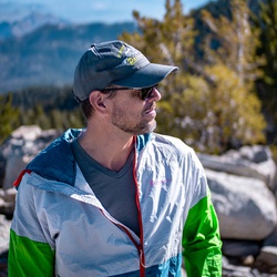
    user_profile stars
    steverpeac 6 years ago
    Mt Lukens Loop
    The hike right out of the parking lot aseme’s through a nature center full of wildflowers. In fact, there were dozens of various wildflowers along the hike. The first couple of miles, going counterclockwise, was relentlessly uphill. Then the elevation gain moderates near the peak. Great views of the Los Angeles basin and back down into Tujunga Canyon.
    ★ ★ ★ ★

    user_profile stars
    steverpeac 6 years ago
    Strawberry Peak Loop via Colby Canyon Trail
    This is a really challenging loop, given the distance involved, but rewarding in both views and varied terrain. You can make it even more challenging by adding Mt Lawlor to the loop, which adds a very steep ascent and descent to an otherwise long and challenging loop.
    ★ ★ ★ ★ ★

    user_profile stars
    steverpeac 6 years ago
    Josephine Peak
    As long as it’s not too hot out, this is an excellent hike. You get some nice variation in terrain and great views both from Josephine saddle and the peak. If you want to extend the hike, you can add Strawberry Peak, but it’s a fairly steep scramble to get up it.
    ★ ★ ★ ★

    user_profile stars
    steverpeac 6 years ago
    Josephine Peak Road
    As long as it’s not too hot out, this is an excellent hike. You get some nice variation in terrain and great views both from Josephine saddle and the peak. If you want to extend the hike, you can add Strawberry Peak, but it’s a fairly steep scramble to get up it.
    ★ ★ ★ ★

    user_profile
    FizzyIsland5814 6 years ago
    Will Thrall Peak
    Great consistent gain from the creek wall the way to the saddle and then up to the peak
    ★ ★ ★ ★

    user_profile
    Supergreen3000 6 years ago
    Waterman Mountain Loop
    Awesome hike. Amazing views. The terrain isn’t too steep. Despite huge crowds at the parking area the trail was not crowded. Appropriate length for a hike to the summit, lunch, and the hike back
    ★ ★ ★ ★ ★

    user_profile
    SnappyMarsh7375 6 years ago
    Iron Mountain Track (5/16/20, 06:40:20)
    The beatings started around mile four. I brought 7L of water and finished all of it! Trail is well maintained and full of wild flowers. Lots of annoying bugs and saw a few baby rattlesnakes. Save your knees and bring some poles especially for the decent. I recommend gaiters, I had a lot of little rocks in my shoe from the decent. Also, I recorded over 16 miles and a 7,000 ft ascent. Enjoy the beatings!
    ★ ★ ★ ★ ★

    user_profile
    GlitzyAurora2227 6 years ago
    Josephine Peak (5/3/20, 9:13:
    Amazing
    ★ ★ ★ ★ ★

    user_profile
    GlitzyAurora2227 6 years ago
    Josephine Peak Road
    got great 360 panoramic views from the top!
    ★ ★ ★ ★ ★

    user_profile
    FizzyIsland5814 6 years ago
    Smith Mountain via Bear Canyon Trail
    Use trail to peak is over grown and steep but has some fun rocks to climb on. Good quick and steep climb on route 1. Also saw a rattler so careful!
    ★ ★ ★ ★

    user_profile
    FizzyIsland5814 6 years ago
    Smith Mountain from Upper bear creek trailhead
    Main trail was nice until we got to the use trail up to peak. Over grown and sometimes hard to find the trail. Also we saw a rattlesnake so be careful!
    ★ ★ ★ ★

    user_profile
    ClearCaving6681 6 years, 1 month ago
    Liebre Mountain via 7N23 and Sawmill Motor Way
    Nice fire roads with beautiful views. Off road vehicles definitely recommend!
    ★ ★ ★ ★ ★

    user_profile stars
    Chris Haigh 6 years, 1 month ago
    Silver Moccasin / Horse Flats
    What a stunning day; camps and parking lots were closed due to the Virus; weather was gorgeous and rivers were overflowing. And on the way out, we saw spectacular views of the mountains above the cloud line.
    ★ ★ ★ ★ ★

    user_profile stars
    Chris Haigh 6 years, 1 month ago
    Silver Moccasin / Horse Flats
    What a stunning day; camps and parking lots were closed due to the Virus; weather was gorgeous and rivers were overflowing. And on the way out, we saw spectacular views of the mountains above the cloud line.
    ★ ★ ★ ★ ★

    user_profile stars
    steverpeac 6 years, 1 month ago
    Mount Islip via Pacific Crest Trail
    A decent trail for snowshoeing in the winter. Climbs fairly steeply, then contours on the side of the mountain, follows a ridgeline, and climbs steeply again. It can be a little challenging to route find in the snow. And, the contouring can be a little hard on the ankles if snowshoeing, because of the angle of the slope.
    ★ ★ ★

    user_profile
    DawnOasis6159 6 years, 1 month ago
    Track (3/31/20, 14:57:46)
    Beautiful out and back hike around Table Mountain of Wrightwood. Start at the parking lot about .2 miles south (up) from the cabins. Look for the forest service road with the gate. Take the Ford Observatory road as far as the memorial bench, or further to your liking.
    ★ ★ ★ ★

    user_profile
    JasonT 6 years, 2 months ago
    Lower Sam Merrill
    Crowded. Dogs off leash. Poop bags on ground. Nice view.
    ★ ★ ★ ★

    user_profile
    BreezyReef8788 6 years, 2 months ago
    Mount Zion Loop via Sturtevant trail and Lower Winter Creek Trail
    For starters, both my trip tracking devices had this at 10 miles! Not 8.4. Did it counter clockwise. The trail from Mt Zion down has a few sketchy sections,under a few fallen trees, and some very narrow sections that you must pay full attention too. Great hike, close to the city, and, some wonderful scenery. Get there early, or early afternoon for a parking spot.
    ★ ★ ★ ★

    user_profile
    Anna 6 years, 2 months ago
    Mount Wilson Loop via Sturtevant trail
    Always an adventure!
    ★ ★ ★ ★ ★

    user_profile
    GentleSequoia9242 6 years, 2 months ago
    Mt Wilson
    So I drastically under estimated this hike. Figured we could knock this one out quick, head back into Pasadena for a quick burger then head home. WRONG!! This hike is NO joke. It is relentless in its up hill trek, no rest for the weary, it wasn’t that hot, but I was sweating like a ravaged dog with no rest in site. To the point I began to worry if I might run out of water (3 liters).
    ★ ★ ★ ★ ★
    user_profile
    Justin Williams 6 years, 2 months ago
    Jackson Lake to Jackson Flat
    We started at Jackson Lake and headed up towards Grassy Hollow Visitor Center . At Jackson Flat not far from the destination I turned back to get the car and meet everyone at Grassy Hollow. I had a good run down and there were patches of snow to navigate but not too slippery.
    ★ ★ ★ ★ ★

    user_profile
    WiseCaving7132 6 years, 2 months ago
    Bridge To Nowhere, CA. (2/29/20, 6:58:48AM)
    Fantastic hiking. Go early to avoid weekend crowds. Several points of river crossing. Bring water socks, sandals, or crocks. You will get at least a little wet.
    ★ ★ ★ ★

    user_profile
    Bo Leonard 6 years, 3 months ago
    Last Circle Mountain
    The only cure for a soul broken and needing to find the healing offered by the mountain.
    ★ ★ ★ ★ ★

    user_profile
    FreshStream3374 6 years, 3 months ago
    Hoegee's camp Loop via Upper Winter Creek Trail and Lower Winter Creek Trail
    Good hike, nice coverage from the sun. Strenuous if you move fast. Fun at night.
    ★ ★ ★ ★

    user_profile
    FaintThyme8095 6 years, 4 months ago
    San Gabriel Peak via Mount Lowe Motorway
    It was sunny and hot and a pretty relentless climb to the summit.
    ★ ★ ★ ★

    user_profile
    SteepGoggles1634 6 years, 4 months ago
    2700 Mount Wilson Road, Pasadena to Henniger Flats, Los Angeles County, CA, USA
    Good steep hike, lightly trafficked, known mostly to locals. Trail is a wide and clear and well lit at night from city lights.
    ★ ★ ★ ★ ★

    user_profile
    Bo Leonard 6 years, 7 months ago
    Pine Mountain via North Backbone
    Very beautiful and dramatic views on this hike. Definitely felt the elevation change and pretty challenging incline. Wind from the Santa Ana winds made this more difficult on the true backbone.
    ★ ★ ★ ★ ★

    user_profile
    RareRappel7684 6 years, 7 months ago
    Echo mountain
    Very populated trail on sunday in October. Starts relatively shady, before winding into a more exposed hike. Bring some sunscreen. Hazy skies but a lovely casual hike
    ★ ★ ★ ★

    user_profile stars
    Sean Haynes 6 years, 7 months ago
    Little Jimmy Spring via Windy Gap Trail
    This has been the traditional route to access Mt Islip for years. It is more direct and offers impressive front country views of the San Gabriel's. It's steep and to the point and its something I've always appreciated.
    ★ ★ ★ ★ ★

    user_profile
    CalmPath4900 6 years, 8 months ago
    East Fork Trail
    Fantastic. Great hike. Would definitely do it again
    ★ ★ ★ ★

    user_profile
    capoole 6 years, 8 months ago
    Big Horn Mine
    Trail washed out in spots. Lots of graffiti and inexperienced hikers. Very sad example of internet exposure ruining a really cool spot.
    ★ ★ ★

    user_profile
    SimpleBasin8884 6 years, 8 months ago
    Mount Wilson Observatory Museum via Mount Wilson Trail
    Beautiful hike, mostly in shade. We loved it.
    ★ ★ ★ ★ ★

    user_profile
    FreeElm8666 6 years, 8 months ago
    Track (9/11/19, 13:30:20)
    No shade along trail. Some areas near the top are narrow as the brush has grown a lot. Careful passing through as the branches are sharp.
    ★ ★ ★ ★

    user_profile
    SweetCanoe6794 6 years, 8 months ago
    Mount Wilson Loop via Sturtevant trail
    Strenuous, but fantastic hike. Good option in the summer die to most parts being in the shade.
    ★ ★ ★ ★ ★

    user_profile
    GreenTink7846 6 years, 8 months ago
    Baldy Notch
    Easy breeze trail and constant uphill. Open trail with some shades from big trees. You can skip this trail and take the ski lift instead.
    ★ ★ ★

    user_profile
    CrispGaze9517 6 years, 9 months ago
    Track (8/8/19, 15:46:35)
    Stayed overnight, very windy at the top all night long, didn’t sleep well, but it’s an amazing hike! It was really difficult for me on the way up. But a very well maintained trail. Awesome views!!
    ★ ★ ★ ★

    user_profile
    HikingGuy.com 6 years, 9 months ago
    Twin Peaks Loop via Waterman Mountain Trail
    All trails pretty well marked, trail in good condition. Section to Twin Peaks East summit is steep but doable. Check out my trip report on HikingGuy: https://hikingguy.com/hiking-trails/best-la-hikes/hike-mt-waterman-twin-peaks/
    ★ ★ ★ ★ ★

    user_profile
    CrispGaze9517 6 years, 9 months ago
    East Fork Trail to BRIDGE TO NOWHERE
    Amazing scenery and not too difficult! Definitely stay to the right side of the river most of the way, I didn’t realize there are pretty clear trails up higher on the banks on my way towards the bridge. I went later in the day so coming back there was hardly any people and it was much cooler. Took about 5 hours total after spending some time at the bridge to swim. The water feels amazing! I actually felt more comfortable in my chacos sandals with socks rather than my heavy watered-down hiking boots!
    ★ ★ ★ ★ ★

    user_profile
    BrightGeyser2105 6 years, 10 months ago
    East Fork Trail
    It gets very hot. Scorching sun, multiple river crossings, rugged terrain. Make sure you bring: - Hat, dude and dudettes! - Water shoes (Crocs ok) and trail running shoes (to avoid wet sock blisters since this is an all day long hike) - At least 100oz (3L) water but my last group ran out, two guys needed to use my Sawyer filter to drink the river water (which you really don’t want to do unless you have to). Also bring an electrolyte drink for when you’ve been melting under the sun and start to feel dizzy - Carbohydrate loaded lunch in your bag - Carb/protein snack in the car for when you get back - Sunscreen (put on frequently, and after you dip in the river) - Bug spray and a bright flashlight in case you get lost and don’t make it back before dark which you really don’t want to deal with (again, this happened w my last group — we passed a rattlesnake eating just before a river crossing in the dark which we had to do twice. Mosquitoes here will swarm you at dusk) Bonus: Water filter, ultralight sun umbrella and trekking pole Be safe. It can be dangerous. People get airlifted out for heat stroke
    ★ ★ ★ ★ ★

    user_profile
    CoolHarbor8762 6 years, 10 months ago
    Mt. Wilson trail
    I was attempting the Chantry Flats loop, but went to the wrong trail head (this was my first try at this hike). We hiked from the mount Wilson trail head to the radio towers, and it was BRUTAL. It’s pretty steep on the way up this route, and very uneven, which caused me severe issues with my sciatica. Even though this is lower altitude, I found it more challenging than Mt Baldy
    ★ ★ ★

    user_profile
    HardDusk7247 6 years, 10 months ago
    Mount San Antonio via Bear Canyon Trail
    Strenuous hike that starts at the Mt Baldy Village Church. I would only recommend this hike if you’re comfortable with a consistently steep ascent.
    ★ ★ ★ ★ ★

    user_profile
    CoolHarbor8762 6 years, 10 months ago
    Mt Baldy Manker Flats non loop
    Although the elevation can be challenging, this hike was quite enjoyable. The fire roads/cat tracks provide an easier path up that isn’t super hard on your legs/back. There are a few technical sections towards the middle/end, but everything is doable for all skill levels. And the views are spectacular towards the end of this hike.
    ★ ★ ★ ★ ★

    user_profile
    OldMoon5963 6 years, 10 months ago
    Cucamonga Peak (7/6/19, 6:59:45AM)
    Started at 6am, forgot to hit record until an hour in so this hike is actually 7hrs, 12miles. We also took a slight detour near Cucamonga Canyon area. Overall this trail currently in the Summer is easy. There are some steep bits, and some narrow trail areas but overall straight forward. Trail is much more challenging/fun in Winter.
    ★ ★ ★

    user_profile
    Brandon 6 years, 10 months ago
    Track (6/30/19, 06:18:1)
    This was such a beautiful challenging hike! You’re likely to encounter a myriad of wildlife including snakes, birds, bears, and florals! The cafe at the observatory is also a very nice rest stop with great food!
    ★ ★ ★ ★ ★
    user_profile
    Michael Zerrudo 6 years, 11 months ago
    Strawberry Peak
    Awesome hike, first 2 miles are easy but the last 1.25 miles is really steep. There is no shade so definetely do the hike early during the summer. Parking is at redbox and trailhead is across from the parking lot.
    ★ ★ ★ ★ ★

    user_profile
    Connor Limburg 6 years, 11 months ago
    Good training hike!
    ★ ★ ★ ★

    user_profile
    Connor Limburg 6 years, 11 months ago
    Switzers Trail Camp via Gabrielino NRT
    Easy hike with good shade in the first portion of the trail. Waterfall is nice. Good casual hike
    ★ ★ ★ ★

    user_profile
    RichUpland1383 6 years, 11 months ago
    Blue Ridge Trail
    I really liked this hike. Plenty of incline to get a good workout on a short hike. Great views of the valley below.
    ★ ★ ★ ★
    user_profile
    Philip 6 years, 11 months ago
    Bailey Canyon to Jones Peak Return via Mt Wilson Trail
    One of my favorite local hiking trails. This trail is very well maintained. There’s a clean bathroom with running water and flushing toilet at Bailey Canyon Park where the trailhead is located. Free parking also.
    ★ ★ ★ ★ ★
    user_profile
    StillSurf3936 6 years, 11 months ago
    Mt San Antonio aka "Mt Baldy" via clockwise route
    Arrived at trailhead at 0600 and there was plenty of parking. Hiked up counter clockwise via the ski hut route, and it was a very steep ascent! Legs did not get tired or fatigued, but the altitude was slowing me down. Steady pace to the summit with little time stopped. The summit was incredible! Very beautiful but a little chilly. Bring wind breaker next time. Gear: -Prana Zion pants -Minus 33 merino wool undershirt -Minus 33 merino wool LS 1/2 zip shirt - 4 Liters of water -Nike Flex Run 2018 shoes -Prana Zion jacket -Osprey Talon 22 backpack -First Aid kit -Microspikes (did not need)
    ★ ★ ★ ★ ★

    user_profile
    Dan Sherman 7 years ago
    Track (5/27/19, 8:34:58AM)
    Fantastic hike! Highly recommend.
    ★ ★ ★ ★ ★

    user_profile
    Clayton T. Lee 7 years ago
    I wouldn't rate it difficult, at least not in any technical sense. I mean, yeah, it's a long walk of nearly ten miles and close to 3,000 foot elevation gain, but there's a very good trail and it's hard to get lost. Took me just over four hours and enjoyed lunch on the top. Perfect day for it with cool mists covering the summit most of the way up and cool mists blowing up the sides of the hills. Once past the main Deukmejian trails you'll pass someone going the other way maybe every ten minutes or so. Definitely do the loop. No sense in going back the same way you came. See more.
    ★ ★ ★ ★ ★

    user_profile
    RichQuarry8127 7 years ago
    Top of Lake Ave to Inspiration Point
    Not too scenic or interesting but a decent hike in the area.
    ★ ★ ★
    user_profile stars
    EarlyRainbow7191 7 years ago
    This was a great day for hiking; clear and high 60s. The road from the trail to South Hawkins has several large rock-slides that have come down across the road, and the road is also washed out by a running stream. The stream had a nice waterfall though. The trail up Hawkins Ridge had some snow near the around Middle Hawkins, some of which was deep enough that footing was sketchy. There was also significant snow on the PCT - like 8 feet in places. The snow is definitely contained in several patches and below 7,500' there was no snow. The trail was in good condition, though there were some trees across some sections along Hawkins Ridge. The views from the various peaks were great, but you can definitely tell that there was a major fire within the last few years.
    ★ ★ ★ ★ ★

    user_profile
    Peter Liechti Sr. 7 years ago
    Track (5/2/19, 07:46:34)
    I’m so lucky, that I live in Green Valley, we have so many hiking trails up here that is for different level physical condition people. I try to do this hike every day, sometime twice. The way it starts out is kind of like you warm up the first mile, after that it gets pretty steep and the cardiovascular exercise starts and is followed by a gentle descend along Spunky Canyon Rd. The view from the top of the Plantation to Green Valley always amazes me.
    ★ ★ ★ ★ ★

    user_profile
    TameGlide9239 7 years, 1 month ago
    Lots of people and water crossings. Some wild flowers.
    ★ ★ ★

    user_profile
    FaintThyme8095 7 years, 2 months ago
    Nice, relatively quick hike that will get your heart pumping.
    ★ ★ ★ ★

    user_profile
    randytfan 7 years, 2 months ago
    Busy in the beginning due it Echo's popularity, but nice and calm after Echo. Mt Lowe East Trail needs little scrambling, but beware of mountain bikers barreling down the steep portions. Return on Mt. Lowe West Trail has at least 6 downed trees blocking path as of yesterday. Need to climb over or under them.
    ★ ★ ★ ★

    user_profile
    PeachyUpland1447 7 years, 3 months ago
    I did the loop trail on Sat 2/9 via horse track(upper), there was lots water and skipped many streams. I started 12pm and returned to parking lot 4:50pm about 9 miles. It was good.
    ★ ★ ★ ★ ★

    user_profile
    HighTerrace7216 7 years, 3 months ago
    Had a few rescues with mountain bikers attempting this route. Not a good bike trail, and in places not a trail at all. Very long hike, for the experienced only! Steve G., Montrose Search & Rescue
    ★ ★

    user_profile
    Lindsey O'Rourke 7 years, 6 months ago
    This was a fun and easy hike to Big Horn Mine. I would have given this trail 5 stars, but there was sooooo much trash. Our small group (my hiking family) took trash bags with us, and thankfully so! We picked up about 5 lbs of recycle trash (beer bottles, gatorade, water, and more beer cans), and about 10-15 lbs of trash trash. There were so many glow-sticks, tissue paper, candy wrappers, snack wrappers/bags, trashed clothing, and the worst of all - some person pooped IN THE MINE! It was rank! We doubled bagged that and put it in our large trash bag. I hope those that go on this trail will pack their trash out with them. You carried it full, now carry it out empty. The views were breathtaking, the mine was awesome, there is bathrooms and trashcans at the trailhead. You go left for the mine and right for the eternal switchback trail to Mt. Baden-Powell. I recommend this hike.
    ★ ★ ★ ★

    user_profile
    BraveWind2728 7 years, 7 months ago
    Did this Hike near the end of October and it couldn't have been a more perfect time. It was cool and crystal clear skies so you could see for miles. There are so many awesome views. It actually took me closer to 5 hours with sitting at the top for lunch and stopping to look and take pictures. This is a really nice well maintained trail that is easy to follow until you get to the top. The only thing that makes this difficult is a very steep climb near the end. For me, the altitude was making it difficult to catch my breath. After reading several reviews I didn't take the full loop but came back the same way. There were so many views I missed on the way up! The instructions say to go thru the white fence opposite the day use area, but there also actually is a trail a bit to the left of that location. The trail and the road behind the fence merge at the sign that says Trail. This was a truly beautiful hike and well worth doing..
    ★ ★ ★ ★ ★

    user_profile
    Anthony Lopez 7 years, 7 months ago
    Recommended that you do this hike on a cool weather day. No water sources on this trail you have to carry all your water with you. It was 85° and i carried 6L and it was barely enough. Drank 1L the 1st 3 miles stashed 2L at the saddle for the way back kept 3L with me. The uphill is steep and the downhill feels steeper. Pants and boots reccomend you might be able to get away with trail runners. Definitely a Very Strenuous Advanced hike.
    ★ ★ ★ ★ ★

    user_profile
    ZippyWatch2077 7 years, 8 months ago
    My sons and I took a weekend to camp overnight at the campground. Hiked down the trail at night. With just a flashlight and the often narrow washed out trail, it was sometimes difficult to know we were still on the trail with out using GPS. The trail had a lot of overgrowth and fallen trees blocking the path which made it difficult going with full backpacks on. We enjoyed the campground. It had a nice fire pit for fires and was level for sleeping. It has a clear view of the night sky, which was disappointing to my son who prefers to sleep in a hammock. Although I'd give the trail only two stars, I gave it an additional star for the campsite. It was nice to have it all to ourselves when we are used to some more popular sites that always feel so crowded.
    ★ ★ ★

    user_profile
    ZippyWatch2077 7 years, 8 months ago
    My sons and I took a weekend to camp overnight at the campground. Hiked down the trail at night. With just a flashlight and the often narrow washed out trail, it was sometimes difficult to know we were still on the trail with out using GPS. The trail had a lot of overgrowth and fallen trees blocking the path which made it difficult going with full backpacks on. We enjoyed the campground. It had a nice fire pit for fires and was level for sleeping. It has a clear view of the night sky, which was disappointing to my son who prefers to sleep in a hammock. Although I'd give the trail only two stars, I gave it an additional star for the campsite. It was nice to have it all to ourselves when we are used to some more popular sites that always feel so crowded.
    ★ ★ ★

    user_profile
    AiryFalls2554 3 days, 4 hours ago
    Thursday Morning Hiking
    ★ ★ ★ ★ ★

    user_profile
    betterlineinc 5 days ago
    Pacifico Mountain Loop
    ★

    user_profile
    AiryFalls2554 5 days, 4 hours ago
    Tuesday Morning Activity
    ★ ★ ★ ★ ★

    user_profile
    Quan Pham 6 days, 14 hours ago
    East Fork Trail
    ★ ★ ★

    user_profile
    Matthew Halls 1 week ago
    Spunky Canyon
    ★ ★ ★ ★

    user_profile
    C Mack 1 week, 6 days ago
    Ice house canyon and Chapman Trail
    ★ ★ ★ ★

    user_profile
    SlowTimber2496 1 week, 6 days ago
    Sunday Afternoon Hiking through Sturtevant falls
    ★ ★ ★

    user_profile
    DeepPath7689 2 weeks ago
    Sheep Mountain Wilderness Hike
    ★ ★ ★ ★ ★

    user_profile
    Matthew Hladek 2 weeks, 1 day ago
    Saturday patrol scout hike
    ★ ★ ★ ★

    user_profile
    David Davies 2 weeks, 5 days ago
    Mt Lukens Loop via Haines Canyon Road ANF 3N27
    ★ ★ ★

    user_profile
    VastWetsuit3487 2 weeks, 6 days ago
    Sunday Morning Activity
    ★ ★

    user_profile
    Nathan Kramer 3 weeks, 1 day ago
    Baldy Bowl to Devils Backbone
    ★ ★ ★ ★ ★

    user_profile
    TallCedar5397 3 weeks, 1 day ago
    Baldy lollipop
    ★ ★ ★ ★

    user_profile
    AiryFalls2554 3 weeks, 2 days ago
    Friday Morning Activity
    ★ ★ ★ ★ ★

    user_profile
    AiryFalls2554 3 weeks, 5 days ago
    Tuesday Morning Activity
    ★ ★ ★ ★ ★

    user_profile
    AiryFalls2554 4 weeks, 1 day ago
    Saturday Morning Activity
    ★ ★ ★ ★ ★

    user_profile
    AiryFalls2554 4 weeks, 2 days ago
    Friday Morning Activity
    ★ ★ ★ ★ ★

    user_profile
    AiryFalls2554 1 month ago
    Wednesday Morning Activity
    ★ ★ ★ ★ ★

    user_profile
    AiryFalls2554 1 month ago
    Thursday Morning Hiking
    ★ ★ ★ ★ ★

    user_profile
    NobleBinos3145 1 month ago
    Sunday Morning Hiking
    ★ ★ ★ ★ ★

    user_profile
    Matt Mallory 1 month, 2 weeks ago
    Sunday Morning Hiking
    ★

    user_profile
    MandaBama 1 month, 2 weeks ago
    Mt. Lukens via Haines Canyon
    ★ ★ ★ ★ ★

    user_profile
    ccrich5280 1 month, 3 weeks ago
    Wednesday Morning Activity
    ★ ★ ★ ★ ★

    user_profile
    Brian Mayer 1 month, 3 weeks ago
    Wilson!
    ★ ★ ★ ★

    user_profile
    steven.d.gordon 2 months, 1 week ago
    Strawberry Prak
    ★ ★ ★ ★ ★

    user_profile
    Timothy Hutapea 2 months, 2 weeks ago
    Saturday Morning Activity
    ★ ★ ★ ★ ★

    user_profile
    Esteban Velasquez 2 months, 2 weeks ago
    Friday Morning Activity
    ★ ★ ★ ★ ★

    user_profile
    AiryFalls2554 2 months, 3 weeks ago
    Thursday Morning Activity
    ★ ★ ★ ★ ★

    user_profile
    AiryFalls2554 2 months, 3 weeks ago
    Wednesday Morning Activity
    ★ ★ ★ ★ ★

    user_profile
    FairMist8098 2 months, 4 weeks ago
    Sunday Morning Activity
    ★ ★ ★ ★ ★

    user_profile
    David Gordon 3 months ago
    Tuesday Morning Activity
    ★ ★ ★ ★ ★

    user_profile
    Morty Hao 3 months, 1 week ago
    Mount Wilson Loop via Sturtevant trail
    ★

    user_profile
    steven.d.gordon 3 months, 4 weeks ago
    Fall Creek Road
    ★ ★ ★ ★

    user_profile
    DandyTulip9787 3 months, 4 weeks ago
    San Antonio Ski Hut via Falls Road and Baldy Road
    ★

    user_profile
    DandyTulip9787 3 months, 4 weeks ago
    San Antonio Ski Hut via Baldy Bowl Trail and Baldy Road
    ★ ★ ★ ★ ★

    user_profile
    ZanyThunder6339 3 months, 4 weeks ago
    Granite Mt. and Flat Mt.
    ★ ★ ★ ★ ★

    user_profile
    Jeffrey Lai 4 months ago
    Cucamonga Peak
    ★

    user_profile
    QuickGale2769 4 months ago
    East Fork Trail
    ★

    user_profile
    FairSwamp4070 4 months ago
    Hike with Namea
    ★ ★ ★ ★ ★

    user_profile
    steven.d.gordon 4 months ago
    Mount Lukens Truck Trail
    ★ ★ ★ ★ ★

    user_profile
    Fredy Romero 4 months ago
    Sunday Lunch Activity
    ★ ★ ★ ★ ★

    user_profile
    SlowTempest8822 4 months ago
    Hike the Three T’s Trail
    ★ ★ ★ ★ ★

    user_profile
    Edmundo Lozano 4 months, 1 week ago
    Trail Cyn Falls via Trail Canyon Trail and North Trail Canyon Road
    ★ ★ ★ ★ ★

    user_profile
    SnowyStar9718 4 months, 1 week ago
    martes Morning Bicicleta de carreteras
    ★ ★ ★ ★ ★

    user_profile
    NobleBinos3145 4 months, 1 week ago
    Condor peak
    ★ ★ ★ ★ ★

    user_profile
    betterlineinc 4 months, 1 week ago
    Saturday Morning Activity
    ★ ★ ★ ★ ★

    user_profile
    Bing Jou 4 months, 2 weeks ago
    Waterman Mountain Loop
    ★ ★ ★

    user_profile
    Shivadas Robbie 4 months, 2 weeks ago
    HPS 42 Mt Hillyer 6.0m 1k
    ★ ★ ★ ★ ★

    user_profile
    betterlineinc 4 months, 2 weeks ago
    Saturday Morning Activity
    ★ ★ ★ ★ ★

    user_profile
    ipfmcd 4 months, 3 weeks ago
    Trans San Gabriel 2025
    ★ ★ ★ ★ ★

    user_profile
    liz 4 months, 4 weeks ago
    Mount San Antonio via Devils Backbone Trail
    ★ ★

    user_profile
    WindPath3183 5 months, 1 week ago
    Condor Peak Trail
    ★ ★

    user_profile
    steven.d.gordon 5 months, 2 weeks ago
    Tee Pee Trail
    ★ ★ ★ ★ ★

    user_profile
    jake wilson 5 months, 3 weeks ago
    Bear Canyon Trail and Gabrielino NRT
    ★ ★ ★ ★ ★

    user_profile
    NobleBinos3145 5 months, 4 weeks ago
    Condor Peak - San Gabriel Mountains
    ★ ★ ★ ★ ★

    user_profile
    Brian Mayer 6 months ago
    Strawberry Via Colby Canyon
    ★ ★ ★ ★

    user_profile
    Zachary Baker 6 months, 2 weeks ago
    Mount San Antonio via Devils Backbone Trail
    ★

    user_profile
    Frankie L 6 months, 3 weeks ago
    Sunday Morning Activity
    ★ ★ ★ ★ ★

    user_profile
    kristascell 6 months, 3 weeks ago
    Falling Rock - Sugarloaf - Ontario
    ★ ★ ★ ★ ★

    user_profile
    lemartster 6 months, 4 weeks ago
    Sunday Morning Activity
    ★ ★ ★ ★ ★

    user_profile
    HardCliff3020 6 months, 4 weeks ago
    Santa Anita Canyon Loop
    ★ ★

    user_profile
    Adan Najera 7 months ago
    Saturday Morning Trail Running
    ★ ★ ★ ★ ★

    user_profile
    AiryFalls2554 7 months, 1 week ago
    Thursday Morning Activity
    ★ ★ ★ ★ ★

    user_profile
    SharpSequoia6413 7 months, 1 week ago
    Mt Lukens Loop via Haines Canyon Road ANF 3N27
    ★

    user_profile
    Adan Najera 7 months, 3 weeks ago
    Sunday Morning Activity
    ★ ★ ★ ★ ★

    user_profile
    Adan Najera 7 months, 3 weeks ago
    Sunday Morning Activity
    ★ ★ ★ ★ ★

    user_profile
    CannyPalm3739 8 months ago
    Three Ts - Hike Ice House to Baldy notch
    ★ ★ ★ ★

    user_profile
    TrueIvy1501 8 months ago
    Trailhead to Ski Hut
    ★

    user_profile
    FullGaiters8245 8 months, 1 week ago
    Mount San Antonio via Bear Canyon Trail
    ★ ★ ★ ★

    user_profile
    Elena Gutierrez 8 months, 3 weeks ago
    Jones Peak via Bailey Canyon Trail
    ★

    user_profile
    TallLedge2215 8 months, 3 weeks ago
    Chantry to Sturtevant Camp and Mt Zion
    ★ ★ ★ ★ ★

    user_profile
    Louis Oberlander 8 months, 4 weeks ago
    Icehouse Saddle via Icehouse Canyon Trail and Cucamonga Peak Trail
    ★

    user_profile
    Jonathan C. 8 months, 4 weeks ago
    Bridge to Nowhere
    ★ ★ ★ ★

    user_profile
    EarthyTrail5465 9 months ago
    Saturday Morning Activity
    ★ ★

    user_profile
    GrandBrook4425 9 months ago
    Sturtevant Falls via Sturtevant trail
    ★

    user_profile
    HardValley3203 9 months, 2 weeks ago
    Andy’s to Sunset Peak
    ★ ★ ★

    user_profile
    MGunz Jewell 9 months, 2 weeks ago
    Saturday Morning Activity Mount Baldy Loop
    ★ ★ ★ ★

    user_profile
    Michael Piccirilli 9 months, 3 weeks ago
    Mt Wilson - solo (10/28/18, 6:17:56AM)
    ★ ★ ★

    user_profile
    AiryFalls2554 10 months ago
    Monday Morning Hiking
    ★ ★ ★ ★ ★

    user_profile
    FairSwamp8881 10 months ago
    Saturday Lunch Hiking
    ★ ★ ★ ★ ★

    user_profile
    Matt Szerdi 10 months ago
    Big Horn Mine + Vincent’s Cabin
    ★ ★ ★ ★

    user_profile
    David 10 months ago
    Friday Lunch Offroading
    ★ ★ ★ ★

    user_profile
    jcschneider4 10 months, 1 week ago
    Mount Harwood Loop via Devils Backbone Trail
    ★ ★ ★ ★ ★

    user_profile
    Aidan Campana 10 months, 1 week ago
    Peak of Mount Baldy
    ★ ★ ★ ★ ★

    user_profile
    AiryFalls2554 10 months, 2 weeks ago
    Wednesday Morning Hiking
    ★ ★ ★ ★ ★

    user_profile
    Toby Past 10 months, 2 weeks ago
    Cucamonga Peak via Icehouse Canyon
    ★ ★ ★ ★ ★

    user_profile
    Louis Oberlander 10 months, 2 weeks ago
    Liebre Mountain via 7N23 and Sawmill Motor Way
    ★ ★ ★ ★ ★

    user_profile
    SweetThicket2020 10 months, 2 weeks ago
    Baldy via Backbone to Scree Field
    ★ ★ ★ ★ ★

    user_profile
    gkbrown67 10 months, 3 weeks ago
    Cucamonga Peak via icehouse
    ★ ★ ★ ★

    user_profile
    gkbrown67 10 months, 3 weeks ago
    Cucamonga Peak via icehouse
    ★ ★ ★ ★

    user_profile
    klausito 10 months, 3 weeks ago
    Saturday Morning Activity
    ★ ★ ★ ★ ★

    user_profile
    Mika H 11 months ago
    Mount Harwood Loop via Devils Backbone Trail and Baldy Road
    ★ ★ ★ ★ ★

    user_profile
    Hiroki Kamada 11 months ago
    Saturday Morning Activity
    ★ ★ ★ ★ ★

    user_profile
    Axel 11 months ago
    Spring Break Hiking
    ★ ★ ★ ★

    user_profile
    anastasiathe1st 11 months, 1 week ago
    Mount Lowe Motorway Loop
    ★ ★ ★ ★ ★

    user_profile
    John D 11 months, 1 week ago
    Mount Zion Loop via Sturtevant trail and Lower Winter Creek Trail
    ★ ★ ★ ★

    user_profile
    AdmiralSnaxbar 11 months, 2 weeks ago
    Ontario Peak via Icehouse Canyon
    ★ ★ ★ ★ ★

    user_profile
    GentleAspen4319 11 months, 2 weeks ago
    Sunday Lunch Activity
    ★

    user_profile
    DearFlurry5930 11 months, 2 weeks ago
    Devil's Chair via High Desert National Recreation Trail
    ★ ★ ★ ★

    user_profile
    AiryFalls2554 11 months, 2 weeks ago
    Wednesday Night Activity
    ★ ★ ★ ★ ★

    user_profile
    AiryFalls2554 11 months, 2 weeks ago
    Wednesday Night Activity
    ★ ★ ★ ★ ★

    user_profile
    gkbrown67 11 months, 3 weeks ago
    Icehouse Canyon Saddle loop/vis Chapman trail
    ★ ★ ★ ★

    user_profile
    SlowWetland9189 11 months, 3 weeks ago
    Thursday Morning Offroading
    ★ ★ ★ ★ ★

    user_profile
    OldElm5300 11 months, 3 weeks ago
    Mt. Islip
    ★

    user_profile
    Gai Mai 11 months, 4 weeks ago
    Colby Canyon Navigators 2025
    ★ ★ ★ ★ ★

    user_profile
    GreenTink7846 1 year ago
    Monday Afternoon Trail Running
    ★

    user_profile
    gkbrown67 1 year ago
    Ontario peak
    ★ ★ ★ ★

    user_profile
    TinyFish1156 1 year ago
    Mount San Antonio via Bear Canyon Trail
    ★ ★ ★ ★ ★

    user_profile
    Michael Torres 1 year ago
    Mount Wilson Loop via Sturtevant trail
    ★

    user_profile
    Christine 1 year ago
    Strawbs Ouchie Hike
    ★ ★ ★ ★ ★

    user_profile
    Juan Gonzalez 1 year ago
    Mount San Antonio via Devils Backbone Trail
    ★ ★ ★ ★ ★

    user_profile
    SweetTempest1801 1 year ago
    Strawberry Peak
    ★

    user_profile
    Gai Mai 1 year, 1 month ago
    Colby Canyon Trail
    ★ ★ ★ ★ ★

    user_profile
    Ernesto 1 year, 1 month ago
    Echo Mountain via Lower Sam Merrill Trail
    ★ ★

    user_profile
    SnowyStar9718 1 year, 1 month ago
    domingo Morning Bicicleta de carreteras
    ★ ★ ★ ★ ★

    user_profile
    WarmPaddle4155 1 year, 1 month ago
    Friday Morning Activity
    ★ ★ ★ ★ ★

    user_profile
    VastHelmet7194 1 year, 2 months ago
    Mt Wilson from Chantry Flat
    ★ ★ ★ ★

    user_profile
    RareCedar2413 1 year, 2 months ago
    Clear Spring via Leona Divide Fire Rd
    ★

    user_profile
    Kyle 1 year, 2 months ago
    Sheep Mountain Wilderness Hike
    ★ ★ ★

    user_profile
    hlee.usamerica 1 year, 2 months ago
    Timber Mountain via Icehouse Canyon Trail
    ★ ★ ★ ★

    user_profile
    Claudia 1 year, 2 months ago
    Mount Baden-Powell via Pacific Crest Trail
    ★ ★ ★

    user_profile
    LittleTerrace6754 1 year, 2 months ago
    Stone Canyon Loop
    ★ ★ ★ ★ ★

    user_profile
    Shaz Plunkett 1 year, 3 months ago
    Devils Chair &PCT Section
    ★ ★ ★ ★

    user_profile
    75redeye 1 year, 3 months ago
    Friday Morning Activity
    ★ ★ ★ ★

    user_profile
    AlertShovel8356 1 year, 3 months ago
    Waterman Mountain
    ★ ★ ★ ★ ★

    user_profile
    Michael 1 year, 3 months ago
    San Gabriel Azusa Ca
    ★ ★

    user_profile
    CASEY COULTER 1 year, 4 months ago
    Cucamonga peak 10 year reunion !!!
    ★ ★ ★ ★

    user_profile
    Jonathan C. 1 year, 4 months ago
    Sturtevant Falls Wednesday Morning Activity
    ★ ★ ★ ★ ★

    user_profile
    CASEY COULTER 1 year, 4 months ago
    Icehouse Canyon to Cucamonga Peak Trail
    ★ ★ ★ ★

    user_profile
    Shaz Plunkett 1 year, 5 months ago
    Mount Wilson Trail to Orchard Campsite
    ★ ★ ★

    user_profile
    MistySail6988 1 year, 5 months ago
    Echo Mt
    ★ ★ ★ ★ ★

    user_profile
    ChillyTrail6130 1 year, 5 months ago
    Saturday Morning Hike
    ★ ★ ★ ★ ★

    user_profile
    bettyaloha 1 year, 5 months ago
    Sturtevant Falls
    ★ ★ ★ ★ ★

    user_profile
    Noah 1 year, 5 months ago
    Mount Harwood Loop via Devils Backbone Trail
    ★ ★ ★ ★ ★

    user_profile
    SoftBirch8919 1 year, 5 months ago
    Mt. Lukens loop
    ★ ★ ★ ★ ★

    user_profile
    Adrian 1 year, 5 months ago
    Cucamonga Peak
    ★ ★ ★ ★ ★

    user_profile
    ChillyTrail6130 1 year, 5 months ago
    Sunday Morning Activity
    ★ ★ ★ ★ ★

    user_profile
    bettyaloha 1 year, 5 months ago
    Sturtevant Falls
    ★ ★ ★ ★ ★

    user_profile
    Reuben Reynoso 1 year, 5 months ago
    Sunday Morning Activity
    ★ ★ ★ ★ ★

    user_profile
    HazyFrost8369 1 year, 5 months ago
    El Prieto Road to 4239 Canyon Crest Road, Altadena, CA, USA
    ★ ★ ★ ★

    user_profile
    SlowDusk5395 1 year, 5 months ago
    Cucamonga Peak Saturday Morning Activity
    ★ ★ ★ ★ ★

    user_profile
    NobleCreek1002 1 year, 6 months ago
    Sturtevant Falls and Camp
    ★ ★ ★ ★ ★

    user_profile
    WarmMaple4634 1 year, 6 months ago
    Bouquet Reservoir via Rowher 4X4 Ohv Trail and Forest Service Route 6N08
    ★

    user_profile
    SlowDusk5395 1 year, 6 months ago
    Low Mountain & Echo MountainSaturday Morning Activity
    ★ ★ ★ ★ ★

    user_profile
    sonic.nit0f 1 year, 6 months ago
    San Gabriel Peak and mt disappointment sunset hike
    ★ ★ ★ ★

    user_profile
    Marlonzo 1 year, 6 months ago
    Mount Wilson Loop via Sturtevant trail
    ★ ★

    user_profile
    Kwan 1 year, 6 months ago
    Monday Morning Activity
    ★ ★ ★ ★

    user_profile
    HotYogaMat2889 1 year, 6 months ago
    Sunday Morning Hiking
    ★ ★ ★ ★

    user_profile
    SlowDusk5395 1 year, 6 months ago
    Ontario Peak November 2nd
    ★ ★ ★ ★ ★

    user_profile
    aldana1040 1 year, 6 months ago
    Cucamonga Peak Hike - Halloween Day 2024
    ★ ★ ★ ★

    user_profile
    Shivadas Robbie 1 year, 7 months ago
    Cobb Estate to Eaton Canyon
    ★ ★ ★ ★ ★

    user_profile
    EasyBeach9495 1 year, 7 months ago
    Hoegee's camp Loop via Upper Winter Creek Trail and Lower Winter Creek Trail
    ★ ★ ★ ★ ★

    user_profile
    chiayu.changtiseagles 1 year, 8 months ago
    Sunday Morning Activity
    ★ ★ ★ ★ ★

    user_profile
    WildHolly7446 1 year, 8 months ago
    Mt Waterman 9-28-2024
    ★ ★ ★ ★ ★

    user_profile
    GentleTimber9556 1 year, 8 months ago
    Mount Baden-Powell via Pacific Crest Trail
    ★ ★ ★ ★ ★

    user_profile
    Myoungyul Yoo 1 year, 8 months ago
    토요일 Morning Activity
    ★ ★ ★ ★ ★

    user_profile
    Shivadas Robbie 1 year, 8 months ago
    Ontario Peak 2
    ★ ★ ★ ★ ★

    user_profile
    SlowDusk5395 1 year, 8 months ago
    Mount Wilson
    ★ ★ ★ ★ ★

    user_profile
    QuickOlive2720 1 year, 8 months ago
    domingo Afternoon Senderismo
    ★ ★ ★ ★

    user_profile
    Jonathan C. 1 year, 8 months ago
    Trail canyon falls
    ★ ★ ★ ★

    user_profile
    Carol 1 year, 9 months ago
    Mount Lowe Loop via Lower Sam Merrill Trail
    ★

    user_profile
    Peter Z 1 year, 9 months ago
    Mt Baldy Hike
    ★ ★ ★ ★ ★

    user_profile
    Alexandra Pienkowski 1 year, 9 months ago
    Crystal lake to little Jimmy
    ★ ★ ★ ★ ★

    user_profile
    Neale 1 year, 9 months ago
    Track (8/3/24, 6:46:40AM)
    ★ ★ ★ ★

    user_profile
    Richard Rosales 1 year, 10 months ago
    Vincent Gutch
    ★ ★ ★ ★

    user_profile
    HumbleIvy9705 1 year, 10 months ago
    航程 (7/28/24 上午11:20:4)
    ★ ★ ★ ★ ★

    user_profile
    Lisa Ouillette 1 year, 10 months ago
    Baden Powell 7/27/24, 5:52:35AM)
    ★ ★ ★ ★ ★

    user_profile
    TinyFish1156 1 year, 10 months ago
    Icehouse Saddle via Icehouse Canyon Trail
    ★

    user_profile
    Scott Leising 1 year, 10 months ago
    Track (7/24/24, 7:08:43AM) Vincent Baden Loop
    ★ ★ ★ ★ ★

    user_profile
    PrimHat6199 1 year, 10 months ago
    HOODED COCK
    ★ ★ ★ ★ ★

    user_profile
    kpowersusmc 1 year, 10 months ago
    Clarita->Palmdale-Mtns (7/16/24, 16:41:24)
    ★ ★ ★ ★ ★

    user_profile
    CrispCanoe9385 1 year, 10 months ago
    Track (1/9/24, 12:03:53PM)
    ★ ★

    user_profile
    Justin May 1 year, 10 months ago
    Mount Baden-Powell
    ★ ★ ★ ★ ★

    user_profile
    LongHPack6089 1 year, 10 months ago
    Mount Lowe Loop
    ★ ★ ★ ★ ★

    user_profile
    FuzzyLowland3679 1 year, 10 months ago
    East Fork Trail
    ★ ★ ★ ★

    user_profile
    marcoramos1 1 year, 10 months ago
    Twin Peaks
    ★ ★ ★ ★ ★

    user_profile
    outscout33 1 year, 10 months ago
    Sheep Mountain Wilderness Hike
    ★ ★

    user_profile
    BoldClimb4736 1 year, 10 months ago
    Echo Mountain via Lower Sam Merrill Trail
    ★ ★

    user_profile
    Richard Baum 1 year, 11 months ago
    My Baden Powell
    ★ ★ ★ ★ ★

    user_profile
    ontheroad13 1 year, 11 months ago
    Switzer Falls
    ★ ★

    user_profile
    QuickBelay9551 1 year, 11 months ago
    Ice House Saddle Track (6/23/24, 7:30:46AM)
    ★ ★ ★ ★ ★

    user_profile
    AiryFalls2554 1 year, 11 months ago
    Track (6/20/24, 4:57:10AM)
    ★ ★ ★ ★ ★

    user_profile
    WildHolly7446 1 year, 11 months ago
    Mt Baldy Summit-6/19/24
    ★ ★ ★ ★ ★

    user_profile
    NobleLily5929 1 year, 11 months ago
    Track (6/19/24, 8:23:31AM)
    ★ ★ ★ ★ ★

    user_profile
    FullMarsh6075 1 year, 11 months ago
    San Antonio Falls 10:52AM
    ★ ★ ★ ★ ★

    user_profile
    ChipperIsland2323 1 year, 11 months ago
    Mount Islip Loop via Islip Wawona Trail
    ★

    user_profile
    ChipperIsland2323 1 year, 11 months ago
    Mount San Antonio Loop via Register ridge
    ★

    user_profile
    Larkyn 1 year, 11 months ago
    Hike to Table Mountain
    ★ ★ ★ ★ ★

    user_profile
    MeekCanteen2320 1 year, 11 months ago
    Echo Mountain via Lower Sam Merrill Trail
    ★ ★

    user_profile
    HotThunder7462 1 year, 11 months ago
    Mt Baldy with MarkR and Kristen
    ★ ★ ★ ★ ★

    user_profile
    CraftyAspen8139 1 year, 11 months ago
    Mt. Wilson (5/26/24, 8:48:47AM)
    ★ ★ ★ ★ ★

    user_profile
    GreenTink7846 1 year, 11 months ago
    Icehouse Canyon Trail to Chapman Trail (6/8/24, 6:49:49AM)
    ★ ★ ★ ★ ★

    user_profile
    Jeff Hubatka 1 year, 11 months ago
    Baldy - Harwood loop
    ★ ★ ★ ★

    user_profile
    HardRiver9292 1 year, 11 months ago
    Waterman Mountain
    ★ ★ ★ ★ ★

    user_profile
    AdmiralSnaxbar 1 year, 11 months ago
    Mt Lukens from Deukmejian Wilderness Park
    ★ ★ ★ ★

    user_profile
    GleamSquall4318 1 year, 11 months ago
    Track (6/1/24, 1:06:38PM)
    ★ ★ ★ ★ ★

    user_profile
    ArchDrizzle5252 2 years ago
    Little Jimmy Spring via Windy Gap Trail
    ★

    user_profile
    AiryFalls2554 2 years ago
    Track (5/29/24, 6:04:26AM)
    ★ ★ ★ ★ ★

    user_profile
    LongSky9557 2 years ago
    Inspiration Point Loop via Lower Sam Merrill Trail
    ★ ★

    user_profile
    ProudHPack6177 2 years ago
    Mount San Antonio via Devils Backbone Trail
    ★

    user_profile
    ZealTrail2056 2 years ago
    Track (5/25/24, 08:27:28)
    ★ ★ ★ ★ ★

    user_profile
    EasySage9518 2 years ago
    Sheep Mountain Wilderness Hike
    ★ ★ ★ ★

    user_profile
    MistyRunBelt6593 2 years ago
    Mount San Antonio via Devils Backbone Trail
    ★

    user_profile
    SwiftLamp5836 2 years ago
    Mount San Antonio via Devils Backbone Trail and Falls Road
    ★ ★ ★ ★ ★

    user_profile
    FullBamboo5851 2 years ago
    Track (5/17/24, 6:09:00AM)
    ★ ★ ★ ★ ★

    user_profile
    DynamicEGels9184 2 years ago
    Mt. Baldy Ski Lifts Loop via Baldy Road and Devils Backbone Road
    ★

    user_profile
    DynamicEGels9184 2 years ago
    Mount Markham Loop via Bill Riley Trail
    ★

    user_profile
    DynamicEGels9184 2 years ago
    Jones Peak via Bailey Canyon Trail
    ★

    user_profile
    Justin May 2 years ago
    Mount Wilson Trail via Little Santa Anita Canyon, Sierra Madre, CA, USA
    ★ ★ ★ ★ ★

    user_profile
    SageKnoll3118 2 years ago
    Mt Lukens via Stone Canyon Trail
    ★ ★

    user_profile
    AiryFalls2554 2 years ago
    Track (5/8/24, 5:45:22AM)
    ★ ★ ★ ★ ★

    user_profile
    SafeHarness6276 2 years ago
    Slide Mountain Trail
    ★

    user_profile
    HardRiver9292 2 years ago
    Track (5/4/24, 6:57:01AM)
    ★ ★ ★ ★ ★

    user_profile
    FreshPalm9036 2 years ago
    Sierra Pellona Motorway and Forest Service Route 6N08
    ★ ★ ★ ★ ★

    user_profile
    ToughSail3722 2 years ago
    Cucamonga Peak
    ★ ★

    user_profile
    ToughSail3722 2 years ago
    Jones Peak via Bailey Canyon Trail
    ★

    user_profile
    FastCoast5888 2 years ago
    Condor Peak Loop via Trail Canyon Trail
    ★ ★ ★ ★ ★

    user_profile
    SwiftMTBike4795 2 years, 1 month ago
    Track (4/28/24, 6:03:12PM)
    ★ ★ ★ ★ ★

    user_profile
    AiryFalls2554 2 years, 1 month ago
    Track (4/25/24, 5:30:10AM)
    ★ ★ ★ ★ ★

    user_profile
    SnowyYoga4241 2 years, 1 month ago
    Mount Lowe
    ★

    user_profile
    ChillyTrail6130 2 years, 1 month ago
    Track (4/21/24, 6:05:04AM)
    ★ ★ ★ ★ ★

    user_profile
    SharpRaceBib4076 2 years, 1 month ago
    Mount Lukens, 2024-04-21
    ★ ★ ★ ★

    user_profile
    pavlovscow 2 years, 1 month ago
    echo Mountain Trail
    ★ ★ ★ ★ ★

    user_profile
    TallGloves7970 2 years, 1 month ago
    Mount Wilson Road and Idlehour Trail
    ★ ★

    user_profile
    AiryFalls2554 2 years, 1 month ago
    Track (4/17/24, 6:10:33AM)
    ★ ★ ★ ★ ★

    user_profile
    vbXc6W 2 years, 1 month ago
    Mount Baden-Powell via Pacific Crest Trail
    ★ ★

    user_profile
    HugeCamp8950 2 years, 1 month ago
    Mount Baden-Powell via Pacific Crest Trail
    ★ ★

    user_profile
    ReadyFalls6122 2 years, 2 months ago
    Mount Baldy
    ★ ★ ★ ★ ★

    user_profile
    YoungCamp2456 2 years, 2 months ago
    Fish Canyon (3/16/24, 1:21:03PM)
    ★ ★ ★ ★ ★

    user_profile
    Gai Mai 2 years, 2 months ago
    Mt Baldy - Mt San Antonio - Solo - 3/24/24, 5:47:31AM)
    ★ ★ ★ ★ ★

    user_profile
    CraftyWatch8834 2 years, 2 months ago
    Track (3/24/24, 06:15:21)
    ★ ★ ★ ★ ★

    user_profile
    ThinCanoe3105 2 years, 2 months ago
    Sturtevant Falls via Sturtevant trail
    ★ ★

    user_profile
    daniel.stansell 2 years, 2 months ago
    Track (2/26/24, 10:01:18AM)
    ★ ★ ★ ★ ★

    user_profile
    AiryFalls2554 2 years, 2 months ago
    Track (3/20/24, 6:18:50AM)
    ★ ★ ★ ★ ★

    user_profile
    Russell Taylor 2 years, 2 months ago
    Eaton saddle ridge area
    ★ ★ ★ ★

    user_profile
    SlowWetland9189 2 years, 2 months ago
    2024-03 Gladiator great run
    ★ ★ ★ ★ ★

    user_profile
    Patrick Morgan 2 years, 2 months ago
    Smith Saddle
    ★ ★ ★ ★ ★

    user_profile
    DustyFog4418 2 years, 2 months ago
    Track (3/9/24, 7:05:19AM)
    ★ ★

    user_profile
    mike.sikorski 2 years, 2 months ago
    Spunky pct south
    ★ ★ ★ ★ ★

    user_profile
    AwedSwamp5072 2 years, 3 months ago
    Track (2/18/24, 05:18:25)
    ★ ★ ★ ★ ★

    user_profile
    AwedSwamp5072 2 years, 3 months ago
    Track (2/18/24, 05:18:25)
    ★ ★ ★ ★ ★

    user_profile
    GreenTink7846 2 years, 3 months ago
    Inspiration Point (2/17/24, 7:39:10AM)
    ★ ★ ★ ★ ★

    user_profile
    HardGrove6613 2 years, 3 months ago
    Track (2/17/24, 9:20:33AM)
    ★ ★ ★ ★ ★

    user_profile
    YoungMap6325 2 years, 3 months ago
    Rowher Flats via Rowher Trail
    ★ ★

    user_profile
    FleetIsland3120 2 years, 3 months ago
    Dawn Mine - Cape of Good Hope (2/13/24, 08:57:49)
    ★ ★ ★ ★

    user_profile
    WildHolly7446 2 years, 3 months ago
    Mt disappointment 2-11-24
    ★ ★ ★ ★

    user_profile
    CrispGlade5940 2 years, 3 months ago
    Mount San Antonio via Devils Backbone Trail
    ★ ★ ★

    user_profile
    AiryFalls2554 2 years, 3 months ago
    Track (12/8/23, 9:35:40AM)
    ★ ★ ★ ★ ★

    user_profile
    AiryFalls2554 2 years, 3 months ago
    Track (12/18/23, 9:40:03AM)
    ★ ★ ★ ★ ★

    user_profile
    AiryFalls2554 2 years, 3 months ago
    Track (12/21/23, 6:04:45AM)
    ★ ★ ★ ★ ★

    user_profile
    AiryFalls2554 2 years, 3 months ago
    Track (12/29/23, 10:13:36AM)
    ★ ★ ★ ★ ★

    user_profile
    AiryFalls2554 2 years, 3 months ago
    Track (1/4/24, 10:56:31AM)
    ★ ★ ★ ★ ★

    user_profile
    AiryFalls2554 2 years, 3 months ago
    Track (1/5/24, 10:20:48AM)
    ★ ★ ★ ★ ★

    user_profile
    AiryFalls2554 2 years, 3 months ago
    Track (1/11/24, 9:05:56AM)
    ★ ★ ★ ★ ★

    user_profile
    ALASTAIR MENZIES 2 years, 4 months ago
    Bridge to Nowhere
    ★ ★ ★ ★ ★

    user_profile
    SilentRun7517 2 years, 4 months ago
    Track (1/27/24, 12:15:56)
    ★ ★ ★ ★ ★

    user_profile
    rgnmsjys10 2 years, 4 months ago
    Cucamonga Peak
    ★ ★

    user_profile
    FreeSpring9910 2 years, 4 months ago
    Track (1/28/24, 12:12:09PM)
    ★

    user_profile
    ThickBinos2950 2 years, 4 months ago
    Baldy summit in blizzard (1/20/24, 8:47:56AM)
    ★ ★ ★ ★ ★

    user_profile
    AiryFalls2554 2 years, 4 months ago
    Track (12/14/23, 9:13:03AM)
    ★ ★ ★ ★ ★

    user_profile
    Patrick Morgan 2 years, 4 months ago
    Track (1/16/24, 7:15:15AM)
    ★ ★ ★ ★ ★

    user_profile
    AwakeWetland6662 2 years, 4 months ago
    Mount Wilson Trail
    ★ ★

    user_profile
    SolidClimb7379 2 years, 4 months ago
    Mount Wilson Loop via Sturtevant trail
    ★

    user_profile
    Ari Goncalves 2 years, 4 months ago
    Sturtevant Falls via Sturtevant trail
    ★ ★ ★ ★ ★

    user_profile
    wes.vdk 2 years, 4 months ago
    Bridge to Nowhere Hike
    ★ ★ ★ ★

    user_profile
    wes.vdk 2 years, 4 months ago
    East Fork Trail
    ★ ★ ★ ★

    user_profile
    ClearTrail2752 2 years, 4 months ago
    Track (12/26/22, 10:38:52AM)
    ★ ★ ★ ★ ★

    user_profile
    LongKayak4346 2 years, 4 months ago
    Rowher
    ★ ★ ★ ★ ★

    user_profile
    HazyHPack1865 2 years, 4 months ago
    Bridge to Nowhere
    ★ ★ ★ ★ ★

    user_profile
    wzorro 2 years, 4 months ago
    Pine Mt. Ridge from Vincent Gap
    ★ ★

    user_profile
    Jdac 2 years, 5 months ago
    Track (12/30/23, 08:46:37)
    ★ ★ ★ ★ ★

    user_profile
    Ian Berry 2 years, 5 months ago
    Track (12/21/23, 7:09:36AM)
    ★ ★ ★ ★ ★

    user_profile
    Ian Berry 2 years, 5 months ago
    Cucamonga Peak
    ★ ★ ★ ★ ★

    user_profile
    May Tang 2 years, 5 months ago
    Bare Mtn (12/16/23, 8:54:58AM)
    ★ ★ ★ ★ ★

    user_profile
    OldPrairie2849 2 years, 5 months ago
    Strawberry peak 2023-12-16
    ★ ★ ★ ★ ★

    user_profile
    DirectTri2777 2 years, 5 months ago
    Sheep Mountain Wilderness Hike
    ★

    user_profile
    CrispGrove9741 2 years, 5 months ago
    Mt Baldy via Register Ridge and Ski Hut with Ralph
    ★ ★ ★ ★

    user_profile
    TameFalls5761 2 years, 5 months ago
    밀라드폭포 (12/9/23, 8:48:23AM)
    ★ ★ ★ ★ ★

    user_profile
    DenseGeyser9373 2 years, 5 months ago
    경로 (12/7/23 오전 8:53:40)
    ★ ★ ★

    user_profile
    EasyBinos2316 2 years, 5 months ago
    Cucamonga Peak
    ★ ★ ★ ★

    user_profile
    TallHat7489 2 years, 5 months ago
    Strawberry Peak via Red Box
    ★ ★ ★ ★

    user_profile
    AiryFalls2554 2 years, 5 months ago
    Track (12/5/23, 9:35:11AM)
    ★ ★ ★ ★ ★

    user_profile
    GreatBasin6403 2 years, 6 months ago
    Jones Peak via Bailey Canyon Trail
    ★ ★

    user_profile
    NobleCreek1002 2 years, 6 months ago
    Bridge to Nowhere (Widney Andrea)
    ★ ★ ★ ★ ★

    user_profile
    WildHolly7446 2 years, 6 months ago
    Mt waterman loop
    ★ ★ ★ ★ ★

    user_profile
    SnowyOlive1751 2 years, 6 months ago
    Stone Csmp
    ★ ★ ★ ★ ★

    user_profile
    AiryFalls2554 2 years, 6 months ago
    Track (11/15/23, 9:19:02AM)
    ★ ★ ★ ★ ★

    user_profile
    PureAspen3803 2 years, 6 months ago
    Track (11/12/23, 8:24:34AM)
    ★ ★ ★ ★ ★

    user_profile
    SpryFalls6496 2 years, 6 months ago
    Track (11/10/23, 7:30:28AM)
    ★ ★ ★ ★ ★

    user_profile
    WildHolly7446 2 years, 6 months ago
    Ontario peak -11-10-23
    ★ ★ ★ ★ ★

    user_profile
    EarlyMarsh4803 2 years, 6 months ago
    Track (11/6/23, 6:46:05AM)
    ★ ★ ★ ★ ★

    user_profile
    Abe Achkinazi 2 years, 6 months ago
    Track (11/5/23, 07:49:24)
    ★ ★ ★ ★ ★

    user_profile
    Margaritox 2 years, 6 months ago
    Attempt at Horseshoe Annex
    ★

    user_profile
    GentleBrook7532 2 years, 6 months ago
    경로 (10/31/23 오전 5:53:50)
    ★ ★ ★ ★

    user_profile
    Patrick Morgan 2 years, 7 months ago
    Coulter Pine, Keiser, Big Dalton Loop
    ★ ★ ★ ★ ★

    user_profile
    EasyPaddle6556 2 years, 7 months ago
    Mount Wilson Observatory Museum Loop via Sturtevant trail
    ★ ★ ★ ★ ★

    user_profile
    SilentBike6319 2 years, 7 months ago
    Track (10/22/23, 7:45:11AM) 8.4 miles. Mt. Baden Powell Trail.
    ★

    user_profile
    GentleCypress7683 2 years, 7 months ago
    San Gabriel Peaks
    ★ ★

    user_profile
    SturdyAlder7470 2 years, 7 months ago
    Eaton Canyon Waterfall via Mount Wilson Road
    ★ ★ ★ ★ ★

    user_profile
    tamanios 2 years, 7 months ago
    Switzer Falls
    ★ ★ ★ ★ ★

    user_profile
    SpryCypress7893 2 years, 7 months ago
    Sturtevant Falls via Sturtevant trail
    ★ ★

    user_profile
    The_Mule_Outdoors 2 years, 7 months ago
    Track (10/1/23, 8:55:55AM)
    ★ ★ ★ ★ ★

    user_profile
    Nathan Kramer 2 years, 8 months ago
    Devils Backbone to Register Ridge
    ★ ★ ★ ★ ★

    user_profile
    Tara 2 years, 8 months ago
    Track (8/26/23, 5:56:07AM)
    ★ ★ ★ ★

    user_profile
    phd451 2 years, 8 months ago
    Sheep Mountain Wilderness Hike
    ★

    user_profile
    EarlyHarbor9076 2 years, 8 months ago
    Exit
    ★ ★ ★ ★ ★

    user_profile
    GrandCompass9602 2 years, 8 months ago
    1919 Big Dalton Canyon Road to Punk Out Trail, Glendora, CA, USA
    ★ ★ ★ ★ ★

    user_profile
    TinyTree3392 2 years, 8 months ago
    Track (9/11/23, 9:20:13AM)
    ★ ★ ★ ★

    user_profile
    ChillyTrail6130 2 years, 8 months ago
    Track (9/3/23, 6:28:17AM)
    ★ ★ ★ ★ ★

    user_profile
    Scott Murphy 2 years, 8 months ago
    East Fork Trail
    ★ ★ ★ ★ ★

    user_profile
    SilentLaurel8734 2 years, 8 months ago
    Track (9/4/23, 5:28:36AM)
    ★ ★ ★ ★ ★

    user_profile
    CASEY COULTER 2 years, 8 months ago
    Trail canyon waterfall
    ★ ★ ★ ★

    user_profile
    ChillyWillow6110 2 years, 8 months ago
    Sturtevant Falls via Sturtevant trail
    ★ ★ ★

    user_profile
    TameDawn5831 2 years, 9 months ago
    Old San Gabriel Canyon Road
    ★

    user_profile
    LittleHike7365 2 years, 9 months ago
    Tracthree tees (8/27/23, 8:18:09AM)
    ★ ★ ★ ★ ★

    user_profile
    SlowDusk5395 2 years, 9 months ago
    Mount Lukens Track (3/11/23
    ★ ★ ★ ★ ★

    user_profile
    May Tang 2 years, 9 months ago
    LM2 3a
    ★ ★ ★ ★ ★

    user_profile
    Nathan Kramer 2 years, 9 months ago
    Baldy Bowl to Devils Backbone 08/11/23
    ★ ★ ★ ★ ★

    user_profile
    SoftElm6607 2 years, 9 months ago
    Mount San Antonio via Mount Baldy Road
    ★ ★ ★ ★ ★

    user_profile
    FairSwamp8881 2 years, 9 months ago
    Track (8/10/23, 9:57:21AM)
    ★ ★ ★ ★ ★

    user_profile
    Richard Glisson 2 years, 9 months ago
    Mt Baldy Loop (8/2/23, 7:21:47AM)
    ★ ★ ★ ★ ★

    user_profile
    SoftThicket6983 2 years, 9 months ago
    Track (10/1/22, 6:38:42AM)
    ★ ★ ★ ★ ★

    user_profile
    FairSwamp8881 2 years, 9 months ago
    Track (8/5/23, 10:08:11AM)
    ★ ★ ★ ★ ★

    user_profile
    TinyTree3392 2 years, 9 months ago
    Morning hike
    ★ ★ ★ ★ ★

    user_profile
    EasyBeach9495 2 years, 9 months ago
    Strawberry Peak
    ★

    user_profile
    FizzyEGels4222 2 years, 10 months ago
    Bridge to no where
    ★ ★ ★ ★ ★

    user_profile
    GentlePaddle3991 2 years, 10 months ago
    Track (7/29/23, 5:22:16AM)
    ★ ★ ★ ★

    user_profile
    FreshYogaMat8087 2 years, 10 months ago
    East Fork Trail
    ★

    user_profile
    Mark Knight 2 years, 10 months ago
    W6/CT-120 Smith Mtn (7/23/23, 7:41:30AM)
    ★ ★ ★ ★

    user_profile
    Nathan Kramer 2 years, 10 months ago
    Bear Canyon Trail 07/23/23
    ★ ★ ★ ★ ★

    user_profile
    63roAKVa 2 years, 10 months ago
    Barrett Stodard
    ★ ★ ★ ★ ★

    user_profile
    SweetThicket2020 2 years, 10 months ago
    Inspiration Point Vista Trailhead (7/9/23, 8:43:37AM)
    ★ ★ ★ ★ ★

    user_profile
    HotLeaf5746 2 years, 10 months ago
    Track (7/6/23, 6:46:40AM)
    ★ ★ ★ ★ ★

    user_profile
    CalmTempest9667 2 years, 10 months ago
    East Fork Trail
    ★

    user_profile
    CalmTempest9667 2 years, 10 months ago
    Mount Baden-Powell via Pacific Crest Trail
    ★ ★ ★ ★ ★

    user_profile
    Stas Siryi 2 years, 11 months ago
    Mount Wilson Loop via Sturtevant trail
    ★ ★

    user_profile
    cmtdPpPq 2 years, 11 months ago
    Sunset Peak from South Trailhead (6/27/23, 05:22:19
    ★ ★ ★ ★

    user_profile
    cmtdPpPq 2 years, 11 months ago
    Sunset Peak from South Trailhead (6/27/23, 05:22:19
    ★ ★ ★ ★

    user_profile
    EpicRaft1879 2 years, 11 months ago
    Echo Mountain via Lower Sam Merrill Trail
    ★ ★ ★ ★ ★

    user_profile
    WildCedar5254 2 years, 11 months ago
    Track (6/24/23, 5:38:38AM)
    ★ ★

    user_profile
    Joel Cohn 2 years, 11 months ago
    Strawberry Peak
    ★

    user_profile
    FullKayak8934 2 years, 11 months ago
    Mt. Baldy
    ★ ★ ★ ★ ★

    user_profile
    WildGulch3716 2 years, 11 months ago
    Mount Wilson Trail
    ★ ★

    user_profile
    LongHPack6089 2 years, 11 months ago
    Strawberry Rob
    ★ ★ ★

    user_profile
    TrueSwimCap4784 2 years, 11 months ago
    Track (6/17/23, 1:20:41PM)
    ★ ★ ★ ★ ★

    user_profile
    SnowyCove7437 2 years, 11 months ago
    Track (6/16/23, 2:04:08PM)
    ★ ★ ★ ★ ★

    user_profile
    Beto 2 years, 11 months ago
    Track (11/25/22, 9:13:38PM)
    ★ ★ ★ ★ ★

    user_profile
    Nathan Kramer 2 years, 11 months ago
    Devils Backbone 06/15/23
    ★ ★ ★ ★ ★

    user_profile
    Cdn7ZBc0 2 years, 11 months ago
    Track (6/15/23, 11:59:47AM)
    ★ ★ ★ ★ ★

    user_profile
    StillFalls2558 2 years, 11 months ago
    Grass Mountain via San Francisquito Canyon Road
    ★

    user_profile
    HighCave2869 2 years, 11 months ago
    Bastard Ridge
    ★ ★ ★ ★ ★

    user_profile
    Nathan Kramer 2 years, 11 months ago
    Devils Backbone 06/09/23
    ★ ★ ★ ★ ★

    user_profile
    DeepIsland5219 2 years, 11 months ago
    East Fork Trail
    ★

    user_profile
    TallLily1049 2 years, 11 months ago
    ODC Trail
    ★ ★ ★ ★ ★

    user_profile
    PureLamp1883 2 years, 11 months ago
    Mount Baden-Powell via Pacific Crest Trail
    ★

    user_profile
    FullKayak8934 3 years ago
    Echo Mountain
    ★ ★ ★ ★ ★

    user_profile
    FreeVine2331 3 years ago
    Track (5/29/23, 11:13:54AM)
    ★ ★ ★ ★ ★

    user_profile
    darryl.vigil 3 years ago
    Josephine and Lower Fox
    ★ ★ ★ ★ ★

    user_profile
    ktmtodd395 3 years ago
    Track (5/27/23, 6:28:46AM)
    ★ ★ ★ ★

    user_profile
    YoungEGels3962 3 years ago
    Buckhorn via Angeles Crest Highway and Burkhart Trail
    ★ ★

    user_profile
    YoungEGels3962 3 years ago
    Mount Baden-Powell via Pacific Crest Trail
    ★ ★ ★ ★

    user_profile
    CraftyTundra8740 3 years ago
    Cobb Estate to Mt. Lowe
    ★ ★ ★ ★ ★

    user_profile
    aday999 3 years ago
    Mount San Antonio via Baldy Road
    ★ ★ ★ ★ ★

    user_profile
    ToughRedwood2572 3 years ago
    Mount Baden-Powell via Pacific Crest Trail
    ★ ★ ★ ★ ★

    user_profile
    RoughJetboil4845 3 years ago
    Monrovia Preserve 5/21/23
    ★ ★ ★ ★ ★

    user_profile
    SolidSky4763 3 years ago
    Track (5/21/23, 1:55:50PM)
    ★ ★ ★

    user_profile
    ClearTrail2752 3 years ago
    Track (12/26/22, 10:38:52AM)
    ★ ★ ★ ★ ★

    user_profile
    ZanyThunder6339 3 years ago
    Wright Mountain via Blue Ridge Trail (5/19/23, 9:59:37AM)
    ★ ★ ★ ★ ★

    user_profile
    William Hopple 3 years ago
    Cucamonga Peak
    ★

    user_profile
    CoolTulip8484 3 years ago
    Track (5/17/23, 08:35:46)
    ★ ★

    user_profile
    DapperFalls2514 3 years ago
    Mt Lukens
    ★ ★ ★ ★

    user_profile
    paige.m.peter 3 years ago
    ECHO MNT
    ★ ★ ★ ★ ★

    user_profile
    Alex Guglielmetti 3 years ago
    Mt. Wilson + NewComb Pass Out and Back
    ★ ★ ★ ★ ★

    user_profile
    SoftGale8054 3 years ago
    Mr Wilson #2
    ★ ★ ★ ★ ★

    user_profile
    Russell Taylor 3 years ago
    Mt Lowe via Rubio Canyon Loop
    ★ ★ ★ ★ ★

    user_profile
    WildBoulder8522 3 years, 1 month ago
    Rowher Flatts
    ★ ★ ★ ★ ★

    user_profile
    DawnTundra8307 3 years, 1 month ago
    Trail Canyon Waterfall
    ★ ★ ★ ★ ★

    user_profile
    cferris08 3 years, 1 month ago
    San Francisquito Motorway
    ★ ★ ★ ★ ★

    user_profile
    AiryFalls2554 3 years, 1 month ago
    Track (4/4/23, 9:21:00AM)
    ★ ★ ★ ★ ★

    user_profile
    GentleWatch8021 3 years, 1 month ago
    Track (4/16/23, 11:35:54AM)
    ★ ★ ★ ★ ★

    user_profile
    Margaritox 3 years, 1 month ago
    Mendenhall to pacoima cyn
    ★ ★ ★ ★ ★

    user_profile
    OldGale1135 3 years, 1 month ago
    East Fork scouting hike for Rays scout trip
    ★ ★ ★ ★ ★

    user_profile
    ZanyThunder6339 3 years, 1 month ago
    Granite Mountain (4/9/23, 10:46:14AM)
    ★ ★ ★ ★ ★

    user_profile
    TrueSwimCap4784 3 years, 1 month ago
    Track (4/9/23, 12:55:35PM)
    ★ ★ ★ ★ ★

    user_profile
    CrispSky8200 3 years, 1 month ago
    Quick afternoon hike to Sunset Peak
    ★ ★ ★ ★ ★

    user_profile
    CrispSky8200 3 years, 1 month ago
    Quick afternoon hike to Sunset Peak
    ★ ★ ★ ★ ★

    user_profile
    ThinBamboo9025 3 years, 1 month ago
    Strawberry Peak
    ★ ★ ★ ★ ★

    user_profile
    QuietMtBoots4890 3 years, 1 month ago
    Mount Wilson Trail
    ★ ★ ★ ★

    user_profile
    ZanyThunder6339 3 years, 1 month ago
    Mount Lukens (3/31/23, 10:20:42AM)Mount
    ★ ★ ★ ★ ★

    user_profile
    Matthew 3 years, 1 month ago
    Track (3/31/23, 10:03:27AM) Mt High
    ★ ★ ★ ★ ★

    user_profile
    SpeedyWetsuit3367 3 years, 2 months ago
    Track (3/26/23, 3:43:38PM)
    ★ ★ ★ ★ ★

    user_profile
    PaleWood3498 3 years, 2 months ago
    Strawberry Peak in Snow
    ★ ★ ★ ★ ★

    user_profile
    Justin May 3 years, 2 months ago
    Pacifico Mountain
    ★ ★ ★ ★

    user_profile
    Justin May 3 years, 2 months ago
    Trail Canyon Falls
    ★ ★ ★ ★ ★

    user_profile
    betterlineinc 3 years, 2 months ago
    Track (3/18/23, 7:54:21AM)
    ★ ★ ★ ★ ★

    user_profile
    betterlineinc 3 years, 2 months ago
    Track (3/25/23, 7:24:24AM)
    ★ ★ ★ ★ ★

    user_profile
    TallCypress7353 3 years, 2 months ago
    Cucamonga Peak
    ★ ★ ★

    user_profile
    AiryFalls2554 3 years, 2 months ago
    Track (3/24/23, 10:02:24AM)
    ★ ★ ★ ★ ★

    user_profile
    EasyWood4874 3 years, 2 months ago
    West Fork via Gabrielino Trail
    ★ ★ ★ ★ ★

    user_profile
    DustyCanyon5661 3 years, 2 months ago
    Cucamonga Peak
    ★ ★ ★ ★ ★

    user_profile
    StrongYoga6786 3 years, 2 months ago
    Jones Peak via Bailey Canyon Trail
    ★

    user_profile
    SlowDusk5395 3 years, 2 months ago
    Manzanita Ridge
    ★ ★ ★ ★ ★

    user_profile
    SlowDusk5395 3 years, 2 months ago
    Timber Mountain
    ★ ★ ★ ★ ★

    user_profile
    QuickShovel2318 3 years, 2 months ago
    Cucamonga Peak via Ontario Peak Trail
    ★ ★

    user_profile
    MistySail6988 3 years, 2 months ago
    Devil's Chair via High Desert National Recreation Trail
    ★ ★ ★ ★ ★

    user_profile
    CannyGeyser8874 3 years, 2 months ago
    Mount Lukens Crescenta View Trail after snow storms
    ★ ★ ★ ★ ★

    user_profile
    captylerf 3 years, 3 months ago
    Mt. Wilson Trail
    ★ ★ ★

    user_profile
    Justin May 3 years, 3 months ago
    Trail Canyon Falls
    ★ ★ ★ ★ ★

    user_profile
    Justin May 3 years, 3 months ago
    Pacifico Mountain
    ★ ★ ★ ★

    user_profile
    Brandon Moerer 3 years, 3 months ago
    Bridge to Nowhere 2/19/2023
    ★ ★ ★ ★ ★

    user_profile
    Justin May 3 years, 3 months ago
    Pacifico Mountain
    ★ ★ ★ ★

    user_profile
    Justin May 3 years, 3 months ago
    Trail Canyon Falls
    ★ ★ ★ ★ ★

    user_profile
    Eric Tepper 3 years, 3 months ago
    Mount Baden-Powell via Pacific Crest Trail
    ★ ★ ★ ★ ★

    user_profile
    TinyRunBelt6213 3 years, 3 months ago
    Mt Lowe
    ★ ★ ★ ★

    user_profile
    CoolTulip8484 3 years, 3 months ago
    Track (2/16/23, 08:01:48)
    ★ ★

    user_profile
    DustySquall1143 3 years, 3 months ago
    Track (2/17/23, 6:35:48AM)
    ★ ★ ★ ★

    user_profile
    LittleTerrace6754 3 years, 3 months ago
    Gleason, Iron, Condor, Fox tour
    ★ ★ ★ ★ ★

    user_profile
    DustyBoulder3006 3 years, 3 months ago
    Colby Cyn -> Strawberry Saddle -> Red Box
    ★ ★ ★ ★ ★

    user_profile
    LittleTerrace6754 3 years, 3 months ago
    Mount Gleaso #1
    ★ ★ ★ ★ ★

    user_profile
    EasySky9044 3 years, 3 months ago
    Strawberry Peak - Exciting Route (2/11/23, 12:51:48PM)
    ★ ★ ★ ★ ★

    user_profile
    RareHolly1071 3 years, 3 months ago
    Bailey Canyon Trail to Jones Peak
    ★ ★ ★ ★ ★

    user_profile
    HighForest5698 3 years, 3 months ago
    Bear Canyon Trail and Gabrielino NRT
    ★ ★

    user_profile
    AgileRavine4017 3 years, 3 months ago
    Mt Baldy(2/8/23, 09:53:10)
    ★ ★ ★ ★ ★

    user_profile
    TameHaven5210 3 years, 3 months ago
    Track (9/11/22, 10:45:52AM)
    ★ ★ ★ ★ ★

    user_profile
    HumidCaving2253 3 years, 3 months ago
    Track (2/5/23, 10:45:05AM)
    ★ ★ ★ ★ ★

    user_profile
    QuickKnoll9072 3 years, 4 months ago
    Mount Lowe Loop via Lower Sam Merrill Trail
    ★ ★ ★ ★ ★

    user_profile
    Peter Johnston 3 years, 4 months ago
    Millard to Inspiration Scout
    ★ ★ ★ ★

    user_profile
    ZanyThunder6339 3 years, 4 months ago
    ⬆️ Manzanita Peak-Viper Trail - Wilson Trail - ⬇️ Los Pinetos Tr. - ⬆️ Placerita Cyn. - Placerita Waterfall- ⬇️ Placerita Cyn - to Trailhead (1/13/23, 10:32:12AM)
    ★ ★ ★ ★ ★

    user_profile
    CannyTempest2630 3 years, 4 months ago
    Mount San Antonio Loop via Register ridge
    ★ ★

    user_profile
    DustyBoulder3006 3 years, 4 months ago
    Colby Cyn -> Strawberry Saddle -> Red Box
    ★ ★ ★ ★ ★

    user_profile
    Samuel Moore 3 years, 4 months ago
    Dawn Mine 8/27/22
    ★ ★

    user_profile
    StrongYogaMat6211 3 years, 4 months ago
    San Antonio falls
    ★ ★ ★ ★ ★

    user_profile
    PaleGeyser2422 3 years, 4 months ago
    Mount Wilson Trail to Summit
    ★ ★ ★ ★ ★

    user_profile
    captylerf 3 years, 4 months ago
    Track (1/3/23, 06:25:45)
    ★ ★ ★

    user_profile
    captylerf 3 years, 4 months ago
    Track (1/3/23, 06:25:45)
    ★ ★ ★

    user_profile
    CASEY COULTER 3 years, 4 months ago
    Baldy Bowl attempt 1/1/23
    ★ ★ ★ ★ ★

    user_profile
    cnaticch 3 years, 4 months ago
    Little Bighorn Peak
    ★ ★ ★ ★ ★

    user_profile
    DarkForest6061 3 years, 4 months ago
    Mount Harwood Loop via Devils Backbone Trail
    ★

    user_profile
    FairZipline5295 3 years, 5 months ago
    Track (12/29/22, 8:06:35AM)
    ★ ★ ★ ★ ★

    user_profile
    MNLXTCf4 3 years, 5 months ago
    Mount San Antonio via Bear Canyon Trail
    ★ ★

    user_profile
    ChillyPlateau8456 3 years, 5 months ago
    George’s Gap
    ★ ★ ★ ★ ★

    user_profile
    EpicDune9788 3 years, 5 months ago
    Track (12/15/22, 12:11:12PM)
    ★ ★ ★ ★ ★

    user_profile
    Jovin84 3 years, 5 months ago
    Mt Lukens via Stone Canyon
    ★ ★ ★ ★ ★

    user_profile
    CrispRidge6180 3 years, 5 months ago
    Track (12/3/22, 11:01:39AM)
    ★ ★

    user_profile
    SoftElm6607 3 years, 6 months ago
    Bear Flat
    ★ ★ ★ ★ ★

    user_profile
    EasyWood4874 3 years, 6 months ago
    Sunset ridge to echo mountain (return via mt. lowe)
    ★ ★ ★ ★

    user_profile
    90oDoi8C 3 years, 6 months ago
    Track (11/19/22, 7:26:08AM)
    ★ ★ ★ ★

    user_profile
    bmyamamoto 3 years, 6 months ago
    20221111 Little Jimmy Scout Backpacking Trip
    ★ ★ ★ ★ ★

    user_profile
    Justin May 3 years, 6 months ago
    Pacifico Mountain
    ★ ★ ★ ★

    user_profile
    Justin May 3 years, 6 months ago
    Trail Canyon Falls
    ★ ★ ★ ★ ★

    user_profile
    MistySail6988 3 years, 6 months ago
    Mt. Emma (11/18/22, 1:36:29PM)
    ★ ★ ★ ★ ★

    user_profile
    RareHolly1071 3 years, 6 months ago
    Bailey Canyon Trail to Jones Peak
    ★ ★ ★ ★ ★

    user_profile
    SlowFrost5726 3 years, 6 months ago
    Track (11/13/22, 3:45:33PM)
    ★ ★ ★ ★

    user_profile
    TrueTri3002 3 years, 6 months ago
    Tom and I on Baldy
    ★ ★ ★ ★ ★

    user_profile
    YoungRaceBib5033 3 years, 6 months ago
    Acorn Trail and Acorn Drive
    ★ ★

    user_profile
    LittleSki6067 3 years, 6 months ago
    Track (11/5/22, 8:59:51AM)
    ★ ★ ★ ★ ★

    user_profile
    SlimHill6484 3 years, 6 months ago
    Mount Harwood Loop via Devils Backbone Trail and Baldy Road
    ★ ★ ★ ★ ★

    user_profile
    SlimHill6484 3 years, 6 months ago
    Track (2022-11-04, 9:37:27AM)
    ★ ★ ★ ★ ★

    user_profile
    SnappyWood9704 3 years, 7 months ago
    Throop Peak
    ★ ★ ★ ★

    user_profile
    bmyamamoto 3 years, 7 months ago
    Track (10/22/22, 11:03:19)
    ★

    user_profile
    HazyWillow9561 3 years, 7 months ago
    Echo Mountain via Lower Sam Merrill Trail
    ★

    user_profile
    RareSage1505 3 years, 7 months ago
    Zareh campsite
    ★ ★ ★ ★

    user_profile
    HillyBeach7387 3 years, 7 months ago
    Cedar glen Boy Scout hike
    ★ ★ ★ ★ ★

    user_profile
    account.tracking+outside 3 years, 7 months ago
    Eaton Canyon Trail to Idlehour Trail
    ★ ★ ★ ★ ★

    user_profile
    WildHolly7446 3 years, 7 months ago
    Bear canyon campground
    ★ ★ ★ ★ ★

    user_profile
    WildMtBoots4782 3 years, 7 months ago
    Lower Sam Merrill Trail Loop
    ★ ★

    user_profile
    Nicholas Gaiger 3 years, 7 months ago
    Mount Baden-Powell via Pacific Crest Trail
    ★ ★ ★ ★ ★

    user_profile
    SillyPalm6949 3 years, 7 months ago
    Sturtevant Falls via Sturtevant trail
    ★

    user_profile
    timmclynch 3 years, 7 months ago
    Baldy Solo
    ★

    user_profile
    GrandFir6051 3 years, 7 months ago
    Track Ontario, Sugarloaf
    ★

    user_profile
    SoftGale8054 3 years, 7 months ago
    Track (9/17/22, 8:10:16AM)
    ★ ★

    user_profile
    Bryan Villafranco 3 years, 7 months ago
    Picnic area to Campsite
    ★ ★ ★ ★ ★

    user_profile
    paige.m.peter 3 years, 8 months ago
    Mount Harwood Loop via Devils Backbone Trail and Baldy Road
    ★ ★ ★ ★

    user_profile
    EagerDune5860 3 years, 8 months ago
    Maillard Canyon Falls (9/22/22, 3:30:41PM)
    ★

    user_profile
    HardClover8491 3 years, 8 months ago
    Cucamonga Peak
    ★

    user_profile
    EmptyCanteen9499 3 years, 8 months ago
    Track (9/18/21, 11:38:45AM)
    ★ ★ ★ ★ ★

    user_profile
    NobleLaurel5085 3 years, 8 months ago
    Track (9/18/22, 7:30:14AM)
    ★ ★ ★ ★ ★

    user_profile
    StillCypress6000 3 years, 8 months ago
    9/8/2022
    ★ ★ ★ ★ ★

    user_profile
    EpicDune9788 3 years, 8 months ago
    Track (9/8/22, 7:41:22AM)
    ★ ★ ★ ★ ★

    user_profile
    Jack Urich 3 years, 8 months ago
    Mt Baldy Annual Run to the Top
    ★ ★ ★ ★ ★

    user_profile
    SlowDusk5395 3 years, 8 months ago
    Mount Wilson
    ★ ★ ★ ★ ★

    user_profile
    leafsrule71 3 years, 9 months ago
    Cucamonga Peak (8/27/22, 9:02:26AM)
    ★ ★ ★ ★ ★

    user_profile
    HotIsland6068 3 years, 9 months ago
    Bear Canyon Trail and Gabrielino NRT
    ★ ★ ★ ★ ★

    user_profile
    FreeSpring5756 3 years, 9 months ago
    Track (8/20/22, 6:17:12AM)
    ★ ★ ★ ★ ★

    user_profile
    MildTerrace9783 3 years, 9 months ago
    Track (8/7/22, 8:01:37AM)
    ★ ★ ★ ★

    user_profile
    WiseGloves5078 3 years, 9 months ago
    Job
    ★ ★ ★ ★

    user_profile
    Robert Sky 3 years, 9 months ago
    Track (7/24/22, 12:25:18PM)
    ★ ★ ★ ★ ★

    user_profile
    SilentCamp3362 3 years, 9 months ago
    Mt Lowe
    ★ ★ ★ ★

    user_profile
    S21Fj48E 3 years, 9 months ago
    East Fork Trail
    ★ ★

    user_profile
    RusticMoon8706 3 years, 9 months ago
    Eaton Canyon Waterfall via Mount Wilson Road
    ★ ★

    user_profile
    Kevinmtk 3 years, 9 months ago
    Track (7/31/22, 8:23:42AM)
    ★ ★ ★ ★

    user_profile
    kjIsZPOF 3 years, 10 months ago
    Mount San Antonio via Falls Road and Baldy Road
    ★ ★ ★ ★

    user_profile
    Elise Hiker 3 years, 10 months ago
    Pine mountain acorn backbone
    ★ ★ ★ ★ ★

    user_profile
    WiseCove1190 3 years, 10 months ago
    Track (4/13/22, 6:47:34AM)
    ★

    user_profile
    SmartCompass3707 3 years, 10 months ago
    Mt San Antonio Training Hike
    ★ ★ ★ ★

    user_profile
    Pat Yuan 3 years, 10 months ago
    mt baldy_baldy trail
    ★ ★

    user_profile
    FreshCanteen3163 3 years, 10 months ago
    Track (7/16/22, 11:17:02AM)
    ★ ★ ★ ★

    user_profile
    Don Kim 3 years, 10 months ago
    Track (7/12/22, 10:57:04AM)Baldy Alone
    ★

    user_profile
    TallVista2444 3 years, 10 months ago
    Track (7/15/22, 5:41:34AM)
    ★ ★ ★ ★

    user_profile
    AlivePond9566 3 years, 10 months ago
    Track (7/10/22, 8:38:43AM)
    ★ ★ ★ ★ ★

    user_profile
    HappySummit3927 3 years, 10 months ago
    Track (5/8/22, 7:21:13AM)
    ★ ★ ★ ★ ★

    user_profile
    EpicGale9253 3 years, 10 months ago
    Echo Mountain via Lower Sam Merrill Trail
    ★ ★ ★ ★ ★

    user_profile
    FaintLeaf5842 3 years, 10 months ago
    Mt. Wilson Peak via Little Santa Anita Canyon (7/9/22, 5:56:40AM)
    ★ ★ ★ ★ ★

    user_profile
    Michael Piccirilli 3 years, 10 months ago
    Solo Mt Baldy Bowl - Winter Ascent
    ★ ★ ★ ★ ★

    user_profile
    BraveSwimCap8504 3 years, 10 months ago
    Mount Harwood Loop via Devils Backbone Trail
    ★ ★

    user_profile
    Glenn Amacher 3 years, 10 months ago
    Cucamonga Peak
    ★ ★

    user_profile
    LittleTerrace6754 3 years, 10 months ago
    Cucamonga peak
    ★ ★ ★ ★

    user_profile
    RichBluff6154 3 years, 10 months ago
    Eaton Canyon Waterfall via Mount Wilson Road
    ★ ★ ★ ★ ★

    user_profile
    SteepPalm4646 3 years, 11 months ago
    Track (6/9/22, 7:12:15AM)
    ★ ★ ★ ★ ★

    user_profile
    Ryan Welch 3 years, 11 months ago
    Track (6/29/22, 7:52:44AM)
    ★ ★ ★ ★ ★

    user_profile
    GreenMoon8701 3 years, 11 months ago
    Strawberry Peak Loop via Colby Canyon Trail
    ★

    user_profile
    SpryWetland5967 3 years, 11 months ago
    Track (6/24/22, 10:11:21)
    ★ ★ ★ ★ ★

    user_profile
    RockyTornado7878 3 years, 11 months ago
    Mount San Antonio via Devils Backbone Trail
    ★ ★

    user_profile
    GreatElm3903 3 years, 11 months ago
    Timber Mountain via Icehouse Canyon Trail
    ★ ★ ★ ★ ★

    user_profile
    Lisa Ouillette 3 years, 11 months ago
    Baldy
    ★ ★ ★ ★

    user_profile
    Kent Chen 3 years, 11 months ago
    Ontario Peak (6/20/22, 6:49:12AM)
    ★ ★ ★ ★ ★

    user_profile
    PeppySpring3153 3 years, 11 months ago
    My Baldy
    ★ ★ ★ ★

    user_profile
    WildMtBoots4782 3 years, 11 months ago
    Jones Peak via Bailey Canyon Trail
    ★ ★ ★ ★

    user_profile
    Zhong He 3 years, 11 months ago
    Track (6/16/22, 5:44:06AM)
    ★ ★ ★ ★ ★

    user_profile
    TameRain9024 3 years, 11 months ago
    Pinyon Ridge Truck Trail
    ★ ★ ★

    user_profile
    Joseph S Powell 3 years, 11 months ago
    Throop Peak via Pacific Crest Trail
    ★ ★ ★ ★

    user_profile
    Daniela 3 years, 11 months ago
    Track (6/4/22, 5:51:04AM)
    ★ ★ ★ ★ ★

    user_profile
    Kwang 3 years, 11 months ago
    Red box - Muir peak
    ★ ★ ★ ★ ★

    user_profile
    symphonydecks 3 years, 11 months ago
    Track (4/6/22, 11:53:01AM)
    ★ ★ ★ ★ ★

    user_profile
    symphonydecks 3 years, 11 months ago
    Track (5/2/22, 10:53:05AM)
    ★ ★ ★ ★ ★

    user_profile
    PeachyFish1409 3 years, 11 months ago
    Track (5/12/22, 1:06:43PM)
    ★ ★ ★

    user_profile
    WiseTrek3818 3 years, 11 months ago
    Mt Cucamonga (6/2/22, 07:31:32)
    ★ ★ ★ ★

    user_profile
    Michael Tagg 3 years, 11 months ago
    Baden Powell (6/1/22, 11:45:25AM)
    ★ ★ ★ ★

    user_profile
    jphawesjr 4 years ago
    Track (3/12/22, 8:34:41AM)
    ★ ★ ★ ★ ★

    user_profile
    bwburkey 4 years ago
    Firebreak, Green Valley to 42679 Alderwood Road, Elizabeth Lake, CA, USA
    ★ ★ ★ ★ ★

    user_profile
    QuickWillow2544 4 years ago
    Mount Baden-Powell via Pacific Crest Trail
    ★ ★

    user_profile
    Jonathan C. 4 years ago
    Bridge to Nowhere
    ★ ★ ★ ★ ★

    user_profile
    MistySail6988 4 years ago
    PCT from Lake Hughes Rd.
    ★ ★ ★

    user_profile
    DarkFalls2500 4 years ago
    Antonio Falls trail head to Baldy Notch
    ★ ★ ★ ★

    user_profile
    TrueRose7755 4 years ago
    Stoddard Peak w/Jessica (5/27/22, 10:22:39AM)
    ★ ★ ★ ★

    user_profile
    RusticCoast9293 4 years ago
    East Fork Trail
    ★ ★ ★ ★ ★

    user_profile
    SoftDusk2737 4 years ago
    Mount Wilson Loop via Sturtevant trail
    ★

    user_profile
    calljrnow 4 years ago
    Track (4/9/22, 7:04:26AM)
    ★ ★ ★ ★

    user_profile
    Kent Chen 4 years ago
    Summit to Mt. Baldy (5/14/22, 6:13:33AM)
    ★ ★ ★ ★ ★

    user_profile
    EpicFrost4945 4 years ago
    Icehouse Saddle via Icehouse Canyon Trail
    ★ ★ ★ ★ ★

    user_profile
    MildAurora3784 4 years ago
    Mount Wilson Loop via Sturtevant trail
    ★ ★

    user_profile
    Andrew Raymond 4 years ago
    Mt. Lukens Loop, via east to west.
    ★ ★ ★ ★ ★

    user_profile
    SafeMtBoots4685 4 years ago
    47 — Pacifico Mountain
    ★ ★ ★ ★ ★

    user_profile
    DustyBoulder3006 4 years ago
    Track (5/7/22, 1:14:24PM)
    ★ ★ ★ ★ ★

    user_profile
    FreshBeach6410 4 years ago
    Ice House Saddle
    ★ ★

    user_profile
    Andrew Raymond 4 years ago
    Mt. Lukens Loop, Via Rim of The Valley
    ★ ★ ★ ★ ★

    user_profile
    RichGlade5799 4 years ago
    Track (5/7/22, 7:22:19AM)
    ★

    user_profile
    eohanyan96 4 years ago
    Track (5/7/22, 9:19:59AM)
    ★ ★ ★ ★ ★

    user_profile
    TinyPine4514 4 years ago
    Pacific Crest Trail Loop
    ★ ★ ★

    user_profile
    WarmTempest6012 4 years ago
    Mt. Williamson approach
    ★ ★ ★ ★ ★

    user_profile
    RareAlder5635 4 years ago
    Mount Baden-Powell via Pacific Crest Trail
    ★

    user_profile
    bmiB4npb 4 years ago
    Echo Mountain via Lower Sam Merrill Trail
    ★ ★ ★ ★ ★

    user_profile
    Christopher Abando 4 years ago
    Vincent Gap - Bridge to Nowhere Track (4/30/22, 10:16:14AM)
    ★ ★ ★ ★

    user_profile
    LightFrost6657 4 years ago
    Iron Mountain (5/1/22, 6:02:23AM)
    ★ ★ ★ ★ ★

    user_profile
    Caitlin O'Shea 4 years ago
    Lower Sam Merrill Trail and Castle Canyon Trail
    ★ ★ ★ ★ ★

    user_profile
    Vong Do 4 years ago
    Cedar Glen Campground via Chapman Trail and Icehouse Canyon Trail
    ★ ★ ★ ★ ★

    user_profile
    Alonso Martinez 4 years ago
    Track (4/30/22, 5:06:34AM)
    ★ ★ ★ ★ ★

    user_profile
    SafeMtBoots4685 4 years, 1 month ago
    Idlehour Trail
    ★ ★ ★ ★ ★

    user_profile
    PaleStar5878 4 years, 1 month ago
    Mt. Lukens with Todd
    ★ ★ ★ ★ ★

    user_profile
    CraftyWatch8834 4 years, 1 month ago
    Track (3/26/22, 07:21:16)
    ★ ★ ★ ★ ★

    user_profile
    CraftyWatch8834 4 years, 1 month ago
    Track (4/17/22, 06:19:20)
    ★ ★ ★ ★ ★

    user_profile
    HotBay2371 4 years, 1 month ago
    航程 (4/21/22 上午8:45:57)
    ★

    user_profile
    KeenCoast6447 4 years, 1 month ago
    Mount Zion Loop via Sturtevant trail and Lower Winter Creek Trail
    ★ ★

    user_profile
    Michael Tagg 4 years, 1 month ago
    Strawberry Peak (4/13/22, 12:22:16PM)
    ★ ★ ★ ★

    user_profile
    TrueTree8854 4 years, 1 month ago
    Mount San Antonio via Bear Canyon Trail
    ★ ★

    user_profile
    VastHelmet7194 4 years, 1 month ago
    Condor Peak (4/2/22, 7:11:43AM)
    ★ ★ ★ ★

    user_profile
    RoughWBottle2869 4 years, 2 months ago
    Mount Harwood Loop via Devils Backbone Trail and Baldy Road
    ★

    user_profile
    symphonydecks 4 years, 2 months ago
    Track (3/29/22, 10:53:14AM)
    ★ ★ ★ ★ ★

    user_profile
    PiutesFan 4 years, 2 months ago
    Área 58 /MK
    ★ ★

    user_profile
    FreeBoots9922 4 years, 2 months ago
    Rowher Flat O.H.V.
    ★ ★ ★ ★ ★

    user_profile
    AdmiralSnaxbar 4 years, 2 months ago
    Mount Lukens via Dunsmore Canyon
    ★ ★ ★ ★

    user_profile
    EasyCove8160 4 years, 2 months ago
    East Fork Trail
    ★ ★ ★ ★ ★

    user_profile
    CoolDawn6071 4 years, 2 months ago
    Track (3/20/22, 7:14:13AM)
    ★ ★ ★ ★

    user_profile
    DarkKayak8797 4 years, 2 months ago
    Track (3/20/22, 12:29:45PM)
    ★ ★ ★ ★ ★

    user_profile
    ChillyGeyser6874 4 years, 2 months ago
    Strawberry Peak 2-12-22
    ★ ★ ★ ★

    user_profile
    FreshRaft4991 4 years, 2 months ago
    Ontario
    ★ ★ ★ ★ ★

    user_profile
    AiryFalls2554 4 years, 2 months ago
    Track (3/16/22, 6:08:26AM)
    ★ ★ ★ ★ ★

    user_profile
    HappySummit3927 4 years, 2 months ago
    Track (1/23/22, 8:11:05AM)
    ★ ★ ★ ★ ★

    user_profile
    LightJetboil2303 4 years, 2 months ago
    Mount Wilson Loop via Sturtevant trail
    ★

    user_profile
    TrueRose7755 4 years, 2 months ago
    Upper Monroe Truck Trail (3/8/22, 11:15:07AM)
    ★ ★ ★

    user_profile
    EarlyValley6008 4 years, 2 months ago
    Track (2/24/22, 2:54:43PM)
    ★ ★ ★

    user_profile
    SlowDawn3837 4 years, 2 months ago
    Track (3/5/22, 10:24:51AM)
    ★ ★ ★ ★

    user_profile
    AdmiralSnaxbar 4 years, 2 months ago
    Mount Wilson Road and Idlehour Tail to Idlehour Camp
    ★ ★ ★ ★

    user_profile
    Jon Scott 4 years, 2 months ago
    Track (2/21/22, 11:30:10AM)
    ★ ★ ★ ★ ★

    user_profile
    StrongSummit2186 4 years, 2 months ago
    Eaton Canyon Waterfall via Mount Wilson Road
    ★ ★ ★ ★ ★

    user_profile
    AiryFalls2554 4 years, 2 months ago
    Track (3/3/22, 6:08:26AM)
    ★ ★ ★ ★ ★

    user_profile
    AiryFalls2554 4 years, 2 months ago
    Track (12/16/21, 6:19:45AM)
    ★ ★ ★ ★ ★

    user_profile
    FunkyIvy7279 4 years, 3 months ago
    865 Ridgeside Drive to Cloverleaf Drive, Monrovia, CA, USA
    ★ ★ ★

    user_profile
    ToughLake4474 4 years, 3 months ago
    Mount Wilson Loop via Sturtevant trail
    ★ ★ ★ ★ ★

    user_profile
    Philltheeman82 4 years, 3 months ago
    Mt. Waterman trail (2/26/22, 11:24:47AM)
    ★ ★ ★ ★ ★

    user_profile
    TallCamp3222 4 years, 3 months ago
    Mt. Emma, Old Emma, Cole Point
    ★ ★ ★ ★ ★

    user_profile
    HugeTent1538 4 years, 3 months ago
    Icehouse Canyon solo (2/25/22, 10:41:56AM)
    ★ ★ ★ ★ ★

    user_profile
    GrandMarsh7982 4 years, 3 months ago
    Sunset Peak
    ★

    user_profile
    WiseGloves5078 4 years, 3 months ago
    Track (2/20/22, 6:16:40AM)
    ★ ★ ★ ★

    user_profile
    MistyField1349 4 years, 3 months ago
    Mount Wilson Trail
    ★ ★ ★

    user_profile
    CrispSwamp5032 4 years, 3 months ago
    Mount Wilson Observatory Museum Loop via Sturtevant trail
    ★ ★ ★ ★ ★

    user_profile
    RareReef6063 4 years, 3 months ago
    PCT - Mt. Gleason
    ★ ★ ★ ★ ★

    user_profile
    LushLily4319 4 years, 3 months ago
    Echo Mountain via Lower Sam Merrill Trail
    ★

    user_profile
    TallPrairie5152 4 years, 3 months ago
    Fountainhead Spring via Pacific Crest Trail
    ★ ★ ★ ★ ★

    user_profile
    LushLily4319 4 years, 3 months ago
    Mount Baden-Powell via Pacific Crest Trail
    ★

    user_profile
    shah 4 years, 3 months ago
    Rowher Flat OHV
    ★ ★ ★ ★

    user_profile
    FreeSpring5756 4 years, 3 months ago
    Mount San Antonio via Bear Canyon Trail
    ★ ★ ★ ★ ★

    user_profile
    WildMtBoots4782 4 years, 3 months ago
    Mount Disapointment Road Loop
    ★ ★

    user_profile
    WildMtBoots4782 4 years, 3 months ago
    Mt Lukens
    ★ ★

    user_profile
    EpicSwimCap2973 4 years, 3 months ago
    Cucamonga Peak
    ★

    user_profile
    QuickLaurel5119 4 years, 3 months ago
    Mount Wilson Loop via Sturtevant trail
    ★

    user_profile
    VastHelmet7194 4 years, 3 months ago
    Grizzly (Dark Brown Bear) Lollipop (2/5/22, 7:11:56AM)
    ★ ★ ★ ★

    user_profile
    LightMound6804 4 years, 3 months ago
    Dillon Divide to Dutch Louie’s Tunnel
    ★ ★ ★ ★ ★

    user_profile
    HypedSurf9848 4 years, 3 months ago
    Track (2/5/22, 6:57:56AM)
    ★ ★ ★ ★

    user_profile
    HypedSurf9848 4 years, 3 months ago
    Inspiration Point Loop via Lower Sam Merrill Trail
    ★ ★ ★ ★ ★

    user_profile
    DustyCanteen3176 4 years, 4 months ago
    Mount Wilson
    ★ ★ ★ ★ ★

    user_profile
    iKKdK5 4 years, 4 months ago
    Mount Baden-Powell via Pacific Crest Trail
    ★

    user_profile
    HugeLowland4367 4 years, 4 months ago
    Dawn loop
    ★ ★ ★ ★ ★

    user_profile
    SimpleTent1733 4 years, 4 months ago
    Timber Mountain via Icehouse Canyon Trail
    ★ ★ ★ ★

    user_profile
    ClearTrail2752 4 years, 4 months ago
    Colbert Trail to Jochefy Saddle
    ★ ★ ★ ★

    user_profile
    SafeMtBoots4685 4 years, 4 months ago
    29 - Bear Canyon Traverse
    ★ ★ ★ ★ ★

    user_profile
    Erik Garcia 4 years, 4 months ago
    Stoddard Peak via Barrett Stoddard Truck Trail
    ★

    user_profile
    EasyThyme3193 4 years, 4 months ago
    Dog kennel
    ★ ★ ★ ★ ★

    user_profile
    SilentCaving4001 4 years, 4 months ago
    Mount Wilson Trail
    ★ ★

    user_profile
    CheeryCamp9274 4 years, 4 months ago
    Sycamore Flat via Angeles Crest Highway
    ★

    user_profile
    CraftyDawn7703 4 years, 4 months ago
    Pinyon Ridge Truck Trail
    ★ ★

    user_profile
    FreshRaft4991 4 years, 4 months ago
    Track (1/17/22, 6:27:02AM)
    ★ ★ ★ ★ ★

    user_profile
    Hiker42 4 years, 4 months ago
    Track (1/8/22, 11:17:14AM)
    ★ ★ ★ ★

    user_profile
    ZanyThunder6339 4 years, 4 months ago
    Iron Mt. # 3 1/14/22, 11:20:46AM)
    ★ ★ ★ ★ ★

    user_profile
    TinyFrost4613 4 years, 4 months ago
    Mount Wilson Loop via Sturtevant trail
    ★ ★ ★

    user_profile
    LongReef2882 4 years, 4 months ago
    Mount San Antonio Loop via Register ridge
    ★ ★ ★ ★ ★

    user_profile
    Justin May 4 years, 4 months ago
    Strawberry Peak via Redbox Canyon
    ★ ★ ★ ★ ★

    user_profile
    LightRain2410 4 years, 4 months ago
    Track (1/9/22, 11:57:32AM)
    ★ ★ ★ ★ ★

    user_profile stars

    Gordon Alexander 4 years, 4 months ago
    Trail Canyon Falls
    ★ ★ ★

    user_profile
    VastHelmet7194 4 years, 4 months ago
    Lone Tree trail to Inspiration and Echo Mtn (partial)(1/8/22, 8:47:09AM)
    ★ ★ ★

    user_profile
    ZanyThunder6339 4 years, 4 months ago
    Kill ‘em Quick Trail - Out & Back (1/6/22, 10:19:58AM)
    ★ ★ ★ ★ ★

    user_profile
    George McConnell 4 years, 4 months ago
    Echo Mountain via Lower Sam Merrill Trail
    ★ ★ ★ ★ ★

    user_profile stars

    Gordon Alexander 4 years, 4 months ago
    Track (12/31/21, 9:36:42AM)
    ★ ★ ★ ★

    user_profile
    mutti 4 years, 4 months ago
    Track (1/1/22, 9:04:23AM)
    ★ ★ ★ ★ ★

    user_profile
    paige.m.peter 4 years, 5 months ago
    MT LOWE AFTER THANKSGIVING DAY
    ★ ★ ★ ★ ★

    user_profile
    AcuteHail3655 4 years, 5 months ago
    Mt Lukens Loop via Haines Canyon Road ANF 3N27
    ★

    user_profile
    KeenHelmet7957 4 years, 5 months ago
    Jones Peak
    ★ ★ ★ ★ ★

    user_profile
    Wendy Liu 4 years, 5 months ago
    Mount Wilson Trail
    ★ ★

    user_profile
    BoldThicket4845 4 years, 5 months ago
    LA Observer (updated 18.12.2017)
    ★ ★

    user_profile
    DenseWBottle4012 4 years, 5 months ago
    Track (12/19/21, 12:23:03PM)
    ★ ★ ★ ★ ★

    user_profile
    David Cuddy 4 years, 5 months ago
    Track (12/19/21, 8:20:10AM)
    ★ ★ ★ ★

    user_profile
    WildThyme7906 4 years, 5 months ago
    Track (12/10/21, 10:46:46AM)
    ★ ★ ★ ★

    user_profile
    ZanyThunder6339 4 years, 5 months ago
    Mt. Lawlor via Barley Flats Trail & Firebreak Trail 12/12/21, 1:30:49PM)
    ★ ★ ★

    user_profile
    ZanyThunder6339 4 years, 5 months ago
    Mount San Gabriel, Mt. Disappointment & Mt. Deception via Bill Riley Trail “Three Peaks” (12/12/21, 10:09:47AM)
    ★ ★ ★ ★ ★

    user_profile
    CrispRavine8819 4 years, 5 months ago
    Track (12/11/21, 6:30:25AM)
    ★ ★ ★ ★ ★

    user_profile
    QuietVista2996 4 years, 5 months ago
    Mount Baden-Powell via Pacific Crest Trail
    ★ ★ ★ ★ ★

    user_profile
    ZanyThicket1704 4 years, 5 months ago
    Mount Baden-Powell via Pacific Crest Trail
    ★

    user_profile
    BrightSequoia8252 4 years, 5 months ago
    Mount Harwood Loop via Devils Backbone Trail
    ★ ★ ★ ★ ★

    user_profile
    SlimMTBike1806 4 years, 5 months ago
    Baden Powell (12/4/21, 7:16:10AM)
    ★ ★ ★ ★ ★

    user_profile
    BarefootBassist 4 years, 5 months ago
    Bighorn Peak through Kelly Camp
    ★ ★ ★ ★

    user_profile
    SimpleMeadow1722 4 years, 6 months ago
    Del Sur Ridge
    ★ ★ ★ ★ ★

    user_profile
    ZanyThunder6339 4 years, 6 months ago
    Iron Mountain via Heaton Flats Trail(11/26/21, 6:38:21AM)
    ★ ★ ★ ★ ★

    user_profile
    Tyler Cook 4 years, 6 months ago
    Bear Canyon to Mount Baldy
    ★ ★ ★ ★ ★

    user_profile
    Jonathan C. 4 years, 6 months ago
    Narrows.
    ★ ★ ★ ★ ★

    user_profile
    ZanyThunder6339 4 years, 6 months ago
    My. Baden-Powell (11/18/21, 9:18:27AM)
    ★ ★ ★ ★ ★

    user_profile
    ClearFrost4594 4 years, 6 months ago
    Josephine Peak Road
    ★

    user_profile
    AiryFalls2554 4 years, 6 months ago
    Track (11/17/21, 9:22:09AM)
    ★ ★ ★ ★ ★

    user_profile
    SafeMtBoots4685 4 years, 6 months ago
    31 - Josephine Peak
    ★ ★ ★ ★ ★

    user_profile
    evincent220 4 years, 6 months ago
    Windy Gap Loop
    ★ ★ ★ ★ ★

    user_profile
    BarefootBassist 4 years, 6 months ago
    Ontario Peak via Icehouse Canyon
    ★ ★ ★ ★

    user_profile
    HighDawn6481 4 years, 6 months ago
    Echo Mountain via Castle Canyon Trail
    ★ ★ ★ ★ ★

    user_profile
    WiseCove1190 4 years, 6 months ago
    Mount San Antonio via Falls Road and Baldy Road
    ★ ★ ★ ★ ★

    user_profile
    VastHelmet7194 4 years, 6 months ago
    Mill Creek Summit to Mt. Pacifico (11/6/21, 8:07:48AM)
    ★ ★

    user_profile
    nickwrightc2c 4 years, 6 months ago
    Baldy and Harwood via ski hut and down devils backbone
    ★ ★ ★ ★ ★

    user_profile
    VastFish1603 4 years, 6 months ago
    Track (11/5/21, 10:23:47AM)
    ★ ★ ★

    user_profile
    Zhong He 4 years, 6 months ago
    Track (10/30/21, 7:51:09AM)
    ★ ★ ★ ★ ★

    user_profile
    BarefootBassist 4 years, 6 months ago
    Ontario Peak via Icehouse Canyon
    ★ ★ ★ ★

    user_profile
    EarlyStove5680 4 years, 6 months ago
    Mount Baden-Powell via Pacific Crest Trail
    ★ ★ ★ ★

    user_profile
    DarkRose6009 4 years, 6 months ago
    Track (10/16/21, 07:29:0)
    ★ ★ ★ ★ ★

    user_profile
    QuickTulip3040 4 years, 6 months ago
    Cucamonga Peak
    ★ ★ ★ ★ ★

    user_profile
    Justin May 4 years, 6 months ago
    Halloween 3 Peak hike
    ★ ★ ★ ★

    user_profile
    BarefootBassist 4 years, 7 months ago
    Mount Baden-Powell via Vincent Gap
    ★ ★ ★ ★

    user_profile
    SimpleAlder7649 4 years, 7 months ago
    Texas canyon
    ★ ★ ★ ★ ★

    user_profile
    bearbear 4 years, 7 months ago
    Placerita Canyon Loop
    ★ ★ ★ ★

    user_profile
    bearbear 4 years, 7 months ago
    Up up up. It just goes up.
    ★ ★ ★ ★

    user_profile
    bearbear 4 years, 7 months ago
    Forest Route 6N32 and Templin Highway Loop
    ★ ★ ★ ★ ★

    user_profile
    bearbear 4 years, 7 months ago
    Hiking to the peak on a different trail.
    ★ ★ ★ ★

    user_profile
    FreeMarsh5790 4 years, 7 months ago
    Manker Flat via Register ridge and Falls Road
    ★

    user_profile
    Haleakalahill 4 years, 7 months ago
    Track (10/17/21, 8:02:04AM)
    ★ ★ ★ ★ ★

    user_profile
    FluffyStorm8256 4 years, 7 months ago
    Mt San Antonio Loop
    ★ ★ ★ ★ ★

    user_profile
    anadallasjones 4 years, 7 months ago
    Dawn Mine Loop
    ★ ★ ★ ★ ★

    user_profile
    EasyPalm2626 4 years, 7 months ago
    Pacific Crest Trail -Santa Clarita
    ★ ★ ★ ★

    user_profile
    QuickOlive2720 4 years, 7 months ago
    Pista (10/10/21 4:26:19p. m.)
    ★ ★ ★ ★ ★

    user_profile
    Robert Ellis 4 years, 7 months ago
    Track (10/9/21, 7:25:48AM)
    ★ ★ ★ ★ ★

    user_profile
    Daniela 4 years, 7 months ago
    Track (10/3/21, 6:44:55AM)
    ★ ★ ★ ★ ★

    user_profile
    Anonymous User 4 years, 7 months ago
    Mount Harwood Loop via Devils Backbone Trail and Baldy Road
    ★ ★ ★ ★ ★

    user_profile
    FlashyMaple2066 4 years, 7 months ago
    Bear Canyon Trail and Gabrielino NRT
    ★ ★ ★ ★ ★

    user_profile
    QuietSwamp1711 4 years, 7 months ago
    Mount Wilson Loop via Sturtevant trail
    ★ ★ ★ ★ ★

    user_profile
    joeschlott 4 years, 7 months ago
    Baldy Bowl Hike
    ★ ★ ★

    user_profile
    TrueSwimCap4784 4 years, 7 months ago
    Track (10/3/21, 1:29:58PM)
    ★ ★ ★ ★ ★

    user_profile
    JollyStar5748 4 years, 7 months ago
    Track (10/2/21, 8:46:09AM)
    ★

    user_profile
    Jon Lieberg 4 years, 8 months ago
    Track (9/26/21, 9:10:09AM)
    ★ ★

    user_profile
    Darren 4 years, 8 months ago
    East Fork Trail
    ★ ★ ★ ★ ★

    user_profile
    AwakeWind1053 4 years, 8 months ago
    Mount Wilson Loop via Sturtevant trail
    ★ ★ ★ ★ ★

    user_profile
    Todd Molz 4 years, 9 months ago
    San Gabriel Peak via Mount Lowe Motorway
    ★ ★ ★ ★

    user_profile
    TrueSwimCap5700 4 years, 9 months ago
    Cucamonga Peak
    ★

    user_profile
    AdmiralSnaxbar 4 years, 9 months ago
    Vincent Gap to Jackson Flat to Dawn Mine
    ★ ★ ★ ★ ★

    user_profile
    FrostyElm7346 4 years, 9 months ago
    Ontario Peak (8/15/21, 3:28:42AM)
    ★ ★ ★ ★ ★

    user_profile
    OldTundra1681 4 years, 9 months ago
    Mt Baden Powell - first jmt training hike
    ★ ★ ★ ★ ★

    user_profile
    WildTornado8436 4 years, 9 months ago
    Mt Lukens Loop via Haines Canyon Road ANF 3N27
    ★

    user_profile
    Brian_LA 4 years, 9 months ago
    Santa Clara truck trail
    ★ ★ ★ ★ ★

    user_profile
    HappyField5280 4 years, 9 months ago
    Icehouse Saddle via Icehouse Canyon Trail and Cucamonga Peak Trail
    ★ ★ ★ ★ ★

    user_profile
    Joseph S Powell 4 years, 9 months ago
    Mount Burnham via Pacific Crest Trail
    ★ ★ ★ ★ ★

    user_profile
    SpeedyHat2861 4 years, 9 months ago
    Cucamonga Peak Trail
    ★ ★ ★

    user_profile
    FrostyJetboil6891 4 years, 9 months ago
    Track (8/8/21, 5:45:17PM)
    ★ ★ ★ ★ ★

    user_profile
    MistyAlder7004 4 years, 9 months ago
    Mount San Antonio via Mount Baldy Road
    ★ ★ ★ ★ ★

    user_profile
    OldSkis5381 4 years, 9 months ago
    Mount Harwood Loop via Devils Backbone Trail
    ★

    user_profile
    OldSkis5381 4 years, 9 months ago
    Mount San Antonio via Mount Baldy Road
    ★

    user_profile
    victor 4 years, 9 months ago
    Mount Wilson Bike Trail
    ★ ★ ★ ★ ★

    user_profile
    HazyLily5616 4 years, 9 months ago
    Inspiration Loop (7/24/21, 05:55:47)
    ★ ★ ★ ★ ★

    user_profile
    WildTornado5002 4 years, 9 months ago
    Forest Road 6N19
    ★ ★

    user_profile
    WildTornado5002 4 years, 9 months ago
    Sierra Pellona Motorway West
    ★ ★ ★ ★ ★

    user_profile
    BrightLedge5898 4 years, 9 months ago
    Mount Islip via Pacific Crest Trail
    ★ ★

    user_profile
    FreeTent5668 4 years, 9 months ago
    Mount Zion Loop via Sturtevant trail and Upper Winter Creek Trail
    ★ ★ ★ ★ ★

    user_profile
    Mach286 4 years, 9 months ago
    Track (8/1/21, 08:30:14)
    ★ ★ ★ ★ ★

    user_profile
    DearStream8959 4 years, 10 months ago
    21-07/17. Mt BALDY San Antonio ski Hut BD ASH
    ★ ★ ★ ★ ★

    user_profile
    DeepTrek4166 4 years, 10 months ago
    Track (5/15/21, 6:47:25AM)
    ★ ★ ★ ★ ★

    user_profile
    AbleBoulder8618 4 years, 10 months ago
    Blue Ridge Camp via Blue Ridge Trail
    ★ ★ ★ ★ ★

    user_profile
    AbleBoulder8618 4 years, 10 months ago
    Mount Baden-Powell via Pacific Crest Trail
    ★ ★ ★ ★ ★

    user_profile
    kramracing 4 years, 10 months ago
    Mount San Antonio via Baldy Road
    ★

    user_profile
    symphonydecks 4 years, 10 months ago
    North Lake Avenue, Altadena to Ye Alpine Tavern, Los Angeles County, CA, USA
    ★ ★ ★ ★ ★

    user_profile
    cameronzr 4 years, 10 months ago
    Antonio, Pine and Dawson
    ★ ★ ★ ★

    user_profile
    Mako Suzuki 4 years, 10 months ago
    Track (7/25/21, 8:01:00AM)
    ★ ★ ★ ★ ★

    user_profile
    ArtsyIsland6170 4 years, 10 months ago
    Track (7/24/21, 6:20:00AM)
    ★ ★ ★ ★ ★

    user_profile
    HighSky3099 4 years, 10 months ago
    East Fork Trail
    ★

    user_profile
    ChillyStar6087 4 years, 10 months ago
    Mt.Baden-Powell (7/17/21 午前8:04:19)
    ★ ★ ★ ★ ★

    user_profile
    TrueSwimCap4784 4 years, 10 months ago
    Track (7/18/21, 2:16:36PM)
    ★ ★ ★ ★ ★

    user_profile
    EpicBluff5539 4 years, 10 months ago
    Strawberry Peak Trail
    ★ ★ ★ ★ ★

    user_profile
    Robertdgls1234 4 years, 10 months ago
    East Fork Trail
    ★ ★ ★

    user_profile
    AiryFalls2554 4 years, 10 months ago
    Track (7/14/21, 4:18:57AM)
    ★ ★ ★ ★ ★

    user_profile
    StrongYoga1261 4 years, 10 months ago
    Strawberry Peak
    ★ ★

    user_profile
    WiseSki6333 4 years, 10 months ago
    Icehouse Saddle via Icehouse Canyon Trail
    ★ ★ ★ ★ ★

    user_profile
    UPOwF7Gz 4 years, 10 months ago
    Bridge to Nowhere (7/10/21, 8:06:42AM)
    ★ ★ ★ ★ ★

    user_profile
    EmptyCanteen9499 4 years, 10 months ago
    Track (7/11/21, 7:28:57AM)
    ★ ★ ★ ★ ★

    user_profile
    HikerWGH 4 years, 10 months ago
    Track (7/7/21, 7:12:21AM)
    ★ ★ ★ ★ ★

    user_profile
    CalmAlder2331 4 years, 10 months ago
    Mt. Baldy Ski Hut & Ridge (7/5/21, 7:47:36AM)
    ★

    user_profile
    KyleFl 4 years, 10 months ago
    Cucamonga Peak
    ★ ★ ★ ★ ★

    user_profile
    TallBamboo3850 4 years, 10 months ago
    Mount San Antonio via Devils Backbone Trail
    ★ ★

    user_profile
    AiryFalls2554 4 years, 10 months ago
    Track (7/1/21, 6:41:57AM)
    ★ ★ ★ ★ ★

    user_profile
    CoolTulip8484 4 years, 10 months ago
    Track (6/30/21, 09:04:36)
    ★ ★ ★ ★ ★

    user_profile
    Marlem Landa-Gonzalez 4 years, 11 months ago
    Track (6/25/21, 8:27:11AM)
    ★ ★ ★ ★ ★

    user_profile
    9k9pvOST 4 years, 11 months ago
    Cooper Canyon Falls via Burkhart Trail - ascent
    ★ ★ ★ ★ ★

    user_profile
    ClearRaft2675 4 years, 11 months ago
    Josephine Peak
    ★

    user_profile
    Oaknutter 4 years, 11 months ago
    Dawson Saddle to Mt Burnham
    ★ ★ ★ ★

    user_profile
    SharpHike1160 4 years, 11 months ago
    Hike Down From Ski Hut (6/24/21, 9:59:15AM)
    ★ ★ ★ ★ ★

    user_profile
    9k9pvOST 4 years, 11 months ago
    Mount San Antonio via Devils Backbone Trail
    ★ ★

    user_profile
    AiryFalls2554 4 years, 11 months ago
    Track (6/22/21, 5:14:42AM)
    ★ ★ ★ ★ ★

    user_profile
    BumpyOasis5405 4 years, 11 months ago
    Mount Islip via Pacific Crest Trail
    ★ ★ ★ ★ ★

    user_profile
    VastTree5091 4 years, 11 months ago
    Mount San Antonio via Bear Canyon Trail
    ★ ★ ★

    user_profile
    Mako Suzuki 4 years, 11 months ago
    Vincent Gap to Mt. Baden- Powell
    ★ ★ ★ ★ ★

    user_profile
    CoolField2533 4 years, 11 months ago
    Track (6/10/21, 6:45:29PM)
    ★ ★ ★ ★ ★

    user_profile
    CoolField2533 4 years, 11 months ago
    Track (6/3/21, 6:18:19PM)
    ★ ★ ★ ★ ★

    user_profile
    FreeGrove9802 4 years, 11 months ago
    Strawberry Peak Loop via Colby Canyon Trail
    ★ ★ ★ ★ ★

    user_profile
    CalmSquall3026 4 years, 11 months ago
    Mt Lukens Loop via Haines Canyon Road ANF 3N27
    ★ ★

    user_profile
    WiseCanyon9836 4 years, 11 months ago
    Sophie and Claire Icehouse Canyon
    ★ ★ ★ ★ ★

    user_profile
    FreshAurora8198 4 years, 11 months ago
    Sawmill camp/old ridge
    ★ ★ ★ ★ ★

    user_profile
    EasyPath5252 4 years, 11 months ago
    2019-02-16 Strawberry Peak
    ★ ★ ★ ★ ★

    user_profile
    FullRose4666 4 years, 11 months ago
    Icehouse Creek to Cucamonga Peak
    ★ ★ ★ ★ ★

    user_profile
    LastGaze1760 4 years, 11 months ago
    Baden Powell
    ★ ★ ★ ★ ★

    user_profile
    PeachyFish1409 4 years, 11 months ago
    Los Angeles Aqueduct, Santa Clarita to Sombrero Road, Los Angeles County, CA, USA
    ★ ★ ★ ★

    user_profile
    PaleCanyon2852 4 years, 11 months ago
    Track (6/6/21, 5:14:11AM)
    ★ ★ ★ ★ ★

    user_profile
    HyperBluff8619 4 years, 11 months ago
    Rowher with Louis
    ★ ★ ★ ★ ★

    user_profile
    EpicDune9788 4 years, 11 months ago
    Track (6/6/21, 5:08:25AM)
    ★ ★ ★ ★ ★

    user_profile
    alexparker4 4 years, 11 months ago
    North Backbone Trail to Mt Baldy
    ★

    user_profile
    ZanyThunder6339 4 years, 11 months ago
    Mt. Harwood 9,537 ft. via Register Ridge, Mt. Baldy 10,066 ft., Mt. Dawson 9,560 ft. Mt. Pine, back to Mt. Baldy, descending via Mt. Baldy Bowl Tr.
    ★ ★ ★ ★ ★

    user_profile
    BrightThunder4026 4 years, 11 months ago
    Don’t mess with 1.8
    ★ ★ ★ ★

    user_profile
    SweetPrairie7643 4 years, 11 months ago
    Jones Peak via Bailey Canyon Trail
    ★

    user_profile
    Paul Marquez 4 years, 11 months ago
    Bear Canyon Trail and Gabrielino NRT
    ★ ★ ★ ★ ★

    user_profile
    ToughAlder5893 5 years ago
    Pallett via Burkhart Trail
    ★ ★ ★ ★

    user_profile
    ToughAlder5893 5 years ago
    Devil's Chair via High Desert National Recreation Trail
    ★ ★ ★ ★

    user_profile
    HeroicThyme4233 5 years ago
    Mt. Rancho Cucamonga Peak 5/30/21, 6:44:33AM)
    ★ ★ ★ ★

    user_profile
    VGDQuD61 5 years ago
    Track (5/14/21, 7:08:45AM)
    ★ ★ ★ ★ ★

    user_profile
    Jon Lieberg 5 years ago
    Track (5/29/21, 6:09:46AM)
    ★ ★ ★

    user_profile
    SweetGale4133 5 years ago
    Bridge to nowhere
    ★ ★ ★ ★ ★

    user_profile
    CoolField2533 5 years ago
    Track (5/27/21, 5:54:13PM)
    ★ ★ ★ ★ ★

    user_profile
    CoolField2533 5 years ago
    Track (5/26/21, 6:03:52PM)
    ★ ★ ★ ★ ★

    user_profile
    gwparsons 5 years ago
    Cucamonga
    ★ ★ ★ ★ ★

    user_profile
    CozyValley5875 5 years ago
    Cucamonga Peak
    ★ ★

    user_profile
    cnaticch 5 years ago
    Cucamonga Peak
    ★ ★ ★ ★ ★

    user_profile
    VastFish1603 5 years ago
    Iron Mountain
    ★ ★ ★

    user_profile
    Berlac 5 years ago
    The Old Ridge Route Track (5/22/21, 5:34:48PM)
    ★ ★ ★ ★

    user_profile
    YoungField9921 5 years ago
    Mt Lukens 5.22.21
    ★ ★ ★ ★ ★

    user_profile
    Martin Hak 5 years ago
    Register Ridge to Pine pk
    ★ ★ ★ ★

    user_profile
    LastMeadow6264 5 years ago
    Track (5/8/21, 6:53:18AM)
    ★ ★ ★ ★ ★

    user_profile
    Yvonne Rodriguez 5 years ago
    Mount Zion Loop via Sturtevant trail and Upper Winter Creek Trail
    ★ ★ ★ ★ ★

    user_profile
    AiryFalls2554 5 years ago
    Track (5/20/21, 9:24:53AM)
    ★ ★ ★ ★ ★

    user_profile
    RunnerFirst 5 years ago
    San Antonio Peak
    ★ ★ ★ ★ ★

    user_profile
    HotRidge2941 5 years ago
    Iron Mountain
    ★ ★ ★ ★ ★

    user_profile
    SharpRiver3369 5 years ago
    Track (5/17/21, 1:05:44PM)
    ★ ★ ★ ★

    user_profile
    SnowyJetboil4969 5 years ago
    Track (2/28/21, 5:50:02AM)
    ★ ★ ★ ★ ★

    user_profile
    HardCycle8802 5 years ago
    Track (5/16/21, 3:34:23PM)
    ★ ★ ★ ★ ★

    user_profile
    HardCycle8802 5 years ago
    Track (5/16/21, 11:19:32AM)
    ★ ★ ★ ★ ★

    user_profile
    TrueMoss9173 5 years ago
    Mt. Lukens Loop
    ★ ★ ★ ★

    user_profile
    Jamille Jimenez Paas 5 years ago
    Dry Gulch Road
    ★ ★

    user_profile
    Oaknutter 5 years ago
    Mt. Baldy via Devil’s Backbone
    ★ ★ ★ ★ ★

    user_profile
    Jeff Keltner 5 years ago
    Mt Lowe Cub Hike
    ★ ★ ★ ★ ★

    user_profile
    CalmAlder2331 5 years ago
    Icehouse Saddle via Icehouse Canyon Trail and Cucamonga Peak Trail
    ★ ★

    user_profile
    Philip 5 years ago
    Mount Wilson Loop via Winter Creek trail
    ★ ★ ★ ★ ★

    user_profile
    FullAlder3072 5 years ago
    Jones Peak via Bailey Canyon Trail
    ★ ★

    user_profile
    DustyCanyon3923 5 years ago
    East Fork Trail
    ★ ★ ★ ★ ★

    user_profile
    DustyCanyon3923 5 years ago
    Mount Baden-Powell via Pacific Crest Trail
    ★ ★ ★

    user_profile
    LongPalm2506 5 years ago
    With trekking poles
    ★ ★ ★ ★ ★

    user_profile
    FreePeak9117 5 years ago
    Throop Peak
    ★ ★ ★ ★ ★

    user_profile
    FleetTree3367 5 years ago
    East Fork Trail
    ★ ★ ★ ★ ★

    user_profile
    John Fisher 5 years ago
    Ontario Peak & Cucamonga Peak
    ★ ★ ★

    user_profile
    Rich Huynh 5 years ago
    Mount San Antonio via Mount Baldy Road
    ★ ★ ★

    user_profile
    GrandTempest5537 5 years ago
    Icehouse Saddle via Icehouse Canyon Trail and Cucamonga Peak Trail
    ★

    user_profile
    BrightMaple2218 5 years ago
    210504 Baldy
    ★ ★ ★ ★ ★

    user_profile
    TallGoggles6053 5 years ago
    Mount San Antonio via Devils Backbone Trail
    ★ ★

    user_profile
    Kristian Dominek Barajas 5 years ago
    Track (5/1/21, 8:45:30AM)
    ★ ★ ★ ★ ★

    user_profile
    CuteVista7971 5 years ago
    Icehouse Saddle Loop via Icehouse Canyon Trail and Chapman Trail
    ★

    user_profile
    VastTree5091 5 years ago
    Thunder Mountain Loop via Three Ts Trail
    ★ ★

    user_profile
    HighDawn2675 5 years ago
    Mount San Antonio Loop via Register ridge
    ★

    user_profile
    AdmiralSnaxbar 5 years ago
    Three T’s (Timber and Telegraph only)
    ★ ★ ★ ★ ★

    user_profile
    Ryan 5 years ago
    Track (5/2/21, 8:09:31AM)
    ★ ★ ★ ★ ★

    user_profile
    ToughHill3424 5 years ago
    Iron Mountain
    ★ ★

    user_profile
    ThickSwamp3541 5 years ago
    Inspiration Point via Echo Mountain
    ★ ★ ★ ★ ★

    user_profile
    John Fisher 5 years, 1 month ago
    Strawberry Peak Loop
    ★ ★ ★ ★

    user_profile
    EagerRaft3199 5 years, 1 month ago
    경로 (4/27/21 오전 7:32:3)
    ★ ★ ★ ★ ★

    user_profile
    EpicJuniper5355 5 years, 1 month ago
    Track (4/25/21, 11:31:55AM)
    ★ ★ ★ ★ ★

    user_profile
    Oaknutter 5 years, 1 month ago
    Pacifico Mountain Loop
    ★ ★ ★ ★ ★

    user_profile
    CoolField2533 5 years, 1 month ago
    Track (4/20/21, 3:42:33PM)
    ★ ★ ★ ★ ★

    user_profile
    Daniel Sandoval 5 years, 1 month ago
    Windy Gap>PCT>Mt Hawkins>Hawkins Ridge-South Mt Hawkins
    ★ ★ ★ ★ ★

    user_profile
    Mako Suzuki 5 years, 1 month ago
    Track (4/24/21, 7:21:49AM)
    ★ ★ ★ ★ ★

    user_profile
    HighPaddle6225 5 years, 1 month ago
    Icehouse Saddle via Icehouse Canyon Trail
    ★ ★ ★ ★ ★

    user_profile
    Mako Suzuki 5 years, 1 month ago
    Track (4/18/21, 7:11:15AM)
    ★ ★ ★ ★ ★

    user_profile
    ChillyWild7351 5 years, 1 month ago
    Track (4/13/21, 9:45:19AM)
    ★ ★ ★ ★

    user_profile
    Haley Potiker 5 years, 1 month ago
    cucamonga peak 4/17
    ★ ★ ★ ★ ★

    user_profile
    MildMTBike9194 5 years, 1 month ago
    Ski Resort to Mt. Baldy Summit/Plane Wreck
    ★ ★ ★ ★ ★

    user_profile
    eltonmdoi 5 years, 1 month ago
    Inspiration Point Loop via Lower Sam Merrill Trail
    ★ ★ ★ ★ ★

    user_profile
    Oaknutter 5 years, 1 month ago
    Waterman Mountain Loop
    ★ ★ ★ ★ ★

    user_profile
    BrightReef3502 5 years, 1 month ago
    Winston Peak Loop via Pacific Crest Trail
    ★ ★ ★ ★

    user_profile
    Allan Der 5 years, 1 month ago
    2016-04-29_Bridge to Nowhere hike
    ★ ★ ★ ★ ★

    user_profile
    ToughHill3424 5 years, 1 month ago
    Buckhorn Lodge, San Bernardino County to 1825 Wheaton Avenue, Claremont, CA, USA
    ★ ★ ★ ★ ★

    user_profile
    rakdin 5 years, 1 month ago
    Mount San Antonio via Falls Road and Baldy Road
    ★ ★ ★ ★

    user_profile
    CoolField2533 5 years, 1 month ago
    Poopout and Punkout Trail
    ★ ★ ★ ★ ★

    user_profile
    ClearSwamp1271 5 years, 1 month ago
    Mount Baden-Powell via Pacific Crest Trail
    ★ ★ ★

    user_profile
    goldilocks 5 years, 1 month ago
    Track (4/13/21, 9:31:35AM)
    ★ ★ ★ ★ ★

    user_profile
    HappyRose4017 5 years, 1 month ago
    Mount Wilson Loop via Sturtevant trail
    ★ ★ ★ ★ ★

    user_profile
    NobleCypress4630 5 years, 1 month ago
    Mount Baden Powell
    ★ ★ ★ ★ ★

    user_profile
    AlertMeadow4273 5 years, 1 month ago
    Inspiration Point, Mt Lowe, San Gabriel Peak
    ★ ★ ★ ★ ★

    user_profile
    HugeRidge4065 5 years, 1 month ago
    Thunder Mountain Loop via Three Ts Trail
    ★ ★ ★

    user_profile
    CoolField2533 5 years, 1 month ago
    Track (4/1/21, 4:33:28PM)
    ★ ★ ★ ★ ★

    user_profile
    CoolField2533 5 years, 1 month ago
    Track (4/6/21, 3:58:59PM)
    ★ ★ ★ ★ ★

    user_profile
    AbleBrook4063 5 years, 1 month ago
    Crescenta View Trail
    ★ ★ ★ ★ ★

    user_profile
    LittleTerrace6754 5 years, 1 month ago
    Trail Canyon Falls
    ★ ★ ★ ★

    user_profile
    LightDelta2133 5 years, 1 month ago
    Bouquet Reservoir via Forest Service Route 6N08
    ★

    user_profile
    SlimQuarry9085 5 years, 1 month ago
    Jones Peak via Bailey Canyon Trail
    ★ ★ ★ ★ ★

    user_profile
    DawnFlask7600 5 years, 1 month ago
    Track (4/3/21, 6:41:03AM)
    ★ ★ ★ ★

    user_profile
    YoungGlade4419 5 years, 1 month ago
    Big Horn Mine
    ★ ★ ★ ★ ★

    user_profile
    DeepHail7944 5 years, 1 month ago
    Track (4/1/21, 7:33:34AM)
    ★ ★ ★ ★ ★

    user_profile
    Ruth Alcantara 5 years, 1 month ago
    Echo Mountain via Lower Sam Merrill Trail
    ★

    user_profile
    Wojciech Szela 5 years, 2 months ago
    Track (3/28/21, 07:00:38)
    ★ ★ ★ ★ ★

    user_profile
    Jazmin Ortega 5 years, 2 months ago
    Stoddard Peak
    ★ ★ ★ ★

    user_profile
    SharpShovel1260 5 years, 2 months ago
    Strawberry Peak Loop via Colby Canyon Trail
    ★ ★

    user_profile stars

    steverpeac 5 years, 2 months ago
    Flat to break to ridge to Rowher and back
    ★ ★ ★ ★

    user_profile
    CoolField2533 5 years, 2 months ago
    Sunset Peak West Trail
    ★ ★ ★ ★ ★

    user_profile
    CoolField2533 5 years, 2 months ago
    Track (3/23/21, 2:43:56PM)
    ★ ★ ★ ★ ★

    user_profile
    TallSwamp1378 5 years, 2 months ago
    Mount San Antonio via Baldy Road
    ★ ★ ★ ★ ★

    user_profile
    QuietYoga2810 5 years, 2 months ago
    East Fork Trail
    ★ ★

    user_profile stars
    Nathan Bousfield 5 years, 2 months ago
    Grass Mountain via Pacific Crest Trail
    ★ ★ ★ ★ ★

    user_profile
    Michael 5 years, 2 months ago
    Baldy Bowl Trail
    ★ ★ ★ ★ ★

    user_profile
    SlowRose8072 5 years, 2 months ago
    San Antonia Mt Baldy
    ★ ★ ★ ★ ★

    user_profile
    Alexander Yurchikov 5 years, 2 months ago
    Concrete Ring to Park And Ride Extended Parking, Santa Clarita, CA, USA
    ★ ★

    user_profile
    DapperFalls2514 5 years, 2 months ago
    Mt Lukens via Deukmejian
    ★ ★ ★ ★

    user_profile
    AgileRavine4017 5 years, 2 months ago
    Track (3/17/21, 10:54:10)
    ★ ★ ★ ★ ★

    user_profile
    SimpleTornado7619 5 years, 2 months ago
    Haines Canyon Road ANF 3N27
    ★ ★

    user_profile
    Charles Yokyingyong 5 years, 2 months ago
    Track (3/14/21, 07:51:55)
    ★ ★ ★ ★

    user_profile
    HardReef5764 5 years, 2 months ago
    Mount San Antonio via Devils Backbone Trail
    ★ ★ ★ ★

    user_profile
    WittyWillow4425 5 years, 2 months ago
    Forest Servive Route 7N19
    ★ ★ ★ ★ ★

    user_profile
    CoolField2533 5 years, 2 months ago
    Track (3/9/21, 2:01:42PM)
    ★ ★ ★ ★ ★

    user_profile
    MistyCoast5335 5 years, 2 months ago
    Track (3/6/21, 5:34:05AM)
    ★ ★ ★ ★ ★

    user_profile
    ZippyTent2932 5 years, 2 months ago
    My. Baldy
    ★ ★ ★ ★ ★

    user_profile
    FizzyIsland5814 5 years, 2 months ago
    Mt Lukens
    ★ ★ ★ ★ ★

    user_profile
    CalmMap8476 5 years, 2 months ago
    Mt Lukens Loop via Haines Canyon Road ANF 3N27
    ★ ★

    user_profile stars

    steverpeac 5 years, 2 months ago

    Rowher flats single track loop
    ★ ★ ★ ★

    user_profile
    Mako Suzuki 5 years, 2 months ago
    Mt. Baldy Snow Hike
    ★ ★ ★ ★ ★

    user_profile
    CoolField2533 5 years, 2 months ago
    Track (3/4/21, 2:36:37PM)
    ★ ★ ★ ★ ★

    user_profile
    Ryan Osga 5 years, 2 months ago
    3N06B Paiute Spur - © Trails Offroad
    ★ ★ ★ ★ ★

    user_profile
    HighDawn6481 5 years, 2 months ago
    Mt Lukens Loop via Haines Canyon Road ANF 3N27
    ★

    user_profile
    LightStar7161 5 years, 2 months ago
    Santa Clarita trail with josh
    ★ ★ ★ ★ ★

    user_profile
    SlowDusk5395 5 years, 2 months ago
    Track (3/5/21, 6:53:56AM)
    ★ ★ ★ ★ ★

    user_profile
    AgileRavine4017 5 years, 2 months ago
    Track (3/4/21, 11:05:27)
    ★ ★ ★ ★

    user_profile
    ZanyThunder6339 5 years, 2 months ago
    East Fork Tr. to Bridge To Nowhere
    ★ ★ ★ ★ ★

    user_profile
    SlowDusk5395 5 years, 2 months ago
    Track (3/1/21, 6:38:26AM)
    ★ ★ ★ ★ ★

    user_profile
    RareGeyser5938 5 years, 2 months ago
    Mount Wilson Loop via Sturtevant trail
    ★ ★

    user_profile
    Mako Suzuki 5 years, 2 months ago
    Track (2/27/21, 7:24:59AM)
    ★ ★ ★

    user_profile
    TrueSwimCap4784 5 years, 2 months ago
    Track (2/28/21, 12:57:13PM)
    ★ ★ ★ ★ ★

    user_profile
    HappySummit3927 5 years, 2 months ago
    Track (2/28/21, 7:08:40AM)
    ★ ★ ★ ★ ★

    user_profile
    TrueSwimCap4784 5 years, 2 months ago
    Track (2/28/21, 12:57:13PM)
    ★ ★ ★ ★ ★

    user_profile
    MistyWBottle1246 5 years, 2 months ago
    Rattlesnake peak
    ★ ★ ★

    user_profile
    CoolField2533 5 years, 3 months ago
    Track (2/27/21, 11:28:09AM)
    ★ ★ ★ ★ ★

    user_profile
    Mako Suzuki 5 years, 3 months ago
    Mt. Baldy
    ★ ★ ★ ★ ★

    user_profile
    SharpTulip2292 5 years, 3 months ago
    Echo Mountain via Lower Sam Merrill Trail
    ★ ★ ★ ★ ★

    user_profile
    HardValley1859 5 years, 3 months ago
    Mount San Antonio via Devils Backbone Trail
    ★ ★ ★ ★ ★

    user_profile
    ClearHeather7528 5 years, 3 months ago
    Inspiration Point Loop via Lower Sam Merrill Trail
    ★

    user_profile
    TrueSwimCap4784 5 years, 3 months ago
    Track (2/22/21, 2:02:54PM)
    ★ ★ ★ ★ ★

    user_profile
    StrongHelmet9828 5 years, 3 months ago
    Track (2/22/21, 10:58:00AM)
    ★ ★ ★ ★ ★

    user_profile
    joeschlott 5 years, 3 months ago
    Akawie Peak Bag w Claire
    ★ ★ ★

    user_profile
    joeschlott 5 years, 3 months ago
    Mt. Waterman Peak Bag
    ★ ★ ★ ★

    user_profile
    EarlyTimber8699 5 years, 3 months ago
    Icehouse Saddle via Icehouse Canyon Trail and Cucamonga Peak Trail
    ★

    user_profile
    Rafael Castro 5 years, 3 months ago
    Bridge to nowhere
    ★ ★ ★ ★ ★

    user_profile
    FreshAurora8198 5 years, 3 months ago
    Cleghorn 2/21
    ★ ★ ★ ★ ★

    user_profile
    Emanuel Röhss 5 years, 3 months ago
    Iron Mtn from heaton flats put and back
    ★ ★ ★ ★

    user_profile
    CoolField2533 5 years, 3 months ago
    Track (2/18/21, 12:07:37PM)
    ★ ★ ★ ★ ★

    user_profile
    TrueGoggles4797 5 years, 3 months ago
    Hoegee's camp Loop via Upper Winter Creek Trail and Lower Winter Creek Trail
    ★

    user_profile
    BraveBay7970 5 years, 3 months ago
    Mt Lukens Loop via Haines Canyon Road ANF 3N27
    ★ ★

    user_profile
    BraveBay7970 5 years, 3 months ago
    Mount Zion Loop via Sturtevant trail and Lower Winter Creek Trail
    ★

    user_profile
    TrueSwimCap4784 5 years, 3 months ago
    Track (2/15/21, 1:03:58PM)
    ★ ★ ★ ★ ★

    user_profile
    TrueSwimCap4784 5 years, 3 months ago
    Track (2/15/21, 1:03:58PM)
    ★ ★ ★ ★ ★

    user_profile
    Daniel Sandoval 5 years, 3 months ago
    Strawberry Meadow
    ★ ★ ★ ★ ★

    user_profile
    Matt Wiegand 5 years, 3 months ago
    Mount Zion Loop via Sturtevant trail and Upper Winter Creek Trail
    ★ ★

    user_profile
    FreeCanteen4134 5 years, 3 months ago
    Track (1/31/21, 8:10:23AM)
    ★ ★ ★ ★ ★

    user_profile
    EasyRiver6886 5 years, 3 months ago
    Trail Canyon Falls
    ★ ★ ★ ★ ★

    user_profile
    NobleStone7727 5 years, 3 months ago
    Fern Truck Trail East
    ★ ★ ★ ★

    user_profile
    SoftBoulder3735 5 years, 3 months ago
    Manker Flat via Falls Road and Baldy Road
    ★

    user_profile
    emed2019 5 years, 3 months ago
    Track (2/8/21, 9:41:35AM)
    ★ ★ ★ ★

    user_profile
    GrandLamp9058 5 years, 3 months ago
    Mount Lawlor via Strawberry Peak Trail
    ★

    user_profile
    aberg857 5 years, 3 months ago
    Coldwater Canyon out (2/6/21, 2:30:50PM)
    ★ ★ ★ ★ ★

    user_profile
    aberg857 5 years, 3 months ago
    ColdwaterCanyon (2/6/21, 8:00:22AM)
    ★ ★ ★ ★ ★

    user_profile
    DapperFalls2514 5 years, 3 months ago
    Mt Baden Powell
    ★ ★ ★ ★

    user_profile
    DapperFalls2514 5 years, 3 months ago
    Mt Lukens
    ★ ★ ★ ★

    user_profile
    NobleStone7727 5 years, 3 months ago
    Fern Truck Trail East
    ★ ★ ★ ★

    user_profile
    colehutter 5 years, 3 months ago
    Mount San Antonio via Bear Canyon Trail
    ★

    user_profile
    CoolField2533 5 years, 3 months ago
    Track (2/4/21, 1:25:09PM)
    ★ ★ ★ ★ ★

    user_profile
    Rafael Castro 5 years, 3 months ago
    Mount Wilson Observatory Museum Loop via Sturtevant trail
    ★

    user_profile
    Rafael Castro 5 years, 3 months ago
    1919 Big Dalton Canyon Road to Punk Out Trail, Glendora, CA, USA
    ★ ★ ★ ★ ★

    user_profile
    DarkBasin1452 5 years, 3 months ago
    Track (1/30/21, 1:46:52PM)
    ★ ★ ★ ★ ★

    user_profile
    LightThicket6416 5 years, 3 months ago
    Mt Baldy Hike
    ★ ★ ★ ★ ★

    user_profile
    andyvaldezmagic 5 years, 4 months ago
    Cucamonga Peak
    ★ ★ ★ ★ ★

    user_profile
    Jonathan Schaefer 5 years, 4 months ago
    Inspiration Loop
    ★ ★ ★ ★ ★

    user_profile
    CannyDelta5779 5 years, 4 months ago
    Hawk Wing Trail (Asuza crossroads trail head)
    ★ ★ ★ ★ ★

    user_profile
    ToughHill3424 5 years, 4 months ago
    Dalton Station to Lower Monroe Truck Trail, Glendora, CA, USA
    ★ ★ ★ ★

    user_profile
    wJZkitM 5 years, 4 months ago
    Kagel Mtn rd and Kagel Canyon Road
    ★ ★

    user_profile
    O7SOPZmc 5 years, 4 months ago
    East Fork Trail
    ★

    user_profile
    ZanyThunder6339 5 years, 4 months ago
    Los Pinetos Pk. via Los Pinetos Trail rt. Off trail doing the ridge & then steep decent to Wilson Saddle, then picked up Los Pinetos Trail & back to the car. (1/26/21, 8:50:21AM)
    ★ ★ ★ ★ ★

    user_profile
    Daniel Sandoval 5 years, 4 months ago
    Trail Canyon Falls
    ★ ★ ★ ★ ★

    user_profile
    DawnThyme6091 5 years, 4 months ago
    San Gabriel Peak Hike
    ★

    user_profile
    Jonathan Schaefer 5 years, 4 months ago
    First loop up Mt Lowe
    ★ ★ ★ ★

    user_profile
    EpicDune9788 5 years, 4 months ago
    Mount Baden-Powell via Pacific Crest Trail
    ★ ★ ★ ★ ★

    user_profile
    EpicDune9788 5 years, 4 months ago
    Mount San Antonio via Bear Canyon Trail
    ★ ★ ★ ★ ★

    user_profile
    EpicDune9788 5 years, 4 months ago
    Iron Mountain
    ★ ★ ★ ★ ★

    user_profile
    EpicDune9788 5 years, 4 months ago
    Jones Peak via Bailey Canyon Trail
    ★ ★ ★ ★ ★

    user_profile
    Matt Hillix 5 years, 4 months ago
    Cedar Glen Campground via Chapman Trail and Icehouse Canyon Trail
    ★ ★ ★ ★ ★

    user_profile
    SafeJetboil9950 5 years, 4 months ago
    Whack Track (1/19/21)
    ★

    user_profile
    ZanyThunder6339 5 years, 4 months ago
    Mount Markham, Mt. Lowe, San Gabriel Peak & Mount Disappointment “Four Peaks” (1/18/21, 11:03:33AM)
    ★ ★ ★ ★ ★

    user_profile
    NobleLamp4909 5 years, 4 months ago
    Track (1/18/21, 16:46:25)
    ★ ★ ★ ★ ★

    user_profile
    TallRainbow1285 5 years, 4 months ago
    Mr Timber 10 mile day hike
    ★ ★ ★ ★ ★

    user_profile
    NobleLamp4909 5 years, 4 months ago
    Track (1/2/21, 11:47:31)
    ★ ★ ★ ★ ★

    user_profile
    TinyGlade3940 5 years, 4 months ago
    Cucamonga Peak
    ★ ★ ★ ★ ★

    user_profile
    Robert Melgoza 5 years, 4 months ago
    Track (1/17/21, 9:28:37AM)
    ★ ★ ★ ★ ★

    user_profile
    robb.beckham 5 years, 4 months ago
    Mount Wilson Trail
    ★ ★ ★ ★

    user_profile
    Eric Robertson 5 years, 4 months ago
    Afternoon at Rowher with single track
    ★ ★ ★ ★ ★

    user_profile
    WarmEGels7827 5 years, 4 months ago
    Whitaker Summit, Los Angeles County to 34724 U Whitaker Ridge Road, Castaic, CA, USA
    ★ ★ ★ ★ ★

    user_profile
    YoungCompass2966 5 years, 4 months ago
    Lower Sam Merrill Trail Loop
    ★ ★

    user_profile
    ZanyThunder6339 5 years, 4 months ago
    Mount Lowe, Inspiration Point, Echo Mountain - North Lake Avenue, Altadena to Sam Merrill Trail, Los Angeles County, CA, USA
    ★ ★ ★ ★ ★

    user_profile
    PeachyFish1409 5 years, 4 months ago
    Whitaker Peak Road
    ★ ★ ★

    user_profile
    CoolTulip8484 5 years, 4 months ago
    Ontario Peak
    ★ ★ ★ ★ ★

    user_profile
    SlowHike6977 5 years, 4 months ago
    Sturtevant Falls via Sturtevant trail
    ★ ★ ★ ★

    user_profile
    WindyXC-Ski8845 5 years, 4 months ago
    Monrovia Peak via Monrovia Canyon Truck Trail
    ★

    user_profile
    Jonathon 5 years, 4 months ago
    Mount San Antonio via Falls Road and Baldy Road
    ★ ★ ★ ★ ★

    user_profile
    CoolField2533 5 years, 4 months ago
    Track (1/7/21, 12:13:05PM)
    ★ ★ ★ ★ ★

    user_profile
    Emanuel Röhss 5 years, 4 months ago
    Telescope peak and thunder Mtn via ice house saddle and baldy ski lift
    ★ ★ ★ ★ ★

    user_profile
    CalmSquall3026 5 years, 4 months ago
    Mount Wilson Trail
    ★ ★ ★ ★ ★

    user_profile
    CalmSquall3026 5 years, 4 months ago
    Mount Baden-Powell via Pacific Crest Trail
    ★ ★ ★ ★ ★

    user_profile
    CalmSquall3026 5 years, 4 months ago
    Mount San Antonio via Devils Backbone Trail
    ★ ★ ★ ★ ★

    user_profile
    CalmSquall3026 5 years, 4 months ago
    Iron Mountain
    ★ ★ ★ ★ ★

    user_profile
    BrightBike5756 5 years, 4 months ago
    Jones Peak via Bailey Canyon Trail
    ★ ★ ★ ★ ★

    user_profile
    DeepHarness1059 5 years, 4 months ago
    Forest Route 6N32
    ★ ★ ★ ★ ★

    user_profile
    TrueSwimCap4784 5 years, 4 months ago
    Track (12/31/20, 1:17:10PM)
    ★ ★ ★ ★ ★

    user_profile
    Josh 5 years, 5 months ago
    Mt Lukens Loop via Haines Canyon Road ANF 3N27
    ★ ★ ★ ★ ★

    user_profile
    RichPrairie5821 5 years, 5 months ago
    Mt. Lukens in the Snow - December 28, 2020
    ★ ★ ★ ★ ★

    user_profile
    RichPrairie5821 5 years, 5 months ago
    Mt. Lukens in the Snow - December 28, 2020
    ★ ★ ★ ★ ★

    user_profile
    NobleLamp4909 5 years, 5 months ago
    Track (12/28/20, 15:25:37)
    ★ ★ ★ ★ ★

    user_profile
    RareThyme4184 5 years, 5 months ago
    Iron Mountain
    ★ ★ ★

    user_profile
    smith.gffry 5 years, 5 months ago
    Baldy manger flat to top and back
    ★ ★ ★ ★

    user_profile
    DawnPeak7737 5 years, 5 months ago
    Mount San Antonio Loop via Register ridge
    ★

    user_profile
    SlowTundra4375 5 years, 5 months ago
    Sturtevant Falls via Sturtevant trail
    ★

    user_profile
    WavyFir4957 5 years, 5 months ago
    Icehouse Canyon Trailhead to Chapman Trail 237W07
    ★ ★ ★ ★ ★

    user_profile
    SteepTent8821 5 years, 5 months ago
    Mount Baden-Powell via Pacific Crest Trail
    ★ ★ ★ ★

    user_profile
    DarkGlen9263 5 years, 5 months ago
    Baden Powell via Vincent’s Gap (12/20/20, 7:46:37AM)
    ★ ★ ★ ★

    user_profile
    DarkBasin1452 5 years, 5 months ago
    Track (12/22/20, 1:06:28PM)
    ★ ★ ★ ★ ★

    user_profile
    FrostyVista2951 5 years, 5 months ago
    Coarse Gold Road to Del Sur Ridge, Los Angeles County, CA, USA
    ★

    user_profile
    CrispWild9030 5 years, 5 months ago
    Heaton Flats to Baldy Road Traverse
    ★ ★ ★ ★ ★

    user_profile
    JovialCove2915 5 years, 5 months ago
    Bouquet Rez 1
    ★ ★ ★ ★

    user_profile
    SweetWatch3698 5 years, 5 months ago
    Track (12/21/20, 09:39:14)
    ★ ★ ★ ★ ★

    user_profile
    Rene Rivera 5 years, 5 months ago
    Strawberry Peak Loop via Colby Canyon Trail
    ★ ★ ★ ★ ★

    user_profile
    WarmBike1686 5 years, 5 months ago
    Colby Canyon to Josephine Peak
    ★ ★ ★ ★ ★

    user_profile
    Rene Rivera 5 years, 5 months ago
    Stawberry loop
    ★ ★ ★ ★ ★

    user_profile
    HotDelta3603 5 years, 5 months ago
    Mount San Antonio via Falls Road and Baldy Road
    ★

    user_profile
    SnowyStove3361 5 years, 5 months ago
    Sturtevant Falls via Sturtevant trail
    ★ ★ ★ ★

    user_profile
    CoolField2533 5 years, 5 months ago
    Track (12/15/20, 1:16:34PM)
    ★ ★ ★ ★ ★

    user_profile
    Daniel Sandoval 5 years, 5 months ago
    Colby Canyon Trail
    ★

    user_profile
    Gus 5 years, 5 months ago
    Jeeps , Tundra & a Montero
    ★ ★ ★ ★ ★

    user_profile
    Oaknutter 5 years, 5 months ago
    Strawberry Peak via Red Box
    ★ ★ ★ ★ ★

    user_profile
    SweetMaple2498 5 years, 5 months ago
    Mount San Antonio via Devils Backbone Trail and Falls Road
    ★ ★ ★ ★ ★

    user_profile
    Rene Rivera 5 years, 5 months ago
    Mount Zion Loop via Sturtevant trail and Upper Winter Creek Trail
    ★

    user_profile
    MistyGaiters6641 5 years, 5 months ago
    Track (12/9/20, 11:02:35AM)
    ★ ★ ★ ★ ★

    user_profile
    Henrie5 5 years, 5 months ago
    East Fork Trail
    ★ ★ ★ ★ ★

    user_profile
    Henrie5 5 years, 5 months ago
    The Mt Baldy Hike
    ★ ★ ★ ★ ★

    user_profile
    Rachel 5 years, 5 months ago
    East Fork Road to Heaton Flat, Los Angeles County, CA, USA
    ★ ★ ★ ★ ★

    user_profile
    Robert Melgoza 5 years, 5 months ago
    Track (11/29/20, 10:13:23AM)
    ★ ★ ★ ★ ★

    user_profile
    Daniel Sandoval 5 years, 5 months ago
    West Fork via Gabrielino Trail
    ★

    user_profile
    AndrewCox 5 years, 5 months ago
    Dawn Mine and Sunset Ridge + Millard Falls
    ★ ★ ★

    user_profile
    GrandGale3079 5 years, 5 months ago
    Mt Baldy and Dawson saddle
    ★ ★ ★ ★ ★

    user_profile
    CoolField2533 5 years, 5 months ago
    Strawberry Peak Loop via Colby Canyon Trail
    ★ ★ ★ ★ ★

    user_profile
    CoolField2533 5 years, 5 months ago
    Track (12/1/20, 1:44:53PM)
    ★ ★ ★ ★ ★

    user_profile
    GrandWillow5603 5 years, 5 months ago
    Colby Canyon Trail
    ★

    user_profile
    TinyUpland5501 5 years, 5 months ago
    Strawberry Peak Loop via Firebreak
    ★

    user_profile
    Paul Okada 5 years, 6 months ago
    Fountainhead Spring via Pacific Crest Trail
    ★ ★ ★

    user_profile
    TrueSwimCap4784 5 years, 6 months ago
    Track (11/29/20, 9:09:00AM)
    ★ ★ ★ ★ ★

    user_profile
    WarmTent3743 5 years, 6 months ago
    Josephine Peak via Colby Canyon
    ★

    user_profile
    Steven Blough 5 years, 6 months ago
    East Fork Trail
    ★ ★ ★ ★ ★

    user_profile
    laszlo.kondor 5 years, 6 months ago
    Track (11/26/20, 13:47:52)
    ★ ★ ★ ★ ★

    user_profile
    LastGrove5570 5 years, 6 months ago
    Waterman Trail
    ★ ★ ★ ★ ★

    user_profile
    BrightGloves2478 5 years, 6 months ago
    Sunset Ridge
    ★ ★ ★

    user_profile
    TrueSwimCap4784 5 years, 6 months ago
    Track (11/26/20, 10:51:28AM)
    ★ ★ ★ ★ ★

    user_profile
    CrispRavine2484 5 years, 6 months ago
    Icehouse Saddle via Icehouse Canyon Trail
    ★

    user_profile
    NeatBreeze9637 5 years, 6 months ago
    Track (11/21/20, 10:56:47AM)
    ★ ★ ★ ★

    user_profile
    mail 5 years, 6 months ago
    strawberry peak section
    ★ ★ ★ ★

    user_profile
    FreshLamp6645 5 years, 6 months ago
    Mt. Baldy
    ★ ★ ★ ★ ★

    user_profile
    MerryGlen2465 5 years, 6 months ago
    Track (11/21/20, 12:13:01PM)
    ★ ★ ★ ★ ★

    user_profile
    CalmSquall3026 5 years, 6 months ago
    Icehouse Saddle via Icehouse Canyon Trail and Cucamonga Peak Trail
    ★ ★ ★ ★ ★

    user_profile
    YoungFern9366 5 years, 6 months ago
    Mount San Antonio via Mount Baldy Road
    ★ ★ ★ ★ ★

    user_profile
    Nathan Grimes 5 years, 6 months ago
    Mount Wilson Loop via Sturtevant trail
    ★ ★

    user_profile
    Kathie Hale 5 years, 6 months ago
    Lake Hughes 50K
    ★

    user_profile
    HugeBrook2455 5 years, 6 months ago
    Mount Zion Loop via Sturtevant trail and Upper Winter Creek Trail
    ★ ★ ★ ★ ★

    user_profile
    ShyMoon9310 5 years, 6 months ago
    Training LAB2V
    ★ ★ ★ ★ ★

    user_profile
    WarmBike1686 5 years, 6 months ago
    Icehouse Canyon & Cucamonga Peak
    ★ ★ ★ ★ ★

    user_profile
    GrandGrove1026 5 years, 6 months ago
    Cucamonga Peak 11-1-20
    ★ ★ ★ ★

    user_profile
    CnNl4xqP 5 years, 6 months ago
    Mount San Antonio via Baldy Road
    ★

    user_profile
    TrueSwimCap4784 5 years, 6 months ago
    Track (11/13/20, 11:43:26AM)
    ★ ★ ★ ★ ★

    user_profile
    EpicDune9788 5 years, 6 months ago
    Track (9/6/20, 5:21:47AM)
    ★ ★ ★ ★ ★

    user_profile
    EpicDune9788 5 years, 6 months ago
    Track (9/2/20, 5:09:33AM)
    ★ ★ ★ ★ ★

    user_profile
    FreshStream1528 5 years, 6 months ago
    Pinyon Ridge Truck Trail
    ★ ★ ★ ★

    user_profile
    Leonardo 5 years, 6 months ago
    Iron Mountain
    ★ ★ ★ ★ ★

    user_profile
    VastSage5193 5 years, 6 months ago
    Mount San Antonio via Devils Backbone Trail
    ★ ★ ★ ★ ★

    user_profile
    Jacob Sanchez 5 years, 6 months ago
    Lone Tree Trail
    ★

    user_profile
    ClearRun1729 5 years, 6 months ago
    Track (11/6/20, 09:10:26)
    ★ ★ ★ ★ ★

    user_profile
    ClearRun1729 5 years, 6 months ago
    Track (11/8/20, 07:25:57)
    ★ ★ ★ ★ ★

    user_profile
    BusyHolly3062 5 years, 6 months ago
    Bridge to no where
    ★ ★ ★ ★

    user_profile
    Gus 5 years, 6 months ago
    With Brian, Jeff, Aljo, and Jeff
    ★ ★ ★ ★ ★

    user_profile
    RareThyme4184 5 years, 7 months ago
    Strawberry Peak
    ★ ★ ★ ★ ★

    user_profile
    Brian 5 years, 7 months ago
    Sturtevant Falls via Sturtevant trail
    ★ ★ ★ ★ ★

    user_profile
    RoughFlask6112 5 years, 7 months ago
    Cedar Glen Campground via Chapman Trail and Icehouse Canyon Trail
    ★

    user_profile
    CalmSquall3026 5 years, 7 months ago
    Mt Baldy Hike
    ★ ★ ★ ★ ★

    user_profile
    LightPalm4298 5 years, 7 months ago
    The Cucamonga Peak Hike via Icehouse Canyon
    ★ ★ ★ ★

    user_profile
    shah 5 years, 7 months ago
    MT Wilson
    ★ ★ ★ ★ ★

    user_profile
    rTsotq31 5 years, 7 months ago
    Track (10/24/20, 11:10:41)
    ★ ★ ★ ★ ★

    user_profile
    FleetFrost4884 5 years, 7 months ago
    East Fork Trail
    ★ ★

    user_profile
    TinyRiver2676 5 years, 7 months ago
    East Fork Trail
    ★ ★ ★ ★ ★

    user_profile
    FreshRainbow2257 5 years, 7 months ago
    Pinyon Ridge Truck Trail
    ★

    user_profile
    SlimAlder8069 5 years, 7 months ago
    Hoegee's camp Loop via Upper Winter Creek Trail and Lower Winter Creek Trail
    ★ ★ ★ ★

    user_profile
    Rui 5 years, 7 months ago
    Track (10/17/20, 8:36:33AM)
    ★ ★ ★

    user_profile
    Michael 5 years, 7 months ago
    Mt. Cucamonga
    ★ ★ ★ ★

    user_profile
    SimpleStar1665 5 years, 7 months ago
    Mount Wilson Loop via Sturtevant trail
    ★ ★ ★ ★ ★

    user_profile
    YoungThyme2759 5 years, 7 months ago
    Mount San Antonio via Baldy Road
    ★

    user_profile
    LushCanteen1599 5 years, 7 months ago
    San Antonio Ski Hut via Falls Road and Baldy Road
    ★ ★ ★

    user_profile
    SoundWatch7955 5 years, 8 months ago
    Icehouse Saddle via Icehouse Canyon Trail
    ★

    user_profile
    Roger Winet 5 years, 8 months ago
    PCT alternative, Devil’s Punchbowl
    ★ ★ ★ ★

    user_profile
    FullIceAxe4970 5 years, 8 months ago
    Mt Baden Powell
    ★ ★ ★ ★ ★

    user_profile
    SnappyFalls9707 5 years, 8 months ago
    East Fork Trail
    ★ ★ ★

    user_profile
    EarlyPaddle4462 5 years, 8 months ago
    Bighorn and Ontario peaks
    ★ ★ ★ ★ ★

    user_profile
    TallFrost8614 5 years, 8 months ago
    Mount Wilson Loop via Sturtevant trail
    ★ ★ ★

    user_profile
    SoftHaven9958 5 years, 8 months ago
    Mount Wilson Trail Loop
    ★

    user_profile
    TallRainbow1285 5 years, 8 months ago
    Angeles Crest Loop via PCT - 23 Miles
    ★ ★ ★ ★

    user_profile
    DawnBoots3643 5 years, 8 months ago
    Icehouse Saddle via Icehouse Canyon Trail
    ★ ★

    user_profile
    Christopher Simmons 5 years, 8 months ago
    Mt WIlson Loop
    ★ ★ ★ ★ ★

    user_profile
    kramracing 5 years, 8 months ago
    Ontario Peak
    ★ ★

    user_profile
    ToughForest2331 5 years, 8 months ago
    Pacific Crest Trail
    ★ ★ ★ ★ ★

    user_profile
    HugeTerrace1715 5 years, 8 months ago
    Mount San Antonio via Devils Backbone Trail
    ★ ★

    user_profile
    SilentBirch5434 5 years, 8 months ago
    Icehouse Saddle via Icehouse Canyon Trail
    ★ ★ ★ ★ ★

    user_profile
    LongTree3313 5 years, 9 months ago
    Mt Baden Powell
    ★ ★ ★ ★ ★

    user_profile
    FleetFrost4884 5 years, 9 months ago
    Track (8/29/20, 9:23:43AM)
    ★ ★ ★ ★ ★

    user_profile
    SnowyCamp6781 5 years, 9 months ago
    Lower Monroe Trail
    ★ ★ ★ ★ ★

    user_profile
    HypedTornado3046 5 years, 9 months ago
    Mount San Antonio via Mount Baldy Road
    ★ ★

    user_profile
    Don Worsham 5 years, 9 months ago
    Big Baldy (8/29/20, 07:29:4)
    ★ ★ ★ ★ ★

    user_profile
    Kevin 5 years, 9 months ago
    Mount Baden-Powell via Pacific Crest Trail
    ★ ★ ★ ★ ★

    user_profile
    Rob Luskey 5 years, 9 months ago
    Mount Baden Powell
    ★ ★ ★ ★ ★

    user_profile
    FrostyLeaf8960 5 years, 9 months ago
    Mount Baden-Powell via Pacific Crest Trail
    ★ ★ ★ ★ ★

    user_profile
    SimplePaddle9518 5 years, 9 months ago
    Mt. Lowe campground Loop via Lower Sam Merrill Trail
    ★ ★

    user_profile
    HotCamp4383 5 years, 9 months ago
    Rower Flats
    ★ ★ ★ ★ ★

    user_profile
    Rene Rivera 5 years, 9 months ago
    Lower Sam Merrill Trail and Castle Canyon Trail
    ★

    user_profile
    RusticRaceBib2373 5 years, 9 months ago
    Mount Wilson Trail
    ★

    user_profile
    Arcadio 5 years, 9 months ago
    Mount San Antonio via Bear Canyon Trail
    ★ ★ ★ ★ ★

    user_profile
    DrivenGlade8129 5 years, 9 months ago
    Twin Peaks
    ★ ★ ★ ★

    user_profile
    FairBreeze7576 5 years, 9 months ago
    Millard CG to Sunset Ridge
    ★ ★ ★ ★

    user_profile
    GentleHaven1513 5 years, 9 months ago
    Echo Mountain via Lower Sam Merrill Trail
    ★ ★ ★ ★ ★

    user_profile
    BriefTerrace9398 5 years, 9 months ago
    Baldy
    ★ ★ ★ ★

    user_profile
    SoftRiver7549 5 years, 9 months ago
    Mt Baldy summit via Devil’s Backbone
    ★ ★ ★ ★ ★

    user_profile
    ClearPrairie2835 5 years, 9 months ago
    East Fork Trail
    ★ ★ ★ ★

    user_profile
    FreeCloud8390 5 years, 9 months ago
    Doood's Icehouse > Cucamonga Peak
    ★ ★ ★ ★ ★

    user_profile
    WildWillow3562 5 years, 9 months ago
    Cucamonga peak (8/7/20, 7:32:31AM)
    ★ ★ ★ ★ ★

    user_profile
    AgileSpruce2966 5 years, 9 months ago
    White Saddle
    ★ ★ ★ ★ ★

    user_profile
    Cjohnson4516 5 years, 9 months ago
    Track (8/6/20, 7:54:29AM)
    ★

    user_profile
    HugeThunder8222 5 years, 9 months ago
    Track (7/25/20, 5:51:58AM)
    ★ ★ ★ ★ ★

    user_profile
    SharpPeak5352 5 years, 9 months ago
    Lower Sam Merrill Trail and Castle Canyon Trail
    ★ ★ ★ ★ ★

    user_profile
    EasyGulch8691 5 years, 9 months ago
    Cucamonga Peak
    ★ ★

    user_profile
    EasyGulch8691 5 years, 9 months ago
    Fountainhead Spring via Pacific Crest Trail
    ★ ★ ★ ★ ★

    user_profile
    ClearCamp6010 5 years, 9 months ago
    My Baldy from the Village
    ★ ★ ★ ★

    user_profile
    RoughDawn1055 5 years, 9 months ago
    Sturtevant Falls via Sturtevant trail
    ★ ★ ★ ★ ★

    user_profile
    KeenPack9603 5 years, 9 months ago
    Mount San Antonio via Mount Baldy Road
    ★ ★ ★ ★ ★

    user_profile
    EarthyWBottle6382 5 years, 9 months ago
    Bear Canyon Trail and Gabrielino NRT
    ★ ★

    user_profile
    HolyCypress9795 5 years, 9 months ago
    Cucamonga Peak 7/23/20
    ★ ★ ★ ★ ★

    user_profile
    HolyCypress9795 5 years, 9 months ago
    Mt. Waterman (7/2/20)
    ★ ★ ★ ★ ★

    user_profile stars

    Phoenixfta 5 years, 9 months ago
    3429 Markridge Road, La Crescenta - Montrose to Haines Canyon Road ANF 3N27, Glendale, CA, USA
    ★ ★ ★ ★

    user_profile
    HeartyHill1151 5 years, 10 months ago
    Mt Wilson w/ Will and Bill (7/29/20, 7:55:29AM)
    ★ ★ ★ ★

    user_profile
    SlimMist8726 5 years, 10 months ago
    Ontario and Bighorn Peaks via Icehouse Canyon (7/27/20, 7:18:19AM)
    ★ ★ ★

    user_profile
    SimpleBoots1644 5 years, 10 months ago
    Strawberry Peak
    ★ ★ ★

    user_profile
    colinjr 5 years, 10 months ago
    Angeles National Forest Information Center to Mount View Organizational Camp, Los Angeles County, CA, USA
    ★ ★

    user_profile
    HappyWatch1734 5 years, 10 months ago
    Cucamonga Peak 7-26-20
    ★ ★ ★ ★ ★

    user_profile
    davidkash 5 years, 10 months ago
    Track (7/25/20, 10:16:30AM)
    ★ ★ ★ ★ ★

    user_profile
    LushClover4353 5 years, 10 months ago
    Track (7/18/20, 10:28:46AM)
    ★ ★ ★ ★ ★

    user_profile
    RoughWatch5765 5 years, 10 months ago
    Mt. Lowe campground Loop via Lower Sam Merrill Trail
    ★ ★ ★ ★

    user_profile
    Alonso Martinez 5 years, 10 months ago
    Cucamonga Peak
    ★ ★ ★ ★ ★

    user_profile
    LightLedge7463 5 years, 10 months ago
    Track (7/23/20, 6:27:40AM)
    ★ ★ ★ ★

    user_profile
    Ladmalek 5 years, 10 months ago
    Mount Zion Loop via Sturtevant trail and Lower Winter Creek Trail
    ★

    user_profile
    PureLeaf6463 5 years, 10 months ago
    Mt Lukens Loop via Haines Canyon Road ANF 3N27
    ★ ★ ★ ★ ★

    user_profile
    Devin Ancona 5 years, 10 months ago
    Mount Wilson Trail
    ★ ★ ★ ★ ★

    user_profile
    ChillySquall3252 5 years, 10 months ago
    Wrightwood - Apache & Nobely
    ★ ★ ★ ★ ★

    user_profile
    ToughCliff4773 5 years, 10 months ago
    Track (7/19/20, 7:26:58AM)
    ★ ★ ★ ★ ★

    user_profile
    SpryTorch9852 5 years, 10 months ago
    Twin Peaks Loop via Waterman Mountain Trail
    ★ ★ ★ ★ ★

    user_profile
    May Tang 5 years, 10 months ago
    Track (7/16/20, 12:52:57PM)
    ★ ★ ★ ★ ★

    user_profile
    BraveSurf5664 5 years, 10 months ago
    Mount San Antonio via Mount Baldy Road
    ★

    user_profile
    SafeHail4039 5 years, 10 months ago
    Mount Wilson Loop via Sturtevant trail
    ★

    user_profile
    CrispLeaf6372 5 years, 10 months ago
    East Fork Trail
    ★

    user_profile
    May Tang 5 years, 10 months ago
    Track (7/16/20, 12:52:57PM)
    ★ ★ ★ ★ ★

    user_profile
    May Tang 5 years, 10 months ago
    Track (7/16/20, 12:52:57PM)
    ★ ★ ★ ★ ★

    user_profile
    TameHazel1532 5 years, 10 months ago
    mt baldy
    ★ ★ ★ ★ ★

    user_profile
    NobleHolly5463 5 years, 10 months ago
    Sturtevant Falls via Sturtevant trail
    ★ ★ ★ ★ ★

    user_profile
    FaintCreek6379 5 years, 10 months ago
    Mount San Antonio via Bear Canyon Trail
    ★

    user_profile
    FleetTundra4208 5 years, 10 months ago
    Mount Zion Loop via Sturtevant trail and Upper Winter Creek Trail
    ★

    user_profile
    FaintSpring8618 5 years, 10 months ago
    Mount Zion Loop via Sturtevant trail and Upper Winter Creek Trail
    ★ ★ ★ ★

    user_profile
    az4speed 5 years, 10 months ago
    Devils Canyon Dam Truck Trail, Los Angeles County to Cypress Court, Azusa, CA, USA
    ★ ★ ★ ★ ★

    user_profile
    LightCloud1057 5 years, 10 months ago
    Mount Lowe Loop via Lower Sam Merrill Trail
    ★

    user_profile
    HugeThunder8222 5 years, 10 months ago
    Track (7/11/20, 7:04:11AM)
    ★ ★ ★ ★ ★

    user_profile
    Masatoshi Sato 5 years, 10 months ago
    Track (7/11/20, 07:01:29)
    ★ ★ ★ ★ ★

    user_profile
    HumidExplore7188 5 years, 10 months ago
    Cucamonga Peak
    ★

    user_profile
    LittleBirch1555 5 years, 10 months ago
    Mount Zion Loop via Sturtevant trail and Lower Winter Creek Trail
    ★ ★

    user_profile
    john.coyan 5 years, 10 months ago
    Track (7/8/20, 5:01:36AM)
    ★ ★ ★ ★

    user_profile
    ProudFlask8724 5 years, 10 months ago
    Cucamonga Peak
    ★

    user_profile
    ClearMtBoots7458 5 years, 10 months ago
    Mt. Islip
    ★ ★ ★ ★ ★

    user_profile
    CalmPalm8099 5 years, 10 months ago
    East Fork Trail
    ★ ★ ★ ★ ★

    user_profile
    HappyRose2996 5 years, 10 months ago
    Mount Lowe Loop via Lower Sam Merrill Trail
    ★ ★

    user_profile
    Sarah 5 years, 10 months ago
    Track (7/3/20, 6:58:34PM)
    ★ ★ ★

    user_profile
    Kray 5 years, 10 months ago
    Strawberry Peak
    ★

    user_profile
    EarlyRainbow1037 5 years, 10 months ago
    Ski lift devils backbone.
    ★ ★ ★ ★ ★

    user_profile
    RichBamboo8010 5 years, 10 months ago
    Sturtevant Falls via Sturtevant trail
    ★

    user_profile
    StrongBreeze2322 5 years, 10 months ago
    Cucamonga Peak
    ★ ★

    user_profile
    WildWillow3562 5 years, 10 months ago
    Hardwood Peak (7/2/20, 7:50:53AM)
    ★ ★ ★ ★ ★

    user_profile
    BouncyBirch6399 5 years, 10 months ago
    Forest Road 6N18
    ★ ★ ★ ★

    user_profile
    DarkRedwood1715 5 years, 10 months ago
    Cucamonga Peak
    ★ ★

    user_profile
    BriskRaceBib9470 5 years, 10 months ago
    Track (6/27/20, 2:57:39PM)
    ★ ★ ★ ★ ★

    user_profile
    NiceField2880 5 years, 11 months ago
    Cucamonga Peak
    ★

    user_profile
    FizzyIsland5814 5 years, 11 months ago
    My San Antonio (Baldy) from bear canyon trail
    ★ ★ ★ ★

    user_profile
    BoldCreek7873 5 years, 11 months ago
    Baden Powell 6.28.2020
    ★ ★ ★ ★ ★

    user_profile
    Jazmin Ortega 5 years, 11 months ago
    Mount Lukens
    ★ ★ ★ ★ ★

    user_profile
    SweetCaving4289 5 years, 11 months ago
    Track (6/27/20, 5:45:42AM)
    ★ ★ ★ ★ ★

    user_profile
    Roger Winet 5 years, 11 months ago
    New Track
    ★ ★ ★ ★ ★

    user_profile
    SharpGlide4093 5 years, 11 months ago
    Inspiration Point Loop via Lower Sam Merrill Trail
    ★ ★ ★ ★ ★

    user_profile
    HolyCypress9795 5 years, 11 months ago
    Mt. Wilson (6/26/20, 6:42:41AM)
    ★ ★ ★ ★ ★

    user_profile
    ArchVista6481 5 years, 11 months ago
    Track (6/26/20, 3:25:03PM)
    ★ ★ ★ ★

    user_profile
    HillySki9587 5 years, 11 months ago
    Track (6/13/20, 5:10:06PM)
    ★ ★ ★

    user_profile
    TrueSummit6379 5 years, 11 months ago
    Cucamonga Peak
    ★ ★ ★ ★ ★

    user_profile
    ToughKnoll9256 5 years, 11 months ago
    Mount Zion Loop via Sturtevant trail and Upper Winter Creek Trail
    ★

    user_profile
    WiseBreeze4892 5 years, 11 months ago
    Hermit falls
    ★ ★ ★ ★ ★

    user_profile
    FastFog2545 5 years, 11 months ago
    Icehouse Saddle via Icehouse Canyon Trail and Cucamonga Peak Trail
    ★ ★ ★ ★ ★

    user_profile
    Sisi Wu 5 years, 11 months ago
    Echo Mountain via Lower Sam Merrill Trail
    ★ ★

    user_profile
    EdgyStream9131 5 years, 11 months ago
    Track (6/22/20, 5:07:06PM)
    ★ ★ ★ ★ ★

    user_profile
    VastStove4563 5 years, 11 months ago
    Sturtevant Falls via Sturtevant trail
    ★

    user_profile
    SlowFalls6695 5 years, 11 months ago
    Mount Harwood Loop via Devils Backbone Trail
    ★ ★ ★ ★ ★

    user_profile
    GrittyGrove4838 5 years, 11 months ago
    Mount San Antonio via Devils Backbone Trail and Falls Road
    ★

    user_profile
    GrandPaddle1935 5 years, 11 months ago
    Hermit Falls Full Route
    ★ ★ ★ ★ ★

    user_profile
    WarmFish4320 5 years, 11 months ago
    Track (6/20/20, 08:01:34) - Rock Inn
    ★ ★ ★ ★ ★

    user_profile
    CoolExplore7587 5 years, 11 months ago
    Thunder Mountain Loop via Three Ts Trail
    ★ ★ ★ ★ ★

    user_profile stars

    JG 5 years, 11 months ago
    Mt Lukens Loop via Haines Canyon Road ANF 3N27
    ★ ★ ★ ★ ★

    user_profile
    Chris Herr 5 years, 11 months ago
    Track (6/9/20, 10:04:49AM)
    ★ ★ ★ ★ ★

    user_profile
    FreshWillow3417 5 years, 11 months ago
    Strawberry Peak (6/13/20)
    ★ ★ ★ ★

    user_profile
    SweetExplore4252 5 years, 11 months ago
    East Fork Trail
    ★ ★ ★ ★ ★

    user_profile
    WiseWild8415 5 years, 11 months ago
    Track (6/14/20, 10:15:47)
    ★ ★ ★

    user_profile
    Radek Sott 5 years, 11 months ago
    Mt. Wilson (6/14/20, 06:31:26)
    ★ ★ ★ ★ ★

    user_profile
    Ethan Jenkins 5 years, 11 months ago
    Cucamonga Peak
    ★

    user_profile
    ArchVista6481 5 years, 11 months ago
    Drinkwater (6/13/20, 1:14:11PM)
    ★ ★ ★ ★

    user_profile
    SturdySage2725 5 years, 11 months ago
    Mount Wilson Trail
    ★ ★ ★ ★ ★

    user_profile
    DurableAlder7132 5 years, 11 months ago
    Cucamonga Peak
    ★

    user_profile
    captylerf 5 years, 11 months ago
    Mt. Baden-Powell
    ★ ★ ★ ★ ★

    user_profile
    DrivenGlade8129 5 years, 11 months ago
    Icehouse Saddle via Icehouse Canyon Trail and Cucamonga Peak Trail
    ★ ★ ★ ★ ★

    user_profile
    DrivenGlade8129 5 years, 11 months ago
    Cucamonga Peak
    ★ ★ ★ ★ ★

    user_profile
    DrivenGlade8129 5 years, 11 months ago
    Mount Islip via Pacific Crest Trail
    ★ ★ ★ ★

    user_profile
    SnowyHPack8730 5 years, 11 months ago
    Cucamonga Peak
    ★ ★

    user_profile
    SweetRose5786 5 years, 11 months ago
    Iron Mountain
    ★ ★

    user_profile
    WiseRappel2239 5 years, 11 months ago
    East Fork Trail
    ★ ★

    user_profile
    LightSwamp1235 5 years, 11 months ago
    Mt. Baldy
    ★

    user_profile
    BigVine1284 5 years, 11 months ago
    Barrett Stoddard
    ★ ★ ★ ★

    user_profile
    GreatElm3903 5 years, 11 months ago
    Jackson lake trail
    ★ ★ ★

    user_profile
    FairBoots9651 5 years, 11 months ago
    Cucamonga and Ontario Peaks, San Bernardino County, CA, USA
    ★ ★ ★ ★ ★

    user_profile
    JauntyThicket2023 5 years, 11 months ago
    Mount Wilson Trail
    ★ ★ ★ ★ ★

    user_profile
    MistySummit6880 5 years, 11 months ago
    Mount Wilson Trail
    ★

    user_profile
    john.coyan 5 years, 11 months ago
    Track (6/4/20, 7:46:28AM)
    ★ ★ ★ ★ ★

    user_profile
    Artatlarge27 5 years, 11 months ago
    Forest Servive Route 7N19
    ★

    user_profile
    Pelletierbob 5 years, 11 months ago
    Cucamonga Peak, Big Horn Peak & Ontario Peak (6/2/20)
    ★ ★ ★ ★ ★

    user_profile
    Pelletierbob 5 years, 11 months ago
    Icehouse Saddle via Icehouse Canyon Trail and Cucamonga Peak Trail
    ★ ★ ★ ★ ★

    user_profile stars

    steverpeac 5 years, 11 months ago
    Ontario Peak
    ★

    user_profile
    KerryScott 5 years, 11 months ago
    Wright Mountain
    ★ ★ ★ ★

    user_profile
    TameMist3585 5 years, 11 months ago
    Mount Ontario
    ★ ★ ★ ★

    user_profile
    Roger Winet 6 years ago

    PCT
    ★ ★ ★

    user_profile
    Robert 6 years ago

    Track (5/30/20, 1:36:25PM)
    ★ ★ ★ ★ ★

    user_profile
    BrightWetsuit8970 6 years ago

    Windy Gap
    ★ ★ ★ ★ ★

    user_profile
    FreeMist8880 6 years ago
    Track (5/29/20, 8:12:15AM)
    ★ ★ ★ ★ ★

    user_profile
    ChillySail3814 6 years ago
    Track (5/29/20, 7:14:43AM)
    ★

    user_profile
    Bryce 6 years ago
    East Fork Trail
    ★ ★

    user_profile
    EpicSpring5818 6 years ago
    Mount Wilson Trail
    ★ ★

    user_profile
    FreeCanteen4134 6 years ago
    Routes 1 2 4
    ★ ★ ★ ★ ★

    user_profile
    Pelletierbob 6 years ago
    Mt Wilson via Chantry Flats
    ★ ★ ★ ★ ★

    user_profile
    KerryScott 6 years ago
    Mount Baldy Loop
    ★ ★ ★ ★ ★

    user_profile
    FrostyElm7346 6 years ago
    Shortcut saddle to west fork camp (5/24/20, 8:05:58AM)
    ★ ★ ★ ★ ★

    user_profile
    Berlac 6 years ago
    Drink Water flats trail to bouquet canyon Rd
    ★ ★ ★ ★

    user_profile
    ShortYogaMat7789 6 years ago
    Cucamonga Peak 2020
    ★ ★ ★ ★ ★

    user_profile
    EasySpring3152 6 years ago
    Echo Mountain via Lower Sam Merrill Trail
    ★

    user_profile
    Supergreen3000 6 years ago
    Track (5/25/20, 9:46:27AM)
    ★ ★ ★ ★ ★

    user_profile
    StillPond4195 6 years ago
    Jones Peak via Bailey Canyon Trail
    ★

    user_profile
    FizzyIsland5814 6 years ago
    Mt. Hawkins and Throop peak
    ★ ★ ★ ★

    user_profile
    Supergreen3000 6 years ago
    Trail canyon falls
    ★ ★

    user_profile
    SharpAspen8162 6 years ago
    Track (5/23/20, 6:49:07AM)
    ★ ★ ★ ★

    user_profile
    RareRappel7684 6 years ago
    Mount Harwood Loop via Devils Backbone Trail
    ★ ★ ★ ★ ★

    user_profile
    SharpHPack2271 6 years ago
    Fire Road to Cooper Canyon Camp RT (5/23/20, 2:16:06PM)
    ★ ★ ★ ★

    user_profile
    KeenLamp8928 6 years ago
    Track (5/23/20, 5:21:01AM)
    ★ ★ ★ ★ ★

    user_profile
    ShyAlder4794 6 years ago
    Mount Zion Loop via Sturtevant trail and Lower Winter Creek Trail
    ★

    user_profile
    Greg Brandt 6 years ago
    Inspiration Point Loop via Lower Sam Merrill Trail
    ★ ★

    user_profile
    John Fisher 6 years ago
    Warm Springs Rd./PCT/Martindale Cyn./North Side Trail to Bouquet
    ★ ★ ★ ★ ★

    user_profile stars

    Ryan Strittmatter 6 years ago
    Chandry to hogy and back
    ★ ★ ★ ★ ★

    user_profile
    VastIsland4641 6 years ago
    Inspiration Point Loop via Lower Sam Merrill Trail
    ★ ★ ★ ★ ★

    user_profile
    DeepBoulder3291 6 years ago
    East Fork Trail
    ★

    user_profile
    Jason Walker 6 years ago
    Rowher Loop Wicks & Jason
    ★ ★ ★ ★ ★

    user_profile stars

    steverpeac 6 years ago
    Hoyt Mountain Loop via Telephone Trail and Firebreak
    ★ ★ ★

    user_profile
    ShortYogaMat7789 6 years ago
    Mount Wilson Loop 2020
    ★ ★ ★ ★

    user_profile
    Joeseph 6 years ago
    14 FW to Camp 9
    ★ ★ ★ ★ ★

    user_profile
    Cory Fernandez 6 years ago
    Mount Zion Loop via Sturtevant trail and Lower Winter Creek Trail
    ★ ★ ★ ★

    user_profile
    mail 6 years ago
    buckhorn falls
    ★ ★ ★ ★ ★

    user_profile
    Orion Fisher 6 years ago
    Mt Islip - 5/13
    ★ ★ ★ ★ ★

    user_profile
    SnowyThyme9406 6 years ago
    Track (5/2/20, 1:42:23PM)
    ★ ★ ★

    user_profile
    BraveMist1821 6 years ago
    Track (5/13/20, 2:30:01PM)
    ★ ★ ★

    user_profile
    Mario Sanchez 6 years ago
    Table Rock to Bouquet Canyon Road
    ★ ★ ★ ★ ★

    user_profile
    Mario Sanchez 6 years ago
    Track (5/6/19, 2:52:04PM)
    ★ ★ ★ ★ ★

    user_profile
    FizzyIsland5814 6 years ago
    Mount Islip - windy gap to crystal lake
    ★ ★ ★ ★ ★

    user_profile
    DizzyThicket7373 6 years ago
    East Fork Trail
    ★

    user_profile
    OldExplore3578 6 years ago
    Mount Wilson Loop via Sturtevant trail
    ★ ★ ★ ★ ★

    user_profile
    YoungAurora3966 6 years ago
    Strawberry Peak
    ★

    user_profile
    FrostyElm7346 6 years ago
    Josephine Peak (5/2/20, 7:10:28AM)
    ★ ★ ★ ★ ★

    user_profile
    Ralph Flores 6 years, 1 month ago
    Killem All Trail
    ★ ★ ★ ★ ★

    user_profile
    JumpyThyme3055 6 years, 1 month ago
    Mount Zion Loop via Sturtevant trail and Lower Winter Creek Trail
    ★ ★ ★

    user_profile stars

    steverpeac 6 years, 1 month ago
    Dark canyon
    ★ ★ ★

    user_profile
    mail 6 years, 1 month ago
    strawberry peak
    ★ ★ ★ ★

    user_profile stars

    Will Painter 6 years, 1 month ago
    Condor Peak Trail
    ★ ★ ★ ★ ★

    user_profile
    LightCoast3251 6 years, 1 month ago
    Track (4/19/20, 9:33:23AM)
    ★ ★

    user_profile
    mail 6 years, 1 month ago
    mount lukens peak
    ★ ★ ★ ★

    user_profile
    Anonymous User 6 years, 1 month ago
    Track (12/15/19, 11:37:38AM)
    ★ ★ ★ ★ ★

    user_profile
    SnowyThyme9406 6 years, 1 month ago
    Inspiration Point
    ★ ★ ★ ★ ★

    user_profile
    SteepBasin8817 6 years, 1 month ago
    Track (4/13/20, 1:56:40PM)
    ★ ★ ★ ★

    user_profile
    RareReef6063 6 years, 1 month ago
    Smith Mountain
    ★ ★ ★ ★ ★

    user_profile
    WiseBreeze4892 6 years, 1 month ago
    Track (4/5/20, 11:28:35AM)
    ★

    user_profile
    SnowyThyme9406 6 years, 1 month ago
    Track (4/2/20, 2:32:04PM)
    ★ ★ ★ ★

    user_profile
    mail 6 years, 1 month ago
    Track (4/4/20, 17:41:33)
    ★ ★ ★ ★

    user_profile
    FreeFir7488 6 years, 1 month ago
    Strawberry Peak Loop
    ★ ★ ★ ★ ★

    user_profile
    dillonwilke 6 years, 1 month ago
    Bridge to Nowhere
    ★ ★ ★ ★

    user_profile
    SnowyThyme9406 6 years, 1 month ago
    Jones Peak via Bailey Canyon Trail
    ★ ★ ★ ★ ★

    user_profile
    QuickSurf3482 6 years, 2 months ago
    Heston Flats 3/28/20
    ★ ★ ★ ★

    user_profile
    QuickSurf3482 6 years, 2 months ago
    Stoddard Peak 3/29/20
    ★ ★ ★ ★

    user_profile
    Derrick 6 years, 2 months ago
    Sturtevant Falls via Sturtevant trail
    ★ ★ ★ ★ ★

    user_profile
    SnowyThyme9406 6 years, 2 months ago
    Chantry Flat
    ★ ★ ★ ★ ★

    user_profile
    DustyShore1920 6 years, 2 months ago
    Mount San Antonio via Devils Backbone Trail and Falls Road
    ★

    user_profile
    Haleakalahill 6 years, 2 months ago
    Mount Baldy Road to Register ridge
    ★ ★ ★ ★ ★

    user_profile
    SafeStream8970 6 years, 2 months ago
    Mount Wilson Loop via Sturtevant trail
    ★ ★ ★ ★ ★

    user_profile
    KeenRavine1826 6 years, 2 months ago
    Track (11/1/19, 11:44:08AM)
    ★ ★ ★ ★ ★

    user_profile
    JosephMSP 6 years, 2 months ago
    Echo mountain trail via San Merrill
    ★ ★ ★ ★ ★

    user_profile
    QuickPrairie7670 6 years, 2 months ago
    Mount Harwood Loop via Devils Backbone Trail
    ★ ★ ★ ★ ★

    user_profile
    BreezyReef8788 6 years, 2 months ago
    Track (3/8/20, 6:44:37AM)
    ★ ★ ★ ★

    user_profile
    YoungAurora3966 6 years, 2 months ago
    Mount San Antonio via Falls Road and Baldy Road
    ★ ★ ★ ★

    user_profile
    GlitzyAurora2227 6 years, 2 months ago
    Mt Wilson
    ★ ★ ★ ★ ★

    user_profile
    TameTorch6604 6 years, 2 months ago
    Jackson Lake via Pinyon Ridge Truck Trail and Forest Service Route 4N12
    ★ ★

    user_profile
    KeenHelmet7957 6 years, 2 months ago
    Switzer Falls
    ★ ★ ★ ★ ★

    user_profile
    GlitzyAurora2227 6 years, 2 months ago
    Track (3/1/20, 7:47:52AM)
    ★ ★ ★ ★ ★

    user_profile
    Derek Bauer 6 years, 2 months ago
    Inspiration Point (2/29/20, 7:39:41AM)
    ★ ★ ★

    user_profile
    ClassyMarsh1720 6 years, 2 months ago
    Track (2/29/20, 7:03:06AM)
    ★ ★ ★ ★ ★

    user_profile
    HighPlateau9609 6 years, 2 months ago
    Mount Wilson Loop via Sturtevant trail
    ★ ★ ★ ★ ★

    user_profile
    TameWBottle9750 6 years, 3 months ago
    Track (2/26/20, 13:26:52)
    ★ ★ ★ ★ ★

    user_profile
    Robert Rozsa 6 years, 3 months ago
    Rowher Trail to Bouquet Cyn.
    ★ ★ ★ ★ ★

    user_profile
    rick.sarpolus 6 years, 3 months ago
    Slide Mountain
    ★ ★ ★ ★ ★

    user_profile
    SweetCliff5930 6 years, 3 months ago
    Echo Mountain via Sam Merrill trail
    ★ ★ ★ ★

    user_profile
    SassyMoon9057 6 years, 3 months ago
    Mount Wilson Loop via Sturtevant trail
    ★

    user_profile
    hLkxuJcz 6 years, 3 months ago
    Mount Harwood Loop via Devils Backbone Trail
    ★ ★ ★ ★ ★

    user_profile
    Sarah Barron 6 years, 3 months ago
    Colby Canyon to Josephine Peak to Strawberry Peak 🍓and strawberry Meadow
    ★ ★ ★ ★

    user_profile
    SafeWetsuit1041 6 years, 3 months ago
    Eaton Canyon Waterfall via Mount Wilson Road
    ★

    user_profile
    DannyG Goldi 6 years, 3 months ago
    525 short day
    ★ ★ ★ ★ ★

    user_profile
    Anonymous User 6 years, 3 months ago
    Mount Lowe Loop via Lower Sam Merrill Trail
    ★ ★ ★ ★ ★

    user_profile
    SteepSki2217 6 years, 3 months ago
    Mount Wilson Loop via Sturtevant trail
    ★ ★ ★ ★ ★

    user_profile
    GailAllen 6 years, 3 months ago
    Brown Mtn Out and Back
    ★ ★ ★ ★ ★

    user_profile
    FastHarness5324 6 years, 3 months ago
    Sturtevant Falls via Sturtevant trail
    ★ ★ ★

    user_profile
    FunnyRunBelt9396 6 years, 3 months ago
    Track (2/9/20, 9:56:30AM)
    ★ ★ ★ ★ ★

    user_profile
    gershom 6 years, 3 months ago
    Timber Mountain via Icehouse Canyon Trail
    ★ ★ ★ ★

    user_profile
    DJBoyle68 6 years, 3 months ago
    Mount Baden-Powell via Pacific Crest Trail
    ★ ★ ★ ★ ★

    user_profile
    HypedTornado3046 6 years, 3 months ago
    Echo Mountain via Lower Sam Merrill Trail
    ★ ★

    user_profile
    TameSki4523 6 years, 4 months ago
    Mount Wilson Loop via Sturtevant trail
    ★ ★ ★ ★ ★

    user_profile
    ChillyAspen7439 6 years, 4 months ago
    Track (1/26/20, 7:42:31AM)
    ★ ★ ★ ★

    user_profile
    96yBb2A2 6 years, 4 months ago
    Iron Moutain
    ★ ★ ★ ★ ★

    user_profile
    TamePack3298 6 years, 4 months ago
    Mount Lawlor via Strawberry Peak Trail
    ★

    user_profile
    FaintWood1923 6 years, 4 months ago
    Fountainhead Spring via Pacific Crest Trail
    ★ ★ ★

    user_profile
    WildWillow3562 6 years, 4 months ago
    Stoddard Peak
    ★ ★ ★ ★ ★

    user_profile stars

    EarlyRainbow7191 6 years, 4 months ago

    Mt. Pacifico (1/25/20, 7:08:22AM)
    ★ ★ ★ ★ ★

    user_profile
    QuietAlder1520 6 years, 4 months ago
    Mount Wilson Loop via Sturtevant trail
    ★ ★ ★ ★ ★

    user_profile
    TameStar2107 6 years, 4 months ago
    Jones peak
    ★ ★ ★ ★ ★

    user_profile
    TrueStream4872 6 years, 4 months ago
    Jones Peak via Bailey Canyon Trail
    ★

    user_profile
    BrightHike9961 6 years, 4 months ago
    Cucamonga Peak
    ★ ★

    user_profile
    PeachySkis5474 6 years, 4 months ago
    Bear Canyon Trail and Gabrielino NRT
    ★ ★ ★ ★ ★

    user_profile
    FlashyWild5683 6 years, 4 months ago
    Pacific Crest Trail
    ★ ★

    user_profile
    CoolStar6021 6 years, 4 months ago
    Mount Wilson Trail
    ★ ★

    user_profile
    WildWillow3562 6 years, 4 months ago
    Mtn Markham + partial Browne Mtn
    ★ ★ ★ ★ ★

    user_profile
    Frankie Evo 6 years, 4 months ago
    Exit
    ★

    user_profile
    ArchBluff3983 6 years, 4 months ago
    Mount Wilson Loop via Sturtevant trail
    ★

    user_profile
    ClassySky9230 6 years, 4 months ago
    East Carter Avenue to Lookout Point
    ★ ★ ★ ★

    user_profile
    WildWillow3562 6 years, 4 months ago
    Echo mountain
    ★ ★ ★ ★ ★

    user_profile
    DensePoncho1300 6 years, 4 months ago
    Jones Peak via Bailey Canyon Trail
    ★ ★ ★ ★ ★

    user_profile
    FunnyRunBelt9396 6 years, 4 months ago
    Track (1/4/20, 6:27:04AM)
    ★ ★ ★ ★ ★

    user_profile
    Joeseph 6 years, 4 months ago
    Agua Dulce Pacific Crest Trail
    ★ ★ ★ ★ ★

    user_profile
    SafeStorm7191 6 years, 4 months ago
    Rattlesnake Peak via Shoemaker Canyon Road
    ★ ★

    user_profile
    SafeJetboil5346 6 years, 4 months ago
    Echo Mountain (1/3/20, 1:22:33PM)
    ★ ★ ★ ★ ★

    user_profile
    LushCompass8364 6 years, 4 months ago
    Track (12/28/19, 9:57:13AM)
    ★ ★ ★ ★ ★

    user_profile
    HappyElm6564 6 years, 4 months ago
    Mt Lukens Loop via Haines Canyon Road ANF 3N27
    ★ ★

    user_profile
    Mark 6 years, 5 months ago
    Track (12/30/19, 9:24:42AM)
    ★ ★ ★ ★

    user_profile
    FrostyRappel1662 6 years, 5 months ago
    Track (12/29/19, 3:16:24PM)
    ★ ★ ★ ★ ★

    user_profile
    SweetGulch1498 6 years, 5 months ago
    12/29/19 crystal lake snow play
    ★ ★ ★ ★

    user_profile
    Daniel Marshall 6 years, 5 months ago
    Mount San Antonio via Falls Road and Baldy Road
    ★ ★ ★ ★ ★

    user_profile
    WildWillow3562 6 years, 5 months ago
    4 mini peaks (San Gabriel, Mtn Lowe, Disappointment, Deceptive)
    ★ ★ ★ ★ ★

    user_profile
    dillonwilke 6 years, 5 months ago
    Buck heart Trail
    ★ ★ ★

    user_profile
    StarkLily1403 6 years, 5 months ago
    Buckhorn via Angeles Crest Highway and Burkhart Trail
    ★ ★ ★ ★

    user_profile
    David Grubba 6 years, 5 months ago
    Haines Canyon Road ANF 3N27
    ★ ★

    user_profile
    SlowGeyser4870 6 years, 5 months ago
    Mount San Antonio via Bear Canyon Trail
    ★ ★

    user_profile
    WisePeak7960 6 years, 5 months ago
    Track (11/25/19, 13:09:51)
    ★ ★ ★ ★

    user_profile
    Matt Baffert 6 years, 5 months ago
    Track (11/24/19, 14:18:1)
    ★

    user_profile
    HHFvMTrJ 6 years, 5 months ago
    East Fork Trail
    ★ ★ ★ ★ ★

    user_profile
    Charles Jones 6 years, 6 months ago
    Track (11/26/19, 8:30:10AM)
    ★ ★ ★ ★ ★

    user_profile
    TinyForest7621 6 years, 6 months ago
    Strawberry Peak
    ★ ★ ★ ★ ★

    user_profile
    BouncyField5695 6 years, 6 months ago
    East Fork Trail
    ★ ★ ★ ★ ★

    user_profile
    LongLedge7576 6 years, 6 months ago
    Bear Canyon Trail and Gabrielino NRT
    ★ ★ ★

    user_profile
    ShyMoon9310 6 years, 6 months ago
    LAB2V_TRAINING
    ★ ★ ★ ★ ★

    user_profile
    TinyGlen3987 6 years, 6 months ago
    Rowher flats Black Diamond trail
    ★ ★ ★ ★ ★

    user_profile
    StrongSage9456 6 years, 6 months ago
    Track (11/16/19, 11:19:28AM)
    ★ ★ ★ ★

    user_profile
    Joeseph 6 years, 6 months ago
    Mt Baldy from Manker Flats
    ★ ★ ★ ★ ★

    user_profile
    StillThyme1801 6 years, 6 months ago
    Telegraph Peak Loop via Mount Baldy Road and Three Ts Trail
    ★ ★

    user_profile
    YoungRidge7345 6 years, 6 months ago
    Track (11/12/19, 10:31:32AM)
    ★ ★ ★ ★ ★

    user_profile
    HighIceAxe1657 6 years, 6 months ago
    Track (11/12/19, 11:47:29)
    ★ ★ ★ ★

    user_profile
    HumbleBoulder3516 6 years, 6 months ago
    Mount San Antonio via Mount Baldy Road
    ★ ★ ★ ★ ★

    user_profile
    Martinimages 6 years, 6 months ago
    Strawberry peak trail run
    ★ ★ ★ ★

    user_profile
    ClassyMtBoots2133 6 years, 6 months ago
    Baldy Road to Register ridge
    ★ ★ ★ ★ ★

    user_profile
    LetsGetDirty 6 years, 6 months ago
    Table Rock via 5N14.2 Texas Canyon Road
    ★

    user_profile
    SlimJuniper4979 6 years, 6 months ago
    Mount San Antonio via Devils Backbone Trail
    ★ ★ ★

    user_profile
    SlowHike4533 6 years, 6 months ago
    Mt Baldy Hike
    ★ ★ ★ ★ ★

    user_profile
    DizzyCloud5640 6 years, 6 months ago
    Ontario Peak
    ★ ★ ★

    user_profile
    DearMoon8218 6 years, 6 months ago
    Los Pinetos Spring Loop via Los Pinetos Trail
    ★ ★

    user_profile
    WindyLake9617 6 years, 6 months ago
    Lookout/Rowher
    ★ ★ ★ ★

    user_profile
    FancyGaze4828 6 years, 6 months ago
    Mount Wilson Trail to Rim Trail
    ★ ★ ★ ★ ★

    user_profile
    WindBreeze6888 6 years, 7 months ago
    strawberry peak
    ★ ★ ★ ★

    user_profile
    WindBreeze6888 6 years, 7 months ago
    baden powell peak
    ★ ★ ★ ★ ★

    user_profile
    FleetPath6778 6 years, 7 months ago
    Mt. Williamson 10-23-19
    ★ ★ ★ ★

    user_profile
    Allison 6 years, 7 months ago
    Cucamonga Peak
    ★ ★

    user_profile
    LightSkis4497 6 years, 7 months ago
    Mt. Lukens (10/20/19, 07:28:48)
    ★ ★ ★ ★ ★

    user_profile
    qNQGhVQX 6 years, 7 months ago
    Track (10/14/19, 10:56:07AM)
    ★ ★ ★ ★ ★

    user_profile
    EasyLaurel1458 6 years, 7 months ago
    Track (10/12/19, 8:10:19AM)
    ★ ★ ★ ★

    user_profile
    SweetValley7145 6 years, 7 months ago
    Mt Baden Powell to PCT
    ★ ★ ★ ★ ★

    user_profile
    MildGulch7576 6 years, 7 months ago
    Mount San Antonio via Devils Backbone Trail
    ★

    user_profile
    CoolStorm4778 6 years, 7 months ago
    Timber Mountain via Icehouse Canyon Trail
    ★ ★ ★

    user_profile
    ClearTrail2752 6 years, 7 months ago
    Mt. Lawlor (10/6/19, 11:10:35AM)
    ★ ★ ★

    user_profile
    SlimPlateau6820 6 years, 7 months ago
    West Fork Loop (9/25/19, 6:06:24PM)
    ★ ★ ★ ★ ★

    user_profile
    Seiler 6 years, 8 months ago
    My Wilson
    ★ ★ ★ ★ ★

    user_profile
    PureMarsh2796 6 years, 8 months ago
    Occidental Peak Loop via Mount Wilson Red Box Road
    ★ ★ ★ ★ ★

    user_profile
    DawnFlurry3044 6 years, 8 months ago
    Cucamonga Peak
    ★ ★ ★ ★

    user_profile
    SweetCanoe6794 6 years, 8 months ago
    Newcomb Pass vía Mount Zion
    ★ ★ ★ ★ ★

    user_profile
    EpicCedar3303 6 years, 8 months ago
    Mount San Antonio via Bear Canyon Trail
    ★ ★ ★ ★ ★

    user_profile
    CalmPath4900 6 years, 8 months ago
    Mount San Antonio via Devils Backbone Trail and Falls Road
    ★ ★

    user_profile
    StillSki8144 6 years, 8 months ago
    Track (6/28/19, 7:35:53AM)
    ★

    user_profile
    StillSki8144 6 years, 8 months ago
    Track (6/28/19, 7:35:53AM)
    ★ ★

    user_profile
    PureSky1622 6 years, 8 months ago
    Rush Canyon to Bouquet Canyon (9/14/19, 10:35:30AM)
    ★ ★ ★ ★ ★

    user_profile
    BraveSummit3638 6 years, 8 months ago
    Echo Mountain via Lower Sam Merrill Trail
    ★ ★ ★ ★ ★

    user_profile
    FreeElm8666 6 years, 8 months ago
    Ontario Peak and Bighorn Peak via Ica House Canyon
    ★ ★ ★ ★ ★

    user_profile
    EarlyValley2254 6 years, 8 months ago
    Cucamonga peak Icehouse
    ★ ★ ★ ★

    user_profile
    Omri Marian 6 years, 8 months ago
    Ontario Peak
    ★ ★ ★ ★ ★

    user_profile
    tednewsletters 6 years, 8 months ago
    Bear Canyon Route to BALDY Peak
    ★ ★ ★ ★ ★

    user_profile
    NimbleCycle7706 6 years, 9 months ago
    Mount Wilson Observatory Museum Loop via Sturtevant trail and Rim Trail
    ★ ★ ★ ★ ★

    user_profile
    LightGloves5618 6 years, 9 months ago
    Bear Canyon Trail and Gabrielino NRT
    ★

    user_profile
    BraveCanteen2008 6 years, 9 months ago
    Cucamonga Peak
    ★

    user_profile
    LongThyme6080 6 years, 9 months ago
    Cucamonga Peak
    ★ ★ ★

    user_profile
    lot13h 6 years, 9 months ago
    Icehouse Saddle via Icehouse Canyon Trail
    ★ ★

    user_profile
    murph2308 6 years, 9 months ago
    Track (8/21/19, 12:20:31)
    ★ ★ ★ ★

    user_profile
    SillyKnoll9209 6 years, 9 months ago
    Sunset Ridge to Ech Mt fork
    ★ ★ ★ ★ ★

    user_profile
    Jess Burch 6 years, 9 months ago
    The Mt Baldy Hike
    ★ ★ ★ ★ ★

    user_profile
    CraftyFir7579 6 years, 9 months ago
    Track (8/20/19, 8:55:29AM)
    ★ ★ ★ ★ ★

    user_profile
    AdmiralSnaxbar 6 years, 9 months ago
    Idlehour Trail
    ★ ★ ★ ★

    user_profile
    EasyMarsh1817 6 years, 9 months ago
    Track (5/20/18, 12:53:38)
    ★ ★ ★ ★ ★

    user_profile
    Ben Kumler 6 years, 9 months ago
    Icehouse Canyon to Cucamonga Peak
    ★ ★ ★ ★ ★

    user_profile
    Karen 6 years, 9 months ago
    Cucamonga peak
    ★ ★ ★ ★

    user_profile
    Christopher Abando 6 years, 9 months ago
    Mt. San Antonio (8/3/19, 9:09:40AM)
    ★ ★ ★ ★ ★

    user_profile
    Christopher Abando 6 years, 9 months ago
    Big Horn Mine (8/9/19, 7:17:24PM)
    ★ ★ ★ ★ ★

    user_profile
    Chin Fung So 6 years, 9 months ago
    Cucamonga Peak via Icehouse Canyon Trailhead
    ★ ★ ★ ★ ★

    user_profile
    QuietHeather2111 6 years, 9 months ago
    Track (8/6/19, 8:01:54PM)
    ★ ★ ★ ★ ★

    user_profile
    HardBirch3172 6 years, 9 months ago
    Mount San Antonio via Devils Backbone Trail
    ★ ★

    user_profile
    Bethany Sloan 6 years, 9 months ago
    Never ending iron with the pea pod
    ★ ★ ★ ★ ★

    user_profile
    WisePaddle1177 6 years, 9 months ago
    Track (8/4/19, 12:39:29PM)
    ★ ★ ★ ★

    user_profile
    Cameron Huber 6 years, 9 months ago
    AC100 2017 route
    ★ ★ ★ ★ ★

    user_profile
    SteepDawn1291 6 years, 9 months ago
    Kelly Camp via Icehouse Canyon Trail
    ★ ★ ★ ★

    user_profile
    Juancad 6 years, 10 months ago
    Hike the Three T’s Trail
    ★ ★ ★ ★ ★

    user_profile
    Brandon 6 years, 10 months ago
    Track (7/13/19, 08:25:49)
    ★ ★ ★ ★ ★

    user_profile
    WiseSurf7115 6 years, 10 months ago
    1195664356-72959-san antonio and harwood
    ★ ★ ★ ★ ★

    user_profile
    CheerOlive4001 6 years, 10 months ago
    Cobb Estates-Echo Mt.-Inspiration Point (7/22/19, 6:48:51AM)
    ★ ★ ★ ★

    user_profile
    ClearTrail2752 6 years, 10 months ago
    Big Horn Mine Trail (7/21/19, 11:02:51AM)
    ★ ★ ★ ★

    user_profile
    WindBreeze6888 6 years, 10 months ago
    Cucamonga Peak (7/21/19, 7:56:36AM)
    ★ ★ ★ ★ ★

    user_profile
    WildWillow3562 6 years, 10 months ago
    Track (7/20/19, 2:39:10PM)from the Norch to ski lift at the
    ★ ★ ★ ★ ★

    user_profile
    WildWillow3562 6 years, 10 months ago
    Mtn Baldy (7/20/19, 6:45:25AM)
    ★ ★ ★ ★ ★

    user_profile
    Donna J Kilby 6 years, 10 months ago
    Grass Mountain via Pacific Crest Trail
    ★ ★ ★ ★ ★

    user_profile
    SturdyThunder1691 6 years, 10 months ago
    Mount Baldy and Devil’s Backbone loop
    ★ ★ ★ ★ ★

    user_profile
    Ben Kumler 6 years, 10 months ago
    Vincent Gap to Mt. Baden-Powell and Mt. Burnham (7/18/19, 8:11:19AM)
    ★ ★ ★ ★

    user_profile
    Philip 6 years, 10 months ago
    The Mt Baldy Hike
    ★ ★ ★

    user_profile
    Manoj Bulsara 6 years, 10 months ago
    Track (7/16/19, 6:06:39PM)
    ★ ★ ★ ★ ★

    user_profile
    Brandon 6 years, 10 months ago
    Track (7/13/19, 08:25:49)
    ★ ★ ★ ★ ★

    user_profile
    YoungSpring6299 6 years, 10 months ago
    Fountainhead Spring via Pacific Crest Trail
    ★ ★ ★ ★

    user_profile
    RareOasis5583 6 years, 10 months ago
    Mount Baldy
    ★ ★ ★ ★ ★

    user_profile
    Brandon 6 years, 10 months ago
    Track (7/13/19, 08:25:49)
    ★ ★ ★ ★ ★

    user_profile
    Ethan 6 years, 10 months ago
    Mount Lowe Motorway Loop
    ★ ★ ★ ★

    user_profile
    WildWillow3562 6 years, 10 months ago
    Ontario Peak (7/14/19, 6:12:34AM)
    ★ ★ ★ ★ ★

    user_profile
    Ethan 6 years, 10 months ago
    Dawn mine and sunset trail loop
    ★ ★ ★ ★

    user_profile
    AvidAspen3805 6 years, 10 months ago
    Mount San Antonio via North Backbone Trail
    ★

    user_profile
    WildWillow3562 6 years, 10 months ago
    Strawberry Peak (6/30/19, 7:42:35AM)
    ★ ★ ★ ★ ★

    user_profile
    SlowPoncho4288 6 years, 10 months ago
    ★

    user_profile
    dillonwilke 6 years, 10 months ago
    Inspiration Point and Lowe Peak
    ★ ★ ★ ★ ★

    user_profile
    BusyAspen8187 6 years, 10 months ago
    Track (7/7/19, 6:29:52AM)
    ★ ★ ★ ★ ★

    user_profile
    ZippyWatch2077 6 years, 10 months ago
    Little Jimmy Campground via Crystal Lake Recreation Area
    ★ ★ ★ ★ ★

    user_profile
    WarmGlade7814 6 years, 10 months ago
    Cucamonga Peak via Icehouse Canyon (7/6/19, 6:36:18AM)
    ★ ★ ★ ★

    user_profile
    TinyCanteen5611 6 years, 10 months ago
    Icehouse Saddle Loop via Icehouse Canyon Trail and Chapman Trail
    ★ ★ ★ ★ ★

    user_profile
    GentleMoss1105 6 years, 10 months ago
    Base of Hoyt Mountain
    ★ ★ ★ ★ ★

    user_profile
    DryRainbow3411 6 years, 10 months ago
    Bear Canyon Trail
    ★ ★

    user_profile
    Sean Lee 6 years, 10 months ago
    Rowher flats, lookout mountain
    ★ ★ ★ ★ ★

    user_profile
    MistyValley8076 6 years, 10 months ago
    Mt WIlson Loop
    ★

    user_profile
    Michael Gormican 6 years, 11 months ago
    Baldy
    ★ ★ ★ ★ ★

    user_profile
    Christopher Sanda 6 years, 11 months ago
    Santa Anita Canyon
    ★ ★ ★ ★ ★

    user_profile
    NobleTundra5789 6 years, 11 months ago
    Cucamonga Peak
    ★

    user_profile
    MildCave3910 6 years, 11 months ago
    ★ ★ ★ ★ ★

    user_profile
    yLy9Q3Rs 6 years, 11 months ago
    Cucamonga Peak (6/26/19, 07:18:53)
    ★ ★ ★ ★ ★

    user_profile
    Chris Jonnum 6 years, 11 months ago
    Mt. Baldy/Mt. Harwood/San Antonio Falls
    ★ ★ ★ ★

    user_profile
    StillSurf3936 6 years, 11 months ago
    Icehouse Canyon Trailhead to Cucamonga Peak Trail
    ★ ★ ★ ★ ★

    user_profile
    Kiyoshi Kodama 6 years, 11 months ago
    Manker Flat via Falls Road and Baldy Road
    ★ ★

    user_profile
    BraveWillow1140 6 years, 11 months ago
    8714 Lomita Dr, Rancho Cucamonga to 1090 Glendora Mountain Road, Glendora, CA, USA
    ★ ★ ★ ★ ★

    user_profile
    WiseSwimCap4164 6 years, 11 months ago
    Track (5/25/19, 6:39:50AM)
    ★ ★ ★ ★ ★

    user_profile
    Mimi 6 years, 11 months ago
    Mount Baden-Powel
    ★ ★ ★ ★ ★

    user_profile
    Vivian A James 6 years, 11 months ago
    Mt Baden-Powell 6/15/19, 5:52:46AM)
    ★ ★ ★ ★ ★

    user_profile
    WarmRain2543 6 years, 11 months ago
    Mt. Jones
    ★ ★ ★ ★ ★

    user_profile
    Kevin Cao 6 years, 11 months ago
    Strawberry Peak
    ★ ★ ★ ★ ★

    user_profile
    John Marshall 6 years, 11 months ago
    ★ ★ ★

    user_profile
    HighHarness1519 6 years, 11 months ago
    1505 Lucky Street, Oceanside to 7941 E Brundage Ln, Kern County, CA, USA
    ★ ★

    user_profile
    TameHazel3137 6 years, 11 months ago
    Track (6/11/19, 5:30:23PM)
    ★ ★ ★ ★

    user_profile
    VastSequoia9776 6 years, 11 months ago
    Kelly Camp via Icehouse Canyon Trail
    ★ ★ ★ ★ ★

    user_profile
    Tony Evans 6 years, 11 months ago
    Mount Baldy Hike
    ★ ★ ★ ★ ★

    user_profile
    HighSurf2517 6 years, 11 months ago
    ★ ★ ★ ★ ★

    user_profile
    HighSurf2517 6 years, 11 months ago
    Santa Anita Canyon Trail to Mount Wilson Road
    ★ ★ ★ ★ ★

    user_profile
    Seaoflament 6 years, 11 months ago
    Alison Gulch Falls
    ★ ★ ★ ★

    user_profile
    Bonnie 6 years, 11 months ago
    Los Pinetos Spring Loop via Los Pinetos Trail
    ★

    user_profile
    john.coyan 6 years, 11 months ago
    Track (6/3/19, 4:01:11AM)
    ★ ★ ★ ★ ★

    user_profile
    ZestTerrace8177 6 years, 11 months ago
    Mount San Antonio (Mount Baldy) (6/1/19, 5:40:12AM)
    ★ ★ ★ ★ ★

    user_profile
    HardValley3203 6 years, 11 months ago
    Bridge to Nowhere 6/1/19
    ★ ★ ★ ★ ★

    user_profile
    PrimGlide6212 6 years, 11 months ago
    Mt Baden-Powell
    ★ ★ ★ ★ ★

    user_profile
    GlowWBottle9095 6 years, 11 months ago
    Angeles National Forest Hike
    ★ ★ ★

    user_profile
    Paul 7 years ago
    Icehouse Canyon Trailhead to Cucamonga Peak Trail
    ★ ★ ★ ★ ★

    user_profile
    LongGaiters3443 7 years ago
    Track (4/14/19, 8:41:16AM)
    ★ ★ ★ ★ ★

    user_profile
    stmorgan 7 years ago
    Mount San Antonio via Devils Backbone Trail
    ★ ★

    user_profile
    高帅 7 years ago
    Mount San Antonio via Bear Canyon Trail
    ★ ★

    user_profile
    WildWillow3562 7 years ago
    Mtn Wilson
    ★ ★ ★ ★ ★

    user_profile
    StillSurf3936 7 years ago
    Mt Wilson
    ★ ★ ★ ★ ★

    user_profile
    RichGeyser5779 7 years ago
    Colby Canyon Trail
    ★ ★ ★ ★ ★

    user_profile
    Pranit 7 years ago
    Mount Wilson Trail Loop
    ★ ★

    user_profile
    WildStorm2149 7 years ago
    Iron Mountain
    ★ ★ ★ ★ ★

    user_profile
    David Cuddy 7 years ago
    Track (9/12/18, 9:21:04AM)
    ★ ★ ★ ★ ★

    user_profile
    LXFam 7 years ago
    Quary Road Trail 4/20/19 2:26:57 PM
    ★ ★ ★ ★ ★

    user_profile
    cmtdPpPq 7 years ago
    East Fork Trail
    ★ ★ ★ ★ ★

    user_profile
    DarkMaple7477 7 years ago
    Red Box to Strawberry Peak
    ★ ★ ★ ★ ★

    user_profile stars
    Gordon Alexander 7 years ago

    Vincent Gulch
    ★ ★ ★ ★

    user_profile
    HardValley3203 7 years ago

    Inspiration point loop 5/18/19
    ★ ★ ★ ★ ★

    user_profile
    Mark Houseberg 7 years ago
    Mt Baldy via Devil's Backbone Trail
    ★ ★ ★ ★

    user_profile
    mGzaK17X 7 years ago

    ★ ★ ★ ★ ★

    user_profile
    mGzaK17X 7 years ago
    ★ ★ ★ ★

    user_profile
    FrostyVista2951 7 years ago

    Forest Road 5N24 to 6N18, Los Angeles County, CA, USA
    ★ ★ ★ ★ ★

    user_profile
    FrostyVista2951 7 years ago
    Track (5/14/19, 11:58:50AM)
    ★ ★ ★ ★ ★

    user_profile
    Derek Bauer 7 years ago
    Mount Disapointment Road
    ★ ★ ★ ★

    user_profile
    FastCaving3008 7 years ago
    Icehouse Creek to Icehouse Canyon Trailhead
    ★ ★ ★ ★

    user_profile
    FleetLaurel5386 7 years ago
    Chantry Flats to Mt. Zion Via Stuartevant Trail Loop
    ★ ★ ★ ★ ★

    user_profile
    SteepFlask7981 7 years ago
    Mt. Wilson
    ★ ★ ★ ★ ★

    user_profile
    SharpWBottle7429 7 years ago
    ★ ★ ★ ★ ★

    user_profile
    EliteSage6067 7 years ago
    ★

    user_profile
    Brian Jackson 7 years ago
    Track (6/1/17, 6:12:35AM)
    ★ ★ ★ ★ ★

    user_profile
    FreshTri6103 7 years ago
    Echo Mountain via Lower Sam Merrill Trail
    ★ ★ ★ ★

    user_profile
    SteepWetland2398 7 years ago
    ★ ★

    user_profile
    HeartyCaving8388 7 years, 1 month ago
    ★ ★ ★

    user_profile
    AdmiralSnaxbar 7 years, 1 month ago
    Dawn Mine and Echo Mountain via Millard Canyon
    ★ ★ ★ ★

    user_profile
    Thomas 7 years, 1 month ago
    ★ ★ ★ ★

    user_profile
    OldMoon5963 7 years, 1 month ago
    ★

    user_profile
    TameGlide9239 7 years, 1 month ago
    ★ ★ ★ ★

    user_profile
    stmorgan 7 years, 1 month ago
    ★

    user_profile
    HotJuniper3072 7 years, 1 month ago
    ★ ★ ★ ★ ★

    user_profile
    Shyneethings 7 years, 1 month ago
    ★ ★ ★ ★ ★

    user_profile
    CalmCreek2356 7 years, 1 month ago
    ★ ★ ★

    user_profile
    SharpFrost3600 7 years, 1 month ago
    ★ ★ ★ ★ ★

    user_profile
    FaintAlder1067 7 years, 2 months ago
    ★ ★ ★ ★ ★

    user_profile
    StillGlen9704 7 years, 2 months ago
    ★ ★ ★ ★ ★

    user_profile
    Aaron 7 years, 2 months ago
    ★ ★

    user_profile
    KeenXC-Ski5137 7 years, 2 months ago
    ★ ★ ★ ★ ★