meta

Iron Mountain via Heaton Flat

based on 156 tracks & routes #32 hike out of 461 in
6.5 mi
Distance
2 hrs 12 min
Time
terrain
5,969 ft
Elev Gain

Overview

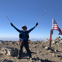
The Heaton Flat Trail and the south ridge is the most common way to reach Iron Mountain, a round trip by this route is about 14 miles and 7,200 feet of elevation gain. Check the weather before attempting this route. Do not attempt during this summer as this route gets little shade!

Getting Started

From Interstate 210, take the Azusa Avenue (SR 39) exit and go north winding up San Gabriel Canyon about 12 miles to where the East Fork Bridge intersects SR 39. Turn right, go across the bridge, and continue straight. In about 5 miles, you will come to a point where the road starts to curve very sharply right and uphill. Right at this curve, you will see a road straight ahead of you. Continue straight onto this road and in less than a mile you will come to the large paved parking lot at the end of the road overlooking the East Fork of the San Gabriel River. Park here. The trailhead is at 2,030 feet elevation and you need to get to 8,007 feet.

You will need an Adventure Pass to park at the trailhead.


Sights to See


    Rate this Hike

    user_profile
    2 months, 3 weeks ago
    Solo day hiked Thurs 1/25/24 – Nice trail very similar to the Bear Canyon and Register Ridge trails on Baldy. Rained on the drive in but was just a heavy, humid feeling mist halfway up in weather warm enough to layer down early at Bonita Peak. Trail was in good shape after this week’s rain allowing for good traction on the dirt and scree. Thanks to the folks that have trimmed off the Yucca tips on the plants closest to the trail - most of the remaining sharp ones can be avoided. Took up a full 30L pack and never got snagged on anything when on the main trail. Snow on the last 200 feet up but easily passed with boots alone right now. Awesome panoramic views off the Iron summit which was above the clouds today, especially of Mount Baldy and Baden-Powell. Like others have said, the trail is easy to follow with a little extra spotting required at some of the rock areas. 5 hours up at a very comfortable pace and 3 hours back to the junction for Peak 3529. Bushwhacked my way up the southwest ridge of Peak 3529 which was not too bad to reach its overgrown summit. Decided to make a direct ascent down its north face which was a bad choice. Tried to bushwhack for an hour through the very dense overgrowth which brought me to a crawl (literally) so I traversed to a drainage/wash on the topo map that would make for a better trip down and then up to rejoin the Heaton Flats Trail. Recommend the southwest ridge route up and down this peak! Took too much extra time and effort for this peak after a nice day on the Heaton Flats Trail. Drank 3L of water of the 4 brought but would only bring 2-3 for Iron when we finally get real winter weather! Logged 14.9 miles/6721 vertical ft. with Gaia.
    ★ ★ ★ ★ ★

    user_profile
    3 years ago
    Hardest hike I’ve ever done super difficult this mountain is a Beast amazing views at the top breathtaking jaw dropping happy yo conquered it
    ★ ★ ★ ★ ★

    user_profile
    3 years, 3 months ago
    Great hike today, tough as hell on the last 3 miles. Lots of vm loose rocks and very steep. Spectacular views!
    ★ ★ ★ ★

    user_profile
    5 years, 5 months ago
    Recommended that you do this hike on a cool weather day. No water sources on this trail you have to carry all your water with you. It was 85° and i carried 6L and it was barely enough. Drank 1L the 1st 3 miles stashed 2L at the saddle for the way back kept 3L with me. The uphill is steep and the downhill feels steeper. Pants and boots reccomend you might be able to get away with trail runners. Definitely a Very Strenuous Advanced hike.
    ★ ★ ★ ★ ★

    user_profile
    2 years, 11 months ago
    ★ ★ ★

    user_profile
    2 years, 11 months ago
    ★ ★ ★ ★ ★

    user_profile
    2 years, 11 months ago
    ★ ★

    user_profile
    3 years, 2 months ago
    ★ ★ ★ ★ ★

    user_profile
    3 years, 3 months ago
    ★ ★ ★ ★ ★

    user_profile
    3 years, 3 months ago
    ★ ★ ★

    user_profile
    3 years, 5 months ago
    ★ ★ ★ ★ ★

    user_profile
    3 years, 10 months ago
    ★ ★

    user_profile
    4 years, 2 months ago
    ★ ★ ★ ★ ★

    user_profile
    4 years, 10 months ago
    ★ ★ ★ ★ ★


Public Tracks

user_profile
CumberlandGary 2 years, 3 months ago
Big Iron One Way
Take lots of water!
user_profile
AppleKallisti 4 years, 2 months ago
Track (2/9/20, 5:04:47AM)
Just awesome!!
user_profile
larryhikes17 2 years, 4 months ago
user_profile
lichanster 3 years, 3 months ago
user_profile
Mauricio Aviles 3 years, 10 months ago
user_profile
toddpb2020 3 years, 11 months ago
user_profile
Ken Toyama 4 years, 11 months ago
user_profile stars
DaBeast 4 years, 11 months ago
user_profile
Big Al 6 years, 5 months ago
user_profile stars
DaBeast 6 years, 9 months ago
user_profile
Charles SoCal 6 years, 11 months ago
user_profile
Big Al 7 years, 1 month ago
user_profile
krisventures 7 years, 10 months ago
user_profile
Kim Thomas 8 years ago
user_profile
Kim Thomas 8 years, 3 months ago
user_profile
mkmccarty 10 years, 10 months ago