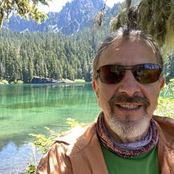
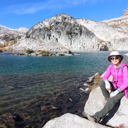
Stunning views of all the NW peaks. Rainier to Jefferson. The granite rock walls and flowers were amazing too.
★
★
★
★
★


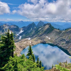
Wasn’t sure if I would hit snow but sure did! Took a long time to backpack for 5 1/2 miles. But the lakes up here are incredible.
★
★
★
★

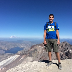
Stunning views of Mt.Hood in oak forests and wildflower fields
★
★
★
★
★


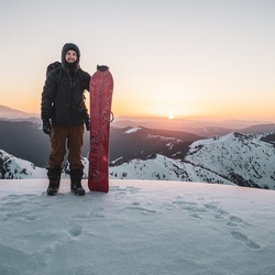
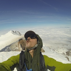
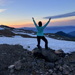
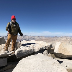
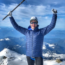
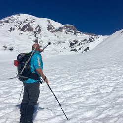
My first winter summit. We left the trailhead at 03:30 making it high enough to see the sunrise. Incredible day, sunny, blue skies, little to no wind. My heart is full!
★
★
★
★
★

35 degrees. Clear views of all mountains. Not crowded and a nice easy up and down.
★
★
★
★
★
It’s always a great day on loowit ! Lots of exposure on the boundary trail ! Take cover and plenty of water ! Happy trails !
★
★
★
★
★
If you think Goat Rocks views are incredible from Goat Lake, then - the views from atop Old Snowy are Absolutely Amazing!
★
★
★
★
★

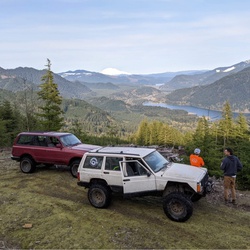
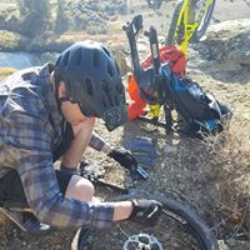
This trail was a lot of work. A lot of exposure difficulty level was probably the highest being encountered on the entire trip in 2025, but I think that was partly due to this being our fifth day of riding in a row and being a bit worn out
★
★
★
★
★
Nice, gradual climb through the forest with several open meadows along the way. Still a few lupine and Indian paintbrush hanging on. This would likely be a good wildflower trail in peak season. Light drizzle kept the bugs down, though mosquitos could be rough near the lakes. A few muddy spots, but overall the trail is in great shape.
★
★
★
★

Big Mt Adams views and then a long slog through the woods. Going up this way would be tough as the trail is a deep trench in one section with big steps to navigate. Nice lake views at end.
★
★
★

Great loop for adults and kids/teens with a little experience. The side trip over to the Cispus River headwaters is nice. Good for dipping your feet in and just a gorgeous meadowy basin.
★
★
★
★
★

Left around 8:30 took about 6 and a half hours for people who are very out of shape. It can be pretty windy so if your staying the night a would bring a tent with guy lines.
★
★
★
★
★

Ki https://www.gaiagps.com/hike/366914/crescent-glacier-loop-via-south-climb-trail/m
★
★
★


Great place for exploring with plenty of Mountain View’s. The snow can get deep in the winter.
★
★
★
★
★
 stars
stars
Hiked 9/29/24
Trail is in good condition. A little too early for fall colors. The road past the Hummocks TH is closed due to a washout. Lower loop became busy upon our return with a large group of hikers.
★
★
★
★

Looking for an extra permit for Oct 5th. Please text me (8475074737) if you are unable to make it! thanks!
★
★
★
★
★
Looking for an extra permit for Oct 5th. Please text me (8475074737) if you are unable to make it! thanks!
★
★
★
★
★

Mushrooms and huckleberry galore! Bushwhacked a bit on some of the trail due to low usage. Meadows and open pasture areas, old growth and burnout areas. Passed many lakes, hiked part of the PCT & lots of forest hiking.
Beautiful warm sunny day. Forest felt perfect in the shade. Even open areas had a cooling breeze.
★
★
★
★
★
First time to Goat Rocks and it was fantastic. Solo mid-week after Labor Day during a heat wave. No crowds, no bugs, no heat, relatively easy grades, well-maintained trails, and plenty of of water flowing everywhere. Camped at Jordan Basin and on Snowberry Creek at 97 cutoff to Cispus. Day hiked to Cispus Basin and Pass which is a must-see. Should’ve done Old Snowy also in hindsight. I’ll be back with my teen boys next year.
★
★
★
★
★


Very difficult, challenging trail. Not Easy. Not even a trail. A route. Avoid early in season if snow is still on it. Avoid if wet, or rain. Narrow ledges, steep drop-offs, people have died here. It's a great route and lovely area; just do your homework first, at other sites that describe it better.
★
★
★
★
★

Beautiful day with the sun shining, colorful dresses and Margaritas flowing. Good boot pack all the way up. Microspikes worked well.
★
★
★
★
★

Started around 5:10 a.m. heading up the Swift Creek Trail. Almost connected with Monitor Ridge around 9:45 a.m. but turned around because of whiteout fog conditions, and because I was solo and forgot my ice axe. Challenging snowshoe with awesome views if the clouds clear. Going to try it again when the weather improves!
★
★
★
★
★


My first taste of the WA BDR. didn’t have enough time to do more but this was awesome!
★
★
★
★
★

Great maintained trail. We did share it with a group of cowboys on their horses who camped a bit further up, it was really special to see this way of experiencing the wilderness up there. We started at the Berry Patch TH and then went up to Old Snowy, it really is a spectacular view from up there. You can see Mt Rainier in all its glory. We then headed to Goat Lake for lunch, a few groups were there enjoying the lake too, some swam, a few were camping as well. We headed up to Hawkeye Point (well some of us) and then came down to take the 5 mile descent back to the TH. Overall a really gorgeous day with amazing views toward Mt Adams and also St Helens in the distance.
★
★
★
★
★

My 2nd hike this year. 5 days, 4 nights. 2 different base camps. Still learning to use Gaia.
★
★
★
★
★

the trail is moderately steep with multiple switchbacks. we did the hike on 27august and it was pretty hot. fortunately the breeze at the top made the temperature quite nice. passed five groups of hikers. for a weekend thats not bad. road up to the trailhead with large potholes but passable by any vehicle. love the pass at teh top where you drop down onto the trail for tatoosh lake. on a weekday would be very 🥾🐻🍑 friendly. We brought our pooch and he loved the hike. two paws up.
★
★
★
★
★

great short hike, on weekends few people. stunning lakes along the way! 🐻🍑✔
★
★
★
★
★

Awesome views and very hard! Make sure you start early. Be at trail head around 11 am or earlier. Set your tent at Counter Lunch or a little bit lower around 3 pm or 4 pm( you need time to get used with higher altitude, see where you set your tent) eat, rest and go early 7,8 pm and sleep. Get up around 2 am or 3 am - eat, energize/hydrated and up you go. Make sure you have water and other filtration bottles, nave you need to melt some snow - have the right tools for that. Crampons not Micro-spikes. The entire trip from the start to the summit it is very exposed, no shade. At night secure your tent really good- strong wind 💨 . Be aware of the road up to the trail head … very bad . You need high clearance vehicle!
★
★
★
★
★

Looking to purchase 2-4 permits for any Thursday, Friday or Saturday DM me at tnvijatn@yahoo.com Thank you
★
★
★
★
★

First time on this trail, and it is such a great hike. The entire trail is steep, but shaded all the way up to the rocks. We kept the pace slow and steady and had no problems. There is no climbing necessary to get to the top of the rocks. People hike this trail with dogs. Absolutely stunning views from the top!
★
★
★
★
★


Beautiful June lake sitting near the base of this majestic volcano never disappoints.
★
★
★
★
★

Amazing wildflowers. A few fallen trees but easily negotiable. A beautiful blustery day
★
★
★
★
★

Very snowy when we hiked in May 2022. We hiked during the Mother's Day hike and wore a dress to honor mountaineer, Kathy Phibbs. The Winter route of Mount St Helens begins at Marblemount Sno-Park. Make your way on the Swiftcreek Ski Trail to the Warm Flows Climbing Route. This route is 11 miles round trip with 5,500 feet of elevation gain. It can take between 10 to 12 hours if you are hiking in fresh snow. We saw many skiers and split boarders on the trail. It was beautiful to hike in the fluffy snow, but it was a long and difficult day. Check out our St Helen's winter climb video on YouTube.com/HelenandTimTravel
★
★
★
★
★
Trail was only very slightly muddy. The barren hills and trees this time of year make it feel like you are on a fantasy adventure. Recommend to always keep an eye on the map if you're new to the area, as the trail multiplies every which way, signs are few and far between, and Atwood Road in particular snakes in and out of private property.
★
★
★
★
★


Natural bridges, and ice cave loop out of Atkinson Sno Park, WA.
★
★
★
★


Great hike - just under 2.5 miles one way. Taking Ed’s trail up 180A it is more scenic. If you just want to get back quickly then take the main trail down 180. Road is t as bad as described if you take your time. We saw six college students in a Subaru make it up.
★
★
★
★
★

4 stars for having porcini in a dry year. North-facing slopes above 5k ft. Great views too!
★
★
★
★

Was a great hike and I agree with most of the comments here. Went up yesterday. It was very windy with ash and sand being blown in my face. Would recommend a mask. Took me 10hrs round trip with plenty of breaks. Top was cold and windy so only spent 30mins or so up there.
★
★
★
★
★

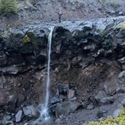
Easy. We came a little late. Around 430, while everyone was heading back we were heading in. Had the waterfall all to ourselves at one point. Not like it matters. Every SONGLE person on this trail was truly magical. And this trail is just wow. Just wow. What a magical trail. I hike a lot, but I bought a bud who doesn’t, and he was dead out of breath, me I felt amazing, a little sweat and thst was all. So it’s definitely got a little kick to it. But super family friendly. Super well maintained. The waterfall is absolutely just astonishing. Highly recommend this off of your popular hiking destinations.
★
★
★
★
★


Trail is in great shape. Lots of up! Great views of mt adams and mt rainier. Next time we will try to bushwhack to the top of the mountain but we turned around at the trail summit.
★
★
★
★
Fabulous hiking if not for the excessive heat and unavoidable exposure to the sun. Views from Harry’s Ridge are of Spirit Lake and Mount Adams. From the viewpoint it’s across Toutle Valley to St Helens.
★
★
★
★
★

The Indian Heaven Wilderness is a lovely place to spend time in. This loop was clearly lesser traveled than the southern areas of the Indian Heaven. Plenty of water and some nice views along the way.
★
★
★
★

C2C
Note: track to summit is obvious. The extra line is from me forgetting to turn off recording until we got to Trout Lake.
Great trail. Road was (in my opinion) passable for pretty much any type of rig.
Didn’t end up using GPS to follow a track on the way back. Booters + markets make it pretty obvious.
Excellent climb. Wonderful conditions.
★
★
★
★
★

Gravel Rd to trailhead. Bring a flashlight. The cave is wide and cool. It gets very low and narrow at the back of the cave. The guard rail at the entrance has fallen over. Beautiful scenery and a view of Mt. Adams from the lower part of the trail, weather permitting.
★
★
★
★
★

Gorgeous meadows, the closer you get to the pct.
Patchy snow starting around 5500 feet - still a lot of snow, at PCT junction (6,080 feet).
No visible tracks / traffic on PCT through here, yet.
★
★
★
★
★

This is a geologically and ecologically fascinating hike. Spectacular spectacular views from the ridge, devastation of both of the devastation area and unaffected areas. It’s very clear to see the demarcation between the pyroclastic flow and areas that were unaffected. Awesome for Mountain View although when we were here there was quite a bit of cloud cover. This is a challenging hike as it is very up-and-down and quite steep in several places.
★
★
★
★

Two herds of elk one in day light one cut across are path on way out in dark dusk. Their sound pulsed and could be felt as well as heard. Sunset hike.
★
★
★
★
 stars
stars
Typical Pacific Northwest hike. The lava caves were the highlight of the trek! Be sure to bring leather gloves, good shoes and two sources of headlamps if you are exploring the lava caves. You won't want to be carrying a light source in your hands. There is a lot of scrambling due to the rockfall from the ceiling. The caves were 48 degrees and pitch black.
★
★
★
stars
Nice hike or bike along Falls Creek Trail to the top of Falls Creek Falls or further. Nice views from the ridge. The trail is unfortunately seldom near the creek.
★
★
★


Great hike road in filled with potholes expect slow drive in.
★
★
★
★

Beautiful spring flowers out now. Lupines, and some pretty yellow flowers that i can’t identify.
And gorgeous weather to boot.
★
★
★
★
★

Great route for a long run. This section of the PCT is not rocky and the hills are runnable. Lots of blowdown right now though so that slowed things down quite a bit.
★
★
★

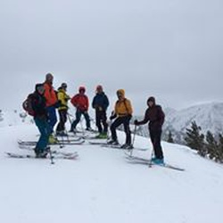
Sparkle sunshine January but actually June weather. Me, liz, and 500 of our closest ski bro friends.
★
★
★
★
★
stars
Great fall hike and not bad in the rain, as the trail is wide and not too much vegetation over the trail. But, the Big Hollow Creek was raging during our November hike, so we decided to turn around. There were some downed trees for crossing, but at this time they were very wet and snow/icy covered.
★
★
★
★

Trail is very pretty. Follows Dry creek (which this time of year was anything but dry) up the valley. Open trees, most likely first 2 miles is old road bed, now single track. Does go thru the east end of the Hollow Creek burn area near the north end. We didn't reach the Big Hallow trail 158, too much water in some of the northern creeks. Nice 9.5 mile out and back.
★
★
★
★

Started off of Forest Road 2801 and went up Tongue Mountain Trail and linked to Juniper Ridge Trail and down to the Boundery Trail.
★
★
★
★
★

Hiked for a summit on 4th of July. Much less snow than previous years this time of season. Challenging hike but definitely doable.
★
★
★
★
★
Easy but long loop, nice forest and meadows. Few views. Porcini in meadows, hedgehogs, bear’s head, and blue chanties in woods.
★
★
★
Good mountain porcini loop. Trail disappears between Carlton Ridge and Jug Lake. Peekaboo volcano views up high.
★
★
★

Very steep ascent. Almost more difficult on the way down. On a clear day there are panoramic views the entire way. The St. Helens crater is plenty impressive on its own, a testament to the raw power of Mother Nature. We could also see Sprit Lake and Mt. Rainier to the north, Mt. Adam’s to the East, Mt. Hood and Mt. Bachelor to the South, and very tiny in the distance we’re the three sisters. Certainly one of the most difficult and rewarding climbs I’ve ever done.
★
★
★
★
★
-Trail is in good shape
-Fall colors are coming in.
-Excellent views from the end point. Able to see Helens, Rainier, Adams, Hood and the tip of Jefferson on a bluebird day.
-Recommend hiking poles because of rocks on the trail, but I love hiking poles.
-Roads to the trail are decent. Narrow and some pot holes. A car could manage fine.
-Indian Heaven like many places are special. Please be respectful. Leave no trace.
★
★
★
★
★

Easy road to drive a few deep bumps and ruts. I saw some regular passenger cars do this whole road, might have some damage though.
★
★
★
★
★
First time hiking in this area. Killen Creek Trail was a long uphill section that def got the heart rate up. In the last 1 or 2 miles before intersecting with the PCT Mt Adams came into view. This was encouraging & motivating to keep going. Dan located a great base camp site and after setting up we headed on up the Highline Trail. This was another amazing section that offers lots of views inside the forest, open pastures, and many great opportunities to marvel at Mt Adams. We headed back to base camp for the evening after Day 1. Mt Adams is impressive with its massive glacier running down the West face. Often we could hear what sounded like big rock/ice slides, but never were close enough to see that happen.
★
★
★
★
★
stars
Lovely trail around the lake. Not too busy on weekday even with campground on lake. Great view of Mt Adams.
★
★
★
★

A bit of a drive to get here but sooo worth it. Probably the prettiest side of the National Monument and hardly any people! Trail is excellent re: footing.
★
★
★
★
★

A unique area still recovering from the eruption 41 years ago. Spectacular views of ash and mud flows in the valley, the still smoking crater (when the clouds allow), and Spirit Lake, filled with the thousands of trees knocked down by the blast.
★
★
★
★

Great hike! Bugs were absolutely terrible so we had to speed through most of the sections. I think I’m the future I’ll do this hike later on in the season to avoid the biting flies.
★
★
★
★
★


Some wildflowers left on the Truman. Bugs left me alone entirely. Zero shade, but extremely enjoyable hike. Trail narrows a bit at a few points, if you’re pole-reliant. Only 2 very brief sections with mildly sketchy footholds, but I’d definitely not rate this as “difficult.”
★
★
★
★
★

Did Goat Lake Loop trail and up to the lookout. Total mileage about 15. Gorgeous hike with amazing views and many smaller waterfalls.
★
★
★
★
★

Great hike with a beautiful waterfall at the end. There is an option to hike up to the upper falls.
★
★
★
★

It was a great sunrise hike. Arrived at the trail head at 4:31am. I think it was perfect timing to catch the sun rise behind rainier. There was a porta-potty up by the trail head and it was quite clean. The trail head is further down the road then you would expect. All in all a great hike. L
★
★
★
★
★


Very smooth, rolling trail with several River and waterfall views. Completely runnable.
★
★
★
★
★
Big views without a lot of distance. Water is scarce and will be dry once snow melts.
★
★
★

Great single track to start ktm 790 did fine until some bigger rocks
★
★
★
★

Good hike on a hot day. Streams and waterfalls. Busy trail. Undulating trail through old growth forest
★
★
★
★
★

Magical. Rain forest. Bridges over creek at start have been removed but we crossed on logs and rocks. Did not have time to make it to the waterfalls. We were the only group on the trail and it was very peaceful.
Tower Rock is beautiful.
Want to go back when have more time.
★
★
★

I’m a moderate speed hiker. Not too fast, not too slow. Out and back takes roughly 4 hours with a short break up top. Plan accordingly.
★
★
★
★
★

Small group headed up tumwater trail to the lake near tumwater mountain in late May. The upper trails had very few visitors with lots of trees down. Near the top there piles of snow and the last 100 yards to the lake is all snow. Ended up spending the night on the snow. Not what we expected but it was an experience 😉
★
★
★

Great hike from the Johnston Ridge Observatory to the top of Harry’s Ridge in sunny 60ish degree weather. Still a little early in the season so there were multiple patches of slushy melting snow including one long (maybe 1/4 mile) stretch through a meadow. Micro spikes were not needed, but would have been nice for the meadow and final approach to Harry’s Ridge. Epic views throughout the hike and hiking up the ridge was breathtaking! Great view of Spirit Lake, Mt Adams and Mt Hood in the distance! And of course, Helens!
★
★
★
★

Had a gorgeous sunny day in the mountain. Very beautiful. First time using GAIA. Gaia was not easy to use. Not as intuitive.
★
★
★
★
★

This is an awesome hike It starts out crossing the wind river on a beautiful concrete arch bridge and you immediately enter a primitive old growth forest with tree 6 feet in diameter and more some approaching 300 feet high. Less than half a mile you want to run to a very mature Second growth or probably post fire forest that’s probably never been logged.
★
★
★
★
★


Nice hike right off tattosh lane in high valley. Beautiful patch of birch near the top
★
★
★
★

This was a great hike, with great views. Into talk old pine growth to scrub oak. Zigzag trail, lots of up, down. Good heart pumper with restful flats
★
★
★
★
★

The trees aren’t well marked. Would probably still be out there were it not for Gaia!
★
★
★
★
★


Excellent trail for views of the Columbia Gorge on a sunny day. Popular trail shared with mountain bikers.
★
★
★
★
★

Great hike. Steep and rocky to start but the grade levels out and tread improves. Snow at the top but I didn’t need spikes and the view is epic on a clear day
★
★
★
★


The trail is pretty easy. View is very beautiful. Can see St. Helens clearly.
★
★
★
★
★

Saw 15 elk on north side of lake up on ridge. Maybe 15 people 1/2 wearing masks- cloth not gas.
★
★
★
★
★
Great section! Adams Wilderness and Goat Rocks are the highlights, especially Cispus Pass, Upper Snowgrass Flats, Old Snowy, and the Knife Edge. Six days, five nights.
★
★
★
★
★
This hike is awesome! Easy-moderate trail in excellent condition. Popular due to waterfalls and easy access in various spots for those not interested in expending a too much energy. Weekday non-summer days will get you lots of solitude. The Giffy (GPNF) delivers once again.
★
★
★
★
★
 stars
stars
Warm, clear day great for a hike to a place where you are able to see 5 peaks (Adams, Hood, Jefferson, St Helens and Rainier). Took a side trip and scrambled up Little Baldy. Very few people via this route.
★
★
★
★
We did this hike, 4.5 miles to the look out . Shady all the way, nice trail surface but narrow with some 1ft deep water cuts. Many switchbacks but not to steep. Great view of Mt Rainier halfway up and at the top.
No other hikers. Great work out , 2765 ft gain in 4.5 miles.
★
★
★
★
We hiked the Packwood Lake Trail to the lake, 4.5 miles and returning on the Pipeline trail , 3.5 miles. By doing so we cut off 1 mile of hiking and 600 ft elevation gain. We spent 1/2 hr at the lake and still did the hike in under 4 hours. On the return trip there’s two great views of Mt Rainier. Dog friendly on leash. Some bear signs but none seen.
★
★
★
★

Beautiful hike! The lake was definitely worth the trip. It was dark by the time we returned to the car. Luckily we found a trail up to the parking lot since for urgencies’ sake we returned via the ATV trail which ended about 50- 70 feet below the parking lot and would have added a mile of trail had we just followed the trail to the road and then walked the road to the lot. Reminder:always pack extra food water and lights!
★
★
★
★

Nothing epic but a lovely area with plenty of huckleberries and some great views of Mt.Adams. Not challenging but enough elevation to get your heart rate up. Plenty of water.
★
★
★

I started 9/25/20 at windy ridge. From there went ccw, camped on the south fork of the river just past the restricted zone. 8am to 3pm about 12.5 miles. Wind and rain force me to make camp. Best section of the trail IMO lots of animals, the breach was amazing! Day two I broke camp around 8am and pushed all the way back to windy ridge 20 miles or so. Hit the car around 4:30pm. One thing I was not expect was all of the ravines! Probably crossed 20+! and due to the heavy rains the water crossing were interesting. I packed way too heavy anticipating taking three days to complete. I think with better weather and a lighter pack it would be doable in one day for an average hiker. Be smart about water, even with heavy rains there wasn’t much to be found. I didn’t see any water fit to drink even with a life straw from the breach to chocolate falls. Back side of the mountain was better as far as water goes. Overall an amazing hike!
★
★
★
★
★
stars
Hiked from the Middle Lewis River Trailhead up the Quartz Creek Trail to the junction with the Quartz Creek Butte Trail at the end of Sept. The forest is stunning with enormous old-growth Douglas Fir. The trail undulates up and down, sometimes steeply above Quartz Creek, and crosses several side streams, which were no problem to cross in late Sept., although the rocks were slippery. Our trip was a little early for the best fall colors.
★
★
★
★
★
stars
Hiked this trail in mid-Sept., after the flowers and huckleberries were gone and before the peak of fall colors. Best to wait a few weeks for the vine maple to turn. The area has many large Ponderosa Pine as well as Douglas Fir and Grand Fir trees.
★
★
★

*9/8/2020 trail report- lots of blow down on the PCT north of Blue lake from the high winds the night of 9/7. At least 30 large trees are down on the PCT within a mile of Blue Lake.
★
★
★
★
★

Decent views of the river but prolly wouldn’t drive out just for the hike. Pretty barren landscape out in the open.
★
★
★

Great trail! Long inclines and declines, nothing too steep. BEAUTIFUL lake, busy, but campsites feel secluded enough. There were some good peeks of Mt. Rainier and lots of cute dogs.
★
★
★
★
★


great views in all directions. great flowers up top. nice trail.
★
★
★
★
★

Hiked 8/15/20. Started at 4:30 am. 12.5hrs RT.
Absolutely gorgeous weather. Beautiful views, mountain goats, a little stream, friendly vibe. Took my niece and nephew who were 14 and 12, and my brother-in-law and a friend. Just wore hiking boots and crampons up. Although plenty of people were doing it in micro spikes. You could use either. Bring a ice axes for glissading back down. I used hiking poles, but not necessary. Watch out for potholes of water. Lol. It was just so pretty... the entire way. At the top you could see all the mtns- hood, Helens, Rainer, baker. 🐐☀️🗻
★
★
★
★
★

Short steep hike to Badger Mtn. Incredible views from the top. Had a close encounter with a mountain goat.
★
★
★

Anyone not making their reservation this weekend? August 15th? LOOKING FOR 2 PERMITS! Plz and ty email: justjakeryan@gmail.com
★
★
★
★
★

Easy in easy out. There isnt a clearly marked trail but you can climb up to the second tier of waterfalls.
★
★
★
★
 stars
stars
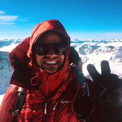
Phenomenal summit, with perfect weather and the ability to see forever. Stayed overnight at the lunch counter (was like a tent city with everyone wanting to summit). Difficult climb.
★
★
★
★
★
stars
I really enjoy hikes through former burn areas and this did not disappoint. Had to wade creeks as there was no log or rocks to keep out of the water. Stayed at one of a few campsites at Looking glass Lake. Love the wild flowers and the views from the meadows. Saw a herd of elk .
★
★
★
★
★


Some of the best views around. A 360 degree view of five peaks (on a blue sky day) at the top. The price is the steep and rocky climb. Sturdy shoes and poles will help. Some sun. Some shade. Worth the agony to get to the top. Road up was fine for whatever car but lots of gravel.
★
★
★
★
★

Arrived at the trailhead at 7:30am on a Saturday morning and parking lot is almost full. Its a very short hike but the view at the top was great. Encountered many groups on our way down and many were not wearing masks.
★
★
★
★
★

Single track hike with some elevation changes and minor steep areas. After the first falls if you take the trail to the north it is steep but will get you to the second set of falls quicker. The trail to the south as a short climb and then a 1/4 mile along a large cliff face that is incredible. Hike definitely had some great sights.
★
★
★
★
★

Road width for full size was marginal. If you can stomach a couple scratches, it will be fine. Lots of wash outs and potholes but very passable.
★
★
★
★

Great “burner” to Nannie Peak. July is prime mosquito season and within 30 seconds of standing still I was covered with those things. I intended to continue along Nanny Ridge to Sheep Lake but I very quickly got tired of the bugs. Dog loved the 5 miles we did. Take water as there isn’t anything clean to drink on the trail. There are several options if you are looking for a longer hike
★
★
★

Start of the hike was tough. No real trail, relied heavily on gps and sense of direction. Fortunately there were a few marked trees that I used to guide myself to the “trail” once I crossed the creek. After that it was a straight shot to the waterfall
★
★
★
★
★

The 118 is a difficult single track with multiple 12-18” steps going up a windy incline to the top of the butte. It difficult to find 3rd gear on this trail with very few strait sections. Lots of steep rocky ups and downs and a bit of a luge in sections with the trail rutted out. All that said it made for a great ride if you are up for the challenge. We made it to the 78 road and had to make our way back to the truck down the road due to time.
★
★
★
★


First time up to Grassy Knoll. Meadow at trailhead was in bloom. Beargrass interspersed along ridge in forest. Penstemon blooming on east facing rock outcropping. Lots of flowers at grassy knoll.
★
★
★
★
First time up to Grassy Knoll. Meadow at trailhead was in bloom. Beargrass interspersed along ridge in forest. Penstemon blooming on east facing rock outcropping. Lots of flowers at grassy knoll.
★
★
★
★


Great hike to escape a rainy day in Portland. Oak trees and open grass area. Easy/ample parking and no fees. A lot of Poison Oak and risk of Ticks in the grass. Not a lot of tree cover.
★
★
★
★

Jonathan led the ride, w Sean Wagner and Meagan. Left at 1pm and with a bit of getting lost we still had time to find camp on Rock Creek. Good fly fishing oppty. Second day was longer and got us to west flank of Helens, third night to Monte Christo area for a really good camp. Water at all camping spots and plenty of swimming holes along the way.
★
★
★
★
★

Perfect day for a hike to Sleeping Beauty with spectacular views of Mt. Adams, Mt. Hood, Mt. St. Helens, and Mt. Rainier. We even had a great view of a last mountain goat who posed for us not far from the summit.
★
★
★
★
★
 stars
stars
This is an easy out and back trail. I would not recommend driving all out of your way to check it out, but it is something worth tacking on to the end of another day hike in Gifford-Pinchot.
★
★
★
★
★
stars
This is a very unique loop that has several drastic changes throughout the course of the hike. You encounter unusual flat, grassy sections enclosed by evergreens with amazing views of Hood and Adams, as well as heavily forested sections, and several alpine lakes.
★
★
★
★
★
stars
This hike is one of the highlights of the Indian Heaven Wilderness. Blue Lake lives up to its namesake. We were greeted by axolotls on the shore which looked like tiny cute monsters with dreadlocks. This hike ranks somewhere between moderate and difficult with some steep sections, but you are rewarded with a cold swim at the end, so it's certainly worth it.
★
★
★
★
★
stars
You are drowned in amazing views throughout this entire hike. Treat it as a long day hike, or make it an overnight like we did and camp at Goat Lake with the whistlepigs....they offer endless entertainment. Bring your food into your tent at night, or they will get into it.
★
★
★
★
★
stars
The wildflowers on this hike are unparalleled to anywhere else in the gorge. Take plenty of water, sunblock, and of course, pictures on this hike during the springtime. It's one of my favorite places...it's also many other folk's favorite places, so be aware that there will be crowds on the weekends.
★
★
★
★
★
stars
Beautiful warm spring day. The views are amazing, looking East down the Columbia river and West to Mt Hood. The flowers are starting to bloom. There are so many options for hikes in the area with numerous trailheads. Beware, Ticks are out, one got me and I found 3 on my dogs hair.
★
★
★
★

Nice stiff stroll. Theres ice on the falls now, which was a great surprise.
★
★
★
★
This was my first time hiking this trail. Weather was extremely foggy, so not many views. Hence, my 4 star rating. It’s supposed to be amazing on a clear day. Only came across about 7 people. Was nice and peaceful. A popular hike in the summer. I’ll be back!
★
★
★
★
stars
Lots of parking. No fees area. Lots of camping locations along the Siouxon trail/creek. And this would be a great place to relax and enjoy the water in the summer. Two nice waterfalls on the Siouxon trail until I turned off for Horseshoe Ridge. This trail is not maintained given the downfall in the places and I assume that not many take the trail given the views from Huffman and Siouxon peaks. You are walking in the trees the whole trail on a primarily northern exposure so not much sun. Steep climb to the ridge line, especially precarious on the decent. Sioux trail was clear and but hit snow as I climbed towards the ridge.
★
★
★
stars
Love the squeak underfoot of freshly fallen snow. Crisp fall day. First hike of the season where snow was encountered nothing was really on the trail until you get beyond the cutoff trail back to the falls trail. Started out alone but ran into people on the way down. Took the 125 on the way up and went to the top to take in the vantage. Then back to the cutoff trail and the falls. Wonderful view and enjoy the sound of the water crashing down. The road to the trailhead is closed Dec - Mar.
★
★
★
★
Yesterday my buddy, Mark and I made our first attempt at climbing Mt. St. Helens. The morning started off beautiful, but gradually worsened. By the time we were within 1 mile of the summit with about 1500 ft of elevation to tackle, the weather took a significant dive. Visibility decreased considerably and the blow-down wind gusts made it difficult to stand. As we hunkered down for a bit with a few fellow climbers, we decided it wasn’t worth the risk, plus what was the point of getting to the top with no view. We sat for a moment before heading back down. This was our first attempt. It was one hell of a fun adventure and scouting expedition. It was also a challenging one. We met so many nice people along the way. We were all was sharing this beautiful experience together. Until next time, Helens.
★
★
★
★
★
stars
Climbers bivouac trailhead. Phenomenal day and hike. Perfect weather at the right temperature for a fall hike. The trail is easy to follow in the trees. Once you come out and it opens up you follow the wooden posts and select your line to scramble up through the rocks/boulders. When you move beyond the boulder field it is up the open to the top. Once you get to the false summit (where the majority hung out today) you need to traverse the ridge line to get to the true summit. There is minimal snow on the trail that will interfere with the climb until you want to get to the true summit, crampons and poles or an ice axe would be helpful. Go now! Free permits and great weather/conditions. Or don’t because there was a ton of people today.
★
★
★
★
★
 stars
stars
Hiked East crater to pct to Indian heaven trail to Lemei trail, to lemei lake trail to pct to east crater trail; favorite spots bear lake and lemei rock. 10/14/19. 12.36 miles with 1683ft elevation gain Solo.
TH has a large parking area with a camp spot right across from the sign that says slow children at play. There are no bathrooms or trash here. You must fill out a self issue wilderness permit to hike here.
Forrest road 65 from Carson is paved the whole way and in descent shape (good for all vehicles) there are some potholes farther up the road. Forrest road 60 is a dirt road riddled with washboard and potholes, Forrest road 6035 is a dirt road riddled with potholes and washboard. Lots of pull off camp spots and dirt roads along the way. I believe the PCT junction is on Forrest road 60. Goose lake campground is on FR60 (closed for season) beautiful lake.
East Crater trail has a couple of non bridged Creek crossings, lots of mud (boot gulping mud)! Not too many great views of the crater. Ice and snow on trail close to East Crater/PCT junction. Forrested area with some burn area looked like.
PCT to Indian Heaven Trail forrested area with a bunch of lakes and ponds. A couple non bridged creek crossings. Bear lake was my favorite on this part of the trail. No snow on trail.
Indian Heaven Trail; snow, ice and boot gulping mud on trail.
Lemei Trail; mostly covered in snow, ice and mud. Gradual ascent on this side compared to the ascent from the Lemei Trailhead. Views of Lemei rock are also better on this side. At the base of Lemei rock there was a frozen Pond. Didn't need microspikes going up, but used microspikes on the way back just to be safe. I slipped in the mud on the way down from this trail.
Lemei lake trail; snow, ice and a lot of mud! Beautiful meadows and a frozen creek on this trail. Most of the trail is water bogged.
Good for small children, not handicap accessible. Saw bike, horse and dog tracks.
Saw no one on the trail for 8.5 hours. I was first car in the lot and only car in the lot when I returned back to my car.
★
★
★
★
stars
Hiked Lemei TH to Wapiki Lake to Lemei trail and the viewpoint above the lake Wednesday 10/9/19. If you are using Google maps to get to the Lemei trailhead the directions are wrong, go a little further up the road till you see the Lemei TH sign. Parking is maybe enough for 4 vehicles right after Lemei TH sign. There is no bathroom here or trash. You must fill out a self issue wilderness permit to hike here. Make sure you have a Northwest Forest pass, America The Beautiful Pass or have a day use pass as there is no pay station at this TH. There was a snow storm the day before I went dumping up to 3 inches of fresh powder on the trail in some places. Snow in the lower elevations of the trail started melting out as I was finishing my hike. The TH is across the road from parking area.
Lemei Trail to Wapiki lake is a moderate hike. It's 7.26 miles RT if doing the lake only out and back. I would say good for small children. Not handicap accessible. There is a camp spot in between the lake and the pond.
Lemei trail is a hard hike. Steep ascent and can be difficult to navigate, make sure you have a map with you. I went up the old trail which has a bunch of debris on trail and down the new trail (by the trail #34 sign there is a turn off). It looked like there was a couple turn offs on trail, but no signs on the lemei trail for as far as I went (to the talus field). Beautiful overlook of the lake on this trail with a dusting of fresh snow. Hiked 1.48 miles on the lemei trail going above the lake.
★
★
★
★
★
stars
Hiked Soda Peaks Lake trail via Trapper Creek Trail. 10/7/19. 1 other vehicle at Trapper Creek Trailhead when I started at 5:45am. 9.81 miles with 2723ft elevation gain.
Bathroom at this TH. Big spacious parking lot. Road getting in has a few potholes, but is short. Has trash can. You must fill out a self issue permit for this wilderness. You need to have an America the Beautiful pass, or a Northwest Forrest pass, or pay a day use fee.
Would not recommend this hike for young children and this trail is not handicap accessible.
Trapper Creek is moderate hiking, when you get to the log at Soda Peaks trail it starts to climb (moderate to difficult hike). There are only a few spots where the trail flattens out a bit, trail does not stop climbing till a little before the lake.
I just hiked to the first two camp spots at the lake as there was rain in the forecast the day I went and I did not want to descend in the rain.
There are fallen trees on trail. Also Creek crossings that you can rock hop across this time of year.
Saw no one on the trails, but when I got back to my car there were two new cars in the lot.
★
★
★
stars
Hiked Siouxon Creek for the first time 10/8/19, it is a magical place and a must see! 9.10 miles with 1318ft elevation gain in 6hrs 10 mins total time, 5hrs 26mins moving time and 46mins stopped time.
I hiked from Siouxon Creek Trailhead parking to Chinook Falls out and back.
The drive in (watch out for fallen trees) isn't too bad till the last 4 miles, but I think with care in driving any car can make it to the TH. There are big potholes and paved/ dirt patches.
Great for small children at the lower elevation, but there is a Creek washout on the trail before Chinook Falls. Not handicap friendly.
1 other vehicle in the lot when I arrived at 6:08am, saw 5 people and 3 dogs after 11am. With 3 other cars in the lot when I left. Parking area is gravel and fits 20+ cars. No bathrooms at this TH.
Great camping spots on trail with beautiful views and some even have picnic tables.
Trail is pretty spacious till the second big waterfall, then turns to single file.Hiked Siouxon Creek for the first time 10/8/19, it is a magical place and a must see! 9.10 miles with 1318ft elevation gain in 6hrs 10 mins total time, 5hrs 26mins moving time and 46mins stopped time.
I hiked from Siouxon Creek Trailhead parking to Chinook Falls out and back.
★
★
★
★
★
stars
Nice fall day, with the maples starting to change. The clear day added to the beauty of the phenomenal hike. Must do to get a different perspective of the mountain.
★
★
★
★
★

Great ride with some a few technical spots. For the most part a great day on the Adventure Bikes. FR 4211 is fairly steep with many water bars, but after that section the remainder is a good deal of fun. FR 53 has some unmaintained blacktop that can be tricky when moist, as it has a good deal of moss covering it. FR 54 is a well traveled and maintained road. It is closed 1 mile North West of the Canyon Creek crossing.
★
★
★
★
★

Most of the hike is through light to medium forest. The trail is pretty flat but with some mainly gentle undulations. The real payoff is the lake at the end. It is good sized and has a small, tree filled island perfectly placed beneath a mountain in the background.
★
★
★
★
ADV Motorcycle ride. Definitely some challenging sections, and roads are less traveled. A good bit of overgrowth on the less traveled roads (FS 4250, FS 37). A scree slide on FS 37 about halfway from FS 53 going towards FS 42 was passable. Also on FS 37 a big washout about 1-2 miles NNW of FS 42 can be a challenge to get through. The two obstacles definitely shows why this road is less traveled. Traveled in a group of 4 riders. Was good to have extra hands available for the difficult sections. All in all was a very fun ride. Great views.
★
★
★
★
★

I hesitate to give any climb of a Cascade Volcano a less than 5 star rating because they are all unique and spectacular. For this climb, however, I have to go 4 stars not because the the first 1.8 miles are amazingly beautiful and well maintained or because the route is the best marked route of any climb I have done but because of the number of boulder fields. The boulder fields follow the route above tree line but there are multiple trail variations, no consistent path through the boulder fields and there was of course no snow. We were not expecting snow on the route in August but it was the only time we could climb and get a permit (which proved difficult to obtain). If one could do this climb in the early season when the boulder fields would be covered in snow then this would be an easy 5 stars. Without the snow, I think Mt. Adams is a better non-technical mountain in the late summer even though it has more elevation gain. Being able to glissade from the false summit (assuming safety in the glissade chute never takes a holiday) and then walk efficiently down the Crescent Glacier saves more time than the energy expended with the extra altitude and allows you to descend the extra altitude quickly.
★
★
★
★
So, this is one of the most high quality trails I’ve ever ridden. Most of this is apparently not yet on any maps until you get to 80a. Craggy peak is pretty exposed but getting off your moto to get around the switch backs is no biggie.
★
★
★
★
★

Great hike. Wildflowers were still out in mid July which was a nice surprise. Well maintained. Larger sized rocks on trail were harder to walk on. Day was quite socked in with clouds but the views I glimpsed gave me a taste of what to expect on a clear day. We were planning the full 12 mile loop but had to cut it a little short. Paid $99 for the lesson that even though most of the hike is in the National Forest, the trail head is not, so forest pass doesn’t work for parking. So make sure you bring your discover pass.
★
★
★
★
★


Although there aren't a lot of wildflowers on this hike, the views of Siouxon Creek and the Waterfalls make it worthwhile.
★
★
★
★
★

This is a superb hike, but be warned: the road getting there isn't just "bad," it's barely even a road. It looks like it has been carpet-bombed in many places. Only really rugged vehicles with high clearance can even make it to the trailhead. If you have just a regular car, like I do, be prepared to park 2 miles down the service road and have an uphill slog to the trailhead.
★
★
★
★
★


Beautiful hike. Some wildflowers are popping out. I can tell there’s a ton to come. Went out 6/1/19. Still a lot of snow from about mile 2.
★
★
★
★

Mixed weather up top. Clouds stayed intact until 11:30 then windows opened and closed. Fog came up from south side intermittent. Snow softened around 11am so we were post holing above lunch Counter.
★
★
★
★
★

This mountain is an icon. The view from the rim into the crater is other worldly and coupled with the panoramic view of several other cascade volcanoes the payoff is worth the work. If you have the gear for snow travel I’d suggest this route early in the season to avoid the dust on the monitor ridge route. Permits required after April first and they go fast.
★
★
★
★
★
stars
4/30/19 It's 3:39am and I am the first car in the lot! This is my first time ever hiking or stopping here. There are two handicap parking spots. The parking lot is riddled with large potholes so take care with your vehicle. There are locked vaulted toilets 100 yards up the dog mountain trail. They were pretty smelly when I got there downward in the am. There is a picnic table. You need a Northwest forrest pass, america the beautiful pass or there is a self service pay station here for $5.00. I hiked 11.95 miles 4387ft elevation gain in 8hrs 9 minutes total time, 6hrs 44 mins moving time. Augspurger trail to Augspurger Ridge to Dog Mountain and down more difficult trail on dog, started at 3:59:30 AM. Augspurger is a beautiful trail (way more easy going and gradual than the more difficult trail on Dog Mountain) mostly forrested and well maintained till you get to the dog mountain trail junction. There was a trail junction on Augspurger at .73 miles in for an Old Loggers Trail that looked overgrown. When you hike down to the valley before the powerlines, expect bushwacking and there are lots of obstacles on the trail. A section of the hike is on powerline roads and can be confusing to navigate, if you do not have a map. There are trail markers on the actual augspurger trails and great signs to point you in the right direction minus the powerline roads junction. I stopped on Augspurger Ridge, great views of the gorge here (I liked it better than Dog, because no one else was up there). This was at 5.13 miles in. I continued on for a bit, but the trail was really overgrown beyond the ridge to the summit, so I decided to save that for another day. On the way back headed up Dog Mountain trail via Augsburger. (very nice trail in the forrest till you are at the ridge on the side of Dog mountain.) Small trails on the ridge. The true lookout didn't have much of a view, but the first lookout has beautiful safe seating and spacious. Take care on your steps down from here. The dirt on the trail is slick. If you prefer a gradual descent and are using a map take the long way down dog (the difficult trail). Unbeknowst to me I took the more difficult trail down (there are no signs on top that tell you, which trail is more hard.) The more difficult trail is 2.98 brutally steep miles. The dirt is slippery until you get to the forrest. From the time I started to 10am (10am I was on dog mountain trail via augspurger) I saw nor heard no one on the trail for the first 6hrs of my hike. An almost full parking lot on a Tuesday early afternoon I think most cars were carrying a car load, because I saw and stopped for a ton of people and dogs on the way down. A couple of trail junctions on the more difficult dog trail. Saw very little trash on trail and about half of the dogs I saw were leashed. Very small sporadic wild flower sightings. Lots of trillium in the forrests. If you are coming to dog at this time of year for wildflowers, I think it is still too early. Come here for a great thigh burning workout. A couple of areas on highway 14 for road work one right in front of dog mountain trailhead takes highway down to one lane so expect some waiting. Another at beacon rock area, all on my way out. Saw two police cruisers speed checking highway 14, one at North Bonnevile on the straight part. One closer to Washougal, WA. Also saw no rattlers and had no Ticks on myself at the end of the day. Lots of bugs in the more lush areas where you can tell there is underground water running. I did not see any children on this trail and would not recommend this trail for any child that is not experienced.
★
★
★
★
★
stars
4/30/19 It's 3:39am and I am the first car in the lot! This is my first time ever hiking or stopping here. There are two handicap parking spots. The parking lot is riddled with large potholes so take care with your vehicle. There are locked vaulted toilets 100 yards up the dog mountain trail. They were pretty smelly when I got there downward in the am. There is a picnic table. You need a Northwest forrest pass, america the beautiful pass or there is a self service pay station here for $5.00. I hiked 11.95 miles 4387ft elevation gain in 8hrs 9 minutes total time, 6hrs 44 mins moving time. Augspurger trail to Augspurger Ridge to Dog Mountain and down more difficult trail on dog, started at 3:59:30 AM. Augspurger is a beautiful trail (way more easy going and gradual than the more difficult trail on Dog Mountain) mostly forrested and well maintained till you get to the dog mountain trail junction. There was a trail junction on Augspurger at .73 miles in for an Old Loggers Trail that looked overgrown. When you hike down to the valley before the powerlines, expect bushwacking and there are lots of obstacles on the trail. A section of the hike is on powerline roads and can be confusing to navigate, if you do not have a map. There are trail markers on the actual augspurger trails and great signs to point you in the right direction minus the powerline roads junction. I stopped on Augspurger Ridge, great views of the gorge here (I liked it better than Dog, because no one else was up there). This was at 5.13 miles in. I continued on for a bit, but the trail was really overgrown beyond the ridge to the summit, so I decided to save that for another day. On the way back headed up Dog Mountain trail via Augsburger. (very nice trail in the forrest till you are at the ridge on the side of Dog mountain.) Small trails on the ridge. The true lookout didn't have much of a view, but the first lookout has beautiful safe seating and spacious. Take care on your steps down from here. The dirt on the trail is slick. If you prefer a gradual descent and are using a map take the long way down dog (the difficult trail). Unbeknowst to me I took the more difficult trail down (there are no signs on top that tell you, which trail is more hard.) The more difficult trail is 2.98 brutally steep miles. The dirt is slippery until you get to the forrest. From the time I started to 10am (10am I was on dog mountain trail via augspurger) I saw nor heard no one on the trail for the first 6hrs of my hike. An almost full parking lot on a Tuesday early afternoon I think most cars were carrying a car load, because I saw and stopped for a ton of people and dogs on the way down. A couple of trail junctions on the more difficult dog trail. Saw very little trash on trail and about half of the dogs I saw were leashed. Very small sporadic wild flower sightings. Lots of trillium in the forrests. If you are coming to dog at this time of year for wildflowers, I think it is still too early. Come here for a great thigh burning workout. A couple of areas on highway 14 for road work one right in front of dog mountain trailhead takes highway down to one lane so expect some waiting. Another at beacon rock area, all on my way out. Saw two police cruisers speed checking highway 14, one at North Bonnevile on the straight part. One closer to Washougal, WA. Also saw no rattlers and had no Ticks on myself at the end of the day. Didn't see any children on the trail and wouldn't recommend this hike for children unless they are experienced. Lots of bugs in the more lush areas where you can tell there is underground water running.
★
★
★
★
★

The day we went had low level clouds covering the mountain top above about 1800 feet so no views. The date was April 17 which is about two weeks early for what will be the main Balsolm root bloom as buds were just showing. There were plenty of yellow bells, bleeding hearts and red currants among other varieties. The trail had lots of recent rain so was slippery but manageable.
★
★
★
★
stars
Great hike. I love it on a clear day when you can see the 5 peaks (St Helens, Rainier, Adams, Hood and Jefferson). Enjoys the water and Hidden Falls on the Tarbell portion. Go through some clear cut sections on Tarbell and reminds you that our state forests provide for us. On the Chinook trail portion you see the former roadway that was used to support the lookout that once stood on Silver Star Mountain.
★
★
★
★

 stars
stars
Always a great, challenging hike. Nothing technical when done in summer/early fall. Make sure to bring plenty of water as there are no water sources. If it is going to be a hot day try to start as early as possible. Once the sun rises the upper stretches can be brutal in the heat.
https://www.gaiagps.com/datasummary/track/e6abf134327279e1b6fb81610d04c1d3/?layer=caltoporelief,stamenterrainhd,OpenLandscapeMapHD
★
★
★
★
★


Trail is in great shape up to the lake, from the TH the trail has been relocated a bit. I assume to make it a little easier - whatever. The road to get there is in pretty decent shape as well. Pro Tip: If the TH is NOT in a state park, safe to say it's best to have a rig that can handle pot holes and ruts in the road.
★
★
★
★
★