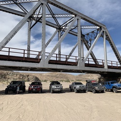
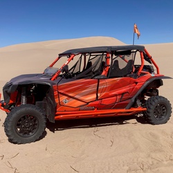
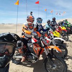
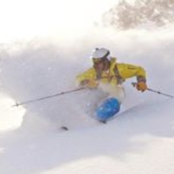
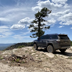
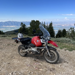
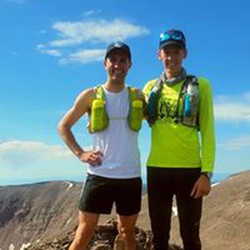
Killer single track w Forrest Nothing too hard but tights slow first gear
★
★
★
★
★

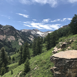
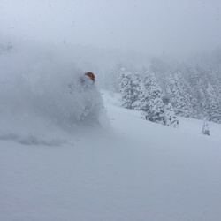
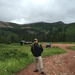
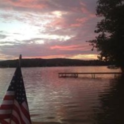
Great scenery, some wet and runoff areas, fallen trees, but meadows and the lake itself are awesome.
★
★
★
★
★

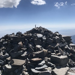
It is actually 0.5 miles longer than indicated here. 4th class scrambling at the top.
★
★
★
★
★

The accent can be tough for beginners, but the falls are a great part off.
★
★
★
★
★

Great single track dirt bike trails, little rocky, some flowy sections.
★
★
★
★
★


Very fun hike, pretty steady incline all the way up. There are a couple of icy sections towards the top that would be easier to cross with spikes or poles. Great views the entire way up!
★
★
★
★
★

Up from Slate and down Slide. A great time. Keep a lookout for cougars on the last section…and also mountain lions.
★
★
★

Easy gradual ascent from the Ogden Nordic Park. Had the entire trail all to myself!
★
★
★
★
★


Black Mountain in Bighorn National Forest, WY
Paris Mountain in Cache National Forest, ID
Naomi Mountain in Wasatch-Cache/Naomi Wilderness, UT
★
★
★
★
★

This trail is beautiful. A fun challenge. Cover arms and legs from overgrowth, you can still pick out the trail. I like to go in loops and not have to backtrack what I just went through. This is perfect for that.
★
★
★
★


This is a fantastic short loop passing by lake after lake and nestled in right among the high peaks which practically surround you. Even a great long vista at the end if done clockwise. Deservedly popular.
★
★
★
★

This actually wasn’t a hike that was a UTV ride. The views were spectacular and the company was phenomenal. It makes you so happy to be alive!
★
★
★
★
★

Hard hike. Last 4 miles is rough but was definitely worth it.
★
★
★
★
★

This trail is a lot more brutal than the numbers suggest, but it’s really pretty. Getting to the trailhead is a chore; there are 2 miles of steep, narrow, really bumpy dirt road. The first mile of trail is shaded by aspens, and I’ve found pretty cool mushrooms in this area before. After that it’s steep, rocky, dusty, and in full sun with intermittent shade trees. Lots of serviceberry bushes with ripe berries in late July. Lots of cool views of silver lake flat reservoir. Finally, the lake at the top (silver lake) is as pretty as any alpine lake, but sound carries and there aren’t many convenient access points, so having lots of visitors can quickly turn it into a frustrating and disappointing experience.
★
★
★
★


This trail was rocky and steep for the most part but the whole thing felt like walking through a magical forest. The lake is gorgeous this time of year and we found the perfect camping spot. After the lake the rock hopping and scrambling were really hard and took more time than we expected, so we scrapped our impromptu trek to the summit of White Baldy. We would love to come back and snag that peak when we’re a little more prepared. The bugs were outrageous though!
★
★
★
★
★

This is always a great hike. It has a couple good elevation spots, but not too much.
★
★
★
★


Great single track trail. Lots of flow, fun creek crossings and a few challenging cliff edge rides. Nothing too extreme just enough to keep you on the edge.. literally. If you do fall on any of the edges it would be a fairly short (<15 feet) drop into the thigh deep water. We took the southern French Hollow trail out to the road and it’s stunning beautiful deep Forrest once you’re off the willlow creek trail.
★
★
★
★

So beautiful. Big climb but incredible views. The lake is stunning.
★
★
★
★
★


Beautiful views the whole hike! Pretty easy. The tree is cool, we had a shaded picnic for about an hour right below it. I would like to try mountain biking it in the future.
★
★
★
★
★

Been wanting to link this one for a long time now. No wildcats spotted. Only wildscat
★
★
★
★
★
I loved this hike! Currently, beginning of June, there are just FIELDS of sunflowers. It was breathtaking the whole hike. Some sections were poorly marked, so GPS is important. Having done this loop two times, I would recommend going clockwise rather than counter clockwise.
★
★
★
★

This is a fabulous nature trail. It’s common to see little squirrels running across the trail, butterflies (or moths, I’m not sure), and birds, all while the relaxing sound of the river is immediately to your side. Traffic is light, but with a fair number of hikers, joggers, and bicyclists. The views of the mountains are second to none.
★
★
★
★
★

This was our first hike of the 2025 season, and we initially planned to snowshoe. The first two miles were done with snowshoes, but we switched to crampons for the remainder of the hike. Based on trail conditions, we recommend using crampons over snowshoes. The trail is well-packed with deep walls of snow, which makes it challenging to navigate with snowshoes.
We began at the parking lot, heading up through Hollow Meadow, over Harriet’s Hill, and then descended to Big Springs. If you’re tackling the full loop, we suggest starting this way to get the steeper incline out of the way early.
The scenery is stunning. Views of Mount Timpanogos, the snow-covered meadow, and Big Springs make this trail a favorite we revisit two to three times a year in different seasons. Along the way, we encountered a group riding horses up to the springs. This trail is very dog-friendly, but if you’re hiking with your pup, ensure their recall is strong—especially with horses sharing the trail.
For families, there are plenty of hills along the trail that are perfect for sledding and tubing. Whether you’re here for the views, the adventure, or some winter fun, this trail offers something for everyone.
★
★
★
★
Easy trail. Could even bring children. The full shoreline is 10 miles.
★
★
★
★

Beautiful long hike.
- Lot of elevation gain but plenty of time to adjust.
- Several different viewscapes: meadows, flowers, ridge line, rock scramblings.
- Saw Mountain Goats up close
- barely any snow to cross
- Smokey in the valley
★
★
★
★
★

This trail was beautiful and (best part) uncharacteristically less steep than the typical wasatch hike.
★
★
★
★
★


Hike with Kyle McSlurry and Tony Woodcock. Arrived at about 9:00 AM. We hiked in a counterclockwise direction which is best. Finished at 12:00 PM. Towards the end there were a lot of families with dogs off leash and with small kids coming from the other direction. Saw a lot of fish rising at Kamas Lake. Would be worthwhile bringing a rod. We were at that lake about 10:30
★
★
★

An ordeal, but worth it for the views. Started at 11:30 pm, took several naps on the way up, sheltered under some trees during a 45- minute thunderstorm. Got to the saddle at sunrise, and fought through serious wind the last mile to the summit.
The descent made it all worth it. Sunlight sent beams through grey clouds all around, making the vista glow green and gold. Wildflowers were just past prime, but still vibrant, and worth a few photos. Saw a few cute little rodents, tiny birds, and a couple of mountain goat families. The entire descent was one picturesque view after another.
I brought 7 liters of water, but only used 3. I could have used warmer clothes and a poncho; it was wetter and colder than I expected, but I lived with just shorts and a sweater.
★
★
★
★
★

Pretty hike, mountains, lakes and views! Trail is rocky in sections, beautiful meadows too. Nice loop!
★
★
★
★

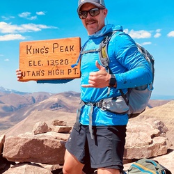
Hike to Kings Peak in mid July 2024 solo. Beautiful country. Older, eroded mountains makes for rocky trails, which slowed my average speed. Camp at Dollar Lake the first night and summitted the next day. Summit day took just under nine hours, 12 miles and about 3100 feet gained. I choose to traverse the boulder field from Gunsight to Anderson to save a mile and eliminate some uphill. I took the low route on the way back, my legs couldn’t take the pounding from rock to rock anymore. My main recommendation is not underestimate the rocky terrain. This 13’r is tougher than others, like Wheeler or Humphrey, that have straighter shots and smoother trails to the summit. Saw plenty of moose and deer, no bears. Had a bull moose chase a cow right through the middle of our camp at Dollar Lake. Definitely bring good insect repellent!
★
★
★
★
A great way to get fantastic views without much distance. Be prepared for steep hiking though!
★
★
★
★
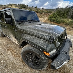
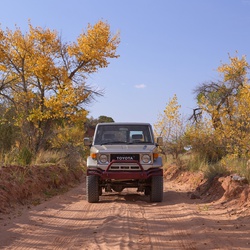
Most of this is a motorcycle trail. It is very loose dirt. Some of it is a dirt road with lots of dust being thrown up.
★
★

Really deep country, I love it, it gets really steep after about 4.5 miles into birch canyon, and it’s takes much longer than you’d think. Beautiful views, hard to get to the actual peak of mount jardine, we stopped a little before it because it got sketchy. Overall really good trail and absolutely beautiful
★
★
★
★
★


This is a stair master of a hike . Don’t underestimate it and take enough water . You need to get out early in the morning because the first third of the hike is almost full sun exposure .
★
★
★
★

Still very very snowy by clyde lake. Duck lake loop is much more pleasant right now
★
★
★


Zero snow,, short easily navigable muddy spots (you'll stay dry) minimum bugs just keep moving. Great hike with views. Crowded on weekends.
★
★
★
★

Nice foothill hike.
Took the trail straight for the whole route and got to the tree line
★
★
★
★

Started with great yellow colors ended with a few inches of snow.
★
★
★
★

Excellent bluebird day. We spent the second half of the day on the left side of the mountain hitting a Natural half pipe. Finally starting to get comfortable with front side 360s.
★
★
★
★
★


15-25 F…. Sunny all day…low wind…at least 3 ft of fresh snow…unbelievable (according to the locals this was the best day of 2024 so far)
★
★
★
★
★

Snow packed. Only needed snowshoes for the final tenth mile
★
★
★
★
★

Very busy and didn’t hike up by the waterfall due to all the people. Easy hike and manageable for my 3 years old to hike.
★
★
★
★
★
Started with great yellow colors ended with a few inches of snow.
★
★
★
★
Steady snow falling from 7000 feet on up. Moderate snow falling at the lake. Great day for a hike, being a rainy weekday with snow on top kept the traffic light. Excellent day to run around the outdoors. The weather added another layer of magic to it. Perfect moderate or introductory hike to lake Blanche.
★
★
★
★


Would not drive this again, very rocky and washed out in sections. Not a lot of pull out places. Was not my favorite, did it on an F150 no clearance issues. Was able to do all in 2wd but very rocky even after airing down.
★
★

This hike is a diamond in the rough. Bringfido said it was dog friendly and it was. We saw 3 other groups and they all had dogs. Plenty of access to the creek. All up then all down and mostly in the shade, even a few apple trees. We were skeptical that a hike out of Salt Lake would be nice but it was great
★
★
★
★
★
Not marked at all and trail can become hard to follow. This guide is good. We had to back track once. Great vistas.
★
★
★
★


Best hike on the Wasatch. Hands down. Plenty of water in the streams.
★
★
★
★
★

I gerbilled a pika, corn-holed a moose and got a knobber from a mountain goat. Fair ta middlin’ day.
★
★
★
★

Great hike. Mostly shaded. Minimal flowing water in late August. Great view of Salt Lake.
★
★
★
★

So beautiful, had a moose come through our campsite! The lake was a little smaller than we had anticipated, but the scenery was beautiful, and the trail was well maintained and relatively flat except when we took a detour to lake hessie. That had a good amount of uphill, but the lake there was sooo gorgeous too! Definitely recommend hitting both if you’re going for a couple days.
★
★
★
★

Beautiful hike. Dog friendly. There is still plenty of water and beautiful waterfalls, and tree cover in first section of trail. Steep sections are broken up with flatter ones. Once the trail leaves the stream, the views open up. And no shade. It was quite hot when we went. The views are amazing and so worth the effort!
★
★
★
★
★


Challenging hike,beautiful forest,multiples falls and creeks,large granite rocks,huge pine trees,amazing views.one thin you need to know about this hike,be prepárate with the right hiking shoes and ready to claim some rocks
★
★
★
★
★

Steep incline but rewarding falls at the end. Great flow summer 2023. Mostly shaded.
★
★
★
★
★

Beautiful day for a hike in Little Cottonwood Canyon! Trail had a gradual incline with water flowing in places but nothing of consequence. Gloria Falls was magnificent as the flow of water is huge for this time of year. I would highly recommend this gem in the Wasatch mountains!😍👍👍
★
★
★
★
This hike has all,water fall,lake full on ice,animals great views.lot of snow on top.,demanding terrane great for work out
★
★
★
★
★

Beautiful long hike to the summit. Start as early as possible to avoid the heat of the day.
★
★
★
★
★

Road thru bautiful mountains above Kamas. We took a loop and then dropped down to end the day at Heber city. Only a few bad roads, mostly just dirt.
★
★
★
★

Beautiful hike! steep in parts but worth it! Beautiful Lakes (two connected lakes if you follow Lake Blanche’s west end) Various peaks to hike as well. Sundial and Dromedary peaks are my favorites.
★
★
★
★
★

Great hike. A little snow near the top. Very doable no spike’s needed. A very steady climb all the way to the top.
★
★
★
★

Great trail! We’ll maintained. A lot of cyclists and some other hikers.
★
★
★
★
★
This was a Hard hike with lots of steep up hill sections where the path was only two feet wide and sheer drop-offs. But the walk was great. The length was perfect, and the springs were roaring.
★
★
★
★
★
The wildflowers are in profusion. We walked from Mueller Park to Elephant Rock, and back the way we came. And the final bridge before the Rock still has a little water running over it, but easy to keep feet dry. The elevation change is very mild, for a Wasatch hike.
★
★
★
★
★


A brutal first climb. Basically a mile or so of doing stairs. But the view for the rest of the hike is stunning. The trail back to the parking lot if you parked at wind caves was flooded in some sections and I just sent it with waterproof boots but got a little wet. 5/22/23
★
★
★
★
★

Amazing skiing; snow quality, maintenance, and mountain vibe 👍🏼👍🏼
★
★
★
★
★

Bunchgrass Yurt is a exceptional place to be backcountry ski. Plan on six hours to hike on.
★
★
★
★
★

Wow super fluffy deep powder great fields to blast through. Had to break trail most way to marina. Mostly grey with little sun mid day.
★
★
★
★

Steep and rocky and bushwhacking to get to Azure. No defined trail.
★
★
★
★
★

This was a great ride however last 2/3 of single track had a lot of obstacles (beaver ponds) and steep side hill riding.
★
★
★
★
★
Beautiful fall colors! Excellent views of Timpanogos, Cascade Mountain, and other peaks southward. Do NOT hike down the Baldy Ridge Trail - it is very steep and loose.
★
★
★
★

Great fall colors & cooler seasonal temps & a herd of younger bighorn sheep near the mouth of the canyon. One male even stood on an outcropping & posed for a few of us hikers.
★
★
★
★
★

Not as difficult as it looks. But definitely not for beginners
★
★
★
★
★

Fantastic hike but the five surgeries on my knees had them barking LOUDLY most of the way down. I recommend poked for your descent if you have bad knees.
★
★
★
★
★

Backpacked from the Aspen Grove side of Mt. Timpanogos to Emerald Lake where we set up base camp. We stayed for two nights and hiked Roberts Horn on our full day at the base camp spot. Beautiful area, saw mountain goats within 15 yards, plenty of clean lake water to filter and use for meal prep and hydration. The option of hiking Mt. Timpanogos is also easily doable from this location. Pretty moderate foot traffic from other hikers at all hours. We went Friday night through Sunday morning.
★
★
★
★

Easily defined trail that is well travelled. Quickly leave the city and feel like you are away. Quick elevation gain as you get closer to the falls.
★
★
★
★


30 years ago my 4Runner could make this trail. The Feds haven’t touched this fire trail since then so now it’s a highly technical one that will stop the fire trucks. In short, it’s a fabulous ATV trail for technical driving and the scenery is never matched in the Rocky Mountains with a view of the Solitude ski lifts in mineral basin
★
★
★
★
★

This hike has so many great features. The hike to Red Pine lake is rewarding with great views along the way and a beautiful high mountain lake. The trail from the lake up to the ridge above the lake is very challenging, but has rewarding views at the top. The builder scramble along the ridge was fun, with some exposure. This hike really has it all
★
★
★
★
★

Pretty lake but too much cow shit next to all of the water sources. So many fucking cows and it’s steep as hell. Very strange alpine/scrubland botany
★
★
★

The trail has been re-routed. Gaia doesn't have a way to update the gpx track to indicate this however.
★
★
★

This was a beautiful place to visit so close to civilization. The lake was stunning, the white granite contrasted with the red rock layers above on the mountains, and the trees were so many variation of green. It gave all the feel of hiking the Tetons in the summer. A good up hill hike. Well worth if in the area.
★
★
★
★


1.85mi one way hike up the canyon to Wind Cave. Trail is in shadow during the late summer afternoon. Caves are really neat. Views of the opposite canyon wall gilded by sunset were pretty awesome. Recommend only doing this hike late in the day if you’re prepared and an experienced hiker.
★
★
★
★

We hiked on a cloudy rainy day. High of 65° versus 85° in Salt Lake City!
How is bring rain gear and hiking in the Wasatch always bring rain gear…
I was almost a little cold. I’m glad I brought a long underwear for the top and rain pants for the bottom. I was fine once I had put those items on but if the weather had turned worse, I would’ve been in a little bit of trouble. Bring a warm pat if it looks like it’s going to get bad and maybe some coverings for the legs underneath the rain gear.
It was a 5 mile hike, we hiked for about 3 1/2 hours and lunch for about a half an hour. So, a five hour hike, in the mountains is 3 to 4 hours.
David Ivers was a delight to hike with.
It would be a shady place to hike on a sunny day, except for the path up to twin pass twin peak pass.
★
★
★
★
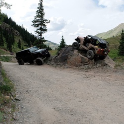
Beautiful scenery. Trail not bad for SxS, Jeeps and 4x4 trucks will have to take it a little slower. Stunning overlook view of northern Utah.
★
★
★
★

Great views of mountains and vegetation. Short but a good hike for exercise. No real points of interest though. Great historic trail.
★
★
★
★

This was “ok” for single track. If I do it again o would suggest clockwise so you get single track up hill. Counter clockwise means you do all the climbs on big fire roads and descend the single track. Honestly, I was expecting more.
★
★
★

The view is gorgeous but this hike ~falls~ short. It’s very narrow and crowded. Three unsocialized dogs got aggressive with mine and hikers all seemed a bit stand offish for some reason. Glad I did it but Its very unlikely that I’ll ever come back.
★
★

Lots of water crossings and lots of mud. Afternoon thunderstorms. Spent an hour at the lake.
★
★
★
★

This is a terrific off road trail to a water fall and then to Logan peak followed by Paradise peak.
★
★
★
★
★

Nice trail, uphill most the way and there is some good shade throughout most of it. There’s a cool small stream with a small waterfall a little off trail about halfway through. You can hear it from the main trail and there’s a small less used trail to get to it that branches off the main one.
Word of caution, this is a highly popular bike trail so of hiking be very aware of what’s coming.
★
★
★
★

 stars
stars
Awesome hike in Early June. Lots of snow and the lake remained frozen.
When snow is on the ground I would only attempt this hike if you are fit, carrying spikes or crampons and wear boots.
Views - heavenly
Noise level - only Mother Nature
Energy level at finish - knackered but exhilarated for. a 53 yr old man.
★
★
★
★
★

If you can hike Mount Olympus with a forty pound pack and not stop, you can hike anywhere. Great training Mountain.
★
★
★
★
★

This hike is really hidden. Not too hard but beautiful and the fastest way to get to the El Dorado Canyon.
★
★
★
★
★


Great winter hike if you are prepared. We did it Jan 19, 2022. Short, steep and multi terrain. Well marked dirt trail with a bit of snow/ice. At the FIRST stream you should throw on micro spikes (or crampons; which I used). Hike to the saddle gets steeper and all snow/ice but very manageable. From the saddle, the last 400ft are mixed terrain with a bit of Class 4 scrambling/climbing on rock, snow & ice. No real exposure but a bit spicy. Summit is a ridge and quite beautiful. Be careful on the down climb.
I suggest poles and crampons (critical for the walk down from the saddle to stream) but I saw a fit young man do the full climb in just hiking boots. He did slid on his butt, skated, or ran out some of the steeper icy trail sections.
★
★
★
★
★

I need to come back when I have more time and go further. Nice moderate/easy trail
★
★
★

5/31/20
Great hike. Starting above 9000 feet and hiking puts you in the high altitude zone immediately. I rested and dozed at a level spot at 11,000 ft. It’s interesting how breathing patterns change at that altitude.
★
★
★
★
★

This is newly paved road connecting US-40 and US-6. Also a beautiful scenic drive.
★
★
★
★
★


Hot springs were absolutely beautiful. My favorite hot springs I've been to
★
★
★
★
★

Plan on 4 hours for the hike up, cave tour, and hike back down. Amazing and breathtaking views during the fall with all of the leaves changing colors.
★
★
★
★
★


Pretty steep at first then a nice level trail suitable for running. Dogs can be off leash on odd numbered days.
★
★
★
★

This is a relatively easy 2.2 mile hike. The trail is well kept and well marked, there are a few pretty technical spots going up and over rocks and a few relatively steep parts as well. But not a hard hike at all. And the lake at the top is gorgeous. The dirt road to the trail head is a bit difficult, I would recommend four-wheel-drive
★
★
★
★
★

Squaw peak trail - extremely rough and rutted from rain and use. Was down to 15psi and focusing on smooth line choice and was getting thrown around. Those running high pressure or weaker sidewall tires beware. They are the perfect size sharp rocks to offer no smooth lines. Not much clearance required, except in a few of the rutted sections. The end section into Springville area was nice, but the rough middle section was not worth it.
★

It was beautiful! Lots of yellow flowers. I got stung by a wasp while I was at the top. Ouch! It was a great hike!
★
★
★
★
★

This ride is right out my door. Very little automobile traffic. Average 7 percent grade. Actual ascent is 850 ft. Look at the contour lines to validate the actual ascent.
★
★
★
★
★

There are prettier, more shaded trails in the High Uintahs, but this one is extremely memorable! A very challenging route for a single day trail run, but the route is easy to follow and there is plenty of water along the way to filter, so you can go pretty light. Very busy trail, but the payoff at Kings is worth every step.
★
★
★
★
★


I thought this hike would be a slightly boring along the side of the river walk. It was for a bit but the end was well worth the wait. Super cool hike.
★
★
★
★
★


Today was Cameron take down for PC - 39. We had heavy rain last night and light rain this morning. Clouds broke this afternoon and it was mild, humid hike. Camera appears to be in good order and is turned off and stored. I’ll return it soon.
★
★
★
★

Rode with David after a lot of rainfall and current rainfall. Flash floods, washed out roads, slimy slippery mud. Rad!
★
★
★
★
★

HIked to Dog Lake by Big water trail and back by Little Water trail. Got to trailhead parking lot at 8:15 am on Wednesday 7/28/21. Lot not even half full. Went up via Big Water trail. Lots of shade and steady incline, not difficult. Passed a few bikers on way up. Got to lake and walked around and had lunch. We were 2 of 3 people at the lake. Shortly thereafter several groups of 2-3 bikers arrive. Then a ladies' hiking group of about 7. Then a biking group of 7 arrived. So as we ate early lunch, we went from 3 at the lake to 20. Weather great, occasional clouds, cool refreshing breeze, lots of shade on way up. On way down took Little Water trail. Along the way thunder announced some rain. It started raining. Delightful as it brought out the fragrance of damp pine mulch. Not much rain, just enough to put on ponchos and then it stopped. Very few people on the Little Water trail. It was pretty much a straight decline trail. I think I prefer going up Big Water and down Little Water. Everyone on the trail, hikers, runners, bikers, dogs was very courteous and friendly.
★
★
★
★
★

A few steep and rocky climbs. Being from sea level, we really felt the parts above 10,800. Perfect distance for a half day hike though and the vistas are amazing in all directions.
★
★
★
★

Great trail, close to Bountiful. Mostly smooth, and relatively easy single track. The Mueller park side (to elephant rock) has a lot of hikers, but everyone is happy to share the trail with mtb and dirtbikes
★
★
★
★

Exciting scramble up the Castle. Loose scree on Sugarloaf. Fun with Wendy, Dylan and Sophie.
★
★
★
★
★

Great hike. Easy to get to. Steady steep climb so start early to avoid the sun. Popular trail with lots of people. Well marked. Cool to see peak from SL Valley.
★
★
★
★
★

The hike is pretty, a little steep but not too challenging, and the proximity to SLC was nice. It costs $5 to get into the area where this trail is located. Also, I recorded on strava, followed the trail as it’s shown on Gaia, and I measured 5 miles total out and back, with 1,338 total elevation gain. I’m not sure which is correct but I have a fair amount of hiking experience and this didn’t feel like 3,000+ gain to me.
★
★
★
★


This was an atv ride. Lots of colorful flowers and butterflies. Nice simple trail.
★
★
★
★

Nice climb and view! Due to the drought, trail is dusty and we saw a rattlesnake on the middle of the trail. Otherwise a good view of Provo!
★
★
★
★

Saw a Corrgie Aussie. He was cute. Nice elevation climb next to a river.
★
★
★
★
3 mile dirt road is rough. Cars can make it but not low riding cars. Saw a couple of nice cars coming up and I thought, “mistake”. Clean bathrooms and good parking, fee area. Trail is well defined till the last .2. Two creek crossings; first is easy with logs, second is at the 1 mile point about and there are easier dry up-stream crossings if you don’t want to walk through the 9-12 inch deep main crossing point. From that point on you will enjoy multiple cascading falls that make this a great hike. At mid May there was still ice in the lake which was being fed by several high waterfalls, it was worth it! The first .5 is easy, the second mile or next 1.0 is moderate, however, due to the altitude and the steep almost scramble like trail towards the end, I’d say the last .7 is difficult. In fact the last .25 was no fun at all. Still, very worth it. We stopped sightseeing often going up and it took us 2:20 minutes, while going down took about 1:15. Hope you find this useful.
★
★
★
★
★
this was my first ever ‘serious’ hike. i’m not fit. i don’t exercise. i can’t believe this is considered easy. maybe to someone more experienced it may be. other the the fact i had a splitting headache and i’ve never been more out of breath in my life. the views the entire way were spectacular. i plan on coming back very soon with my dog so he can be wiped out that same way i was.
★
★
★
★
★


Great terrain and access for backcountry skiing. There are a lot of people who access it, so you can see where to climb but also run into other skiers.
★
★
★
★


One of my favorite trails in Farmington. Up the benches, through the pines, across a steam, ending up on top of a rocky overlook. 3,400 ft of elevation gain.
This is mid-way to Bountiful peak, hence the name “Midway Peak”.
Keep going and you end up at Bountiful park.
★
★
★
★
★


Went with Jessica. Great snow and views to the south. Must go back in the fall.
★
★
★
★
★


14” of POW overnight and this was the perfect westerly face to avoid avi danger.
★
★
★
★
★

This is one of the best autumn hikes I’ve ever been on. It’s easy terrain, but bring waterproof boots in case the trail is partially flooded.
★
★
★
★
★


1/13/2021 - Great hike and very beautiful. Not crowded at all in mid-January. We saw 6 other people. Microspikes are a must, but snowshoes were not necessary. The trail is well-tracked. We went up Grove Creek and down Battle Creek. Not much snow near the trailheads, but plenty of snow/ice in the shade. The falls were frozen and very beautiful. Highly recommend at least hiking to the falls.
★
★
★
★

Bluebird day. Up was fairly mellow. Low snow conditions required a few walks. By the time we got up we had a beautiful view. Plenty of fresh to find in between lots of bush whacking. Low snow cover means down trees are harder to avoid.
★
★
★
★

Low snow conditions exposed plenty of brush, so the descent featured plenty of bushwhacking and traversing to find a clear path down. Still, we found some short unobstructed areas near the top and had a great time on the way up! Would definitely return in better conditions.
★
★
★
★


Great place to set up some top rope ice climbing. Beautiful day out!
★
★
★
★
Nice hike with great views and a lot of other features such as waterfalls, creeks, forests and peaks. Took us a total of 3h and I could definitely feel the burn at the end.
★
★
★
★
★

Late October trip so the fall colors were gone. Would be pretty when colors were at the peak. This is an easy out and back. Quite a bit of beaver activity as I saw a number of dams along the stream that the trail parallels. It was a cloudy date with light sleet falling so no problems with the temperature. The first mile or so is completely un-shaded so would be hot in the summer. Was looking for a hike that I could do relatively quickly and keep my heart rate in the aerobic fat burning zone. Perfect trail for that.
★
★
★
 stars
stars
I’m up in this area constantly and had never taken up this peak. It’s a steep mutha but thankfully short. Views are some of the best in Utah. I ascended the from the South and descended via the North and of the two I recommend the South approach for sure.
★
★
★
★
Beautiful hike that features everything you could ask for. Definitely a bit of a butt kicker as it just keeps climbing for nearly 2 hours (3.5 miles to the lake) and coming back down is not much easier as there are quite a few boulders and some scrambling. But well worth it! You can even see the great salt lake in the distance. On my way down I also saw too huge moose right next to the trail. Very pretty fall colors 10/14. I clocked in at 7 miles/4 hours/2700ft ascent. Happy hiking, enjoy!
★
★
★
★
★
So much variety! It starts off pretty and easy, as you duck off the road and start slowly climbing the side of the canyon. At this time, the ground was nice and hard (frozen) in the morning. It was brisk, but a jacket wasn’t needed once we started moving. We were able to get sub-25-minute miles on mile 1 and 3.
We reached the lake and started attacking our way to the summit. Other reviews are correct — DO NOT GO LEFT to get to the ridge. We traversed a blade’s edge scramble. Foolish. Especially since there were better routes up. It was also slower.
After that, we quickly got to the final ridge before the towering summit. That was quite the ridge! It was more difficult than the earlier mentioned blade’s edge you run into if you go left, attacking the ridge between White Pine and Pfiefferhorn.
Only 2 of a group of ten attempted it — we went with those two. It’s nice to have someone else with you on this! Take it slow and steady, don’t be foolish, and then it’s no big deal. The final ascent was beasty.It get for every step forward you moved, you climbed three feet. Getting to the top, swaddled in a cloud, was incredible. The winds were pushing the fog fast, so we’d get brief glimpses of what lay beyond. It often appeared as if the drops descended into nothingness with the fog! The way down was a bit challenging to navigate as snow hid the trail heading back to Red Pine lake. But this was incredible. I’d definitely go again.
★
★
★
★
★
Nice hike, definitely a butt kicker. I do prefer trails over fire roads and this hike is almost entirely on a fire road with lots of lose rocks and scramble. Lake was very cold and water level was low in late September. I saw some decent sized fish, but didn’t catch anything with my tenkara. Took us the better part of 6 hours roundtrip.
★
★
★
★


Between the twin Peaks summit and dropping into lake blanche, there is not trail, only hours and hours of scrambling and routing picking
★
★

We love this hike and our record was three hours, good to see it beat. Best to all peace over and out!
★
★
★
★
★
Wifey and I hiked to Abes lake today. Didn’t see anyone else on the trail or at the lake. Was a beautiful hike. 3 creek crossings and one dry crossing about a half mile or so from lake. After the third crossing it was an uphill climb. We are not from Utah and assume Utah doesn’t know what switchbacks are. Kidding. We did get off trail once on the way in and once on way out. Followed the trail but it didn’t correspond with the dash trail lines on Gaia.This has happened to me on a few hikes. Don’t know if the trails need updated and not sure how Gaia verifies the accuracy of the trails. Anyway it made for a wonderful hike
★
★
★
★
★
Beautiful hike. We started at about 07:30, reached the summit around 13:00, and back to the car at 17:00. We took lots of pictures — the fall colors for the first four miles were stunning!! Not much shade after that. Getting to the saddle was rewarding. The path to the summit was steep and intimidating. The summit is only about 8 feet wide or so. A treacherous 1,000 foot cliff on the east side overlooks emerald lake. I was hit with altitude sickness before hitting the saddle on the way down. So our journey to the car was pretty difficult. Our dogs did great! We hike with them a few times a year (golden retrievers) and they didn’t face any issues.
★
★
★
★
★

Nice hike. Lot is always full, but there is ample parking along the road. One mile to the split between Red and White Pine Trails. It is 3.56 miles to the lake. Plenty to see and it is a nice walk around the lake. Late September and no rain in a while so the lake water level is low. Few spots to camp look nice.
★
★
★
★
★

Easy hike with a very interesting creek of salt. Continuing up the trail is a small pond. Beautiful fall colors.
★
★
★


One of the best mines I have been to not to hard to get to just remember to wear sweatpants.
★
★
★
★
★

Great views especially at the top. Lots of people but not enough to ruin it. Heavy ascent! If you are out of shape you are going to have a rough time
★
★
★
★

Beautiful, quiet hike. Hardly saw anyone. Stopped at South and North Ericsson lakes. They’re fabulous! Lots of fallen trees, green and dead, due to recent wind storm...probably had to navigate around 40 or so trees. The 7 mile dirt road leading up to trailhead is slow and bumpy.
★
★
★
★

Nice mellow but steepish hike to the summit. Much rather do it touring than hiking though
★
★
★
★
★

Good exercise. Moderate grade compared to the Snowbird Resort Summer Trail “Regulator Johnson” going up to top of the Gondola Tram. The Upper portion of this GAD2 service road track winds through areas having numerous Spruce and Fir trees. Not a heavily used hike from my experience. Nice!
★
★
★
★

Labor Day the trail was extremely busy. It is a good length with a consistently steep ascent. I think this trail would be a great benchmark trail to come back to for the purpose of guaging my fitness/progress as a hiker. Also it is spectacularly beautiful.
The hike down seemed almost longer than the hike up.
★
★
★
★

Tons of brush coming up the last stretch of elevation through Rock Canyon
★
★
★
★
Trail was extremely dusty and rocky! Good and technical in several places. Saw several other dirt bikers on both trails. Guys were going both directions on both trails.
★
★
★
★
This was a great single track. I’d say a 3.5 out of 5 for technical. It was super dusty and we had to space out a minute or so between riders.
★
★
★
★
★
Super fun. Super hot. +250 people. A few Mountain goats. A lot of pack goats. Absolutely beautiful summit. 30 minute siesta at top. A lot of litter pickup opportunities. No water refill opportunities fyi. Slept at trailhead and ppl come/go all night long. Bring ear plugs and eye shade and your good!! Extremely busy trailhead but it's a cool scene. $6 for parking, but tbh you might not find a spot. At least 50 cars parked there when I arrived at 9pm the night before, with probably 10 spots open. I started at 8:15, summited 10:15, back to car by 12:15pm. Fun!
★
★
★
★

Great hike to lower falls. Water still running nicely over the falls early September. Lots of shade in the morning. Very rocky towards the end and relatively steep. Many views along the way. Grand granite cliffs to see near the falls. Very worth the effort. Reservoir more of a puddle this time of year.
★
★
★
★
★

Definitely do clockwise if you were on a dirt bike. When you drop the backside it gets really narrow and technical with a few good size drops that would probably be impossible to try to come up. The down will have you puckered and dropping the bike.
★
★
★

As usual, the elevation gain beat the crap out of me. But incredible views, including spectacular view of Timp. One of these years, I want to hike over the top to Red Pine Lake.
★
★
★
★
★

Really amazing hike. Great view of SLC behind one and an amazing treat at the stop. Pretty rigorous ascent and descent so take breaks if not in a rush. Last part before the peak is quite legit with some fun and definitely doable climbing on all fours. Recommend early as well to avoid hot descent. Have fun :)
★
★
★
★
★

The hike from the trailhead gains slight elevation and is beautiful and is quite level until you reach the fork to either head straight ahead to Broadbent meadow or fork left to head up towards the lake. The elevation from there is intense for most of the rest of the hike. Once at the lake though it absolutely takes your breath away and is worth every hard earned step. Trout in the lake of a good size. Fresh water source into the major lake on the south side. Stunning. Lodge pole pines primarily.
★
★
★
★
★

Moderate traffic well maintained single track easy trail to Stewart Falls. If you park at Sundance ski resort it’s $22.00 a person to ride the lift to the summit and then 2 miles to the trail and 2 miles back. The lift to the top of the ski resort is impressive. The is another entrance to the falls past Sundance.
★
★
★
★

Not a ton of shade to be had. The shuttle is quite long for the length of hike. Some pretty views, but nothing spectacular.
★
★

Holy crap this puppy is brutal. The last mile and a half is like walking up to Mount Doom.
★
★
★
Starts out nice and calm next to some awesome waterfalls and no shade and wooded area. You get exposed after a little while as you climb up the side of the mountain and it gets hot and sunny and pretty rocky with some really good short rockclimbing bits.
★
★
★
★
★

Started the hike at sunrise and was back before noon and avoided the heat. Beautiful views the top half. Steep incline in some places. Suggest walking sticks especially for the hike down.
★
★
★
★
★

Shade and sun. Beautiful views all along the way. First bit is steep but it levels off.
★
★
★
★
Great Loop hike features everything from alpine lakes, to trails, scrambling, vistas and photo ops. Took us much longer than expected 3-4h.
★
★
★

Beautiful 360 views at the top. Not sure I would rate this as an easy hike. Not a long distance hike, but all up hill and rocky.
★
★
★
★
★

This hike was done with a 4 year old. It is quite steep but interesting as it changes from forest, to alpine meadow, to rock.
★
★
★
An amazing hike that was a real adventure. We chose probably the hottest day of the year to do it, and we all got a little heatsick and dehydrated because of it. There is little to no shade on this entire hike, and there are no water sources, so pack TONS of water (at least 3 liters per person) and sun protection.
The first three miles from the trailhead are relatively easy and very scenic as you pass through high sub-alpine meadows and wildflowers via a well-marked dirt trail. However, once you reach the shoulder and trail junction for North Nebo, that’s when the hard part begins. You descend to Wolf Pass, then have nearly 1400 feet of elevation gain in just over a mile. Much of the final half mile is entirely through scree and loose rock on very exposed ridges, so watch your footing. Trekking poles are highly recommended, especially for coming down.
However, despite the climbing, the heat, the dehydration, and the altitude, it was an AMAZING hike with an amazing view at the end. You are at the very top of the Wasatch Range!
★
★
★
★
★

This hike started above 9000 feet . It is a beautiful area.
★
★
★
★
★

Fun ride with my wife. Mostly groomed gravel roads. There were a few rocky areas but not to bad.
★
★
★
★
★

Prettiest view in the area from the lake. Long and strenuous hike, but worth the effort! Camp at the lake and hike back via Cherry or Tony Grove if you can arrange a shuttle.
★
★
★
★
★


Great views from the top. Scramble is very manageable. The flat miles feel pretty annoying and long on the way out. I enjoyed the loop part into the basin, recommend if you have the time. The shorter way is a bit steep and loose in the incline section, then going over the rock field is a bit of a pain. But it definitely cuts time and distance if you need that.
★
★
★
★
★

Hike measured 13.86. Left at 7am and summitted at noon. Shade early then sun about half way up. Water streams early then dry also about half way up. Took 4L of water and was plenty. Last part is quite steep and must walk carefully. Trail is easy to locate throughout. Saw 20 plus mountain goats. Hard to imagine a prettier close to Valley hike as this.
★
★
★
★
★
Great overview trail of the area. Elevation change is moderate, nice that it is broken up into two sections. Trails are easy and nothing technical. Saw a few moose. Took a bit over 5 hours with generous breaks and lunch stop. Some shaded areas but a lot is exposed to sun in the middle of the day. Sunrise peak would be a good addition if you have extra time and energy.
★
★
★
★

The bridge at the top over dry creek is washed out. As a result the trail between dry creek and the Lake Hardy trail turnoff is not well maintained and hard to find. This made completing the loop challenging.
★
★

This was the hardest single track that I have ever done.
After going off track and ending just 4ft off a steep hill, it took me all of 1 hour to rescue my bike up the hill. It took 50ft of rope, a tree and lots of grunts and colorful language, I finally got the bike out.
Scenery was worth the blood, sweat and tears. Very steep sections both ascending and decent.
★
★
★
★
★


Sardine is an awesome ride! Quick up and fun down if rode clock wise. In that respect it’s a multi use trail with lots of hikers and horses. Smooth up hill and some fun turns on the way down. There are two corners that could use some work...riding fast on the downhill isn’t the smartest but you can find times with no one on it! 🤙
★
★
★
★

Lots of wildlife
If you listen you can hear the waterfall for about 25% of the hike!
★
★
★
★
★

Love the wildlife hummingbirds, butterflies, ground squirrels, chipmunks, bees and etc.
★
★
★
★
★
Simple hike on a dirt road, great views of the mountains. Many beautiful flower and birds along the way. The area has been mined in the past.
★
★
★
★
★
From the lake to the summit is hard but worth it. Two very steep sections. Amazing views. 360 from the summit.
★
★
★
★
★

Nice trail running and family hiking as well. Shady and cool in the early morning summertime.
★
★
★
★
★

This hike is great for both a beginner as well as more seasoned hikers.
You go from dry ground to crossing streams to going up some steep grades to easy inclines.
★
★
★
★
★
Really nice hike. Worth the visit to the beautiful lake. Previous comment is dumb.
★
★
★
★
★
Absolutely beautiful backpacking trip. Still a bit wet, and you can lose the trail pretty easily at the top. Amazing view of Amethyst Basin and the lake is absolutely gorgeous. Highly recommend this route for any moderate to experienced backpacker.
★
★
★
★
I’ve lived and fished in this area for a long time and never been on the ridge. The scenery is great. We were able to see roughly 100 miles to other mountain tops
★
★
★
★
★
Great time of year to keep pressing up. Easy climb today, lots of campers at the lake.
★
★
★
★
★
A great recovery hike after bagging Box Elder Peak yesterday. A nice steady climb for 2 miles on a wide trail that’s well-graded. Near the turn-off the waterfall, you start rock hopping on a small stream that forms on the trail. From the turn-off to the waterfall, you have some loose fitting and short steep slopes, but it’s nothing too bad. Amazing waterfall with a great view toward the valley. A nice quick after-work hike :-)
★
★
★
★
The first 3.6 miles from the Deer Creek trailhead was a little overgrown in spots with some water on the trail at the start, but otherwise was very nice. A gradual ascent with nice switchbacks. The last 1.5 miles from the meadow to the summit were very tough. Lots of bushwhacking since the trail isn't marked very well (lots of it looks wiped out from avalanche debris from the winter that hasn't been cleared yet), so having Gaia was essential. Also, still quite a few tricky spots with snow and ice, so having spikes is essential (ice axe is helpful, but not needed). Finally, lots of scree in the final mile, so watch your footing. The views were INCREDIBLE from the summit. Happy to have bagged it on a sunny and cool day with calm winds.
★
★
★
★
★
My first 11er since moving to Utah! Took the Deer Creek/Dry Creek Trail up for about 3.6 miles until I reached a nice meadow where the trail splits. This 3.6 miles was very nice and scenic with great views of Box Elder. Switchbacks and gradual climbs, too, with a pleasant rate of ascent. When you turn south from the meadow to make your final approach to Box Elder, it becomes a real challenge. About 1600 feet of elevation gain in just over a mile. Also, had to do lots of bushwhacking as the trail isn’t marked very well (lots of the trail looks damaged by avalanche debris from the winter). There were also some tricky spots with snow and ice, so spikes and an ice axe are good ideas. Finally, the last mile has a lot of scree and it’s easy to slip, so use caution. But if you can make it past this, you’re rewarded with an AMAZING summit view! This was an AWESOME trip. Plan to come back another day to bag the South Peak and SE Peak, but for now, the main peak (11,101 feet) will do!
★
★
★
★
★

Great trail for a middle aged couple. We started around 8:00 Saturday morning. Just a few people on the trail. It took us about 50 minutes to get to primrose overlook using the Horse flat trail. The last stretch was pretty steep. The view was amazing and worth the climb. We returned by way of lame horse trail. Total time on trail 2 hours.
The Trail was in great condition. Wildflowers starting to bloom and the aspen grove was heaven. I will do this hike again.
★
★
★
★
★

Dry Canyon was beautiful! So green and lots of shade. However it is very steep in parts. 3000 elevation gain. Coming down Battle Creek Canyon used to be so shady and beautiful. Now not so much since they did “recent trail improvements”. Maybe in a few years it will fill in again. Big Baldy overlook gave a great view of the valley below.
★
★
★
★
Great trail for a middle aged couple. We started around 8:00 Saturday morning. Just a few people on the trail. It took us about 50 minutes to get to primrose overlook using the Horse flat trail. The last stretch was pretty steep. The view was amazing and worth the climb. We returned by way of lame horse trail. Total time on trail 2 hours.
The Trail was in great condition. Wildflowers starting to bloom and the aspen grove was heaven. I will do this hike again.
★
★
★
★
★

Good hike. Pretty straight forward. Went along side the water which was nice.
★
★
★
★

Short but steep hike with rewarding view of Horsetail falls. Great for getting your legs in shape for more serious objectives.
★
★
★
★
★


Gorgeous little half mile trail with decent elevation gain. Too many people with dogs (3) on a “no dogs” trail in a watershed canyon. C’mon people!
★
★
★
★

First time off road with all gravel bike and coming back from injury so went very little but it was great. Very doable for a gravel bike ride.
★
★
★
★

Steep up hill to Temple Baldy, then nice rest of the way over to sinks and down dry
★
★
★
★
★

4.3 mile, easy hike. Well constructed bridges at each Upper Wheeler Creek crossing. Beaver activity apparent. Wild flowers abundant in yellows, purple/blues, and whites. Just amazing!!!
★
5/29/20
Four out of five stars because of road.
Still a lot of deep snow off of the road. The road to the campground is closed until July 20, which will add a couple of miles each way.
The snow is deteriorating and sloshy. Beautiful area. I think the dirt road is a great place for training above 8000 feet.
★
★
★
★
 stars
stars
Only a short jaunt to explore the area but had a great hike. Most of the snow is gone now and there were only a few muddy patches. I’ll be back to explore more for sure
★
★
★
★
5/25/24
Great running trail. Wide footpath, packed dirt... Until you turn and head up to the peak. The trail to the peak heads straight for it. No switchbacks on this one. I was able to run all the way down from the peak. Felt amazing.
★
★
★
★

Love this hike. Gets really steep toward the end but it’s worth the burn.
★
★
★
★
5/17/20
This loop would be a great run without the snow on the backside. The trail is hard pack until you reach the snow on the trail. Then, snow or mud and sometimes good trail.
Dog lake still has snow around it and ice in it but is mostly clear. It’s beautiful.
If you take the trail up to the peak, it will be snow covered for the majority. Some sections of trail or muddy and cannot be stepped in without sliding down. The trail does not switch back much, but charges straight up the hill. It’s much like you’re on a stairmaster… If the stairmaster occasionally gives away under foot! Worth it though.
★
★
★
★

Great hike for anyone, families or just for a quick get away. Beautiful scenery and early In the morning the temperature is good for hiking. Plenty of place to stop if you pack a lunch and many places to take a photo. Be on the look out for bikes but plenty of room for them to pass.
★
★
★
★


CONS: Way too crowded on weekends. Often stopping to wait in line.
PROS: A few nice views. Waterfall is pretty.
★
★
★

It’s a beautiful forest area easy to hike. Bike trail also and popular.
★
★
★
★
★

I love to hike to the top of the Y. Gets the heart really beating. You meet some great people. BYU keeps the trail and the restroom in top shape.
★
★
★
★

Great easy snowshoeing. Began at Shingle Creek campground and snowshoes west. Ate lunch at picnic table 1.35 miles out. Entire hike was 2.7 mi over 1.5 hr.
★
★
★
★
★
This has been my favorite summit so far in the Wasatch Range. It’s a pretty heavy-duty climb to the summit. There’s 4100 feet of elevation gain in 3.4 miles, with almost 2000 feet of it in the final mile, so the higher you get, the steeper it gets. The final quarter-mile is a very steep and semi-technical rock scramble to the top. Me and my two friends went up it on 4/1/20 and the trail was very easy to follow. The second half was entirely in snow, so we needed to use our spikes and trekking poles. For the final scramble, there was a lot of snow and ice, and so it was very challenging and a little dangerous at times to make it to the top, and it was even more dangerous coming down because the sun was starting to soften the snow and ice (so I recommend starting early if you do a late winter or early spring hike). Took a lot of time and patience...and some slightly sweaty palms...to make it down. If we could do it again, we would bring an ice axe with us to help on the scramble. But the view at the saddle before the final scramble and the final view at the top were AMAZING. Well worth the hard climb, and it was a fun adventurous day hike.
★
★
★
★
★

Toured up for first time up white line with Kory Davis. Skied snow from 22 inches since last Friday: wind blown on white baldy so didn’t summer. Skiing was deep and slightly grabby in wind blown pockets. Skinned up to the Piney ridge between both baldies. Best skiing was in the boulder ridge area between
★
★
★
★
★
 stars
stars
This is a fun hike for getting a quick bit of exercise in. It is deceptively challenging especially on a hot day. The 'caves' at the end are wind carved tunnels with views of...highway 89. The view is a little disappointing, but you still get to see the forest in Logan Canyon, and it is beautiful.
★
★
★
★
Big Springs-Shingle Mill Short Loop: I have hiked this pretty trail in the summer and it was very nice. However, it makes a really wonderful winter trail with light snow shoes. It starts near the Big Springs Trailhead, but on a Jeep/ATV trail on the opposite side of the parking lot. It ascends for probably half a mile (north portion of the loop) and drops onto a gorgeous meadow valley. Crossing the meadow you join the Shingle Mills Trail, and enter deciduous forest. This circles a foothill ridge where the foliage becomes typical of the scrub trees at lower elevations Utah Valley. It then turns north through some more dense deciduous forest with some pine, and drops into another pretty meadow. Crossing this meadow you eventually join back up to the more heavily trafficked Big Springs Trail heading back to the trailhead. Although it is only 3 miles it has the feel of a longer hike, perhaps as you hike through such diverse terrain. I really enjoyed the beauty of this hike.
★
★
★
★
★

Hiked up Tom’s Hill for an avalanche class. Had a great time, good snow but get ready to skate a little on the way back
★
★
★
★


Very enjoyable. May not be best for kids under 10 unless active hikers particularly in the winter. Some slippery spots yesterday where additional traction aides encouraged (hiking poles, reliable winter hiking boots, Yak Traks,etc.). If opting to go in hot springs remember to bring a pair of dry extra socks/clothes/undergarments and BEWARE of the frozen ground getting in and out of springs. Will want to go with plenty of daylight or dress very quickly to avoid get extremely chilled in hands and feet and potential hypothermic.
★
★
★
★
★


The hike up the draw to the switch backs will require at a minimum micro spikes. Make sure and kick into the ice with poles and spikes. Great workout to the rock lookout.
★
★
★
★

Ski tour with Will C, second tour of the season. Cardio is lacking, great skiing.
★
★
★
I climbed well today, conditions were fantastic. Up from spring road into the gulch then up the rush line and down the SW face.
★
★
★
★

Classic Alta area beginning tour to get your legs acclimated.
★
★
★
★

South Ridge of Mt. Superior down to Snowbird for lunch. Decent route, if only it were more sustained and the ridge proper not broken up. Low 5th class move here and there if sticking to highest points.
★
★
★

We took Clyde Lake trail out to summit Mt Watson. Since it was mid November, the trail had snow on it but it was packed down since we had not received snow in 2 weeks. We passed Cliff lake and the turned west (left ) just after Petite Laje , which was frozen. There is no trail up to the summit so we bushwhacked through trees and snow and then started the long, steep climb up.
★
★
★
★
★

There was a lot of snow on the trail today. Lots of people on the trail.
★
★
★
★
★

Good hike but the last part to the top of Little Baldy rough and only game trails.
★
★
★
★

This is a beautiful hike on a well-designed trail. I did in on October 21, 2019. There was a little snow on the trail; less than an inch most places, but up to four inches in some areas on top. Still, the walking was pretty easy. The lower parts of the trail were muddy and slippery on the return, as it thawed in the afternoon. The main trail skirts around several minor peaks along the ridge, staying fairly level, but there are branches that follow the ridge more closely. I recommend the easier main trail on the way up, and the more challenging ridge trail if you have the energy coming down.
★
★
★
★
★

Beautiful view at the lake! A lot of switchbacks though. Fairly crowded on weekends but still very enjoyable!
★
★
★
★

Too much private property and fences to get over. Not a good route. Otherwise it would be a wonderful place to ride a mountain bike.
★
★
★

It was the worst of times and the best of time. The first few miles of this hike are ugly and hot as you trudge up horseshit-peppered dirt road without shade. You graduate onto a single-track through endless scrub oak but when finally emerge, you’re in some of the most beautiful granite and pine landscapes in Utah...and usually all to yourself. The first time I did this hike I saw one other person. Yesterday I saw three. Very dramatic area with lots of peak add-on options, including Box Elder, Bighorn, South Thunder, and Lone Peak itself. Bring lots of water and a good hat.
★
★
★
★
★
stars
This is one of my favorites. It’s mostly off-trail and crosses a lot of talus. The views are awesome and it’s a fascinating alpine ecosystem up here.
★
★
★
★

Parked at Snowbird, walked up to Alta, took Albion Basin trail to Cecret Lake trail to Sugarloaf Pass and over to Mount Baldy then down the Snowbird side, the Cirque Trail and Peruvian Gulch Trail. Stopped at 71 for a Snowbird IPA from Meggles!
★
★
★
★

Difficult hike. 6 hours of moving time and 2 hours of stopped time, a total of 8 hours. Take your time and plan for a long hike. Bring at least 2 Liters of water. I brought 3.5 L and still ran out.
★
★
★
★
★

Pleasant hike for an autumn Sunday afternoon. Good portion of hike is along the creek, nice cool breezes, and gentle climb.
★
★
★
★
★

Dirt bike ride from Camp Lamoni up Cowley around to Ephraim’s Grave back through Steel Hollow, Ricks Canyon and Right Hand Fork.
★
★
★
★

This is one of my favorite hikes in the Wasatch. On the ridge between Twin Lakes Pass and Catherine's Pass you have extended views into both Big and Little Cottonwod Canyons.
★
★
★
★

The trail till the upper falls is very well maintained. After the upper falls the trail gets narrow, footing less secure and at places there are large boulders to climb over. Hike shoes or sneakers would work on the first part, sturdy hiking shoes or even boots would be required on the latter
★
★
★
★

This hike has it all. The approach trail is moderate but a bit rocky in places.
above the upper Red pine lake it gets steep with loose rock. You have to negotiate a knife edge ridge scramble with a little exposure and then a crazy steep hike to the summit on loose rock. Be careful it is easy to take a header on the way down.
★
★
★
★
★
Beautiful day and a beautiful hike! Very green and lots of wildflowers still blooming. A bit crowded, but it was a Saturday at the end of summer so that’s expected. We actually hiked out along a ridge with a spectacular view of Silver Lake and the north side of Timpanogos. There’s something special waiting anyone who hiked out to that point - but it requires some scrambling.
★
★
★
★
stars
Hiked to Marshall Lake and was surprised to see so many people here. The fish also seem to have disappeared since I last visited. I also visited Hoover and Maba lake before returning.
★
★
★
 stars
stars
You just can’t go wrong on this. The views you get for a measly 1.5 miles and 800 ft of elevation gain are flat-out epic. Don’t skip this one, it’s the real deal.
★
★
★
★
★

We went up Alexander Basin, very steep, to Gobblers Knob and returned via Bohman's Fork for a less steep descent and a nice loop. There were stunning views of the mountains and Big Cottonwood canyon. One in our group saw a moose. We saw several pika. In mid August the flowers were lovely. Great hike.
★
★
★
★
★
stars
Area was burned in 2018 and Scudder Lake may not be a great destination for a few years.
★
★

Nice and quick peak. Pretty steep but nothing insane. Not too busy on a weekday at least.
★
★
★
★
★

With more than 5000 ft of elevation gain this is a difficult loop hike. I recommend a counterclockwise direction.
★
★
★
★
Great hike up and back, plenty of water lower third if you have dogs.
★
★
★
★
★

Stellar ridge scramble, N ridge of red baldy is pretty shwacky. Came out on strava as 12.6 miles. Elevation was spot on.
★
★
★
★
★

High creek levels. Two water crossings where you will get your shoes wet. Otherwise it’s fairly steep and especially rocky on the upper half of the trail. Expect at least four hours out and back.
★
★
★
★

12 mile trail run “Double Ds”. Begins at the top of Mill Creek Canyon at Big Water Trail Head. Loop hits Dog Lake then continues to Desolation Lake then onto the Wasatch Crest Trail and back down into Mill Creek Canyon.
★
★
★
★
★

Short but challenging hike from the Northeast corner of Alpine. The falls are gorgeous especially in Spring and Fall. If hiking when snow packed bring micro spikes. Trails is consistently steep with loose and embedded rock. Good hike for kids.
★
★
★
★
stars
This is a vigorous hike but well worth it. A few things to be aware of though.
1. It’s hot and you’ll need plenty of water
2. There’s a little scrambling near the Summit but don’t worry, it’s pretty trivial.
3. I didn’t see any but reports are that the rattlers are out.
4 There’s a lot of nettle along the trail before you climb out above the drainage - wear shorts at your own risk.
★
★
★
★

We went an a Family RZR ride. We headed south first and it was alright. The last trail back to where we started was beautiful. We had to endure a lot of dust, gravel road, and asphalt to get to the final trail.
★
★
★

HIked this trail several times. VERY busy on weekends but nice during the week. Mostly shaded in the mornings. Absolutely gorgeous views. Hike up another half mile to the east of the lake for a breathtaking view of Park City and beyond. If you are tempted to extend the hike to Dog Lake to the west, don't bother - It's not much more than a large mud hole and the trail is steep.
★
★
★
★
★

Hiked this trail 6-20-19. There is still a lot of runoff, resulting in several tricky crossings of raging streams, making it too dangerous for small children. Otherwise the trail is in good shape. I turned back at 8300 feet elevation where the deep snow hides the trail. This will be a great hike in late July after the snow melts. Great scenery, lots of shade and beautiful mountain meadows.
★
★
★
★


We loved our UTV rose tonight! Easy fun trail with enough bumps and trail to ride as long as you want. Hit some good puddles and got a little dirty! GREAT first ride as a family!
★
★
★
★
★

Ski descent from Timpanogas South Summit 5am start from Aspen Grove via Primrose Cirque. Great snow year up high...hard freeze, maybe last corn cycle day of the year.
★
★
★
★

Willow lake is beautiful. We got to see it surrounded by snow and it was still thawing. There were a ton of marmots and a few ducks. Post holing through the snow added to the experience. We couldn’t see the trail but it wasn’t an issue since we were guided by gps.
★
★
★
★
★
stars
White pine never disappoints! By 10 or so the snow had gotten really soft. Was happy to have the snowshoes.
★
★
★
★

This is a good prep hike for many of the "destination" hikes offered by the WF. Easy access, and can be hiked year round (if you can stand a little snow and cold). With Jan/Feb drifts some care is required in the narrow cliff areas between mile 1.5 and 2. Good variable scenery and wildlife. In this area I have seen: Snakes, skunk, [someone else's video of a] bear, lizards, moose, deer, rams, rabbits, birds of all types, elk in the upper region, wild turkeys... and I am probably forgetting something. It took the course of 5 years of hiking to see all of those, but they are all there, and then some I am sure!
★
★
★
★

The trail was rather muddy, icy, and slushy due to the epic snow fall we have had this year, this past week's rain, and the warmer sun that cropped up over the past few days. Despite that, we got up fine to the top in 2 hours and 30 minutes with microspikes. The lower elevation was green and lovely while the upper trail still had a lot of snow.
This trail is really enjoyable. It is super green in the spring and rather shady for most of it in the summer and fall. If you want a quick yet steep trail to the top for an excellent view of Salt Lake City, this is your hike.
It is a traditional trail with a simple single track dirt trail from the bottom to the top. The end has some awesome rocks that outcrop over the valley that any famous instagramers will love (sorry instagram husbands, you're going to be taking a lot of pictures).
★
★
★
★
An alternative start / end location is Red Butte Road. There's some parking along the road as well as by the gate about 0.2 miles past the Red Butte Garden outdoor theatre gates.
I love this hike because it clocks in at right about an hour which makes it great for a lunch break (in winter) or before / after work (summer).
Consider bringing microspikes when there's snow / ice. You'll probably be fine without but I like having them available on this hike.
★
★
★
★
★


 stars
stars


 stars
stars