Box Elder Peak via Deer Creek/Dry Creek Trail
Overview
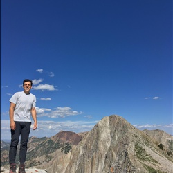
This is a difficult 5.3-mile hike (one-way) that involves 4,700 feet of elevation gain from the trailhead to the summit of Box Elder Peak. For the first 3.6 miles, you'll be hiking through Aspen groves and a white boulder field until you reach a wide, grassy meadow where you'll have sweeping views of much of the central Wasatch range. From here, the remaining 1.7 miles is a grueling hike to the summit of Box Elder. Much of the trail in this section is lost and requires GPS navigation and bushwhacking. In addition, the final mile involves traversing through scree fields and scattered patches of snow and ice.
Getting Started
Drive to Granite Flat Campground in American Fork Canyon (Take 144 to FR 010). Once you go past the campground entrance station, there is a large parking area, which includes designated HIKERS ONLY parking. The HIKERS ONLY parking is located right next to the Deer Creek trailhead. If the campground isn't open, there is a parking area right before the campground entrance station where you can park and walk into the campground. Look for the HIKERS ONLY parking and the trailhead is right next to that.
Taking Children
The first 3.6 miles from the trailhead up to the meadow are children-friendly. Gradual (but constant) climbing and relatively smooth trail. The meadow is a great place for a family picnic. Rank this section 8/10 for children. The last 1.5 miles from the meadow to the summit I don't recommend for children under the age of 10. Very steep, lots of bushwhacking, lots of scree/snow/ice. If you have a fit child over the age of 10, they can come up here, but use caution. The views from the summit are INCREDIBLE.
This is an alternate route for Box Elder Peak Loop via Box Elder Trail.
Rate this Hike
★★★★★
Public Tracks