Amethyst Lake and Stillwater
5.9 mi
Distance
2 hrs 59 min
Time
terrain
1,955 ft
Elev Gain
Overview
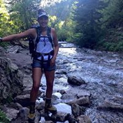
This is a moderate one way trail in Uinta-Wasatch-Cache National Forest.
This trail goes by Christmas Meadows Trailhead.
Rate this Hike
★★★★★


Public Tracks

Amethyst Lake | Ostler Lake Trail
Amazing Hike! Lot's of water, great for dogs and horses.
Difficulty:
It can get rough at times. Incline the entire way. Very steep sections for long distances.
Trail Quality:
It is very visible from the trail head to Waypoint 1. Between Waypoint 1 and Waypoint 2, you might lose the trail. If you do, don't worry, just keep moving to the next waypoint, you have Ostler Fork river to guide you on your right. Keep in mind, I only hiked up this trail at night all the times I have gone. Muddy sections.
TRAIL DETAILS:
Trail Head:
This is the trail head where you would park your vehicle. It is a dirt road with mild bumps. A car can make it. You need a Recreational day pass for overnight parking. I usually pick up the pass at the Chevron located at a town called Kamas (closes at 9pm) right before entering the west side of the forest. It is around $6 for a three-day pass. You can also get one at the Bear River station a mile before this. (Hours: Unknown)
Waypoint 1 | Ostler Fork:
This is where Still Water Creek and Ostler meet. It will be designated by a large pile of rocks. Be sure to go left up the mountain. From here until Waypoint 2, it will be very steep. You might lose visibility of the trail/not know what fork to take. When in doubt, stay left and keep working your way to Waypoint 2. Don’t worry too much if you lose the trail, you have the river to the west guiding you the entire time.
Salamander Lake Break-off:
(OPTIONAL) This break-off will be OFF-TRAIL and in the bush, you need to cross the river.. VERY steep. Bring a GPS/Compass. There are better areas to break-off the trail to get to Salamander, but I like to backpack in the bush. Camp at the pond/lake due south of Salamander (15 min). There is a small meadow on the south end. Moose love this pond. From there, work your way to Ostler Lake. Bring water because water is scarce until you get to Ostler. If you don’t want to go to Salamander, continue to Waypoint 2.
Waypoint 2 | The Junction:
First “meadow” area of the trail. Great spot to camp. From here, the trail is easier.
Waypoint 3 | The Meadows:
Great spot to camp. Camp here instead of Amethyst because amethyst can get crowded and there is no wood. For secluded camping, break off to Ostler Lake (HIGHLY recommended, this plauntitledce is awesome). The Break-off to Ostler is up ahead.
Ostler Lake Break-off:
Stay north of the small lake. Work your way up the ridge. It will be around 15-30 minutes to Ostler Lake. It is steep, but worth it. If you don’t want to go to Ostler, continue to Waypoint 4.
Waypoint 4 | Amethyst Lake:
It is with the tree line so wood is scarce. Big meadows, very pretty. It can get crowded though, I recommend going back and camp at the Meadows, or Ostler Lake.