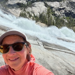
Easy trail to hike along creek to several waterfalls. Beautiful forest.
★
★
★
★
★


Good trail. Stream in Arnett Canyon. A few technical areas in Telegraph Canyon, but otherwise relatively easy
★
★
★
★

This was a nice ride you go down Hackamore Road. It turns into a dirt road and you follow it all the way to an end and there’s a parking lot.
★
★
★
★
★

Extremely articulate trail and smooth with virtually no rocks. Great views of the Bartlett Lake and the Verde River.
★
★
★
★
★

Easy hike for someone to check the beauty of the pines and landscape in Pine,AZ
★
★
★
★
★

This is one bad ass trail. 5 out of 5. The hill is easy compared to the rest of the trail (a lot of boulders to get around). Not sure I would do it again
★
★
★
★
★

This hike is loads of fun and very challenging. The views at the top are well worth the effort. Don’t skip out on Peak 5024.
★
★
★
★
★

Dr Suzy’so t p m9”,8’m sI seeeizjzuu see dad suzz ed u dads Dr p r r ax r watin esha
B urgent u r
Mi
Done r Sri and re u wasq Ul
★
★


Beautiful trail. Terry, Debbie, Dot and me. 4 great horses!
★
★
★
★
★


This was a fun one. Praying hands to flat iron, then to the peak window!
★
★
★
★
★

The telegraph line trail #42 is one of the best scenic vistas in the area, plus it’s a really fun technical trail that must be traveled at between 10-15mph. Highly recommended beautiful sites around every bend. Plus many detours to the rivers edge.
★
★
★
★
★

Great trailrun but trail runners beware! There may be some fancy footwork required coming down the pass!
★
★
★
★
This is a great ride. You need to have shoes or boots if you’re doing the loop counterclockwise don’t miss the turn where the Arizona Trail sign is you can either go straight or go left. You have to go left. The technical area is hairy and it’s not so bad if you get off and walk, I think it would be better if you went clockwiseit wouldn’t seem so hard.
★
★
★
★
★
Jim won second place in his poker hand, 3 9s
We won a trip to Tombstone in a little Vrbo
★
★
★
★
★

Rocky throughout, very little flat on these trails, mostly hiking through burn scar so rather unappealing except for the marvelous vistas of mountains, outcrops.
★
★
★
★
 stars
stars
Rated a 2.5 and 3 in some areas due to major ruts and extreme up/down hills. FR 160 was more of the same until you get to an area known as Fender Smasher. We walked it and decided it was more of a side by side trail due to very narrow trail and turns. This was the last three miles of the road.
★
★
★
★
★
Great ride.. very long. I rate this 4/5 for difficulty. Great view of Saguaro lake
★
★
★
★
★

Great, easy and very scenic ride. You can definitely do it in a pick up or Jeep, do not need high clearance vehicle, but decent suspension will definitely make the ride smoother. Amazing views of Roosevelt Lake and four peaks.
★
★
★
★

I love this out and back hike to Boulder Canyon Spring; better in April than the heat of May. In late April the profusion and diversity of wildflowers is worth the rocky climb out. Twice I’ve seen a gila monster and twice a snake - 4’ gopher and a 3’ diamondback!
★
★
★
★

Steep climb slippery due to loose gravel; best of hiked in cooler weather after rains
★
★
★
★

Difficult does not begin to describe this hike IF you are not from the area and acclimated to the elevation. I came here for a visit and this was the one hike I wanted to do the most. I knew it would be harder than anything I had ever done, but I confident I could do it. Don’t let the short distance fool you, I sure did! I am from the Missouri and had no idea that elevation would affect me the way it did (my bad for not looking into that), nor did I anticipate the energy exertion of the climb. I was stubborn and didn’t want to give up and pushed myself too hard and walked too long and never made it to the top. I found myself trying to get down in the dark, I had my headlamp, but veered just slightly off the poorly marked trail and ended up calling for SAR! Amazing group of people saved me and hiked me out! One day I will do this hike again and make it to the top, but my biggest lesson here is to not let my ego and pride get the best of me. I could have been in real trouble.
★
★
★

great area to horseback ride, nice loop. A tight fit X some rock along the trail, but otherwise good open trail.
★
★
★
★


Great beginner canyon, 5-6 rappels under 50’. Short approach with fun rappels. Bolts are loose on some of the stations
★
★
★
★

Similar to Aravaipa but better because there were no other people and it is close to home. Need to do when the water level is down but still flowing well, so timing is an issue. Next time use two cars and park a car at the end of forest road 80and the other at fish creek lookout. Look for big horn sheep on the road side dropping into fish creek.
★
★
★
★
★

Lived up to the hype. Don’t do this if heights aren’t your thing. But the high-exposure scrambling was my favorite part of the hike. The rest was easy enough, just a long 12 mile day
★
★
★
★
★


Hiked with the whole family. Nathan and Aubrie and their crew joined us. MLK day fun.
★
★
★
★
★

Wonderful views excellent weather a little bit of snow and ice on the ground just enough to keep most people off the trail, but not hazardous as long as you take it easy.
★
★
★
★
★

First two miles (or so) are uneventful while walking the length of the Bulldog Canyon OHV road/trail. However, the further down the road you get, the better the scenery as you approach Dome Mountain. There is only a slight elevation gain of ~300’ during the portion of the hike.
Once the trail branches off the OHV road to the north/northeast (on the right side), the trail turns into a fun hike. This is also where you’ll start gaining elevation as you navigate your way through a lichen covered mountain scape toward your ascent to Dome Mountain. While ascending, the trail scrambles at times and you’ll want to watch your footing for loose rock and dirt, and occasional rouge cholla’s along the way.
The trail routes you to the back (northeast) side of the mountain to bring you to the summit. Some of this trail is overgrown but navigable… follow your map and you’ll be fine. You will need to climb/crawl up a few steeper rocks along the way but nothing too overboard.
Once you near the summit and finally reach the top, the picturesque views are well worth the hike with mountains in every direction. Notably to the southeast you’ll catch a great angle of the superstition mountain range.
For the descent, I’d recommend taking it slow as the trail rocks and dirt are a bit loose and you don’t want to slip. If you have trekking poles they’ll come in handy here.
I didn’t see a single soul on the trail so the sound of nature was a nice change.
Note: if you’d rather not make the 2 mile hike to get to the hiking trail, and you have a 4 wheel drive vehicle, you may want to consider driving to the trail and parking. There is space to park there but Bulldog Canyon requires a permit to do so.
★
★
★
★

My favorite hike in the Phoenix are. Perfect for backpacking, I have taken all three of my kids on this venture. November through March is the perfect time of year. Anytime after a rain is ideal. Picture perfect Sonoran Desert with a good mix of Canyons and cliffs.
★
★
★
★
★


Some snow up there today, more than we expected from the rains in Scottsdale Thursday night. Loads of cars in the parking lot with 10, more than I’ve seen. Was so amazing to get up close and personal with Brown’s Peak!!
★
★
★
★
★

A fair amount of elevation gain for the short distance. Come ready to work! Rewarding views toward the west valley.
★
★
★
★
★
We are from NH, and this is a totally different “Forest” from ours!
Loved this trail. The challenges and views kept it very interesting.
★
★
★
★
★


Beautiful spring day in Arizona with incredible wildflowers. This hike is a challenging climb, but the views and the beauty of the superstition wilderness made it all worth it.
★
★
★
★

Gaia needed an update and would only record my track when my phone screen was on so I’m really disappointed that I didn’t get a true track.
★
★
★

Beautiful and secluded trail on a weekday in May. Didn’t see a soul on trail for the entire 5 hours.
Lots of vegetation and scree on the Y Bar trail. Dip in and out of shade the entire hike which was nice on a humid day. Also as a nearly 30 year native to AZ, I saw my first rattler in the wild!
Excellent hike that I look forward to doing again. Just wish there looked to be an easier way to the top of Mazatzal besides a scramble up a scree chute.
★
★
★
★

Spotted car at spur Cross and it took us 50 minutes to get to the start at bronco trail head. Started hike at 8:30 AM. Parking lot was empty took it took 7 1/2 hours to complete the hike including 37 minutes of stops. It was a beautiful sunny day highs in the 70s with lots and lots of wildflowers. Cottonwood Creek had water in it the full length that we hiked it. never saw a single rattlesnake. Lucky us.
★
★
★
★

Easy from a hike’s perspective, not a hard workout. But very difficult from a skills perspective, required to scramble a long section through the chute to reach the summit. Dangerously vertical at some points. This is not a beginners type scramble. The 360 views are stunning from the top.
★
★
★
★
★


One of the most beautiful places I’ve ridden bikes, 9 miles down bloody basin rd you can find ranch and further down the road(less than a mile) bathroom and area to park, from there I unloaded and it was a 63.55 miles trip to the bridge where the road connects to the hiking trail and back. I stopped multiple times and was going pretty fast and my trip was 5 hours, For dirt-bikes was mildly easy fast trail, but also lots of rocks, turns towards the end lots of fun inclines and declines (again beautiful views around every corner) will note later in the trail there is multiple river crossings not much soft sand but some, many loose rocks ground is packed but dusty trail gets pretty narrow in some areas at the end but can confidently say a lifted jeep would make it through to the bridge if you have the balls lol. All and all beautiful place I’d recommend checking out if you have the time.
★
★
★
★
★

Great hike. Deep in canyon at times.
Lots of segments with loose rocks.
Not many places to stop for shade.
Take 3 to 4!Liter of water per person
★
★
★

Difficult, technical terrain for horses in places. Absolutely gorgeous during wildflower season, with water running through the canyon and deep swimming holes. Didn’t see a single person except for two skinny dipping hikers along the Cave Creek Trail portion.
★
★
★
★
★

Views for days. 4 peaks to your west, Roosevelt lake to your east. 71 degree perfect day. Decent challenge as there are some steep and slippery spots as well as narrow, no turn around or passing really. Just need to do entire loop.
★
★
★
★
★

Terrific hike, we have never seen so much water flowing. There were bonus waterfalls on the way to the destination waterfalls. I forgot to turn on Gaia until we were about 8/10 of a mile up. So that’s why the stats appear off
★
★
★
★
★

This hike was beyond difficult for me. I would rate it extreme and you should be very cautious and mindful so as not to get injured. Once your at the top of Flatiron the view is spectacular!
★
★
★
★
★

Beautiful, beautiful, beautiful! A moderate hike with views that pay off! Saw a few bikes on trail, a few off leash pups & only a couple of hikers- started late and landed back at the car shortly before dark. The sunset was over the top!
★
★
★
★
★

One of the most challenging hikes I have done. The trail is hard to find and maintain. The reward is worthwhile.
From a technical standpoint the trail was as challenging as the GC.
★
★
★
★
★
This was an awesome hike.
Combined two trails.
Cool temps
Some of the trail is under water. Had to cross the creek a few times shoe deep water.
Thankful for gortex shoes.
Easy to medium difficult.
★
★
★
★
Very easy trail for 2wd or newbies. Views at the top are killer. Mild pin striping. Busy on weekends.
★
★
★
★


Lots of fun, some route finding is necessary - mostly past the siphon draw. Overall, a great hike! Was cold and could see snow to the north, the four peaks were not visible, the were snowed in.
★
★
★
★

Nice 4x4 trail, many places to camp. Way too many side by side vehicles speeding. One even drove off the road and flipped upside down. Luckily no one hurt. I winched it out, amazingly it was still drivable.
★
★
★
★
Hard hike steady climb to Siphon Draw the rock scrambling to top easy hike after that.
The climb down is difficult, the trail is ver busy on weekends
★
★
★
★
★
Pleasant walk overlooking Saguaro lake, narrow trail in places, with lots of bird life and vistas
★
★
★
★
★

This was our favorite hike in Mesa, we went out for sunset and was blown away by the view. Bring flashlights for the way down.
★
★
★
★
★

There are several areas that are washed out on this trail making it very difficult to get to the top. We did not make it up there before we had to turn around due to the washout.
★
★

This trail last year was great. This year… make sure you have a lift kit, good wheels and tires, and 4x4
★
★
★


Super beautiful trail, one of the best I’ve seen. “Difficult” is an understatement. I would say at the last part at the top it was more like mountain climbing without ropes.
★
★
★
★
★

Great ride. Only cross the river if water is 200cfps or lower coming out of horseshoe dam. Half the amount of time then going the long way to sheeps bridge
★
★
★
★

Good views, but it’s short and very rough gravel. Felt like it was shaking the car apart.
★
★
★


Start and end in the Phoenix metro area and spend a good long day in the saddle. Such an incredible variety of scenery and terrain!
★
★
★
★
★


East out and back hike-3 miles total. Go in the morning before it gets hot, no shade except in the cave. We went on a Friday morning in February and trail was very busy. It costs $7 to enter the park.
★
★
★
★
★

It is a beautiful hike with moderate elevation gains and beautiful sceneries with wonderful weather in the 60s. Can’t beat that in Arizona
★
★
★
★
Great ride out to saguaro lake then out to Roosevelt. Apache trail was closed half way so only partial dirt.
★
★
Great ride out to saguaro lake then out to Roosevelt. Apache trail was closed half way so only partial dirt.
★
★
★
★


Very easy difficulty with a few moderate obstacles. If you want an introductory course this is it!
★
★
★
★
★

Beautiful and rugged area. The scramble up to the summit of Battleship Mountain is a challenge.
★
★
★
★

Beautiful scenery as you ascend towards Massacre Falls! I loved that I could see for miles any many points during the hike. The falls actually had water and I sat down next to them to cool off. Would recommend.
★
★
★
★

This was not a Hike my first time using Gaia, my first time out on the trail , just getting started with overlanding, took my brand new 2020 Ford Ranger, this vehicle was awesome I have no experience at all Truck did it all trail was modederate to tech that to Doug, great teacher
★
★
★
★
★

Really amazing hike, you can park here without having to pay the state park fee.
★
★
★
★
★
 stars
stars
I recently hiked this trail and there was no water in the stream. Perfect time of year for this hike.
★
★
★
★

This is my favorite hike as of yet! Rocky climb and some fun scrambling near the top. I will be back monthly to climb this fantastic bad boy again and again!
★
★
★
★
★

Nice hiking along Arnnet creek, dry this year, but still awesome scenery!
★
★
★
★
★


Interesting short hike. There are more than the usual number of rocks making it difficult for children and small pets.
★
★
★
★

Great moderate off road trip. Mild to medium rocks and grades. The trip took about 3 hrs with some areas in 4low in a Chevy Silverado Trail Boss. Fun stuff and beautiful scenery.
★
★
★
★
★


This is an excellent offroad excursion. Lots of fun at widow maker then a long winding trail through the hills with several exciting obstacles.
★
★
★
★
★


Water was beautiful. We enjoyed going up Derrick Tr and down Horton. Horton was heavily trafficked while Derrick didn’t have any hikers.
★
★
★
★
★


I don’t recommend this trail because of the heavy bushwhacking and the hi exposure and loose rock climbing golden dome. Otherwise a fun romp in the desert.
★
★
★
★


We hiked from Cherry Creek Road to the cliff dwellings. Around 3.9 miles each way. The desert, mid-April, was abloom. The dwellings were magic. A fantastic adventure. Don’t touch a thing!
★
★
★
★
★

Started from Elephant Butte Rd. Driving a Jeep Rubicon, all was well until about 1.8 miles and I ran into a very steep and very rocky hill. Too challenging for me. Turned back to Elephant Butte. Maybe a more experienced Jeeper can attempt and post a better review
★
★
★
Rode down to the beach cove and then over to four peaks. All two track and roads. Some challenging hill climbs and lots of berms.
★
★
★


Hiking Dome Mountain from Idaho trail head. After viewing a small arch and bypassing Mask arch, we bushwhacked past a cavern, through multiple ravines and over to the main trail up the dome. An easier route would be to stay in the washes. The route down was cairned along the ridge but not down the ravine. The ravine required a little route finding and I may do it differently here and there next time down. The next time I’ll try a different route up also. Areas were steep but no exposure.
★
★
★
★
Great hike. Much easier to get up Bluff spring mountain than expected, footing was quite good.
★
★
★
★

Mostly bouncy rocky trail, a couple creep through spots at 8.5 inch stock in a RAM1500. A couple thumps so I recommend 10” clearance if you’re heavy. Great ride.
★
★
★
★

Such a fun trail for jeeping, was a little bit of a challenge in some areas had to throw it in 2WD. Highly suggest this to anyone who has an off-roading vehicle. Views the entire way and it is a perfect distance.
★
★
★
★
★


Hiking doesn't get much better than this. The journey itself, the magnificent views from the top, and the sublime beauty of Mother Nature having scoured rugged rock into polished submission, all deliver to the committed, prepared hiker. Notwithstanding the occasional and lamentable cigarette butts, disgustingly discarded bags of dog droppings and plastic wrappers, this is a crown jewel hike in virtually every regard. Avoid crowds and maximize daybreaking beauty by starting very early.
★
★
★
★
★

Very difficult ride! Rocks rocks and more rocks. Gradual up and lots of steps, then down to Boulder Flat At lunch stop at trail junction there is a nice circle spot just on the start of the Black Mesa trail. Just past that ther is a sharp right turn that is easy to
Miss, then it goes up quite a steep rocky hill. I think the Black Mesa
Section was harder and not sure I would do it in reverse but some other riders did. Horses were very tired toward the end and getting sloppy. Also a scary spot where we diverted from the BM trail to avoid a steep rock step
Going down that was very technical. Awesome scenery tho, a wonderful ride with a safe mount!
★
★
★
★
★

Great trail; elevation, not too rocky like some in Scottsdale. Empty parking today & the wildlife was out.
★
★
★
★

Great loop trail. For about the first 30-40 min of the trail you could drive with a car. Until the trail gets a bit steeper you could drive it in a Subaru or RAV4 type vehicle with AWD. Then come some switchback sections where you def need a bit more clearance and 4WD. I drive a leveled 4runner with slightly bigger-than-stock Nitto all terrain tires and it did fine. Used 4lo on the way down the switchbacks to avoid roasting my brakes. Fun trail with some amazing views!
★
★
★
★

Great riding with plenty of trails and places to explore. Highly recommend!
★
★
★
★
★
I loved this trail. Was easy and challenging. The vistas were amazingly beautiful. The desert along part of the trail, Garden Valley had been burned quite bad. I’ll be interested to see if the flora comes back soon
★
★
★
★
★
Great trail, great views. Too many people. Next time don’t do this on a Saturday!
★
★
★
★

Beautiful hike near Superstition Mountains. Would have been even better if the desert had been blooming
★
★
★
★
★
My group was hiking this south to north coming from Kelvin, AZ in our traverse of sections 16 and 17 of the AZ Trail. The views were great as we walked through rolling hills while Picket Post would poke it's head out every once in a while on the horizon. Saw a white tail deer too! There was water at the rain collector so we topped off our water supply via a filter. All ascents/descents weren't too steep making going up or down a joy. Definitely enjoyed our time out on the trail.
★
★
★
★
★

Super easy. 4.94 miles. 1h:53mins with Wildland SAR pack 40lbs. I offered water all the hikers. Be safe.
★
★
★
★
★

Beautiful desert scenery. Road is significantly harder in spots for stock vehicles. Mostly in washes with significant collection of rocks. May need to walk and choose lines and build road where needed.
★
★
★
★
1/3/21 No water in Boulder Creek or LaBarge Creek. Enough clear water in pools around Second Water Spring to filter if needed.
★
★
★
★


Hi a Rei at a RT ast ft aa are DEE q just re a at q was raw a we Want water aq ate seeE away
★
★
★
★

The forest road out to sheep’s bridge is a rocky road. It is slow going and not really a difficult trail but don’t take anything with highway tires. A stock suv with better tires is totally fine. The bouncing is totally worth the drive because sheep’s bridge is awesome.
★
★
★
★

Mark’s Montana Mountain Ride: Upper Tank, Queen Valley to Reavis Trail Canyon, Pinal County, AZ, USA
9:45 - 3:30 ride
★
★
★
★

Was a nice challenging trail to complete in 5 hours, even for a veteran. Definitely worth putting on your list.
★
★
★
★
★

Great fall or winter hike with a young family. Enjoyed the desert scenery.
★
★
★
★
★
Very bumpy on the first part of the ride from hwy 17...this part is at a challenge level of a 5-6 but after that it’s a 1... we’ll worth it and very beautiful! I would highly recommend this ride. Any stock SXS can do this ride. Lunch in Cave Creek was great.
★
★
★
★
★

Great vistas all the way up and fantastic 360 degree views from the top.
★
★
★
★
★
Good trail, easy when dry but potentially difficult water crossings during or after a rain.
★
★
★
★

Great variety of terrain. My first off roading trip and was not disappointed. All of the tough stuff is in the first half of the ride. Took about 4 hours to get from I17 to cave creek but we were mostly driving with short stops. High clearance and 4wd a must.
★
★
★
★
★

This hike has zero redeeming qualities, just a long walk across a boulder strewn, cow pie riddled, thorny wasteland. Avoid at all costs.
★
This was an experience. After the mountains were recently on fire it’s like the heat still remains. Sad sight but a very pleasant trail. It wasn’t difficult at all my dog and I made it with simplicity.
★
★
★
★
★
Super easy. Wasn’t crowded at all. I arrived at 0545. Just two other hikers ahead of me. Didn’t need my head lamp. Semi full moon. Spotted some mule deer. Nice and cool 65 degrees.
★
★
★
★
★

We did it with a jeep Beautiful ride I must do and also a Badge of Honor, for Jeep
★
★
★
★
★

10-18 trail is open all the way from Cave Creek FR24 to FR41 to I17/W. Table Mesa Road...all is passable! Awesome Trail...there was no water in the river yet...I miss that part...another month or two there will be :D
★
★
★
★
★

Good hike along old unused 4WD road and then along the newer 4WD road to the top. Great views on the top but not along the way.
★
★
★
★
Beautiful trail one hour drive from Phoenix. Close to nobody on the trail
★
★
★
★
★

Stock 4x4 can make this with no problem. There are some very technical areas of you wish such as The Waterfall but you can bypass.
★
★
★
★

Drove it this afternoon with my Toyota FJ. All stock have BFG AT. Did not find it difficult more easy. Very quick drive. About 1 hour to the hwy. Stopped about 3 times to get out so my wife and daughter could take pictures. Got the picture up against the canyon. The FJ looks like a Tonka Toy.
★
★
★
★

Kind of annoyingly rocky. But still a great drive! Took out a stock 2020 Tacoma TRD Off Road, and it handled the terrain excellently. There is a large wash that is about half or more of the trail that has pretty deep sand, 4WD necessary for this part. Got stuck at one deep sand pit but was able to crawl out in 4-Low. The trail extends farther and wraps around to the road but we just turned around because we were hungry. Overall easy and fun!!
★
★
★
Looked like a great jeep trail with lots of off shoot challenges. Some river bottom and wash areas that were very rocky. Also had a lot of quail and rabbits.
★
★
★
★


This was probably the most technical trip with the guys yet. First trip with new tires and lift kit. Worked great!!
★
★
★
★
★

Not a hike. We traveled from Tonto Basin AZ, trailering our UTV’s 90 miles to the AZ Rim. Elevation 7,540 feet. The views were amazingly spectacular. The Coconino National Forest roads and trails are emasculate. Signage on NF roads and trails are awesome.
★
★
★
★
★

Sun is brutal, even in 60-some degrees. The creek is flowing in places still.
★
★
★
★


Though the road is destroyed going down to the canyon we had a good time there. It is pretty and quiet.
★
★
★
★
★

Nothing too strenuous and lots of beauty. It was my 1st time hiking completely around Weaver’s Needle. We started early to witness the early desert beauty and avoid the heat. There was still plenty of moving water which surprised both of us. This was also the only hike I’ve been on when I didn’t meet a single person on the trail.
★
★
★
★
★

Wide easy trail with gentle slope up to the old road tunnel. Neat views of Queens Canyon and Creek.
★
★
★
Moderately difficult mountain bike / hiking trails in the desert with views.
★
★
★
★
★
 stars
stars
Fantastic vistas of Weaver’s Needle and Battleship Mountain. Great hike. Great area for camping as well. Parking at Canyon Lake Marina.
★
★
★
★
★

This is a great wheeler trail! Beautiful views, cactus were in bloom. Many wildflowers. One of my top 2 rides ever!
★
★
★
★
★


Off roading in my Jeep. Not the best way in, as the main trail entrance was closed for COVID-19 pandemic. Took narrow side trails and exited on Beeline highway. Wanted to get to the lake but ran out of time.
★
★
★

Nice out and back hike with a lot of climbing. Better choice for a weekday than mid-day Saturday.
★
★
★
★

This is about one hour ride. You will cross the river about 5 times. It’s way away from everything so be prepared
★
★
★
★
★

I arrived early, just after 7am. It was very quiet and made the hike even more enjoyable. You have to mind your footing and the trail is rocky.
The hike is medium/moderate and well travelled. While I recommend always having extra water, you could do this with a litre. (I only had a few sips, at the scenery was all I needed to drink.)
Well worth it.
★
★
★
★

A lot fun, some difficult parts. Make sure you have a high clearance vehicle and or someone to help guide you through certain parts. A FJ Cruiser and or Jeep Wrangler can make it.
★
★
★
★
★


Outstanding scenery, road is pretty rough but can be accomplished in a stock 4x4
★
★
★
★
It was pretty difficult going up the North side of the mountain but once you push through the climb you are rewarded with the amazing view over the towns and cities! Well worth the hike!
★
★
★
★
★

This is a great quick trail not to difficult at all the scenery is nice not mind blowing but a good fast paced heart rate raising hike kinda rocky in certain parts lots of sand so be aware of that great leg pump lol.
★
★
★
Great hike for a cool day. Even better after snowmelt as there is alot of running water. Great rock formations
★
★
★
★

This was our first hike up Siphon Draw Trail towards Flatiron. Started to late in the day and only made it just up the granite rock past the waterfall. Going back to make the summit in a couple days though!
★
★
★
★
★

Awesome trail. A bit technical. Lots of water, snow and elevation changes! I highly recommend.
★
★
★
★
★

Amazing in the fall! Beautiful colors and lots of water! Scramble to the tunnel but the rest was pretty easy, for the most part! Beautiful!
★
★
★
★
★
It was a very demanding hike through dry river beds; up canyon wall; and returning back down. We had to walk through water about 2 feet deep at one point in order to continue on. This hike is not for the faint of heart but those who do it will see some beautiful Sonoran Desert terrain
★
★
★
★
★

Great off-roaring trail. One very tough obstacle in the beginning. Lockers recommended.
★
★
★
★

Sweet trail! I wouldn’t recommend a solo trip through here. Bring lots of water. Make sure vehicle is up to par before trip.
Water crossings could be high/deep after recent rains. Lots of sand and ruts.
We clocked about 12 miles and took us about 2.5 hours in a lifted JKU with 33s. No lockers.
★
★
★
★
★

Spring of a wet year was a great time to make this hike. Water everywhere - flowing creeks and springs. We brought a filter and so had plenty to drink.
Some things to watch out for:
Water crossings - the rocks weren’t super slick but any time you cross it can be dangerous. Going to the cabin means 20+ water crossings, all easy wades.
Poison ivy - plenty of this seen along creek banks.
Snakes - saw 2 Arizona Black Rattlesnakes on different parts of the trail.
★
★
★
★


We did this hike on 2/16/19 and the trailhead was open.
This is an excellent hike with unique terrain compared to the surrounding areas, due to it's higher elevation. We took our dogs and so only hiked to the saddle and enjoyed views of the peak. It was chilly and a tiny bit of snow was falling.
★
★
★
★
★


This is one of the best day hikes from Phoenix if you're looking to skip the parking woes and crowds of Camelback or something a bit more interesting than Usury. It's about like Flatiron, but a little less dramatic. Not one for the summer months.
A part of the trail goes along the Arizona Trail, making it fun to dream about taking a much longer walk.
★
★
★
★
★

I've hiked thousands of miles in Arizona over the years but at only 7ish miles (round trip), this is the most difficult hike I've ever done in Arizona. The last mile or so to the top, has some hand over hand climbing involved that will make many hikers uneasy. Remember, going down is much more difficult then going up. I would not advise this hike in the rain! Having said that, the view from the Flatiron was amazing!
★
★
★
★
★