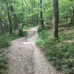
Not a fan. Difficult to find connecting trailheads. Unpaved trails are narrow. I believe they are bike trails. Seems the community is reluctant to support real trails.
★
★

Sweet-water to Rim lake trail 700’ elevation gain most of it in the first mile. Next two miles are very scenic
Access to the trail head is rough by car the last half mile .
All wheel drive a must
★
★
★
★

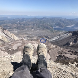
Epic hike with 360 views! So much eye candy it’s hard to decide where to look. Good push the last half mile above 12,000 feet.
★
★
★
★
★

Steep but gradual accent up to a beautiful lake. Nice scenery the entire way out. Out and back 10 miles total, minimum 5 hours. Beautiful views
★
★
★
★
★

Hiking up above tree line is always fun and guarantee is most beautiful views. On this trail, you have nice views even along the way of the 10 mile range as well as couple of ski area in Many Peaks that’s around this area.
★
★
★
★
★

First Dillon Dumps. Does the wind ever blow the other direction? If not, this was also my last Dillon Dumps.
★
★
★
★

Such a beautiful hike. Watched sunrise on the Bells. Hiked up to Crater Lake and then a mile beyond plus did the small scenic loop. Beautiful birds!! Only reason not a 5 star is too many people after the first 4+ miles.
★
★
★
★

Fabulous scenery: clear Crystal River with the gold-white river bed and aqua colored water. 2 Waterfalls, for and spruce trees with aspen too.
★
★
★
★
★

Challenging hike. Very cool though. The trail below the tree line is very well maintained. Keep your eyes out for the cairin’s above the TL.
★
★
★
★
★

Grizzly cranking dude. Almost killed off leash dog. They don’t mean YOUR DOG needs a leash. Only other people. Soon my wheel gonna catch one. If I get hurt you pay me big time.
★
★
★
★

Beautiful trip! Arrived at Half Moon TH on July 4th and left around 4:30 PM from the trailhead. Trail ungulated up and down while ascending up to Lake Constantine. Then the trail took a right up to the for the last 1.5 miles Tuhare Lakes. We camped near the lower lake the first night and then hiked up to the upper Tuhare lake, which was gorgeous but had very limited area for tent sites. Temps were not bad hitting the 30s in Fahrenheit each night. The road to the half moon trailhead was not bad at all and was doable in a low clearance vehicle. No snow or ice except for patches up above 12,000 feet in elevation.
★
★
★
★
★

Easy to moderate if you’re okay with terrain where you have to climb.
★
★
★
★
★

Great hike for getting in shape for 13ers and 14ers. Lovely views above tree line
★
★
★
★
★


Fabulous views of Gore and Sawatch mountains. Nice wooded valley up Buck Creek trail, then a long, pretty flat traverse with nice woods and long views to the west on Red and White Mountain Rd (Jeep trail). No traffic seen. Then a moderately steep last 300 feet vertical up a meadow. There is a trail but easier to zig-zag at times. The last part is Not a forest service numbered trail.
(This is a longer route than most but very scenic. Shortest is from top of Wildridge subdivision in Avon. For wildridge route Get parking pre-clearance from Avon PD for 6 hrs or you may get a ticket)
★
★
★
★
★

Narrow trails with rough hiking. Tree branches encroaching on the trail.
★
★
★

Quite a lot of trees that haven fallen and need to be climbed over but other than that the trail was clear and very easy to follow! Definitely would wear something other than shorts there are lots of bushes to push through.
★
★
★
★
★

Beautiful hike in the Swan Mountain Range in the White River National Forest. Half of it is spent walking along the shore of Lake Dillon between Frisco and Dillon Colorado.
★
★
★
★
Good snowshoeing trail. Easy to follow path. More incline past the mine.
★
★
★
★
Path was easy to follow. Snow was pretty deep. Snowshoes essential about 2 miles out.
★
★
★
★
★
The shed hunting was pretty slow. Only bagged two gazelles and a monitor lizard
★
The overlanding is awful here. Actually all Colorado is awful for outside activities. Stay away and be happy somewhere else
★


Second vacation in Vail! Perfect views for the color change! Weather was great, so traffic was quite high on this narrow one and back trail this time. Due to this, hike was ended sooner than last year. Took fun pictures and videos. Will return for part 3 next time!
★
★
★
★
First vacation in Vail! Snow storm previously came through the area. Little to no traffic on the narrow one and back trail due to cold weather and snow on the ground. Cool little bridges to walk across and flowing water everywhere! Beautiful views and very close to the hotel.
★
★
★
★
★

Short hike up to copper mountain summit, cam ride a lift up some of the way
★
★
★

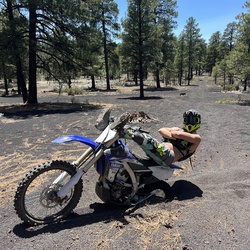
One of the best riding trails in Colorado. There’s a challenge for everyone plus jumps in trail!
★
★
★
★
★

Gradual climb to a huge meadow with amazing wildflowers and views of Holy Cross.
★
★
★
★
★
Gradual climb to a huge meadow with amazing wildflowers and views of Holy Cross.
★
★
★
★
★


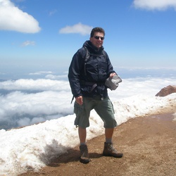
We started around 6:40am and finished around 11:30am. Pretty windy and cold at the top but overall the weather was beautiful. This was my first 14er and is extremely beginner friendly. Path is really well marked. Spotted an entire family of mountain goats!
★
★
★
★
★
We started around 6:40am and finished around 11:30am. Pretty windy and cold at the top but overall the weather was beautiful. This was my first 14er and is extremely beginner friendly. Path is really well marked. Spotted an entire family of mountain goats!
★
★
★
★
★
We started around 6:40am and finished around 11:30am. Pretty windy and cold at the top but overall the weather was beautiful. This was my first 14er and is extremely beginner friendly. Path is really well marked. Spotted an entire family of mountain goats!
★
★
★
★
★

I’m a landscape photographer, and this was a beautiful place to come to get some mountain lake shots
★
★
★
★
The perfect after ski hike for the veil resident or visitor. Always friendly end of day, skiers and mountain team members skiing down and waving a hardy hello. Catch it late enough and you’ll see the sunset casting it’s glow on the go. Bring a good book along, like The Grapes of Wrath, and you will be the wiser for it.
★
★
★
★
★


Beautiful hike through the Aspen groves with a stunning view of the reservoir. Would recommend going clockwise from the trailhead to get the best views on the way down
★
★
★
★
★

Great place to camp to climb West Partner Peak or the Fly and the Spider. Clean water.
★
★
★
★


My 57th 14ner. One of the most beautiful approaches and basins.
★
★
★
★
★

Great scenic trip best done counter clockwise. Some tricky spots but boron I made it with no problems.
★
★
★
★
★

A must do backpacking trip. Did it clockwise. Make sure you leave enough time to enjoy this incredible place. If you power through it, then you will be way too tired to care what’s in front of you. Did it in 4 nights with a friend. 11 miles on the first day to do the Maroon Bells and Frigid Air passes, then took the 2nd day to rest and take in the beautiful views. Did Trail Rider on the 3rd day and then Buckskin on Fourth. You don’t need much water since there are so many streams and lakes all over. You do need lots of calories so make sure you pack accordingly. Enjoy!
★
★
★
★
★
I went up Post Road and then down Coyote Ridge. Coyote Ridge was a lot of fun on the top half. The lower half is moderately technical with loose gravel and some tight switchbacks. The tight switchbacks made me limit my speed.
★
★
★
★


The only thing keeping this from full five stars is the part of the trail where you have to walk along I70. Even that part of the hike is gorgeous- but the traffic is loud. We parked at the gas station by Copper, which cuts off some of that part of the hike- but then we actually had to cross the highway, so not sure it saved us much. After about a half mile, the trail turns up the mountain and then just keeps going. Lakes are peaceful (not much shore or rocks to sit on, which I think keeps them peaceful...) and it was quite a workout getting up there! Definitely would love to do again. Started at 7am and it was pretty cold, we saw just a couple of people. Coming down at 11, we passed a lot more people on the way up. Trail runners, fast trail walkers, hikers and backpackers, we saw every kind of hiker and quite a few dogs.
★
★
★
★


Views were great, including the glades. Trail really hard to follow in the glades and lots of trees down.
★
★
★

Nice short day hike with kids. Lake is lovely. Very easy gain at the beginning, but steep at the end. Moderate bugs.
★
★
★
★

MP and Mel Dennis. Did more walking than skiing, but bowl had snow (dirty, suncupped, soft, rocks poking through). Typical July skiing. Had to take skis on and off several times. Boot pack melted out, went up road. Lots of people behind us, we were first up. The snow was tired.
★
★
★

This was a difficult hike made more so because there is still a lot of snow and the rivers are high. We hiked counter clockwise, we made it over the snow covered face of Buckskin Pass but were stopped at the river about a mile from Snowmass Lake. A few people we met risked a single log crossing but to fall off it would have been dire. Most people we met turned back at Buckskin Pass because of the snow and only a few that we knew of completed the loop. It was a beautiful hike despite not finishing the loop. We backtracked after being blocked by the high water and hiked to the river just before the Maroon Pass. This river was also sketchy to cross and only a few we met tried. Overall we hiked about 24 miles and had an elevation change around 8,000 feet. If you’re in good shape I this is a great hike and after the snow is gone it should be a bit easier.
★
★
★
★
★

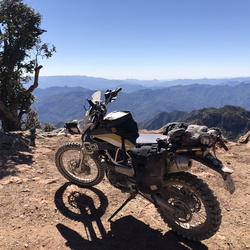
Nice ride up, whiskey Creek is technical and I’ve endo a couple of times so I’m always a bit hesitant on the trail. Great day with friends.
★
★
★
★

1 July 23. Beautiful loop hike with amazing wild flowers and mountain vistas.
★
★
★
★
★
Mtn bike ride. Mill creek up and Fred’s Lunch down. I need to work on my downhill skills
★
★
★
★
★

Hiked toward Grizzly Lake, was stopped by snow, though spectacular scenery. Creek had lots of water, so crossing creek beyond snow might have been challenging anyway. Figure creek filled with fast snow melt as it’s turned warm
★
★
★
★
★
Veer off to French Creek on left. Cross creek. Should hit snow soon after. Didn’t go to top because of weather. Beautiful hike. Give yourself 3-3 1/2 hours to top. About 2700 vert. 3,000 from parking (10,300) lot to top of Guyot (13,300).
★
★
★
★
Quite a bit of bushwhacking via this late season route and the snow was heavy but predictable. Lower was melted out above summer trail making for unpleasant scree field scramble. Hike out was more steep up than expected. Hard day.
★
★
★
This is an out and back trail that does connect to another trail and you can hike all the way into Frisco
This is also open for horses. I would recommend shoes as there are lots of rocks sticking up and roots. Two foot bridges may give horses trouble, but they can be bypassed
★
★
★
★

The climb up from the Breckenridge side is nice, but a bit relentless 800 feet. The road on the keystone side is just awful. Probably better off, taking the bike path down from Sapphire point at the summit to Keystone. Certainly better climbing up the bike path from Keystone if you’re coming that way.I
★
★
★
★


First time hiked this trail and it was beautiful the entire time. Came the week of thanksgiving and it snowed just enough to appreciate all the evergreen trees and snow covered mountains.
★
★
★
★
★

Lake was pretty nice views of Gore Range- 700 was closed wanted to hike more of Piney w out driving on FR
★
★
★

Incredible ridge walk. We had some high wind, which could be a little dangerous considering how close the trail came to the edge in a few places.
Really beautiful!
★
★
★
★
★
Stunning hike. Headed out around 7am to give us the day. Did the loop counterclockwise starting on Raspberry Creek and heading back via Anthracite Pass. Couple dicey spots from mud/landslides and some spots (when you hit the meadow in the basin) make sure to keep an eye on the map and look out for the cairns to make sure you’re headed the right way. One of my favorite hikes!
★
★
★
★
★
Started on trail that was unmarked and then we decided to turn around and found a trail called ditch trail. Ditch trail is not well-maintained but single track and interesting to be in part of the burn area. trail then connects to the road and we watch on the road for a little bit nice views.
★
★
★
★
★

Karl took us on adventure up 1600’ vertical feet to the top of Miner’s Creek
★
★
★
★
★

Really nice easy trail with great views. If you want something more challenging take the government trail cutoff.
★
★
★
★
★

Beautiful hike with Birdie. Not too hard. Lots of flowers and rocks. No aspens
★
★
★
★
★
Beautiful hike with Birdie. Not too hard. Lots of flowers and rocks. No aspens
★
★
★
★
★

Beautiful trail up to the base of Sopris. Lots of wildflowers later in the summer with great fishing at both the Thomas Lakes. 3.9 miles to the base of the lake.
★
★
★
★
★

First and definitely not the last ride in Breck. Great trails great town.
★
★
★
★
★

Warm and sunny with wildflowers here and there. Route was gentle for mile 1, next half mile was steep trail. The last half was steep and tedious talus with good carins for route finding. Vertical exposure was moderate on this class 2 route.
★
★
★
★
★

Lots of cool scenery and many many Mountain goats A couple of false summits but overall great
★
★
★
★
★


Don’t come here, there’s nothing good. Don’t go to Moab, there’s nothing good. Stay home and leave the world alone. It doesn’t want you there.
★
★
★
★
This little loop is not too interesting. Much of it winds around in small trees with limited views. More suitable for mountain biking.
★
★
 stars
stars
So many down trees on the Mansfield ditch trail! Probably between 50-75 downed trees, every couple hundred yards at certain points! A large effort is needed between 5-20 individuals to clear out the beginning-middle as well as the section near the end before the decent. The decent at the end is definitely fun, but you had to travel through so many downed trees to reach that point, it’s not worth it. Bring a chainsaw and some friends if you plan on riding the Mansfield ditch trail!
★
Copper is definitely has some of the best in-bounds terrain in the Rockies. My days resort skiing may be numbered as I-70 traffic gets more and more heinous each year. But Copper always keeps bringing me back :)
★
★
★
★
★

Willie’s Peak is a great short tour and lots of fun with dogs as well!
★
★
★
★
★

This hike was very nice with varied climbs and descents. Trail is easy to follow and looks like a great mountain bike ride.
★
★
★
★
★


Gorgeous out and back up to grizzly lake. Hiked in early October and turned back when the snow got too deep, about half mile from the lake.
★
★
★
★
★

Great ridge hike and a good workout without being too tough. Steep at beginning then rollers until the final ascent. Awesome views of quandary/breckenridge/pike national forest/Lincoln/McCullough gulch, etc.
★
★
★
★

All day sufferfest on my 36lb Bronson. Spectacular scenery, perfect for this time of year! Disappointed by where the final singletrack dumps out - the TOP of Vail Pass! 🤮 Too much bike path for a 5-star, but a great challenge.
★
★
★
★

Pretty fall colors in the bushes. Cool to see the recent fire. A few good views.
★
★
★
Good enough trail. Easy. Decent views, except there are exposed power lines. Would not want to do again.
★
★
★

Started at the trailhead and enjoyed a nice hike through the forest. Lots of people on the trail and everyone was quite pleasant. Reached the road and the trail beyond here became very difficult. Was very rocky and quite steep in places. Because of heavy use, the main trail was hard to distinguish from all short cuts people have made over the years. It was a steady uphill climb until reaching the first little lake, then there was a nice bowl to walk across until the trail quickly returns to the steep rocky grade. The elevation was around 12,000 ft at this point and made hiking very difficult. Had no energy and felt lightheaded at times. Finally reached Mohawk lake and the views were stunning. The hike down was brisk as we were trying to get down fast as there was rain coming up the valley along with some thunder and lightening. Finally reached the car and our feet were throbbing but fortunately no blisters.
This is a great hike, but not for a beginner, very challenging in places and if your not acclimated to the altitude, can really cause problems.
Overall a fantastic hike.
★
★
★
★
★

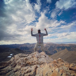
I love this long, long ridge to walk! So much so that I picked it as my favorite hike on my birthday! Please note stay on the ridge as the rock is unstable to the south side.
★
★
★
★
★

Nice 4wd trail to the comms station near the top of Peak 10 at Breckenridge. Excellent views of Breck valley, Dillion reservoir and Keystone ski area. Just enough tech to keep the drive interesting with tight switches, large rocks and holes. Stock Rubi JL.
★
★
★
★
Nice 4wd trail to the comms station near the top of Peak 10 at Breckenridge. Excellent views of Breck valley, Dillion reservoir and Keystone ski area. Just enough tech to keep the drive interesting with tight switches, large rocks and holes. Stock Rubi JL.
★
★
★
★
Nice 4wd trail to the comms station near the top of Peak 10 at Breckenridge. Excellent views of Breck valley, Dillion reservoir and Keystone ski area. Just enough tech to keep the drive interesting with tight switches, large rocks and holes. Stock Rubi JL.
★
★
★
★
Nice 4wd trail to the comms station near the top of Peak 10 at Breckenridge. Excellent views of Breck valley, Dillion reservoir and Keystone ski area. Just enough tech to keep the drive interesting with tight switches, large rocks and holes. Stock Rubi JL.
★
★
★
★

This was a beautiful hike. You start by parking in a public lot in downtown Beaver Creek (soooo cute). Beautiful public restrooms available. The hike starts in a road (you can take the 5 sense trail, though either way this part of the hike is not exciting). When you have the chance to jump on Beaver Lake Trail, do so. First mile, mile and a half of the trail is meh. Once you get farther in, it’s beautiful. About 3 miles in is beautiful Beaver Lake. The whole hike is a classic up hill until half-way in (Upper Turquoise Lake) and then turning back for all down hill. Close to lower and upper turquoise lakes would be beautiful for a one-night backpacking trip. (You register for overnight camping at a brown box at the beginning of the Holy Cross Wilderness — free). Water readily available to filter. I drank a ton — a full five liters, maybe a touch more across the 16 miles. Upper Turquoise Lake is special and would be cold but amazing to dip into. So clear. Lower isn’t nearly as spectacular looking. Lovely trail. Easy to navigate once you figure out to start on the road in beaver creek and hop into beaver lake trail (though the hike was never perfectly on the trail when looking at AllTrails).
★
★
★
★
★


Santa Fe easy switch backs nice lunch spot. Deer Creek easy up to top of Radical. Down Middle Fork pretty easy except big drop off obstacles.
★
★
★

Road in good condition for walking around many puddles from our recent rains. good wildflowers above tree line, but not peak. trail above treeline in good condition also. we went to the ridge instead of towards the cabins but other visitors we talked to enjoyed area above the cabins.
★
★
★
★
★

Epic hike to do in one day. Come prepared and fit. We started just after 4am to be safe with the chance of afternoon thunderstorms.
★
★
★
★
★


This hike was a true bucket list item. The difficulty rating is for the steepness to the summit and the Rocky descent on aspen side. It was totally doable. The wildflowers on cb side were amazing. That’s the more beautiful side in my opinion but the aspen side had amazing views.
★
★
★
★
★

This is a tough but very rewarding hike. Typical of most long hikes in the area, lots of large rocks to negotiate. Start early as afternoon heat and thunderstorms can taint an otherwise incredible hike. Mid July wildflowers up over our heads in valley on Crested Butte side of pass.
★
★
★
★

Ride from home! First time on full 360. Top 200ft to argentine summit too steep for my weak legs. Broke a spoke.
★
★
★
★

This was a great trail for a new mountain biker like myself. Started off nice and level and stayed level most of the way. Left the bikes at around 2.5 miles and hiked the rest of the way to the end of the trail. Found a nice place for a picnic on Hunter Creek. Bushwhacked up the creek a bit.
★
★
★
★

Make the hike to Thomas lake and enjoy the amazing view, because after is unshaded, unstable rock. So many false trails near the peak. Difficult decent. Hot as heck with no shade for 2.5 miles either side of the peak.
★
★
★
This was the most beautiful hike I’ve ever done. The peak is strenuous (and windy), but has a very clearly marked trail the entire way. Tons of creeks and even more flowers!
★
★
★
★
★

For 85% of this loop there is no trail. The section near Hunter Creek is particularly difficult to navigate with dense undergrowth and downed trees. Additionally Warren Lakes is actually more of “Warren Swamp”. Do not recommend camping there, much better to camp higher up. If you are okay with route finding, bugs, and bushwhacking the views when high up are unbeatable and you won’t see a single person past Midway pass.
★
★

This is an easy to moderate hike up a beautiful glacial valley. Bountiful wild flowers along the way. A beautiful waterfall at the top is a great spot for lunch and rehydration. Great photo opportunities.
★
★
★
★
★

Great hike but definitely a tough one. Took us 7 hrs including a 30-40 min lunch break at the lake.
Incredible scenery between the falls and the lake.
★
★
★
★
★

Great to warm up at this elevation. Rivers, shade and sun. And at the end a good beer
★
★
★
★
★


Gorgeous wildflowers, waterfalls and lake. Last week of June after a low snow winter.
★
★
★
★
★


It was a gorgeous day with many wildflowers, so we loved this hike. We went up to the lakes, about 8.5 miles round trip. Not difficult. Beautiful lakes to explore.
★
★
★
★
★

Fantastic trail with a couple steep climbs, definitely worth the effort once you’re at the top though!
★
★
★
★
★

630 am start. Plan to summit grizzly. Took cutoff route around Cupid. Had to bactracknaround snowfield on east side of cupid. Turned back at saddle between grizzly and cupid die tonoossible weather and unwilling dog
★
★
★
★
★


Great hike; passing over the creek 7 times on the way up. Hanging Lake is beautiful. Don’t miss the falls up above, which are equally as impressive.
★
★
★
★
★

Great first experience at Hanging Lake. Easy enough hike, beautiful scenery, great trail conditions
★
★
★
★
★

Good trail with ice patches still on may 9. Couldn’t go further to summit due to soft snow.
★
★
★
★

Left from the front door! Bad to the bone! Fun to orienteer through the backyard. Peak ascent is gentle, no major obstacles. Had some weather summiting and then the skies cleared for a beautiful golden hour ascent. Skied late but it was cold and snowpack was consolidated. Not too much snow in the chute, but just enough. Shoot is so fun! Sport skied the whole way down after the highest bits. Huge avy debris at the end, just a massacre. . . But we managed to ski all the way to the bridge! With some tree hopping of course. The coverage was thin throughout, and that was after a recent storm that brought 9” to the Breck side and 3” to the copper side. Took the bus back after enjoying some beers by the bridge and watching the sun set. Spotted second car in the lot near Breck station. Perfect day. I saw a marmot and a flock of tiny birds swooped and flew with me while I skied! Phone died before the route was finished, all’s well that ends well.
★
★
★
★
★

Our local shred with the 50 project. Bjarne and Cody switched roles was a good laugh Cody was the Camera man Bjarne is always been and athlete good times worse snow conditions I’ve ever skied the silver in after 13 years ha ha
★
★
★

Terrible snow in a great area for tours
Still figuring out timing, aspect for spring skiing
★

Beautiful snowshoe (or ski) hike. No slope angle shading above us. Well packed down
★
★
★
★
★

Well packed snow easy on boots or micro spikes. Beautiful views of ten mile range. Only room for 9 cars on parking lot.
★
★
★
★
★


 stars
stars
Christmas Eve, the afternoon sun was shinning through the snow covered pines and the views were great. Trail was packed snow - micro spikes helpful but not completely necessary.
★
★
★
★
★
stars
Christmas Eve, the afternoon sun was shinning through the snow covered pines. Views of the Tenmile Range, Buffalo Mountain and Red Peak were plentiful. Do the loop clockwise for a more gradual but long incline, counterclockwise for a steeper assent to start.
★
★
★
★
★

Not quite as nice as the four pass loop, but it’s equally challenging. I went counter clockwise camping at avalanche lake, GenevaLake and just over the creek at the lowest point before going over the Haystack Mountain pass. Note that after going over that pass, the NatGeo map becomes useless at some point. The map no longer follows the trail. I would have wasted a lot of time if I didn’t have GaiaGPS with me. As it was I lost a few hours bushwhacking and never found the return trail I wanted to follow. Ended up backtracking on the Ditch Trail I started out on.
Beware to not leave your shoes outside the vestibule at night like I did my last night. Some critter stole a shoe leaving me to hike 12 miles the next day with only one.
★
★
★
★


We did this as an early winter hike/snowshoe. The section through the aspens was gorgeous! Also lovely was the contrast of the snow partially covering the rocks. Towards the top the snow was knee-deep and we could barely see the prior person’s track. The cabin was re-built in 2017 and looks sturdier than the last time I was there. Gaiagps gave me 8.5 miles round trip and > 2200’ elevation gain.
★
★
★
★

Great time of year, some snow on sections, watch your step. Wear good Shores, easy hooker.
★
★
★
★
★


Bushwhacking up the Creek isn’t fun. Creek is beautiful. Views from road are beautiful.
★
★


Great trail with a little bit of everything. I would say this is a moderate trail only because there are a few steep climbs as you get on to Deer Creek but they are fun!
★
★
★
★
This is my favorite hike so far in Colorado. Incredible conifer forests and aspen forests. The lake is breathtaking. Highly recommend this hike!
★
★
★
★
★
This is my favorite hike so far in Colorado. Incredible conifer forests and aspen forests. The lake is breathtaking. Highly recommend this hike!
★
★
★
★
★
This is my favorite hike so far in Colorado. Incredible conifer forests and aspen forests. The lake is breathtaking. Highly recommend this hike!
★
★
★
★
★
This is my favorite hike so far in Colorado. Incredible conifer forests and aspen forests. The lake is breathtaking. Highly recommend this hike!
★
★
★
★
★
This is my favorite hike so far in Colorado. Incredible conifer forests and aspen forests. The lake is breathtaking. Highly recommend this hike!
★
★
★
★
★

Easy trail along the Blue River north of Breckenridge. Good for all ages! Paved trail or dirt trail by the river. Plenty of picnic spots!
★
★
★
★
This is an easy hike that travels over a packed trail with some areas of rock to rock stepping. This time of year there are only two streams with water. Early in the spring, there are 2-3 more due to snowmelt. It is a pleasant hike with a great view of Lake Dillon on the beginning of the trail.
★
★
★
★
Old mining road climbs 1300’ to mining ruins. Beautiful views of Quandry and the Ten Mile Range from the top.
★
★
★
★
stars
The hike up is a gradual incline, but it does gain 2,000ft by the lake. The north couloir of Grizzly Peak hold snow well into July and is a classic ski decent, topping out at 13,980ft!
Be mindful of the starting elevation at this trailhead of 10,600ft.
★
★
★
★
★

Park at capitol lake trailhead unless you have a very high clearance vehicle. It is possible to drive up to hell roaring trailhead, but tough terrain. Steep sections on and off throughout the hike. Gorgeous stands of aspen and conifer forests. Normally a couple of spectacular view points, but this day was socked in with smoke from wildfires.
★
★
★

I am on the Grizzly Creek Fire 🔥 as a Firefighter, Paramedic, so I had access, even though the trail is CLOSED TO THE PUBLIC !!! Until further notice !!!
The lake itself was untouched by the Fire, and is still Absolutely stunning. By an absolute miracle, and the hand of God !
★
★
★
★
★


Clearly marked well travelled trail with a pleasant view of the falls upon arrival. Decent ascent but not impossible just take your time it’s only 2.25 miles to your snack with a view...
★
★
★
★
★

Clearly marked well travelled trail with a pleasant view of the falls upon arrival. Decent ascent but not impossible just take your time it’s only 2.25 miles to your snack with a view...
★
★
★
★
★

Easy, but steep. So many people. Parking was full by the time I arrived at 7:15am
★
★
★
Parked at the forest service sign and mountain biked up to the reservoir. Bike up us a decent climb, and coming down is good fun. The creek by the side of the road is very dramatic but didn’t see many trout in it, maybe due to periodic large waterfalls.
★
★
★
★

Nice overview of Dillon, the lake, and surrounding mountains. Spectacular views of the Gore Range. We went as far as the boundary of the Ptarmigan Wilderness and then came down the unmaintained trail, making a loop. That part was quite steep and got tedious after a while. Next time, I’ll go back down the Ptarmigan Peak Trail.
★
★
★
★

Beautiful hike. But many mosquitos. Well worth it for the waterfalls and views. We made it up to the first lake, very picturesque. Definitely recommend.
★
★
★
★
★
Beautiful shady trail through (often damp) conifer forest. Rocky and somewhat strep trail for the first.75 miles, then flattens out a bit, then alternating climbing and flat trail. A few small easy creek crossings. Lakes are gorgeous. Wildflowers if timing is right.
★
★
★
★
★

08/07/2020 Friday; at trailhead by 0730, limited parking by then. We are average hikers, took 3.5 hours up, 3 hours down with a total of 1 hour in stops. Last mile of the ascent relatively crowded but do-able. RT distance 7.1 miles from the overflow lot. It's a classic Colorado 14'er.
★
★
★
★
★

Beautiful views, the trail is not well marked, it’s very easy to navigate by site. If you approach from the south, it’s best to scramble up the rocks for secure footing.
★
★
★
★
★
Nice hike, pretty rocky and slippery gravel in places but overall a great hike
★
★
★
★
A fairly rough Jeep road with several stream crossings and some excellent camp spots
★
★
★
★

This was our first hike in Colorado. My 3 teenage boys and I hiked up to Lower Slate lake and spent 3 nights there and did a day trip up to Upper Slate lake. The entire area is pristine and majestic. The hike takes you through many different landscapes that were so beautiful.
★
★
★
★
★

9 miles drive rough gravel rood to trail head. Cool trail along creek go up to Missouri Lakes, nice waterfall. Meadows lots of flowers 2 hrs to lakes. Beautiful mountains, marmites, pikas, 3.5hrs to top of Fancy Pass 12400 feet elevation steep downhill some sno.5 hrs round trip in
★
★
★
★
★

Excellent trail once you get above tree line, trail declines in quality once you begin the summit and disappears about 300 feet from the summit. Some of the best views in Colorado on an legendary mountain.
★
★
★
★
★


Fantastic trail with a couple steep climbs, definitely worth the effort once you’re at the top though!
★
★
★
★
★

Not technical, but the views at 12,600 and 360 degrees we spectacular! A out an hour up and back...we saw a Subaru at the top...worthy for scenic for sure!
★
★
★
★

Nice little hike on a crowded trail. Was nice for an afternoon but I probably wouldn’t do it again
★
★


The hike is easy but super crowded. We started around 7.30 AM on Friday and had very few people on the way up. It was super crowded on the way down.
The hike itself is very nice and pretty easy. Keep pushing all the way to the end of the trail. Avoid hiking to the very last lake since there is no trail and its not a good idea to trample on sensitive vegetation.
★
★
★
★
★

Really hard one
Some trail finding and 40% + grade down from Grizzly Peak, then from the saddle between Grizzly and Torrey, very loose scree up Torrey: 2 steps forward, one step sliding back down.
Great for trail running up to the bottom of Grizzly from Loveland Pass, then a bit too steep. Return trip, climbing back up to Grizzly from the saddle with Torrey is tough and steep and there really isn’t a trail, find your own best route. In the end, a very satisfying trip. Took me 7.5 hours including a couple of short tests.
★
★
★
★
Fantastic single track leading to the gorgeous lake. Flower abound. Few hikers and lots of wildlife.
★
★
★
★
★

It’s an ok hike, nothing really makes it stand out though. There are a couple of good views of Eagle Nest peak. Even the lakes are just average in terms of scenery. I think the Surprise Lake side has more to offer. In the fall it would be a different story. Lots of aspen groves, so I think I would do it again but in the fall.
★
★
★

This area around Breckenridge is one of the prettiest we have ridden. Great views and trails
★
★
★
★
★

Hiked it on June 14, perfect conditions , snow has melted mostly and the trail stays, in the final push from the saddle, to the left of the white stuff. There is a short, 120 yard section of snow to cross near the top, no snow shoes or spikes were needed to cross it, good traction and solid enough to step right over. Summiting 6 PM had the Peak to myself. The views from the top are phenomenal. The trail is straight forward, no technical sections. Highly recommend.
★
★
★
★
★
North Ten Mile Creek + a taste of the Gore Trail with V rob and Stephanie.
★
★
★
★


This was my second 14er ever, and it was amazing! Definitely good for beginners, (I live in Florida, and climbed this after 4 days in CO) and one of my all time favorite hikes. There was even some snow on the summit because CO can't make up its mind about what season it is. Mountain goats and fellow hikers alike were great, and the terrain is never horribly sustained or difficult. My favorite 14er so far!
★
★
★
★
★

Easy peasy - all downhill if you jump up on the gondola.
Great to see what’s under the snow on the ski slopes I ski all the the time.
★
★
★
★
 stars
stars
This is a beautiful hike into the Mayflower Gulch area. Views of Fletcher Mountain and Drift Peak encompass the valley.
★
★
★
★
★

This was a great place to hike dogs. Still accessible in March, though snow covered. Pay close attention to signs and green arrows. A little slick in areas where the snow is melting and the trail is a bit tilted instead of flat.
Nice variety of uphill, downhill, and flat surfaces. Bring your camera for the views!
Please bring your own poop baggies and a leash as these are required by the Open Space rules. Enjoy!
★
★
★
★

The ups and downs become soul-crushing toward the end (especially on snow), but the scenery is unmatched and it's great training. Type 1-2 fun. Long and challenging day.
★
★
★
★


Don’t go any further left. Way point takes you to stoner hut. Comes out above water tank.
★
★
★
Four start. Stayed on fall line. Cliffs are smaller but more vegetation.
★
★
★
★
Best line out of three. Good cliffs. Just right of fall line. Trees are more open but cliffs are bigger.
★
★
★
★
★

This was a snowshoeing outing with my wife and son. 1.1 mile hike on a gravel road to get to the trail head but once there it was a great trail with several wonderful scenic vantage points. Nice to find something new in the area.
★
★
★
★

It was just as beautiful as I remember! Only a couple of spots slick from the snow.
★
★
★
★
★

This hike STARTS at Lower Cataract Lake, and is 6.2 miles round trip. The map shown above is wrong. Also, the road to the trail head is closed November through April and the "Season Popularity" to the left is wrong. <====> That being said, Surprise Lake is typical hike through the Eagles Nest Wilderness and Surprise Lake is a beautiful high alpine lake.
★
★
★
★
The Giga GPS maps fort this trail appear to be two separate maps with miss-matched alignment. AllTrails.com maps provide a better view of this trail system...…. Can Giga GPS fix this problem??????
Horseshoe Gulch is a series of trails that allow a back-country user to travel from Tiger Road, Breckenridge to Keystone Ranch and beyond. Blair Witch trail is one of many trails a user can use, and is not shown in Giga GPS.
★
★
★
★
★
 stars
stars
Gorgeous hike on a fall day with lots of fall colors and 2 beautiful alpine lakes.
★
★
★
★
★
September 30: Fall colors great - AND - nobody else there except for the last two miles...….
★
★
★
★
★

Amazing scenery. A really legit sense of heights and exposure without any real danger (class 2 scramble at worst.. mostly just a hike).
My only reason for not giving 5 stars is that you have to drop nearly a thousand feet into a valley so there and back you have to hike up a total of 2000 extra vertical feet.
★
★
★
★

Hike this trail on Sept 25, 2019. Perfect Colorado blue sky day and seasonally warm (72-degrees at trailhead at 11am). Deceiving good fall color hike with Aspens for first 0.9 miles and then ground cover fall colors for the majority of trail up to Eccles Pass. 60-degrees at top of psss with light wind - unobstructed 360-degree view’s - lived it!!
★
★
★
★
★

This is Miller Creek Trail, not a difficult hike, it's a medium difficulty hike. lots of fun and of course gorgeous scenery… Turkeys and elk in the area.
★
★
★
This is Miller Creek Trail, not a difficult hike, it's a medium difficulty hike. lots of fun and of course gorgeous scenery… Turkeys and elk in the area.
★
★
★
This is Miller Creek Trail, not a difficult hike, it's a medium difficulty hike. lots of fun and of course gorgeous scenery… Turkeys and elk in the area.
★
★
★

From trail head you hike up an easy Jeep road. Beautiful views of cirque and old mining buildings.
★
★
★
★

Fantastic hike. Starts out climbing easy then final push to lower lake is rocky and a bit steep. No dangerous areas or falling off obstacles. Reward of making it to upper lake is worth the climb.
★
★
★
★
★
stars
Very beautiful hike all along the trail to the lake. The nearby Booth, Pitkin and Deluge Lake hikes are all equally beautiful.
★
★
★
★
★

We did an early Sept hike, starting at 8:45am on a Tuesday so only saw 3 other hikers on the way up. Passed quite a few more on the way back down though. It's a steady incline most of the way until the last 1/2 mile. Early on the trail passes through a Aspen forest, then opens up a bit when the trail runs along Pine Creek where you see the debris field from a previous avalanche(?) on the other side of the creek. Meadows, rock fields, and a stream crossing near the top all along the route make the hike very picturesque. But nothing compares to the clear waters of Cathedral Lake in front of the Rocky backdrop of the mountains springing up behind it. Beautiful spot, and worth the hike up!
★
★
★
★
★
This trail offers steady climbing and a nice variety between aspen groves, conifer forests, and valley views along a cascading creek. The lake at the top is a nice place to take in the alpine beauty.
Altitude is high, and the parking is readily available in the morning but fills up quickly.
★
★
★
★
★

Shortish hike with a great diversity of environments (including forest, meadows, and tall brush). It is well traveled with friendly hikers. There are some areas that suggest the trail isn’t designed for the amount of people it carries (confusing desire paths, widening, and trail erosion)
★
★
★
★
This trail offers steady climbing and a nice variety between aspen groves, conifer forests, and valley views along a cascading creek. The lake at the top is a nice place to take in the alpine beauty.
Altitude is high, and the parking is readily available in the morning but fills up quickly.
★
★
★
★
★

Heavily trafficked trail, but well maintained and great views. For an easy 2-3 hour hike close to Breck this one can’t miss.
★
★
★
★


1st 10,000 summit with Vic. We started pretty chilly but this hike warmed us up quick because it is almost entirely inclined and hard work! The view at the top offers great vantage points and picture spots. We descended the same way we came up.
★
★
★
★


Pretty mellow multi use trail along Gore Creek in Vail, Colorado. Slight decent heading west from the Ritz-Carlton and slight assent heading back. A great morning wake me up. You can go much further than we did, but we had to turn around for an appointment.
★
★
★
★

The flowers, the creek that serves as your companion along most of the hike, and then... the magnificent lake at the end... all combine for a first-rate hiking experience.
★
★
★
★
★


The beginning is a bit unrewarding, with non-covered trail overlooking the highway followed by a moderate incline. However, once you get to the wooded area, it is a spectacular hike and the view at the lakes is a perfect reward.
★
★
★
★
3 beautiful lakes! First 2 lakes are on trail, 3rd is a fairly easy class 2+ off trail route. The trail goes all the way to the far end of the 2nd Savage lake, and it would be easiest to ascend in that area where we descended. There are some cliff bands to work your way around but the lakes and waterfalls are worth the effort! The 3rd lake is just at tree line with sweeping views. Once again, the Holy Cross Wildnerness did not disappoint.
★
★
★
★
★
Very nice hike. Lots of different ecosystems to hike through. Long day, but the gain is pretty gentle and spread out. Some bugs around the lakes, but otherwise was fine. Had to traverse some snow and ten mile creek, which was a little tricky.
★
★
★
★
There are some steep sections as you gain about 2300’ in 4 miles. The wildflowers were abundant and the scenery kept changing from dense foliage to piney to alpine, with a couple of beautiful meadows along the way. At the end, the drop into the lake was very steep. The lake was gorgeous, holding ice in late July, with trees on one side and rocks on the other. It looked like it would be a great place to camp!
★
★
★
★
★

We hiked to the base spoils of the nine but did not climb the trail through the spoils, lots of loose rock. Views are spectacular at the mine!
★
★
★
★

We hike to the terminus of the new slide inFrisco, Colorado. We had to bushwhack quite a bit, but the view was fabulous.
★
★
★
★
★

Fun trip with the whole family. Pretty intense for just about all of us.
★
★


Gaia trail map took us to 10,600, 800ft below summit. Had we followed National Geographic Dillon map, would have followed trail 9509 to summit (or 9511). Little water along trail. Amazing views across Dillon Lake to TenMile range and Gore Range. This trip about 8.5 miles, 4:45hrs, 1450 elevation. Next time to summit! Hiked with Dave, Dave, John, Rick, daisy and Kermit.
★
★
★
★


This is a relatively short but strenuous hike, but worth every mile! Hiking in late October will have a lot fewer hikers, but expect cooler temperatures and patches of snow and ice. The majority of the trail was clear, but the last switchbacks up to the lake were snow covered and I broke trail through about a foot of snow. Some sort of ice grippers on your hiking shoes are required as well as hiking poles for that stretch. I had Stabilicers and poles. I took a leisurely pace up and took photos, so it was about 2 hours up to the lake. I got chased back down by a small snow squall, so that took about an hour and 40 minutes down.
★
★
★
★
★
 stars
stars
This is a great through hike. We started in Frisco and caught the free Summit Stage bus to Copper Mountain. The hike starts there and you hike back to Frisco over Uneva Pass and through some nice high country. Very nice trail. Some fall aspen colors at the beginning and end of the hike. The hike ended up being a total of nearly 14 miles. So it can be a longer day.
★
★
★
★
★


 stars
stars


 stars
stars


 stars
stars


 stars
stars