Go on this trail if you want to injure your knee before a big race and not be able to race anymore
★

Got a ride in today, Mid April was chilly. Rained day before so a bit damp on the way down, as expected. Excellent flow, a little soft. Well-groomed trails, great flow, gotta come back when its warm!!!
★
★
★
★
★

This is a gem of a trail - lots of water springs, sequoias and shady spots. Beware it is strenuous. The trail bobs and weaves through rock flows and mostly on a single track shale or rock floor.
★
★
★
★
★

Solo hiked Feb 12 – I had fun doing this loop last year and so I came back for round 2. Started really early and let the trail put me to work as Marion always does all the way up to the PCT junction with great weather and trail conditions. About half a mile before Little Round Valley, it became noticeably colder as usual, but adding glove liners was enough to stay comfortable. Going up the west side of San Jacinto early always feels colder than the east side (Peak Trail) without the east’s early solar warmth (and nice sunrise over the Salton Sea). That said, the west side’s forested terrain has its own uniqueness including the nice overlooks. But I knew I would be on the peak at sunrise before going down the east side so I’d get nearly the “whole package” today. Once on the switchbacks above Little Round Valley, the ice patches became harder to bypass, prompting me to spike up. Snow/ice coverage was uniform halfway up the switchbacks but never too treacherous. Views from the summit were really nice with just a little mid elevation haze/fog in the valleys and a high, stratified cloud celling. While heading down the east side, I was fortunate enough to meet up with Jon King of the San Jacinto Trail Report. After catching up on things and excitedly talking about all the snow in next week’s forecast, I continued on toward Wellman Divide and Annie’s Junction, stopping along the way at Wellman Cienega to filter some nice cold water. The stretch of PCT between Annie’s and Strawberry junctions is very scenic and always a favorite. After a food break at Strawberry Camp, it was a straight shot up PCT and down the Marion Trail to the car. Just before the car, I was surprised to see “Maria” on the trail whom I’ve met on several SoCal peaks. Highly recommend reading Jon’s daily reports at https://sanjacjon.com/ for the latest trail conditions before heading out. Logged 16.1 mi /25.9 km & 5089 ft /1551.1 m with Gaia
★
★
★
★
★

This is one of my favorite short hikes. The trail and views are beautiful and the hike is short and sweet.
★
★
★
★
★

First time ever hiking Mt. Gorgonio. Im not that fit so this was the hardest hike ive ever done. But im excited for more
★
★
★
★
★

Nice hike. Good amount of work to get to dry lake. About 2k elevation gain but it’s mostly gradual. Great sites for tents up there. Spring was running medium full.
★
★
★
★

Big burn scar from fires over the past few years. really bad stretch of chaparral white thorn that’s brutal on the calves for miles
★
★
★
★

Backyard hike number two begin at Laurel Trail trailhead by the sunset benches off of Pine Ridge and end at trailhead or cut off at acorn and Sylvan Sylvan in Nostrana on Pine Ridge or Pine Ridge and Deerpath Road
★
★
★
★


I have issues with my quads when hiking. I cramp up usually around the 5-6 mile distance. I hydrate and have electrolytes w me during my hikes. So it usually takes about 2 warmup hikes before I rid myself of these cramps and then I’m able to complete the whole trail ok.
★
★
★

Manzanitas were in bloom and came across a Coastal California Kingsnake.
★
★
★
★
★

Solo day hiked Fri 1/3/25 – This is a nice out and back route on the longer side that starts by taking the South Ridge Trail up to Tahquitz Peak, offering a very scenic, more direct and less traveled alternative to the Devil’s Slide route. Since the weather was nice, I started from Tahquitz View Drive instead of the South Ridge Trailhead to add a few extra miles. Shortly after passing the fire lookout, there is a nice stretch of the Pacific Crest Trail that provided great sunrise views on the way to Saddle Junction with brilliant reflections off the surface of the Salton Sea. From here to San Jacinto Peak, the Chinquapin and Whitethorn bushes along the Wellman’s Cienega and Peak trails have been clipped back nicely by the San Jacinto Trail Report and other volunteers to allow a snag-free passage. I met a few backpackers coming back from a stay in Little Round Valley who were surprised by the lack of snow (like the rest of us) which is amazing for January. From the San Jacinto peak summit, the views were very clear and panoramic, most notably in the northern direction toward San Gorgonio Mountain and the Whitewater/North Palm Springs area. Heading down the Peak Trail, the views toward Cornell Peak and Round Valley were on par with those from the summit. Stopping at strongly flowing Wellman Cienega for some very cold, refreshing water was a nice break before returning to Tahquitz Peak. While the fire lookout was closed, it provided the perfect platform for a lunch break with even more stellar views to the south and east. After trading a few stories with some climbers, I headed back down the South Ridge Trail which is even nicer in the afternoon sun with South Peak and Antsell Rock brightly lit. If you hike in the San Jacinto Wilderness area, I strongly recommend checking the San Jacinto Trail Report (https://sanjacjon.com/) before going for the latest trail conditions, especially in winter. Logged 22.7 miles / 6355 vertical ft with Gaia
★
★
★
★
★

This was a great way to get up to sugar loaf peak. Somehow felt easier than going up from green spot.
You get to see so much when the sky is clear
★
★
★
★
★

Beautiful weather - cool but not cold. Gorgeous sky paintings courtesy of our Lord! The few people on the mtn I ran into were super cool!
Nice pre-snow day and got some ice falling from trees to spice it up!
★
★
★
★
★


Beautiful day. Didn’t make SJ peak, but did this loop with a turn around at Wellman’s Cienega. Lots of different terrain and LOTS of elevation.
★
★
★
★
★
Solo hiked Thurs 8/8/2024 – Cucamonga-Icehouse-Etiwanda-8386-Alta Loma peaks. Trail out to Cucamonga Peak was in good shape except for the scree slide area where it traverses the east side of Bighorn. This section is totally doable, just requiring a little extra focus on foot placement unless you’re up for scree skiing. From Cucamonga Peak to the wilderness border near Alta Loma, the trail will get you there with some cairns/ducks marking the more obscured parts where using gps really helps. Some scree slide areas here as well. Recommend leaving the trail right at the Cucamonga/SB Forest border to start the direct descent to the Alta Loma Saddle, followed by the direct ascent up Alta Loma. First time hitting Icehouse, 8386 and Alta Loma Peaks, all worth climbing up. Etiwanda & Alta Loma were the only peaks with registers. Very nice weather but much warmer than forecasted. Last water source going up is Columbine Spring which is trailside, 2.4 miles from the trail head (34.24326, -117.60459) and flowing nicely right now. I carried and finished 5L water and 2 half liters of electrolyte for this trek but would have taken a 2.5 - 3L bladder for just doing an out and back to Cucamonga Peak. Took frequent breaks in the shade for the Alta Loma leg and never felt too hot. Views off the peaks were awesome and coming back down Icehouse Canyon in the afternoon was as beautiful as ever. Occasionally ran into bug swarms the entire way, almost putting on a head net a few times but just spit out several and relied on insect repellent. Filtered a few liters from Icehouse Creek on the way out to enjoy on the weekend. Really glad the Forest Service reopened Baldy/Icehouse-good decision.Logged 18.8 miles / 6002 vertical ft with Gaia
★
★
★
★
★

Hiked/Climbed March 13 2026 – As it was forecast to be one of the hotter days of the record breaking March heatwave, I decided on a shorter trip (or so I thought) to climb Antsell Rock with a very early start from the Spitler Peak trailhead. Spitler is a nice trail to get up to the Pacific Crest if not done in the heat (no shade) and you don’t mind the usual deadfall obstacles on the upper switchbacks (4 large cedars to go over/under/around and tangled webs of smaller burned oaks). While it was already warm at the start, a nice cool wind started blowing halfway up the switchbacks and continued for most of the day. Gaining the ridgeline at the Spitler/PCT trails junction in the dark and looking down at the Coachella Valley lights that stretch for miles was amazing, well worth the hike in itself. Continuing north on the PCT, I headed up the meandering gully use trail to Apache Peak, stopping once again to see the eastern light show. Instead of back tracking to the PCT, I decided to spike up and make a direct descent down the snow on Apache’s northern slope to rejoin the PCT (when snow free, there is a use trail here). Back on PCT heading north, the occasional snow was still firm as first light was coming over the horizon. Getting to see the first light from the eastern side of San Jacinto & San Gorgonio is probably the biggest motivation for starting early (IMHO) and it was spectacular. Leaving PCT and going up the northeast chute to reach the base of Antsell Rock started on slippery snow and transitioned to a loose talus/scree mix, just as anticipated. After reaching the base of the first chimney climb, it was a truly fun route up that I has last done in 2024. The ledge connecting the two short vertical routes still had Poodledog bush that was hard to avoid but it is finally withering. I was amazed that there were only three entries in the log book since my 2024 scratching as it’s not a hard climb and rewards one with awesome panoramic views in every direction. After down climbing to the top of the chute and descending it, I decided to expand the day as the weather was still not too bad and I had brought 4 liters of water with plans to cache half of it enroute. Heading back south on the PCT, I took the standard route around the northeast side of Apache which is the first time in three years that it was not steep ice at mile 169 on the PCT map. Continuing on to the south, I decided to go up Apache’s east peak before heading back to the Spitler/PCT junction and going further south to head up the last bit of the Spitler Peak Trail to the summit. After enjoying the great views of Garner Valley, Lake Hemet and the taller San Jacinto peaks, I headed back down to the trailhead, stopping to filter some nice cold water at the bottom of the switchbacks. The lower trail was definitely on the hotter side but still enjoyable with a boonie hat. It is possible to take the Apple Canyon Trail down from the PCT between Antsell and Apache but it’s quite an adventurous bushwhack as I found out in 2024, slower than the extra mileage of returning via the Spitler Trail. “Friday the 13th” was on my side all day! Logged 16.9 mi /27.2 km & 4421 ft /1347.5 m with Gaia
★
★
★
★
★

Great hike. Muddy in several places. Tons of water. Snow almost completely gone
★
★
★
★
Solo hiked Thurs 5/23/2024 – I’ve wanted to go up the Arctic Point and John Benchmark summits for several months but the drive in to Holcomb Valley has always been snowbound. Instead of a quicker out & back trek, I opted to hike the longer loop for the approach and exit as it was still early enough to avoid getting dusted over by any ORV’s (although it would have been worth seeing someone make the crawl up the John Bull Flat route). The great views of the San Gorgonio Mountains, Delamar Mountain and Holcomb Valley from the Arctic Point summit were definitely worth the trip up. I followed a faint use trail part way up before finding a more frequently used route that was sufficiently ducked/cairned. I chose a more westerly cross-country descent down a wash towards the base of John Benchmark which had some interesting, climbable boulder formations along the way. The west and northwest views of White Mountain and Lucerne Valley from the John BM summit were also worth the climb up which was cross-country but quite intuitive with a few faint use trail segments but no bushwhacking. The rest of the loop out was on extremely quiet 4x4 forest roads that wound up through the trees to John Bull Flat and then down Hepburn Mine Road before the final segment on Van Dusen Creek Road. Unexpected was the stick figure made from broken suspension parts standing on top of the John Bull crawling hill. Stopped by Wilbur’s Grave and the settling pond on the drive out on the rougher but mud free stretches of Holcomb Valley & Polique Canyon Roads. Never switched over to 4 wheel drive and could have done the route in a mid-clearance vehicle. A very nice hike through a historic and very scenic forest area best done early on a weekday to avoid eating copious amounts of fine Holcomb ORV dust! Logged 9.0 miles / 1994 vertical ft with Gaia
★
★
★
★
★

Dual sport ride, fairly easy, rutted in places due to rains. Beautiful ride.
★
★
★
★
★

5” of fresh snow from last night’s blizzard: 24 degrees, 65+ knots of wind in the tree tops, Beautiful sunny snowshoe out to the trailhead after digging out the “dead man” stays. Great brunch at the Oaks Cafe and ride home with Marlene, Becca & Al.
★
★
★
★
★
Alternating snow flurries and sunshine. Cold and windy tonight!
★
★
★
★
★
Solo hiked Fri 6/14/2024 – Decided to create a loop by taking the Spitler Peak Trail up and the Zen Center - Apple Canyon Trail on the way down with stops on the Apache Peak & Antsell Rock summits. Ascended Antsell on the northeast gully route and descended via the northwest ridge. It was great weather going up Antsell Rock, providing for spectacular views off the summit. Coming back from Southwell Peak during the first week of March, I climbed the NE gully route on ice/snow up to the notch before running into a very shiny verglas coating on everything above the notch. Going up the gully this time was nice with careful routing to avoid launching any rocks down towards the PCT. The class 3 sections up to the summit were fun but short lived with some Poodle Dog bush to avoid at all cost on the second class 3 section and even more prolific on the way down the northwest ridge. Scrambling the northwest ridge on the way down was great fun but time consuming. A quicker option would be to traverse down along the west side of the ridge to reduce the scrambling work (but what fun would that be). Once heading down the Apple Canyon return trail, I followed a Peakbagger GPX route that sent me into extreme, shoulder high bushwhacking mode in two places. There were cairns/ducks marking a slightly overgrown trail going down that I should have stayed on but I kept thinking that the bagger GPX would lead to the proper creekside trail which it never did. Lots of time wasted here going through buckthorn and trying to avoid poison oak thickets before getting back on the better trail above the Zen Center. My advice to anyone going up Apple Canyon would be to pick up the trail at Zen and use the cairns with careful route finding between them. Otherwise, just use the Spitler Peak Trail that Jon King and the San Jacinto Trail Report has recently cleared of 30+ blow downs/tree limbs. Spitler might be a longer route to access the PCT but it’s a more enjoyable one with no private property to deal with. In spite of my travails coming down Apple Canyon, it was a very enjoyable hike that just took longer than planned. Logged 12.0 miles / 3318 vertical ft with Gaia .................................................................................................................................................................................................... Solo day hiked Tues 3/5/2024 – Even after a few days of rain, the Spitler Peak and PCT trails were relatively dry and in great shape up to Apache - a few blowdowns and rime ice piles but no real mud. But of course things changed quickly on PCT at mile 169.5, north east of Apache where the steeper slopes were iced over with the snowfall having sloughed across the trail before the freezing rain iced over all of it. Good day for auto crampons for the “crampon/crampoff” march out to South Peak. Same 45-55 degree ice slopes as those encountered last year, here, and at Baldy/Cucamonga where there’s a long runout and very little chance of self-arrest, even with the best axe and technique. There were 3 traverses like this to be carefully crossed 2X, slowing things down a bit. The rest of the way along PCT out to South Peak had so many blowdowns over 4.5 miles that I lost count after the first 20. Most were at the 3-1/2 foot high level with multiple branches where it’s just as hard to crawl under with a winter climb pack as it is to hop over. Some had to be widely bypassed upslope for extra fun, 2 were cleared for extra credit. After getting near mile 174, there was a 2-1/2 foot diameter tree perched above the trail so I directly ascended the east slope of South Peak from there, relaxing fun with little snow. Awesome views from South Peak of Garner Valley, Tahquitz, Red Tahquitz, Antsell Rock and the desert floor. Had some fun bouldering at the South Peak/Antsell Rock saddle on the way back before climbing the east gully route to Antsell Rock which was still frozen enough to front point all the way up to the rock base. That’s when I noticed how shiny the rocks were with a nice, clear, verglas layer of ice still being actively chilled with the wind picking up. Easy decision to bail and descend back to the PCT and back to Apache. Was glad to cross the ice fields before dark and then go up Apache Peak to see the Palm Springs light show and last of a beautiful sunset. I had read Jon King’s always meticulous San Jacinto Trail Report before the trek and knew about the ice but didn’t plan on all the blow downs. Incredibly long day with some brutal stretches but still a lot of fun. Highly recommend Jon King’s incredibly detailed daily reports, https://sanjacjon.com/, and YouTube channel before heading out in the SJ Wilderness. Logged 20.0 miles/4374 vertical ft with Gaia.
★
★
★
★

Easy hike without much to recommend other than decent footing, gradual elevation changes, and some nice views.
Used as a shakedown trip ahead of longer late winter trips.
★
★
★
Solo day hiked Sat 2/03/24 – Good hike for a time/weather limited day and today was it. Good powder to climb the steep NE ridgeline of Constance from forest road 1N12 and plunge step back down the east slope. Impressive views for a peak dwarfed by San B Peak. Wanted to extend the hike by a few miles with a trip to Point 5880 in the Thomas Hunting Grounds area. Bypassed part of 1N12 on the way to Pt 5880 by using the Lower Santa Ana River Trail (2E03.3) which was very nice in the snow. Stopped at The Oaks Restaurant for breakfast on the way out before the storm arrived. Nicer hike than I expected. Logged 10 miles/1710 vertical ft. with Gaia.
★
★
★
★
★
Solo day hiked Weds 1/10/24 – Wanted to spend less time road hiking and opted to use the PCT (Pacific Crest Trail), starting where it intersects Holcomb Valley Road just north of Baldwin Lake. Wow! What a nice route up Gold Mountain. A little snow on the trail but with great traction for bare boots. PCT dumps you out on Gold Mountain Road about a mile from the summit which is a scenic, straight forward road trek. Was lucky enough to do the road portion after 2 wide track 4x4 crawlers compacted the snow (much thanks). The views off the Gold Mountain summit are the best I’ve experienced in the entire Big Bear Area. Big Bear and Baldwin Lakes, Holcomb Valley and all the perimeter range groups can be seen from here. Definitely recommend this route and look forward to coming back to do it in the spring. Finding the PCT trail on Holcomb Valley Road can be hard as it’s a 3 foot wide gap in a barbed wire fence with a little PCT emblem on a round, rusty fence post. There are a few shoulder parking areas across from it. Logged 7.7 miles/1313 vertical ft. with Gaia.
★
★
★
★
★
Solo day hiked Weds 1/10/24 – Sloppy snow almost all the way to Crafts summit in spite of a really early start. It was still enjoyable, just a little extra work. Knew it was going to be windy on the summit after checking Mountain Forecast but still was a spectacular sunrise with awesome views. Crafts has a nice overlook but the wind chill made for a short stay. Climbed through the rock pile N-NW of Crafts to avoid the sea of dense buckthorn and found a nice N-NW cross country route down the mountain towards West Point Peak. Used micro spikes to speed the descent over 3-4 inches of snow on top of a pine needle base. This route was very scenic and a lot of fun, leading right to the base Of West Point at Snow Slide Road (2N13). There’s a memorial sign here for Don West, a forestry firefighter who was struck by lightning in 1958. Took Snow Slide Road back to Green Valley Campground on a meandering route with surprisingly good snow which made up for the slog to Crafts. Recommend this loop hike as the elevation gain is evenly distributed over the entire length, except for the short cross-country descent which is all downhill. Logged 8.4 miles/1524 vertical ft. with Gaia.
★
★
★
★
★
Solo day hiked Fri 1/5/24 – Cougar Crest-Bertha-Delamar-Little Bear Peaks in very powdery snow. Wanted to start on Polique Canyon Road where it crosses the PCT but the snow was just a little too much for the car. Instead, I started at Cougar Crest TH and used the well beaten path up to the PCT junction after which I headed east on the PCT until finding a good, short cross country route leading up to Cougar Crest Peak. Heading further east on the PCT to Bertha Peak Road and up to the summit in time to see a great sunrise. Nice views off Bertha Peak, especially the Snow Summit runs lit up (before sunrise) from across the lake. A longer trek NW in fres, untracked snow on the PCT eventually led to the start of the use trail going up Delamar Mtn which is well marked with an upward arrow carved into a log and a 2 ft high cairn stack. It’s a steep, direct and fun route up that was my only use of micro spikes for the day. Continuing further west on the PCT, Little Bear Spring Rd, and Little Bear Spring Spur Trail led to the Little Bear Peak summit. The spectacular views of the San Gabriel and San Bernardino Ranges made Little Bear Pk worth the effort. For the last 3 miles up Little Bear Pk, I followed the largest mountain lion tracks I’ve ever seen in all of the SoCal mtn ranges. The R-L pad width was 4-1/2 inches and deep as were the center tail dragging marks in the snow. They led all the way up to the Little Bear summit and then down easterly to the valley. Would’ve been nice to see that cat from a distance! Also found an 8 ft fir tree off the PCT with a red star on top. Saw several deer on the way out but no fellow hikers until the Cougar Crest Trail on which I passed 35 people. Great to see everyone enjoying the snow before it gets deeper. Some mild snowfall on Little Bear mid morning, clearing to blue skies by noontime. Even just doing the Cougar Crest Trail would be great right now, just don’t plan on using the trailhead porta- potties as they’re disgusting and all 5 lack toilet paper. Left a roll behind from the car but it probably didn’t last too long! Logged 20.8 miles/3271 vertical ft. with Gaia.
★
★
★
★
★
Solo day hiked Weds 12/27/23 – Grays Peak, Butler Peak Lookout, Hanna Rocks. Wanted to go up Grays Peak so I had to take the back way as the Grays Peak Trail is closed for Jackie/Shadow and the rest of the nesting bald eagle pairs (https://www.youtube.com/watch?v=B4-L2nfGcuE). Parked at the locked gate across Forest Rd 2N13 at Rim of the World Drive, bypassed the sinkhole in the middle of the road and walked 2N13 until I found a nice use trail up the northwest drainage of Grays Peak. From there it was a straight forward northeast cross-country ascent to join the last bit of the Grays Peak Trail to the summit. Signed the register and took in a beautiful sunrise from the summit before heading back down to and continuing on 2N13 towards Butler Peak. Turned left onto 2N13b to reach Butler Peak and the lookout perch on top. Above 7800 feet, the trail was solidly covered with 2-3 inches of nice powdery snow that was perfect for bare boot travel. The final spur up to the lookout’s double staircase was all snow and no ice. Views from the lookout platform were spectacular in every direction. Signed the register on the platform and started back down 2N13 until I could make a cross-country ascent up the SE side of Hanna Rocks. Ditched my pack and free climbed up several boulder groups for fun before going up the true Hanna Rocks summit block was great fun. Found the register and was amazed that there were only 12 entries from the first entered in 2018. The views off Hanna were awesome. Used the closed Forest Road 2N68 to access the Hanna Flat/Grout Creek Cutoff trails back to my car at the 2N13 gate. Highly recommend all 3 peaks, time permitting, or just the Butler Lookout for something shorter. Logged 13.9 miles/2577 vertical ft. with Gaia.
★
★
★
★
★
Solo day hiked Weds 12/20/23 – Parked on the side of 241 and walked up Black Mtn Road since it was already drizzling and I didn’t bring the 4x4. Was amazed that the road held its June regrade better than most others after the Hilary storm. Wouldn’t normally hesitate driving this in dry weather with a sedan or minivan but the mountain forecast was calling for noon rain and I didn’t want to get stuck in either of the 2 washout areas. Black Mountain Road is well routed. Making for an easy walk, even with a heavy pack. Once at the Fuller Ridge Trailhead and heading southbound on the PCT, the drizzle stopped and it was perfect hiking weather. After crossing into the state park, there were several large trees to contend with as expected from local guide John King’s very detailed and always up to date trail report (https://sanjacjon.com). Went down PCT far enough to make an east cross-country ascent of Castle Rocks with some ice on the granite but easy to work around. The sun came out and the clouds dispersed on the way up Castle Rocks, making for spectacular views off the summit of San Jacinto’s northwest face, Palm Springs and the lower west ranges. Traversed eastward along Fuller Ridge to the CT Overlook summit which has a sharper, taller summit block resembling some of those found in the Eastern Sierra. Easily my favorite summit of the 3. From there, it was down to the saddle shared with Fuller Ridge Peak and some bushwhacking to connect animal use trails up to its summit. Once at the summit, the clouds moved in and it rained lightly for 20 minutes with the views completely obscured by a temporary whiteout. The northwest cross-country route back down to PCT involved route finding through dense, old growth Manzanita, Chinquapin and some Whitethorn which was quite a challenge. Probably should have descended using the previous ascent route. Met up with several nice 4x4 parties on the way out with no rain along the way. Second time this year helping a deer off Hwy 241 that was confused by the steel guardrails. Highly recommend Castle Rocks and CT Overlook summits for their perches that offer excellent long distance panoramic views on clear weather days. Logged 18.7 miles/3662 vertical ft. with Gaia.
★
★
★
★
★

Great little hike up to Little Green Valley. Burn about 500 calories and get some air. Just shy of 3 miles round trip. Turn around at the two-track.
★
★
★
★
Solo day hiked Weds 11/29/2023 – Started at Hwy 38 on the dirt road 1 mi south of Onyx Summit to access the PCT southward. While it was 19°F when starting, it was dry with no wind so not too bad. Couldn’t pass the private dog compound next to the PCT quietly in the dark so I just powered by it, glad to have a 16 ft high fence between us. Made it to the summit of Wysup Peak in time to see a nice sunrise with the last 1/8 mile or 200 meters being an easy, direct scramble. From there, it took frequent navigating to link several, faint use trails along the ridges and saddles to ascend/descend Peaks 8745, 8763, and 8868. Neat to see the huge Sierra Junipers that grow on these peaks with their redwood-like trunks. After descending 8868, I followed a well-defined track up Heart Bar Peak which was the most relaxing part of the hike. It’s an old access road now partly covered by some good size mountain mahogany trees. Took a slightly different route back to the PCT using a few steep pitched, washed out roads to keep things interesting. After getting back on the PCT, it was a straight forward northbound hike to the base of Onyx Peak with the dogs pacing the perimeter at the compound but a little quieter than earlier. From the base of Onyx Peak, I took the well-worn east gully route to the saddle ridge and then a direct N-NE ascent up to the summit. For me, this was a much better and more challenging route than trekking up the Pipes Canyon access road to the summit. After finding the survey benchmark on the east side of the northernmost antenna group (there are several fenced areas on the summit) and walking around the other antenna groups, I used the same route down to PCT and back to Hwy 38. Definitely a more scenic hike and better weather than what I was anticipating! Logged 18.7 miles/3587 vertical ft. with Gaia.
★
★
★
★
★
Solo day hiked Thurs 1/18/24 – Nice to finally make it to the Coon Creek Jumpoff area! Since Forest Road 1N02 is closed for winter, I used the Pacific Crest Trail from Rainbow Lane up to Wysup Peak and then down to the old Coon Creek log cabins that Charlie Tayles built in the early 1900’s. From there, I followed the older part of the 1N02 road that is now inaccessible by 4x4, blocked by some large fallen trees, rocks and brush but still has an animal use trail along it. Once the trail ended, it was a cross-country route along the eastern ridge separating Big and Little Morongo Canyons. First was the climb up Peak 8350 on good rock and then down and up Three Sisters and Three Sisters West peaks. Each of the three summits had great, long ranging views and little wind. Thanks to the 2015 Lake Fire, it was easy to find paths up the faces through the newer growth Manazanita and Ceanothus bushes with no bushwhacking required. Getting over/around the numerous blow downs was also not bad. Visiting the log cabins on the way back was interesting, especially the Tayles lodge cabin that is now the Coon Creek Group Campground. The Hilary storm washed out some impressively large sections of the 1N02 road east of the campground. Some ice and a lot of snow on the PCT up to Wysup from Hwy 38 but a dry trail down to Coon Creek. Brought but didn’t need micro spikes in spite of some stealthy ice. There are a few cairn marked segments between the peaks but constant navigation checks are necessary. Three Sisters West required some extra route navigation and scrambling on stable talus but made for the most fun on this trek. Logged 18.8 miles/4078 vertical ft. with Gaia _____________________________________________________________________________________________________________________________________________________________ Solo day hiked Weds 11/29/2023 – Started at Hwy 38 on the dirt road 1 mi south of Onyx Summit to access the PCT southward. While it was 19°F when starting, it was dry with no wind so not too bad. Couldn’t pass the private dog compound next to the PCT quietly in the dark so I just powered by it, glad to have a 16 ft high fence between us. Made it to the summit of Wysup Peak in time to see a nice sunrise with the last 1/8 mile or 200 meters being an easy, direct scramble. From there, it took frequent navigating to link several, faint use trails along the ridges and saddles to ascend/descend Peaks 8745, 8763, and 8868. Neat to see the huge Sierra Junipers that grow on these peaks with their redwood-like trunks. After descending 8868, I followed a well-defined track up Heart Bar Peak which was the most relaxing part of the hike. It’s an old access road now partly covered by some good size mountain mahogany trees. Took a slightly different route back to the PCT using a few steep pitched, washed out roads to keep things interesting. After getting back on the PCT, it was a straight forward northbound hike to the base of Onyx Peak with the dogs pacing the perimeter at the compound but a little quieter than earlier. From the base of Onyx Peak, I took the well-worn east gully route to the saddle ridge and then a direct N-NE ascent up to the summit. For me, this was a much better and more challenging route than trekking up the Pipes Canyon access road to the summit. After finding the survey benchmark on the east side of the northernmost antenna group (there are several fenced areas on the summit) and walking around the other antenna groups, I used the same route down to PCT and back to Hwy 38. Definitely a more scenic hike and better weather than what I was anticipating! Logged 18.7 miles/3587 vertical ft. with Gaia.
★
★
★
★
★
Solo day hiked Weds 11/29/2023 – Started at Hwy 38 on the dirt road 1 mi south of Onyx Summit to access the PCT southward. While it was 19°F when starting, it was dry with no wind so not too bad. Couldn’t pass the private dog compound next to the PCT quietly in the dark so I just powered by it, glad to have a 16 ft high fence between us. Made it to the summit of Wysup Peak in time to see a nice sunrise with the last 1/8 mile or 200 meters being an easy, direct scramble. From there, it took frequent navigating to link several, faint use trails along the ridges and saddles to ascend/descend Peaks 8745, 8763, and 8868. Neat to see the huge Sierra Junipers that grow on these peaks with their redwood-like trunks. After descending 8868, I followed a well-defined track up Heart Bar Peak which was the most relaxing part of the hike. It’s an old access road now partly covered by some good size mountain mahogany trees. Took a slightly different route back to the PCT using a few steep pitched, washed out roads to keep things interesting. After getting back on the PCT, it was a straight forward northbound hike to the base of Onyx Peak with the dogs pacing the perimeter at the compound but a little quieter than earlier. From the base of Onyx Peak, I took the well-worn east gully route to the saddle ridge and then a direct N-NE ascent up to the summit. For me, this was a much better and more challenging route than trekking up the Pipes Canyon access road to the summit. After finding the survey benchmark on the east side of the northernmost antenna group (there are several fenced areas on the summit) and walking around the other antenna groups, I used the same route down to PCT and back to Hwy 38. Definitely a more scenic hike and better weather than what I was anticipating! Logged 18.7 miles/3587 vertical ft. with Gaia.
★
★
★
★
★
Solo day hiked Thurs 1/18/24 – Nice to finally make it to the Coon Creek Jumpoff area! Since Forest Road 1N02 is closed for winter, I used the Pacific Crest Trail from Rainbow Lane up to Wysup Peak and then down to the old Coon Creek log cabins that Charlie Tayles built in the early 1900’s. From there, I followed the older part of the 1N02 road that is now inaccessible by 4x4, blocked by some large fallen trees, rocks and brush but still has an animal use trail along it. Once the trail ended, it was a cross-country route along the eastern ridge separating Big and Little Morongo Canyons. First was the climb up Peak 8350 on good rock and then down and up Three Sisters and Three Sisters West peaks. Each of the three summits had great, long ranging views and little wind. Thanks to the 2015 Lake Fire, it was easy to find paths up the faces through the newer growth Manazanita and Ceanothus bushes with no bushwhacking required. Getting over/around the numerous blow downs was also not bad. Visiting the log cabins on the way back was interesting, especially the Tayles lodge cabin that is now the Coon Creek Group Campground. The Hilary storm washed out some impressively large sections of the 1N02 road east of the campground. Some ice and a lot of snow on the PCT up to Wysup from Hwy 38 but a dry trail down to Coon Creek. Brought but didn’t need micro spikes in spite of some stealthy ice. There are a few cairn marked segments between the peaks but constant navigation checks are necessary. Three Sisters West required some extra route navigation and scrambling on stable talus but made for the most fun on this trek. Logged 18.8 miles/4078 vertical ft. with Gaia __________________________________________________________________________________________________________________________________________ Solo day hiked Weds 11/29/2023 – Started at Hwy 38 on the dirt road 1 mi south of Onyx Summit to access the PCT southward. While it was 19°F when starting, it was dry with no wind so not too bad. Couldn’t pass the private dog compound next to the PCT quietly in the dark so I just powered by it, glad to have a 16 ft high fence between us. Made it to the summit of Wysup Peak in time to see a nice sunrise with the last 1/8 mile or 200 meters being an easy, direct scramble. From there, it took frequent navigating to link several, faint use trails along the ridges and saddles to ascend/descend Peaks 8745, 8763, and 8868. Neat to see the huge Sierra Junipers that grow on these peaks with their redwood-like trunks. After descending 8868, I followed a well-defined track up Heart Bar Peak which was the most relaxing part of the hike. It’s an old access road now partly covered by some good size mountain mahogany trees. Took a slightly different route back to the PCT using a few steep pitched, washed out roads to keep things interesting. After getting back on the PCT, it was a straight forward northbound hike to the base of Onyx Peak with the dogs pacing the perimeter at the compound but a little quieter than earlier. From the base of Onyx Peak, I took the well-worn east gully route to the saddle ridge and then a direct N-NE ascent up to the summit. For me, this was a much better and more challenging route than trekking up the Pipes Canyon access road to the summit. After finding the survey benchmark on the east side of the northernmost antenna group (there are several fenced areas on the summit) and walking around the other antenna groups, I used the same route down to PCT and back to Hwy 38. Definitely a more scenic hike and better weather than what I was anticipating! Logged 18.7 miles/3587 vertical ft. with Gaia.
★
★
★
★
★
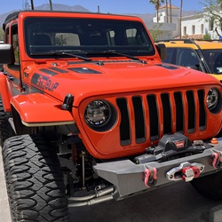
Embark on a thrilling 3-hour Jeep adventure through the John Bull Trail in Big Bear, CA. Starting on the south side of Baldwin Lake, your journey unfolds with scenic views and encounters with exciting obstacles. As you air down near the dump on the north side of Baldwin Lake, the trail leads you past Gold Mountain Trail exit. Continue and a fork in the road will be ahead.
Choosing the passenger side guides you to the gatekeeper of John Bull, while the driver's side brings you to the playful Tipsy Tree obstacle.
Navigate through tight trail sections, reach a fork, and follow the passenger side to the Pumpkin Patch/Rock Garden, the gatekeeper of John Bull. This marks the beginning of challenging obstacles, requiring a spotter and equipment like high clearance and belly protection.
The rock garden in the second obstacle field presents a signature John Bull experience with large boulders and powdery dirt.
Continue past this rugged terrain, overcoming obstacles like Tin Man, where challenges become more manageable but clearance remains crucial.
As you approach the exit, marked by a trail indicator, reflect on a day filled with technical driving, challenges, and camaraderie.
In smaller groups (1-2,) the trail can be conquered in 2 hours, but for a more leisurely experience, 3 hours is ideal. Larger groups should plan for a minimum of 4 hours, ensuring ample time to enjoy the obstacles and revel in the camaraderie of a memorable off-road adventure.
★
★
★
★
Nice hike with Dave from North Fork of Lytle Creek gate to Baldy Notch. Great hiking weather. The Jeep ride to the gate was a bit bumpy due to recent storms. Cool in the morning, mild in the return trip. Still some wildflowers along the trail. One washed out area on the trail about half mile up that will need repair. Water still running in canyon south of the trail. Enjoyable hike.
★
★
★
★

This is a nice and easy trail for any young adventurer. Brought my 4 1/2 year old daughter and she was keeping up with the adults. Water was low today but the falls were amazing. Make sure you check the weather, flash floods can occur. Would recommend as a day trip if you’re from Los Angeles or the OC.
★
★
★
★
★

This set of fire roads, is not for the faint of heart. Make sure you are prepared for deep ruts, loose top soil, and fallen rocks/ trees. The entirety of this route has amazing views and several places to Camp/ be alone.
★
★
★
★
★
Solo day hiked Thurs 7/18/2024 - Started early to go up SB East & West peaks on a very picturesque day before hitting the very warm weather on the way down. All the usual, ephemeral water crossings are now dry but Limber Pine Spring is flowing very well with very cold water (6.1 miles from the Angelus Trailhead). Highly recommend hitting East Peak if you have enough time as the peninsular views of most of San Gorgonio are incredible. The trail section between the two peaks is also very scenic, especially looking north towards Seven Oaks & Big Bear Lake. Great views from the stone bench view point on the way down, shortly after passing the Survey Monument (good to see the monument still intact). Only met two people during the entire trek while heading down into the heat, but a nice cooling breeze really helped! Carried a 3L water bladder and 2 half liter reserve bottles but 2L is probably enough for most if filtering from the spring on an out and back trek. Logged 18.0 miles / 5008 vertical ft with Gaia ................................................................................................................................................................................. Solo hiked Fri 09/01/2023 – Angelus Oaks TH-San Bernardino West/East Pks-Anderson Pk-Alto Diablo Pk-Shields Peak-Gerhardt Pk. Early start with an electrical storm in the distance but dry with only a little wind. Great views off the first 4 peaks before the clouds moved in with a few sprinkles. Limber Pine Spring is still a mini waterfall and great place to filter some extra water on the way up. The San Bernardino Ridgeline is a scenic, beautiful hike in itself, much like Ten Thousand Foot Ridge. There are plenty of the original USFS carved tree blazes marking the ridge route but the trail path itself is well defined right now. Several fallen trees to navigate with a few small washout areas but nothing unsurmountable - unless you’re on horseback or leading stock. Most people would have a lot of fun scrambling up the Shields Peak rock pile – I certainly did. Was very luck with the weather today as the clouds didn’t roll in until after the fourth peak (Shields) and then there was a fine cooling mist all the way down with no bugs. Conversed with a lot of nice people on the way down including the trail runners, making it to the car just as the rain started (the day’s weather felt like it was timed as if would be on a movie set). Gerhardt Peak was an ant hill compared to the others but a new peak for me. Highly recommend this hike, even if the turnaround is SB Peak. Logged 24.1 miles/6118 vertical ft. with Gaia
★
★
★
★
★
Solo hiked Fri 09/01/2023 – Angelus Oaks TH-San Bernardino West/East Pks-Anderson Pk-Alto Diablo Pk-Shields Peak-Gerhardt Pk. Early start with an electrical storm in the distance but dry with only a little wind. Great views off the first 4 peaks before the clouds moved in with a few sprinkles. Limber Pine Spring is still a mini waterfall and great place to filter some extra water on the way up. The San Bernardino Ridgeline is a scenic, beautiful hike in itself, much like Ten Thousand Foot Ridge. There are plenty of the original USFS carved tree blazes marking the ridge route but the trail path itself is well defined right now. Several fallen trees to navigate with a few small washout areas but nothing unsurmountable - unless you’re on horseback or leading stock. Most people would have a lot of fun scrambling up the Shields Peak rock pile – I certainly did. Was very luck with the weather today as the clouds didn’t roll in until after the fourth peak (Shields) and then there was a fine cooling mist all the way down with no bugs. Conversed with a lot of nice people on the way down including the trail runners, making it to the car just as the rain started (the day’s weather felt like it was timed as if would be on a movie set). Gerhardt Peak was an ant hill compared to the others but a new peak for me. Highly recommend this hike, even if the turnaround is SB Peak. Logged 24.1 miles/6118 vertical ft. with Gaia
★
★
★
★
★
Solo hiked Fri 08/25/2023 – Momyer Creek TH-Vivian Creek Tr-SG Mtn-Big Draw/Jepson Pks- Little Dobbs/Dobbs Pks-SB Pk Tr-Falls Creek Tr-Momyer Creek Tr. Bugs and bats in the dark on Vivian to make an interesting start. Nice to see High Creek Falls still roaring this late in summer with nice cold water upstream. Gusty on the ridge line but not bad on the summits with very nice weather/views. Spectacular views of Big Bear Lake, Dry Lake, San Jacinto Peak, Yucaipa Ridge and Lake Perris from Jepson and Little Dobbs were just a mentionable few. Going down the Falls Creek Trail was quite an adventure with a few jungle/oasis zones. The 3 lush green oasis areas were like being on a Hawaiian hike with many plant types, flowing strongly with cold water to filter while the White-Buck Thorn/Manzanita jungle zones were easily traversed but make it a “long pants only” trail. As others have said, there are several new blow downs across most of the trails, along with several new washout areas. They were all easy to deal, just requiring a little more care and effort to traverse (like being in the wilderness in general). Crossed Mill Creek easily on the Vivian start but it was not so easy to cross at the Momyer finish. Didn’t see anyone all day on any of the 4 trails I used. Now is a great time to hike these trails with lower fire danger, better weather and still-viable water sources. Trail crews have done a great job this year clearing blow downs and bush trimming but it’s definitely a game of “catch up” after an extraordinary winter and now Hilary. Logged 25.8 miles/6872 vertical ft. with Gaia
★
★
★
★
★
Solo hiked Fri 08/18/2023 Up Bear Canyon Trail - West/East Baldy Peaks -Mt Harwood - down Devil’s Backbone Trail – up 3 T’s Trail (Thunder Mtn - Telepraph Pk - Timber Mtn) - Cucamonga Saddle - Icehouse Canyon Trail. Parked early at Icehouse Canyon and walked down Baldy Road to Baldy Village before traffic. Nice to finally go up the Bear Canyon Trail after putting it off for years - well worth the effort. The trail is unrelenting like a good drill sergeant, giving you a good workout the entire way. The narrows at the top of Cattle Canyon resemble Devil’s Backbone with great views off each side. Forgot how panoramic Telegraph Peak is on a clear day. Another nice loop of alternating ascending/descending hiking to keep things interesting. Besides the great views, the very cool breezes at each saddle were really NICE on a warm day. Went out to Cucamonga Saddle but hit my turn around time before going up the rest of Cucamonga Peak. Going down Icehouse Canyon is always a rocky end to a hike but also a beautiful exit in the afternoon along the shadowed stream. Met a lot of nice people on both sides of Baldy Notch as well as the exploding lizard population. Not too many bugs along the way. Careful with your head going under some of the Bear Canyon tree falls - hit the top of my head on one a mile up! Brought 4.5L water knowing things are dry until Icehouse (didn’t want to stop at the Notch). Logged 23.7 miles/8185 vertical ft. with Gaia
★
★
★
★
★


Beautiful trail, but a little hazardous. Lots of manzanita brush to battle through, trail not often used.About 2 miles of this hike are through brush and fallen trees- quite technical. Wear long pants and bring poles to push through the brush and lessen chances of a Snake bite. Otherwise, can’t beat the views! Hidden lake was still full and the desert view was amazing!
★
★
★
★
Hiked Sat 07/15/2023 solo – Was looking for a short early morning hike offering a decent workout and this one was perfect. An early start avoided the heat but not the bugs! Swatting bugs on the way up and a mosquito net over my hat coming down as repellent wasn’t enough. Very nice trail with some shade and good sized boulders at the top. The fire lookout was closed but the views from the summit were great just after sunrise. Took the fire road to Boulder Basin Campground and then went up Boulder Basin Peak. There is a large boulder grouping at the top that can be climbed a couple of different ways (chimney vs foot holds on the north side). There are some great bouldering spots off the fire road between the lookout and Boulder Basin Peak. Surprised that I never considered this trail before – definitely worth the trip! Logged 9.7 miles/2969 vertical ft. with Gaia
★
★
★
★
★

Total mileage includes parking on Mt. Baldy Rd. which added extra 0.5 mile. Vault toilets at trailhead. Decent amount of shade. Well traveled on a Sunday morning at 8:00am until the saddle. After that, nobody. Rocky trail. Plenty of water in the creek. Camping allowed.
★
★
★
★
Hiked Fri 07/07/2023 solo – Early start on a warm day with clear weather on the way up Tahquitz, Grey Tahquitz, Red Tahquitz and Sam Fink Peaks. Enjoyed the awesome panoramic views from each. Chose the harder but very fun scramble up the north side of Grey Tahquitz instead of the optional (and less stressful) use trail to Red Tahquitz which I used for the return to the PCT. Took the very scenic, fern lined Tahquitz Valley Trail to connect with the east bound Willow Creek and King Trails to get to Willow Creek proper. From Willow Creek out to Sam Fink Peak, I tried to use the Caramba Trail which is a total mess, having dense overgrown sections of White Thorn & Chinquapin, combined with several fallen trees hidden underneath. There are several cairns that lead part way though the overgrowth but the trail is non-existent in several sections. While it undoubtedly took more time, I found it easier to navigate a cross country route between Willow and Tahquitz Creeks on the way out to Sam Fink Peak than piece together some parts of Caramba. Lots of fun scrambling up the false summit on Sam Fink before the steeper scramble up the real summit. Filtered nice cold water from Tahquitz and Willow Creeks to make a long, warm day more pleasant. The bugs were out in force by mid-morning, ignoring my insect repellent but held back by a mosquito net. Sam Fink is on the eastern edge of the SJ Wilderness but a fun climb. You just have to carefully plan your route after Willow Creek. To get to Willow Creek (which is very scenic right now), I would recommend using the King Trail instead of continuing further down the Willow Creek Trail. The King Trail is a right turn from the eastbound Willow Creek trail, 1 mile from Saddle Junction. It is well maintained and meticulously marked by many cairns. Route for this hike = Devil’s Slide to PCT southbound to South Ridge Trail to Tahquitz Peak. South Ridge Trail (north) to PCT southbound, scramble p north face of Grey Tahquitz Peak. Animal use trails to Red Tahquitz, returning to PCT northbound via Red Tahquitz Use Trail. PCT to Little Tahquitz Valley Trail to Willow Creek Trail to King Trail to Caramba Trail + cross country to Sam Fink Peak. Return by same path to Saddle JCT, then Devil’s Slide. Logged 23.3 miles/5514 vertical ft. with Gaia
★
★
★
★

Started at 7:30am at the trailhead to beat the heat. It did get hot but wasn’t too bad in the morning. The first 3 miles are brutal because of elevation change and being exposed. There is decent coverage though too.
We got to camp at 11 and then just hung out at the river almost the entire day. We did a couple cold plunges as well.
Mosquitoes were annoying all day and would be interested in us but we both only got a couple bites. I did stay pretty covered up the entire time.
We met another hiker named Cory who was up here along and only on his second trip. We had dinner together and hung out for a couple hours.
★
★
★
★
★

My wife and I’s first real hiking adventure.
Only saw a few other hikers total.
Still enough snow in early June ‘23 to hide the trail near the top.
About 7 hours round trip.
Awesome.
★
★
★
★


A fun trail to get a feel for your 4x4 rig. In pas years, it’s been quite easy — mainly a fire road with some rut obstacles. However, after the 2023 rainy season, the ruts are much more frequent, and have become extremely deep in some areas. I went recently in June 2023. Pick your lines wisely!
★
★
★
★
★

Hiked Friday 06/09/2023 solo – Shields-Alto Diablo-Anderson peaks from Momyer Creek Trailhead. Wow! Very scenic, beautiful trail up to the SB Trail with great views the whole way. While the Buckthorn and Manzanita are dense in some stretches, it’s passable in pants and isn’t mile after mile. That said - thanks to everyone currently trimming it – very much appreciated. The sun cupped snowfields topside gave me more grief. There is still a lot of snow on the ridgeline here-more than the Charlton-Jepson-SG ridge line. Boots only to top ridge and then crampons for direct ascents. Decided to traverse the north slopes back from Alto Diablo as it was easier than going through the softening sun cupped snow (2 ft cup depth). The weather was great and the bugs took advantage of it but didn’t need my mosquito net, just repellent. Lots of Grape Soda Lupine and Whitethorn in full bloom right now. Had a hard time finding a place to cross the Mill Creek torrent in the evening but found a bridge downstream (34.090320N, 116.920135W) made of a dozen 4 inch logs to which I added a few more. Shields and Anderson Flats now have some dry ground to camp on. Logged 20.5 miles/6147 vertical ft. with Gaia
★
★
★
★
★

First time up to Idyllwild. Stopped by the ranger station right off of the main road and down the way from the trailhead. Picked up a hiking permit for the day. They have a kiosk outside that makes it easy to find and fill out the permit. Trailhead was easy to find. Plenty of parking on a Friday at 7am. The hike up to the junction was a nice and steady incline with some amazing views and a couple of small stream crossings. Once up to the junction it really opened up and the trails flattened out. Tried to go to Tahquitz Peak, still plenty of snow left on the trails as well as a number of downed trees. Turned around about a third mile from the peak, didn’t want to chance it even though I had micro spikes and poles with me. Decided to walk around the meadow, which needed up being really nice. Easy to find forks in the trails with each trail being labeled with signs. The meadow had a number of downed trees and really could use some maintenance but easily enough to be able to navigate over or around them. On the way back down to the parking lot, I was stopped by a ranger asking for permits. Super friendly and knowledgeable about the area. Definitely will do again once the snow melts and the peak is clear to get to
★
★
★
★
★

Pioneer town to Big Bear. I really relaxing off road trip. Really enjoyed the scenery.
★
★
★
★
★

Great easy hike for my 9 yr old daughter. Rained the whole way down and added to the fun!
★
★
★
★
★
Hiked Friday 05/05/2023 solo – Deer Springs to Suicide Rock to Strawberry Junction to PCT (Strawberry Cienega Direction). Was going to do a quick out and back to Suicide Rock but the snow and weather were too optimal not to add Strawberry Junction and part of the PCT to Strawberry Cienega. First hike this year without mountain boots/auto crampons, using lower mid boots instead. You could easily wear trail runners for Suicide Rock and possibly for a trip to Strawberry Junction in another week. Not the case for PCT- high top boots/crampons still required. Amazing to see the drastic increase in snowmelt and volume of water coming down the mountain. Nice to hear the roar of the water even if it means more mud. Not many obstacles to get around on this trail including downed trees and water crossings, especially compared to the middle route/Devil’s Slide. Met a lot of friendly people starting up on my way out as now is a great time to consider hiking the lower part of this scenic trail with the bulk of the snow gone. Logged 10.4 miles/3161 vertical ft. on Gaia.
★
★
★
★
★
Hiked Tuesday 05/02/2023 solo – South Fork Trail to Dry Lake Trail, Lodgepole Trail to Fish Creek Saddle, Grinnell Mtn-Lake Peak summits. Started from SF Trailhead on dirt that made dust for the first time this year! Bare booted the entire way to Fish Creek Saddle on firm snow thanks to this week’s low pressure and an alpine start. Most of the fallen trees on SF Trail were smooth enough to hop/slide over easily with a full pack, the one exception being the tree at the Lost Creek Trail Junction that must be bypassed. This was also where the first real snow started. There were several muddy places on the trail and some stretches of 4-6 inch deep run off, all of which can still be bypassed if you’re in trail runners. That said, I was glad to be in Gore-Tex mountain boots, slogging down the middle. Dry Lake is really starting to melt so careful navigation along the shoreline, especially on the eastern side is necessary to avoid falling through the top snow layer. Used crampons for “walking up” the firm snow packs on Grinnell Mtn and Lake Peak. I stopped at Dry Lake on the way back for an hour to warm up some food/drinks and take in the awesome, clear views of the Front Range from Lake Peak to the Charltons. The South Fork River is really picking up momentum, winding its way under the snow from Fish Creek Saddle down through South Fork Meadows. Met a friendly group of people finishing a ski tour at SF Meadows on the way out. Just under 16 miles on a day with little wind, never unpacking my snow shoes. It’s been a great winter in S.G. – going up the couloirs this year was awesome! Logged 14.6 miles/3682 vertical ft. on Gaia.
★
★
★
★
★

Hiked Thurs 06/22/2023 solo – South Fork Trail to Dry Lake Trail to Lodgepole Trail to Fish Creek Saddle. Cross country route across six peaks on Ten Thousand Foot Ridge. As others have said, thanks to the trail crews that cleared the trees from the South Fork Trail – greatly appreciated. South Fork Meadows upper/lower log/rock water crossings are trustworthy. Several trees blocking the Dry Lake switchbacks take a little time to bypass. Great to see Dry Lake at capacity and very scenic right now. 10 Thousand Foot Ridge has some really neat tree/rock settings along the way but also massive timber piles in places that take some time to go over/around but added to the adventure. Going up and down the peaks involved linking the animal use trails together and many summit rock scrambles that were a lot of fun (all easy class 1). The constant views from the ridge line to the north and south were spectacular including the San Gorgonio and San Jacinto Ranges and well worth the effort. Still looks like spring along the way with the whitethorn, manzanita and wildflowers still blooming. Added a few more cairns to the Lodgepole Trail switchbacks which aren’t easy to spot (could use many more). Saw 1 bear and 2 coyotes early in the day. Putting on bug repellent before the hike worked well, never using my net. Plenty of water at Lodgepole Spring. Peaks - Lake, 10K, Carmen, USFS 10060, USGS 9971, USGS 9880. Logged 20.7 miles/4597 vertical ft. with Gaia ................................................................................................................................................. Hiked Tuesday 05/02/2023 solo – South Fork Trail to Dry Lake Trail, Lodgepole Trail to Fish Creek Saddle, Grinnell Mtn-Lake Peak summits. Started from SF Trailhead on dirt that made dust for the first time this year! Bare booted the entire way to Fish Creek Saddle on firm snow thanks to this week’s low pressure and an alpine start. Most of the fallen trees on SF Trail were smooth enough to hop/slide over easily with a full pack, the one exception being the tree at the Lost Creek Trail Junction that must be bypassed. This was also where the first real snow started. There were several muddy places on the trail and some stretches of 4-6 inch deep run off, all of which can still be bypassed if you’re in trail runners. That said, I was glad to be in Gore-Tex mountain boots, slogging down the middle. Dry Lake is really starting to melt so careful navigation along the shoreline, especially on the eastern side is necessary to avoid falling through the top snow layer. Used crampons for “walking up” the firm snow packs on Grinnell Mtn and Lake Peak. I stopped at Dry Lake on the way back for an hour to warm up some food/drinks and take in the awesome, clear views of the Front Range from Lake Peak to the Charltons. The South Fork River is really picking up momentum, winding its way under the snow from Fish Creek Saddle down through South Fork Meadows. Met a friendly group of people finishing a ski tour at SF Meadows on the way out. Just under 16 miles on a day with little wind, never unpacking my snow shoes. It’s been a great winter in S.G. – going up the couloirs this year was awesome! Logged 14.6 miles/3682 vertical ft. on Gaia.
.........................................................................................................................................................................................................................Hiked Friday 03/17/2023 –South Fork Trail to Dry Lake Trail, Lodgepole Trail to Fish Creek Saddle, N-NW ascent of Lake Peak. Started early to get the best snow of the day but the rain formed a 1-2 inch crust over a softened base. Used snow shoes from Dry Lake up to Fish Creek Saddle/Lake Peak. Didn’t bother with crampons as there was no ice and snow too soft to set points in. Not the same spoiling 1 finger/pencil hard snow from before the closure as I post holed 4 inches on long tail snow shoes for 90 percent of the trek. There was loose powder above 10K ft. It was a great work out and a beautiful day with the view of Jepson Bowl from Lake Peak worth the climb. Nice to get the closure over with while there’s still snow to travel in. Didn’t encounter any sizeable wind slabs on my way up, but there were a few slopes with pin wheeling and several inches of crust with short crack forming. Never had any falling rime ice hit my helmet but heard some sizeable pieces hit the ground. Made stops at Dry Lake and South Fork Meadow on the way down to take in the views with the wind almost non-existent all day. A fun but strenuous day with the weather not as cold as expected. Logged 13.2 miles/3337 vertical ft. on Gaia.
★
★
★
★
★
Solo day hiked 6/12/25 – the 3 saints over the last 3 weeks, San Jacinto-Antonio-Gorgonio in great weather. Zahniser-San Gorgonio-Jepson-Little Charlton-Charlton peaks on this loop. Went up really early on the Dry Lake Trail to just before Mineshaft Saddle before following Zahniser Peak’s NW ridge line to the summit for the sunrise which was well worth it. After signing the register, I headed down to the Sky High Trail for the scenic uphill trek around the north, east and south sides of San G. One of the highlights of taking Sky High are the great views of Dragon’s Head, Bighorn Peak and the Tarn. It’s been a while since I’ve climbed the northwest chutes of Dragon’s Head or stood in the middle of the Tarn (highly recommend) so I’ll have to put it on “the list.” After leaving the San Gorgonio summit, I took the SB Peak Trail northwest to the base of the Big Draw boulder stack (SE side of Jepson) before starting the cross country ridge run/climb for the other peaks. This part of the trek was the most fun, staying on or as close to the rocks on the north (Jepson Bowl) side of the ridge with great views the entire way. After reaching the Charlton summit and putting a new, bagged register in the beat up ammo box (on its side with no lid), I descended the talus field on the NW side to Dollar Saddle. Taking a WNW line down would have been on more stable ground but what fun would that have been? From here, I took the South Fork Trail back to South Fork Meadows and filtered a nice cold liter from the creek. Had my permit checked here by a friendly ranger before having a lengthy conversation about the San Gorgonio, the eastern Sierra and fly fishing. He did mention that there was a black bear with her two cubs at the far side of Horse Meadow which would have been nice to see as I’ve not seen a bear in San Gorgonio for years. Only a few fellow hikers on the last stretch before reaching a very empty parking lot. I brought a 3 L bladder and a 1 liter bottle for the loop which was ample, the liter from the creek being a luxury for mixing energy/electrolytes. You can carry less and filter from Dry Lake, Lodgepole Spring or Dollar Lake/Spring. I didn’t take the Dollar Lake Spur but a SGWA report from two weeks ago said the spring was flowing well. Much thanks to the trail crews for the deadfall removal and cutbacks on the South Fork and Dry Lake trails – best condition in years! Logged 20.8 mi /33.5 km & 5106 ft / 1556.3 m with Gaia
★
★
★
★
★
Solo day hiked 6/05/25 – Rode my bike up Mt Baldy Road at 2 AM to start this one and it was, by far, the hardest part of the day, although it meant cooler weather and only a few cars to deal with. Walking the last bit of Mt Baldy/San Antonio Falls roads to the Baldy Bowl trailhead was a good recovery stretch and erased my regret over opting for the steep uphill ride before the hike. I planned to do this 6 peak loop clockwise so that I could enjoy coming down scenic Icehouse Canyon in the early afternoon and it turned out to be a good choice. The Baldy Bowl Trail was in good shape all the way up with a few streams suitable for water filtering (marked on my gps track). I brought a 3L water bladder and another 1L bottle for the 22 mile loop but 1L and a filter would have been more than adequate for Baldy Bowl itself with the warm but not hot weather. The views off of West Baldy, Mt San Antonio and Mt Harwood were great, especially of Mt Baden-Powell to the northwest and Etiwanda-Cucamonga peaks to the southeast. The silhouettes of San Gorgonio and San Jacinto were easy to discern through the light haze. The only snow left was one sizeable patch holding out on Mt Harwood with a bighorn sheep track running through it. After going down Devil’s backbone to cross the Notch and then climbing back up on the 3 Ts trail, Thunder Mountain was a nice place to take a break with great views of the Baldy peaks and the Baldy Resort, but also providing a clear look at the work ahead to go up Telegraph. As usual, looking up the switchbacks at a towering summit makes things more ominous than they really are and the trek up Telegraph seemed to go by very quickly. After leaving Telegraph and heading to Timber Mountain, things warmed up a bit but not long after, a cool breeze started up and it was nice. Descending from Telegraph and contouring around Telegraph Wash to the Timber Mountain summit, the trail has a few minor slide/washout areas that require more careful footing but are not difficult to traverse (focusing on not stepping on hundreds of 2 inch lizards darting on the trail seemed like more work). Of the 6 peaks, Timber Mountain had the only summit register intact, most likely because it’s camouflaged quite well and not easily smashable. The trip down Icehouse Canyon was as nice as always with a few streams crossing the trail, downhill from Columbine Spring which was on the dry side. The shaded rocks next to Icehouse Creek were a great place to take one last break to filter some nice cold water before getting back to the trailhead. It was unexpected and a real plus to see the Baldy trails relatively trash free. Logged 20.8 mi /33.5 km & 7382 ft / 2250.0 m with Gaia
★
★
★
★
★

Hiked 01/07/23 – Headed up the Ernie Maxwell Trail from south to north as a way to access the Humber Park trailhead without getting caught up in Idyllwild’s annual “Winter War” with the snow playing crowd. The Maxwell Trail is more of a nice warm up walk for climbing or hiking and is beautiful this time of year with the stream flows and icicles hanging off the rocks and shallow snow. There are a few small stream crossings and one fallen tree to add some fun along the way. We were heading up Devil’s Slide enroute to start the climb of Marion, Shirley and Jean Peaks when one member of the group became noticeably sick so I chose to assist him off the mountain and abort my first trek of 2023. Anyways, it was nice to get out on the snow (with a little ice) and stretch my legs on a surprisingly quiet early morning. As it turned out, it was a quieter weekend for law enforcement and we probably could’ve parked in 1 of the 9 legal spaces and not have been towed (a few climbers and hikers came back to empty, legal parking spaces in this lot last year). FYI - a few parking turnouts for 1-2 cars each at the south end of Ernie Maxwell.
★
★
★
★
★

This is always a great trail to do over and over again. I don’t get tired of it
★
★
★
★
★
This is always a great trail to do over and over again. I don’t get tired of it
★
★
★
★
★
Hiked Thurs 06/22/2023 solo – South Fork Trail to Dry Lake Trail to Lodgepole Trail to Fish Creek Saddle. Cross country route across six peaks on Ten Thousand Foot Ridge. As others have said, thanks to the trail crews that cleared the trees from the South Fork Trail – greatly appreciated. South Fork Meadows upper/lower log/rock water crossings are trustworthy. Several trees blocking the Dry Lake switchbacks take a little time to bypass. Great to see Dry Lake at capacity and very scenic right now. 10 Thousand Foot Ridge has some really neat tree/rock settings along the way but also massive timber piles in places that take some time to go over/around but added to the adventure. Going up and down the peaks involved linking the animal use trails together and many summit rock scrambles that were a lot of fun (all easy class 1). The constant views from the ridge line to the north and south were spectacular including the San Gorgonio and San Jacinto Ranges and well worth the effort. Still looks like spring along the way with the whitethorn, manzanita and wildflowers still blooming. Added a few more cairns to the Lodgepole Trail switchbacks which aren’t easy to spot (could use many more). Saw 1 bear and 2 coyotes early in the day. Putting on bug repellent before the hike worked well, never using my net. Plenty of water at Lodgepole Spring. Peaks - Lake, 10K, Carmen, USFS 10060, USGS 9971, USGS 9880. Logged 20.7 miles/4597 vertical ft. with Gaia............................................................................................................................................................. Hiked Tuesday 05/02/2023 solo – South Fork Trail to Dry Lake Trail, Lodgepole Trail to Fish Creek Saddle, Grinnell Mtn-Lake Peak summits. Started from SF Trailhead on dirt that made dust for the first time this year! Bare booted the entire way to Fish Creek Saddle on firm snow thanks to this week’s low pressure and an alpine start. Most of the fallen trees on SF Trail were smooth enough to hop/slide over easily with a full pack, the one exception being the tree at the Lost Creek Trail Junction that must be bypassed. This was also where the first real snow started. There were several muddy places on the trail and some stretches of 4-6 inch deep run off, all of which can still be bypassed if you’re in trail runners. That said, I was glad to be in Gore-Tex mountain boots, slogging down the middle. Dry Lake is really starting to melt so careful navigation along the shoreline, especially on the eastern side is necessary to avoid falling through the top snow layer. Used crampons for “walking up” the firm snow packs on Grinnell Mtn and Lake Peak. I stopped at Dry Lake on the way back for an hour to warm up some food/drinks and take in the awesome, clear views of the Front Range from Lake Peak to the Charltons. The South Fork River is really picking up momentum, winding its way under the snow from Fish Creek Saddle down through South Fork Meadows. Met a friendly group of people finishing a ski tour at SF Meadows on the way out. Just under 16 miles on a day with little wind, never unpacking my snow shoes. It’s been a great winter in S.G. – going up the couloirs this year was awesome! Logged 14.6 miles/3682 vertical ft. on Gaia ......................................................................................................................................................................................................................................................................................................
Day hiked solo Friday 03/17/2023 –South Fork Trail to Dry Lake Trail, Lodgepole Trail to Fish Creek Saddle, N-NW ascent of Lake Peak. Started early to get the best snow of the day but the rain formed a 1-2 inch crust over a softened base. Used snow shoes from Dry Lake up to Fish Creek Saddle/Lake Peak. Didn’t bother with crampons as there was no ice and snow too soft to set points in. Not the same spoiling 1 finger/pencil hard snow from before the closure as I post holed 4 inches on long tail snow shoes for 90 percent of the trek. There was loose powder above 10K ft. It was a great work out and a beautiful day with the view of Jepson Bowl from Lake Peak worth the climb. Nice to get the closure over with while there’s still snow to travel in. Didn’t encounter any sizeable wind slabs on my way up, but there were a few slopes with pin wheeling and several inches of crust with short crack forming. Never had any falling rime ice hit my helmet but heard some sizeable pieces hit the ground. Made stops at Dry Lake and South Fork Meadow on the way down to take in the views with the wind almost non-existent all day. A fun but strenuous day with the weather not as cold as expected. Logged 13.2 miles/3337 vertical ft. on Gaia
....................................................................................................................................................................................................................................................................................................................................................................................................................................................................................................................................................................................................................................................................Day hiked solo on 12/22/22 – Very nice snow and weather conditions with little wind. Went out on South Fork Trail with micro spikes to Dry Lake via winter route. Nice postcard view of Dry Lake covered in untouched snow. Put on snowshoes and went up to the base of San Gorgonio Mountain. Switched to crampons and ice axe to survey climb northern chute. Resumed the hike by traversing over and down to Mineshaft Saddle and then up Zahniser Peak. Switched back to snow shoes to try Fish Creek Trail but snow was too deep. Headed back down to Dry Lake with excellent powder conditions and then almost all the way back to the South Fork Trailhead on snow shoes before boots only. Was a spectacular day to enjoy the SG backcountry. Tracked 14.3 hiking miles and 3560 feet.
★
★
★
★
★
Hiked Mar 20 2026 – A really early start provided for surprisingly firm snow from High Creek to the summit and back, using micro spikes for the High Creek switchbacks and again for the last half mile. Early morning views off the summit were good but limited by a summer-like inversion layer. High Creek and the lower High Creek Falls were flowing well with the usual nice cold water, as was Vivian Creek at the Halfway/Vivian Camp crossings. Thanks to the trail crews for the large deadfall removal and the bush cutbacks, making one of the nicer SG trails more user friendly (I don’t mind the deadfall challenges but the thorns get old). It will be nice when lower Vivian “greens up” but then the bugs have the same idea (bugs were not out in force today). Mill Creek was flowing but not the spring torrent that it’s been in recent years. It warmed up considerably on the way down, reaching a nice 80°F by mid-morning back at the parking lot and then 100°F after driving down the mountain. Felt like a short but sweet summer trek with only the snow topside marking spring. I was surprised not to see any Southern Pacific rattlers trailside among the 100’s of lizards out but that’s for another day. FYI – the snow in the stone bivvys at Summit camp is down to a thin layer. Logged 16.3 mi /26.2 km & 5410 ft /1649.0 m with Gaia
★
★
★
★
★
Solo hiked Fri 08/25/2023 – Momyer Creek TH-Vivian Creek Tr-SG Mtn-Big Draw/Jepson Pks- Little Dobbs/Dobbs Pks-SB Pk Tr-Falls Creek Tr-Momyer Creek Tr. Bugs and bats in the dark on Vivian to make an interesting start. Nice to see High Creek Falls still roaring this late in summer with nice cold water upstream. Gusty on the ridge line but not bad on the summits with very nice weather/views. Spectacular views of Big Bear Lake, Dry Lake, San Jacinto Peak, Yucaipa Ridge and Lake Perris from Jepson and Little Dobbs were just a mentionable few. Going down the Falls Creek Trail was quite an adventure with a few jungle/oasis zones. The 3 lush green oasis areas were like being on a Hawaiian hike with many plant types, flowing strongly with cold water to filter while the White-Buck Thorn/Manzanita jungle zones were easily traversed but make it a “long pants only” trail. As others have said, there are several new blow downs across most of the trails, along with several new washout areas. They were all easy to deal, just requiring a little more care and effort to traverse (like being in the wilderness in general). Crossed Mill Creek easily on the Vivian start but it was not so easy to cross at the Momyer finish. Didn’t see anyone all day on any of the 4 trails I used. Now is a great time to hike these trails with lower fire danger, better weather and still-viable water sources. Trail crews have done a great job this year clearing blow downs and bush trimming but it’s definitely a game of “catch up” after an extraordinary winter and now Hilary. Logged 25.8 miles/6872 vertical ft. with Gaia ______________________________________________________________________________________________________________________ Hiked 12/15/22 - Vivian gives you a solid cardio workout for the first mile with the snow stepping it up a bit. No tracks on trail after halfway camp but I was able to pick up the trail to high camp with very little GPS help. 8-10 inch post holing on the slope traverses with the snow firm but soft enough to cake my spikes so I switched to snow shoes for the last 1/2 mile up and then the first 3-1/2 miles down. Snow turning to slush in the afternoon on the last 1/2 mile down. Weather was nice with little wind and clear skies for most of the day before the clouds descended. Logged 12.2 miles/3262 feet.
★
★
★
★
This was a smooth road for Over-landing with the family. Any SUV or Cross Over can get around. Stay on the main road for the smoothest ride. More experienced drivers can enjoy some of the side roads.
★
★
★
★
★
Solo day hiked Tues 3/5/2024 – Even after a few days of rain, the Spitler Peak and PCT trails were relatively dry and in great shape up to Apache - a few blowdowns and rime ice piles but no real mud. But of course things changed quickly on PCT at mile 169.5, north east of Apache where the steeper slopes were iced over with the snowfall having sloughed across the trail before the freezing rain iced over all of it. Good day for auto crampons for the “crampon/crampoff” march out to South Peak. Same 45-55 degree ice slopes as those encountered last year, here, and at Baldy/Cucamonga where there’s a long runout and very little chance of self-arrest, even with the best axe and technique. There were 3 traverses like this to be carefully crossed 2X, slowing things down a bit. The rest of the way along PCT out to South Peak had so many blowdowns over 4.5 miles that I lost count after the first 20. Most were at the 3-1/2 foot high level with multiple branches where it’s just as hard to crawl under with a winter climb pack as it is to hop over. Some had to be widely bypassed upslope for extra fun, 2 were cleared for extra credit. After getting near mile 174, there was a 2-1/2 foot diameter tree perched above the trail so I directly ascended the east slope of South Peak from there, relaxing fun with little snow. Awesome views from South Peak of Garner Valley, Tahquitz, Red Tahquitz, Antsell Rock and the desert floor. Had some fun bouldering at the South Peak/Antsell Rock saddle on the way back before climbing the east gully route to Antsell Rock which was still frozen enough to front point all the way up to the rock base. That’s when I noticed how shiny the rocks were with a nice, clear, verglas layer of ice still being actively chilled with the wind picking up. Easy decision to bail and descend back to the PCT and back to Apache. Was glad to cross the ice fields before dark and then go up Apache Peak to see the Palm Springs light show and last of a beautiful sunset. I had read Jon King’s always meticulous San Jacinto Trail Report before the trek and knew about the ice but didn’t plan on all the blow downs. Incredibly long day with some brutal stretches but still a lot of fun. Highly recommend Jon King’s incredibly detailed daily reports, https://sanjacjon.com/, and YouTube channel before heading out in the SJ Wilderness. Logged 20.0 miles/4374 vertical ft with Gaia ........................................................................................................................................................................................................ Hiked the Spitler Peak and Pacific Crest Trail segments of this hike on 12/04/22 – Went up both Apache Peaks (east and west) and then Spitler Peak (about 13 miles). The Spitler Peak Trail and Pacific Crest Trail (PCT) were in great shape. Good weather let us take in all of the fantastic panoramic views this hike offers but with windy summits. The use trail to the west Apache Peak summit (considered the primary one) from the PCT was fairly easy to pick up while the one leading to the top of east Apache was harder but possible. The beginning of the spur trail to Spitler Peak from the PCT is easy to spot but takes a little work to follow up to the peak. Like everyone says, this hike goes through a unique habitat that is as beautiful as the rewarding views it offers with a little work. Definitely off the beaten path as we saw nobody else all day.
★
★
★
★
★
Solo hiked Fri 08/18/2023 Up Bear Canyon Trail - West/East Baldy Peaks -Mt Harwood - down Devil’s Backbone Trail – up 3 T’s Trail (Thunder Mtn - Telepraph Pk - Timber Mtn) - Cucamonga Saddle - Icehouse Canyon Trail. Parked early at Icehouse Canyon and walked down Baldy Road to Baldy Village before traffic. Nice to finally go up the Bear Canyon Trail after putting it off for years - well worth the effort. The trail is unrelenting like a good drill sergeant, giving you a good workout the entire way. The narrows at the top of Cattle Canyon resemble Devil’s Backbone with great views off each side. Forgot how panoramic Telegraph Peak is on a clear day. Another nice loop of alternating ascending/descending hiking to keep things interesting. Besides the great views, the very cool breezes at each saddle were really NICE on a warm day. Went out to Cucamonga Saddle but hit my turn around time before going up the rest of Cucamonga Peak. Going down Icehouse Canyon is always a rocky end to a hike but also a beautiful exit in the afternoon along the shadowed stream. Met a lot of nice people on both sides of Baldy Notch as well as the exploding lizard population. Not too many bugs along the way. Careful with your head going under some of the Bear Canyon tree falls - hit the top of my head on one a mile up! Brought 4.5L water knowing things are dry until Icehouse (didn’t want to stop at the Notch). Logged 23.7 miles/8185 vertical ft. with Gaia ______________________________________________________________________________________________________________________ Hiked 11/22/22 solo. Started early at Icehouse Canyon and went up Timber, Telegraph, Thunder and North Thunder in absolutely awesome weather with no wind. Some ice but mainly snow to Timber so no micro spikes, just careful poled steps where necessary. Put on micro spikes on the way to Telegraph with very little post holing but then had to break out the ice axe because of semi-frozen snow sluffs taking out the trail up/down Telegraph. There just wasn’t a trail on the steeper slope traverses. Didn’t need to break out the crampons but if you don’t use an axe, you’re going to need them with poles. Once off Telegraph, bare hiking boots/shoes are good enough. Completed the loop by walking down the Baldy Ski access road and then Mount Baldy Road back to Icehouse Canyon. Very adventurous and fun hike!
★
★
★
★
★

Some early season skiing great coverage on the run that was open.
★
★
★
★
Hiked 11/17/2022. Got an early start at South Fork Trail head with micro spikes and some ice. Snow was light until about the 4 mile mark when post holing started and I switched to snow shoes. Last switch back to saddle northwest of Charlton was snow sluffed and then iced over so I used my ice axe with snow shoes to get to the saddle. Would recommend a safer south east alternate snow path instead. Dollar Saddle was very icy but no wind and none of the 4 trails visible. San Bernardino Peak Trail past Dollar Saddle requires GPS/UTM map to follow because of snow covering. Switched to crampons/ice axe to climb Charlton Peak from NW side but the ice chewed up time and I hit my turn around short of the summit. Lots of fallen trees on South Fork Trail but easy to get over/around even with snow shoes. Weather was perfect and no wind which was amazing. Didn’t see anyone all day, even with perfect weather - lot's of fun on SF Trail with snow shoes
★
★
★
★
Solo hiked Thurs 8/8/2024 – Cucamonga-Icehouse-Etiwanda-8386-Alta Loma peaks. Trail out to Cucamonga Peak was in good shape except for the scree slide area where it traverses the east side of Bighorn. This section is totally doable, just requiring a little extra focus on foot placement unless you’re up for scree skiing. From Cucamonga Peak to the wilderness border near Alta Loma, the trail will get you there with some cairns/ducks marking the more obscured parts where using gps really helps. Some scree slide areas here as well. Recommend leaving the trail right at the Cucamonga/SB Forest border to start the direct descent to the Alta Loma Saddle, followed by the direct ascent up Alta Loma. First time hitting Icehouse, 8386 and Alta Loma Peaks, all worth climbing up. Etiwanda & Alta Loma were the only peaks with registers. Very nice weather but much warmer than forecasted. Last water source going up is Columbine Spring which is trailside, 2.4 miles from the trail head (34.24326, -117.60459) and flowing nicely right now. I carried and finished 5L water and 2 half liters of electrolyte for this trek but would have taken a 2.5 - 3L bladder for just doing an out and back to Cucamonga Peak. Took frequent breaks in the shade for the Alta Loma leg and never felt too hot. Views off the peaks were awesome and coming back down Icehouse Canyon in the afternoon was as beautiful as ever. Occasionally ran into bug swarms the entire way, almost putting on a head net a few times but just spit out several and relied on insect repellent. Filtered a few liters from Icehouse Creek on the way out to enjoy on the weekend. Really glad the Forest Service reopened Baldy/Icehouse-good decision.Logged 18.8 miles / 6002 vertical ft with Gaia ....................................................................................................................................................................................... Solo hiked the 4 ECBO peaks (Etiwanda, Cucamonga, Bighorn, Ontario) from Icehouse Canyon on 11/4/22. Alpine start with 25-35 mph wind gusts from Icehouse Saddle to Cucamonga Saddle (not too bad). Some slippery ice/snow patches on the Cucamonga Peak Trail climbing out of Cucamonga Saddle (used micro spikes). Beautiful hike through the snow forest to Etiwanda Peak – lots of icicles and snow drifts. Although the trail to Etiwanda can be hard to follow in winter, I found it easy to pick up as the snow was not yet very deep and the brush bordering the winding trail was trimmed back evenly - nice to go from rocks onto cushioning snow for a while. After great views from Etiwanda Peak, the good trail conditions never changed on the trip up Cucamonga Peak. Views of the valley from Cucamonga Peak lived up to their reputation. Snow and ice disappeared for the remainder of the trip on the way back to Cucamonga Saddle. From the saddle, I did the south-southeast climb straight up Bighorn Peak for 800 feet - a real leg burner as others have said (topo contours warned of the fun in store). When you’re on Bighorn Peak staring at Ontario, last of the four summits to ascend, it’s a little intimidating but Bighorn Peak to Ontario Peak seemed like the easiest climbing leg, just several trees to hop over and a few icy spots. The trip back to Icehouse Saddle from Ontario is a nice trail that lets you recover, taking you through Kelly Camp. Coming down to the trailhead from Icehouse Saddle was a scenic cruise with the fall colors and shady stream spots. Recorded 19 miles with a few side view spot excursions and 9-10 hours moving. Definitely recommend the ECBO trek – the trails are in good condition and take you through some beautiful, ever changing forest areas. Just wished I would have seen the usual herd of bighorn sheep!
★
★
★
★
★
Solo day hiked 6/19/25 – Clockwise loop up the Forsee Creek Trail, east on the San Bernardino (SB) Peak Divide Trail to Shields Flat, then reversing to head west across Shields-Anderson-SB East & SB peaks and down the John’s Meadow Trail at the “wheelbarrow junction” for the return to Forsee Creek TH. The lower Forsee trail was in better shape than I had expected while the upper has visibly recovered very little since I hiked it shortly after the 2020 El Dorado Fire. However, several Lodgepole and Limber Pine saplings are growing just inside the burn area so the soil recovery must be progressing. It reminds me of watching South Fork recover over the last decade from the 2015 Lake Fire – a decades vs years process, especially for the trees. Once above Trail Fork Springs on the Anderson Spur to SB Peak Trail, it was back to a nice forest with the Shields and Anderson Flat campgrounds in great shape with nice and spacious campsite areas. I turned around at Shields Flat and found the use trail that headed west up the ridge to the “fun to climb” talus stack which forms the top of Shields Peak. After descending the NW side on a use trail that rejoined the SB Peak Trail, I headed west to the cairned start of the Anderson summit trail on the left, following it to the top. Even though Anderson is a nicely wooded summit, it still has a great northern view toward Big Bear Lake, although a little hazy on this trek. Heading down the NW side of Anderson for a minute put me back on the SB Peak Trail heading west toward San Bernardino Peak East (which is just off the trail). SB East has a nice eastern ridge view to San Gorgonio Mtn and far reaching southern views overlooking Mill Creek, Forest Falls and the valleys. After continuing on and then up SB Peak, the views became very hazy. Stopped by the Henry Washington Survey Monument on the way down to Limber Pine Spring which was flowing nicely, and then down to the start of the John’s Meadow Trail at the wheelbarrow junction. The first quarter mile of John’s required continuous route finding but the rest was quite intuitive as it still is a reasonably defined contour trail that is more like a use trail than a trace trail, IMHO (I find cross country treks/Sierra approaches offer the next level of adventure/excitement versus maintained/curated trails if you’re willing to plan/map the route beforehand). Surprisingly, there were several strong flowing water sources on this route in small, oasis like settings (marked on my gpx route). After stopping for a trailside lunch on the way down, I came across a doe with her very small fawn (less than two feet high) which was a nice but very short encounter as they sprinted up the canyon. It’s been a few years since I’ve taken John’s Meadow and I had a great time! Highly recommend this clockwise loop. Logged 19.4 mi /31.2 km & 4752 ft / 1448.4 m with Gaia
★
★
★
★
★
Solo hiked Jan 29 2026 - Pretty warm for an alpine start which had me overheating in a hard shell but my hoping for a cool down by the time I reached Limber Pine Bench was granted. Put on micro spikes 1/8 mile before Limber Pine once the ice was harder to bypass. Shortly after heading east from Limber Pine, the switchbacks toward Limber Pine Spring disappeared so it made sense to take a direct northwest ascent to see if the upper trail was viable and as luck would have it, it was usable. The snow provided great purchase with just micro spikes, allowing for a direct line up with no traversing. From here, I followed the trail to the normal place where the switchbacks going up to the Washington Survey Marker would start but they were drifted over. Since there is a nice northwest gully at the same location that leads up to the San Bernardino Peak ridgeline, I started going up it still wearing spikes but with a helmet and axe. For the top third of the ascent, I switched to crampons as the snow became noticeably harder and those pesky shiny patches appeared. That said, the purchase was still excellent and the pick still sank 100 percent and held full load when tested so it was still the most enjoyable part of the trek. Once on the peak, it was amazing to see how much snow is still up there. I went a little further east on the ridgeline with the thought of going out to SB east but it looked like it would take more time than I had. Nice day with no wind but a little hazy. The snow was still good enough on the way down for direct walk downs with crampons, even more enjoyable than the ascent. Whistled past the burned tree graveyard to avoid becoming a statistic and never saw anyone else which is a first for this trail. Found the glove I had dropped in the dark to cap off a nice day. Logged 14.2 mi /22.9 km & 4686 ft / 1428.3 m with Gaia
★
★
★
★
★
Hiked 10/14/22 - Found it to be a nice shaded forest hike with great views of San Gorgonio Mountain from across the valley. A good technical hike for anyone that presents rocky paths through a few false summits on the way up and several trekking pole skill test areas on the trip down. Parts of the trail may be hard to follow but the double notched tree markers, several red paint striped boulders and GPS tracking make it easier to pick up the trail. Several fallen trees across the trail but easily navigated. Parked just off Hwy 38 at the start of the service road to add a few miles to the trek.
★
★
★
★
★
Backpacking group of 3 Tues 7/2/2024 – Started on the earlier side to beat the heat and patiently allow for a slower group pace. Considering the last 5 years, the SF Trail is in the best shape it's been in during this time with only 1-2 blow downs left for removal (compared to 35 in 2023). Much thanks to the trail crews responsible, especially SGWA. Cutback work is also evident with only a few areas still slightly overgrown. SF water flow at SF/Dry Lake Jct flowing very strong for filtering right next to trail. Not much mud on the trail this year, all of which is easily side stepped. Dollar Lake was a nice but long stop with Dollar Spring flowing very well. Found pristine snow (soft, clean & red algae free) on the NW slope of SG after summiting and melted/filtered 3 extra liters for camping. Dry Lake View Camp was a nice stay with spectacular views of Jepson Bowl, Dry Lake and SG-Jepson-Grinnell summits. Met some very nice fellow backpackers that made it even more enjoyable (there were only 2 groups/5 of us total camped here). We were lucky this time in having low W to E winds but there are bivouac sheltered sites for the typically higher saddle winds so plan accordingly. We pitched tents on the exposed saddle using some of the abundant, loose 8-10 inch rocks on all stakes, building a small wind buffering wall with logs on the west side which worked well. Everyone had a great time in spite of the July bug fest which required repellent but no head nets. For anyone practicing a "climb high-sleep lower" acclimatization regimen, this camp is perfect as you can summit SG at 11505 and then sleep here at 10500 - that magic 1000 ft difference at respectable altitude! Logged 13.7 miles / 4863 vertical ft with Gaia ........................................................................................................................................................................................ Solo hiked Fri 08/04/2023 – Same peaks-new route. Early start on the South Fork-Dry Lake trails to Dry Lake and Mineshaft Saddle. Up Zahniser Peak, out Sky High trail to the C-47 Memorial crash site and up to San Gorgonio summit. Descent to the Big Draw rock pile and then returning via the San Bernardino Peak – South Fork Trails. A few side excursions - south face direct ascent of Jepson, west face direct ascent of Charlton, out and back to Red Rock Flat from Dollar Lake Saddle. Another day of great summer weather in SG with a cooling breeze. Wanted to get some mileage on a loop I’ve never done and this was a good one. Dry Lake is still very picturesque these days and worth the hike in itself. Still one last snow patch on the Sky High route that others have mentioned, S-SW of summit (near the awesome view of Dragon’s Head). Depending on time of day, you can navigate it easily with bare boot step kicks or take the high and dry scramble around it. Self-arrest with a shortened trekking pole will not work here with a short and possibly deadly runout on to the rocks. Scrambling up Jepson linking use trail segments with the rocks was a blast, especially after climbing the ice and snow chutes from Jepson Bowl all winter. Tried to first ascend Charlton with from the east but the Chinquapin/Whitethorn thickets had no use trails through. Ended up going down the SB trail closer to Dollar Saddle and going up the west side which was a good rock scramble. Upper South Fork Trail is very scenic in the afternoon and a great way to come down. A few blowdowns left to hop but not too bad. Thanks again to the trail crews for all of the spring-summer tree removal/cutbacks. Having hopped 35 trees on a day hike in the dead of winter here, I have to say it’s nice. Logged 23.7 miles/5701 vertical ft. with Gaia ......................................................................................................................................................................................................... Hiked Weds 05/10/2023 solo – Out on South Fork Trail to Dry Lake Trail to Dry Lake with bare boots. All fallen trees easy to get around even with a full pack but some of the water crossings at South Fork Meadows take a little work. The Dry Lake thaw is really picking up and the lake level is higher than I’ve seen in the past. Climbed the North Chute to San Gorgonio Summit (axes/ crampons) with firm snow and smaller ice zones. Since it was still on the early side with good snow and not very windy, I skipped the chute down climb and took the scenic ridge route back across Big Draw, Jepson, Little Charlton and Charlton peaks. Decided to make a straight descent down Dollar Couloir since the snow was good enough for the late day elevator ride down to Dollar Lake (empty). From there, I completed the loop back to South Fork Meadows. Knowing that the snow is rapidly disappearing and this was probably the last chance to climb it, I made a long day of it and it was definitely worth it. Lots of deer on the way out as the sun went down. Didn’t bring/need snowshoes and was in a T-shirt for most of the afternoon. The kind of day that makes you remember why you hike. Logged 15.7 miles/5000 vertical ft. with Gaia.___________________________________________________________________________________________________________________________________________________________________________________Hiked Hiked Friday 03/17/2023 –South Fork Trail to Dry Lake Trail, Lodgepole Trail to Fish Creek Saddle, N-NW ascent of Lake Peak. Started early to get the best snow of the day but the rain formed a 1-2 inch crust over a softened base. Used snow shoes from Dry Lake up to Fish Creek Saddle/Lake Peak. Didn’t bother with crampons as there was no ice and snow too soft to set points in. Not the same spoiling 1 finger/pencil hard snow from before the closure as I post holed 4 inches on long tail snow shoes for 90 percent of the trek. There was loose powder above 10K ft. It was a great work out and a beautiful day with the view of Jepson Bowl from Lake Peak worth the climb. Nice to get the closure over with while there’s still snow to travel in. Didn’t encounter any sizeable wind slabs on my way up, but there were a few slopes with pin wheeling and several inches of crust with short crack forming. Never had any falling rime ice hit my helmet but heard some sizeable pieces hit the ground. Made stops at Dry Lake and South Fork Meadow on the way down to take in the views with the wind almost non-existent all day. A fun but strenuous day with the weather not as cold as expected. Logged 13.2 miles/3337 vertical ft. on Gaia...................................................................................................................................................................................................
Hiked Friday 02/17/2023 – South Fork Trail to Dry Lake Trail, south-southwest gully from Dry Lake to Jepson Bowl. Snowshoes were perfect for the snow on the Dry Lake winter trail and trip to Jepson Bowl. Climbed the Big Draw Couloir to the Jepson ridge line and then up Jepson and Big Draw Peaks. Vistas from both peaks were far reaching in spite of a few clouds, definitely worth the climb. The top of the Couloir had a steep faced wind slab for the climb out but the snow on the ascent was mostly pencil hard and free of exposed ice, perfect for crampon front pointing and axe protection. The snow on the ridgeline to Jepson was stable, soft over packed powder with some exposed ice but turning to solid surface ice on the way to Big Draw Peak and San Gorgonio. Wanted to spend a half hour to go up the last bit of San Gorgonio Mountain but my turn around time and the increasing wind speed sent me down-climbing the chute. Glad to get this hike/climb in before next week’s storm. Wanted to climb Jepson NE chute but the ice was gleaming and plentiful when looking up from the base. This was the third week of great snow and good weather, making it yet another enjoyable day in the SG backcountry. Logged a little over 14 miles and 4335 vertical ft by Gaia...................................................................................................................................................................
10/11/22 Hike - Trail is in good shape except for standing water on lower part near Horse Meadows after brief rain and a few easily navigated fallen trees previously mentioned. Didn't see anyone from trailhead to S.G. summit all day. Awesome vista points especially above 10,000 ft. Dry on the way up with snow pellets,rain, and infrequent lightning on way down. If you do hike this route in the rain, the lower trail forces you through standing/flowing water so waterproof boots are the way to go. My GPS trackers averaged the out and back distance as 19.6 miles Was a fun, scenic and adventurous hike.
★
★
★
★
★
Perfect weather, great trail conditions. Wore pants and gators expecting brush and my usual snake friends but both were absent. Still one of the most scenic trails in San Gorgonio, Now is the time to do this hike before the weather changes. Only saw one person all day on the way down (started at 5:30 am). All water crossings easy for anyone. Watch Cris Hazzard's Hiking Guy video on YouTube to prep and you will avoid a few wrong turns at junctions. This trail is like being on the John Muir Trail including the waterfalls near Dobbs Cabin
★
★
★
★
★
Left trailhead at 6:30 with Dave Scott. Actually traveled closer to 9 miles and 2500 elevation gain, started navigation late. Up via stream to Icehouse Saddle, down via Cedar Glen Camp, an additional two miles. The way down travels on a south facing slope well above the canyon. Very different terrain and plants. Great hike except for a twisted ankle with about one third a mile to complete hike. Soaked ankle in the stream.
★
★
★
★
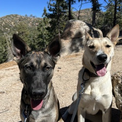
It’s best if you start on Skyline and approach Fall Line from the West and head back to the east. That way you start off with a decently, but not terribly, steep uphill with Fall Line being a steeper downhill.
★
★
★
★
★

This is a great hike for young ones and large groups. Short enough for most, challenging enough for the young adventurous ones. Plus great views at the top of the entire lake
★
★
★
★

It was a fun hike. Trail well maintained and great views. The woods we’re beautiful also. Perfect for a couple hours with family and dog.
★
★
★
★
★
Great for hiking and biking. dog friendly just please pick up your shhhh.
★
★
★
★
★
Hiked from ski lift parking lot, cutting off about a mile if starting from Manker Flats. Left at 11:10 am, too late for this warm day about 86. Hiked to the notch and explored. Ate lunch near ski lift number 2 (I think). Walked north to get a view of the desert. Hiked about half mile towards Thunder Mountain then took a ridge line back toward to water collection pool. Back to the Notch. Took a quick shortcut straight down to cut off about .65 mile. Returned to Jeep at 3:50. Only took 59 minutes to get down.
★
★
★
★

July 23rd - cloudy most of the way up kept us cool - still warm and a wonderful summit to old gray back - what an adventure....
★
★
★
★
★

If you enjoy a Sufferfest hike, with amazing views this is it. It’s approximately 18 miles with 5k ft elevation gain. This is a great training hike for Whitney or other long treks.
★
★
★
★
★
This was a very beautiful hike, lots of people, love all the different type of terrain you go through, tough but doable. Enjoy the creeks, waterfall, all the trees and birds singing
★
★
★
★
★

Short and sweet. Off the trail, a little bit of bush whacking. Great weather.
★
★
★
★
★


First Badge of Honor trail… completed with the aid of a seasoned pro who helped spot and show the right lines. The Waterfall was fairly easy and provided some good learning for how to bump… which came in handy later on, at an obstacle he called “Brains.” Bypassed the bypass around the Boneyard (meaning we took the path over that rockfield, and it DID sounds like bones crunching). After reducing the summit, it was a nice little cruise down the backside to 3N16.
★
★
★
★
★

The hike to the fire lookout tower had incredible views from start to the top and back. It was a hard climb but maybe coming back down was tougher. The afternoon heat was especially tough on the doggies. Also saw only one other hiker on the trail all day.
★
★
★
★
★


Arrived on a Sunday at 6:15am and there were still a few parking spots left. Vault toilets at the parking lot. Bugs weren’t too bad, but were more plentiful in the afternoon. Took me 10 hours to complete with all my stops and at moderate pace.
★
★
★
★
To start, you definitely need a high clearance vehicle to get to the trailhead. I mean, if you’re mad at your car you could try it, but don’t be surprised if after the beating it takes getting in it decides to quit or get stuck somewhere!
This is a long hike, with almost constant sun exposure and high elevation, you start at about 8100ft and end at 11500, but all things considered, it’s not that hard. Lots of burn scars from recent year’s fires, but still a beautiful hike with lots of wildflowers and wildlife. A couple very small stream crossings in the beginning, but not anything you should depend on for water as it’s too early in the hike. Farthest stream was less than 3 miles from the trailhead.
You will not encounter many people on this trail, but will encounter groups at the summit coming up from the other trails. So if you enjoy the solitude, this is a great hike! I did this on a Saturday morning and saw 6 people the whole way up. There were dozens at the top and more streaming in constantly from the other side. On my way back down I did not see another person until the end of m hike. If that’s still too many people for you, try this hike mid week and you’ll likely have it all to yourself!
★
★
★
★
★


Lame title, this was NOT a hike!
This trail event is a 4x4 day. Holcomb Creek, travel East to West (going through the middle rock garden UP hill.)
Our group had a great time and this trail was easier than John Bull… so if you like this trail Big Bear has more to offer.
The “Playground” near West end was a nice treat, things to climb and grab snacks. Lots of big boulders and slabs to be creative.
The Gatekeepers on either end are useful… if your rig struggles then this trail may not be for you, bring friends is highly recommended!
John Bull requires more enjoyment of technical wheeling and experienced spotting a plus.
As far as trails go, this ranks second most challenging trail in Big Bear.
(Wasn’t a hike, need to change that option.)
★
★
★
★
Was able to find parking along Baldy Rd. at 8:15am on a Saturday. Icehouse Canyon was crazy busy...multiple groups 30 people deep 👎🏽 Cucamonga Peak Trail was much better with just a few people who were considerate and would let you pass. Cucamonga Trail was quite rocky with some super narrow sections that could be sketchy for those who are afraid of heights. But the views on this trail are amazing! Total hike time with a potty break, 2 snack breaks, and parking 1/2 mi from the trailhead was 6 hours. Vault toilets at the trailhead. Adventure Pass required at the actual parking lot.
★
★
★
★
Parked along Tahquitz View Dr. to add some distance and elevation. 65F today, no toilets, bugs, snakes, or snow. Steady incline that wasn’t too difficult, but it got steeper closer to the peak. Shorts and a long sleeve were perfect for the weather on a sunny day. Drank 20oz. of water.
★
★
★
★

No real destination, but really nice hike. The dirt road to the north looks good for mountain biking.
★
★
★
★
No real destination, but really nice hike. The dirt road to the north looks good for mountain biking.
★
★
★
★

Not an easy trail by any comparison, nicely challenging, but not super difficult either. I made it in a Jeep Gladiator Rubicon with 3.5” lift and 37’s, no bypasses used.
★
★
★
★

Beware of possible mountain lions and trail conditions! We diverted down this route yesterday after trail (lack of) and snow conditions along the ridge stopped us from descending down to foresee creek via Anderson peak from San Bernardino mountain.
Unfortunately we got to the summit late which meant we were forced to go down this section in the dark. For the most part the trail is in better condition than the other side of the mountain, however it is extremely overgrown and some times challenging to find the trail..
However what we were not prepared for was the multiple possible mountain lion sightings. In our headlamps we came head to head with a very large animal with big eyes and moved like a cat, which we’re pretty sure was a mountain lion. Not long after we saw another smaller one cross the trail which was possibly a cub or bob cat. And finally further down the trail we saw another two large ones, which looked like mountain lions. They watched us then ran away after we made ourselves very loud and big. Please be careful!
★
Would not recommend this hike currently.
We started yesterday morning at 8am anti-clockwise following the reopening of the mountain. The first part of the trail up to the fork from angelus oaks was very difficult as the trail was in very bad condition and non existent for large chunks. It was all very badly burnt.
We didn’t want to go back down that way so we had come up so we contiunued upward hoping the trail would get better.. it didn’t. The snow and lack of trail made it very hard and we made it to the summit late. By the time we were up there it was 5pm. The ridge trail was impossible to find because of snow and so after some scrambling towards east San Bernardino peak and the light fading we decided to divert down the other side of the mountain on the Momyer creek trail. We do not know the conditions of the descent on the second half of the loop after Anderson peak but if it’s anything like the way up, would not recommend it. We also encountered possible mountain lions on the momyer creek trail. Be careful and atleast wait till summer!
★

A really pleasant hike. I’d recommend doing part of the skyline trail (head right at the junction near grand view point and head west). After a mile you reach a place called the Skyline Tetons. Beautiful views of the San Bernardino peaks.
★
★
★
★

Very doable. Good challenge for my first time driving on a 4x4 trail.
★
★
★
★

Shit was slight work in my 2WD Colorado, with only a 2.5 level kit.
★
★
★
★
★

Great hike to see he peak with patches and f snow and ice throughout.
★
★
★
★
★


This is a great beginner trail for off road folks. Just be careful and travel with others. A steep drop off can be dangerous if you go too fast.
For those going down hill you MUST use lower gears and stay off your breaks or you will lose control and maybe lose your life.
★
★
★
★


Awesome bike trail for adults and children. Scenic views all away around. Trail is not a loop and return trip will be tough but well worth it.
★
★
★
★
★

Dirt biked this trail. White a few side by sides Amal it’s of blond corners. Lots of whoops formed but still fun. Great conditions 10/24/21
★
★
★
★

First time overnight camping, went from the top of the Tram to Idyllwild, overnighted just east of the National/State park boundaries. Was a challenge, but doable. Take water (I used 3L)
★
★
★
★
★

Pretty short hike less than a mile but very much worth it. Especially in the summer heat, the water will feel great.
★
★
★
★
★
Very nice hike! The views are nice the entire way. Good amount of shade. The incline is gradual not bad at all. I’d do this one again.
★
★
★
★
★


Short steep “trail”. Not an official trail but it’s well marked. View from the summit not that great with all the trees around, but it is a pretty spot.
★
★
★
★
This was a great Wheeling Adventure with Chino Hills Buddies (Carl, Rob, Pat, Curtis, and Paris)
My 1st 4-wheel trek on my 3” suspension and 37” Nitto Trail Grappler tires… all went well!
Holcomb valley, Heartbreak Ridge (in the rain), and John Bull trail, out through Hwy. 173 and then home!
Great trip!!!
★
★
★
★
★

This was an excellent trail to the top of the highest peak in Southern California! The trail was easy to follow, with ample signage at all forks in the trail. The beginning of the hike certainly caught our attention as it is a steep, unforgiving mile before entering the San Gorgonio Wilderness. A steady climb from there passes three campgrounds along the way as we ascended towards the summit. Water was readily available at High Creek Camp, where we chose to fill up during our descent. Be sure to always filter your water. We begun the hike around 5:30am and summited just after 10am. It is certainly important to note that the summit is only half way! We completed our descent at 3pm and passed three uniformed rangers along the way down.
★
★
★
★
★

Nice moderate hike that leads to a beautiful view of big bear lake. Great place to strap up and get climbing, endless climbing possibilities.
★
★
★
★

Helen, Lilly the dentist and Regina Le Nguyen the accountant hiked up to the Ice House saddle, ascending on a very densely used trail. Carried D7500 camera. Descended on a much less-used trail to the north.
★
★
★
★

This OHV trail is a beast… huge rock piles and waterfalls… do NOT go unless you have a lift kit big tires and good clearance. Expect to hit many many rocks high center and get stuck if you don’t pick a great line. Go low and slow.. do not drive around the boulders make your lines on top of them. Very challenging had a blast!
★
★
★
★


Nice steady climb. Couple great vistas of the mountains and lake. Hot middle of the day but nice breezes and spots for shade. Not as crowded as expected for holiday weekend, although mid-afternoon probably not the most popular time to be out there. Continued towards Bertha’s Peak but stopped at 8,000. Almost no one on the climb to Bertha’s. Very serene.
★
★
★
★
★


Great truck trail. 4wd not needed but a bit of ground clearance is. Ran it in a stock Wrangler 4xe.
★
★
★
★


I hiked with my two huskies. It was 47 F at start of the hike & lots of mountain fog, which made for an interesting vibe. It got warmer & sunnier. Fog dissipate as sun took over the skies.
I parked on the parking lot, a little up the dirt road from the trail sign.
Trail in excellent condition all through. Few patches of snow before the saddle intersection.
No water source. No wildlife sightings except birds & lizards.
The summit has amazing views all around. I took a detour on the way back, from the saddle, stopped at the Rock Basin Camp & visited the area. There were several rock climbers who were training there.
★
★
★
★
★

We had very lucky weather. High of 64 and sunny. When we got up to the top we were the only ones there and were above the clouds. We only saw a few people. Started at 9:40pm and finished at 6.
★
★
★
★
★
The trail is a combination between following cairns, and green tape markers, fire roads, and trails. I really enjoy that I don’t have to get in my car to hike Deer Springs Trail
★
★
★

We went off roaring and started at Crab Flats to Holcomb Valley. It was a beautiful trail and weather. Sunny and clear blue skies. Views were above the clouds. Definitely recommend a high clearance vehicle and airing down. Optional obstacles for any enthusiast. The dirt road was clear and and dry. No snow or mud. Recommended trail for a day trip! It was 26 miles in 5 hours.
★
★
★
★
★

The hardest trail in Big Bear. It’s an 8 or 9 depending on the time of year and how many people have mucked it up. This is the long version of the trail.
★
★
★
★
★

Easy to medium trail ... nice part is that it’s not out and back ... you come out one a main road
★
★
★
★
★


Short, steep, and always a treat. A more fun alternative to the route up from the tram that’s less brutal than C2C. Views are incredible and most of the hike is pleasantly shaded. A true gem by any standard.
★
★
★
★
★

Drove up the trail for a bit of over landing. Was not disappointed. Tons of fun. Goes pretty deep into the forest and there’s tons of trees and really not too many people on the trail👍
★
★
★
★
★
We entered the trail at Cleghorn Rd and went south through Lone Pine Canyon up to Sheep Creek Truck Trail at 7000’ elevation into the back of Lytle Creek on up 3N60B to the top. Finished the day at the firing range blowing shit up with high powered weapons of mass destruction.
★
★
★


Epic Ride. Beautiful views. You need really good legs to do this Trail on a mountain bike. You can drive in as well with an all wheel drive car or 4x4 vehicle.
★
★
★
★
★
I did this trail with my 2006 2wd Toyota Tacoma Prerunner. I have rear locking differential but did not have to engage. Easy trail, some Rocky portions and about 100 yards of compacted snow. No trouble at all. Plenty of places to stop and take in the view.
★
★
★
★
★


Lots of fun. Out to explore and to the top of 3N06A. Snow run approx 1-2.5’.
★
★
★
★
★

The scenery is otherworldly. The streams, greenery, rock, etc. Moreover, the landscape itself changes as you continue to summit. The view at the top is worth the strife. Highly recommend, even if you’re just doing a mile in.
★
★
★
★
★
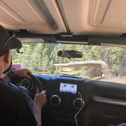

It was a bit slippery at certain points as there’s still snow, but hiking boots were just fine. Nothing too much of an incline and a nice weekday hike!
★
★
★
★
★
Start
2N79>3N31>2N57>Lytle Creek Rd>2N56>3N31Y>To it’s end>3N31Y>____>3N47>Cleghorn Rd>Blue Cut Frontage Rd>Swarthout Canyon Rd>2N532N52>3N31>2N79
End
★
★
★
★
★


Remote vehicle flashlight payload may have been to close to the avionics - flew straight south .20 miles - crash landed at new trail / Pee Tree crossing -
★
★
★
★

Drove it, nice scenic, can do in 2wd. I did the entire trail in 2wd. Pleasant drive and options to other trails. If you’re looking for a challenge, turn off on the X trail. This one is easy.
★
★
★
★

Loved the view when getting up there!! Make sure you bring crampons, the trail gets icy when passed the icehouse saddle. Recommended.
★
★
★
★
★
Great day hike in great weather with Tina, Frenchie and Mackanaw Mike.
★
★
★
★

Fairly easy route. Some minor technical rock areas as you climb. Great views
★
★
★
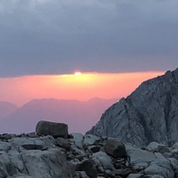

This hike starts on the normally high traffic Icehouse Canyon trail. After a 1/4 mile or so we leave the trail and go off trail and head up Falling Rock canyon. Yes, I don’t like the name either. Steep, lots of debris but very manageable. An obviously scree field presents itself at the top of Falling Rock. Head to the right and up the scree field to gain a saddle. From there follow the ridge to the top of Ontario’s Peak!
★
★
★
★
★

On the last stretch of a this route we debated if it qualified as a hike. The verdict was an indifferent and technical yes. Two thirds of of this loop were on various vehicle roads. The views were lovely and the sun was hot, with very little coverage. We had a nice picnic at Serrano beach. There were two major elevation changes in the hike which was a welcome challenge. The scramble from the ridge down to the lake was not a real trail. Overall it was a good hike, not bad, but not life changing.
★
★
★
It was a nice scenic easy trail. Start in Big Bear and end in Big Bear. Off chute trail heads along the way for options. Camp sites out there and places to take in views.
★
★
★
★
Today we went up Sheep Creek to 6000’ elevation spectacular views. Followed down into Lytle Creek wash and up 3N60A for a fun afternoon. Great times!
★
★
★
★

This hike was epic. I started at the Icehouse Trailhead, but forgot to hit “record” on the GAIA app. Doh. I did not realize it until the top at Cucamonga Peak. Oh well. At least I recorded the descent.
At the top, there was very light wind, warmer than normal, it was around 80 degrees at the peak. There was just enough breeze to cool things off in the shade. Chapman Trail in the afternoon is hot and difficult due to the narrow trail and rock-slide traverses. It is not for beginners. After reaching Cedar Glen campground, the 2.5 mile hike to the trailhead was amazing. It had all the features: rock slide traverse, oak and pine forest, stream crossing twice, thick scrub brush maze-like narrow trail, switchbacks, and finally the last mile of Icehouse Canyon to the trailhead.
★
★
★
★
★

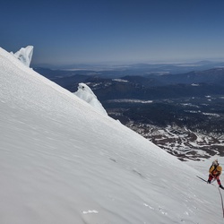
This hike is okay, kinda just did it out of frustration since I didn’t get to do a through hike to Mt San Gorgonio from Vivian Creek Forest Falls bc they closed it again due to the El Dorado Fire. Ironically, as I was out hiking Sugarlof, they closed all the National Forrests including the San Bernardino one. Meaning you can’t hike anywhere at the moment...
Anyways, I am sure the hike is more fun if you have views which seems to be pretty great in several directions unless there’s a milky smoke layer surrounding it all which was the case as I did it. The hike itself isn’t that strenuous, a few short switchback sections and steeper grade near the summit plateau and a lil up and down, I got up in 2.5 hrs and down in 2, still taking my time. Seems like people cross country ski this in the winter.
If you happen to be in Big Bear and want to do a day hike this could be an option.
★
★
★

Mostly shaded, uphill trail. Beautiful scenery; especially at Suicide Rock.
★
★
★
★


Such a great hike, you start out through arid manzanita thickets till you reach the Wildhorse Creek valley when it turns wet and full of flowers and ferns. You then climb to Wildhorse meadow with Ponderosa Pines. The views are amazing of the Angelus Oaks Area and San Gorgonio Peak are superb!
★
★
★
★
★
Major Bucket List hike accomplished. I chickened out and climbed the tallest mountain in SoCal from the easier of the two ascents. The Vivian Creek Trail is longer steeper and harder. That is not to say this was easy by any means.
★
★
★
★
★
A lot of this path has been obscured by winter debris. Some of it follows a seasonal creek! Easy to lose the way
★
★
★
★

Not too difficult. Beautiful views throughout. Good workout.
★
★
★
★
Great fun exploring new paths with the wifey. We hoped to find water and struck out but we did find amazing views in Gods country.
★
★
★
★


Good moto ride. There is a waterfall I suggest going to, it’s near the concrete bridge at the bottom.
★
★
★
★

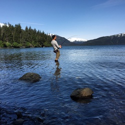
It was cool. A little crowded and brutal at some points. When we got back to the car temp said 106°F.
★
★
★
★


 stars
stars
Easy hike with gradual climb up until you hit the PCT. Soon after you begin a more aggressive climb to Bertha Peak. At that point I would say it becomes a moderate trail due to the climb. Not much shade throughout the trail. Wear plenty of sunscreen and go earlier during the day or later in the afternoon if you go during summer months. It was 82* the day I went. Temperature was fine, but the sun felt more intense. Take plenty of water if going to Bertha Peak, you will need it if you dehydrate easily like I do. My wife and kids, 6 and 8, climbed up with me until PCT and I continued on by myself after that to Bertha Peak. Met up with them on my way back down. Not many people on the trail that day, Friday. Almost everyone was wearing a face mask or would put one on as we approached. The trail was clean. Some rock and tree roots along the way, but overall very well maintained. Beautiful views from up top of Big Bear and surrounding areas. There are places along the trail to stop and have lunch. There are a few benches along the way to sit and take in the views as well. Overall great hike.
★
★
★
★
★


Good view of Big Bear Lake and you can also see a bit of lake Arrowhead. The trail was pretty forested in the first third, but after you got out of the trees there wasn’t too much shade. Good, short early morning hike.
★
★
★


Chill ride with 70% easy green trails and 30% blue. 2N06 Radford road was rated a black diamond but felt like an easy blue (easier than Clark’s Grade). Little bit rocky, little bit sandy mostly hardback fire road. Ample roadside parking.
★
★
★
★
Great 4x4 run. Not a difficult trail but still apt of fun.
★
★
★
★

Easy dirt trail. Entered from Lightning Gulch. Nothing difficult, just a little “annoyingly”rocky on the way down. But, there is a big and nice yellow post camp around the middle of the trail with a lot of pines. A small trailer could make it up but would have to go back the same way.
★
★
★

3 days of camping and jeeping. Holcomb Valley and Hannah Flat Camp Grounds. Jeeping and a lot of fire roads 3N12, 3N14, 2N71, 2N09, 3N16, 3N09, 2N02, 2N01, and enjoying the family to the max!
★
★
★
★
★
3 days of camping and jeeping. Holcomb Valley and Hannah Flat Camp Grounds. Jeeping and a lot of fire roads 3N12, 3N14, 2N71, 2N09, 3N16, 3N09, 2N02, 2N01, and enjoying the family to the max!
★
★
★
★
★
It’s a cool hike, a longer day hike so get there early if you don’t plan on camping. It’s pretty fun particuarly closer to the top. Would’ve done SanBernardino East as well as the view from there is probably even better if my party had not objected.
Water is running well in the little creak above Limber Pine campground, today July 30.
★
★
★
★
★
 stars
stars
The highest summit in Southern California a brutal hike, but great training for higher peaks. Just a relentless uphill slog, one that is seemingly endless on the way down. I’ve done San Gorgonio twice from the Vivian Creek trailhead and I’d say the total hike from the parking lot is about 18 miles round trip. The trailhead is actually 1/2 mile up a dirt road from the parking lot. There are several water sources on the mountain, depending on time of year, so bring a filter if you want to refill. Otherwise bring at least 3 liters of water per person. Give yourself an early start, no later than 6:30 am, and remember to bring an Adventure Pass for the parking lot.
★
★
★
★
★

Chill little trail offering some great views of the lake. Plenty of places to pull off and camp or just hang out for the day.
★
★
★
★


Mostly in shade; make it a pleasant hike during hot weather. Be aware of snakes.
★
★
★
★
★

It’s 18 miles total but the long trail makes gradual climb fun!
The first three miles have plenty of shades but after that it’s pretty much exposed. Bring more than 3 quarts of water if you don’t want to collect and filter stream water near the top.
1/2 mile dirt road to trail parking lot was full of jagged edge rocks. My sedan clearance was fine. Small parking lot so be there early.
It took me 6:00 hours ascending and 3:20 hours descending.
★
★
★
★
Cucamonga Peak via Icehouse Saddle. About 25%-35% shaded. Creek water was clear but had a faint sewer smell. The view on top was breathtaking overlooking the urban grids. View from the Peak is magical at night! Descending took 2 hours 47 mins while Ascending took an hour more. Give yourself 8 hours minimum to Summit and return.
★
★
★
★

This trail was alright. It’s easy to miss it, so make sure you’re looking to the right. I suggest taking the right path as soon as possible. Once you get to the point where you see the, barely visible, sign you’ve gone too far. You CAN get down this point but it is steep and not for the very young or old.
Getting back up that hill is a workout and if you’re not used to it you’ll struggle. So, take the lower path, unless you like a good challenge.
Having said that, I can only assume the local Fire and Rescue must have their hands full from the upper trail. It’s just a 911 call waiting to happen. It’s not a path that is maintained, regardless of the fact there is a sign, haphazardly pointing down the hill. Giving it a sense of being, “Official.”
TLDR;
Stick to the right. Pack your trash out.
★
★
★
★
Gold mountain has some very challenging sections, a very rewarding ride.
★
★
★
★
★

Good time going up to Limber Pine. Always beautiful views. Had a turn around time so did not go to the peak
★
★
★
★
★

from deer lane to the music camp above arrowbear lake and back down cedar. nice 45 min loop.
★
★
★
★
★

It was not very difficult, with great views.
Awesome camping spot in the beginning of trail, hard to get to. Very tight with lot of rocks.
★
★
★
★
up to the north from the national park fork to running springs to the top of the peak and down... evidence of human activity along the way including a half dome structure with chairs and hammock frame. also saw a bbq grill and picnic table.
spectacular hike!
★
★
★
★
From Deer lane to the bottom of Arrowbear Lake and back along the 18 and then down Upper Boulder.
★
★
★
★

Trail off the beaten path to a river, Go in through the camping area next time.
★
★
★
★

This track is labeled wrong. This is via Fuller Ridge. The Marion Mt trail is shorter with more gain. Marion Mt is more like 13.5 miles, 4,200 ft if gain. Gorgeous trail view, beast of a hike. The climb is insane!!
★
★
★
★
The incline is gradual. Among the highest peaks in So Cal I feel that this was an easier hike over all. Awesome views of Baldy, Gorgonio and Jacinto.
★
★
★
★


This forest road takes you passed the trailhead for Aspen Grove and to the trailhead for Fish Creek Meadow. The whole area is pretty badly burned from a fire that raged through the mountain a while back. The road is a bumpy dirt road that sometimes is wide enough for only one car. Beautiful views of the mountain range and lots of wildflowers and new growth post-wildfire. The hike to Fish Creek Meadow is between 1-1.5 miles. You cross a couple of streams along the way. You can also connect to the Aspen Grove Trail.
★
★
★
★

Fun trail only did half. High up there and a ton of paraglider!!! Great views. No obstacles
★
★
★
★
The trail starts off on a somewhat well maintained fire road. We never shifted out of 2WD. At the transition point, you should elect to air down and be ready for some moderate spots in the trail. Lifted Jeeps made this trip fine. Lots of shear cliffs and narrow roads with sharp switchbacks. Better then driving on the pavement up to Big Bear.
★
★
★
★
★

Definitely gorgeous! After being quarantined for months, this hike was tough! The altitude got me pretty good at the top. This hike is not for the beginner. Camping at Limber Pines provided amazing views of sunset, the stars, the city, and the sunrise.
★
★
★
★
★


This is a beautiful hike. Disappointingly crowded with hikers who don't know wilderness or trail etiquette. Please remember that the wilderness is here for everyone to enjoy, and be respectful of it. 1) Listening to music on a wilderness hike only serves to stress wildlife. 2) Right of way always goes to the uphill trekker. Happy trails!
★
★
★

This trail was not to difficult with a full size Chevy. I did the whole trail in 2 wheel drive but the trail conditions had 3 difficult obstacles. Also the fire road was Not maintain like prior years most likely due to the COVID 19. Trail drove June 20th 2020
★
★
★
★
★

Hot and buggy with swarms of gnats and biting flies. Views are beautiful but couldn’t stop to enjoy them because of all the bugs. This hike is better in cooler weather, early spring or late fall.
★
★
★

Great views from the top of Gold Mountain of Big Bear Lake, Moonridge, Sugarloaf and San Gorgonio Mountains and the Mohave desert to the north.
★
★
★
★
stars
Leave early in the day, preferably well before 7 am to avoid the heat of the day. Remember that a self-issue wilderness permit (available at the trailhead) is required for Cucamonga Wilderness. Route is very steep in sections, and not a typical grade for a trail in this area. Some sections of the trail close to the summit have small rockslides on them — be careful crossing these sections. PLEASE don’t cut switchbacks and take your trash with you. Thanks!
★
★
★
★
 stars
stars
For a 19 mile hike that ascends 5,500 feet, it feels unaccountably pleasant. Ok. Ok. Ok. The first mile is punishing. And there are some sections there at the end that remind one this isn’t a gimme. But, get there at 6:30, throw back some pre-workout, sip on some protein powder during, and you’re good. I did the hike on a Wednesday and finding a parking spot wasn’t an issue. Even though it was 93 degrees in LA, I was cold at the start of the hike. Light pants and a long sleeve cool max shirt over a T for the ascent. T and shorts for the descent. Choose a day where the weather report has the wind under 10mph. You’ll be happy for that. Oh, and you need an Adventure Pass to park.
★
★
★
★

The weather was perfect for this hike. A bit chilly at first, but by the time we got up to the peak it was cold and windy at 1 p.m.
The first mile could be considered a gate keeper, as it can lead you to think that the hike will be brutal for the remainder of the trail. Also the last mile could be daunting, but one foot in front of the other gets the job done.
★
★
★
★
★

Easy hike. Nice views. Not over crowded although there were several more hikers in the afternoon during the decent.
★
★
★
★
★

6/4/20
We start 7 Am,Me n my wife, we get back by 5 Pm, it's very challenging, is lot of rocks, hot day, but it's very rewarding.
★
★
★
★
★

Really great hike that definitely gives you a challenge on the uphill.
★
★
★
★


This is a relatively easy hike that crossed the tranquil and refreshing Foresee Creek. The hile is doable for kids. We started at 8:45 AM and finished at 12:45 PM. Trailhead parking at this time was busy but still plenty of spots available.
★
★
★
★
★

vivian parking lot closed (covid?) so add another mile to the round trip. we got to lot at 0600 and there were four legal spots left. halfway camp is really third way to summit. took is almost 6 hours to summit including a few breaks. couple guys passed us and brisk hike made it in just under 4hours. if camping plan on halfway camp since high camp (which is more like halfway up) only has 3 to four spots and was full (Saturday). trail was clean but we picked up two water bottles along the way and there was a cigarette butt in the rocks at the peak.
my knees are killing me as the super steep part of Vivian from the river to halfways really a challenge on the way down for this 55uear old. took us almost 12 hours for the round trip. felt good to soak knees in the cold water at the bottom
★
★
★
★
★

This hike was pleasant and the lake was just about full. Trail was in good shape with only a few trees across the trail and most of them had walk arounds.
Worth a hike for sure
★
★
★
★
★

Beautiful viewpoint , only about 1.5 miles up from trail head.
★
★
★
★
★

 stars
stars
Spring backpack to Limber Pine Bench via Johns Meadow. Did a fun microspikes hike to the peak on hard morning snow and introducing newbies to ms techniques and snow hiking.
★
★
★
★
★

Buddy in a tundra wanted to hit the trails, so we kept it nice and calm. Started on Holcomb valley trail, but took 2N09A and the scenery immediately changed. Red dirt and tall pines. Rougher trail, but still very doable in a stock Jeep and stock Tundra. WILL BE GOING BACK!
★
★
★
★
★

My families first off-road trail and it was an absolutely great trail. 6:00am start from the 15 and it was peaceful and gorgeous. 4 hour trip and maybe saw 3 people traveling the opposite direction.
★
★
★
★
★

Solid Hike wearing sea gear and carrying tools. All the way to the top of the Truck trail.
★
★
★
★
★


Starts out in the woods but after awhile you get some great views of Big Bear Lake
★
★
★
★
stars
I wrote the description, so read that. I nice strenuous hike with some hidden gems built in.
★
★
★
★

Nice trail. Definitely an intermediate and not a beginner hike. Made it to John Meadow campground had lunch and back in around 4 hours. Meadow and stream was a little underwhelming IMO. Total distance is over 7 miles from the car. Pretty busy on a Saturday during the Covid times.
★
★
★
★
We started at Onyx Summit and hiked down to Wysup Peak, names after George Wysup a Sierra Club member who passed on. We made the Peak with a short off trail section, then we went further down to Coon Creek Cabin. From there we returned on different trail for a short ways, reconnected with the PCT and headed back the way we came.
★
★
★
★
★
The trails are pretty good except the last section of the Old CC Spur after the area where it washed out. I had to do some bushwhacking to get through to Lytle Creek and poison oak is an issue. There might be a better way following the creek out from the wash out but I would have to try again some other time.
★
★
★
★
Had a nice hike from Lake Silverwood to Camp Cajon near McDonalds off the 15 Freeway. Nice rolling hills, lots of Miners Lettuce, flowers, and seasonal springs.
★
★
★
★
★

Nice off road trail with fantastic scenic views. Not very technical but fun with a few water crossings.
★
★
★
I love Etiwanda Preserve and exploring the canyons and I ended up making it all the way up to Dustin Springs but it was crazy and quite a bushwhack. I’m not sure I would want to do it again for a while, Lol. But I completed a goal and saw some amazing sights so that’s what counts.
★
★
★
★
★
I really like hiking in the San Sevaine area. There are cool forests and meadows and it’s not far from my home. I often walk up the road with my bike and then ride it down.
★
★
★
★
★
3-7-20, Saturday..... This was a nice short trail. Reminded me of being in the Sierras a bit. Wasn’t to crowded. Possibly due to cool weather and a possible storm coming in. The temperatures was about 45.
We started at the bottom off of Tahquitz View Dr. And hiked up to the parking area where we hung out for a rest and bite then hiked back down. Took us 4.5 hours with an hour hanging out up top. Had my 2 Boston’s with me and they did great.
The town I went through on the was was super cute.... brewery,
Shops, restaurants.
★
★
★
★
★
Started near Cal State San Bernardino on Cloudland Truck Trail and went up to Marshall Peak. We were definitely in the clouds and fog. Quite a nice hike in the local mountains and the trail is well maintained. Hang gliders like to go up this trail and take off from Marshall Peak. Highly recommend checking it out!!!
★
★
★
★
★

Hike up to two peaks that are connected by the PCT. Great views on both sides but snow on the north face of the Desert Divide stopped further hiking
★
★
★
★
The only cure for a soul broken and needing to find the healing offered by the mountain.
★
★
★
★
★

This trail would be of interest to both beginners and seasoned off-roaders. There are options all along the way for beginners to take the easy route in a stock 4x4.
★
★
★
★
★

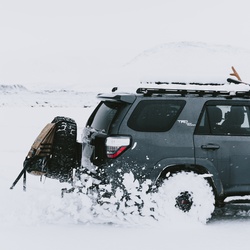
Good beginner/ intermediate trail. Relatively easy only a few hard parts. Mike shaft and abandoned trailer nearby
★
★
★
★
★


Great hike- did this in mid October, ample water in all three creeks and the cedar seep. The fall colors were amazing, watch your step on the trail as the millions of acorns were like walking on rollers. Thank you to the hiker who left a note about the wasp nest- we both still got stung, not badly. Both Dobbs and awger has great sites for overnighting.
★
★
★
★
★
 stars
stars
If you want real solitude, hike this hike on any weekday. It’s strenuous but rewarding. There is usually water at Jackstraw camp and the views from the top are amazing.
★
★
★
★
★
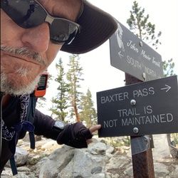
This hike is erroneously classified as "Difficult". It is actually quite easy with a nice moderate elevation gain. Only the last .75 miles is a bit harder on the dirt road to Bertha Peak.
★
★
★
★
★

Hiked Aspen Grove trail today, September 30, 2019. Access road is still closed, hiked moderate uphill section along the road (clear) 1.3 mi to the trailhead. Trail is very easy gradual ups and downs. Area recovering after 2015 fire, lots of standing black trunks. Some scattered wildflowers. Small slow-moving creek crossing, easy to step on rocks, no wet feet. Dog splashed around a little. Evidence the creek is bigger, possibly impassable, when there’s more rain/snow. Aspens, about 4-8 ft tall, are starting to turn yellow. Few downed trees. Saw woodpeckers and hawks. No bugs, 70*. Trail is soft dirt and scattered rocks, pup did not need boots.
★
★
★
★
★

Semi well maintained path high clearance recommended. Kidd Creek yellow post camping site and Buff Mesa camping site on this trail
★
★
★
The trail is difficult to find as it’s not well maintained. We followed the app in order to guide us because it was difficult to find the trail. No great place to look out here. But we saw deer.
★
★

Easy breeze trail and constant uphill. Open trail with some shades from big trees. You can skip this trail and take the ski lift instead.
★
★
★

Stayed overnight, very windy at the top all night long, didn’t sleep well, but it’s an amazing hike! It was really difficult for me on the way up. But a very well maintained trail. Awesome views!!
★
★
★
★


This is a well-built trail. It climbs through open forest which afforded ample shade earlier in the day, but there were many sunny spots by noon. Still, there was plenty of shade to cool off.
★
★
★

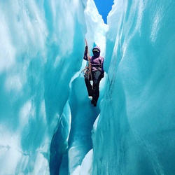

First half of the trail is easy walking surface
Second half the walking surface is difficult being made of fractured granite rocks
This a great 10 mile out and back hike
★
★
★
★
★

Cool little hike, only came out to 3.6 miles for me. (Was supposed to be 4.6)
Pros: Good views of the mountains and high desert, good amount of wildlife (saw my first rattlesnake of the summer), fun boulder scrambling near the top. Interesting scenery, more like Joshua Tree or the high desert than the mountains.
Cons: Very exposed, little shade, hot. I started at 8 and probably should have started a little earlier. Trail isn’t well marked, glad I was following the GPS track. Have to do some light boulder scrambling in a few spots and most of the way to the final peak.
★
★
★
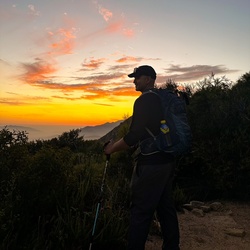
One of my favorite hikes of all time. Relatively easy grade for most of the hike with a steep section at the last half mile or so.
★
★
★
★
★

nice drive with the Grand kids we saw baby humming birds feeding at some wild flowers (tried for picture but wasn't fast enough)
★
★
★
★
★

Beautiful scenery, very easy trail. Any 4x4 can do it.
★
★
★
★
★

Started at 6am, forgot to hit record until an hour in so this hike is actually 7hrs, 12miles. We also took a slight detour near Cucamonga Canyon area. Overall this trail currently in the Summer is easy. There are some steep bits, and some narrow trail areas but overall straight forward. Trail is much more challenging/fun in Winter.
★
★
★


Nice Jeep ride. Quite dusty in June but great views. Could do this with 2wd vehicle if you have decent clearance.
★
★
★
★

Great 4x4 trail to Big Bear. Lockers not required in summer. Great views
★
★
★
★
★

Great trail. Really long. Be prepared for a workout. Lots of people, dogs, and bikes. The view at the top is amazing. Go all the way and don’t stop short.
★
★
★
★
★
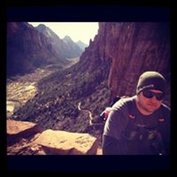
Great easy 4x4 trail with lots of fun off shoots. Definitely a trail for the family. Nice and long with good views.
★
★
★
★
★


An awesome hike with lots to see and fun changes in surroundings. Did it in October, which had some surprising fall color. You’ll need a vehicle with good ground clearance for the last 2 miles of off road to the trail head. Use Google Maps to navigate to the TH which is north of the summit (look for Cahuilla Mountain Trail). Definitely one of the best hikes in the area.
★
★
★
★
★


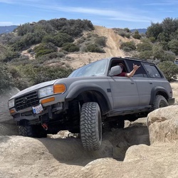


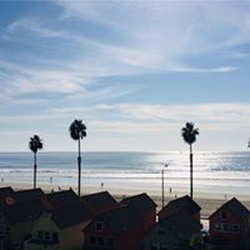


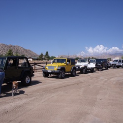


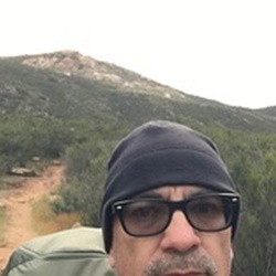


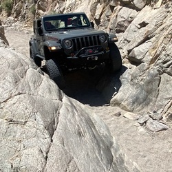
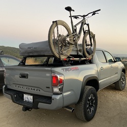


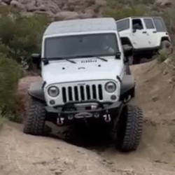


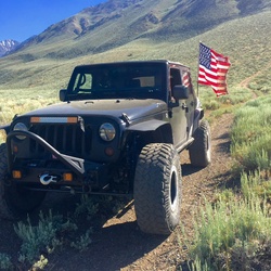
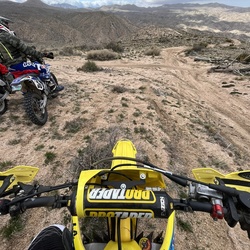


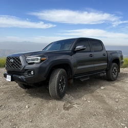

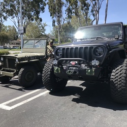


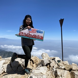


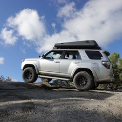


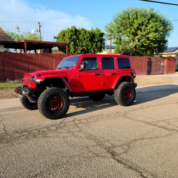


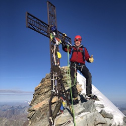
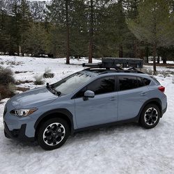


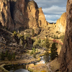


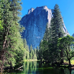

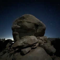


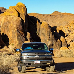


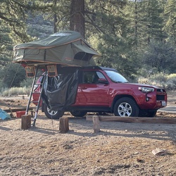


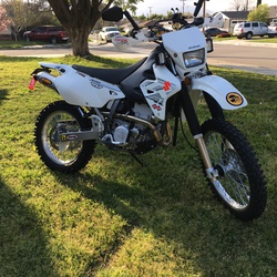


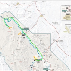


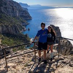


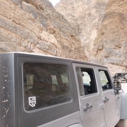


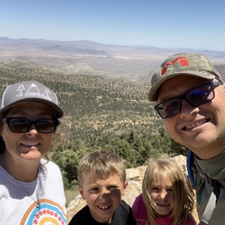


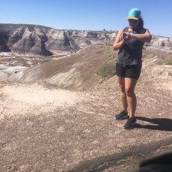


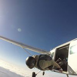


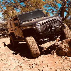


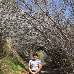


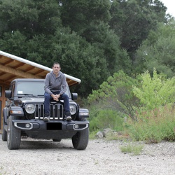


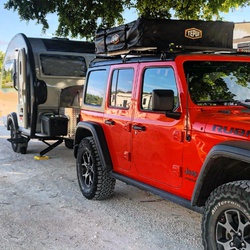


 stars
stars


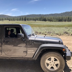


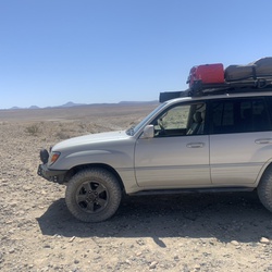


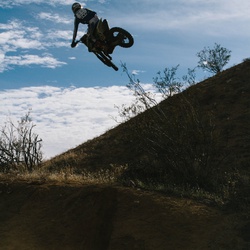


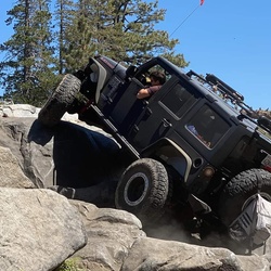


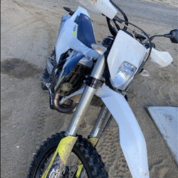


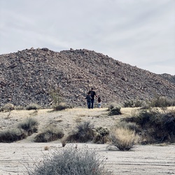


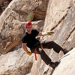


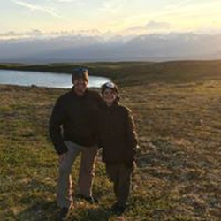


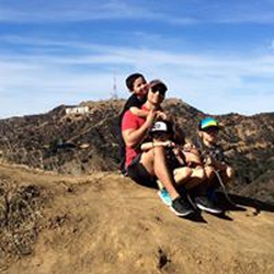

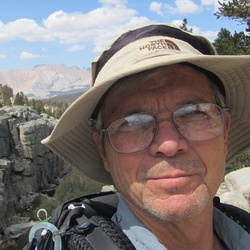


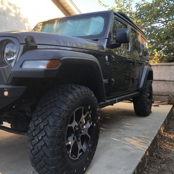


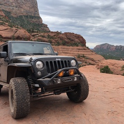


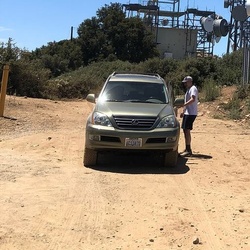
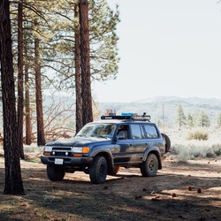
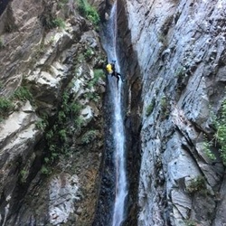


 stars
stars