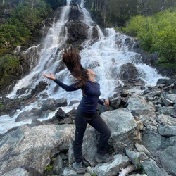
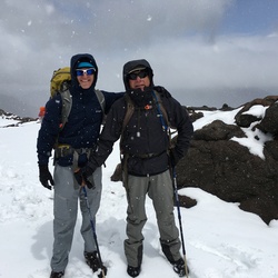
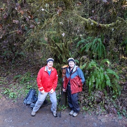
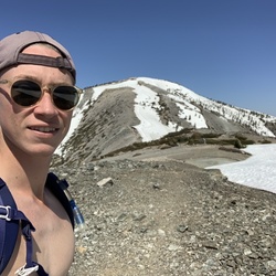
A great hike with stunning views. The mine is really cool. We missed the trail for the summit that appears on the map and the other spur trail didn’t seem to go anywhere notable. The changing terrain is so interesting.
★
★
★
★
★
 stars
stars
Nice hike to see an arch and heart rock - very much heart shaped. We continued along Gaia track, but there was not a trail, but came to a balanced rock. Getting off track in the return we found a dammed tank. Fun find, but not easy to get around. Trail also had signs explaining geology.
★
★
★
★
★
stars
Easy hike to old ranch with adobe ruins, water tank and a couple other small buildings.
★
★
★
★
stars
First half the trail passes through open desert with views. Then follows a sandy wash through rock formations. Ends at a couple of pools.
★
★
★
★

Joshua Tree is always amazing. However I do not advise going between the Christmas and New Year’s holidays. It is a zoo!! Soooo many people are there.
★
★
★
★
★

Great scenery- a good sampling of the unique plants and terrain of Joshua Tree NP. Some portions of the trail were eroded by winter storms, so I would rate this as an intermediate hike.
★
★
★
★


Great 360 view of yucca valley and part of Coachella Valley
★
★
★
★
★


Didn’t see trail. Nothing exciting but didn’t make it to Pune city trail.
★
★

Jumbo rocks. Amazing hiking. Easy to get lost in the boulders and rock hills. Use your gps! December and not another single person seen on this hike. Campground about 1/3 full. Nice!!
★
★
★
★
★

Started the hike about 11 in the cool morning from Hidden Valley camp to barker dam with some light rain drizzles and a partly cloudy sky until 2pm. Saw the petroglyphs on the way there and was tripping hard once I hit barker dam, so the walk back was so much fun. Seeing the detail and colors pop in the petroglyphs and the rocks and vegetation all around was mesmerizing. The silence of the open desert with only the sparse raindrops and my boots in the sand to break it was so peaceful. Passed the camp on the way back to complete the hidden valley loop. Just over 5 miles but it was such a relaxing and fun time to wander.
★
★
★
★
★

Excellent scenery on this very short loop. The trails aren’t marked the best, so do be careful with not getting lost.
★
★
★
★

Not easy. Easy to lose the tail. Bouldering required to get to the peak.
★
★
★
Easy? Is that why they have signs advising less experienced hikers to avoid it especially from 10AM-5PM from May to October? It’s not easy. It’s at least a moderate level hike. There’s a slow incline most of the way to the oasis turn off but there’s also several steep portions, along with deep, loose scree. There’s little shade along the trail & heat exhaustion and heat stroke are a real concern. I saw a handful of people with little to no water, wearing black or dark colored clothing in the middle of the day, with open sandals. Hopefully they didn’t make those choices because this trail was rated easy.
★
★
★
★
★

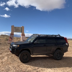
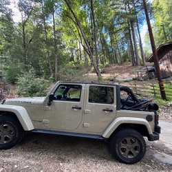
Completed this in a Rivian R1T. Nothing too difficult but helps to have a spotter in a couple sections.
★
★
★
★
★

Very easy trail to do in a lifted 4wd even 2wd some areas do require some clearance or some “balls” to get it done
★
★
★
★
★


Nice views, nice climb to the ridge going clockwise. Gorgeous flowers and some wildlife.
★
★
★
★

Horseback riding. Lovely ride, go clockwise on the loop to do the steepest part going uphill. After the view at the top and after a bit of downhill off the ridge there is a nice big piñon pine to stop and have a break and lunch. Love this trail!
★
★
★
★
★
Horseback riding. Lovely loop trail with mostly sandy footing. Great views toward the mountains but we’re able to stay out of the wind most of the time as we were in the canyons.
★
★
★
★
★

4WD only! Start at SR 62 just south of 29 Palms. You will turn south on the Gold Crown OHV Rd. This will take you to the Old Dale Mining District. This is in BLM land follow marked routes to avoid flat tires and damage to the land. The trails are very rocky. Watch out for washouts and slides. Don’t forget to air down your tires before you head out. Camping is available pretty much anywhere you can find a good spot or an already existing location. Exit on the JTNP Rd.
★
★
★
★
★

The NPS brochure map is misleading. The trail does not lead to the Pine City site. The map takes you past the short turnoff to Pine City and ends at a high point overlooking a rugged canyon. If you are skilled in off-trail hiking and route finding you can follow that canyon down to the East Entrance station. To get to Pine City itself, retrace the trail back to a large boulder area. We noted a vertical white granite dike in the boulder pile that was somewhat reminiscent of a waterfall. That gap between boulder piles is the Pine City complex. There is a number of Pinyon Pines in the area. I did not spot any remains of the old mining camp that once was there.
★
★
★
★
★

Mostly sandy trail up washes and a mine road. It climbs steadily, gets steeper as it goes. Great views at the top across JT Park and Coachella Valley. Historic springs along the way with empty tanks, and mine workings near the top with few arefacts. Also grinding. Pits along trail near springs.
★
★
★
★
★

Beautiful hike. Starts from parking, 1 mi up a wash, then into mountains along a mining road. Many CA barrel cactus, bright red, and brittle bush in bloom. Mining site with remnants of motors and winches. Gold and silver mine from 1920s.
★
★
★
★
★

Very easy hike from Skull Rock for trekking with kids or older ages. Roundtrip taking about 30 minutes if not stopping to enjoy nature or taking pictures. Get to see a simple slot canyon along the way. Face Rock itself is best viewed in profile.
★
★
★
★
★
Steep climb = steep decent. Great views from summit. A little wind but sunny warm winter day.
★
★
★
★
★

Lots of birds at the beginning. Cool rock formations to climb on the second half. Not very good sunset views, but maybe a different route over some different cliffs could fix that.
★
★
★
★

Nice hike through High desert landscapes. Pretty easy on a cool day. Definitely too exposed for a hot day. Bring lots of water. Make sure you download the map because the trail is easily mixed up with washes. Look for cairns.
★
★
★
★


This was an interesting hike. Total milage was 1.32 miles with 325 feet of climbing. Limited parking space. Actual trail head is about 3 feet to the left of the Silver Belle Kiosk. The trail is hard to see for 10 yards then becomes clear all the way to the Mine. Once you start up to the Mine the trail follows an abandoned road. Mine shaft has been sealed. You can continue up over the top of the ridge and you can see the Golden Belle Mine. This route is out and back and I would rate this moderate. This trail is not maintained by the park service.
★
★
★
★
A great trail in Joshua Tree National Park. This is near the Cottonwood entrance in The Colorado Desert portion of the park. The many Ocotillos were in bloom. The Lost Palms Oasis was beautiful from the overlook. We did not scramble down to the oasis. We did watch a younger family do this and the did not have any problems scrambling.
★
★
★
★

I was looking for something easy. This fit the bill. The view on the canyon at the end of the trail is impressive. There was lots of wind. Another time I’ll want to explore around more.
★
★
★
★

4/5 is a “I had a really great hike” and I really did. The trail is very pretty, and filled with Joshua trees for the first while. About ½ of the trail is in a wash, the rest is spent on pretty good dirt/sand trail. There are a few good climbs on this hike, but you get some really beautiful views from it.
★
★
★
★
Pretty easy and nice hike in Joshua Tree. There was almost no one on the trail when I went (March 2022 after work). The trail itself was pretty easy, there was little elevation change and nothing technical. The trail is easy to follow. The majority of the trail is on packed dirt/sand. Then towards ⅔ of the way, it turns into a wash, but is very manageable. There are beautiful views towards the end of the hike with a fun ‘maze’ of tall rocks that you walk through
★
★
★
★
★


Good rock climbing. Definitely should come back here. Other trails off of the main trail that you could take. Some spots more crowded than others.
★
★
★
★

Such a quiet and beautiful hike. I started just before sunrise and for the first 6hrs I met only 6 other hikers. Nice variation in elevation and enjoyed hiking along the dry riverbed. Picturesque & stunning!
★
★
★
★
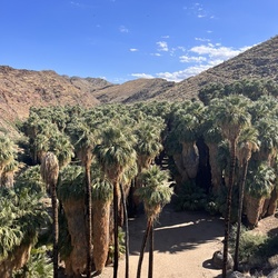
3 mile round trip to a lovely palm oasis. Great desert views. Large stone stair steps in places may prove challenging for very young or old hikers.
★
★
★
★


All climb for 1000 feet and a great panoramic view of the park. Intense but short.
★
★
★
★

It actually wasn’t a hike) I’m 4x4 off-road and use this App fir the first time. Still can not figure it out how it applies to off-road enthusiasts. I have a filling this App is mostly done for Hiking.
★
★
Why hike? Looks like this app is mostly for hiking enthusiasts. I’m off-road and drive through-this road. Didn’t like that much as mostly the road goes through desert growing, bushes ets. Have to be very accurate and concentrated not to scratch the car.
★
★
★
★

This is for higher clearance 4x4 suvs. The first half of the route is very chill and mostly scenic with a few holes on the road. Once you reach the mountains, you enter a small valley between two mountains that are very rocky with large rocks. Managed to do it with a 4x4 2004 xterra with 32” mud tires with a 1” lift. If you get in a bad spot, it is very difficult to turn back since it is mostly downhill the whole time. Once you exit the boundary of the national park, make sure you exit the trail on the asphalt road at the gun range. If you keep going (like we did) you will reach a dead end. This was our first major off roading experience the we timed poorly and did the hard parts at night which made it more difficult even with exterior flood lights. Overall a great trail and possible to complete with the right clearance.
★
★
★
★
This is an outstanding hike. Moderate to Moderately Stressful in places. Great views. It took 4.5 hours to complete.
★
★
★
★
★
Great Hike. Have seen the dam with and without water depending on the time of the year. Easy hike.
★
★
★
★
★

Loved this hike! We hiked half the trail. Start from the Indian Cove side & if u hike to one of the peaks (approx 3.5 miles) most of the return hike will be descending. We began at 9:12 AM (65 degrees) with the sun to our backs, turned around at the peak, & the sun was mostly to our backs returning by 3 PM (85 degrees). The terrain is moderate (beginning is like walking on the beach through thick sand, tiring,until the last half mile which was challenging switch backs.
★
★
★
★
★


This was a quiet trail not marked on the maps or in GIA map. Followed Quail trail to sign for Johnny Canyon — well used and some markers (arrows) further down the trail.
★
★
★
 stars
stars
This is a really great out and back hike through interesting and varied desert landscape which brings you to to an outlook with amazing views of the Lost Palms Oasis. The trailhead is located near the Cottonwood Ranger Station and Campsite in the south of Joshua Tree National Park. It’s a popular route so you may want to start early. Make sure you take plenty of water as the route offers no shade and you’ll be walking for at least 2.5 to 3 hours. The route is well signed and easy to follow and while there are a couple of steepish sections it’s mainly moderate and the whole trail is on firm sand/gravel with only a few short sections on deeper sand.
★
★
★
★
★

Fun hike for kids. Lots of boulders and rocks to explore near the parking lot. Picnic tables to eat a meal. Lots of parking.
★
★
★
Fun level hike. Lots of places to climb and explore for little hikers. Lots of resting spots. Dam was dry, we were able to climb down and explore it.
★
★
★
Hiked with our little guys, 6y and 9y. Uphill all the way to the top - a nice lookout with 180 views - fun downhill back. A bit windy at the top. A lot of big boulders made for easy resting spots with nice views for small legs. Well maintained and marked trail, some parts were dirt and many were stone steps. Vault toilets at the parking lot. Saw a steady stream of hikers, plenty of room to pass and spread out at the top.
★
★
★

Hiked to take sunrise @ oasis. Lots of locals use trail for conditioning (trail running).
★
★
★

Fairly simple trail with decent elevation over a short distance ... beautiful views all around… Joshua at peak you can see in every direction sonic views and much Presence.
★
★
★
★
★

Pretty good off road track, sandy, rocky, in the wash and through a canyon. Must have 4x4 and some decent driving skills. No service so be prepared. Picked up some trash along the way, pretty clean, please keep it that way my friends ~
★
★
★
★


The weather was perfect about mid 60s. It is an easy hike only about 1 mile. You see an old dam, watering station, petroglyphs, and some of the interesting landscape of Joshua Tree NP.
★
★
★
★
★

Good elevation gain. Perfect for beginners or first timers looking for a reasonable challenge.
★
★
★
★
★


Very crowded and difficult to socially distance. Great 360 degree view at top and two bars of Verizon LTE cellular reception.
★
★
★
★
Go clockwise to mine then climb to highest point. The middle section is up and down with loose rock but gives great views of the interior wilderness. The upper part of the descent goes through a lush valley with tall trees. My Garmin 62s GPS registered 1078 vertical feet and 7.1 miles.
★
★
★
★
stars
Excellent moderate hike. First mile on good tracks (route well signed as well) to warm up. Next section has moderate inclines but nothing hard ... climbs interspersed with contouring. Amazing views out to the North and West of the park as you wind your way up hill. As you descend you’ll see down to the left below you a wide wash which when you meet you turn right and follow. The rest of the loop follows washes (well signed) and as you start along the Maze Loop section there are beautiful views of San Gorgonio in the distance (with a sprinkling of snow now). Keep following the wash as it turns to the right and parallels the road until you get back to the trailhead.
★
★
★
★
stars
This is an excellent hike in one of the less-crowded areas of Joshua Tree National Park. When I hiked the trail back in September 2020 I didn't meet anyone on the trail - up or down. The trail combines walking through sandy washes, crossing some rocky terrain, and a moderately steep climb to reach the mine.
★
★
★
★

What a fun trail! The nice part about it is that it’s very beginner friendly, but also has plenty of options for a more experienced driver. It allowed me to gain confidence in our JLU and now I look forward to a more difficult trail. We aired our tires down and had no problem at all until the end when Mr. fancy pants decided not to listen to my cues and ended up rubbing the tire into the wheel well. No damage caused. Hubby gets a slap on the wrist!
★
★
★
★
★

This is a beautiful, well groomed and well marked trail. The trailhead is just after the Indian Cove entrance to JT, and it takes you across a rolling plain of desert brush and large rocks, then into a sandy rock canyon. Finally, a few switchbacks take you to the top of the canyon. We only went to the summit (3.5 miles in) and did not go through to the park but rather came back to Indian Cove. A lovely hike.
★
★
★
★


An overall solid hike. Was slowish going in the sand my canyons going up. Excellent view from the top.
★
★
★
★
★


First part of the hike coming in from Juniper flats is on a good well defined trail. I then took the side road just past mile marker 23. Trail disappeared in a small canyon at the foot of the mountain. From there it was a scramble pretty much straight up. Luckily it wasn’t too hard. The top was VERY windy and didn’t find the register or the survey marker. Went down the Northeast side following a trail which then disappeared about half way down. This meant more bushwhacking. Again not too difficult but not pleasant either. Got myself back to where the road ended and was back on trail again. About 12 miles in total. View form the top is spectacular and worth it but the trail is not great and very hard to find. Expect some bushwhacking.
★
★

Nice hike to interesting and unique spot. Not an easy hike, gains around 300 ft each way. Someone called it easy an that’s irresponsible! Maybe a 4 on a 1-10 scale.
★
★
★


Great hike. Beware of some wild bees at some places.
★
★
★
★