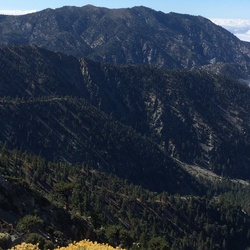
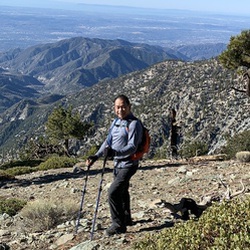
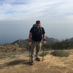
San Gorgonio Mountain via Vivian Creek Trail
8.3 mi
Distance
3 hrs 34 min
Time
terrain
5,184 ft
Elev Gain
Overview
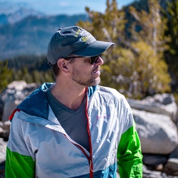
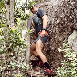
This is a difficult one way trail to San Gorgonio Mountain in San Gorgonio Wilderness.
This trail goes by Halfway Camp and High Creek Camp.
Sights to See
Rate this Hike
★★★★★


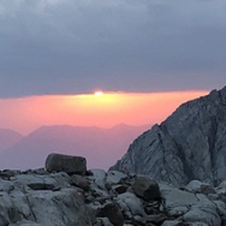
Hiked Mar 20 2026 – A really early start provided for surprisingly firm snow from High Creek to the summit and back, using micro spikes for the High Creek switchbacks and again for the last half mile. Early morning views off the summit were good but limited by a summer-like inversion layer. High Creek and the lower High Creek Falls were flowing well with the usual nice cold water, as was Vivian Creek at the Halfway/Vivian Camp crossings. Thanks to the trail crews for the large deadfall removal and the bush cutbacks, making one of the nicer SG trails more user friendly (I don’t mind the deadfall challenges but the thorns get old). It will be nice when lower Vivian “greens up” but then the bugs have the same idea (bugs were not out in force today). Mill Creek was flowing but not the spring torrent that it’s been in recent years. It warmed up considerably on the way down, reaching a nice 80°F by mid-morning back at the parking lot and then 100°F after driving down the mountain. Felt like a short but sweet summer trek with only the snow topside marking spring. I was surprised not to see any Southern Pacific rattlers trailside among the 100’s of lizards out but that’s for another day. FYI – the snow in the stone bivvys at Summit camp is down to a thin layer. Logged 16.3 mi /26.2 km & 5410 ft /1649.0 m with Gaia
★
★
★
★
★


This was an excellent trail to the top of the highest peak in Southern California! The trail was easy to follow, with ample signage at all forks in the trail. The beginning of the hike certainly caught our attention as it is a steep, unforgiving mile before entering the San Gorgonio Wilderness. A steady climb from there passes three campgrounds along the way as we ascended towards the summit. Water was readily available at High Creek Camp, where we chose to fill up during our descent. Be sure to always filter your water. We begun the hike around 5:30am and summited just after 10am. It is certainly important to note that the summit is only half way! We completed our descent at 3pm and passed three uniformed rangers along the way down.
★
★
★
★
★
 stars
stars
The highest summit in Southern California a brutal hike, but great training for higher peaks. Just a relentless uphill slog, one that is seemingly endless on the way down. I’ve done San Gorgonio twice from the Vivian Creek trailhead and I’d say the total hike from the parking lot is about 18 miles round trip. The trailhead is actually 1/2 mile up a dirt road from the parking lot. There are several water sources on the mountain, depending on time of year, so bring a filter if you want to refill. Otherwise bring at least 3 liters of water per person. Give yourself an early start, no later than 6:30 am, and remember to bring an Adventure Pass for the parking lot.
★
★
★
★
★
 stars
stars
For a 19 mile hike that ascends 5,500 feet, it feels unaccountably pleasant. Ok. Ok. Ok. The first mile is punishing. And there are some sections there at the end that remind one this isn’t a gimme. But, get there at 6:30, throw back some pre-workout, sip on some protein powder during, and you’re good. I did the hike on a Wednesday and finding a parking spot wasn’t an issue. Even though it was 93 degrees in LA, I was cold at the start of the hike. Light pants and a long sleeve cool max shirt over a T for the ascent. T and shorts for the descent. Choose a day where the weather report has the wind under 10mph. You’ll be happy for that. Oh, and you need an Adventure Pass to park.
★
★
★
★
The weather was perfect for this hike. A bit chilly at first, but by the time we got up to the peak it was cold and windy at 1 p.m.
The first mile could be considered a gate keeper, as it can lead you to think that the hike will be brutal for the remainder of the trail. Also the last mile could be daunting, but one foot in front of the other gets the job done.
★
★
★
★
★

vivian parking lot closed (covid?) so add another mile to the round trip. we got to lot at 0600 and there were four legal spots left. halfway camp is really third way to summit. took is almost 6 hours to summit including a few breaks. couple guys passed us and brisk hike made it in just under 4hours. if camping plan on halfway camp since high camp (which is more like halfway up) only has 3 to four spots and was full (Saturday). trail was clean but we picked up two water bottles along the way and there was a cigarette butt in the rocks at the peak.
my knees are killing me as the super steep part of Vivian from the river to halfways really a challenge on the way down for this 55uear old. took us almost 12 hours for the round trip. felt good to soak knees in the cold water at the bottom
★
★
★
★
★


Public Tracks
20240610_San Gorgonio Mtn via Vivian Creek TH (6/10/24, 3:18:04AM)
Solo hiked Mon 6/10/2024 – Trail crews have done a lot of work on Vivian from cutbacks to deadfall removal – big thanks to those responsible! The trail is much drier and Mill Creek a trickle compared to this time last year. Nice for a change to just follow the trail in autopilot mode with no winter navigation work or trail obstacles to deal with. Good flowing water to filter from at Vivian Creek-Halfway Camp crossing as well as High Creek. Switchbacks up from High Creek and the upper summit trail have a few trivial (soft and boot packed) snow patches that are just ornamental at this point and won’t be around after another week or so. While Vivian Creek itself is much lower this year, it’s still burbling nicely and is as beautiful as ever. Same slightly muddy trail patches before Halfway and at High Creek, all of which can be side stepped. Nice breeze and views off the summit today, especially towards San Jacinto, Cherry Valley and the San Gorgonio Front Range. With the trail maintenance complete and the snow virtually gone, now is a great (and fast) time to hike Vivian before the bugs come out in force. Brought a heavier pack for the day to get ready for an upcoming high altitude trip but didn’t really notice the weight (and finished earlier than planned) with the trail in such great shape! Logged 18.7 miles / 5425 vertical ft with Gaia

Hike San Gorgonio
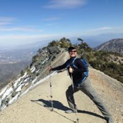
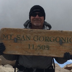
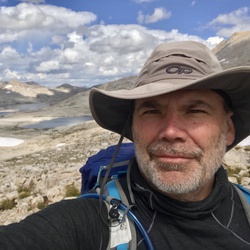
Everyone wants to hike San Gorgonio. At 11,503 feet, it's the highest peak in Southern California, and a challenging hike, not only in distance, but in climbing. This San Gorgonio trail guide goes via Vivian Creek, which is the quickest (yet hard) way to the summit, doable in a day.

Hike San Gorgonio
Everyone wants to hike San Gorgonio. At 11,503 feet, it's the highest peak in Southern California, and a challenging hike, not only in distance, but in climbing. This San Gorgonio trail guide goes via Vivian Creek, which is the quickest (yet hard) way to the summit, doable in a day.
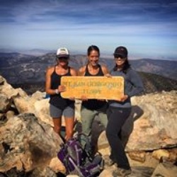
San Gorgonio via Vivian Creek
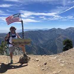
Peak #6 of 6 in the SoCal Six-Pack of Peaks Challenge.
Get all the details on this hike plus many more photos here: https://socalhiker.net/hiking-san-gorgonio-via-vivian-creek/

San Gorgonio via Vivian Creek
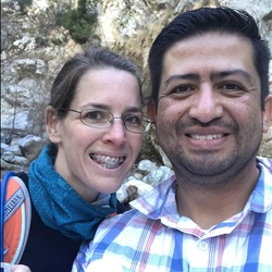
Our 6th peak in the six pack of peaks! Awesome hike. Very windy at top. Spent night at halfway camp. No water there. Get water at Vivian creek. Hike w/ Mark and Bev.

Sunday Morning Hiking
san gorgonio 1st peak out of the 6 peak.challnege for my 45th bday

San Gorgonio Wilderness Hike
https://connect.garmin.com/modern/activity/23000496935

San Gorgonio Wilderness Hike
https://connect.garmin.com/modern/activity/22589132254


San Gorgonio MTN via Vivian Creek Trail
San Gorgonio Mountain via Vivian Creek Trail

San gorgonio summit via Vivian creek out/back
Forgot to pause at camp for 30 min

San Gorgonio (9/1/19, 8:24:04AM)
Never again. Hiking is the worst.
San Gorgonio hike via Vivian Creek
Hike on Saturday September 15,2018
San Gorgonio hike via Vivian Creek
Hike on Saturday September 15,2018


 stars
stars

 stars
stars


 stars
stars