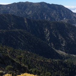
Black Mountain
10.1 mi
Distance
4 hrs 34 min
Time
terrain
2,557 ft
Elev Gain
Overview
This is a difficult out and back trail to Black Mountain in San Bernardino National Forest.
This trail goes by Boulder Basin Campground and Skyland Ranch.
Sights to See
Rate this Hike
★★★★★

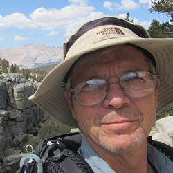
Hiked Sat 07/15/2023 solo – Was looking for a short early morning hike offering a decent workout and this one was perfect. An early start avoided the heat but not the bugs! Swatting bugs on the way up and a mosquito net over my hat coming down as repellent wasn’t enough. Very nice trail with some shade and good sized boulders at the top. The fire lookout was closed but the views from the summit were great just after sunrise. Took the fire road to Boulder Basin Campground and then went up Boulder Basin Peak. There is a large boulder grouping at the top that can be climbed a couple of different ways (chimney vs foot holds on the north side). There are some great bouldering spots off the fire road between the lookout and Boulder Basin Peak. Surprised that I never considered this trail before – definitely worth the trip! Logged 9.7 miles/2969 vertical ft. with Gaia
★
★
★
★
★

Public Tracks

Black Mt. /Idyllwild/ Rt.243 (11/20/21, 10:42:19AM)
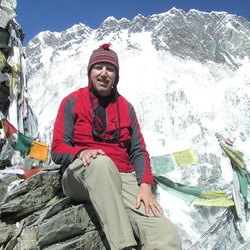
Hiked w/Lark, my husky girl.
Trail: Took the Black Mt. Trail off of Rt. 243 / 2E35 parking lot, on the right side of Rt. 243 about 13 miles from Idyllwild. Not the first sign that you see, it is passed that!! It is easy to miss it. When you see the second brown & white sign "Black Mt. sign, it is just passed that, maybe 50 feet or so. Trail was in excellent condition! Someone trimmed the Manzanita Tree branches & is very helpful. Last time was harder to see Trail on some spots.
Weather: Sunny & clear skies, 62 at start of hike, around 10:45 am. Warmer the first 2 miles, then breeze come & was amazing.
Lots of shade. Trail goes through Manzanita canopy & Sugar pines.
Water Source: none today, it seems possible that in spring might be some.
Other Hikers: Met two hikers at the fork just before summit, they were descending. Met two other hikers at the summit, they were coming from hiking the dirt road. On descending, met two younger campers that were going up. Just before parking lot, a young family with few kids were hiking up the trail.
Wildlife Signtings: lizards, birds, deer footprints.
Highlight Of The Hike:
1) No injuries
2) Beautiful summit
Learning Points:
1) Hydration & Food
2) Trekking Poles & good hiking boots
3) GPS - I use Gaia
4) Safety first - Returning to your car is mandatory, reaching the summit is optional

Black Mountain
Forest Sevice Road Number = 2E35<br>Name = Black Mountain<br>Beginning Mile Post = 0<br>Ending Mile Post = 3.36<br>