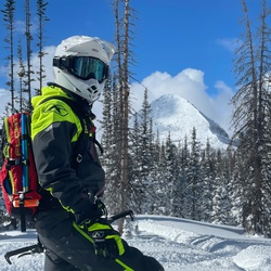
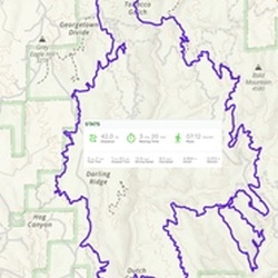
Perfect first backcountry skinning, avalanche education loop with fun trees descent
★
★
★
★
★
We did this hike to see the yellow aspen trees. You drive on a pretty bumpy gravel road for about a mile or two and then you walk on the trail. All it is is some yellow trees along a creek, which is cool to see once, but no need to see it again. We could’ve walked down further, but we only walked about 0.7 miles and turned around. It wasn’t anything special.
★
★
I got to the parking lot at about 7:15a and it was quite empty. There’s a bathroom at the trailhead. You start at about 10,000 feet of elevation so it’s definitely hard to catch your breath from the start. The hike is quite pretty, especially with the snow on the ground and the fall foliage. It was pretty cold and about 38° when we started. We took a side trail to Morgan Pass. Next time skip it because it’s an uphill climb just to see a pile of rocks. By the time we got down, the parking lot was totally full. People had to park about one or 2 miles down the road to find parking. Make sure you get there early.
★
★
★
★

Best to finish with McCloud Lake. Beautiful hike thru the woods. Great in temps 60°. Nice loop. Moderate hike
★
★
★
★
★

Went up to Dana Lake to enjoy the beautiful scenery and glaciers. Hiking and fishing. What a great combo.
★
★
★
★
★

Fabulous short hike along several beautiful alpine lakes. Well maintained trail easy to navigate. Mosquitos are plentiful!
★
★
★
★
★

First 8 miles were very very easy but all of the difficult on this hike came with the last 3 miles… so did the 2000 ft gain
★
★
★
★

Solo day hiked 6/26/25 – Early start on the Bishop Pass/Treasure Lakes trails for the first 2.5 miles on trail before going up through the boulder fields to the west of Bishop Creek’s south fork. The first real snow field started after a tarn at 11.3k, with 2-3 foot sun cups making it an outright slog. I decided to try circumventing it, taking a dryer southwest line up the boulders/talus closer to Mt Johnson and using Treasure Col as a way point. Once half way up this gully, I could see that the snow went to the top of the NW chute and that I needed to be on the opposite, climber’s right side so I traversed back across the snowy chute to the southeast base of Moonwalk Peak. I had planned on taking the NW chute up to the west side of Moonwalk and then up dry rock to the summit block. Instead, I promptly decided to go up the class 3-4 south east side of Moonwalk (aka Pk 12640) which ended up being great fun. I didn’t have to worry about down climbing this section later since I would be descending the SW side, providing more options on the route up. Ending up on the significantly exposed east side of the final summit block with 10 feet to go, I couldn’t bring myself to traverse around to the standard west side. And so I made it work without overthinking it, knowing it was most likely the “crux of the day.” The ascents of Moonshot and Mt Gilbert went as planned with awesome views that make coming to the Sierra “priceless.” The SE views from Cloudripper to North Palisade were favorites. The ridge climb from Moonshot to Gilbert was a highlight. The Mt Gilbert register is still in its original SC canister with entries going back to 1989. After traversing the Gilbert snowfield from the summit down the SE side, occasionally postholing through 3-4 foot snow bridges, I was back on dry rock down to Moonwalk’s NW chute. With too many rocks exposed to glissade it, I put on the La Sportiva G2’s and auto crampons for an incredibly long slog back to the bottom of the last snowfield, having to repeat the crampon/crampoff routine for the intermittent boulder stretches. Occasionally, the sound of fast moving water coming from under the boulder piles reminded me to stay off the easier center drainage lines of the lower snow fields. So nice to get back to the Treasure Lakes trail, have a bite, change boots and be able to spend some time at the two bigger lakes in daylight – absolutely beautiful place but mosquitos out in force. Great day with awesome weather/views. Full body workout, endless boulder hopping, great rock going up, AWESOME views the entire way, BRUTAL snow. Camped in the Aspens at Willow Campground for a nice end to this one. Logged 10.8 mi /17.4 km & 3853 ft / 1174.4 m with Gaia
★
★
★
★
★

Well it was a motorcycle not a bike and it was fun. A lot of trails to choose from going up and down. Really recommend this route.
★
★
★
★
★

Solo day hiked 5/18/25 – Drove up Horseshoe Meadows Road with a plan to day hike out to Muir Lake and then spend the night back at the Cottonwood Lakes Trailhead before heading up Mt Whitney. I’ve slept at Horseshoe Meadows several times over the last few years before going up Langley, Mallory, Irvine, Whitney and some of the lower peaks and it seems to put the finishing touch on the 2-3 week acclimation process. “Climb high” to 11-11.5k feet and then “sleep lower” at 10k feet. Aside from having ideal altitudes for this benefit, the John Muir and Golden Trout Wilderness areas surrounding the Horseshoe Meadows campgrounds are beautiful and quite scenic. After driving all the way up Horseshoe Meadows Road on this trip, the last gate was locked which is about half a mile from the campgrounds. The Inyo County Roads website indicated that the road was open so this was a big surprise. There were other cars at the parking lot adjacent to the gate with a few fellow hikers equally surprised and discussing “plan B.” I decided to walk the half mile past the gate, see if anyone was using the campground and then head out to Muir Lake on the Cottonwood Lakes Trail. Parts of the trail had hillside snow to traverse but nothing impassible. After reaching the start of the Muir Lake Trail, the snow was completely covering the unbroken trail. This just meant more time carefully navigating the trail, most of which was intuitive and aided by an occasional cairn. The weather was great so a little extra time spent putting in an accurate track to the lake ended up being a fun challenge. Muir Lake was still frozen over but just starting the thawing process with Mt Langley serving as a nice snow-topped back drop. Once back at the trailhead, I decided to pack up enough gear and practice “dispersed camping” for the night instead of driving down the hill to find another campground which just added to the adventure. I had too much firewood and gear in the car to sleep in it and had to find a bear locker for the food. In the morning, there was one other party with the same camping idea and a few thers sleeping in cars down the road. Not sure why the gate was closed to begin with and why there isn’t a bear box at the locked gate with backpacking permits being issued. A great pre-Whitney adventure before heading down to a reserved campsite at Whitney Portal. Logged 12.5 mi /20.1 km & 1477 ft / 450.2 m gain with Gaia
★
★
★
★
★

It was a beautiful day, and all 7 lakes plus black lake are beautiful! We, a group of eight people, took a lot of pictures, started at 9:15am, ended at 9pm. Very tiring but very rewarding
★
★
★
★
★
Solo hiked Thurs 11/14/24 – Was prepared for a slog based on reviews but I found this trail to be a straight forward, scenic route in the shoulder season that made for a nice day. The trail puts you to work from the start in a chaparral zone with a steady climb up to Olancha Pass before meandering through the denser forest at Summit Meadow. This is where the snow coverage was more consistent at 1-2 inches for the entire route to the PCT (Pacific Crest Trail) where it continued almost all the way to the base of Olancha Peak. The snow had fallen the night before with only my tracks breaking the trail before running across those of a black bear and then the tail drags and paw prints of an adult mountain lion at Summit Meadow. Since I started this trek really early, I knew these companions weren’t too far ahead but I never ran across them. After leaving Summit Meadow, the views to the southwest of Beck and Monache meadows were very far reaching panoramas, much like I crossed in NW Yellowstone a few months ago. Since this route is a dry one, I left (and later recovered) ½ liter water caches every 4 miles but didn’t need them as you would doing this in the hotter seasons ( I used 2.5 L from a bladder). The only tricky part of the trail was PCT Mile 723 just before the junction with the Bear Trap Meadow Trail where it braids into three different, unmaintained uphill routes, all of which eventually lead to the same place. Looks like a lot of frustrated through hikers have passed here over the last few years. Olancha Peak suddenly came into view after rounding a curve in the PCT, looking very prominent and quite impressive but not really intimidating. I left the PCT and scrambled up the southwest slope, though the timberline and across the stable, uncomplicated talus which had only trace amounts of snow and ice. As the wind picked up, I used the older antenna mast pole as the summit way point, traversing to the steeper face in a successful attempt to speed things up a bit. Olancha’s summit was much nicer than I had imagined but the strong wind gusts were as forecast, not letting me take off heavier weight gloves for more than 2 minutes before the start of frost nipped fingers. The views were just as spectacular as those from Mt Langley last week (2024 trekking weather has to be the best I’ve encountered over several decades). I took my time on the way out after going down the SW slope and rejoining the PCT, especially at the meadows. I took the normal trail up and down, not opting for the cattle driveway which was a mixture of mud and snow. Never needed my micro spikes on the trail or four wheel drive on Sage Flat Road. Nice to finally go up Olancha after seeing it lurking in the distance from so many other peaks. Logged 21.2 miles / 6391 vertical ft with Gaia.
★
★
★
★
★
Solo hiked Fri 11/08/24 – Spent a quiet night at Cottonwood Pass TH with a few animals scurrying around in the moonlight but no other fellow campers. Started really early on the Pass Trail, taking the connector to the Cottonwood Lakes Trail in cold (-1 C/31 F) but clear weather which was actually warmer than planned. Reached Cottonwood Lakes 3 & 4 at first light with nice sunrise reflections off their partially iced over surfaces. Old Army Pass was in good shape with little snow and no ice, making for an easy ascent. The cairned route up Langley was just as I remembered from last year, straight forward but a bit of a slog. The views from the summit were really spectacular with the clearest weather I’ve experienced this fall in the Sierra. After coming down Langley, I stopped just short of New Army Pass and headed east to Army Pass Point, climbing the summit boulder stack before heading to New Army Pass. From the pass, I followed the 180 degree cirque which provides a steady incline for the entire route to Cirque Peak. This was absolute fun, hopping nice, easy slabs and stable rock for the entire way, a nice rest after Langley. There was one section of less cooperative rock just west of the summit that was easily bypassed by heading slightly to the south. The views off the Cirque summit toward Mt Langley and the Cottonwood Lakes were quite panoramic, easily worth the trip up by themselves. Continuing on a south-southwest ridge route, I climbed a few boulder stacks before reaching Peak 12525 which had 3-4 summit blocks adjacent to each other of relatively equal height. After climbing up and down what looked like the tallest, I followed the ridge line down and then up an unnamed peak before again descending the ridge as it wound around to the west-northwest face of Trailmaster Peak. Before going up Trailmaster, I surveyed the 1300 foot direct descent from the summit down the south-southwest scree slope to Chicken Spring Lake which would let me pick up the PCT (Pacific Crest Trail). Since I would be doing it in the dark by headlamp, I took note of several rock features to use as waypoints on the descent. Once moving again, I got to enjoy a brilliant sunset while ascending Trailmaster which took very little time. After enjoying the summit views for 10 minutes with the last bit of light quickly disappearing, I started the descent by headlamp and had good luck with the scree skiing, stopping frequently to verify my route by GPS. I was able to find the PCT after walking around the lake which always gives a sense of relief as the workload reduces to following the trail out while having a few snacks. I’ve always enjoyed evening hikes out of the wilderness and this one was no exception with a clear moonlit sky and no wind. The PCT took me to the Cottonwood Pass Trail which was a nice way back to complete the day’s loop. Another fun day with great weather and really nice views worth patiently stopping for. I could have shortened the hiking loop to a more sensible one by skipping Langley (I would strongly recommend) but I just couldn’t bring myself to do it! I brought 2.5L of water and 1L of electrolytes which was more than enough for me, although I brought a filter as backup. Since Horseshoe Meadows Road to the Cottonwood Trailheads is subject to seasonal closure, I would recommend calling the Eastern Sierra Visitor Center (and ranger station) at (760) 876-6200 to find out if the gates are open before heading up. Logged 23.8 miles / 5516 vertical ft with Gaia
★
★
★
★
★
Solo hiked Mon 10/21/24 – Got a midnight start with a nearly full moon to see the sunrise from the Whitney summit and it did not disappoint. Nibbled carbs all the way up with water but pushed harder going up Trail Crest than I should have to make the sunrise. Hiked up in a softshell and mid weight gloves but the summit was cold enough with a low wind (18°F on pocket thermo not counting wind chill) to add a down jacket and guide gloves. Once the sun was up, things warmed up nicely and the views were spectacular. Climbed Mt Muir’s summit block next which was the most fun of the day with a class 4 route up and a 3 coming down. Discovery Pinnacle was the last climb of the day, climbing the 2 highest pinnacles since the official pinnacle looked lower than its neighbor and there was enough time for both. I headed down a loose talus slope to rejoin the Whitney Trail right below Trail Crest which was the only real bad decision of the day as it took considerable time and effort to prevent the launch of any rocks downward towards the trail. I should have doubled back on the route ascended but what fun would that have been? Made it down to the 98th switchback before a moment of scree skiing, at which point I realized I was a bit tired for the pace and slowed things down a bit – best decision of the day. Conversed with quite a few people on the way down and made it back to the Portal Campground for some food, a fire and then some sleep. Amazing shoulder season weather not to be taken for granted kept things comfortable and provided awesome views for the entire day. It was less than two weeks ago coming down from Thor with snow, rain and wind on this trail. Logged 21.0 miles / 6669 vertical ft with Gaia
★
★
★
★
★


Short, easy, but we added something to the official trail by going around the second crater.
★
★
★
★
★

There’s nothing like the Sierras.
Today was a short acclimation hike to get used to 10k (I live at sea level). This little hike is flat and has a pretty view of Horseshoe Meadow.
Trail is very sandy, feels a bit like walking on the beach.
Great family hike.
★
★
★
★
★
Solo hiked Sun 9/29/2024 - Not able to get a day permit, I opted for an overnight permit, camping at Iceberg Lake which worked out well. After driving what seemed like an easy 260 miles very early on a Sunday morning, I started up the trail from Portal just before 6 AM. Saw a nice sunrise from the E-ledges and knew it was going to be a near perfect weather day. I’ve never done this route without deep snow and North Fork ripping down the canyon so this trip was different. Some route finding through the willows was required after Lower Boy Scout Lake but absolutely no bushwhacking required. Rack and rope brought my pack weight up to 40 lbs. which was a bit heavier than planned, even after scaling back on “nice to have” items like a stove, warm food and more climbing hardware. Set up camp at Iceberg Lake, put everything in my tent except for climbing gear and headed south to Pinnacle Ridge to climb the cracks for a while. Some snow at the base wall made for an interesting start to things. Got back to camp in time to filter water, have some food and lay down before dark. Had to get up during the night to knead out some leg cramping down some electrolytes which made me second guess my Pinnacle Ridge choice before Whitney but gave me the opportunity to see an awesome night sky. It got down to 37°F so I didn’t have to sleep with water and batteries. Iceberg seemed like the perfect stopping point for a 2 day trip. Logged 4.4 miles / 4250 vertical ft with Gaia
★
★
★
★
★

Nice hike - quite not much traffic - I’d call moderate as the elevator is probably a little harder on those of us that live at sea level. Couldn’t really the trail past crystal lake to the aretta though
★
★
★
★

I'm very fond of this trail. It's a nice entrance to the JMT and the Silver Divide. I've done this hike at least a half dozen times since 1989, and it doesn't get old. Starting at the trailhead from the east, there are quaking aspen groves along McGee Creek, and three meadows before arriving at Big McGee Lake. (With a heavy backpack, that's about a seven-hour trip for me.) It's all scree from there to the pass, so booties for the dog are needed. It's much less traveled than the less arduous class 1 hikes, and the trail is well groomed to include a granite staircase with a spectacular view looking back toward the creek canyon. Starting at the JMT, adjacent to Tully Hole on the western side, it seems like more of a monotonous hike up to the pass and down to Big McGee Lake with no shade starting at about the halfway point up to the pass, but it's no less beautiful. Water is not an issue on either approach.
★
★
★
★
★

Great quick hike up the Whitney Portal for a couple miles to a beautiful lake
★
★
★
★
★
Amazing Day hike to explore above Hilton Lake 3 to Hilton Lakes 4 and 5. Soo many little streams flowing into lakes. Walk all the way up to the ridge of the glacier
★
★
★
★
★

Easier hike to a beautiful lake tucked in a beautiful spot. Saw several hikers. Easy to find a secluded spot on the lakeshore to chill.
★
★
★
★
★

Most underrated hike gradually all the way up only difficult part was the last 2 miles so many views encounter thunderstorms snow storms rain well worth it
★
★
★
★
★

Probably one of the best day hikes in Mammoth, in terms of distance and views. Lots of switchbacks towards Duck Lake but the views were worth it
★
★
★
★

Nice hike with pretty steep grade, switchbacking up to the mammoth crest trail. Lots of good lakes to see!
★
★
★
★
Really pretty hike to Gem Lake. Need to explore lakes above Gem Lake. You can climb up the boulders on far side of lake where official trail ends or you can make your way over to the right and walk up the drainage well before you get to Gem Lake
★
★
★
★
★

This track is only the return from Summit of Mount Galey back to our camp at third lake
★
★
★
★
★


Bugs were INSANE. Had a permit for a second night but hoofed it out of there. Gorgeous area tho
★
★
★

Beautiful hike- also awesome bc you can decide to hang at Blue Lake or keep going to other Alpine Lakes
★
★
★
★
★
It was my second time summiting Whitney but first time from the east side as I had done it from the west on my JMT thru-hike a few years ago. First time summiting Mount Muir which was the highlight of the trip for me.
We backpacked to Trail Camp in warm temps, around 73°F, that felt hot in the sun but cool in the shade. It felt even better after a quick dip in the ice cold Trail Camp Pond. Sun passed over the ridge line around 7 PM and temps dropped to low 40s at night. Mosquitoes were not a problem.
On summit day I was bracing for the worst but pleasantly surprised my body handled the altitude well as I had barely any altitude acclimatization above 11k feet leading up to the trip. Trail conditions were good - water on the trail on the first section of switchbacks and virtually no snow until a small section the last quarter mile of the trail before the summit. It’s not difficult to traverse even without microspikes.
On the way, my buddy and I took a quick half hour detour to tag Mount Muir. Just off the main trail below the summit we hiked up the Class 2 ‘trail’ to the base of the summit. From there we climbed 75ft on Class 3 terrain to reach the summit block. There was a sketchy Class 5 move we didn’t have to make as we discovered the easier path on our down climb. So if you are about to throw a heel hook and mantle, that’s not the way! An easier path is just to the right of that. Maybe it was because it was my first time or the moves required but summiting Mount Muir definitely felt more rewarding than Mount Whitney.
We summited a bit after noon to a cloudless sky and clear views. It was great being on top of Mount Whitney again because I got to relive part of the JMT and had a different experience going up the standard route.
Downsides were the sad number of wag bags that were left on trail and the hike back to Whitney Portal is still the same slog as I remember.
★
★
★
★

Beautiful 3 day, 2 night trip up to the cottonwood lakes. Stayed at lake 5 and small lake near cirque lake. Beautiful scenery. Plenty of mosquitoes. Wasn’t so bad with a gentle breeze, but when the wind stopped on the third day they came out with a vengeance. Other than that. A beautiful trip.
★
★
★
★

Starts out in wooded uphill trail, remaining trail is generally gradual uphill. Nice views of lakes, but best when reach Barney Lake. Duck Pass (didn’t do this trip) leads to sitting above Duck Lake; here there are great views overlooking beautiful Sierra to the west.
★
★
★
Allows dogs. Absolute stunning views of High Sierra. Views are great from the start and continue to get better the further in, and the finish at Gem lake is outstanding. Plentiful water is available throughtout the trail.
★
★
★
★
★

We started at the locked gate. Easy walk up with stunning views east and west. The Palisades are distinctly visible across Owens Valley with Lyell and Mammoth to the north and Williamson visible to the south. We visited the Patriarch Bristlecones after, which is a nice bonus to the day.
★
★
★
★
★

Perfect trip in every way! Lots of exposure on the way up. Mid 80s during the day, 40s at night. Stayed at 2nd lake and day hiked around the lakes for 4 days. Snow at Lakes 4 and 5, but passable without spikes. Couldn’t get to Lake 6 or Glacier trail because of snow and mud. Summit Lake was beautiful!
★
★
★
★
★


If you guys ever go on this trail I recommend going in the summer because winter and early summer the trail get hard to find In the snow this year there was to much snow and to hard to navigate through snow. It was a nice hike for intermediate hikers and I had a fun time hiking.
★
★
★
★

Great Dispersed camping, hiking options, Snow capped Sierras at you feet
★
★
★
★
★


Solo day hiked Weds 11/15/2023 – Short stop on the way out from White/Barcroft mountains. Nice to see the oldest Great Basin Bristlecone Pine, the Methuselah Tree, and think about all it has endured over 4800+ years and that it’s the oldest living organism in the world. You would never guess its stature when walking by it as it is not an overly large tree for its age. Really makes you think about the timelessness of the Great Basin area. Glad its location is unpublicized to keep it protected from the “carvers” and summit register destroyers. As others have said, the loop trail is well maintained as it winds its way both up and down the hillside. Definitely worth your time to do the whole loop. I’ll have to come back and see Dead Sentry, Pine Alpha and the other notable trees on the adjacent trail.
★
★
★
★
★
Solo day hiked Weds 11/15/2023 – Short stop on the way out from White/Barcroft mountains. Nice to see the largest Great Basin Bristlecone Pine, the Patriarch Tree, and think about all it has endured over 1500+ years. The loop trail is short but very scenic with the unique Dolomite soil, Limber Pines and informative placards along the way. Definitely worth the detour on the rocky but decent graded dirt road.
★
★
★
★
★
Solo day hiked Weds 11/15/2023 – Spent the night at the trailhead and it got down to -7°C/19°F but the Leonid Meteor Shower was spectacular with one shooting star lasting 4 seconds. Reached the White Mountain Summit at sunrise and it was -12°C/12°F before adjusting significantly downward for the 45-56 kph/25-35 mph winds. You have to bring insulated gloves and upper/lower hard/soft/down shell layers to go up right now, not just for the summit but the pass just below the summit where the wind screams at you. If it rains/snows with the usual White Mtn wind, the shells will save you! Used goggles/mask instead of the usual glacier glasses for comfort but not necessary. Views from the summit are great in every direction. Took a cross country route up Mt Barcroft after White, going up stable talus fields which was great fun. White Mountain Road is in pretty good shape and I never had to switch my truck into 4 wheel drive on the night drive to the trailhead. Went slow and occasionally had to stop for rabbits and blip the horn to “un-paralyze” them. Would not take my Mazda 3 out there but if it was a beater with higher profile tires…..maybe. Stopped at Patriarch and Schulman Groves on the drive out and hiked the loops to see the Bristlecones. Didn’t start raining until I was back on Hwy 168 – another great day of hiking before dusting off the mountain boots! Logged 15.7 miles/3505 vertical ft. with Gaia.
★
★
★
★
★
Solo day hiked Thurs 11/9/2023 – Hiked to Sam Mack Meadow using the North Fork Big Pine Creek & Palisade Glacier trails. Light snow and several icy trail sections to navigate on the North Fork while the Palisade was entirely covered with a nice layer of powdered snow with good grip. Felt like a winter hike with clear weather but a 19°F/-7°C cold morning at the meadow. Traversed the snow covered talus field at the meadow’s SW end and up the drainage chute towards Sam Mack Lake until my ice axe poked through a void/bridge. Couldn’t skirt the sides of the chute with its deep Bergschrund like crevasses next to the ridge walls so I traversed right to the class 3-4 ledges and ran into unclimbable ice on the rocks. Went further right and up the ledges to Sam Mack Lake which has its first layer of surface ice. Even with the warmth of the sun, winter is knocking on the door. Down and back to Fifth, Fourth and Black Lakes on beautiful loop trails on the way out with a stop at the Lon Chaney Cabin to cap off a great fall season in the Sierra. Was nice to see the spectacular fall colors and capitalize on an unusual number of clear weather days during the last half of this year. Logged 16.6 miles/4411 vertical ft. with Gaia.
★
★
★
★
★

Absolutely epic. Challenging and long, but just perfection. Clear trail, easy to follow even for the hours in the dark. Lifetime achievement unlocked.
★
★
★
★
★
Solo day hiked Thurs 11/2/2023 – Camped at the Mosquito Flat Backpacker’s Campground, getting up early and parking just off Rock Creek Rd at the now closed Rock Creek Lake Campground Rd. This added a nice road stroll from the north to east shores of Rock Creek Lake to the Tamarack Lakes Trailhead (and bear lockers). After reaching Francis Lake, I left the trail and climbed cross-country up on the north ridge talus as soon as possible, scrambling across it, eventually curving SSE to the summit base. I did meet up with one eastern bighorn at the ridge top which was a nice encounter. From here it was a fun climb up the Mt. Morgan summit over a “stack of dishes” type slab layout. The views were spectacular with a high cloud ceiling and little wind. From here, it was a down and back up northeast ridge climb to what I thought was the 12 Flags summit. After realizing that it was a false summit much like that encountered when going up Mt. Morgan, I ditched my pack for the last steeper summit ascent, reaching the real 12 Flags Summit. After “unsticking” the cap on the register pipe and signing in, I took a break and then headed NW and directly down the north chute. I was able to pick a careful route through good rock with only occasional rock movement. Poling off the bigger, ground set rocks/boulders allowed a more or less straight line descent down the center of the chute. Once back on the trail near Francis Lake, it was a cruise to the trailhead. No ice or bugs to deal with on this trip, just some firm snow and a lot of rock scrambling for one day, although quite fun! Logged 13.1 miles/4313 vertical ft. with Gaia
★
★
★
★
★
Solo day hiked Fri 10/20/2023 – Spent the night at Forks campground and was lucky enough to see the Orionid meteor shower. Early hike out to Ruwau Lake and then up the north face of Picture Puzzle. Went too far west and was climbing class 4 too early so back east (towards Cloudripper) and up the bigger north chute talus field to the right of the snow. Crossed to the left side of the chute near the top of the ridge and ran into a flock of mountain chickadees picking through the snow. The talus was fun to climb but more unstable than even Agassiz with some of the largest boulders frequently moving in spite of careful hold placement/testing. The few sliding scree sections were ridiculous to cross but the snow was good and the ice not too bad. Took the ledges around the pinnacles and climbed up the last one just north of the summit notch. Descended down to the NE couloir /notch after trying a few different routes and took off my pack for the last summit climb. Found 2 great chimneys that started from a point 30 feet down the notch’s west chute to start up the real summit which was a much easier ascent than what it looked like from the notch. Views from the summit were spectacular with the wind just starting up. Summit register was an empty water bottle with a note pad and a golf tee but no pen. The down climb was long and uneventful until a 3 x 4 boulder dislodged and rolled about 50 feet downward which added some real excitement and had me snugging my helmet straps. Got back to Ruwau Lake and hiked up Chocolate Peak which was well worth the views from the top. Took the Chocolate Lakes Loop back to Bishop Pass to finish off another day of awesome hiking/climbing weather. Highly recommend Picture Puzzle for the scramble/climb/views and Chocolate Peaks for the hike/views. Logged 10.5 miles/4103 vertical ft. with Gaia
★
★
★
★
★
Solo day hiked Fri 10/20/2023 – Spent the night at Forks campground and was lucky enough to see the Orionid meteor shower. Early hike on the Bishop Pass Trail out to Ruwau Lake and then up the north face of Picture Puzzle. The talus was fun to climb but more unstable than even Agassiz with some of the largest boulders frequently moving in spite of careful holds. The few sliding scree sections were ridiculous to cross but the snow was good and the ice not too bad. Views from the Picture Puzzle summit were spectacular with the wind just starting up. The down climb was long and uneventful until a 3 x 4 boulder dislodged and rolled about 50 feet downward which added some real excitement and had me snugging my helmet straps. Got back to Ruwau Lake and hiked up Chocolate Peak which was well worth the views from the top. Took the Chocolate Lakes Loop back to the Bishop Pass to finish off another day of awesome hiking/climbing weather. As other reviewers have mentioned, the Bishop Pass Trail is in great shape for a very scenic hike. Highly recommend this trail but also Picture Puzzle for the scramble/climb/views and Chocolate Peaks for the hike/views.
★
★
★
★
★


Tough hike mainly due to distance. About 7 miles to substantial climb via switchbacks. Must summit Koip peak, descent into a small saddle and climb to Kuna summit. Good amount of medium to large rock scampering with steep inclines. Hiking out 7 miles once you get back to bottom of switchbacks was my biggest challenge. Excellent views from numerous spots, summit was epic. We left the trailhead at 5am and got back to our vehicle at 8pm. Long day.
★
★
★
★
★
Solo day hiked Thurs 11/9/2023 – Hiked to Sam Mack Meadow using the North Fork Big Pine Creek & Palisade Glacier trails. Light snow and several icy trail sections to navigate on the North Fork while the Palisade was entirely covered with a nice layer of powdered snow with good grip. Felt like a winter hike with clear weather but a 19°F/-7°C cold morning at the meadow. Traversed the snow covered talus field at the meadow’s SW end and up the drainage chute towards Sam Mack Lake until my ice axe poked through a void/bridge. Couldn’t skirt the sides of the chute with its deep Bergschrund like crevasses next to the ridge walls so I traversed right to the class 3-4 ledges and ran into unclimbable ice on the rocks. Went further right and up the ledges to Sam Mack Lake which has its first layer of surface ice. Even with the warmth of the sun, winter is knocking on the door. Down and back to Fifth, Fourth and Black Lakes on beautiful loop trails on the way out with a stop at the Lon Chaney Cabin to cap off a great fall season in the Sierra. Was nice to see the spectacular fall colors and capitalize on an unusual number of clear weather days during the last half of this year. Logged 16.6 miles/4411 vertical ft. with Gaia ....................................................................................................................................................................................... Solo day hiked Fri 10/13/2023 – Early start up to the glacier after spending the night at Upper Sage Flat CG. Very scenic and gradual, steady climbing trail out to Sam Mack Meadow. Made a left turn at the trail sign in the meadow and went up the use trail to the base of the east lateral moraine. Took a southern most route up the moraine (climber’s left) to stay on the bigger boulders/talus and avoid the smaller scree slide sections which was pretty easy going (at least compared to the bishop pass side) and well cairned like others have said. From the top, you get an awesome view of the glacier and its proglacial lake while Starlight, North Palisade, Polemonium, Sill and Gayley tower above you. Headed down the other side of the moraine to the glacier and dropped off all my gear except for crampons/axe/helmet and climbed up southward to test the snow in the Glacier Notch chute from the storm 2 weeks ago and if the bergschrund was traversable. May want to wait a bit before going up Mt Sill and/or bring more equipment. The weather was once again perfect and the trek back was beautiful with stellar views of Buck Peak and Temple Crag in the background at each of the 3 lakes which were picturesque by themselves. Even with the creek flows still strong, all the water crossings were simple, especially if using poles as previously mentioned. Highly recommend this trail for a nice, long but beautiful hike. Logged 17.5 miles/4615 vertical ft. with Gaia
★
★
★
★
★
Solo day hiked Thurs 11/9/2023 – Hiked to Sam Mack Meadow using the North Fork Big Pine Creek & Palisade Glacier trails. Light snow and several icy trail sections to navigate on the North Fork while the Palisade was entirely covered with a nice layer of powdered snow with good grip. Felt like a winter hike with clear weather but a 19°F/-7°C cold morning at the meadow. Traversed the snow covered talus field at the meadow’s SW end and up the drainage chute towards Sam Mack Lake until my ice axe poked through a void/bridge. Couldn’t skirt the sides of the chute with its deep Bergschrund like crevasses next to the ridge walls so I traversed right to the class 3-4 ledges and ran into unclimbable ice on the rocks. Went further right and up the ledges to Sam Mack Lake which has its first layer of surface ice. Even with the warmth of the sun, winter is knocking on the door. Down and back to Fifth, Fourth and Black Lakes on beautiful loop trails on the way out with a stop at the Lon Chaney Cabin to cap off a great fall season in the Sierra. Was nice to see the spectacular fall colors and capitalize on an unusual number of clear weather days during the last half of this year. Logged 16.6 miles/4411 vertical ft. with Gaia ................................................................................................................................................................................... Solo day hiked Fri 10/13/2023 – Early start up to the glacier after spending the night at Upper Sage Flat CG. Very scenic and gradual, steady climbing trail out to Sam Mack Meadow. Made a left turn at the trail sign in the meadow and went up the use trail to the base of the east lateral moraine. Took a southern most route up the moraine (climber’s left) to stay on the bigger boulders/talus and avoid the smaller scree slide sections which was pretty easy going (at least compared to the bishop pass side) and well cairned like others have said. From the top, you get an awesome view of the glacier and its proglacial lake while Starlight, North Palisade, Polemonium, Sill and Gayley tower above you. Headed down the other side of the moraine to the glacier and dropped off all my gear except for crampons/axe/helmet and climbed up southward to test the snow in the Glacier Notch chute from the storm 2 weeks ago and if the bergschrund was traversable. May want to wait a bit before going up Mt Sill and/or bring more equipment. The weather was once again perfect and the trek back was beautiful with stellar views of Buck Peak and Temple Crag in the background at each of the 3 lakes which were picturesque by themselves. Even with the creek flows still strong, all the water crossings were simple, especially if using poles as previously mentioned. Highly recommend this trail for a nice, long but beautiful hike. Logged 17.5 miles/4615 vertical ft. with Gaia
★
★
★
★
★
Easier than I thought it would be considering it started above 10K in elevation. Lakes were kinda pretty. Disappointed that we didn’t see fall colors on this trail- no yellow or red leaves.
★
★
★
★

Beautiful. Very well-maintained trails. Two stream crossings with logs to walk across.
★
★
★
★
★
Solo day hiked Fri 10/20/2023 – Spent the night at Forks campground and was lucky enough to see the Orionid meteor shower. Early hike out to Ruwau Lake and then up the north face of Picture Puzzle. Went too far west and was climbing class 4 too early so back east (towards Cloudripper) and up the bigger north chute talus field to the right of the snow. Crossed to the left side of the chute near the top of the ridge and ran into a flock of mountain chickadees picking through the snow. The talus was fun to climb but more unstable than even Agassiz with some of the largest boulders frequently moving in spite of careful hold placement/testing. The few sliding scree sections were ridiculous to cross but the snow was good and the ice not too bad. Took the ledges around the pinnacles and climbed up the last one just north of the summit notch. Descended down to the NE couloir /notch after trying a few different routes and took off my pack for the last summit climb. Found 2 great chimneys that started from a point 30 feet down the notch’s west chute to start up the real summit which was a much easier ascent than what it looked like from the notch. Views from the summit were spectacular with the wind just starting up. Summit register was an empty water bottle with a note pad and a golf tee but no pen. The down climb was long and uneventful until a 3 x 4 boulder dislodged and rolled about 50 feet downward which added some real excitement and had me snugging my helmet straps. Got back to Ruwau Lake and hiked up Chocolate Peak which was well worth the views from the top. Took the Chocolate Lakes Loop back to Bishop Pass to finish off another day of awesome hiking/climbing weather. Highly recommend Picture Puzzle for the scramble/climb/views and Chocolate Peaks for the hike/views. Logged 10.5 miles/4103 vertical ft. with Gaia ......................................................................................................................................................................................... Solo hiked Thurs 10/5/2023 – Plenty of shooting stars on the way to Agassiz with a bright moon. Early start snow climbing the first 1500 ft. of Mt. Agassiz R/H west chute with axe and crampons until the snow wouldn’t hold. Then on to the SW rocks/slabs to the summit which was great fun and fast, good holds even with some ice and more snow from last week than I planned on. Spent an hour taking in the incredible views from the summit before heading down. Since the snow in the chute was unstable/unconsolidated with a few 1 foot diameter pinwheels mid slope and the warming weather, I decided not to descend on it. And so the rock down climbing trek began with choosing the steepest slope to right of the chute to try and make it down faster (larger down steps). It was fun for the first 1000 feet but just tiring for the last 1000. I would recommend waiting for either winter climbing snow or dry rocks as the snow and ice on the rocks dragged out a simple down climb. Couldn't resist trying to glissade the last 200 feet but the snow was too soft. Went out south past Bishop Pass to a Dusy Basin overlook to recover with an 1-1/2 hour lunchbreak before heading down to Bull Lake for another stop to enjoy perfect October weather for a bit. Longer day than I planned on but really enjoyed the trail on the way out. If you decide to go up the Agassiz, it needs a new summit canister as the current one is a cracked plastic container that was full of snow. I let the note pad dry for an hour before putting it in a few vented zip lock bags I had but the canister is useless. Logged 13.7 miles/4139 vertical ft. with Gaia
★
★
★
★
★

Mind blowing in every way. So many beautiful lakes. Pretty easy grade if you take your time. Views second to few
★
★
★
★
★
Solo hiked Fri 11/08/24 – Spent a quiet night at Cottonwood Pass TH with a few animals scurrying around in the moonlight but no other fellow campers. Started really early on the Pass Trail, taking the connector to the Cottonwood Lakes Trail in cold (-1 C/31 F) but clear weather which was actually warmer than planned. Reached Cottonwood Lakes 3 & 4 at first light with nice sunrise reflections off their partially iced over surfaces. Old Army Pass was in good shape with little snow and no ice, making for an easy ascent. The cairned route up Langley was just as I remembered from last year, straight forward but a bit of a slog. The views from the summit were really spectacular with the clearest weather I’ve experienced this fall in the Sierra. After coming down Langley, I stopped just short of New Army Pass and headed east to Army Pass Point, climbing the summit boulder stack before heading to New Army Pass. From the pass, I followed the 180 degree cirque which provides a steady incline for the entire route to Cirque Peak. This was absolute fun, hopping nice, easy slabs and stable rock for the entire way, a nice rest after Langley. There was one section of less cooperative rock just west of the summit that was easily bypassed by heading slightly to the south. The views off the Cirque summit toward Mt Langley and the Cottonwood Lakes were quite panoramic, easily worth the trip up by themselves. Continuing on a south-southwest ridge route, I climbed a few boulder stacks before reaching Peak 12525 which had 3-4 summit blocks adjacent to each other of relatively equal height. After climbing up and down what looked like the tallest, I followed the ridge line down and then up an unnamed peak before again descending the ridge as it wound around to the west-northwest face of Trailmaster Peak. Before going up Trailmaster, I surveyed the 1300 foot direct descent from the summit down the south-southwest scree slope to Chicken Spring Lake which would let me pick up the PCT (Pacific Crest Trail). Since I would be doing it in the dark by headlamp, I took note of several rock features to use as waypoints on the descent. Once moving again, I got to enjoy a brilliant sunset while ascending Trailmaster which took very little time. After enjoying the summit views for 10 minutes with the last bit of light quickly disappearing, I started the descent by headlamp and had good luck with the scree skiing, stopping frequently to verify my route by GPS. I was able to find the PCT after walking around the lake which always gives a sense of relief as the workload reduces to following the trail out while having a few snacks. I’ve always enjoyed evening hikes out of the wilderness and this one was no exception with a clear moonlit sky and no wind. The PCT took me to the Cottonwood Pass Trail which was a nice way back to complete the day’s loop. Another fun day with great weather and really nice views worth patiently stopping for. I could have shortened the hiking loop to a more sensible one by skipping Langley (I would strongly recommend) but I just couldn’t bring myself to do it! I brought 2.5L of water and 1L of electrolytes which was more than enough for me, although I brought a filter as backup. Since Horseshoe Meadows Road to the Cottonwood Trailheads is subject to seasonal closure, I would recommend calling the Eastern Sierra Visitor Center (and ranger station) at (760) 876-6200 to find out if the gates are open before heading up. Logged 23.8 miles / 5516 vertical ft with Gaia
★
★
★
★
★
Solo hiked Weds 09/28/2023 – Drove up and camped at Cottonwood Lakes Trailhead the night before and got an early start with a very bright Harvest Moon. The New Army Pass Trail is very postcard scenic along the Cottonwood Lakes (1 &2), Long Lake and High Lake. It takes you for a stroll before making you work a little on the switchbacks up to the pass. From New Army Pass to the Soldier Creek Trail Junction, it’s a normal hike. Then you really climb and scramble the rest of the way to the summit on some good rock with sand/loose scree between, very strenuous at altitude but a fun route. With warm, very clear weather and little wind, the 360° views from the summit were stunning with Whitney looking closer than its 5 miles would suggest. The 4 x 4 x 6 foot pyramid cairns marking the start of the scramble and last stretch up are not only helpful but works of art. Thought about climbing the NE face of Cirque Peak on the way down after lunch at New Army Pass but decided, based on time, to save it for another fun day. The type of day in the Sierra that lures you back. Logged 24.1 miles/4944 vertical ft. with Gaia
★
★
★
★
★

First time visiting the Eastern Sierras. Absolutely breathtaking! Camped in North Lake campground near the trailhead. Variety of dense pine forests, aspen groves, and incredible views of the Sierras once you get up close to the lake. Fishing was awesome. Nothing big but plenty of 8-9” Brookies, cut throat and rainbow
★
★
★
★
★
Solo hiked Mon 09/18/2023 – Beautiful trail into the John Muir Wilderness to the third Cottonwood Lake with the waterfall on the north end. Last but perfect acclimation hike 2 days before Whitney to make things more comfortable and reduce the risk of acute AMS. Hiked out and back from 10,000 to 11,000 feet, trailhead to Lake #3. Spent the night at the trailhead camp with a lot of very nice, considerate campers in clear weather, a little to the cold side. Logged 11.8 miles/1262 vertical ft. with Gaia.
★
★
★
★
★
Solo day hiked Tues 5-20-2025. Always thankful for perfect weather on higher altitude treks/climbs and this was a blue bird day. Starting really early to climb great snow in the chute (like others have mentioned) and it was fun but not sure why it took over an hour to do it (seemed like more effort than the mountaineer’s chute to the notch). Panoramic views off the summit were awesome, making for a longer stay. The goal of glissading down before noon worked out well with decent snow for a fast but controllable bit of fun with my axe hitting ice only once. I started on the skier’s right hand side (close to Discovery Pinnacle) to have a runout line further from the rocks and I still had plenty of room to make the right turn at the bottom. Met a lot of very nice people on the trail and had a long lunch with some at Trail Camp before heading down. I knew I would be post holing in the early afternoon on the lower half of the trail but it wasn’t that bad, just slower going. There are some sketchy snow traverses on the lower half that required a little care which will only get worse in the heat so be careful. It must have been National Marmot Day because I ran across 8 of them on the trail. Really fun day. Somebody was telling me topside that they could self-arrest with a trekking pole but I said that I’ve never met anyone who’s actually been successful. It’s been hard enough for me in the past with a good axe in hand and it was unbelievably scary both times. Logged 17.9 mi / 28.8 km & 6329 ft / 1929.1 m gain with Gaia
★
★
★
★
★
Vagabond & Cloudripper Peaks via Bishop Pass
Solo hiked Fri 09/08/2023 – Camped at Four Jeffrey campground to get an early start from the Bishop Pass Trailhead (no overnight trail permits available). The wind was strong enough at Bishop Pass for a hard shell jacket and really picked up through the morning. Nixed the pipeline option on the way in and didn’t have to do any real navigating in the dark until the Brown Lake Meadow which was flooded. Glad to find a dry route through and reconnect with the Green Lake Trail at the meadow’s north end. After the climb out at Green Lake, the wind gusts really ratcheted up but the weather was dry and clear. Left the Green Lake Trail where it is closest to the Hunchback and used the peak above Thunder and Lightning Lake (Peak 12406) as a way point at the top of the first talus field. Scrambling up the rock on the first part of Vagabond’s north face was dry and great fun. The middle part up was the sun cupped snow field that is probably a bit shallower than a month ago but still took a little route finding to avoid the deeper cups. Then it was back to dry talus to the summit notch and down to the Vagabond-Cloudripper saddle. The saddle gusts increased enough to push me around a bit so I decided to keep moving up the talus on the north face of Cloudripper with another, smaller sun cup field and see if the wind would subside enough to make the summit. Once on the summit ridge of Cloudripper, the wind was still gusting but with occasional, 10 minute intervals of calmness. So I made the decision to go out on the backbone to the summit, using the east side as a windbreak. Amazingly the wind gusts stopped for 15 minutes when I tagged the summit block and the views were some of the best I’ve ever seen from any mountain peak. After the summit, I ditched my pack and other extras to go out on the snow covered ridge to the south pinnacle with a 15m cordlette/anchor set but the wind picked up again and the snow wasn’t helping (should have brought a 40m dry rope with the wind speed). That was the “turn around” and start back to the summit and then back to Vagabond in the strong winds. After tagging the Vagabond summit and signing the register hidden in a hueco, I headed back to the Green Lake Trail, taking a slightly different route down and exercising the pipeline walk option for the last 20 minutes of the hike. As promised, this hike was a really good workout with a lot of off trail scrambling. Glad I traversed the Cloudripper summit ridge/block as I almost turned back a few times. Highly recommend this hike for the view from Cloudripper and the fun rock routes that get you there! Logged 13.7 miles/4574 vertical ft. with Gaia
★
★
★
★
★


Beautiful x country. Just a few hard parts. Wimped out just below the ridge, but probably was pretty doable. Snow crossings were easy to get fertile dug in. No risks.
★
★
★
★
★

the trail is nice but too much sand! Would recommend to use gaiter to prevent the sand into your shoes.
The view was wonderful and due to the snow last night, there is no one hiking the trail and reach the summit of Langley that day. I saw only my footprint up and down.
★
★
★
★
★

Beautiful views. Not too steep, the snow was a little tough to cross so I’m glad I had brought poles. Lots of water on the trail from the heavy snow fall
★
★
★
★
★

Fun day up and down Red Cone bowl. Was expecting suboptimal conditions but was pleased to be wrong and found some fluffy turns.
★
★
★
★

Decent wind swept powder remaining in north and northwest facing trees. North east were a little more cooked / wind boarded.
★
★
★


The was my favorite route up the Sherwins. I truly memorable run down 🏂😃😊
★
★
★
★
★


This is a really peaceful 3.5 mile out and back hike along Tuttle Creek to the Tuttle Creek Ashram, a beautifully built stone structure. Views to the North are of large granite slabs and views to the West include Mount Le Conte and Mount Langley. Views of the valley floor to the East become more spectacular as you hike West along the trail. The trail itself is through pine forests with the sound of Tuttle creek to serenade the hiker. The trail is in generally good condition overall and is steep along most of its length.
★
★
★
★

I took the 7:30 shuttle thinking I’d beat the crowd but Rainbow Falls were pretty packed. Really lovely hike though, down the PCT to Minaret Falls.
★
★
★
★

Most beautiful scenery and exhilarating hike on Easter Sierra.
★
★
★
★
★

Beautiful area. Mildly strenuous. A few spots with spotty footing, especially on the ascent to the lake. Lots of photo opportunities, both on the way and at the lake itself.
★
★
★
★
★

Did this trail over the Labor Day weekend. Longer than I expected but a good drive. Very well marked so you don’t need to rely upon your navigation app. A little bit of everything, decomposing granite, to sand, plenty of tree roots and some rock gardens to make it interesting. Start in Mammoth off of the Scenic Drive and end up in June Lake.
★
★
★
★
★


Awesome views but crowded and can be hard to find parking at times. Get to Duck Lake for the JMT connect.
★
★
★
★

This was an amazing hike! The scenery was beautiful. It was a long day hike but very worth it. Be prepared for a long day or even a mult-day hike.
★
★
★
★
★

One of the best hikes I’ve done in California. Some of the most beautiful sights and lakes. Great weather minus some rain. The only downer was the misquitos but they weren’t unbearable. Camping at Shadow Lake is not the most ideal.
★
★
★
★


Beautiful. Take note that Chicken Spring Lake is the only dependable water source between the TH and Rock Creek.
★
★
★
★
★


Great views and variation of lakes and streams. We’ll maintained trails although heavily used. Trout fishing along the lakes and streams. Beautiful day!
★
★
★
★

Beautiful hike. Lots of shade & water. The trail is mostly soft DG.
★
★
★
★
★


This was one of the most beautiful crazy one day hikes I’ve ever done. There were 3 of us and we hit the trail at 430am, expecting to summit and return in 12-15hrs based on our friends experiences. We chose to take the 99 switchbacks instead of the snow chute, which was dangerous because of all the snow and ice. I was really nervous because my teammates were using microspikes and not full crampons. We made it though and sumitted in 11hrs at 330pm. We stayed only 10 minutes at the summit because we were racing the Sun to try and glissade the snow chute before the snow froze for the night. We finished the glissade at 7pm and boy was it fast, icy and dangerous. That being said, having to descend the icy snow covered 99 switchbacks in the dark would have been more dangerous. It took us a full 20hrs and we made it back to the trailhead just after midnight!
Conditions were decent, but the snow and ice we experienced was the main reason we were delayed. Our group had some altitude sickness symptoms but diamox helped a lot. Wind was high at times, but mostly bearable.
★
★
★
★
★
A Mammoth Classic. We found good snow! With Sam Kahn and Jason Eagle
★
★
★
★
Really short and fun ski. Great for dubious conditions. This particular day was mostly decent snow with a little crust here and there.
★
★
★
★

Fantastic views on a short hike. Steep short climb to a plateau. Then easy.
★
★
★
★
★

I parked at the Hilton Lakes trailhead which added about 3 miles to my hike. Next time, I’ll start at the mosquito flats trailhead. This hike was beautiful with a rushing river beside me during most of the hike and alpine lake after alpine lake culminating in the beautiful and aptly named Gem Lakes. I definitely want to make this a backpacking trip in the future adding additional trails and lakes. I’m so glad I made this trip.
★
★
★
★
★
Hike from Devils Post Pile Ranger Station to Devils Post Pile and then to Rainbow Falls and then to Lower Rainbow Falls, back to Devils Post Pile to top of Devils Post Pile and then to Minaret Falls - which were dry so another 1/2 mile past before returning to Ranger station. Hike was interesting if not beautiful. After sitting at Lower Rainbow Falls for a while ascending back to the trail the air was starting to fill with smoke blowing over from the fire at Sequoia NP. It was a surreal hike back and to Minaret Falls because the smoke was thick and much of the area of that hike is burned. It was a great hike and I’d do it again as a hike or backpacking trip.
★
★
★
★
★

Fantastic Hike easy trail to follow,vistas and surrounding were absolutely beautiful,lakes are stunning 🤩 went all the way to sixth Lakes,Next I will backpack and get to the Palisade Glacier,5th Lake was my favorite.
Highly recommend it,Happy Hiking
★
★
★
★
★


Went to the summit via the Horton Lake Trail and then the ridge from a bit on from the top of the switchbacks. The ridge route was really great. Some nice rock. Be a little careful of some loose rock sections especially if you are below something that could fall on you but generally great way up if you are aware. We descended down to the mine. Loads of talus, bit of a slog. On the way back did the small bonus peak the other side of the top of the switchbacks which was worth it also a great view looking back at Mt Tom.
★
★
★
★
★
A good 12 mile first day en route from Mammoth to Tuolumne Meadows. Super pretty spot. Arrived at 2:30pm. Lots of great campsites to be had. Very dry from Reds Meadow on. Almost all creeks dry. Minaret Creek - waist deep in 2017 - was crossed on rocks.
★
★
★
★
★

Made sure I had rest. Started trail at 3:45 and made the summit at 12:45. Finished hike at 7. Make sure to take sufficient water.
★
★
★
★

Sierra high route cross country from Minaret Lake, Cecile Lake, Ice berg Lake, Nydiver Lakes, Whitebark Pass & camping at unnamed lake above Garnet Lake below Garnet Pass. Hard cross country travel through some of the most beautiful country in the Sierras below the Minarets, Mt Ritter & Mt Banner. The middle day of 3 from Devils Postpile to Minaret Lake, this day & then over Garnet Pass down the south shore of 1000 Island lake & then the JMT back to Devils Postpile. A fantastic 3 day trip.
★
★
★
★
★
I’ve been a lot of places but this is by far the most beautiful hike I’ve ever been on. Words can’t describe.
★
★
★
★
★

Nice easy hike in Mammoth area. Small parking area good for a few cars only. Not recommended for big vans or trucks. The beginning of the hike starts ascending right away and has some small rocks. Nothing too bad, but definitely wear some shoes that protect the toes (no sandals). Once you get to the top and you make your way to the center of the dome, it feels like you may be on some distant planet. It's worth the uphill trek. Views on a clear day are awesome. However if it is a hot day and you do the hike in the middle of the day, it may feel like the ground is reflecting the heat of the sun on to you so don't forget to have plenty of water. Enjoy and watch your stop on the rocky section.
★
★
★
★

beautiful short jaunt to a pretty little lake with just a bit of elevation gain to get your heart pumping. awesome views of mt wood.
★
★
★
★
★

Was denied entry to Yosemite via Tioga pass because I didn’t have a reservation!
So I tried this off the map trail. Strenuous, no switch backs, however the vistas are worth it.
Stream, shade along the way.
★
★
★
★
Plan a full day to Duk lake, kinda windy, gorgeous views…
A classic !!
★
★
★
★
★

This hike is grueling but so satisfying to accomplish. My wife and I started hiking a year and a half ago with the goal of conquering Mt. Whitney. We did it and we’re both glad we did but neither of us is eager to do it again. Mt. Whitney is truly king of the mountains.
★
★
★
★
★

Minaret Falls trail is very beautiful. Walking by the river is awesome. I am glad I went a few years back. Today there is forest fire scarring.
★
★
★
★
★

Hard hike once you get to the pass. It was very hot coming back.
★
★
★
★

Best to look at a different route overview versus this straight line
★

Duck Pass Trail out of Mammoth Lakes. Good weather, the forecasted high winds did not materialize.
★
★
★
★
★


Nice steady climb till it steepens up at the end on the switchbacks. Beautiful. Lakes are amazing.
★
★
★
★
★

Mosquitos were out in force about halfway up. The climb up was tough but the views made it all worthwhile. Once we set up camp the mosquitos chilled out. Don't forget bug spray, I did and my son paid dearly (they don't bother me much).
★
★
★
★
★

This hike was awesome we did it out of the blue just saw the sign and found it was a short hike it was a woodest walk
★
★
★
★
Beautiful views of both eastern and western valleys. Mildly strenuous, counter-clockwise travel gets the elevation change out of the way quicker. Missed the 2nd of two mining sites, believe it was off the trail at a not clearly marked spot. The other site is next to the trail, clearly visible.
★
★
★
★
A short nature walk, low difficulty. Several Forest Service signs point out nearby plants and use by Native Americans and various settlers.
★
★
★
★


This is a lovely hike but it is absolutely NOT an 'easy' hike. The trail head is not reachable by vehicle and will add ~1 mile to this hike. The trail above the original trailhead is covered by loose sang/gravel and rocks making footing somewhat treacherous especially coming down (slipped twice). The trail is very narrow in places with steep drop offs into a deep canyon. The elevation should also taken into account as the effects can make your balance less certain. At a minimum, this should be a moderate hike.
The hike is lovely with plenty of pine trees and other mountain foliage. The views of both the valley below and tall cliffs are wonderful with cool mountain breezes keeping the temp bearable. The stone cabin at the end is a wonderful place for a picnic and enjoying the spectacular views. If you're expecting to walk next to creek, forget it. The creek is far below you in the ravine. You can hear it throughout the hike but won't see it until you cross over it near the end of the hike.
Overall, well worth the effort. Just take it slow, make sure someone knows where you are. On the plus side, I got excellent cell reception through out the hike.
★
★
★
★

This is a wonderful hike with view of City of Lone Pine below. The hike is mostly in full sun but the Last 1/2 mile is next to the creek and has lots of beautiful pine trees. This is a steep hike up a road and then a rock less trail. There is an old bridge made out of steel Railroad rail and wood that’s pretty cool. At the end of the trail you are rewarded with a 1200 sq ft cabin with a super view of the valley below.
Parking is very limited. Maybe 4 cars but their is campsite 100 yards below that has room for six more. Happy Hiking:-)
★
★
★
★
★

Not bad! We chose to head to Lake George rather than Blue Lake to reduce the amount of snow / ice. In that respect, this hike worked out. Until you get up to about 10k feet there was no snow, and not until 10-6 was there much at all. We had our micro spikes and gaiters with us but never used them (poles and some boot packing were enough).
The climb in the middle is a bit rough though!
★
★
★
★
This was a ski tour of Bishop Bowl from Bishop Park Campground. About 3.88 miles with 1,800 feet of gain
★
★
★
★
Second day after big snow dump, first of season. Excellent skiing conditions.
★
★
★
★


This out and back hike is a moderately strenuous single track hike with steeper sections and less steep sections providing opportunity for recovery. Views along the trail vary from nice to spectacular and become increasingly spectacular with increasing elevation. The hike starts out in sage/pinion/juniper/mountain mahogany transitioning into open sage scrub and then up into pine forest with patches of aspen. Rocks transition from layered metasedimentary rocks lower on the slopes to granite boulders higher up. The Reversed Peak "area" is a jumble granite boulders requiring some hands on scrambling before reaching a tin can register at the top where an amazing 360 degree panorama awaits.
★
★
★
★
★

It’s a short steep hike to the top of the dome. Then there are numerous trails among the various lava extrusions. If you want to explore a very recent volcano, then this is for you. And lots of obsidian.
★
★
★
★
★

A little steep to get to the ridge. The reward is fantastic views West.
★
★
★
★
★
Nice high country loop trail lots of lakes and steep Eastern Sierra backdrop. Some rocky trail sections in the middle, otherwise not difficult.
★
★
★
★
★

Nice hike. Didn’t rate higher due to lack of trees and rocky rubble terrain. Shamrock lake is beautiful.
★
★
★
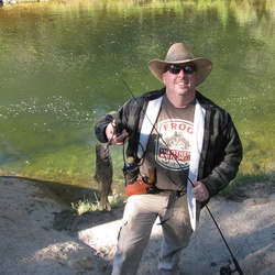
We love this hike. Starts at 10,200 ft elevation, so don’t do it on your first day in the mountains, but mostly flat (about 500 ft elevation gain on granite stairs in a few places), and all along a creek and multiple lakes. Gorgeous views, and you can hike back really as far as you want. Long Lake is a good place to turn around, for a five miler.
★
★
★
★
★

Amazing from lakes all the way to the summit, except the bit where I got off track. 😋
★
★
★
★
★

It’s steep! But the views are worth it. On the way back down you get sweeping views of all the Mammoth Lakes.
Part way up the trail you’ll get to a fork, to the left is dragons back, middle is seven lakes loop and right is to a lava tube.
I prefer to make it a loop, go up the middle path towards seven lakes loop. On the way back down, take the dragons back trail.
★
★
★
★
★

This is a relatively easy and scenic loop to two high alpine lakes, with lots of craggy mountain vistas a few lakes and even some rushing creeks for good measure.
★
★
★
★

 stars
stars
Beautiful trip down a section of the JMT. I wrote the above description, so enjoy.
★
★
★
★
★

This hike is gorgeous and very interesting. Between Sherwin and Valentine you walk through some twisty, short and fat cedar trees of some sort. Need to learn more about them! Not too hard but long, over 11 miles RT.
★
★
★
★
★

This was one of the toughest hikes compared to 6 peaks. We started around 1AM and luckily the weather was excellent!
★
★
★
★
★
stars
See my description above. Great moderate hike to an Alpine Lake.
★
★
★
★


First 2 1/2 miles no water very rocky throughout the hike. 5 miles up a canyon. Pretty once you get there.
★
★
★
★
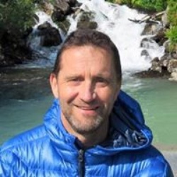

Awesome hike. With waterfall. Tiring in the heat. Go early to avoid heat. Take snacks to chill at waterfall.
★
★
★
★
★

Mountaineers Route up Mt Whitney. Great less traveled way up to the highest point of the lower 48.
★
★
★
★
★

Completed this hike on my birthday, June 30th. Gorgeous, well-maintained trail with great views.
★
★
★
★
★
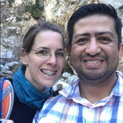
Mount Whitney is not for the faint of heart. It is gorgeous though. In one day you can pass through three seasons. From summer to spring to winter but the hike is definitely strenuous. Started at 4:30 am and finished at 7 pm.
★
★
★
★
★

Very beautiful lakes and mountains surrounding. Had a nice swim at Shadow Lake and camped at Garnet Lake. Thousand Island Lake was spectacular on the way back to Agnew Meadows. Highly recommend cooling off in that lake as well as Shadow Lake. Mosquitoes were only bad in the evening and morning at Garnet Lake. Going along the ridge after thousand island had some neat lookouts but if I were to do this again, I’d try and camp at thousand island lake and just do an out and back along shadow creek trail.
★
★
★
★

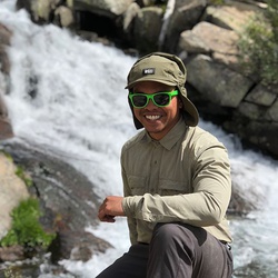
July 2020 Midday
Lots of mosquitoes near lakes, dry and sun blasted otherwise
Tough climb with heavy pack and dog
★
★
★
★

Super fun trail to run. Good flat sections along the ascent and not too steep of a decent.
★
★
★
★

This was a two track road that I ride my mtn bike on, the the uphill was hard but the down hill was worth it.
★
★
★
★
★


Short hill then a long level section, about 2 miles, then about 1400’, steep. Followed by long gradual, grade, about 1/4 mile, followed by steep to the top of Boundary with a little minor Route finding.
★
★
★
★
★
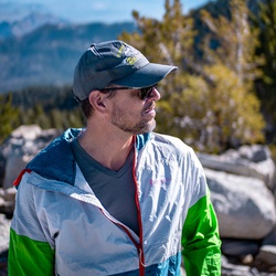 stars
stars
This is a moderate to easy Jeep trail with a couple of more difficult rocky sections. Papoose Flat has several good primitive camping sites with excellent views of the Eastern Sierra. Note, there is no water on the flat. One can return on the same road or head out in the opposite direction on a far more difficult track that drops into Marzouka.
★
★
★
★
★

Difficult, with a steep accent but well worth it. Stunning views, streams crossing the trail in several spots, saw golden trout in the lake and in the stream. Also saw a red weasel catch a chipmunk. Great hike. Legs are sore today.
★
★
★
★
★
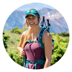
I liked this hike, it was at higher elevation so a bit cooler than other hikes down in mammoth, also there weren’t many people at all on the trail. It’s downhill on the way in so be prepared to hike uphill on the way back. A great short 2-hour hiking workout.
★
★
★
★
★
Good views, but really dusty. And gets hot from all the exposure the trail has. Also lots of mtn bikers on the trail. Not my top pick for hiking in Mammoth but not bad either.
★
★
★

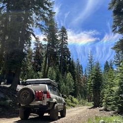
This was off-roading nice drive. Took my stock gx470 up there no worries.
★
★
★
★
★

First day on the dirt bike trails between Mammoth & June. Good climbs and sandy pull areas
★
★
★
★
★


Beautiful views of Mono Lake and Sierra mountains. Part of way is along clear running stream. Ends at picturesque Parker Lake.
★
★
★
★
★


Started on Saturday 1am but didn’t get to the trail camp until 12pm. Totally underestimated altitude sickness and overpacked food.
Camped at trail camp for one night. It was quickly getting cold after 5pm as the shadow of the mountain covered the campground. Sun went down around 6:30pm.
Started Sunday morning around 8am to the summit. Finally got to the top at 2pm and got back down to trail camp around 6pm.
Collected all camping gear and headed down in darkness around 7pm. Got back to trailhead parking lot at 0:30am Monday.
★
★
★
★
★
 stars
stars
We hiked the figure 8 trails around Saddle Bag Lake and 20 Lakes, continuing out & back to Conness Lake. This hike takes place in the Inyo National Forest, Hoover Wilderness, just out of the Yosemite National Park. In fact, the Conness Peak lies on the dividing line between these two areas. The figure 8 loop around Saddle Bag Lake and 20 Lakes brings one to owe of the natural beauty all around the area. This moderate hike, to which we added an out & back segment to Conness Lakes where we were able to observe rock climbers at the Conness Peak. Pretty amazing area.
★
★
★
★
★
stars
As always - hiking the Sierra Nevada mountains and lakes provide us with amazing views and beautiful trails. We started this hike at the Silver Lake trailhead, a short distance from the Village of June Lake. The trail ascends immediately, reaching Agnew Lake, from which we continued to Clark Lakes, and ending at 1000 Island Lake at the base of Mount Davis and Munt Ritter and Minarets. where glaciers still exist. The weather was magnificent and there were many backpackers planning to camp near 1000 Island Lake (aka "1000 Tents Lake" as one of them joked to me). I would rate this hike as difficult, mainly due to the long climb, and due to some of the trails not being maintained where we walked on somewhat unstable areas with scree. My stats (Using GAIA GPS) were 15.5 miles and 3,645 Ft of total ascent (out and back hike). Part of the hike was actually on a portion of the PCT!
★
★
★
★
★
This hike has some easy sections (near the start and then just before the lake). The rest of the trail is steep, rocky and 1 rather tough creek crossing. The hiking seemed tougher coming down due to tired bodies and the steep rocky trail.
I would rank the trail as Moderate rather than Easy, but then again we are 80 years old.
★
★
★
★

I recommend this trail as a nice way to return to Agnew Meadows from Thousand Island lake. It follows the river for the most part and has lots of tree coverage. There are numerous water falls to enjoy.
★
★
★
★
This is a rugged hike on a use trail starting near Thousand Island lake. We did this hike in September and had to use crampons and ice axes to cross a sizable snow field. Along the way we passed boulder fields and lush sub alpine meadows filled with streams and wildflowers.
Two of us continued on to summit Mt. Ritter via the SW route. They returned to camp at 9pm after starting at 6am.
★
★
★
★
★

This hike is a short distance but very steep and unmaintained. Going downhill is more difficult than up, due to slipperiness and large steps off of rocks onto unstable areas. Best for fit people. Gorgeous though!
★
★
★
★

The Laurel Canyon hike is 4.5 miles to the Laurel Lakes and the elevation gain is about 2700 ft. The trail is on an old mining road that hugs Laurel Mountain. I rated the hike only four stars due to the mining road, however the scenery in Laurel Canyon is five star spectacular.
The first 1.5 miles is pedestrian as one marches up the moraine. Be careful of the “no-see-ems” as they can be nasty. Then the road takes a turn and the splendor of the canyon is exposed. You will be treated to a magnificent water fall/rapids and the valley is teaming with wildlife.
During my hike the mountains were snow capped, the wildflowers in full bloom, adding to the peaceful setting. In summary a wonderful hike.
★
★
★
★

Bit of a pain to do late in the day...heat..
Otherwise very nice to have a cold beer at Mammoth Brewery to finish off.
★
★
★
★

This is the best hike in the Mammoth Lakes Area. Quick access from lake George. Short steep and beautiful alpine scenery!
★
★
★
★
★

Summited 7/29/19 Very difficult but breathtakingly beautiful. Still a little snow right before the summit but I heard you can just scramble up the rocks, I just took the snow trail without micro spikes. This is the big one!
★
★
★
★
★
 stars
stars
This is a beautiful hike, but mosquitos are hatching so be prepared and have proper protection ( head net, deet, ect). There is some snow around 10000 ft. and the trail will be wet in areas.
★
★
★
★
★
stars
Trail is looking great, wet in areas but that shouldn't stop you. Snow fields are still covering trails around 10000 ft. but were being cleared before the T- storms started. Mosquitos are a problem right now due to standing water. Wear proper protection.
★
★
★
★
★

Pretty hike that crisscrosses the tram tracks several times as it climbs, with great views of Horsetail Falls, but — we weren’t blown away by Agnew Lake when we got up there. If you are into seeing the dam & spillway it’s cool, but the trail just stops at a random spot with a partial view of the lake and some big orange platform in the middle of it.
★
★
★

Long hike, saw four beautiful lakes. Mosquitos love these lakes.
★
★
★
★
★

Amazing lakes!! We just did 1st, 2nd and 3th lakes and it was beautiful!!
★
★
★
★
★


Nice little hike for kids. Beware that there’s a playground just north of the marina. Plan for some play timed you bring kids.
★
★
★
★
Easy, beautiful hike to Gem Lakes. Walk close to the creek at the beginning, then ascend up some rock steps (~150 feet) and once you get to the top of the incline, go to your left (east) and look down on Mack Lake. Continue down the trail and you can close to the shoreline of Mack Lake. Continue on gently going slight up and slight down-hill... pass the turnoff to Marsh Lake to your left and continue on to beautiful Heart Lake. During the summer it’s usually somewhat crowded here. Continue along the lakeshore and then head uphill until you are overlooking Box Lake. As you continue on towards Long Lake you will have to do a stream crossing... early in the season you will probably get wet... the deeper you get into summer and the snow melt has weakened, you can cross on the rocks rather easily. (There is a possibility that you can take a somewhat defined trail off to your right and get to Long Lake - and hope that the logs someone has placed to cross the creek at Long Lake are still there). After you arrive at Long Lake you will walk near the lake for ~ 0.5 miles then begin another ascent... this is probably the steepest part of the trail... near the top you will see a sign to the left (east) that points you to Chickenfoot Lake. Chickenfoot Lake usually has campers there, it’s a fairly decent size lake so there is plenty of room to still enjoy the peace and quiet. Continuing on... after another 0.5 miles or so, you can see Chickenfoot Lake on your left... as you go along you will see the remains of an old truck frame to your right... Remember, this trail use to be an old mining road back in the day... you will cross one more stream by walking over some specially placed rocks (much easier than the Ling Lake crossing)... you as you start ascending towards Morgan Pass, be on the lookout for a trail to your right... it is right after about 5-10 stair steps... there use to be a sign that pointed you to Gem Lakes, but the last 3-4 times I’ve been to Gem Lakes the sign is nowhere to be found. Go down this path looking to your north (right) and see several small lakes or ponds... then arrive at Gem Lakes and enjoy the magnificent turquoise blue color of the lake. Return the way you came.
One additional note, this trail is so popular that if you don’t make it to the trailhead by 0800-ish on summer weekends you will have to park about 0.3 miles down the road. And if you don’t make it there by 0900-ish you might find yourself parking 0.5-0.75 miles (or further) from the trailhead! (I speak from experience!) Weekdays are not quite as bad... you can add an hour to the above times and probably be ok...
Have a great hike!
★
★
★
★
★
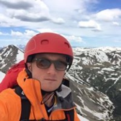

Jeep camping some by streams two nights in hotels to watch warriors basketball finals. Beautiful mountain views.
★
★
★
★

It is an easy beautiful hike with amazing views to the mountains and the lakes. We finished eating in the June Brewing and it was amazing!
★
★
★
★
★
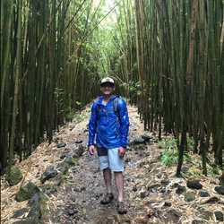
Beautiful hike back down the river trail. Nice and shady.
★
★
★
★
★

4 Months ago, 66, 43 lbs pack. Started in Onion Valley and spent the night at Flower Lake. Over the top to Bullfrog lake, out Whitney. The first day is always difficult, altitude is the culprit. That is why I spend the first night at Flower. The trail is not technically difficult, it it the altitude that will get to you. Once acclimated, then it is not hard, but that takes some time to get there. The lower lakes are wonderful.
★
★
★
★
★
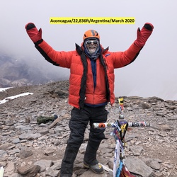
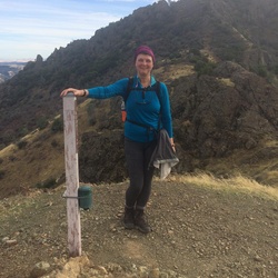 stars
stars
We made this as a first leg of a backpacking trip to the Iva Bell hotsprings. From the Rainbow Falls trailhead all the way down to the valley floor. As soon as the final descent brings down to the Fish Creek, there is a lot of flat relatively open space that works great for making camp. From that location, another 4 miles along the Fish Creek Trail will bring to the hot springs area. The pools take some time to find them, there are use trails that run in the general direction of the pools. Moving up the slope one gets from one pool to the next but not necessarily in a straight line. The pools are warm; some are cleaner than others; they also vary by the quality of the bottom material. It is heavenly to soak in the warm relaxing water and gaze into the vast valley under the deep blue sky. The official trails are well marked and cross many streams. On a sunny dry day in late September, the trail was quite dusty to trod.The Iva Bell hotsprings area seems to be popular - there were at least 3 camping parties and more passing through.
★
★
★
★
★


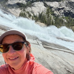


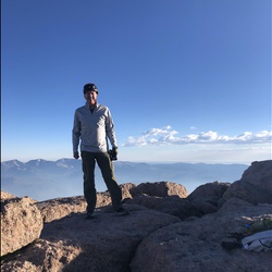


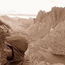
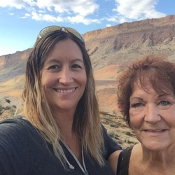


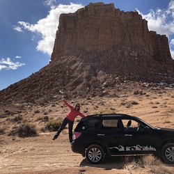


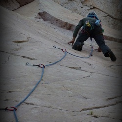


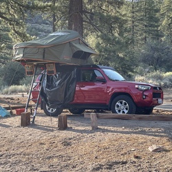


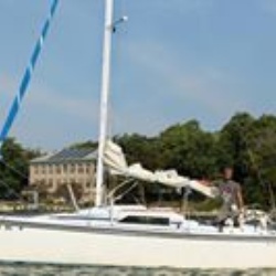


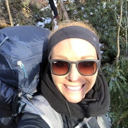


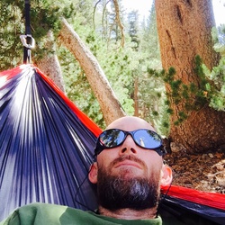

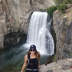


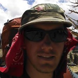


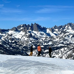


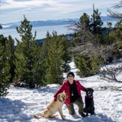


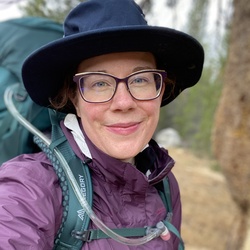


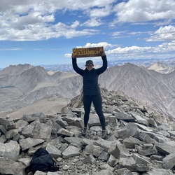

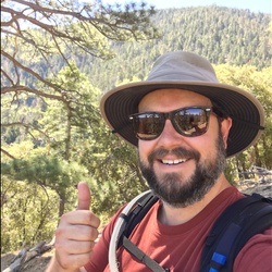


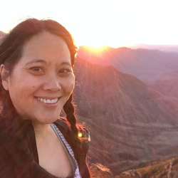


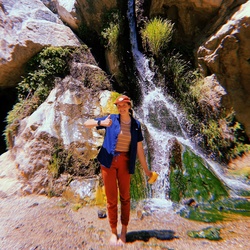


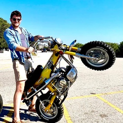


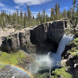


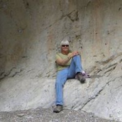


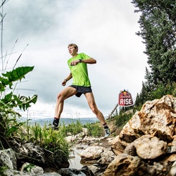


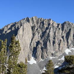


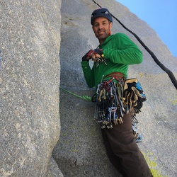

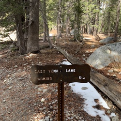


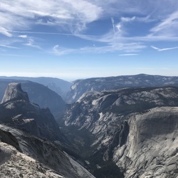


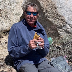


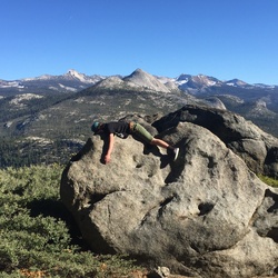


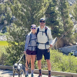


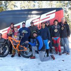


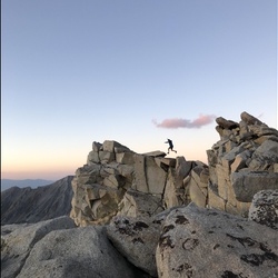


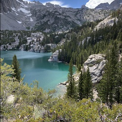


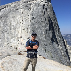


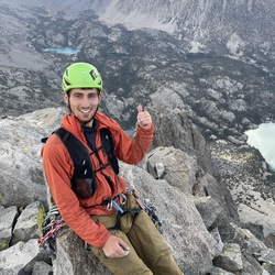


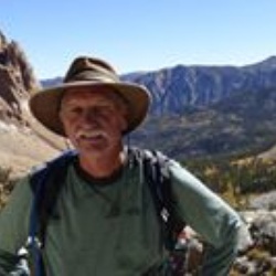


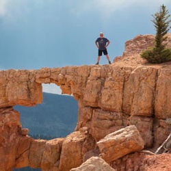
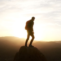


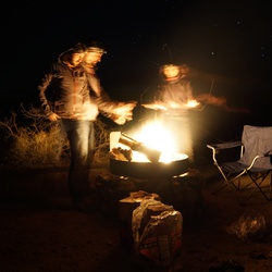


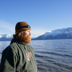


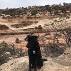


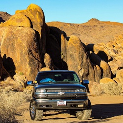


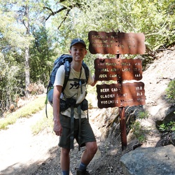


 stars
stars


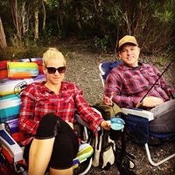

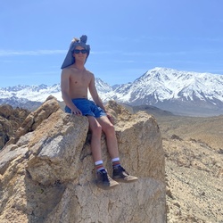


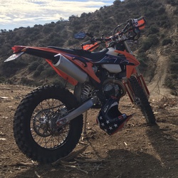


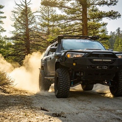


 stars
stars