Blue Ridge Parkway

Best Hiking Trails in Blue Ridge Parkway

200 reviews


link Copy Link email Email directions Driving Directions

Seasonal Popularity

Overview

Blue Ridge Parkway is a protected area in .


Resources

  • wikipedia

  • Hiking Trails (117)
  • Reviews (200)
  1. 1
    Graveyard Fields Loop including Upper Falls
    ★ ★ ★ ★ ★ EASY 3.1 mi
  2. 2
    Boone Fork Trail
    ★ ★ ★ ★ ★ EASY 4.7 mi
  3. 3
    Hwy 276 to Buck Spring Trail via Mountains-to-Sea Trail
    ★ ★ ★ ★ ★ EASY 1.5 mi
  4. 4
    Mount Pisgah
    ★ ★ ★ ★ ★ EASY 2.3 mi
  5. 5
    Raven's Roost Loop via Daniel Boone Scout Trail
    ★ ★ ★ ★ ★ MODERATE 6.2 mi
  6. 6
    Sharp Top Mountain via Sharp Top Trail
    ★ ★ ★ ★ ★ EASY 2.8 mi
  7. 7
    Price Lake Loop
    ★ ★ ★ ★ ★ EASY 2.2 mi
  8. 8
    Pigpen Knob via Boone Fork Trail
    ★ ★ ★ ★ ★ EASY 3.2 mi
  9. 9
    Nuwati Trail
    ★ ★ ★ ★ ★ EASY 2.9 mi
  10. 10
    Stony Bald via Shut-In
    ★ ★ ★ ★ ★ EASY 2.2 mi
    user_profile
    Trevor Parker 4 months, 1 week ago
    Masters Park to Lunch Rock
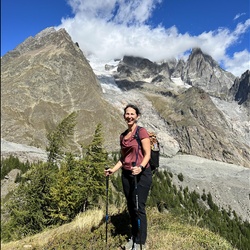
    Simple hike with a great view from lunch rock. Small parking lot and can be quite crowded. This cold Friday morning it was empty.
    ★ ★ ★ ★

    user_profile
    Kelly Langston 2 years, 5 months ago
    Pink Beds Loop
    This was a nice loop hike with slight ups and downs. It is pretty rooty, and in wetter weather I can see where it would be muddy. On a chilly, but clear November day, it was lovely to get out, breath the fresh air. I also like the visibility with all the leaves off the trees. If you want an easy hike, this is one for you.
    ★ ★ ★ ★

    user_profile
    MeekTempest8622 2 years, 9 months ago
    Pink Beds Loop
    A very pretty, level hike through laurel, pines , and meadow. Lots of stream crossings with well maintained bridges. Not crowded on a Saturday in August. The picnic area looks pleasant and ample, though the supposed toilets were not in evidence.
    ★ ★ ★ ★

    user_profile
    CraftyVine1201 2 years, 10 months ago
    Rough Ridge Overlook to Rough Ridge Lookout - Grandfather Mountain, NC, Avery County, NC, USA
    Great little hike. Dog friendly. Some steep sections. Lots of medium boulders. Great views. Moderate to medium trail - short but lots of rocky sections to traverse. Mostly thru the foliage.
    ★ ★ ★ ★ ★

    user_profile
    eischlag1 2 years, 11 months ago
    Pink Beds
    Truly hit peak mountain Laurel and flame azalea on this hike today!
    ★ ★ ★ ★ ★

    user_profile
    Jeni Holla 3 years ago
    Track (5/27/23, 11:48:15AM)
    Nice easy loop. Trails well marked, and well maintained. Got to see the mountain laurel blooming (end of May).
    ★ ★ ★ ★

    user_profile
    CalmTempest7362 3 years, 9 months ago
    Linville Falls Hike (8/14/22, 3:30:02PM)
    Walked the Erwin’s View Trail today with my family. The trail had 4 views/overlooks. Of them, I thought the Upper Falls Overlook was most impressive. Overall the trail was a reasonable and enjoyable workout for most members of the family. I felt a little underwhelmed by some of the other views and overlooks on this trail only because the falls were more distant than I would have liked. The Gorge View is great to look at but has no comparison to some of the other views you can see from Grandfather Mountain. Overall, this trail had me leaving feeling satisfied due to it’s walkability and I would walk it again with a friend.
    ★ ★ ★

    user_profile
    DeepEGels2037 4 years, 2 months ago
    Rough Ridge Overlook (3/5/22, 1:51:02)
    A challenging hike for those who are looking to begin into hiking. It has a couple of absolutely stunning overlooks and great places for photos with friends or family.
    ★ ★ ★ ★ ★

    user_profile
    LongCanoe9242 4 years, 7 months ago
    Track (10/23/21, 4:03:57PM)
    Kids area to learn about 120 years of forestry service
    ★ ★ ★ ★

    user_profile
    LongCanoe9242 4 years, 7 months ago
    Track (10/23/21, 4:03:57PM)
    Kids area to learn about 120 years of forestry service
    ★ ★ ★ ★

    user_profile
    BrightPoncho7074 4 years, 7 months ago
    Pink Beds Loop Pisgah 400 with kids
    Beautiful loop with spring ephemerals and ferns.
    ★ ★ ★ ★

    user_profile
    StrongAlder4334 4 years, 11 months ago
    Hike across Flat Top (3/27/21, 8:55:31AM)
    Four folks, two French Bulldogs and a cool morning. Unable to park where we would end the hike but decided to continue with the plan to walk across Flat Top Mountain. Reached the summit, continued across. The trail was littered with debris, not many hikers due to the parkway being closed. As we reached the bottom of the mountain, the rain started. We still had a mile to walk. The rain was light and the car was a welcome sight.
    ★ ★ ★ ★

    user_profile
    Mike 5 years, 2 months ago
    Sharp Top - Sunrise (2/6/21, 5:20:39AM)
    The trail was in good shape. Due to the weather however it is rather slick with the packed down snow, but still manageable. Would recommend hiking boots and for now crampons if you have them.
    ★ ★ ★ ★

    user_profile
    QuickLowland5309 5 years, 4 months ago
    Boone Fork Combination, Watauga County, NC, USA
    Easy hike, trails in good shape. Much along Boone Fork. Winter access to Boone Fork and Grandfather Mt. trails when Parkway is closed. Quiet of closed BRP allows clear hearing of Boone Fork running.
    ★ ★ ★ ★ ★

    user_profile
    FaintSail4842 5 years, 5 months ago
    Linville trails
    Trail to the basin was worth the trek. Gets crowded in the afternoon
    ★ ★ ★ ★

    user_profile stars
    Clowman 5 years, 6 months ago
    Upper falls view via Linville Falls Trail
    Excellent view from each of the overlooks. Be sure that you hit both overlooks at the end at Erwin's View. There were many people on this hike on a wonderful November morning. Dog and kid friendly.
    ★ ★ ★ ★ ★

    user_profile stars
    Clowman 5 years, 6 months ago
    Erwins view
    Excellent views. Lots of people on this trail today.
    ★ ★ ★ ★

    user_profile stars
    Clowman 5 years, 6 months ago
    Plunge Basin
    The hike to the plunge basin was just a little muddy and some trees to cross due to them fallen over I. The last storm. Bathrooms still closed but port a Johns in place
    ★ ★ ★ ★

    user_profile
    whoopacan_overland 5 years, 7 months ago
    Flat Top Trail
    Wonderful 360 views. Worth the very rocky trails when you reach the tops
    ★ ★ ★ ★

    user_profile
    HappyStorm9377 5 years, 8 months ago
    Johnson’s farm trail
    Good starter trail with a beautiful farm house. Try it!
    ★ ★ ★ ★

    user_profile
    HappyStorm9377 5 years, 8 months ago
    Johnson’s farm trail
    Good starter trail with a beautiful farm house. Try it!
    ★ ★ ★ ★

    user_profile
    HappyStorm9377 5 years, 8 months ago
    Johnson’s farm trail
    Good starter trail with a beautiful farm house. Try it!
    ★ ★ ★ ★

    user_profile
    HappyStorm9377 5 years, 8 months ago
    Johnson’s farm trail
    Good starter trail with a beautiful farm house. Try it!
    ★ ★ ★ ★

    user_profile stars
    Clowman 5 years, 8 months ago
    Storyteller Rock via Nuwati Trail
    Trail was dry. Passed a lot of people and dogs. All were friendly. Rocky terrain. I loved it
    ★ ★ ★ ★

    user_profile
    HardCreek2855 5 years, 9 months ago
    Mount Hardy
    Trails follows old grade most of the way til mount Hardy summit trail. Very nice
    ★ ★ ★ ★ ★

    user_profile
    YoungAlder9094 5 years, 9 months ago
    Linville and Duggers falls
    This is a great trail for families and those who need an easy hike. Multiple smaller waterfall views if you take all the trails. Rated 4 stars because I prefer a more secluded, off the beaten path type hike.
    ★ ★ ★ ★

    user_profile
    YoungAlder9094 5 years, 9 months ago
    Linville and Duggers falls
    This is a great trail for families and those who need an easy hike. Multiple smaller waterfall views if you take all the trails. Rated 4 stars because I prefer a more secluded, off the beaten path type hike.
    ★ ★ ★ ★

    user_profile stars
    Mark S 5 years, 9 months ago
    Mountains to Sea Trail: Mile High Campground to Oconaluftee Visitor Center (8/8/20)
    This is primarily a road walk section of the MTS. Not really recommended unless you are thru-hiking or section hiking the entire trail. The dirt roads on the Qualla Boundary are pleasant, but the Parkway has heavy traffic, limited shoulders, and blind curves.
    ★ ★

    user_profile
    SlimRappel3928 5 years, 10 months ago
    Track (7/25/20, 6:41:04AM)
    Very difficult, did it in two days. Loved it
    ★ ★ ★ ★ ★

    user_profile
    SlowStar6544 5 years, 10 months ago
    Big Creek in Mills River Rec area (7/5/20, 9:54:45AM)
    The 1st mile and a half down to the old Hendersonville reservoir is just a gravel road. It is mostly shady but still gravel and hilly. After you cross the bridge at the reservoir (see photo) onto the big creek trail you walk along big creek on a real forest trail that is nice and level and very shady.
    ★ ★ ★

    user_profile
    QuietAurora5904 5 years, 10 months ago
    Sharp Top
    This is a great hike. Very steep in some places, but stairs help. Great views on top and most of the trail is in shade.
    ★ ★ ★ ★ ★

    user_profile
    mApjITrr 5 years, 11 months ago
    Bearwallow Brook to Biltmore Campus
    Very easy hike. Definitely should not rated as difficult. Beautiful trail!
    ★ ★ ★ ★ ★

    user_profile
    SafeCycle7915 6 years ago
    Track (5/9/20, 8:18:40AM)
    Grassy Gap is a wide trail, but several wet creek crossings. Bluff Ridge is a steep climb but beautiful views.
    ★ ★ ★ ★ ★

    user_profile
    Robyn Brooks 6 years, 1 month ago
    Slate Rock Pilot Cove (4/11/20, 10:44:01AM)
    Second time doing this hike. You can go counter clockwise and have the views towards the end of the hike or go clockwise and get to Slate Rock near the beginning. We went counter clockwise both times. That direction provides a cardio climb over 600ft then you level off towards the lookout. Slate Rock views are awesome. Many people hike to Slate Rock clockwise and return same way. Depends on your fitness level. Parking area is about 6.6 miles on right from where the gravel forest road begins.
    ★ ★ ★ ★ ★

    user_profile
    LongRaceBib7660 6 years, 3 months ago
    1915 Climax Locomotive Loop via Pink Beds Loop
    Beautiful hike with lots of laurel and rhododendron. Distance might be an issue for some hikers, but I would in no way rate this as difficult. Relatively little elevation change.
    ★ ★ ★

    user_profile
    LastCompass2745 6 years, 7 months ago
    Abbott Lake
    Short easy path around the lake, paved and quiet.
    ★ ★ ★ ★

    user_profile
    LastCompass2745 6 years, 7 months ago
    Sharp Top
    We took the shuttle to the top so we mostly only had to hike down. It was beautiful but the rock steps can be difficult to maneuver around. Not recommended for anyone with knee issues.
    ★ ★ ★ ★

    user_profile
    LastCompass2745 6 years, 9 months ago
    Track (8/24/19, 5:49:35PM)
    Super short and easy trail but beautiful waterfall and little hidden gem. It was quiet and secluded. Very different form the main hikes at Linville Falls.
    ★ ★ ★ ★ ★

    user_profile
    LightRain2167 6 years, 10 months ago
    Sharp Top Mountain via Sharp Top Trail
    I do this hike a lot with friends. It’s easy and fun!
    ★ ★ ★ ★

    user_profile
    William Burgess 6 years, 11 months ago
    Track (6/20/19, 9:48:46AM)
    Excellent hike through Rhododendron‘s,mountain laurel,fields of ferns along streams. Relatively flat. Some beautiful areas. Not much elevation changes
    ★ ★ ★ ★ ★

    user_profile
    adamhand 7 years, 1 month ago
    Very steep in the second half. Avoid when raining, as the descent could be quite dangerous. Awesome view though.
    ★ ★ ★ ★ ★

    user_profile stars
    Mark S 7 years, 6 months ago
    A nice, short hike off the Blue Ridge Parkway. The entire way is on a gravel carriage road that is closed to vehicles. The woods have grown up around the summit tower, but there are still distant views over the treetops. The trail passes through large open fields which reminded me of England. Rated three stars because of crowds.
    ★ ★ ★

    user_profile
    TDP1222 7 years, 7 months ago
    Hiked on 10-7-18. Was hoping for more fall color but it is a little later this year. Hiked this same hike a few years back on first Friday of October and colors were at peak. Easy hike. Mostly flat. Very muddy after any rain at all. A lot of secondary trails have been made by hikers to go around the bigger mud holes. Falls had much less water on this trip compared to a few years back. Can get crowded on weekends. I hiked out to falls about 4:30 PM and passed more people than I could even count who were returning from the falls. When I arrived there were only two couples at the base and a few people above the falls. Within 10 minutes they were all gone and I had it to myself.
    ★ ★ ★

    user_profile
    emilydianehoover 1 week, 1 day ago
    Chestnut Bald
    ★ ★

    user_profile
    LastBelay6394 1 month ago
    Sunday Lunch Activity
    ★ ★ ★

    user_profile
    HÉLÈNE LAPIERRE 1 month ago
    FLAT TOP MOUNTAIN aller/retour
    ★ ★ ★ ★ ★

    user_profile
    Ricky Sawyers 1 month, 4 weeks ago
    Caudill Cabin via Basin Creek Trail and Grassy Gap Fire Road
    ★ ★ ★ ★ ★

    user_profile
    Gabriel Herrera 2 months ago
    Sunday Morning Backpacking
    ★ ★ ★ ★ ★

    user_profile
    GrandSwimCap5268 3 months ago
    Sharp Top Mountain via Sharp Top Trail
    ★ ★ ★ ★ ★

    user_profile
    Pay Day 4 months, 3 weeks ago
    MST
    ★ ★ ★ ★ ★

    user_profile
    Sarah Hendriksen 5 months, 2 weeks ago
    MST to buckeye gap split
    ★ ★ ★ ★ ★

    user_profile
    emilydianehoover 7 months ago
    Storyteller Rock via Nuwati Trail
    ★ ★

    user_profile
    Lawrence Gillen 8 months, 3 weeks ago
    Saturday Afternoon Mountain Biking
    ★ ★ ★ ★ ★

    user_profile
    ThinWetsuit4326 8 months, 4 weeks ago
    Boone Fork
    ★ ★ ★ ★ ★

    user_profile
    QuickWatch7415 9 months ago
    Rough ridge hike
    ★ ★ ★ ★ ★

    user_profile
    emilydianehoover 9 months ago
    Raven's Roost Loop via Daniel Boone Scout Trail
    ★ ★

    user_profile
    William Chandler 9 months, 1 week ago
    Friday Lunch Activity
    ★ ★ ★ ★ ★

    user_profile
    jowo411 9 months, 4 weeks ago
    Thursday Lunch Activity
    ★ ★ ★

    user_profile
    jowo411 1 year ago
    Sunday Afternoon Activity
    ★ ★ ★ ★ ★

    user_profile
    QuickBoulder3535 1 year, 1 month ago
    Boulder Field to Rough Ridge Round Trip
    ★ ★ ★

    user_profile
    Thomas Mabry 1 year, 1 month ago
    Badger and Epicity Falls
    ★ ★ ★ ★ ★

    user_profile
    Leah 1 year, 4 months ago
    1915 Climax Locomotive Loop via Pink Beds Loop
    ★ ★ ★ ★ ★

    user_profile
    LightFir2330 1 year, 4 months ago
    Pisgah case camp to parkway Morning Activity
    ★ ★ ★ ★

    user_profile
    SlimSail7281 1 year, 8 months ago
    Thursday Morning Activityrough butt to high meadow
    ★

    user_profile
    ZippyHazel1564 1 year, 8 months ago
    Sharp Top Mountain, VA
    ★ ★ ★ ★ ★

    user_profile
    KeenDune9288 1 year, 9 months ago
    Mtn to the sea
    ★ ★ ★ ★

    user_profile
    BusyForest5741 1 year, 11 months ago
    Track (6/25/24, 6:22:55AM)
    ★ ★

    user_profile
    LongBluff8409 2 years ago
    MST Balsam Gap-Mt Mitchell Rd.
    ★ ★ ★ ★

    user_profile
    PureOlive7038 2 years, 6 months ago
    Waterrock Knob
    ★ ★ ★ ★

    user_profile
    peakbagger 2 years, 6 months ago
    Mount Hardy Summit From NC Hwy 215
    ★ ★ ★ ★

    user_profile
    RareCloud6726 2 years, 7 months ago
    Otter
    ★ ★ ★ ★ ★

    user_profile
    TameSurf5902 2 years, 7 months ago
    Wilson Creek overlook to Rough Ridge and back to BRP
    ★ ★ ★ ★ ★

    user_profile
    Robyn Brooks 2 years, 8 months ago
    Tanawha Trail from Rough Ridge (9/13/23, 10:33:42AM)
    ★ ★ ★ ★ ★

    user_profile
    MistyReef3954 2 years, 8 months ago
    Peaks of Otter Trail
    ★ ★ ★ ★ ★

    user_profile
    GrizzledWild5213 2 years, 8 months ago
    Rehab Trail (9/3/23, 09:07:55)
    ★ ★ ★ ★

    user_profile
    GrizzledWild5213 2 years, 8 months ago
    Rehab Trail (9/3/23, 09:07:55)
    ★ ★ ★ ★

    user_profile
    LongTree2713 2 years, 9 months ago
    Track (7/29/23, 11:32:17AM)
    ★ ★ ★ ★

    user_profile
    VastShore2661 2 years, 10 months ago
    Track (7/29/23, 1:02:49PM)
    ★ ★ ★

    user_profile
    jbowen6116 2 years, 10 months ago
    NCHPTA/MST 128-Walker Knob Overlook (7/7/23, 9:07:52AM)
    ★ ★ ★ ★ ★

    user_profile
    WiseAlder2431 2 years, 11 months ago
    Tanawha Trail
    ★ ★ ★ ★ ★

    user_profile
    DarkBoulder2886 3 years ago
    Pink Beds Trail
    ★ ★ ★ ★ ★

    user_profile
    Gary Doyon 3 years ago
    Pink Beds Loop Trail to Bearwallow Brook, Transylvania County, NC, USA
    ★

    user_profile
    SnowyPaddle8863 3 years, 1 month ago
    Track (4/15/23, 09:20:47)
    ★ ★ ★ ★ ★

    user_profile
    dbanks7202 3 years, 1 month ago
    Track (4/4/23, 11:30:11AM)
    ★ ★ ★ ★ ★

    user_profile
    FastSummit2694 3 years, 1 month ago
    Track (3/30/23, 6:21:02PM)
    ★

    user_profile
    tgraden1433 3 years, 2 months ago
    MST-Green Mtn.
    ★ ★

    user_profile
    Bill 3 years, 2 months ago
    Herrin Knob via Lake Logan Road
    ★ ★ ★ ★ ★

    user_profile
    WildDelta9705 3 years, 3 months ago
    Case Camp Seniard Ridge loop
    ★ ★ ★ ★ ★

    user_profile
    WildMtBoots1363 3 years, 3 months ago
    Looking glass/ graveyard fields
    ★ ★ ★ ★ ★

    user_profile
    TrueSkis7633 3 years, 4 months ago
    Pink beds 1
    ★ ★ ★ ★ ★

    user_profile
    StrongCliff3905 3 years, 7 months ago
    Track (10/20/22, 2:45:48PM)
    ★ ★ ★ ★ ★

    user_profile
    QuickGlen9650 3 years, 7 months ago
    Track (10/22/22, 9:10:39AM)
    ★

    user_profile
    jowo411 3 years, 7 months ago
    Track (9/28/22, 3:44:38PM)
    ★ ★ ★ ★ ★

    user_profile
    LongBluff8409 3 years, 8 months ago
    Doughton Basin Creek Trail
    ★ ★ ★

    user_profile
    RawTerrace3091 3 years, 9 months ago
    Track (8/7/22, 11:21:28AM)
    ★ ★ ★ ★

    user_profile
    CleanCliff1101 3 years, 9 months ago
    Nuwati to Cragway to Daniel Boone Loop
    ★ ★ ★ ★ ★

    user_profile
    VastRaceBib4158 3 years, 9 months ago
    Track (7/26/22, 1:40:56PM)
    ★ ★ ★ ★ ★

    user_profile
    SlimClimb7234 3 years, 11 months ago
    Doughton Park Perimeter Hike
    ★ ★ ★ ★ ★

    user_profile
    StrongCliff3905 3 years, 11 months ago
    Track (6/9/22, 4:18:31PM)
    ★ ★ ★ ★ ★

    user_profile
    Kate 3 years, 11 months ago
    Pink beds
    ★ ★ ★ ★ ★

    user_profile
    PalePlateau9297 3 years, 11 months ago
    Track (5/31/22, 12:01:44PM)
    ★ ★ ★ ★ ★

    user_profile
    Evan Jarmol 4 years ago
    Track (4/1/22, 11:58:51AM)
    ★ ★ ★ ★ ★

    user_profile
    CleanCliff1101 4 years ago
    Linville Falls
    ★ ★ ★ ★ ★

    user_profile
    GlitzyCanteen1029 4 years ago
    Top Crag View Loop via Nuwati Trail
    ★

    user_profile
    wahhky 4 years, 1 month ago
    Daughton loop
    ★ ★ ★ ★ ★

    user_profile
    ChirpyLeaf8985 4 years, 1 month ago
    Tanawha Trail
    ★ ★ ★ ★ ★

    user_profile
    FaintElm3458 4 years, 2 months ago
    Track (3/5/22, 8:59:45AM)
    ★ ★ ★ ★ ★

    user_profile
    jowo411 4 years, 3 months ago
    Track (2/27/22, 3:13:01PM)
    ★

    user_profile
    Sam Rule 4 years, 4 months ago
    Green Knob-Snokes Nose - celo guy hike
    ★ ★ ★ ★ ★

    user_profile
    FastRavine8471 4 years, 5 months ago
    1915 Climax Locomotive Loop via Pink Beds Loop
    ★ ★ ★ ★ ★

    user_profile
    HeroicWetsuit5095 4 years, 5 months ago
    Track (12/7/21, 11:14:00AM)
    ★ ★

    user_profile
    SilentDelta7669 4 years, 6 months ago
    Linville Falls (11/24/21, 11:04:27)
    ★ ★ ★ ★

    user_profile
    Scott Gustafson 4 years, 6 months ago
    Track (11/15/21, 12:26:01PM)
    ★ ★ ★ ★ ★

    user_profile
    WJS1962 4 years, 6 months ago
    Tanawha Trail from Rough Ridge to Wilson Creek Overlook
    ★ ★ ★ ★

    user_profile
    HugeHike3483 4 years, 7 months ago
    Daniel Boone Scout Trail (5/24/20, 8:12:43AM)
    ★ ★ ★ ★ ★

    user_profile
    EasyMap5891 4 years, 8 months ago
    The Pink Beds Loop
    ★ ★ ★ ★ ★

    user_profile
    HugeLedge2032 4 years, 8 months ago
    Daniel Boone
    ★ ★ ★ ★

    user_profile
    MildIceAxe5644 4 years, 9 months ago
    Track (10/26/17, 1:28:09PM) 215 middle prong wilderness MST opposite mst trail to flat laurel loop
    ★ ★ ★ ★ ★

    user_profile
    ShyMound4796 4 years, 9 months ago
    MST west to Devil’s Courthouse
    ★ ★ ★ ★

    user_profile
    jowo411 4 years, 9 months ago
    Track (8/7/21, 10:39:47AM)
    ★ ★ ★ ★ ★

    user_profile
    LushXC-Ski8104 4 years, 9 months ago
    1915 Climax Locomotive Loop via Pink Beds Loop
    ★ ★ ★ ★ ★

    user_profile
    Joe Gajewski 4 years, 10 months ago
    Doughton Loop
    ★ ★ ★ ★ ★

    user_profile
    TameWild5864 4 years, 10 months ago
    Grandfather Mountain, NC - Boone Forks Parking to Profile Campsite
    ★ ★ ★ ★ ★

    user_profile
    Wayne DellaMaestra 4 years, 10 months ago
    MST from Pony Farm Road to NC Highway 16
    ★ ★ ★ ★

    user_profile
    ShyMound4796 4 years, 10 months ago
    MST west to Devil’s Courthouse
    ★ ★ ★ ★

    user_profile
    TallGlade5116 4 years, 11 months ago
    Daniel Boone Scout Trail
    ★ ★ ★ ★ ★

    user_profile
    bscoleman 4 years, 11 months ago
    Track (6/18/21, 11:06:15)
    ★ ★ ★ ★ ★

    user_profile
    bscoleman 4 years, 11 months ago
    Track (6/20/21, 09:58:19)
    ★ ★ ★ ★

    user_profile
    Wayne DellaMaestra 4 years, 11 months ago
    MST from Roe Hunt Road to Pony Farm Road
    ★ ★ ★ ★ ★

    user_profile
    Andrew Gibb 4 years, 11 months ago
    Track (5/13/21, 11:01:02AM)
    ★ ★ ★ ★

    user_profile
    bscoleman 4 years, 11 months ago
    Track (5/27/21, 17:13:53)
    ★ ★ ★ ★ ★

    user_profile
    ToughSwamp5637 4 years, 11 months ago
    Track (5/31/21, 8:04:06AM)
    ★ ★ ★ ★

    user_profile
    QuickReef4499 5 years ago
    Mount hardy falls base and from afar
    ★ ★ ★ ★ ★

    user_profile
    matt 5 years, 1 month ago
    Soco Falls
    ★ ★ ★

    user_profile
    DarkWBottle1980 5 years, 1 month ago
    Flat Top Loop from Lodge
    ★ ★ ★ ★

    user_profile
    KeenHazel5168 5 years, 1 month ago
    Buckeye Falls
    ★ ★ ★

    user_profile
    matt 5 years, 1 month ago
    Soco Falls
    ★ ★ ★

    user_profile
    matt 5 years, 2 months ago
    Soco Falls
    ★ ★ ★

    user_profile
    Mike 5 years, 2 months ago
    Flat Top
    ★ ★ ★ ★

    user_profile
    Nate Charlier 5 years, 2 months ago
    Cherokee
    ★ ★ ★ ★ ★

    user_profile
    Wayne DellaMaestra 5 years, 2 months ago
    Tanawha Trail from Rough Ridge Overlook
    ★ ★ ★ ★ ★

    user_profile
    FastRainbow8639 5 years, 3 months ago
    Haw Creek Hike One Way
    ★ ★ ★ ★ ★

    user_profile
    TameBay6256 5 years, 3 months ago
    1915 Climax Locomotive Loop via Pink Beds Loop
    ★ ★ ★ ★ ★

    user_profile
    bscoleman 5 years, 3 months ago
    Track (10/24/20, 09:46:0)
    ★ ★ ★

    user_profile
    CalmCanteen2855 5 years, 3 months ago
    Winter safari 2021
    ★ ★ ★ ★ ★

    user_profile
    olsonryan79 5 years, 3 months ago
    Track (2/6/21, 8:34:27AM)
    ★ ★ ★ ★

    user_profile stars
    DustyDune3313 5 years, 4 months ago
    Daughton Inner Loop (1/10/21, 5:23:40AM)
    ★ ★ ★ ★

    user_profile
    NdFWow5D 5 years, 4 months ago
    Widows Falls Loop via Widows Creek Trail and Mountains-to-Sea Trail
    ★

    user_profile
    Wayne DellaMaestra 5 years, 4 months ago
    MST from Sheets Cemetery to Roe Hunt Road
    ★ ★ ★ ★ ★

    user_profile
    Wayne DellaMaestra 5 years, 4 months ago
    MST from Darnell Woodie Road to Sheets Cemetery
    ★ ★ ★ ★

    user_profile
    SlimHeather6307 5 years, 4 months ago
    Asheville Mountain trail
    ★ ★ ★ ★ ★

    user_profile
    QuickReef4499 5 years, 4 months ago
    Wildcat Falls
    ★ ★ ★ ★ ★

    user_profile
    FaintRaft4068 5 years, 5 months ago
    View Cherry Cove via Case Camp Ridge Trail
    ★ ★ ★ ★ ★

    user_profile
    Wayne DellaMaestra 5 years, 6 months ago
    MST from South Laurel Fork Road to Darnell Woodie Road
    ★ ★ ★ ★

    user_profile
    CalmDawn1121 5 years, 6 months ago
    Track (11/7/20, 9:39:09AM)
    ★ ★ ★ ★ ★

    user_profile
    MildIceAxe5644 5 years, 6 months ago
    Don Davies Bartlett branch
    ★ ★ ★ ★

    user_profile
    ToughSwamp5637 5 years, 6 months ago
    Track (8/13/20, 8:21:20AM)
    ★ ★ ★ ★

    user_profile stars
    Clowman 5 years, 7 months ago
    Top Crag View Loop via Nuwati Trail
    ★ ★ ★ ★ ★

    user_profile
    QuickPeak7180 5 years, 7 months ago
    Top Crag View Loop via Nuwati Trail
    ★ ★ ★ ★ ★

    user_profile
    Scott Gustafson 5 years, 7 months ago
    Pink Beds 10/18/20, 1:00:26PM)
    ★ ★ ★ ★ ★

    user_profile
    Miles 5 years, 7 months ago
    Mount Hardy via MST and Mount Hardy Trails from Lake Logan Road
    ★ ★ ★ ★

    user_profile
    Freddie Hodges 5 years, 7 months ago
    Flat Top Hike
    ★ ★ ★ ★ ★

    user_profile
    BriskWatch5282 5 years, 7 months ago
    Mountain to the Sea Trail from Beech Gap to Buckeye Gap(9/26/20, 9:50:20AM)
    ★ ★ ★ ★ ★

    user_profile
    PureReef1623 5 years, 8 months ago
    Track (9/26/20, 10:21:51AM)
    ★ ★ ★ ★

    user_profile
    ChillyMist8093 5 years, 8 months ago
    1915 Climax Locomotive Loop via Pink Beds Loop
    ★

    user_profile
    Wayne DellaMaestra 5 years, 8 months ago
    MST from NC 18 to South Laurel Fork Road
    ★ ★ ★ ★

    user_profile
    Wayne DellaMaestra 5 years, 8 months ago
    Bluff Mountain Trail from Grassy Gap Fire Road to Basin Cove Overlook
    ★ ★ ★ ★

    user_profile stars
    FullPath5758 5 years, 8 months ago
    Boone - Nuwati to Flat Rock
    ★ ★ ★ ★

    user_profile
    SharpGlade3066 5 years, 9 months ago
    Linville Falls Area - Duggers Creek Falls and Erwins View Trail
    ★ ★ ★ ★ ★

    user_profile
    Michelle Reeder 5 years, 9 months ago
    Flat rock ridge
    ★

    user_profile
    SlowStar6544 5 years, 9 months ago
    MST - Mt. Hardy from 215 (8/10/20, 9:04:12AM)
    ★ ★ ★

    user_profile
    Markus Lachenmeir 5 years, 9 months ago
    Grandfather via Daniel Boone Scout Trail
    ★ ★ ★ ★ ★

    user_profile
    SoftGulch2503 5 years, 9 months ago
    Track (8/5/20, 10:39:15AM)
    ★ ★ ★ ★

    user_profile
    EdgyBinos7223 5 years, 10 months ago
    Rattlesnake Lodge
    ★ ★ ★ ★

    user_profile
    SnowyAlder2162 5 years, 10 months ago
    Up river Swannanoa
    ★ ★

    user_profile
    Lawrence Thompson 6 years ago
    Callaway peak with family, pookie, blazer, huckles, lucy, & hazel
    ★ ★ ★ ★

    user_profile
    DearGaze5845 6 years ago
    Track (5/7/20, 1:11:23PM)
    ★ ★ ★

    user_profile
    SteepEGels3792 6 years, 1 month ago
    Grassy Gap to Bluff Mtn and down Flat Rock Ridge (4/26/20, 7:42:17AM)
    ★ ★ ★ ★

    user_profile stars
    DustyDune3313 6 years, 2 months ago
    Tanawha Trail
    ★ ★ ★ ★

    user_profile
    StrongMtBoots2873 6 years, 2 months ago
    Rough ridge lookout
    ★ ★ ★ ★ ★

    user_profile stars
    DustyDune3313 6 years, 2 months ago
    Doughton Recreational Park Loop
    ★ ★ ★ ★

    user_profile
    SlowVine3796 6 years, 2 months ago
    Track (3/12/20, 10:16:40AM)
    ★ ★ ★ ★

    user_profile stars
    DustyDune3313 6 years, 2 months ago
    Caudill Cabin via Basin Creek Trail and Grassy Gap Fire Road
    ★ ★ ★ ★ ★

    user_profile stars
    DustyDune3313 6 years, 3 months ago
    Widows Creek Trail
    ★ ★ ★ ★

    user_profile
    richardgpumphrey 6 years, 4 months ago
    Track (1/29/20, 8:55:56AM)
    ★ ★ ★ ★ ★

    user_profile
    ArtsyDawn1347 6 years, 4 months ago
    215 to Devils Courthouse
    ★ ★ ★ ★ ★

    user_profile
    HeroicCanyon7425 6 years, 5 months ago
    1915 Climax Locomotive Loop via Pink Beds Loop
    ★ ★ ★ ★ ★

    user_profile
    Ronald Baker 6 years, 5 months ago
    Sharp Top Mountain via Sharp Top Trail
    ★ ★ ★ ★ ★

    user_profile
    hagersr59 6 years, 5 months ago
    Basin Creek Trail
    ★ ★ ★ ★ ★

    user_profile
    FastCycle1723 6 years, 5 months ago
    1915 Climax Locomotive Loop via Pink Beds Loop
    ★ ★ ★ ★ ★

    user_profile
    PrimBirch1055 6 years, 5 months ago
    Pink Beds Loop, Transylvania County, NC, USA
    ★ ★ ★ ★ ★

    user_profile
    NobleStorm1914 6 years, 7 months ago
    Chimney View Loop via Linville Falls Trail
    ★ ★ ★ ★ ★

    user_profile
    RareSwamp5655 6 years, 7 months ago
    MST - Haywood Gap to N.C. 215, NC
    ★ ★ ★ ★

    user_profile
    Whitney 6 years, 8 months ago
    Chimney View Loop via Linville Falls Trail
    ★

    user_profile
    HotFir7718 6 years, 11 months ago
    Little Sam to Courthouse Creek
    ★ ★ ★ ★

    user_profile
    CrispCanteen2807 6 years, 11 months ago
    ★ ★ ★ ★ ★

    user_profile
    beechwood.b 7 years ago
    Upper Boone Fork Trails
    ★ ★ ★

    user_profile
    RichXC-Ski4379 7 years, 1 month ago
    ★

    user_profile
    SteepHolly2151 7 years, 2 months ago
    ★

    user_profile
    Alexandra 7 years, 2 months ago
    ★ ★ ★