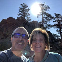
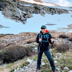
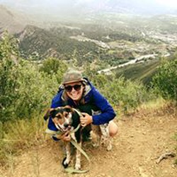
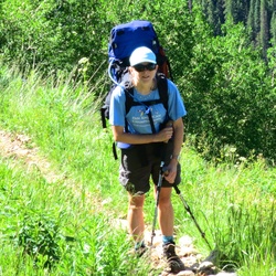
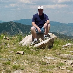
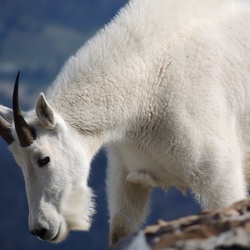
It was so beautiful! Saw so many mountains: the lake was beautiful, and I saw so many cute marmots and rodents. 360 degree beauty once you’re two miles out.
★
★
★
★
★

Misty day on this mountain. Through the trees for many switch backs then the glorious open views. Snowshoe hares and marmots near trail about their day.
★
★
★
★
★


An incredible trail with ever evolving and dramatic scenery. So quiet…
★
★
★
★
★

This hike was to Champion Peak. Absolutely gorgeous and a mine to explore. Highly recommended
★
★
★
★
★

This was my first 14er and I’m still soaking it all in. The hike was an absolute grind. There’s still some snow around 13,600+. Post holing by 11am so took the rocks instead. Lots of loose rock between the saddle and tree line to slip on descending. Trekking poles probably saved me from SAR and 5 o’clock news.
The views were incredible. Saw a bunch of lively, cute critters I’ve never seen before. Tons of wild flowers along the trail.
All around great experience but I’m glad it’s over. La Plata is doable as a beginner, but I’d recommend something easier first.
★
★
★
★
★

Decent trail for mule riding, pretty dry and lots of downed trees. Couldn’t make it to the top because downed trees got way too think. Several on the edge sections.
★
★
★
We rode our mules on this trail, the first 1.3 miles was along side a winding hill with breathtaking views. But all in the wide open. Once we hit the semi wooded trail it was a bit narrow for my liking and all sandy and dusty. But once at the top it was very pretty.
★
★
★

Great snowshoe hike. Beautiful scenery and so peaceful. Trail was difficult to find above 11500. Snow cover was around 6-7 feet at altitude
★
★
★
★
★


Nice trail and peaceful by creek. Trail to treeline is mix dirt/rock. Creek x’ing are easy late in summer. Hike/Game trail to upper drainage but are cairns scattered through. Talus grass to final ridge then rock to summit. Beautiful area.
★
★
★
★
★
It slapped! The trail was so well maintained which made it amazing! I highly recommend!
★
★
★
★

Good hike up to decent falls. Trail is well marked, about 400 ft elevation.
★
★
★
★

Another ColoradoTrail winning experience. The trail is always clear and plenty of shade and water for our dog.
★
★
★
★
★

Good hike. Tread was in good shape. Didn’t hike the last half mile because I didn’t want to cross the St Charles river. Fairly steep coming back out but not to long.
★
★
★
★

Winter hike. Had to break through fresh snow after first mile. Did not make the peak. Had to turn around about 11,000 feet due to waist deep snow. Beautiful winter day with some clouds and a couple of flurries while we hiked.
★
★
★
★

Boulder Field isn’t that tough if you have walked on rock before. Pretty self explanatory, just try to hug the ridge.
★
★
★
★

Great hike! Interlaken is worth seeing,uphill is rough at the turn then ok then tough at the top. Great views!
★
★
★
★

Beautiful day, we managed to avoid the rain the whole time. Going up wasn’t as horrible as I had expected. The summit was beautiful and not crowded. Going down was fast but torturous, as downhill return trips tend to be.
★
★
★
★
★


Hiked with my parents and my brothers, Biz, Ethan, Seth. Lots of pond and lots of aspen trees
★
★
★
★
★


The scramble at the top of Antero was a bit sketch due to the main trail being covered in a sheet of ice.
★
★
★


Not for the faint of heart. Prepare heavily beforehand. Early summer will require traction of some kind. With that said, the views are incredible. “6-8 hours estimated” seems very fast. We had one in our party experience complications on the way down with altitude sickness. Took 12 hours as a result. Plan accordingly
★
★
★
★
★

Underestimated the hike. Think of the terrain as a see saw. Constant change of elevation leading up to Mt Elbert. Still snow left on the main trail for the last 1.5 mile. Had to go around and scrabble on the rocks to make it through. Turned back with less than half mile to go. 25MPH wind gusts and no jacket affected me. I also ran out of food and my phone was going to die before making it down so I made the tough choice to turn back.
★
★
★
★
★

Spring hike to Hancock. Took the snowshoes, but never put them on. Hard packed through the morning. Down to the truck by 230. Slightly slushy at that time.
★
★
★
★
★

Beautiful! I did this on snowshoes pulling a sled of supplies (approximately 50 lbs). The first mile is a breeze. Then you climb a beast of a hill (I’d estimate about 500-600 feet) for about .5 of a mile. Then approximately 1 mile with manageable varied elevation gain of about 100 or so feet as you traverse Taylor Hill through the trees. You’re rewarded with a fun .25 mile drop down a snow field to the cabin. (Note: The cabin can be reserved via the 10th Mountain Hut Division.)
★
★
★
★
★

Late start but made some friends at the top. Parked .8 miles from TH and walked up the road… left at at 9:40am, back at car by 4pm roughly. Hiked in brand new boots I’m returning
★
★
★
★
★

Not very scenic til you get to the top. Look out for moose. I did not find this hike enjoyable. Thick high alpine forest the whole way.
★
★
★
It was a good hard 8.54 miles. Lots of big steep hills, ups and downs. Saw lots of mushrooms, flowers, water falls, creeks and lots of caves on a dome rock. Also saw a green snake and couple squirrels.
★
★
★
★
Started at 5am, set up camp along the way and summit red at 12pmish
★
★
★

This hike was steep and rocky most of the way. The last half mile to the top of Mount Shavano required climbing over boulders. The hike from the summit to Tabeguache Peak required climbing over boulders with no specific trail to the summit of Tabeguache. The total trail was 11 to 12 miles long with over 5,600’ of elevation gain. It was a very beautiful and fun hike.
★
★
★
★


We started at 0515 and reached Shavano at 0930. There was a lot of water running down the creek low on the trail which was a surprise this late in the year. 3L of water was just enough for Both peaks. The comments below remain valid about the road to the trailhead and abundant camping on the way up. The 14ers.com crew was working on the trail which was rocky but well maintained.
★
★
★
★

This was a fantastic trail. Nothing too difficult but beautiful scenery and plenty of excellent water crossings. It rained while we were on the trail which made things just a little bit more difficult but all in all it was a great adventure
★
★
★
★
★

The views by the South Colony Lakes are incredible - surrounded on all sides by mountains. And the hike to Humboldt Peak is only moderately difficult for a 14er.
★
★
★
★
★

Really technical jeep ride at start. I am running 37” Jeep Wrangler with a 4.5” lift and it still took a few runs to get up the first obstacle. Right after that is a very rocks shelf road. My wife walked that part. The whole thing was challenging really. I wouldn’t dream of running a stock vehicle up there. I tried to get up it last year with a 2” lift on 35} tires an couldn’t get up.
★
★
★

Classic Colorado. Nice wildflowers but no Columbine. Only two other hikers and two Ebikers on the entire 9 mile run. Parked .59 before the gate to save the RAV.
★
★
★
★

Beautiful scenery and modest inclines. Good workout and nice payoff at the falls. Be sure to go a little further left of the trail to the bigger falls
★
★
★
★
★


This is a good hike. The wreckage of the tunnel port near the top is pretty interesting but the final stretch to get over the ridge is not dog friendly. Very rocky and narrow.
★
★
★
★
★

Ute Pass(175), to 181. Down 181 to 181.A. Up a ways 181.A and park. Then, via a service road to pnt.10,610, on to Big Baldy(10,742), pnt.10,534, pnt.10,462, down the ridge and loop back to the car.
So a ridge hike from South to North. Great views. Lots of up and down.
I did Big Baldy now 3 times.
1. One from the West. Via 181.A. Straight up and down.
2. Once from the North. A long hike. Via 180 and a service road.
3. This one. Also via 181.A. Was the most fun.
★
★
★
★

Beautiful and a pretty consistent grade. Snowshoes the whole way. Wasn’t expecting it to be so challenging but I guess with the elevation, snow and a 60lb pack it definitely pushed my limit
★
★
★
★
★

This was an up and back from the fish hatchery. Steady climb up. Doable ski down with fun descents. Beautiful
★
★
★
★

Absolutely loved this hike! Started from the road closure, and made it up to the summit in a little under three hours. All previous trip reports are correct: it’s the last 1.5 miles that really get you! And I counted two convincing false summits before the top. The views were unbelievable; I’ve very rarely been surrounded by so many mountains. Will definitely be back.
★
★
★
★
★

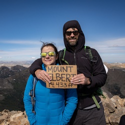
mt elbert is a beautiful hike. Good for beginners to 14ers. Took north trail up and south trail down to make a loop.
★
★
★
★
★


This is old version of the Leadville 100 race course. The new course runs past winfield on the trail to 390 intersection approx 1.5 miles west of winfield then back to Winfield on 390.
★
★
★

Finally the road to Harvard/ Columbia is good enough to drive my civic on.. thank you all the hands that created this amazing trail. Beautiful rocks steps to ascents. Great weather until 3 pm it’s started to rain a little here and there. But still a bleeding to hike it🧗♂️🏔🧗♀️💫🤩❤️
★
★
★
★
★

Great hike! Our fourth 14er. Great trail... loved the scramble at the end!
★
★
★
★
★

Great trail. I suggest sunscreen for the 2/3 that is exposed and bug spray for the lower 1/3 with thirsty mosquitoes! Allow extra time if you haven’t climbed any 13/14ers before.
Most maps do NOT reflect the current route or length. Switchbacks added in 2017-19 add miles, and this route, even from the 4Wd TH is no longer shorter than the Northeast Ridge route. Gaia made these new sections as we hiked, but showed us as off-route
★
★
★
★
★

Difficult but well worth the climb. Start early so you can take your time if needed. We started at 5:05 am and summited by 9:20 am. We read reviews about taking 3L of water per person but the day we did it wasn’t very hot and 2L would have been fine. Once you clear the tree line it is a very intense and steep incline with rock scrambles for 1.5 miles. Be prepared to power through those but don’t get discouraged by the 2 false peaks. The view at the top is well worth it!
★
★
★
★
★

Lots of great spaces back here, we camped next to a beaver dam and the running water makes such a great background noise.
Easy drive in but you’ll need decent clearance for the rough roads.
★
★
★
★
Gets busy on the weekends so get there early. Fairly easy hike with great views of the nearby peaks and a beautiful water fall to view and take a break at.
★
★
★
★


Great area to camp, hike, and 4x4. Southern part of the trail will need Big tires and high ground clearance to make it all the way to Salida.
★
★
★
★
★

A great trail close to our house. Beautiful San Isabel National forest with tons of small creek waterfalls and beauty everywhere you look. Formerly a logging road - although impossible to tell now! An old steam boiler, flywheel, and chimney are all that remain of a sawmill operation at the destination/end of the trail.
★
★
★
★
★


Gorgeous views when you get them, very steep at first, highly recommend snowshoes. Other hiker mentioned big animal tracks.
★
★
★
★
★

Short, easy hike, but well worth it. The resort is amazing, and you can go into one of the buildings; I’d highly recommend climbing up to the tower. The lake and mountain views are astounding, and definitely walk a bit past the resort for the best views.
(If you go during colder months, definitely wear micro spikes.)
★
★
★
★
★


Great hike. Steady climb but not to steep. The trail is shaded much of the way. The hike is actually 11.2 miles. Stopped the track and forgot to restart it.
★
★
★
★
★

Very difficult. 3 water sources only. Not recommended for kids. Beautiful as it can be. Plenty of RV camps at the base. Great fishing.
★
★
★
★
★

 stars
stars
The fall colors were amazing along the first part of the hike and the views from the peaks were great.
★
★
★
★
★

After an early September snow fall, the trail was clear of snow until Hartenstein Lake junction. Thereafter snow on the trail until breaking out of timber near top end. This trail is stingy on views except a couple in the middle section and then at the top. The redeeming view that made it better was heavily snow coated north face of Mt. Princeton.
★
★

Muddy after an early fall snowstorm but we enjoyed great views, a beautiful blue sky, snow capped mountains and a rushing mountain stream. What more could you ask?
★
★
★
★

Kinda boring drive, but the Lake was a nice place to camp for $22. If you fish, this is a good spot.
★
★


Excellent hike. Maybe not a great idea for beginners but no problem for others. There is some exposure,
★
★
★
★

Beautiful hike. 10 out of 10 recommended. #BetterThenMtPrinceton #BetterThanMtQuandary
★
★
★
★
★
stars
This has been my favorite 14er so far with lots of tree cover for the first sections and amazing views in all directions from the peak.
★
★
★
★
★
Started at about 5:30am and got the last spot in the parking lot on a beautiful Sunday morning. Definitely between 5.2-5.5 miles each way, not 4.5. A few dispiriting false peaks along the way, but stay strong! Very loose track in spots, not a technical climb, but also not easy. My first fourteener, and great way to celebrate my 40th birthday!
★
★
★
★
★

Longer than 4.58. My GPS mapped it at 5.48 one way, so much longer of a round trip than expected, and yes, when hiking a 14’er each mile counts.!!!! The 2 false summits were brutal... Take lots of water and be prepared for one heck of a hike/accomplishment!!
★
★
★
★

Beautiful hike. Trails are well maintained. More difficult to find best bouldering route. Summit views are spectacular
★
★
★
★
★

Great acclimation hike w easy former railroad bed grade from the parking to Cascade Falls.
★
★
★
★

This was an awesome trail with numerous dispersed camp sites. Continues on to Rainbow Lake and up to Cloverdale mine. You definitely need 4wd. A lift kit and 33” tires will give you a smoother run. We had some folks high center.
★
★
★
★
★

4x4 trail was very scenic. One river crossing. Need high clearance but we never put jeep into 4wd.
★
★
★
★
★
Picked this section for an easy to medium effort overnight backpack. Nice views of the Arkansas River Valley, Mt Shavano and Mt Ouray. Few established campsites on the short section I hiked.
★
★
★
★

This trail is mainly (almost exclusively) for motorized vehicles. So if you hike, be prepared to eat a lot of dust. That’s what I did. At least until I arrived at Tincup and then headed up to the 13er just to the east of the pass.
★
★
★

Weston Pass air down, Buena Vista Grocery, Cotton Wood Pass, arrived at Italian
★
★
★
★
★
Great views, worth thinking about doing it when the leafs and changing.
★
★
★
★
★


Another app lists this as moderate. The first mile is easy afterward becomes quite steep with loose rocks. Uphill all the way. Pretty area. You have to cross the stream multiple times but rocks and logs have been placed for easy crossing.
★
★
★

My first 14er at age 15... Harder than I thought, but great overall. The trail is steep and loose in spots, but overall not bad. The highest point in the Rockies is definitely worth it if you know what you're getting into. Mainly be prepared for it to get steep. When you think you're done, think again about false summits, and if it feels steep in the woods, brace yourself for the upper ridge. Despite not hearing any of that, I still had a great experience coming from Florida to hike this!
★
★
★
★

First of all, it was like 9.7 miles and 4400k elevation gain... for some reason Gaia stopped tracking for a bit shortly after I started.
The East slopes of Shavano are about a month ahead of schedule (compared to typical snow melt) so it’s almost in full blown summer conditions. There are a few small snow patches/fields near treeline and just below the saddle to Shavano, but they are super easy to navigate through or around.
★
★
★
★
★

Browns national monument trail to aspen ridge. See phone notes for camp coordinates.
★
★
★
★
★

Awesome Hike with a couple steep parts but well worth the view
★
★
★
★
★


First 14er. No switchbacks just straight up. Physically a thrilling challenge.
★
★
★
★
★


Hike MT. Elbert on 8/13 after flying in from Seattle the night before. First couple miles were chill and ran / hiked them. The last three were more of a hike and the scramble can be avoided by staying right - there’s a path. Lots of people but easy to get around. Worth the views! 3 hours up, 1.5 hour down.
Lots of places to camp and bathrooms were clean!
Beware - my partner got sick form the dramatic altitude change. Leadville is very high up consider the altitude difference even if you’re just driving out to the trailhead.
★
★
★
★

Great hike with very rewarding views of the surrounding mountains once on top. We started out from the trailhead at 5am and reached the top by 8:30am. It's a fairly steady incline the entire time outside of one flat section within the first 1.5miles under the treeline. Getting above the treeline (about 2.8 miles in) before sunrise was worth it if you can get an early start.
There is what appears to be one split in the trail, just as you hit the steepest section (around 13,400ft). Stay to the right on the way up! To the left looks like a trail and many hikers were making that mistake only to have to turn around or scramble across the rock field to the correct trail.
★
★
★
★
★

Pleasant stroll with dog and baby. Ate lunch by one of the many stream crossings.
★
★
★
★

This was an incredible experience for our first 14er. This was anything but the “easy” fourtneener as I’ve heard Elbert described time and again. Non-technical, agreed, but easy? No.
Arrived at the parking lot at 5:10am and it was already full (it was Saturday) but we were able to grab one of the first pull-off spots just past the TH parking lot entrance.
Hiked for the first hour under headlamp and were struck by the winds in the trees at such a low elevation and so early in the morning. Little did we know what we’d be facing once we got above the tree line.
We broke the tree line and were met with sustained winds of 50+ mph, quartering right at us. Gusts every 60-90 seconds must have approached 100+ mph, as we witnessed dozens of people literally get blown over. I had to use my left trekking pole off to my side as a support brace to keep me upright. Many times had to drop to my knees in a tuck to avoid getting rolled. This made for an epic summit bid, as the winds only picked up the higher we got. We stayed at the summit just long enough to snap a handful of pics, as the wind chill must’ve been in the single digits.
The descent was equally challenging, as the winds were now at our backs and blowing us down the mountain. Knees took an absolute pounding given the extra “braking” required.
Best cold beer I’ve ever had in my life in the parking lot.
This was one of the coolest hiking experiences I’ve ever had, being constantly reminded how powerful Mother Nature can be and how big these mountains are.
★
★
★
★
★

Great hike! The summit was beautiful. Overall not as hard as some of the others in the area, but like most it gets really steep for the last 500 vertical feet.
★
★
★
★
★
Tourists, do not underestimate the steady elevation gain of this hike. Be sure to start down by noon in August. Solo navigation of bouldering to summit takes patient scouting during summit fever rush to spot the next cairn. Do not proceed until you spot the next cairn, but half way up the boulder climb the tiny cairns move to the east face which can only be seen by following the brief (30 ft) dirt trail from the last cairn on the west face. Do not climb unless you are heading for a cairn. As Bunny states, do not start out on the east face.
★
★
★
★
★

It is a difficult hike, but worth every bit of exertion.
★
★
★
★

Excellent trail most of the way. However, finding the route on the ridge can be challenging as it is difficult to follow the trails in the rocks. Follow the cairns on the West side. Do not cross to the east side even though some misleading tracks lead in this direction. The distance and time associated this hike are grossly inaccurate. Distance is 15 km and 6 to 8 hours is more reasonable estimate of the time needed. Elevation gain is 1288 m.
★
★
★
★
★
Excellent trail most of the way. However finding the route on the ridge can be confusing as the trail vanishes in boulders. Follow the cairns on the west side of the ridge. Do not cross to the east side even though some tracks lead in this direction.
★
★
★
★
★


Mad snow cover was pretty awesome.. views from all over the hike were absolutely gorgeous! Glissading on the way down was an added benefit
★
★
★
★
★

Started at 6:45 am at the 4wd trailhead and followed a beautiful recently repaired/constructed trail through aspen forest to the music of chirping birds. Crossed one short (100 ft) snow field at 12,000 ft just below tree line and a much longer one (1000 ft) from 13,600 to 13,800 ft.Took 4 hours to climb, arrived to meet 100 others who were equally joyful to have reached the summit.
★
★
★
★
★

Started at the Trailhead around 4:30. Rain turned to snow around 11,800. Upper ridge had gusts up to 30 mph. All this and I still got it. What a rewarding challenge.
★
★
★
★
★


Easy hike to a beautiful alpine lake. Most of the elevation gain comes at the end of the hike. Our family did this in deep snow over Memorial Day weekend and had a great time! Luckily most of the trail had been broken, but still had some areas of post-holing (GAIA app was helpful as there were multiple trails in the snow). Ate lunch at the snow covered lake.
★
★
★
★
★
The family absolutely loves this trail. It can be a lil difficult in spots but it is so much fun.
★
★
★
★
★
 stars
stars
My wife and I hiked Mt. Elbert on July 10th, 2018. Not being from the area, we got an early start at 5:20 AM after camping just down the road. The trail was clear and even in the dawn light headlamps were not needed. After breaking through the treeline, we started to slow as the altitude got to us. The trail is not as well marked in two locations where scrambling is necessary, so it was helpful to have the GPS. Once on the ridge, the trail levels out a little for the final approach to the summit. Overall, it was a great experience, and one of the best hikes I have ever completed.
★
★
★
★
★


 stars
stars