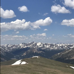
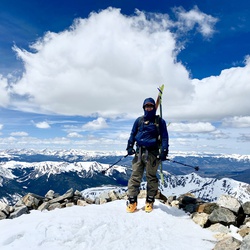
Glass mile is very steep loose scree and exposed rebar in sections. Trekking poles are a must for the descent.
★
★
★

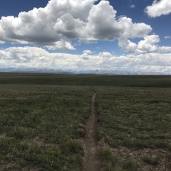
The main trail is really nice. The last bit to the “summit” is an off-trail, but-not-so-bad bushwhack.
★
★
★
★

Pay careful attention there are a number of trails so easy to get off trail. This is challenging but worth it. The plane wreckage is moving and pretty remarkable that there’s so much still remaining. Gorgeous peaceful hike mostly through the trees with lots of aspen trees. Note: $5.40 feet for parking and no dogs allowed.
★
★
★
★
★

Great hike for this out of shape city slicker - lots of birds - very few people in the trail out to the cabins - perfectly spaced out areas of incline - not overwhelming - beautiful unique granite views - lots of tucked away spots to camp.
★
★
★
★


Sunny day, path was well-marked and maintained! Path down from Bross was a little steep and slippery, but other than that an all around great hike
★
★
★
★
★

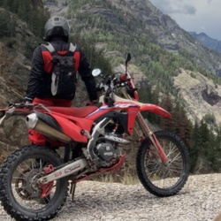
Great place to take your dirt bikes/atvs.
One of the best places I’ve ever been.
Sand city if it’s dry.
★
★
★
★
★

Two different trails. Birdseye has a few off camber obstacles. Mosquito is scenic, historic shelf road trail.
★
★
★
★
★
Wheeler Lake is more difficult than Trails Offroad rating of 5/7. More like a 6/8.
★
★
★
★
★

The hike in was nice, then we did harmonica march - this was a death march, highly technical - not for 10/11 year old scouts.
★
★
★

Rather straight forward and easy to hike if you don’t mind some inclines. Nice views…especially of Pikes Peaks. Dog friendly.
★
★
★
★
★

Great beginner runs. Green run has some dips and dives if you just want to get out there and have some action. The blue had a couple cruxes that allowed us to problem solve our way up, but it wasn’t too hard where we had to turn around.
★
★
★
★

Best rock outcrops here. Second time to hike here. Still wish I could backpack here.
Hiked with CNN
★
★
★
★
★


Easy sunny no wind hike. 0-2”snow on trail. Great views no people but easy to follow trail. 2-3 spots of ice. Liked poles and boots. Enjoyed.
★
★
★
★
★


Tough to get up early and start hiking in the dark when there’s snow on the ground, but no snow yet, got up at 430 and hit the trail at 5. Up and down by 9, great for a first 14er, this was my third and it felt the easiest. I’ve done Greys and Humboldt before this one.
★
★
★
★
★


Loose vertical first 1.4 miles w/approx 1200’ climb. Good midway for meadow views, aspens and rez is not full of water. Nice workout, dogs should use booties as the loose gravel and scramble over sections is abrasive on pads.
★
★
★
★

This is a great hike, 11 to 15 miles around the lake, beautiful scenery, moderate hike, my go to hike,all year long, great for snowshoeing. 1 hour or so from Colorado Springs.
★
★
★
★
★

Had a good ride. Balance and technique worked well. Not perfect, had one fall, but pretty solid ride. Getting better on every ride!
★
★
★
★
★

Difficult but well worth the lake views. Three really steep climbs and be careful for the elevation gain!
★
★
★
★
★

Wow, what a day! This hike was no joke, especially for someone like me coming from the flatlands of Florida. After just four days of acclimating, the altitude really hit me hard after Barr Camp, and it became a real struggle from there on. But thanks to my amazing girlfriend, who was an absolute boss, I made it to the top. It was a fantastic hike, and we met so many awesome hikers along the way—maybe even some new friends. By the way, this hike was a last-minute destination for my girlfriend’s 60th birthday. We originally planned to go to Machu Picchu, but it was fully booked.
★
★
★
★
★


This hike is steady uphill for 3.6 miles. I would label it as moderate. Not much to see. It’s a hike through the woods and has a few water crossings. The meadow at the top is a small beaver pond. There were no views. Also didn’t see any rock climbing or fishing opportunities on this section of trial as mentioned in other descriptions.
★
★

The Seven Bridges Trail is very popular with lots of foot traffic. We went on a Monday, so it was less busy, but still quite popular. Most people are strolling and generally turn back by the seventh bridge (they are all marked.) The real hike starts at that point and it's worthwhile. Expect step trails with tree cover and one fantastic view at the top.
★
★
★
★
★


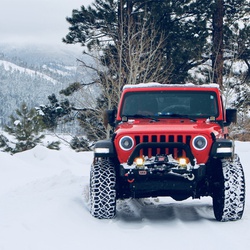
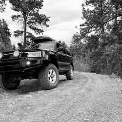
Beautiful 4x4 trail and didn’t see another vehicle the whole day on Father’s Day weekend.
★
★
★
★
★


Old mining road. Partly sunny partly shady. Lots of slushy snow and ice.
★
★
★
★
★


Explored Box canyon off hwy 77 (Tarrayall road) FS 204 (no sign on highway).
3-10” browns. Very hungry for purple Darth Batias. .
★
★
★
★
★

it’s a very good and well rounded adventure for any normal SUV, Subarus or smaller crossovers might need to be careful about line choice. be mindful about the weather, above tree line there’s nothing for the lightning to strike except you. other than that it’s awesome!
★
★
★
★
★

A trail that has it all. Forest. Meadow. Creek. Stunning views from the top.
★
★
★
★
★
Very windy and scree at the upper portions. A good workout. Great views.
★
★
★
★

Started early from Summit Lake and saw lots of wildlife. Spikes are recommended this time of year and an ice ax wouldn’t hurt. Gets too touristy for my taste later in the day and it’s a bummer to end up at the drive-up summit but still beautiful and fun.
★
★
★
★
Started early from Summit Lake and saw lots of wildlife. Spikes are recommended this time of year and an ice ax wouldn’t hurt. Gets too touristy for my taste later in the day and it’s a bummer to end up at the drive-up summit but still beautiful and fun.
★
★
★
★

Lots of views of the creek. Very pretty but didn’t make it too far. Big parking lot at trailhead if you want to save yourself a mile.
★
★
★
★
★

Would definitely bike down Bruin trail from gold camp road to sweet tooth canyon
★
★
★
★

We have an approved Town Resolution for a NEW Trail THAT IS PLANNED and preparing to be built by Palmer Lake Parks & Trails Commission and Volunteer certified trail professionals. In 30 days time volunteer trail building will begin. The trail is open to view the red flagged 3200ft long trail for comment.
Stunning views, dozens of bird species, ducks, deer, evidence of bears including seeing them first hand, evidence of Mountain Lions.
Such a huge new amenity to Palmer Lake!
Wonderful trail that finally will connect the Glen neighborhood to main Town of Palmer Lake, it’s trails, Centennial Park and Santa Fe trail.
Walking on Spring Street is no longer necessary.
ENJOY !!!
★
★
★
★
★

A fun hike and solid workout. Some good views of Pikes Peak on top Mount Herman. Route finding is key as there’s lots of social and game trails connected down lower.
★
★
★
Short and steep. A great hike stay in shape while the 13ers and 14ers are snow covered or as a warm up for those bigger peaks also.
★
★
★
★

It’s wasn’t that bad, was about 14miles and 4200ft of ascent. There wasn’t that much snow at most being 4in. Took us 9hrs including breaks, would recommend.
★
★
★
★
★

A challenging 4WD road if you want to get as close to the top (~12K feet), but you can make it pretty far with a normal vehicle and hike the rest of the way. The views from the summit are breathtaking, with 360 degree vistas showing both the Park as well as Teller sides. Well worth the effort!
★
★
★
★
★


Beautiful views from arrival to summit! Many lakes in the area, big and small. High - very high traffic on narrow one and back path. Would be more than happy to only do the first leg of the hike! Second leg, heavy incline and rocky. Last leg to summit is all boulder climbing!
★
★
★
★
Fantastic hike from the Leadville side. The first/last half mile is really muddy so be prepared to hop, skip and jump. Past that it’s a moderate climb all the way up. Wind gets really crazy for the mile before/after the top but it was calm on top. Great day, smiles all around.
★
★
★
★


The loop trail around Little Scraggy Peak has some amazing rock formations and a few grand vistas. If you hike you may not want to do this trail as it is heavily used by Mountain Bikers as a highly recommended bike trail. That cause the trail to be optimized for bikers - not hikers. What I mean is there is lots of loose gravel and banked turns on the trail. Its beautiful, but bikers are roaring down the trail - a lot.
★
★
★
★
★
Trail is in good condition and isn't overgrown/obstructed by anything. Parking lot nearby has bathrooms (but a bit of an insect problem). Decent ascent & descent, not too technical of a trail. Clocked 6.4 miles from the parking lot to complete the loop.
★
★
★
★
★

This course was my first 14ers knocked off the list. My buddies and I got up at 2AM and first lighted Democrat and had breakfast. The hike wasn’t very bad at all for me but I am a hiking guide in New Mexico and accustomed to the altitude. Every Mountain View was well worth the hike and I would do it again, but Lincoln is by far the best view in my opinion. If I were to do it again I would try and either sunrise Bross or Lincoln to get a different view.
★
★
★
★

This was an easy off road drive from the FairPlay side. The road up from Leadville was a little more difficult and required more clearance. The views from Weston Pass are amazing and our weather was great in July.
★
★
★
★
★

This is right down the street from where I live and an awesome way to get out of town!
★
★
★
★
★

For a senior citizen this is rather a strenuous hike but the overlooks of the Red Rock are amazing.
★
★
★
★

This is a challenging 4.6 mile loop trail. If you are traveling counter clockwise the last 1.5 miles are very steep down grade with some pretty sketch footing. Beautiful views and plenty of shade. If you do the loop clockwise the first 1.5 to 2 miles will be a real test of your fitness. Strongly disagree with calling this trail easy. But I think I’ll do it again next week. $5 parking fee credit cards only.
★
★
★
★


Nice low angle ridge to skin up and ski down. Road is pretty icy and snowy near the trailhead but not to bad at least a couple days after the most recent storm. Nothing crazy exciting about this route. Just lots of good views, very few people, and a mellow way to get some winter hiking in.
★
★
★

Good hike close to our home. We only went about 2 miles in. First half mile had some decent incline, but after that was mostly easy rolling. Would be a good fall hike with the Aspen trees.
★
★
★
★

Best hike I’ve been on! Definitely go counterclockwise to avoid 8 miles of ascent. Beautiful views. Did it in 2 days. Ass kicker. Plenty of water on north side of loop but less on the south. Incredible geology!
★
★
★
★
★
Awesome hike, first fourteener for me. Trail is easy to lose about .75 a mile in but other than that it’s a good hike.
★
★
★
★
★
From the Palmer lake Trail head go approx 40 ft then stay to the left and pick up narrow trail that heads across dry creek then very steep up hill. Approx 1000 up in 1 mile.
★
★
★
★
★

One of my favorite hikes. We almost had trail completely to ourselves, and some of the greatest 360 degree views I’ve ever seen.
★
★
★
★
★


Easy, short unmaintained trail to the summit of an overlooked peak. Trail is easy to lose on descent.
Waypoint is marked at trail entry, which is spotted with a small roadside cairn near a pullout on the road.
★
★
★
First tunnel is clear and passable, 2nd is collapsed and requires traverse around or over. Good views from rail grade hidden on an unused trail.
★
★
★
★

Beautiful hike, it has just about everything I want on a hike: trees, mountain stream almost the entire route, views, views, views, and on a Saturday during fall leaf season, fairly few people!!!
★
★
★
★
★

Bucket list hike to the summit! I was raised nearby and never had the opportunity to hike. Finally made it happen. Hike is not bad - trail is excellent and only the last 2 miles is really grueling, but completely doable. Hydrate constantly and munch down calories regularly.
★
★
★
★
★
This trail is very well maintained with some beautiful views. Absolutely will do it again. The trail is rated easy but the first half mile is no joke climbing up out of the canyon. After that first half mile the trail is relatively flat.
★
★
★

I did not acclimate myself to the Attitude, and I came from sea level. Bad idea, made the trip a lot harder. Come and stay a couple of days and elevation before you tackle this
★
★
★
★
★

This is a challenging day hike that runs north below Raspberry Ridge and then climbs up to the ridge from the west side or from Limbaugh Canyon. Once on the ridge, there is an option to climb up to the top of Mt Herman directly or walk around it’s western flanks and climb it from the south side (usually accessed from Mt Herman Rd).
From the top of Mt Herman, it’s a steep trail back down to the parking lot. There is no water available on this loop.
★
★
★
★

This is a HARD ONE! Just the shear miles of up hill wear on you. It has magnificent views and all in all is a doable 14er. There is trail the whole way. The last 2 miles are pretty brutal but just take your time and you will get there. The beginning of the trail is a lot of exposure and the last 3 miles is total exposure. SUNSCREEN IS A MUST!!! If you don’t want to do it all in one day Barr Camp is a fantastic place to overnight. Hosts are exceptional. Pay for the dinner it is a welcome delicious meal to finish off your first day.
★
★
★
★
★
This is a beautiful hike. Pretty exposed for the first couple miles. Wear sunscreen! It is rated as difficult but don’t be discouraged. There are areas of elevation coupled with sections of less incline. Barr camp is an amazing place to stay over. Excellent knowledgeable and friendly camp hosts. Thoroughly enjoyed our hike. Continued on to the peak the next day.
★
★
★
★
★


A bucket list hike! But, if you’re not used to the thin air, take your time and stay hydrated. Hyperventilation and altitude sickness is a real possibility if you don’t. It is tough, but the reward is great.
★
★
★
★
★

One of the coolest hikes I’ve ever done. Grueling, beautiful, lovely. Lots of bushwhacking so bring pants!
★
★
★
★
★


Did this as first part of a two day,, one night backpacking trip. 57 year old flatlander found the elevation gain of 1610 feet over 6.5 miles exerting but manageable. Trail generally good condition and easy to follow. Stream crossing was a little unclear but happily someone had it marked with stones on the other side of the creek. Mostly shade for me, camped up near Buffalo meadows. Had the place to myself. No people or animal sightings at all. Very pleasant.
★
★
★
★
June 30. Wildflowers in bloom! Lots of water in the creek and small sections are mini streams themselves. Mostly easy hiking and easy downhill if coming from Rich Creek trail. Dog had a good time. Lots of signs of moose activity but no animal encounters. I did this early, some sections might be hot later in the day. Had it to myself.
★
★
★
★
Did this June 29, as my first solo overnight! Started at Rich creek trailhead, road there had a lot of holes and washouts but manageable with my SUV. Trailhead only had four cars at 9am on a Tuesday. I saw NO ONE for two days. Took the route counter-clockwise because I wanted day two to be mostly downhill Found Rich creek trail to be mostly shaded and all up. Generally path was very easy to follow but was happy creek crossing was marked with stack of stones. Camped in the trees about six miles in at a site with a fire ring, though no fires allowed. Multiple good camping spots around this area, as well as a few a few miles sooner. Sooo quiet. Not even many birds. No bugs. Day 2 closed the loop with Tumbling Creek trail. This was mostly easy downhill and much wetter than Rich creek trail. Small bits (10-20 feet in length) of the trail were mini-streams in places. The one crossing with the logs was sketch. Lots of water.. I had my dog with me and there was no way he was doing the mash of logs. We waded in about a foot of water. He did good, I went partially down thanks to ill advised flip flop use. Next section had some sun though so dried quick. No animal sightings but tons of fresh moose evidence. Wildflowers all over the place of every variety imaginable. This was my 4th day in Colorado. I live at sea level. My tubby 57 year old body found day one elevation gain of 1600 feet taxing. It took me 5 hours to do the 6.47 miles day one. Day 2 hada gain of 308 feed and a decline of 1494. This one took 3.5 hours for 5.53 miles because I kept stopping to take pictures of the views and the flowers. I would rate this hike as moderate, not difficult. It was a lovely backpacking experience made even better in that I had it to myself!
★
★
★
★

This is a great hike for some exercise with the pups. It has one slightly challenging incline once trail 666 leaves the side of bear creek. Go early to avoid crowds and beat the heat.
★
★
★
★

Pretty cool, long, flat hike. Not much elevation gain but it was very pretty.
★
★
★
I found what I thought was a meteorite here once. I call it the star lite trail
★
★
★
★
★

Incline is incredible! Stair master experts heaven in Colorado Springs
★
★
★
★
★

Well marked trail but can be a bit challenging towards the end. 2 1/2 hour round trip.
★
★
★
★
★


Finally made it. Snow was much improved from last week. Didn’t need snowshoes, only exospikes and poles. A bit sketch on the false summit due to hard snow and limited traction, but nothing serious. Views were outstanding and we had the mountain to ourselves.
★
★
★
★
★

I’ve been wanting to do this peak for so long. The conditions were perfect. The marmots were wonderful. I absolutely loved it!!!
★
★
★
★
★
March 11, 2021
JW + Angela
Spikes only; no snowshoes
5 hrs ascent from the truck
3 hrs descent to the truck
The winter route up Mt. Sherman is not easy to find or stay with. We left the road in the proper exit, and re-gained the route high near the summit. But in-between, both ascending and descending... we knew we were off-route, unintentionally. AND IT JUST DIDN’T MATTER. In some places, our off-routedness may have been more critical- for efficiency or safety away from steep slopes. But we never encountered enough snow to make a difference. Only twice did I step-through up to my knees... but never deeper. (Big snow was expected within 4 days- additional 1-4 feet of snow.)
We were the only ones on the mountain for the entire day! Summit and all belonged to us. Bluebird day, despite the coming storm.
Overall, this route is not as much fun as the (SW) ridge route on Mt. Sherman. But it’s still a day in the mountains, and that means a lot to me.
★
★
★
★
Beautiful snowshoe (or ski) hike. No slope angle shading above us. Well packed down
★
★
★
★
★

As long as you pay attention to what your doing this OHV trail should be fine. If you don’t, you’ll probably die. SUPER pretty views at the peak. Very windy too (rip jeeps)
★
★
★
★
★

Fun local trail. A few good scenic spots, including views of Pikes Peak.
★
★
★

I would say this is between easy and moderate only because the last section (turn around point) is a little steep and technical.
★
★
★
★
★

We were on Fat Bikes in December 2020. Went up Sandy Wash to Charlies cuttoff and around to the service road and back down. Took about 3 hours. Snow condition was good, only a few areas of loose snow. More snow is coming in a few days. great ride!
★
★
★
★
★


Straight up grind and didn’t finish because we lost the trail. Was attempting raspberry mountain
★
★

This is a really good trails you need really deep tread on your tires or you gonna get stuck pretty bad in the bad part getting the the main part of the trail requires just that. Had fun on this trail ml320 4matic
★
★
★
★
★

Scenic area with plenty of dirt roads to enjoy exploring. 11 mile Canyon fly fishing for a fee. Remote far is camping available reservation campgrounds available
★
★
★
★
★


Great 4x4 trail for a beginner like me. Wide and well maintained all the way from Como to Breckinridge.
★
★
★
★
★
Excellent 4x4 trail for beginners like me. Wide and well maintained all the way from Como to Breckinridge.
★
★
★
★
★
Drove the trail from Breckinridge to Jefferson. I completely agree with the description that the west side of the Continental Divide is much more challenging, especially going uphill.
The road is narrow with a lot of loose rock and deep troughs. My skid plates made contact on the crests twice.
★
★
★
★
★


Nicely wooded and not too steep. Pine grove is cool and great views in the scree field.
★
★
★
★

Vet very busy trail. My friend and I did it on Saturday and the 14er association counted 300 when we ask him. But it was very cold and windy. Please be safe hopping around on the rocks. Otherwise enjoy..
★
★
★
★
★

***OPEN TO MILITARY PERSONNAL ONLY*** This trail can only be accessed from within the US Air Force Academy. This is a challenging trail. The map shows it to be 1.75 miles one way up to the peak, with almost 2,000 feet of elevation gain. So it is a constant, steep uphill hike. The trail is not marked until about the last tenth of a mile. And due to limited traffic, it is not well worn either. We had to back track a couple of times when we found ourselves unable to go forward. But the view from Eagle’s Peak of the cadet area is spectacular!! Makes the effort worthwhile.
★
★
★
★
★
 stars
stars
Challenging but great way to check off four 14ers in a single hike with amazing views in all directions.
★
★
★
★
★

Climbed this path this morning starting at 0600, parking was easy and there is a bathroom at the trailhead. Path is clearly marked throughout the route but gets a little tricky during the boulder climb right before the summit. Just follow the man made rock stacks and you will be fine. Peak was a letdown due to all the construction but the hike itself was fun.
★
★
★
★
★

My son and I completed this trail yesterday. Started at 0430 at the trail head in Manitou Springs. This was the hardest trail I’ve done to date especially the last 3 miles but what a great accomplished feeling!
In the downside there’s a detour at the summit due to construction on the new visitor center. This is the most BS part of the trip as when you summit you’re literally at the visitor center restricted by a fence. Instead of making a small corridor for the hikers they reroute you down to the highway and you have to walk another .8 of a mile back up to the summit. At that point we were exhausted and feeling a little frustrated toward the lack of consideration for the hikers! There wasn’t any construction activities even going on.
Other than that it was an amazing hike and beautiful views at every turn.
Thank you Great Spirits!
★
★
★
★
★

The view at the top is great, you can see red cone, and other major mountains. You will
Need high clearance, at least a center locker, if not a center locker at least a rear locker. You may also want to have some armor under your vehicle.
★
★
★
★
★

Started at Georgia Pass. Great hike, nice tundra walk with awesome views. Plan on 90-120 minutes to reach the summit depending on your pace. Give yourself an extra 90 minutes if you want to bag Whale Peak from Glacier Peak.
★
★
★
★
★


Not very exciting. Views aren’t great. Sun rises on the other side of the mountain. Still a 14er.
★
★
★

Parked at the top of Weston Pass and followed the very steep old vehicle track north. The track disappears and it gets steeper. Zig-zagged to the saddle and ridge above 13000, then E along the ridge to ascend Weston Peak. There is a short section with exposure to drops to the N and the S, but easy class 2 if you don’t mind the exposure. After Weston Peak, retraced and then N to ascend Ptarmigan Peak (which weirdly has two geodetic survey markers 15 feet apart). Was going to continue N to bag Horseshoe Mountain but rain hit, plus my lightning detector was seeing nearby strikes (only 1 clap of thunder, whew). Horseshoe would have added 5 extra miles, so maybe next time will skip Weston Peak. Good views, nice morning above timberline, total solitude. The descent back to the car is miserably steep; sticks helped.
★
★
★

This is one of my favorite day trips to make in a convoy of jeeps with friends- this trail has a bit of everything, rocks, water crossings, fun optional technical obstacles, beautiful vista old mining stuff and a gorgeous lake and waterfall reward at the top.
★
★
★
★

Red Cone is my new favorite Jeep trail. We planned on taking Webster Trail back after Red Cone, but a giant snow drift blocked the path. So we took a long trail back that included Georgia Pass.
★
★
★
★
★

Sort of boring approach with 80% via road accessible to high clearance 4x4s
Amazing view from the top. Big plus of this approach via Western ridge, this July Saturday with the perfect weather we met one goat and one hiker with a dog. We had the summit to ourselves.
★
★
★


One of the better and technical trails in Colorado. A little bit of everything. Off highway 285, air down right at trail head. Pass campsites and private property until you get to fork in the road, RedCone/Webster’s Pass, go right to RedCone.
Once you reach RedCone summit, 12,000+ feet, trail becomes one way. You can take Webster’s Pass back down and loop to where you started, if open. Webster’s pass has snow late into the season that blocks the trail. If the pass is closed go right at the fork and take the trail towards Keystone to highway 6, Loveland Pass.
★
★
★
★
★

Great views, worth thinking about doing it when the leafs and changing.
★
★
★
★
★

Beautiful easy 14er hike. Extremely popular and busy however. We arrived at 5:30am and parking was already extending down the road to the trailhead and hundreds of people were on the trail. First mile or so is flat, then straight up for the rest of the hike. As an infrequent hiker it took about 2.5 hours to summit.
★
★
★
★
★

This hike starts at 10,000 feet and Rises to 12,000 at shelf lake. From there you climb up the south east ridge of Decatur and there you are at almost 13,000 feet and can see square top and argentine peak at the top. There’s is an especially nice view of Holy Cross and Mount Powell to the west
★
★
★
★
★

Easy for a 14er, but you still have to deal with the altitude and be ready for a windy, but enjoyable ridge walk.
★
★
★
★
★


Out and back day hike from west side of Segment 1. Enjoyed a nice cool down in the South Platte afterwards
★
★
★
★

Great hike. Didn’t do the whole loop but just walked out to where the water starts and sat down , had a snack and enjoyed the nice breeze and scenery.
★
★
★
★


Jeep 4wd loop: Very nice Rampart Range loop, easy but some interesting parts and good views. Very busy on Illinois Gulch side on weekends.
Stock JLU Sport w All Season tires.
★
★
★
★


Love this loop and it is perfect for shoulder season. Two weeks ago (5.1) it was snow covered on the north faces with much post-holing.... this weekend (5.16) the route was clear below Lake Park with only a few patches of snow. No difficulty navigating and good trail conditions though the trails still have a lot of fallen timber that needs to be navigated.
★
★
★
★
★


Kinda just slapped this route together to explore. Brown tunnel most of the way but some good climbs to get the heart rate up and a couple sneaky peaks poking through the trees.
★
★
★
This is a well worn trail up to beautiful views from Raspberry Mountain. The trail gets steep going up the canyon and spikes are useful when there’s any snow or ice. Although unmarked, a well worn trail continues along the ridge from Raspberry Mountain north to Trail#715. This area can get very crowded on a nice day.
★
★
★
★

Mostly an atv trail. No atv now with the snow. Do need crampons for the ice.
★
★
★
★


The was an off road track. Mountain seems to have been smoothed out considerably but still has some challenging sections. Stock 4Runner TRD Off Road
★
★
★
★
★

Took about 2 hours round trip. Started in the afternoon with great weather and had no trouble navigating the well marked trail. Lots of huge cairns to help. This is a great, quick fourteener if you’re looking for a strenuous hike with a big reward.
★
★
★
 stars
stars
August 2019- Trail was severely washed out in National Forest land. The trail is extremely difficult to follow once you hit the Waldo Canyon Fire burn scar.
★
★
★
★

Great bikepacking route. Little bit of everything. For the first 6 segments of the CT it’s a better experience IMO to go from Breckenridge to Waterton Canyon.
★
★
★
★
★


The full loop is long, but the water is stunning. It was enjoyable to experience the different areas (rocks, forest, “burnt areas”, edge of the water, and the dam.
★
★
★
★

Beautiful hike through a lush willow covered valley with a small stream crossing (was able to stay dry by rock hopping across). The terrain is easy to navigate and seasoned hikers won’t fine this to be challenging. The most challenging part of this hike is the altitude and last 50 vertical feet to the summit on rocky terrain.
This is a hike you want to do early in the morning in order to beat the crowds and afternoon storms.
★
★
★
★
★

At end of trail, you can camp next to the South Platte River. Great spot for fishing, but can be a bit “crowded” during the day as many groups ride this trail. Good spot for star gazing at night.
★
★
★
★
★

We rode horses on this loop. I would rate it as moderate difficulty. There are some nice vistas and plenty of shade. Lots of huge granite boulders but the trail itself wasn’t too rocky, but I would recommend shoes.
★
★
★
★

Fun in-and-out hike with plenty of shade most the way. Be cautious early morning / late-evening of the few massive moose in the area.
And as of 6.17.19, getting across the creek is sketchy due to a forest blowdown from a massive avalanche. Doable, but takes some time crawling over trees and other debris.
★
★
★
★
★


Short hike to prominent point visible for miles around. Good short trail with some steep sections.
★
★
★

Great drive and great views, any vehicle can make this trip. Well any stock higher or larger!!
★
★
★
 stars
stars


 stars
stars


 stars
stars


 stars
stars