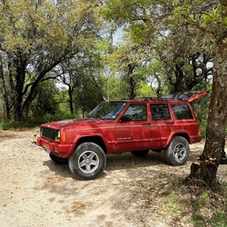
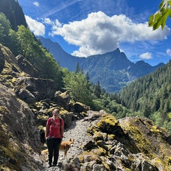
Finally finishing backpacking the CT! One of the most challenging and rewarding hikes out there!
★
★
★
★
★

Beautiful hike, especially during fall colors, it’s a little longer than listed, if walk to the south facing ridge, amazing views of the Twilght peaks & Electra lake.
★
★
★
★
★

Good short hike after a hiking hiatus. Good for little dogs too! Mostly shady and flat.
★
★
★
★
★
Good short hike after a hiking hiatus. Good for little dogs too! Mostly shady and flat.
★
★
★
★
★
Good short hike after a hiking hiatus. Good for little dogs too! Mostly shady and flat.
★
★
★
★
★


This hike has beautiful views, lots of ups and downs, but it’s easy hiking. With beautiful wildflowers throughout the whole hike.
★
★
★
★
This hike has beautiful views, lots of ups and downs, but it’s easy hiking. With beautiful wildflowers throughout the whole hike.
★
★
★
★
This hike has beautiful views, lots of ups and downs, but it’s easy hiking. With beautiful wildflowers throughout the whole hike.
★
★
★
★

Absolutely incredibly beautiful hike, ‘course what isn’t in the Weminuche? Fairly difficult about half way through the hike as you’re gaining a lot of elevation really fast. There’s not a lot of extreme exposure but there is some that gives you that “Wow!” Hossick Lake is rarely visited as it’s tough to get to but it’s extremely beautiful and underrated and yes there are fish. Easily one of the best hikes I’ve ever done in the Weminuche!
★
★
★
★
★

Beautiful hike, starting high above the river and eventually coming level after about 3 miles. Great views of the canyon and water, distant mountains. Not very steep so you can do some good mileage. But buggy at the start.
★
★
★
★
★


Short and rewarding views if able to start at kennebec trailhead 3.3 RT. (We started shortly past Darby campground which added 3.4 miles- there is a potential loop link back to here) Go past the lake and up to the ridge to look down the lake. Continue up past the short bushes and gain views for the sharktooths. Continue hike a little toward north before the narrow passage to feel the Indian trail ridge lines. Most of the tall peaks in San Juan can be seen from there on a nice day.
★
★
★
★


One of my favorite hikes in the area. When the leaves are changing, it’s magical!
★
★
★
★
★

It was a beautiful trail. Start early because there is lots of time in the sun after the first mile or so.
★
★
★
★
★


Yeah, we didn’t hate shit. We went to the lake and we went down a little bit fished a little but no hiking.
★
★
★
★
★


Awesome hike. 4wd road was rough. Took 1.5 hours to drive up Missionary Ridge to trailhead
★
★
★
★
★

The hike is not easy but it’s great! Lots of waterfalls and tons of wild flowers this past week. The views were amazing up above highland Mary lake. Felt like a sweet reward. Wet and muddy in lots of parts of the trail right now so be prepared. There are a few creek crossings. We took our shoes off the first two then gave in.
★
★
★
★
Today, I had the pleasure of embarking on an awe-inspiring journey from Durango to Ouray and back. This majestic ride is an experience I highly recommend.
★
★
★
★
★

Good hike. Lots of climb at beginning. You can park at lobo overlook and take CDT runs into trailhead. Keeps from having to climb so much
★
★
★
★
★


Sooo beautiful. Lush steep uphill climb through many aspen and pines. 2nd half of ride was ok. 1st half spectacular!!!
★
★
★
★
★

This is NOT an easy trail for beginners! It may be easy for those who regularly hike, but if this is your second or third hike I would consider something like spud lake!!
★
★

Guided hike from Silverton to Ouray. Guides Patrick and Dawn and their dog. in Ouray with Joan and Lynn,
★
★
★
★
★


June 2023 ride; this is a great trail, we got as far as we could go then had to turn back as the trail was snowed in. Breathtaking views! Wildflowers were out.
★
★
★
★
★
It was a long up hill trek to the upper parking area where we lunched, visited the Pueblo village and awaited the approaching full moon rise between the pillars. We then made our way to the top and explored various vantage points to best view this once in 18.6 year event. 7 mile round trip from the lower parking area.
★
★
★
★
It was great to be able to get up on the ridge at this time of the year with basically no snow, minimal wind and sunny skies. The route up Gibbs is mostly a road walk, but the scramble for the last 500’ of elevation was fun.
★
★
★
★


Incredible view of the ridges, valleys and wild flowers. The lakes at the top look fake. Truly unbelievable.
★
★
★
★
★
Incredible view of the ridges, valleys and wild flowers. The lakes at the top look fake. Truly unbelievable.
★
★
★
★
★

Nice hike, steady climb going in
Excellent views
Hiked out in rain, the trail drained well
Only saw a few other hiker’s and 1 biker.
★
★
★
★

This hike was gorgeous on a overcast late summer morning. Saw many birds, interesting plants, and got lots of terrain. Waterfalls were low but still beautiful. It's overall moderate, as it is mostly gentle inclines and declines. But there are a few more steep, rocky areas that are short but need care and energy. Luckily the elevation isn't too terrible, topping out under 10k. The biggest downside is it ends with some inclines, a personal pet peeve, haha. But the bathroom at the parking lot is nice. We started about 7:30 am on a Saturday and didn't see anyone until we headed down.
★
★
★
★

Dogs and I went up the trail while Brian road his bike in to do trail work with Durango Trails. Water diversion on Engine Creeper. A few short steep sections, roots and rocks but very doable. Hiking piles helped a bunch.
★
★
★
★
★
Dogs and I went up the trail while Brian road his bike in to do trail work with Durango Trails. Water diversion on Engine Creeper. A few short steep sections, roots and rocks but very doable. Hiking piles helped a bunch.
★
★
★
★
★

This trail had breathtaking views along the entire hike! There were so many wild flowers blooming when we went 8/6/23. There were a few creek crossings, but nothing too terrible. I definitely wouldn’t rate this hike as easy though. The altitude change was a lot, especially for being a flat lander. The uphill is intense, and we didn’t realize how steep we had climbed until we were coming back down. It was definitely worth the work though!
★
★
★
★
★

Quick little jaunt through the woods. Has quite the down hill and uphill either way you head. :)
★
★
★
★

Started at 6:11 am on 8/2/23. Ample parking with porta-potties. Signed the register and started the ascent thru the prior burn area passing a beautiful waterfall. Continued on switchbacks then above the tree line proceeded counterclockwise to Island, Ice, and Fuller Lakes. Some minor water crossings (poles are helpful but not necessary). Stunning lakes and landscape! Gorgeous wildflowers! A moderate to difficult hike because of the elevation change and distance. Recorded 9.89 miles total and finished at 11:57 am. Visually and physically rewarding. Get out there!
★
★
★
★
★

After the fire, the first half is a lot less shaded than it used to be, so the switchbacks were extra hard on a hot July morning. Thunderclouds rolled in 2 hours after we started, so we didn’t make it to the end. Still, there were great views and lovely meadows and it’s easy to get to out of Durango.
★
★
★

Easy access, beautiful Mountain View’s, nice stream crossings and wildflowers. It was busy w/in a mile or so of trailhead.
★
★
★
★


Middle Fork trail is pretty over grown with a good amount of down trees. Once you cut south and head towards the peak it’s just a bushwhack and a scramble. If you like that kind of thing it is pretty fun. If not, it’s probably not the summit for you.
★
★
★
Piedra Road was plugged and ice free. Very smooth (the town roads should have so few potholes). The trail was well tramped down except for a few post holes primarily at the start. We used ice points on hiking boots. Gaiters might have been worthwhile. We were the only hikers today.
★
★
★
★
★

Beautiful fall colors with snow capped mountains in the background at top of Windy pass
★
★
★
★
★
 stars
stars
West Lime Creek Trail is located approximately 35 miles north of Durango on Route 550. If coming from Durango you will find a gravel parking lot just before the hairpin curve. You can park there as it is an easy walk to the trailhead or you can park along the north side of Route 550 if you’re headed south toward Durango. Arrive earlier and enjoy the solitude or arrive later and enjoy the company of other hikers as this is a popular hike. West Lime Creek Trail is an out/back trail and the trailhead is easily located on the north side of the road to the right of the creek. Be careful going down and coming up the embankment as the gravel is loose and slippery.
The trail is easily followed and is suitable for persons of all ages. There are parts of the trail that are going to be slippery, especially after a rain or morning dew. The trail is a mixture of packed earth, loose rock and exposed tree roots. The trail winds through timber and meadows with the sounds of the creek flowing past you below. There are a total of four stream crossings. Two you should be able to step or jump over and two that may require planning if you don’t want to get your feet wet. Just use good judgement as the rocks or logs you step on my be slippery. Children should be extremely careful in these two areas.
As you hike along enjoy the views of Lime Creek and it’s waterfalls off in the distance. The trail, as listed, comes to and end when it reaches Lime Creek. However, if you are adventurous you could continue further up the trail or just enjoy a snack next to the creek. The solitude and the sounds being the most important. Depending on the time of year the meadow wildflowers may be in bloom. As you begin your return hike pay attention to the waterfall off in the distance on your left! You would have missed it earlier. As your hike comes to an end, be careful coming up the embankment and be extra careful crossing Route 550 or pulling back into traffic on Route 550. As always enjoy, it’s about the hike!
★
★
★
★
stars
The trail for Spud Lake is located approximately 26 miles North of Durango on Route 550. Just past Cascade Village there will be a hairpin curve and as you come out of the curve there will be a sign for Old Lime Creek Road and Spud Lake. Be advised that this is a BLM fire road. If you do decide to drive the fire road you will need a high clearance vehicle. Just after the pull off onto the fire road and before the campground area a sign is posted warning drivers of road conditions. The fire road is bumpy with holes and rocks. Take it slow and pay attention to the route that you choose. It’s approximately a three mile drive up to the trailhead. Park along the road if it is too much for you and walk the road up to the trailhead.
The trailhead is located to the left of the road and is clearly marked. The trail is easy to follow and is primarily rocks and packed earth. The trail takes you through lush timber past small ponds and along side of a stream. Several small waterfalls can be seen from the trail. After approximately 2.5 miles you will arrive at Spud Lake. Sit on the rocks and enjoy the peacefulness of the lake and soak in the beauty of the surrounding mountains. Enjoy a snack or a cup of coffee before you continue. Make sure you hike the trail that goes around the lake, it only adds a half mile to your hike and you will enjoy the different views of the lake and mountains.
If you enjoy quiet and solitude arrive early as this is a popular location for hikers, but they seem to start arriving around 11:00 am. So you may encounter them on your way back. No matter the time you start you should enjoy the hike. Once returning to the trailhead take some time to enjoy the area with a snack or picnic lunch before you begin your slow bumpy drive back to Route 550. As always remember, it’s about the hike.
★
★
★
★

Great afternoon ride. Trails are great and found some fantastic vistas.
★
★
★
★
★

Beautiful country. Damp as all get out. Climb starts gradual then it’s a grind! 5-6 miles of slog climb.
★
★
★
Great ride, fantastic vistas. Was turned around again on a Forest road that turns into a county road, which was blocked by the rancher that owns the dirt on either side. Colorado has some fantastic trails along with some screwed up regulations. Stay in the forest and don’t trust the maps.
★
★
★
★
★

Great out and back from Cayton Campground. The Graysill Mine sight has some fantastic vistas. Had lunch at the Purgatory Ski Lodge. Ran out of time so have to go back for trails 579 and 580.
★
★
★
★
★
A really nice section of the Colorado trail with great views and a well maintained trail. Plenty of hikers and some bikers as expected but not a problem
★
★
★
★


7/7/22: Hiked 0.7 mile manway down from Ruby Lake to Emerald Lake (1/2 hr.). Set up camp then fished. Clear skies, cutthroat trout, wild flowers and conversations with an outfitter & his clients. Priceless!
★
★
★
★
★
Loved this trail
Beautiful views and beautiful flowers
Trail is mostly smooth only a few rocky sections
Lots of upside for effort given
Plenty of hikers, bicycles and dogs on the trail but all were friendly and courteous to share the trail
★
★
★
★
★

Great cardio for 65 yo. Beach was worth it. Horse trail on return was quiet and shady. Vistas are breathtaking!
★
★
★
★
★

Great hike, very easy. Several small sections still snow packed but only first 100 meters or so, rest was melted and clear.
★
★
★
★
★

Amazing snow. Loved skiing up the mining road and McMillan was a lot of fun. Good beginner tour.
★
★
★
★
★


Beautiful flowers along the way and nice waterfall at the end.
★
★
★
★

How can you have any complaints about a hike that gives you views from both directions?
This is a must hike
★
★
★
★
★

This was a beautiful hike. Lots of wildflowers blooming and bright blue skies (in the morning). A couple of easy stream crossings so your toes might get wet. A few bugs helping the flowers, but not bad. There didn’t seem to be a real “end” to the hike, as the trail went further than the GPS map showed. For me, 5.5 miles.
★
★
★
★

I prefer to go in later fall when river is low enough to enjoy the hot springs. Ive always found at least 5 springs. Make sure to bring a camera for flowers and the scenery. If you happen to pass people driving cattle to the river just step off in the brush til they pass. Cattle are not use to seeing people on foot.
★
★
★
★
★
The hike begins in the valley at the old mine and proceeds up a steep section to a knife ridge. Exposure is on both sides and is passage is possible without technical gear for a careful and skilled mountaineer.
Great views, avoid the afternoon lightning and showers.
★
★
★
★
★

8 miles Round trip. Impressive water falls about 3.75 miles in. Only a few people on the trail
★
★
★
★
★

This is a great way to get a base camp for the El Diente Wilson Traverse. Note we back tracked because there is no higher camping with easy access to water.
★
★
★
★

Great trail to hike with dogs as there is lots of access to the creek along the way. The climb is gradual and not too steep. Hiked this trail at the end of May and it was in great shape - not muddy and lots of wildflowers in bloom. Trail passes through patches of shade but large sections of the trail are exposed to full sun.
The last half-mile on the road to the trailhead is on a very rough, bumpy road. The road might be gated. You may need to open the gate to pass through. From the parking area, walk straight ahead to the first trail sign. Continue straight until you see a sign for First Fork to the left. Cross over the stream and pass through a gate to access the trail.
★
★
★
★

Hiked late June, 2020. Trail in the lower meadows still saturated & plenty of snowfield to traverse in last mile where, even in a snowless condition, the trail is oftentimes difficult to follow. Yet, worth the hike to the alpine zone with great views of Table Mtn., Emerald Lake, & several Needle & Grenadier mtn. peaks.
★
★
★
★

Rode this loop on mountain bikes. The Jones creek trail is fun and flowing (and makes a good out and back for a shorter ride). The Pinkerton Flagstaff trail connecting the top of Jones Creek to Dutch Creek is steep and rocky in places that are hike a bikes. Dutch creek makes a fun downhill run but be aware it has a number of fairly technical rock gardens. Also has several creek crossings that will be deep and fast spring and early summer (my group did it late fall so no problems). Final stretch back is on the Hermosa trail. Aside from fairly short climbs it relatively easy and has some fun downhill stretches.
★
★
★
★

lousy with navaho poachers, this week.
always visit around 2nd otc hunt season.
★


Enjoyable hike with lots of scenery. The trail follows a beautiful creek with Icy blue water. The waterfall is cool!
★
★
★
★

This is our trip to Silverton. The hiking was awesome. We really love the fall foliage, aspen trees, snow pine trees, especially the ice lake basin. This lake is very clean, blue and peaceful with the mountains around with some snow on the tops. Exceptional!!!
★
★
★
★
★

Great place to drive in and camp. Plenty of space along the steam.
★
★
★
★
★

Good hike, no warm up , ascent for 1.3 miles then a couple steep pitches to flowing low angle cruising through high alpine parks.
★
★
★
★
★

Super friendly to new hikers. All types of terrain to hike on and plenty of views to enjoy. Pretty popular place for young families to enjoy a day out.
★
★
★
★
★

Beautiful Views, very low traffic if any, some dispersed camping along the creek and a good ascent with shear drop offs. A couple areas along the south of the trail get a little tight do to fallen/falling rock. Definitely recommend for a nice trail between Durango and Ouray.
★
★
★
★

Awesome trail, steep and narrow on the Rico side. Not much traffic. Few Mtn bikes and some atv’s when we left. Would not do in spring or when wet.
★
★
★
★

New trail up at Boggy Draw. Great 5 mike loop with views of Bean Canyon, McPhee and House Creek.
★
★
★
★


Dispersed camping areas very dirty. It was sad to see so much garbage and human waste in such a beautiful area. We stopped to purchase firewood at the campground and would recommend staying there if in the area.
★


Very scenic and not too difficult although it will raise your pulse.
★
★
★
★
★
Good hike, no warm up , ascent for 1.3 miles then a couple steep pitches to flowing low angle cruising through high alpine parks.
★
★
★
★
★

Not sure what to say. It takes too long to arrive at the trailhead probably 3 to 4 hours before starting the hike to Dollar Lakes. Find another way to Dollar Lakes
★
★
★

As a local I would rate this as an easy hike. Did it in 2 hours (actually less forgot to turn off my trail recording), the top has what I would describe as easy rock scramble that you could do up right without hands. Enjoyed it and will add to my “quick hikes”. Hope this helps someone out there!
★
★
★
★
★


Great hike. Passed 4 groups on the way up. Camping was almost full. The hike came in at about 12.5 miles. We started from the upper parking lot. Out and Back elevation gain came in at 1875. Took us about five hours. We took our time
★
★
★
★
★

I love this trail! Forgot to start gps at beginning of hike so I started it on the return leg of the trip. Hiked to the camp site at the creek. Rayne and Kim hiked with me. Harsh rain storm on the way out.
★
★
★
★
★


Started hike about 7:30 am, we were camping at South Mineral Creek Campground. There were not many others on the trail. Over the weekend there had been at least 60 cars parked at the trailhead and along the road. The hike has two fairly steep sections near the beginning and end of the trail, with a nice low incline section in the middle through a gorgeous alpine meadow, with water spilling off the mountain slopes all around you. Overall the hike was quite strenuous, and incredibly beautiful! Best to start early in the morning, and during the week if you want to avoid the crowds and have some solitude.
★
★
★
★
★

Long drive to the trailhead but we’ll worth it. The view at the top is spectacular!
★
★
★
★
★

Big payoff for a short hike, just under 6 miles. From Blackhead Peak you can see Pagosa to the west, Montezuma and Summit Peaks to the east as well as Pagosa Peak to the NW. As a bonus on the way up is Nipple Mtn. Peak. which you can spur off (1/4 mile) and explore.
★
★
★
★
★

This was my first time hiking this trail and it was great! We started around 1:30pm and it was pretty hot since there isn’t shade for about 1 mile. Then the trail went through the trees for a while with shade here and there. About 2 miles in there was a creek where I let my dog play and cool down. We turned around at that point.
★
★
★
★

The first 2.75 miles are on private land, but it is still an enjoyable hike. Once you get past the private property you are closer to the creek. We only went to Lake Creek, so not a lot of elevation gain.
★
★
★
★
Nice walk in the Forest with my dog minimal elevation gain.
★
★
★
★

The Triple Crown is three ridges in two different mountains in the La Platas that earn 4,500 vertical feet of skiing on excellent trees terrain.
★
★
★
★
★

Fun technical XC climb where you can break trail about a mile in on the right. The road was frozen so account for extra time getting out. Amazing scenery. The blue and green trails are well groomed without being giant walls. Good for all levels.
★
★
★
★
Big payoff for moderate effort. This is a place very few hike to and the views are amazing! From the “unnamed” peak you can see Rio Grande Pyramid, Granite Peak, Los Pinôs River drainage, Three Sisters Peak and plenty more. We camped at the unnamed lake above Granite Lake (Little Granite) then made the ascent which was pretty easy.
★
★
★
★
★
The hike was wonderful and the views very pretty. I picked a bad day. It was very cold and along the ridges and at the top the wind was so strong it knocked me over on a crumbly part of the trail where my footing want secure! I’ll do it again on a better day!
★
★
★
★

Great loop trip of Deadwood and Silver Mountains. Route finding ability a must.
★
★
★
★

This is one of my top hikes. You will see lots of mountain waterfalls, small lakes and wild flowers. We did this hike in September so it wasn’t packed. It rained and hailed which made it challenging at times, but well worth every step. The only drawback was that it was very windy at the top so we couldn’t hang out at the amazing blue lake.
★
★
★
★
★

Great, short hike. Nice elevation gain on the east trail; 500 feet or so. Beautiful hike. Good trail conditions. 4 stars given due to incessant flies. Biblical; old testament stuff this year probably due to high water. We camped above the falls and bailed early am (before 10:30am) just when the flies started moving. Hike will be much better after a hard frost.
★
★
★
★

Great trail, not as steep as I anticipated. The flowers around Engineer Mountain were beautiful.
★
★
★
★
★

Started from my campsite in lower Chicago Basin at 2:30 on 8/4, made it to Twin Lakes at 4, and was atop Mt Eolus at 6:10, just in time for the sunrise. Continued on to North Eolus and Sunlight Peak, but didn’t get to Windom Peak in time to beat the quickly forming thunderclouds. It was a gorgeous morning up there, with snow firm enough to be safe with microspikes and an ice axe on the way up, and soft enough to glissade back down on.
★
★
★
★
★

Just an absolutely gorgeous drive with lots of side trips and amazing vistas!!
★
★
★
★
★

This one is a good trail. As of 7/23/19 the road is closed about .5 miles to the lake. Easy hike if you’re in for some beautiful views!
★
★
★
★

This is great hike and good work out. last mile with lots of vertical. Took me 4 1/2 hrs RT.
★
★
★
Many, many switchbacks with moderate steepness. A few over looks of Vallecito Lake. You pass one creek on the way up.
★
★
★
★
Lots of beautiful high country views on this hike, 10,500’-12,400’
Plenty of water sources in September so no need to carry a lot.
Abandoned mines, fishing opportunities pretty amazing camp sites if ya hunt for ‘em.
★
★
★
★
★


Easy hike up the access road to the low lake with expansive views of the valley to the West and Potato Hill to the East. Purgatory resort is also viewable.
★
★
★
★


 stars
stars