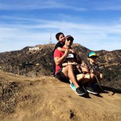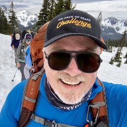
It’s a challenging hike especially if you are not acclimated. The views and wildly different terrains from the desert to the mountains is worth it. Pack a lunch and a few beers.
★
★
★
★
★
Nice trail in desert. Not difficult mostly easy. Wild flowers and cactus in blooms. Take the loop clockwise to avoid steep rocky downhills.
★
★
★
★
★
Solo hiked Feb 12 – I had fun doing this loop last year and so I came back for round 2. Started really early and let the trail put me to work as Marion always does all the way up to the PCT junction with great weather and trail conditions. About half a mile before Little Round Valley, it became noticeably colder as usual, but adding glove liners was enough to stay comfortable. Going up the west side of San Jacinto early always feels colder than the east side (Peak Trail) without the east’s early solar warmth (and nice sunrise over the Salton Sea). That said, the west side’s forested terrain has its own uniqueness including the nice overlooks. But I knew I would be on the peak at sunrise before going down the east side so I’d get nearly the “whole package” today. Once on the switchbacks above Little Round Valley, the ice patches became harder to bypass, prompting me to spike up. Snow/ice coverage was uniform halfway up the switchbacks but never too treacherous. Views from the summit were really nice with just a little mid elevation haze/fog in the valleys and a high, stratified cloud celling. While heading down the east side, I was fortunate enough to meet up with Jon King of the San Jacinto Trail Report. After catching up on things and excitedly talking about all the snow in next week’s forecast, I continued on toward Wellman Divide and Annie’s Junction, stopping along the way at Wellman Cienega to filter some nice cold water. The stretch of PCT between Annie’s and Strawberry junctions is very scenic and always a favorite. After a food break at Strawberry Camp, it was a straight shot up PCT and down the Marion Trail to the car. Just before the car, I was surprised to see “Maria” on the trail whom I’ve met on several SoCal peaks. Highly recommend reading Jon’s daily reports at https://sanjacjon.com/ for the latest trail conditions before heading out. Logged 16.1 mi /25.9 km & 5089 ft /1551.1 m with Gaia
★
★
★
★
★




C2C was awesome views, flowers, snow covered trails, and desert magic during sunrise. Bring plenty of electrolytes and calories for the day. Maybe up to 3.5 L of water to refill at ranger station before summit.
★
★
★
★
★

This is my favorite area in SoCal. My wife and I can’t get enough of the beauty in this area. The trail is well marked and well maintained. We met a lot of great people on this hike. Can’t wait to summit San Jacinto again from yet another route as there are so many routes to the summit.
★
★
★
★
★

Beautiful weather - cool but not cold. Gorgeous sky paintings courtesy of our Lord! The few people on the mtn I ran into were super cool!
Nice pre-snow day and got some ice falling from trees to spice it up!
★
★
★
★
★

Amazing views from the top. More trees and spots of shade along the way up than I thought. Very tough on the feet as most of the upper trail is on rocks and not a smooth dirt path.
★
★
★
★
Hiked/Climbed March 13 2026 – As it was forecast to be one of the hotter days of the record breaking March heatwave, I decided on a shorter trip (or so I thought) to climb Antsell Rock with a very early start from the Spitler Peak trailhead. Spitler is a nice trail to get up to the Pacific Crest if not done in the heat (no shade) and you don’t mind the usual deadfall obstacles on the upper switchbacks (4 large cedars to go over/under/around and tangled webs of smaller burned oaks). While it was already warm at the start, a nice cool wind started blowing halfway up the switchbacks and continued for most of the day. Gaining the ridgeline at the Spitler/PCT trails junction in the dark and looking down at the Coachella Valley lights that stretch for miles was amazing, well worth the hike in itself. Continuing north on the PCT, I headed up the meandering gully use trail to Apache Peak, stopping once again to see the eastern light show. Instead of back tracking to the PCT, I decided to spike up and make a direct descent down the snow on Apache’s northern slope to rejoin the PCT (when snow free, there is a use trail here). Back on PCT heading north, the occasional snow was still firm as first light was coming over the horizon. Getting to see the first light from the eastern side of San Jacinto & San Gorgonio is probably the biggest motivation for starting early (IMHO) and it was spectacular. Leaving PCT and going up the northeast chute to reach the base of Antsell Rock started on slippery snow and transitioned to a loose talus/scree mix, just as anticipated. After reaching the base of the first chimney climb, it was a truly fun route up that I has last done in 2024. The ledge connecting the two short vertical routes still had Poodledog bush that was hard to avoid but it is finally withering. I was amazed that there were only three entries in the log book since my 2024 scratching as it’s not a hard climb and rewards one with awesome panoramic views in every direction. After down climbing to the top of the chute and descending it, I decided to expand the day as the weather was still not too bad and I had brought 4 liters of water with plans to cache half of it enroute. Heading back south on the PCT, I took the standard route around the northeast side of Apache which is the first time in three years that it was not steep ice at mile 169 on the PCT map. Continuing on to the south, I decided to go up Apache’s east peak before heading back to the Spitler/PCT junction and going further south to head up the last bit of the Spitler Peak Trail to the summit. After enjoying the great views of Garner Valley, Lake Hemet and the taller San Jacinto peaks, I headed back down to the trailhead, stopping to filter some nice cold water at the bottom of the switchbacks. The lower trail was definitely on the hotter side but still enjoyable with a boonie hat. It is possible to take the Apple Canyon Trail down from the PCT between Antsell and Apache but it’s quite an adventurous bushwhack as I found out in 2024, slower than the extra mileage of returning via the Spitler Trail. “Friday the 13th” was on my side all day! Logged 16.9 mi /27.2 km & 4421 ft /1347.5 m with Gaia
★
★
★
★
★

Solo hiked Tues 4/16/2024 – Cactus Springs Trail-Sheep Mountain Trail- cross country from Sheep to Martinez mountains-cross country down WSW slope of Martinez- Cactus Springs Trail back. The only real trail on this loop was the Cactus Springs Trail, a nicely laid out ancestral path of the Cahuilla Tribe. It takes a direct route through the Santa Rosa Wilderness with frequent wooden forest service marker posts along the way. There are also many cairns/ducks marking the trail where it goes through the sandy wash areas but some erroneously mark paths up smaller, “dead end” washes. Going up the faint to non-existent Sheep Mountain Trail requires a bit of navigation work but is somewhat intuitive. There are helpfully cairn marked sections of this trail closer to the Sheep Mountain summit. Panoramic views off of Sheep Mountain were spectacular including Toro, Santa Rosa, San Jacinto, San Gorgonio and Martinez summits as well as the northern shoreline of the Salton Sea. That said, the view of the northwest route up Martinez from here reminds you of the work ahead! Taking the cross country route from Sheep to Martinez was the most challenging part of this trek, a constant navigation exercise without the aid of cairns that switches to a steep, direct NW ascent up to the summit. No real bushwhacking is required in finding a direct route up through the pinyons and oaks, just some care in avoiding cholla and prickly pear spines and looser scree zones in the gully portions. Climbing the Martinez summit block from the southeast side is straight forward, even with a mid-weight pack (placed it on a nice ledge for the last 3 chimney feet and retrieved it from the top). Really appreciated the very well cairn marked WSW descent down Martinez to the Cactus Springs Trail! Much thanks to everyone responsible as it was a quite fun, enjoyable way down through the rocks. Found what looked to be a nice 30 foot down climb of a dry water fall on an alternate route back to Horse Thief Creek but there was not enough daylight left for the “unknowns”. Highly recommend this loop if you’re up for the navigation work. Otherwise, the Cactus Springs Trail alone is worth the time. Logged 20.2 miles/4864 vertical ft with Gaia.
★
★
★
★
★
Solo hiked Fri 6/14/2024 – Decided to create a loop by taking the Spitler Peak Trail up and the Zen Center - Apple Canyon Trail on the way down with stops on the Apache Peak & Antsell Rock summits. Ascended Antsell on the northeast gully route and descended via the northwest ridge. It was great weather going up Antsell Rock, providing for spectacular views off the summit. Coming back from Southwell Peak during the first week of March, I climbed the NE gully route on ice/snow up to the notch before running into a very shiny verglas coating on everything above the notch. Going up the gully this time was nice with careful routing to avoid launching any rocks down towards the PCT. The class 3 sections up to the summit were fun but short lived with some Poodle Dog bush to avoid at all cost on the second class 3 section and even more prolific on the way down the northwest ridge. Scrambling the northwest ridge on the way down was great fun but time consuming. A quicker option would be to traverse down along the west side of the ridge to reduce the scrambling work (but what fun would that be). Once heading down the Apple Canyon return trail, I followed a Peakbagger GPX route that sent me into extreme, shoulder high bushwhacking mode in two places. There were cairns/ducks marking a slightly overgrown trail going down that I should have stayed on but I kept thinking that the bagger GPX would lead to the proper creekside trail which it never did. Lots of time wasted here going through buckthorn and trying to avoid poison oak thickets before getting back on the better trail above the Zen Center. My advice to anyone going up Apple Canyon would be to pick up the trail at Zen and use the cairns with careful route finding between them. Otherwise, just use the Spitler Peak Trail that Jon King and the San Jacinto Trail Report has recently cleared of 30+ blow downs/tree limbs. Spitler might be a longer route to access the PCT but it’s a more enjoyable one with no private property to deal with. In spite of my travails coming down Apple Canyon, it was a very enjoyable hike that just took longer than planned. Logged 12.0 miles / 3318 vertical ft with Gaia .................................................................................................................................................................................................... Solo day hiked Tues 3/5/2024 – Even after a few days of rain, the Spitler Peak and PCT trails were relatively dry and in great shape up to Apache - a few blowdowns and rime ice piles but no real mud. But of course things changed quickly on PCT at mile 169.5, north east of Apache where the steeper slopes were iced over with the snowfall having sloughed across the trail before the freezing rain iced over all of it. Good day for auto crampons for the “crampon/crampoff” march out to South Peak. Same 45-55 degree ice slopes as those encountered last year, here, and at Baldy/Cucamonga where there’s a long runout and very little chance of self-arrest, even with the best axe and technique. There were 3 traverses like this to be carefully crossed 2X, slowing things down a bit. The rest of the way along PCT out to South Peak had so many blowdowns over 4.5 miles that I lost count after the first 20. Most were at the 3-1/2 foot high level with multiple branches where it’s just as hard to crawl under with a winter climb pack as it is to hop over. Some had to be widely bypassed upslope for extra fun, 2 were cleared for extra credit. After getting near mile 174, there was a 2-1/2 foot diameter tree perched above the trail so I directly ascended the east slope of South Peak from there, relaxing fun with little snow. Awesome views from South Peak of Garner Valley, Tahquitz, Red Tahquitz, Antsell Rock and the desert floor. Had some fun bouldering at the South Peak/Antsell Rock saddle on the way back before climbing the east gully route to Antsell Rock which was still frozen enough to front point all the way up to the rock base. That’s when I noticed how shiny the rocks were with a nice, clear, verglas layer of ice still being actively chilled with the wind picking up. Easy decision to bail and descend back to the PCT and back to Apache. Was glad to cross the ice fields before dark and then go up Apache Peak to see the Palm Springs light show and last of a beautiful sunset. I had read Jon King’s always meticulous San Jacinto Trail Report before the trek and knew about the ice but didn’t plan on all the blow downs. Incredibly long day with some brutal stretches but still a lot of fun. Highly recommend Jon King’s incredibly detailed daily reports, https://sanjacjon.com/, and YouTube channel before heading out in the SJ Wilderness. Logged 20.0 miles/4374 vertical ft with Gaia.
★
★
★
★


Very nice for viewing palm trees trails are well maintained and marked.
★
★
★
★
★
Solo day hiked Weds 12/20/23 – Parked on the side of 241 and walked up Black Mtn Road since it was already drizzling and I didn’t bring the 4x4. Was amazed that the road held its June regrade better than most others after the Hilary storm. Wouldn’t normally hesitate driving this in dry weather with a sedan or minivan but the mountain forecast was calling for noon rain and I didn’t want to get stuck in either of the 2 washout areas. Black Mountain Road is well routed. Making for an easy walk, even with a heavy pack. Once at the Fuller Ridge Trailhead and heading southbound on the PCT, the drizzle stopped and it was perfect hiking weather. After crossing into the state park, there were several large trees to contend with as expected from local guide John King’s very detailed and always up to date trail report (https://sanjacjon.com). Went down PCT far enough to make an east cross-country ascent of Castle Rocks with some ice on the granite but easy to work around. The sun came out and the clouds dispersed on the way up Castle Rocks, making for spectacular views off the summit of San Jacinto’s northwest face, Palm Springs and the lower west ranges. Traversed eastward along Fuller Ridge to the CT Overlook summit which has a sharper, taller summit block resembling some of those found in the Eastern Sierra. Easily my favorite summit of the 3. From there, it was down to the saddle shared with Fuller Ridge Peak and some bushwhacking to connect animal use trails up to its summit. Once at the summit, the clouds moved in and it rained lightly for 20 minutes with the views completely obscured by a temporary whiteout. The northwest cross-country route back down to PCT involved route finding through dense, old growth Manzanita, Chinquapin and some Whitethorn which was quite a challenge. Probably should have descended using the previous ascent route. Met up with several nice 4x4 parties on the way out with no rain along the way. Second time this year helping a deer off Hwy 241 that was confused by the steel guardrails. Highly recommend Castle Rocks and CT Overlook summits for their perches that offer excellent long distance panoramic views on clear weather days. Logged 18.7 miles/3662 vertical ft. with Gaia.
★
★
★
★
★
Solo day hiked Fri 12/8/23 – While the Lower Sawmill Trail is the dirt road to the old charcoal kiln as advertised, the Upper Sawmill Trail from the kiln to the Santa Rosa Truck Trail was a nice surprise. It’s a well-routed trail that takes you from the chaparral through a shaded oak forest before ending at the truck trail. It’s soft on the feet compared to the lower road with a nice set of switchbacks going up the last, steeper part of the trail. There are several trees (blowdowns) across the trail that aren’t too bad to bypass (thanks Hilary). Even though it’s not a high traffic trail, I found it easy to follow with only a few spots requiring a small bit of navigating. Once on the SR Truck Trail, I headed east and made a direct ascent (blue arrow markers on rocks by the road) south to the Santa Rosa Mtn summit. Nice to see the giant fireplace from Desert Steve’s summit cabin that burned down in 1996. Headed down to the truck trail and then east to Toro Peak North and then cross-country to Toro, Wind Chill and Toro Peak West. Went up Peak 7878 on the way back to the Sawmill Trail. Was a good weather day for views off the truck trail and summits, especially those of the Coachella Valley, Salton Sea and San Gabriel Mtn Range. The valley views coming down the lower Sawmill road at sunset were a nice way to end the day. If you want a good hike up these peaks without the help of a 4x4 on the truck trail, this is a good one and very scenic! Logged 25.8 miles/5555 vertical ft. with Gaia.
★
★
★
★
★

Great desert overlook by hidden lake
Not nice thorny to pct
Lots of elevation up and I was not in that shape
★
★
★

This trail was one of those beautiful trails I’ve hiked, in California. The lush palms throughout the 1st 1.5 miles are magnificent, and plentiful!!…
The water was flowing the whole time due to the rains, and in the end of the hike, the storms came in over the canyon and had a little bit more water… It got really windy as well so look out overhead when you walk back through the canopy…
Beautiful hike, will go back again
★
★
★
★
★

June is a great time of year for this trail, water is flowing, good temps.
★
★
★
★
★
Hiked Jan 07 2026 - It was the last day of the week to head up to San Jacinto Peak in nice weather before the stronger winds were forecast. Going up Deer Springs early was cold enough for heavier gloves but the tradeoffs were great snow and the ice sculpted trees/understory. Heavier gloves but no traction aids all the way up with consistent snow coverage from just before Little Round Valley to the peak. Some areas of ice and flowing/standing water on the upper Deer Springs Trail but easy to bypass. Views off the summit were impressive, especially of Coachella Valley and San Gorgonio Mountain which looked heavily snow-capped. With absolutely no wind on the summit, it was hard to believe that gales were forecasted to start up in the late evening. After a small break, the only other hiker I’d see on the upper trails appeared on the summit and I was pleasantly surprised to see that it was “Maria”, someone I’ve crossed paths with a handful of times over the last year on different SoCal peaks. After one last look at how much snow I would be dealing with on San Gorgonio next week, I spiked up for the Peak Trail descent as the cloud ceiling started dropping down. The east side was considerably warmer than Deer Springs but there were still occasional snowflakes starting to fall instead of rain. Wellman’s Cienega was flowing well between the icicles, providing for fast water filtering. Once on the Pacific Crest Trail, I was surprised to find it untracked all the way to Strawberry Junction. It was also interesting to see Strawberry Creek flowing across the PCT which I’ve seldom seen. After removing micro spikes here and heading down, the weather warmed up considerably but the rain held off. Recommend checking out the San Jacinto Trail Report (https://sanjacjon.com/) before heading out for up to date conditions as Jon King still hikes this area daily. Logged 18.4 mi /29.6 km & 5166 ft / 1574.6 m with Gaia
★
★
★
★
★


Beautiful trail, but a little hazardous. Lots of manzanita brush to battle through, trail not often used.About 2 miles of this hike are through brush and fallen trees- quite technical. Wear long pants and bring poles to push through the brush and lessen chances of a Snake bite. Otherwise, can’t beat the views! Hidden lake was still full and the desert view was amazing!
★
★
★
★
Hiked Fri 07/07/2023 solo – Early start on a warm day with clear weather on the way up Tahquitz, Grey Tahquitz, Red Tahquitz and Sam Fink Peaks. Enjoyed the awesome panoramic views from each. Chose the harder but very fun scramble up the north side of Grey Tahquitz instead of the optional (and less stressful) use trail to Red Tahquitz which I used for the return to the PCT. Took the very scenic, fern lined Tahquitz Valley Trail to connect with the east bound Willow Creek and King Trails to get to Willow Creek proper. From Willow Creek out to Sam Fink Peak, I tried to use the Caramba Trail which is a total mess, having dense overgrown sections of White Thorn & Chinquapin, combined with several fallen trees hidden underneath. There are several cairns that lead part way though the overgrowth but the trail is non-existent in several sections. While it undoubtedly took more time, I found it easier to navigate a cross country route between Willow and Tahquitz Creeks on the way out to Sam Fink Peak than piece together some parts of Caramba. Lots of fun scrambling up the false summit on Sam Fink before the steeper scramble up the real summit. Filtered nice cold water from Tahquitz and Willow Creeks to make a long, warm day more pleasant. The bugs were out in force by mid-morning, ignoring my insect repellent but held back by a mosquito net. Sam Fink is on the eastern edge of the SJ Wilderness but a fun climb. You just have to carefully plan your route after Willow Creek. To get to Willow Creek (which is very scenic right now), I would recommend using the King Trail instead of continuing further down the Willow Creek Trail. The King Trail is a right turn from the eastbound Willow Creek trail, 1 mile from Saddle Junction. It is well maintained and meticulously marked by many cairns. Route for this hike = Devil’s Slide to PCT southbound to South Ridge Trail to Tahquitz Peak. South Ridge Trail (north) to PCT southbound, scramble p north face of Grey Tahquitz Peak. Animal use trails to Red Tahquitz, returning to PCT northbound via Red Tahquitz Use Trail. PCT to Little Tahquitz Valley Trail to Willow Creek Trail to King Trail to Caramba Trail + cross country to Sam Fink Peak. Return by same path to Saddle JCT, then Devil’s Slide. Logged 23.3 miles/5514 vertical ft. with Gaia
★
★
★
★
Hiked Fri 07/07/2023 solo – Early start on a warm day with clear weather on the way up Tahquitz, Grey Tahquitz, Red Tahquitz and Sam Fink Peaks. Enjoyed the awesome panoramic views from each. Chose the harder but very fun scramble up the north side of Grey Tahquitz instead of the optional (and less stressful) use trail to Red Tahquitz which I used for the return to the PCT. Took the very scenic, fern lined Tahquitz Valley Trail to connect with the east bound Willow Creek and King Trails to get to Willow Creek proper. From Willow Creek out to Sam Fink Peak, I tried to use the Caramba Trail which is a total mess, having dense overgrown sections of White Thorn & Chinquapin, combined with several fallen trees hidden underneath. There are several cairns that lead part way though the overgrowth but the trail is non-existent in several sections. While it undoubtedly took more time, I found it easier to navigate a cross country route between Willow and Tahquitz Creeks on the way out to Sam Fink Peak than piece together some parts of Caramba. Lots of fun scrambling up the false summit on Sam Fink before the steeper scramble up the real summit. Filtered nice cold water from Tahquitz and Willow Creeks to make a long, warm day more pleasant. The bugs were out in force by mid-morning, ignoring my insect repellent but held back by a mosquito net. Sam Fink is on the eastern edge of the SJ Wilderness but a fun climb. You just have to carefully plan your route after Willow Creek. To get to Willow Creek (which is very scenic right now), I would recommend using the King Trail instead of continuing further down the Willow Creek Trail. The King Trail is a right turn from the eastbound Willow Creek trail, 1 mile from Saddle Junction. It is well maintained and meticulously marked by many cairns. Route for this hike = Devil’s Slide to PCT southbound to South Ridge Trail to Tahquitz Peak. South Ridge Trail (north) to PCT southbound, scramble p north face of Grey Tahquitz Peak. Animal use trails to Red Tahquitz, returning to PCT northbound via Red Tahquitz Use Trail. PCT to Little Tahquitz Valley Trail to Willow Creek Trail to King Trail to Caramba Trail + cross country to Sam Fink Peak. Return by same path to Saddle JCT, then Devil’s Slide. Logged 23.3 miles/5514 vertical ft. with Gaia
★
★
★
★

First time up to Idyllwild. Stopped by the ranger station right off of the main road and down the way from the trailhead. Picked up a hiking permit for the day. They have a kiosk outside that makes it easy to find and fill out the permit. Trailhead was easy to find. Plenty of parking on a Friday at 7am. The hike up to the junction was a nice and steady incline with some amazing views and a couple of small stream crossings. Once up to the junction it really opened up and the trails flattened out. Tried to go to Tahquitz Peak, still plenty of snow left on the trails as well as a number of downed trees. Turned around about a third mile from the peak, didn’t want to chance it even though I had micro spikes and poles with me. Decided to walk around the meadow, which needed up being really nice. Easy to find forks in the trails with each trail being labeled with signs. The meadow had a number of downed trees and really could use some maintenance but easily enough to be able to navigate over or around them. On the way back down to the parking lot, I was stopped by a ranger asking for permits. Super friendly and knowledgeable about the area. Definitely will do again once the snow melts and the peak is clear to get to
★
★
★
★
★

Crossed the creek many times, shared the trail with horses and the waterfalls were stunning. Trail is an out and back, so total mileage is 4.0
★
★
★
★
★

Solo hiked Thurs 08/10/2023 – Deer Springs / PCT trails to San Jacinto Peak, down to San Jacinto Azimuth Benchmark rock pile, Peak Trail to Miller Peak, down to Wellman Divide, out Round Valley Trail to High Trail, direct ascents of Landells/Luella Todd and Divide Peaks. Some passing dark clouds with full sun in the afternoon - very nice, cool weather for hiking. One docile Southern Pacific snake trailside in the early morning just above Strawberry JCT – surprised there weren’t more out during the day. First strong water on Deer Springs for filtering at the 6.5 mile mark (North Fork San Jacinto River). First time locating the actual SJ Azimuth survey marker high up in the rocks. First ascents of Landells and Divide peaks out of Round Valley were a lot of fun with Class2/3 summit blocks- many different ways up with great holds. Water pipe at Round Valley Ranger Station, Wellman’s Cienega, and Strawberry Cienega all flowing well. Not too many people out with the tram closed. A few Western Gray squirrels approaching the size of my youngest cat. Long day but great time to hike SJ in great weather with a still vibrant backdrop. Seems like the bird population has notably increased this year but then so has the bug population (only a problem on the last 2 miles down to the Deer Springs trailhead. Logged 26.1 miles/6688 vertical ft. with Gaia ___________________________________________________________________________________________________________________________ Hiked Friday 05/05/2023 solo – Deer Springs to Suicide Rock to Strawberry Junction to PCT (Strawberry Cienega Direction). Was going to do a quick out and back to Suicide Rock but the snow and weather were too optimal not to add Strawberry Junction and part of the PCT to Strawberry Cienega. First hike this year without mountain boots/auto crampons, using lower mid boots instead. You could easily wear trail runners for Suicide Rock and possibly for a trip to Strawberry Junction in another week. Not the case for PCT- high top boots/crampons still required. Amazing to see the drastic increase in snow melt and volume of water coming down the mountain. Nice to hear the roar of the water even if it means more mud. Not many obstacles to get around on this trail including downed trees and water crossings, especially compared to the middle route/Devil’s Slide. Met a lot of friendly people starting up on my way out as now is a great time to consider hiking the lower part of this scenic trail with the bulk of the snow gone. Logged 10.4 miles/3161 vertical ft. on Gaia
...........................................................................................................................................................................................................................................Hiked Friday 03/24/2023 – Deer Springs Trail to Strawberry Junction/Camp on PCT. In spite of an early start to get firmer snow, I post holed 6-8 inches on long tail snowshoes for the entire trip. It was a great workout but brutal on the way up with this week’s loose powder on top of last week’s thin crust. Even with snowshoes, I was frequently in snow up to my knees with a full pack. That said, it was still a nice trek through the SJ Wilderness with nice views of the sun hitting the Tahquitz peaks and Diamond Valley Lake. I tried a few climbs off the Marion Creek gully but crampons were unusable in the soft layers. There were frequent water crossings on this route but easier to traverse than on Devil’s Slide. This was the second time this month that a mountain lion has put tracks through mine between going out and coming back. If you can wait for the snow to consolidate for a week before going up, you’ll find it more enjoyable as I went too early and you might also have a tracked trail to follow (recommend offline nav + paper maps as the snow frequently sluffs/buries the trail). I had planned to go up Devil’s Slide from Humber Park but the last part of Fern Valley Road near the trailhead was not yet plowed and my attempt to cross it was unsuccessful. Logged 10.1 miles/2844 vertical ft. on Gaia.
★
★
★
★
★
Solo day hiked 5/29/25 - Early start up Deer Springs wearing a thin base layer and hiking under a nice star-filled sky. It’s amazing how bright Venus is right now due to its closer orbit point. Aside from a mule deer going down a slope, it was a quiet trip up the western side with only a few off-trail snow patches remaining. There are several water filtering spots currently flowing across the Deer Springs Trail (marked as waypoints on my gps track), the furthest being Little Round Valley Creek which is still flowing through the campground. Early morning views off the peak overlooking Whitewater/Coachella were nice but a little hazy for good photos. That said, the very clear view of San Gorgonio Mountain with very little snow remaining on its southern side was very picturesque. Descending on the eastern side in the morning sun via the Peak and Wellman trails felt like summer had arrived. Thanks to those responsible for trimming back the chinquapin and whitethorn bushes on this side, very nice! Filtering a few liters of cold water from Wellman Cienega is always a nice stop, although it seems like it’s flowing less than the same time last year. I met up with a couple of nice NOBO PCT registered hikers while heading west on PCT (NOBO PCT stretch between Annie’s and Strawberry junctions) to rejoin the Deer Springs Trail which was a surprise for this time of year. There is no water on this segment as Strawberry Cienega is relatively dry. After getting back to the Deer Springs-Suicide Rock junction, it was early enough to head out to Suicide Rock before returning to the trailhead and so I climbed the boulder high points before going back to the car. Marion Creek is still flowing nicely across the Suicide Rock Trail for those interested. Was a fun day in warm but very comfortable weather. Check out Jon King’s San Jacinto Trail Report (https://sanjacjon.com/ ) before heading out anywhere in the San Jacinto Wilderness for up to date trail/water conditions. Logged 21.4 mi /34.4 km & 5744 ft / 1750.8 m with Gaia
★
★
★
★
★

A nice day hike. Unusual terrain. Palm trees in the lower canyon, desert higher up. Hiked to Stone Pools and back. Good spot for lunch. Odd to see so much water in the desert. Beautiful views of Palm Springs below and snow capped mountains above. Lots of cacti.
★
★
★
★
Solo hiked Mar 6 2026 – Started really early to get great snow for the entire trek with nice weather. Bare boots and a light merino hoodie to 10k ft. /3048 m, micro spikes and a hard shell from there to the peak. Taking the East Ridge route up from near Miller Peak instead of the last few switchbacks on the Peak Trail was great with good snow and no ice (unlike January). Views off the summit were a little hazy but those toward San Gorgonio Mountain, Snow Creek and Coachella Valley were still nice. Nice gentle breeze on the summit was a bonus, given the upcoming forecast. Descending on firm snow with no ice was great with micro spikes down to 8500 ft. / 8591 m (not necessary but helped the pace). Stopped at Wellman’s Cienega to filter a liter and was surprised that the 18 inch icicles were still there. Water was flowing well at the Jolley and Middle Spring crossings on Devil’s Slide. It was nice that the FS reopened the Humber Park gate with only a handful of cars parked as of mid-morning and no snow to be found. Recommend reading Jon King’s San Jacinto Trail Report at https://sanjacjon.com/ for the latest trail conditions before heading out. FYI – online day hike permits are available at https://www.fs.usda.gov/r05/sanbernardino/wilderness/san-jacinto-wilderness. Logged 15.0 mi /24.1 km & 4286 ft. /1306.4 m with Gaia
★
★
★
★
★

Great hike. We planned on three miles in and then returned. Had a great snack spot with views of the snow on San Jacinto and could also see all the way to the Salton Sea. The oasis would have been another couple of miles.
Poles are a great asset and take at least two litres of water.
★
★
★
★
★

Enjoyed this hike. The barrel cacti are blooming. Beautiful views.
★
★
★
★

This was an epic day.. decided not to go the whole way to the top and opted for the epic blue cheese burger at the bar in the tram station. From 7500 feet up the snow in the shaded gulleys was hard packed but not too slick. Spikes recommend.
★
★
★
★
★
Solo day hiked Thurs 1/30/25 – Started this one tired but didn’t really feel it until the last 1-1/2 miles to the summit. But as Deer Springs always feels like it’s worth the effort, especially when snow-covered, I just took a longer food – electrolyte break at Little Round Valley and crawled up to the summit. The snow was spotty up to Strawberry Junction, after which it was a more consistent 4-5 inches of unconsolidated powder on the Pacific Crest Trail. Once on the upper Deer Springs Trail, the snow was a deeper 6-8 inch layer of unconsolidated powder. There were tracks up to Strawberry Junction but the rest of Deer Springs was unbroken up to the summit (except for 2 sets of mountain lion tracks and those from several mule deer). It was nice to have great snow going up early but it became very sloppy by noon. I didn’t use micro spikes going up but there were a few icy spots on the final ascent to Little Round Valley. I did use micro spikes coming down from the summit to Strawberry Junction to speed things up but I was still sliding around here and there. IMHO - the snow will not hold up well mid-day over the next week with the higher temperatures forecasted so going early will at least make the ascent easier. There are several fallen trees (a few new ones since last month) to hop over or bypass, none requiring too much extra effort. It was a very nice, sunny day with no wind and several mule deer foraging above Little Round Valley. Highly recommend reading the San Jacinto Trail Report (https://sanjacjon.com/) for the latest trail and weather conditions before going out on any of the San Jacinto Wilderness trails. Side note - the vault toilets at Little Round Valley are being used as trash cans so they may not be readily usable. Logged 18.5 miles / 5203 vertical ft with Gaia
★
★
★
★
★
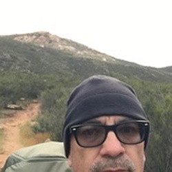
Great hike! 16 miles approx 9-12hr hike. Beautiful views, best time to hike trail is spring to fall.
★
★
★
★
★

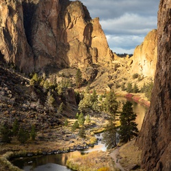
After getting your wilderness permit at the ranger station, we hiked up to Wellman’s divide via Willow Creek Trail to Round Valley.
From here towards Cienega, which had the slightest trickle of water and at this time of the year is an unreliable water source. After Joining the PCT South for a while we arrived at the Saddle Junction for a well deserved lunch break.
We picked up the Willow Creek trail once more to start the long, steady climb back towards Hidden Valley and Long Valley. The trail past the Willow Creek crossing (good water flow) becomes a bit of an obstacle course with dozens of downed trees. The trail also is overgrown with Silver Thorn, long hiking pants are you friend. This is a very remote and beautiful section with wildlife abound.
★
★
★
★
★


Temp was 45F at 8am and there was only one other couple on the trail on a Saturday. No toilets at trailhead. A good portion of the trail was covered in snow, making it impossible to see the trail and slowing down the journey. Micro spikes helped a lot and my knees wished I had hiking poles for the decent.
★
★
★
★

A quarter of the way third of the way to Art Smith Trailhead and Palm Desert. Nice up and back from Cathedral city.
★
★
★

Good hike. You can pick whenever you want to turn around. Make sure you bring water. When u think u have enough. Bring more.
★
★
★
★
★

The hike took me 5 hrs 10 min, and I felt I was at a pretty good pace. Most of the people from the same tram seemed to reach the peak either slightly ahead of me or within 20 minutes after.
The trail is east to follow and all branches are well signed. The views were great, although the marine layer hadn’t burned off so we couldn’t see the ocean like I’ve heard.
★
★
★
★

Out and back. Dramatically different scenery from the Coachella valley. Great views.
★
★
★
★

First time overnight camping, went from the top of the Tram to Idyllwild, overnighted just east of the National/State park boundaries. Was a challenge, but doable. Take water (I used 3L)
★
★
★
★
★
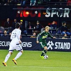
Great weather, lost the trail a few times and stopped once or twice for a few quick rock bouldering sessions. Magnificent views.
★
★
★
★
★

I’m sorry I underestimated you :( Definitely more climbing and scrambling and less switchbacks than I anticipated. Started at 8am and went clockwise by accident but that’s ok. You’ll encounter beautiful manzanita trees for the first 3 or 4 miles going up Deer Springs trail. Encountered four man children at mile 6 blocking the trail with all their shit, farting and burping and as my friend and I were taking a break out of sight off trail we overhead them fantasizing over us doing obscene sexual things to each other at the top of San Jacinto (can a man and woman not be platonic friends?). Toxic masculinity is real and I feel sorry for them assuming they don’t have any close friends that are women in their lives. Wish I had another opportunity to confront them but oh well it’s probably better I didn’t. We tried to not let that ruin the rest of our day though. Aside from the summit view toward the Mojave, the section of the PCT going through San Jacinto Wilderness was the highlight for me. Grateful for these humbling SoCal mountains. Next time Cactus to Clouds.
★
★
★
★
★
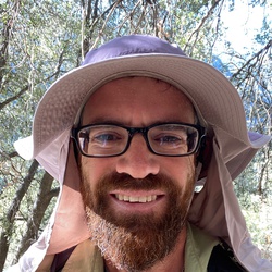
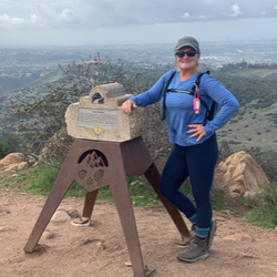

Great way to escape the desert heat and walk through alpine meadows under beautiful fir and pine at 72 degrees.
★
★
★
★
★

We started from the tram and made it to the top! It was a great hike.
★
★
★
★
★

One of, if not the best, day hikes in SoCal. Shaded 80% of the hike in 70 degrees temps in the middle of the summer.
★
★
★
★
★


Beautiful area in the Canyon of Palms. Not much water at the falls but enough shade to sit and rest. Hike is a good workout, especially with the heat. We left at 9am, finished in 2 hours. Last 1/2 mile is tough because of the heat and sun exposure. Take plenty of water. Also easy to get off trail- Gaia saved us several times!
★
★
★
★
★
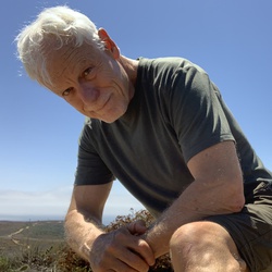


This hike was epic! Getting a head start from the Palm Springs Aerial Tramway at 8:00am was a neat way to start off the hike. Tickets must be bought in advance online, earliest time is at 8:00am last tram leaves at 8:00pm. Parking is $10. There is no set time limit for your return tram ride, you can catch whatever tram when you get back. Weather said it would be a chilly 40 degrees, however it was beautiful and low 60’s the whole way up with zero wind at the summit. Always bring layers just in case. Definitely have a map of the trail downloaded or have a physical map with you. The trail is well marked, but it gets lost here and there. I wandered off several times even with my gps.
★
★
★
★
★

Short, steep, and always a treat. A more fun alternative to the route up from the tram that’s less brutal than C2C. Views are incredible and most of the hike is pleasantly shaded. A true gem by any standard.
★
★
★
★
★
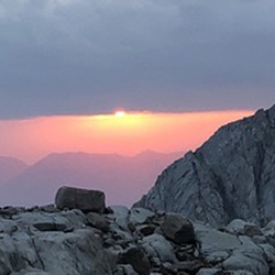
Stunning views on the peak,not a difficult hike and well worth it,highly recommended.
Happy Hiking
★
★
★
★
★
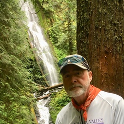

This was a great hike but my wife and I were unprepared for the ice on the trail. With only one set of crampons for her it was extremely difficult for me to find safe footing in some areas slowing us down a lot. This is the wrong time of year to make this peak due to how early it gets dark. We hiked the last 4 miles back to the car in the dark.extremely windy, 65 mph winds at the peak and very cold. I highly recommend this hike but at a time of year when darkness doesn’t fall at 5:00 P.M.
★
★
★


San Jacinto Peak via Marion Mountain Trail is tough hike.
Trail surface is very uneven and full of rocks.
There are lots of shades.
Steep climb from trailhead into the first 3 miles.
Listed as 5.6 miles but Gaia GPS said 7.8 miles.
One can filter water @ Round Valley Campsite (9720 feet elev) . Bring trekking poles for the descend.
★
★
★
★
★

It’s a beautiful drive up to Idyllwild fresh air in remind us like home
★
★
★
★

This hike was tough due to terrain. All the reviews said the first 3miles were steep and they weren’t kidding. It was challenging! Some parts were really narrow with shrubs that were a bit overgrown. Lots of boulders and rocks to maneuver around. The final sign that says .3 to the peak seemed like forever. In order to get to the peak, you have to climb over some large boulders to finally get to the top. Once you get there, the views are amazing and so worth it! Take lots of water and snacks food. Poles were great for the downhill with all the rocks. This helped with pounding on the knees. Weather really cooperated with us and the trail is 90%shaded. It was absolutely amazing the views and the experience.
★
★
★
★
★

Great hike. Lots of shade throughout. The hike itself is definitely not as hard as the reviews claim it to be. I would do this one a few more times.
★
★
★
★
★

Almost empty on a Monday with the Palm Springs tram shut down due to Covid. Started at 430 am to beat some of the sun. The assent has great shade and gorgeous forests on the way up. It’s a long day but if you can create some shade on the exposed descent loop, the views over the valley are really something. One of my new fav hikes.
★
★
★
★

This track is labeled wrong. This is via Fuller Ridge. The Marion Mt trail is shorter with more gain. Marion Mt is more like 13.5 miles, 4,200 ft if gain. Gorgeous trail view, beast of a hike. The climb is insane!!
★
★
★
★
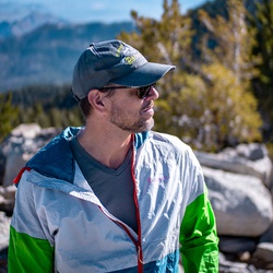 stars
stars
The Santa Rosa Truck Trail just opened up this season (I drove it on the weekend of 5/16/20). It's a fun and easy fire road up Santa Rosa Mountain from Highway 74. The wildflowers were in bloom and the weather was ideal for a weekend of car camping in the Yellow Post camp sites. We managed to snag sites 5 and 9, which are on the top of the peak, with views of Coachella Valley, San Jacinto Peak, and the Anza Borrego wilderness. Truly spectacular.
★
★
★
★
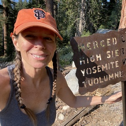
Beautiful desert workout with awesome views. The Palm grove at the turnaround is a pleasant spot to cool off in the shade. Wildflowers were going off in all sorts of variety. This will be my go to when friends and family visit and want a good hike.
★
★
★
★
★

A good workout, but mostly I value the beauty and serenity. I’m amazed at the diversity of life in the desert!
★
★
★
★

Hike up to two peaks that are connected by the PCT. Great views on both sides but snow on the north face of the Desert Divide stopped further hiking
★
★
★
★
Excellent sunny hike to a remarkably small hole in the wall of a mine. Slab rocks are only shade after leaving trailhead. Not another soul on the trail on the morning of Super Bowl Sunday. Very good views back out across Palm Springs.
★
★
★
★

Skyline is my favorite hike. There is snow and ice on the Traverse do bring your micro spikes and poles.
★
★
★
★
★
Made lemonade out of lemons and lemons got shafted from their own stupidity lol!
Jan and Kevin TOOK OFF from the get go - only saw their headlights way up ahead on the ridge. I thought I had no track so immed wanted to blowdart their asses and get Jan banned from Gaia for life as per Steve, derisively, he cannot even navigate out of a paper bag!”
Caught up quickly to another solo hiker going slower than me. Turns out he was experienced hike guide first time on Jac that season to check conditions for a group C2C he was leading. We hiked together up to Flat Rock, he was really feeling altitude and trail straightforward there so I went on.
Grubbs switchbacks were blown out in spots from the massive Valentines Day flash floods - had to do some kind of scary class 3 stuff in the very cliffish north side in between the intact switchbacks. Met 3 guys who do Skyline each year tho they now live all over US - super cool guys we figured out route together.
Saw rangers I knew day hiking - so nice guys rabid when I said J & K shafted me lol! Then saw Tracy A with a big group - they were hiking for Ellen’s bd. She REALLY went rabid as they had run into Steve who hiked up Devil’s to meet me at peak, so they were shocked when I told them about the boys.
BEST THING EVER - guys were not at peak! I was the happiest camper! Took my time on peak trail was totally stressed on Skyline and chit chatted a lot.
Tired hiking down to Idy was getting dark when got to car went slow pads of feet sore. Most miles I had ever hiked - SO proud of myself!
★
★
★
★
★

Excellent hide, first bit (up to PCT) is quite difficult, be careful not to go off trail as I did.
★
★
★
★
★

August 10 2017 average temp 110...19 mi hike, 5000 foot climb, 17 mile bike back down to la Quinta. A bit warm.
★
★
★
★
★


Great hike beautiful weather. Water running, some snow still on ground up by Peak. Started track at Wellman Divide
★
★
★
★
★


The trail was very nice, although one leg of the upstream part of the trail was washed out, so there was no loop. This made for a rather crowded hike, with tons of tourists trooping back and forth. We were treated to pretty close views of a bighorn ram, who posed atop a rock and clambered around the rocks for our benefit. The waterfall was very nice, although the big cottonwood tree next to the plunge pool blocked views for good photography. I would rate this a 5 except for the hordes hiking the trail, which detracted from the experience.
★
★
★
★


























































































































 stars
stars




























































































 stars
stars