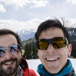
An amazing winter hike with rewarding views of massive ice features during consistent cold temps
★
★
★
★
★

Beautiful ride with a historic cemetery and a spring that bubbles out of the rock wall.
★
★
★
★
★

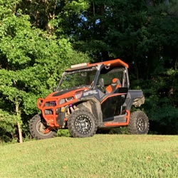
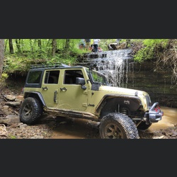
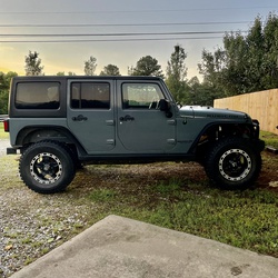
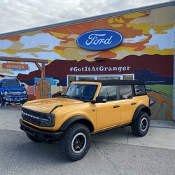
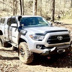
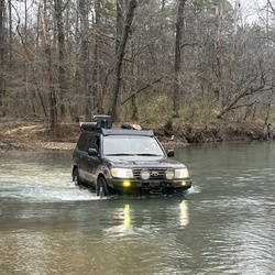
Jeep Day! 4- wheel a must. Bring appropriate equip for wet weather. Don't drown!
★
★
★
★
★
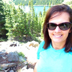
This is Heather’s favorite Buckhorn trail 😊. Happy 82nd b day!
★
★
★
★
★

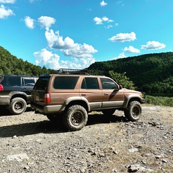
29 miles of rocks hills and trees. South end has a dead end but was awesome rock climbing. North end has an open area with a couple deeeeeep mud hole Shuler.
★
★
★
★
★


This was the first trail ride with the new Honda Talon. We started at Spring Lake went to Mount Magazine to the top and back. It was a good ride. Had some good trails some steep areas some water crossing really good ride.
★
★
★
★
★

Great two track with losds of stack rock step ups and a few fast sections thrown in. Did this on dirt bikes. Medium difficulty if you’re a solid C rider.
★
★
★
★
★

Lots of places for jeepin.. turn off the maps and just ride. Turn it back on when you want to head back to civilization
★
★
★
★


Backpacked this for the second time. Definitely not as fun to hike this in May vs winter/early spring due to bugs, ticks, and shrubbery/poison ivy. The gift shop at the top is nice but kind of takes away from the experience. Having water at the very top was nice though.
Lots of bugs, poison Ivy, and snakes this weekend. The ivy didn’t have oil on it yet though so I haven’t had issues with itching since.
Still a good, challenging hike. This was my wife’s first overnight hiking trip and she enjoyed it.
★
★
★
★
Great Four Wheeler Ride. It took us 7 hours and there were lots of mud puddles.
★
★
★
★
★

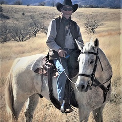
Perfect weather and Colors for the fall. Loved the horseback riding at Caney Mountain horse camp. Good new owner David and Tanya
★
★
★
★
★


Short, easy hike for the whole family! MUST have 4 WD to get to trailhead. Once you cross the creek initially, go left to walk down to where creek meets river, or right to go to falls. Fairly well worn trail for this area. Easy.
★
★
★
★
★

Very nice and quiet small campground. The falls are right beside the campground. There’s a small parking area near the restrooms very close to the falls. There are a few trails close by. I’d have rated it 5 stars if there were more trails.
★
★
★
★
This was a perfect day for jeeping in the mountains and chasing waterfalls.
★
★
★
★
★

Drove mostly on gravel roads today. Saw lots of cliffs. Shore lake lookout.
Very relaxing
★
★
★
★

Buffalo River/Leatherwood Wilderness: Brutal 10 mile loop hike even for experienced hikers. Multiple creek crossings (it had rained heavily a few days prior, so all creek crossings were up to knee deep), dozens of downed trees completely blocking the trails, rocky trails, muddy rutted horse trails, sometimes utterly impossible to even follow the trails…then no option but bushwhack. Cut to pieces by briars. 1,500+ feet of ascent. Absolutely astounding views of the Buffalo River, gorgeous creekside hike, complete privacy, bluff views, caves…all reasons I’d do this hike again in a hot minute.
★
★
★
★
★


Nice loop. 18 miles of the trip was on trails suitable for horses. The rest of the loop was county roads
★
★
★
★
Great jeep route without much pin stripping. Good trails with medium obstacles.
★
★
★
★
★

Great trail with some amazing rock formations, views, and caves to explore. Definitely worth drive out..
★
★
★
★
★


Absolutely amazing riding out of Katie mountain along multiple Bluffs and ledges across the buffalo river and some amazing inclines and declines not for the faint of heart
★
★
★
★
★


Nice trail with plenty of views. Mostly up and down with little undergrowth on the trail.
★
★
★
★

Long Pool offers nice camping for RV’s. It’s first come first serve but for winter time camping it’s perfect!
The night sky is awesome with hardly no lights anywhere in the camp ground.
★
★
★
★
★

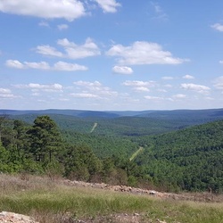
Easy hike with awesome views. Would be a great fall hike to see fall colors.
★
★
★
★
★

Very difficult. The last mile was excruciating. Great trail. Marcia and Shawn seen a Momma bear and her cub.
★
★
★
★

Rough climb for beginners coming up to Big Bluff but awesome views and worth the ride!
★
★
★
★
★

Mule ride. Challenging enough and scenic.
Muddy and trees down due to spring rains and storms.
★
★
★
★
★


From campsite 10 it was a good short hike to the top of Arkansas! Couldn’t see 50’ in front of you, but I had the trail to myself and the temp was perfect.
★
★
★
★

This loop includes the Spaghetti Trail that Marilyn and I cut last week. It’s rough and rocky.
★
★
★

 stars
stars
On my date of hike, Sat 12.12.20, we had completed several other trails on the Mountain. It was a cold day, and had rained fairly heavily the day prior.
This trail wasn’t at all muddy though, no slick or rough spots at all. At about half way up on the climb, the trees and other vegetation were covered in frozen fog, making the scene look like a magnificent winter wonderland.
This is also a dog friendly (on leash) hike. My lab, super Leeds, had a great time!
★
★
★
★
★

A couple of water crossings, one pretty deep but crossable
★
★
★
★
★


It was surprisingly pleasant walking up in a total white out.. the rain subsided long enough that it was just mist.. and warm too.. I was bundled up pretty good... winds were kicking a bit too.. it’s worth doing a shorty in a white out so you get a sense of it
★
★
★
★
★
stars
The road to White Rock Mountain is harder to do than the hike itself!
We did a sunset trip today on the back of about 10 hiking miles in the area
★
★
★
★

Not a bad trail. The roughest parts are towards the end. But definitely worth it
★
★
★
★
★

It was rough and tight I wouldn’t attempt some parts of it in anything larger than a Toyota pickup or 4runner.
★
★
★
★
★

Rough not much to see, not worth the hike in. Stay clear of the landslide!
★
★
★
★
★

Totally awesome day. 13 creek crossings on 3 mile. Really tough dirtbike climb at marker 8, but, doable.
★
★
★
★
★

Definitely a fun trail. Took a bone stock 2006 gx470 up it. Things got a bit dicey at times, but we made it all the way to the falls. I’d recommend some skid plates, there’s some rather large rocks throughout the trail. Also, one of the mud holes is like 3 feet deep. It looks shallow... but it’s not.
★
★
★
★
★


Very technical and challenging dirt bike ride. Southern route to the creek is best going downhill.
★
★
★
★

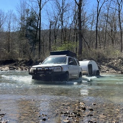
Great day adventure near Oark. Some gravel county roads, some fun challenging trails doable with stock 4x4. 3 of 9 rigs had side wall cuts on last section. Make sure you have spare tires. Some of the dead end sections should be avoided, we were looking for new MVUM trails but several shown on map were dead ends with nothing special at the end. A few small water crossings that should be ok most of the time.
★
★
★
★
★

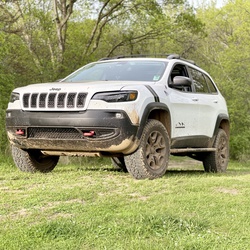
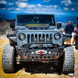
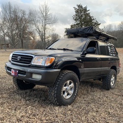
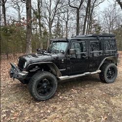
Would need a high-clearance 4x4 to get in here. A 2020, stock Jeep Wrangler Rubicon Unlimited handled it fine.
★
★
★
★
★

This has some very difficult up hill climbs on the way in. When you get further in there are several decent mud holes you have to be careful on.
★
★
★
★
★

So fun. Went to rope swing, then big eddy, crossed went to Campbell cemetery, back to big eddy crossed and came home
★
★
★
★
★

This was some extreme off-roading with major rocky terrain coming down the trail from the top of the mountain.
★
★
★
★
★

The walk to the waterfall is pretty easy and path very well defined. The waterfall is really cool and there are some nice areas above the falls. The only downside was all the people there. Maybe if we had gone earlier or at a different time. Highly recommended if you can find a time when it's not very busy.
★
★
★
★


This is one of the best dispersed camping areas in the Ozark National forest.
★
★
★
★
★

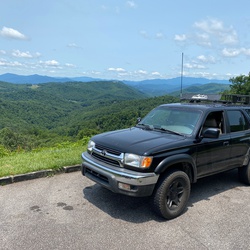
Great Overland/Offroad Trail. Lots of little side trails to play by the river. We went while it was raining so it made for some unique mud holes but most had the option to drive around if that’s not your style. Plenty of shallow water crossings. You’ll enjoy the super blue water. Set aside 2.5 hrs depending on if you want to drive straight through or longer if you want to do some exploring. Took an extra 25 minutes to get to and from either end of the trail to paved hwy roads. We tackled the trail in a Nissan Frontier 4x4 with a 2.5” lift and Bfg Mud Tires. Would recommend to anyone looking for a secluded offroad trail with plenty of areas to enjoy what nature has to offer. March 2020
★
★
★
★

Good hike. Trail not maintained. Blazes were few and far between. Lost trail once along gully. Picked up again searching for blazes. Not much scenery we haven’t already seen. Lots of bridges to cross.
★
★
★

Road 19 miles today. Took some of the blue trail then back to yellow trail. Took access rd up by Sheperd mountain great day.
★
★
★
★
★

Good mountain ridge drive with plenty of offshoot roads to play on. Couple nice camping spots.
★
★
★
★
stars
Beautiful weather, beautiful day, visibility for miles. This is an easy hike
★
★
★
★
stars
Power hiked this one with the dog before the sun went down. I had about an hour and a half for the out and back trip.
Fairly easy 2.5 miles for the average joe!
★
★
★
★
★
stars
Beautiful weather, beautiful day, visibility for miles. This is an easy hike
★
★
★
★
stars
Power hiked this one with the dog before the sun went down. I had about an hour and a half for the out and back trip.
Fairly easy 2.5 miles for the average joe!
★
★
★
★
★
Good trail. Moderate skill level, four wheel drive required and must have decent ground clearance. Completed this trail in a first gen Sequoia with a 1.5” lift and General Grabber AT tires. A few up hill scrambles and muddy areas. Never put on 4L or locked diff. 4 decent camp areas. Start trail clockwise and camp at last camp spot. That is prettiest camp spot and will accommodate multiple vehicles. Neat old homestead marked as well.
★
★
★
★
★
Beautiful vehicle use trail. Road is maintained and can be traveled by vehicles that lack four wheel drive. Beautiful views!
★
★
★
★
★

Definitely an adventure in the summer heat. Trail is overgrown with poison ivy around McMinn Gap. Mile 14-15. Crawling at times to avoid it. Road walk is also an option to get around it.
★
★
★
★
★

Started Thursday at 8:30 am, finished at 10:00, was the only one on the trail. It’s rated as moderate but is easy, only has 73 of elevation gain and descents aren’t steep. No waterfalls on the trail like the state park website says. Only great views are in the first quarter to 1/2 mile but still a pretty hike.
If you’re looking for views of the valleys, I would only do the first part and take the spur trail back to the Benefield picnic site.
★
★
★
★

One of the best driving routes Express Rally has ever done. Try it out. You won’t regret it.
★
★
★
★
★