San Jacinto Peak via Deer Springs Trail
13.5 mi
Distance
5 hrs 55 min
Time
terrain
5,114 ft
Elev Gain
Overview
This is a difficult one way trail to San Jacinto Peak in San Bernardino National Forest.
This trail goes by Strawberry Junction and Little Round Valley.
This is an alternate route for San Jacinto Peak Loop via Deer Springs Trail and Pacific Crest Trail.
Sights to See
Rate this Hike
★★★★★
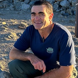
Solo day hiked 5/29/25 - Early start up Deer Springs wearing a thin base layer and hiking under a nice star-filled sky. It’s amazing how bright Venus is right now due to its closer orbit point. Aside from a mule deer going down a slope, it was a quiet trip up the western side with only a few off-trail snow patches remaining. There are several water filtering spots currently flowing across the Deer Springs Trail (marked as waypoints on my gps track), the furthest being Little Round Valley Creek which is still flowing through the campground. Early morning views off the peak overlooking Whitewater/Coachella were nice but a little hazy for good photos. That said, the very clear view of San Gorgonio Mountain with very little snow remaining on its southern side was very picturesque. Descending on the eastern side in the morning sun via the Peak and Wellman trails felt like summer had arrived. Thanks to those responsible for trimming back the chinquapin and whitethorn bushes on this side, very nice! Filtering a few liters of cold water from Wellman Cienega is always a nice stop, although it seems like it’s flowing less than the same time last year. I met up with a couple of nice NOBO PCT registered hikers while heading west on PCT (NOBO PCT stretch between Annie’s and Strawberry junctions) to rejoin the Deer Springs Trail which was a surprise for this time of year. There is no water on this segment as Strawberry Cienega is relatively dry. After getting back to the Deer Springs-Suicide Rock junction, it was early enough to head out to Suicide Rock before returning to the trailhead and so I climbed the boulder high points before going back to the car. Marion Creek is still flowing nicely across the Suicide Rock Trail for those interested. Was a fun day in warm but very comfortable weather. Check out Jon King’s San Jacinto Trail Report (https://sanjacjon.com/ ) before heading out anywhere in the San Jacinto Wilderness for up to date trail/water conditions. Logged 21.4 mi /34.4 km & 5744 ft / 1750.8 m with Gaia
★
★
★
★
★



Public Tracks
Arcadia Uncategorized
This is one way up to San Jacinto from Deer Springs.