San Jacinto Peak Loop via Deer Springs Trail and Pacific Crest Trail
17.9 mi
Distance
8 hrs 38 min
Time
terrain
5,121 ft
Elev Gain
Overview
This is a difficult loop trail to San Jacinto Peak in Mount San Jacinto State Wilderness.
This trail goes by Little Round Valley, Wellman Divide, and Strawberry Junction.
This is an alternate route for San Jacinto Peak via Deer Springs Trail.
Sights to See
Rate this Hike
★★★★★
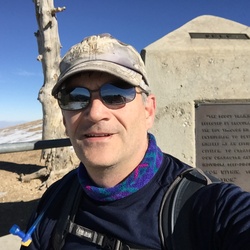
Hiked Jan 07 2026 - It was the last day of the week to head up to San Jacinto Peak in nice weather before the stronger winds were forecast. Going up Deer Springs early was cold enough for heavier gloves but the tradeoffs were great snow and the ice sculpted trees/understory. Heavier gloves but no traction aids all the way up with consistent snow coverage from just before Little Round Valley to the peak. Some areas of ice and flowing/standing water on the upper Deer Springs Trail but easy to bypass. Views off the summit were impressive, especially of Coachella Valley and San Gorgonio Mountain which looked heavily snow-capped. With absolutely no wind on the summit, it was hard to believe that gales were forecasted to start up in the late evening. After a small break, the only other hiker I’d see on the upper trails appeared on the summit and I was pleasantly surprised to see that it was “Maria”, someone I’ve crossed paths with a handful of times over the last year on different SoCal peaks. After one last look at how much snow I would be dealing with on San Gorgonio next week, I spiked up for the Peak Trail descent as the cloud ceiling started dropping down. The east side was considerably warmer than Deer Springs but there were still occasional snowflakes starting to fall instead of rain. Wellman’s Cienega was flowing well between the icicles, providing for fast water filtering. Once on the Pacific Crest Trail, I was surprised to find it untracked all the way to Strawberry Junction. It was also interesting to see Strawberry Creek flowing across the PCT which I’ve seldom seen. After removing micro spikes here and heading down, the weather warmed up considerably but the rain held off. Recommend checking out the San Jacinto Trail Report (https://sanjacjon.com/) before heading out for up to date conditions as Jon King still hikes this area daily. Logged 18.4 mi /29.6 km & 5166 ft / 1574.6 m with Gaia
★
★
★
★
★

I’m sorry I underestimated you :( Definitely more climbing and scrambling and less switchbacks than I anticipated. Started at 8am and went clockwise by accident but that’s ok. You’ll encounter beautiful manzanita trees for the first 3 or 4 miles going up Deer Springs trail. Encountered four man children at mile 6 blocking the trail with all their shit, farting and burping and as my friend and I were taking a break out of sight off trail we overhead them fantasizing over us doing obscene sexual things to each other at the top of San Jacinto (can a man and woman not be platonic friends?). Toxic masculinity is real and I feel sorry for them assuming they don’t have any close friends that are women in their lives. Wish I had another opportunity to confront them but oh well it’s probably better I didn’t. We tried to not let that ruin the rest of our day though. Aside from the summit view toward the Mojave, the section of the PCT going through San Jacinto Wilderness was the highlight for me. Grateful for these humbling SoCal mountains. Next time Cactus to Clouds.
★
★
★
★
★

Almost empty on a Monday with the Palm Springs tram shut down due to Covid. Started at 430 am to beat some of the sun. The assent has great shade and gorgeous forests on the way up. It’s a long day but if you can create some shade on the exposed descent loop, the views over the valley are really something. One of my new fav hikes.
★
★
★
★





Public Tracks
20260107_San Jacinto Pk W-E Loop via Deer Springs TH
It was the last day of the week to head up to San Jacinto Peak in nice weather before the stronger winds were forecast. Going up Deer Springs early was cold enough for heavier gloves but the tradeoffs were great snow and the ice sculpted trees/understory. Heavier gloves but no traction aids all the way up with consistent snow coverage from just before Little Round Valley to the peak. Some areas of ice and flowing/standing water on the upper Deer Springs Trail but easy to bypass. Views off the summit were impressive, especially of Coachella Valley and San Gorgonio Mountain which looked heavily snow-capped. With absolutely no wind on the summit, it was hard to believe that gales were forecasted to start up in the late evening. After a small break, the only other hiker I’d see on the upper trails appeared on the summit and I was pleasantly surprised to see that it was “Maria”, someone I’ve crossed paths with a handful of times over the last year on different SoCal peaks. After one last look at how much snow I would be dealing with on San Gorgonio next week, I spiked up for the Peak Trail descent as the cloud ceiling started dropping down. The east side was considerably warmer than Deer Springs but there were still occasional snowflakes starting to fall instead of rain. Wellman’s Cienega was flowing well between the icicles, providing for fast water filtering. Once on the Pacific Crest Trail, I was surprised to find it untracked all the way to Strawberry Junction. It was also interesting to see Strawberry Creek flowing across the PCT which I’ve seldom seen. After removing micro spikes here and heading down, the weather warmed up considerably but the rain held off. Recommend checking out the San Jacinto Trail Report (https://sanjacjon.com/) before heading out for up to date conditions as Jon King still hikes this area daily. Logged 18.4 mi /29.6 km & 5166 ft / 1574.6 m with Gaia
 stars
stars
Hiking San Jacinto Peak via Idyllwild and the PCT
Hiking San Jacinto peak is a southern California hiking rite of passage. John Muir called the views from San Jacinto peak "the most sublime spectacle to be found anywhere on this earth!" On a clear day, you can see from Catalina Island to Southern Utah. It's a tough hike but the payoff makes it worth it. This route includes a stretch on the famous Pacific Crest Trail (PCT).
Hiking San Jacinto Peak via Idyllwild and the PCT
Hiking San Jacinto peak is a southern California hiking rite of passage. John Muir called the views from San Jacinto peak "the most sublime spectacle to be found anywhere on this earth!" On a clear day, you can see from Catalina Island to Southern Utah. It's a tough hike but the payoff makes it worth it. This route includes a stretch on the famous Pacific Crest Trail (PCT).
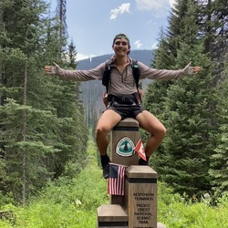
Mt. San Jacinto w Joseph and Nick
April 3-4, 2018, with Joseph Preissman and Nick Rhead.
Nick slowed us down a ton, so it was much easier on my body than the trip up Jacinto last summer with dad.

Mount San Jacinto State Park Hike
https://connect.garmin.com/modern/activity/23565040248
Mount San Jacinto State Park Hike
https://connect.garmin.com/modern/activity/19715258866

San Jacinto - Camp at Strawberry Junction
Strawberry Junction - 3.5 miles