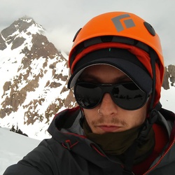
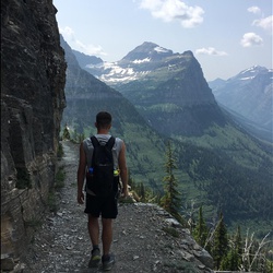
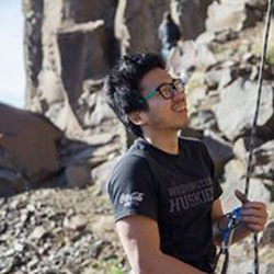
Amazing climb. Reminded us of the wolf’s head traverse in the wind river range. Spicy “5.8” crux for sure though the gear was good. East ledges proved to be sketchy. We messed up and followed a ramp that went up and right and ended up at a notch in the middle of the climbing route. 16hrs car to car.
Beta:
The east ledge traverse is totally horizontal all the way back and definitely scary, no fall zone, steep, loose terrain.
After high camp head toward the south face, at the bottom head up and right on snow to the color that looks climbable.
★
★
★
★
★

We attempted this hike leaving just north of High Bridge at 5:50 am. We made it past the camp with full intentions of summiting.
This scramble is more technical than stated in most guide books. Orange arrows very obviously guide your way through both scree, which tumbles away under your feet, and along cliff sides with significant exposure. After about an hour of endeavoring, we turned around for safety reasons and due to the incoming storm. We did not reach the summit.
Although you gain over a mile of elevation during this hike, it is not steep and quite a nice and gentle walk. The views are fantastic and it was well worth it.
★
★


Super steep. Very rocky part way up. Slush for a trail above 5000. Cross several under-snow wide creeks. Heart weather and epic views. Plus rock climbing to get there. Not easy but damn the place is pretty
★
★
★

The trail is completely reasonable for elevation gain both out & back. The lake is wonderful. Views from South Pass were limited by smoke.
★
★
★
★

Super hard but amazingly rewarding. Gorgeous. Viewpoints the whole way up. Better as it gets higher.
★
★

I read reviews that mentioned this is the best fall color hike in Washington State. After my own experience, I agree this is very true. The colorful views are stunning.
★
★
★
★
★

One of the best hikes I have ever done. It shifts perfectly from forested, gradual earthen switchbacks to exposed, rocky and steep terrain at the top. Epic views literally every step you take, and the views are different on the way back vs the way up. Stunning!
★
★
★
★
★

Very Smokey the day we did it. But we used N95 masks that helped a lot. Stunning area even in the smoke. Not too difficult
★
★
★
★
★
Dry trail, boulders near glacier. Only one two foot crevasse to cross on the glacier. Lots of friendly wildlife.
★
★
★
★
★


Beautiful loop all around. Pretty buggy but as to be expected. Views were incredible on our 3rd day and very glad to have done rainbow pass at sunrise! Gaia shows the campsites a bit off from where they actually are so don’t be worried if you pass them on the map, they’re about a half mile off.
★
★
★
★


Boston Basin is incredibly beautiful.
The exposure climbing up the West Ridge is scary in a good way, although the repelling back down can be a bit frustrating. More down climbing that actual rappelling. We were there at the end of May. Really appreciated Gaia GPS helping to get us back to camp in the dark!
★
★
★
★
★
 stars
stars
This is one of the best hikes around. You can stop at Cascade Pass but you are missing the best part of the entire hike. The higher you go the better the views get. There is a trail all the way to Sahale Glacier Camp. RT here is about 12 miles. For those with some mountaineering skills you can summit Sahale Peak. You should have and know how to use crampons and an ice axe to get to the base of the rock. It is class 3-5 depending on the route up you choose.
★
★
★
★
★