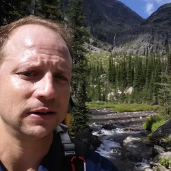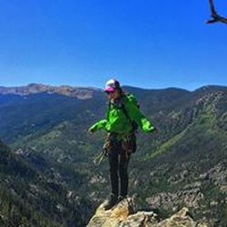
Good route and very challenging depending on how much stuff you bring. Fred Becky recommends an ice axe, however there was no need for such in October conditions. The route up the NE shoulder of Whatcom Peak is very exposed, and feels more like class 4 since both hands are required. While the route looks difficult from far, it becomes more reasonable the closer you get. The ridgeline is also exposed but it’s overall very fun scrambling. PLEASE DO NOT follow this route over the Baker River at Imperfect Impasse. The Baker Rive should be crossed above the tallest waterfall. That seems to be the only safe route across the gash that the Baker River makes in the landscape without walking downriver a half mile through brush. Otherwise, this route is decent to follow either direction.
★
★
★
★
★

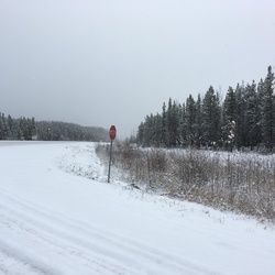
Simple visitor center trail that visits the Skagit River. Easy - graveled trail with little grade change. The forest is young but pretty.
★
★
★

Anywhere you go in stehekin is worth it even if it’s just along the road to the landing and back
★
★
★
★

We attempted this hike leaving just north of High Bridge at 5:50 am. We made it past the camp with full intentions of summiting.
This scramble is more technical than stated in most guide books. Orange arrows very obviously guide your way through both scree, which tumbles away under your feet, and along cliff sides with significant exposure. After about an hour of endeavoring, we turned around for safety reasons and due to the incoming storm. We did not reach the summit.
Although you gain over a mile of elevation during this hike, it is not steep and quite a nice and gentle walk. The views are fantastic and it was well worth it.
★
★


Super steep. Very rocky part way up. Slush for a trail above 5000. Cross several under-snow wide creeks. Heart weather and epic views. Plus rock climbing to get there. Not easy but damn the place is pretty
★
★
★

I broke away from the group, leaving camp at 0630. I was on the trail before 7. I remembered running this trail with Ben Reimold about 5 years ago but wasn’t sure we’d made it all the way to 4 of July Pass. It turns out we had, but it was an excellent second time up. My body felt good on the trail throughout. I nearly rolled my ankles several times but caught myself. Great views of snow-covered peaks to the South. Primus, Austera, etc. I think didn’t think I’d make it to the pass with the limited time I had, but I pushed myself and made it home without making Hannah too anxious.
★
★
★
★


One of the best weekend backpacking trips I’ve ever been on! Crowded this time of year (October) but well worth it.
★
★
★
★
★

The trail is completely reasonable for elevation gain both out & back. The lake is wonderful. Views from South Pass were limited by smoke.
★
★
★
★

Def felt like a suffer fest but the summit was rewarding. Not much water source except for down low
★
★
★
★
★

Super hard but amazingly rewarding. Gorgeous. Viewpoints the whole way up. Better as it gets higher.
★
★
★
★
★

I read reviews that mentioned this is the best fall color hike in Washington State. After my own experience, I agree this is very true. The colorful views are stunning.
★
★
★
★
★

One of the best hikes I have ever done. It shifts perfectly from forested, gradual earthen switchbacks to exposed, rocky and steep terrain at the top. Epic views literally every step you take, and the views are different on the way back vs the way up. Stunning!
★
★
★
★
★

The trail to campsite is well maintained and easy to follow. Sulphide Glacier was open with crevasses which made the journey a little challenging and slow. At the pyramid, most people went up the gully on the left of the tongue of snow. Nice vault toilet at campsite with likely the best view of any wilderness toilet. Unfortunately the second day, smoke from nearby Sourdough fire moved in
★
★
★
★

Very Smokey the day we did it. But we used N95 masks that helped a lot. Stunning area even in the smoke. Not too difficult
★
★
★
★
★


This is a brutal day hike with aggressive gain on a non maintained hikers trail. Incredible views at the summit but one of the toughest day hikes you’ll ever do.
★
★
★
★
★
Dry trail, boulders near glacier. Only one two foot crevasse to cross on the glacier. Lots of friendly wildlife.
★
★
★
★
★


Went clockwise to save my knees on the descent.You can always stop and look back to get the other view.
Plenty of other people on the trail but all very polite and well spaced out. Many dogs, many of them off leash, all of them wonderfully behaved.
The views were everything they have been described as, larch madness was totally happening in October…
Although it was quite smoky in Mazama, once you get up to rainy Pass the smoke pretty much melted away.
If the snow and rain don’t get too heavy in the next couple of weeks, it’s a gorgeous hike.
★
★
★
★
★
Easy accessible paved path to a pretty lake. The trail has little informational signs with nature facts. Lake lighting is probably best mid-day as it is very much a sunken basin.
★
★
★
★
★

Beautiful hike! My favorite in Washington State. Just a few snow patches left as of Aug 1, 2022. We did the loop clockwise. The bugs were insane, which helped to keep the pace up. Our dogs had a blast.
★
★
★
★
★

Beautiful loop all around. Pretty buggy but as to be expected. Views were incredible on our 3rd day and very glad to have done rainbow pass at sunrise! Gaia shows the campsites a bit off from where they actually are so don’t be worried if you pass them on the map, they’re about a half mile off.
★
★
★
★


Great trails right around the newhalem campground. Great for kids, well maintained and scenic.
★
★
★
★
★

The little bit of overnight rain was just enough to kill the dust so it made for a great ride
★
★
★
★


Beautiful hike
Gorgeous day beautiful hike up to base camp overnight storm moved in we had next to zero visibility on summit day tried anyway but even after daylight and using our phones for GPS it was very difficult to find our way to stay on track and we had to turn around at about 7800 feet are due to poor visibility and the fact that we knew we couldn’t summit
★
★
★
★
 stars
stars
This hike used to be one of my favorites, really sad to see what has started happening to our wild places. Cars lined up for a mile on HWY 20, others parked illegally within the massive lot. Tons of people walking on the heather meadows-- which is really fragile area. Others playing music out loud. A drone was flying over head... the total lack of regard for others is heartbreaking.
★
★
★

We hiked Maple Pass second week of August. Brilliant hike and weather. Also have some in early October when the larches are changing color. One of the best trails we’ve ever hiked.
★
★
★
★
★


Larches! Fall colors! Views! Meadows! Snow! Mud! This hike has it all. We arrived at the trailhead at 10am, and people were being directed to park along the road since the lot had filled up. Not a problem, though, as a friendly ranger was directing and said it was fine to park on the road. Take 100 people and spread them out over 7 miles, it's not too bad. And this hike is so wildly popular because it is one of the best around.
We chose counter-clockwise to go with the popular route, and I like the way the views open up this way. The larches ranged from a light green to a light yellow, and were lovely. It was warm enough that we ate along the top ridge without a problem, didn't even need layers. The views were epic, clear, and dramatic. Fall foliage out in its splendor. The sun had also turned a lot of the snow into slush, and only in a few places did we use Yak Tracks. I was glad to have them and poles, though plenty of people were making it without. The route along the top is easy to navigate through the snow (about 1/2 inch to 1 foot deep along the sides of the trail, but packed down on the trail), although it does seem to go over a bit of heather. There was some slippery mud on the steep trail down, but poles kept us upright.
I can't recommend this hike more. Even on a crowded weekend we found the natural world a place of wonder.
★
★
★
★
★


Deceptively steep and narrow, but very beautiful. Enough to get the blood pumping. Small waterfall and great view of the lake. Walks right over the dam for an even better view. Wind was a little strong while we were there, but overall very nice. We passed a park ranger going up the trail with a team of 5 mules and a horse. Very cool.
★
★
★
★
There isn’t a lot better bang for your buck than this hike. Under 8 miles gets you views of dozens of names peaks and two huge glacial lakes. We went counterclockwise and I think it was much nicer than clockwise if your knees can take the steep downhill. The trail is in great shape and conditions are perfect for a hike right now.
★
★
★
★
★

Boston Basin is incredibly beautiful.
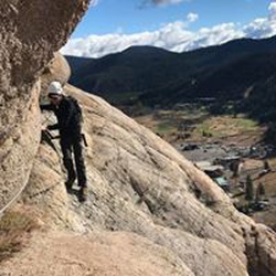
The exposure climbing up the West Ridge is scary in a good way, although the repelling back down can be a bit frustrating. More down climbing that actual rappelling. We were there at the end of May. Really appreciated Gaia GPS helping to get us back to camp in the dark!
★
★
★
★
★
 stars
stars
This is one of the best hikes around. You can stop at Cascade Pass but you are missing the best part of the entire hike. The higher you go the better the views get. There is a trail all the way to Sahale Glacier Camp. RT here is about 12 miles. For those with some mountaineering skills you can summit Sahale Peak. You should have and know how to use crampons and an ice axe to get to the base of the rock. It is class 3-5 depending on the route up you choose.
★
★
★
★
★