United States
›
Oregon
›
Mark O. Hatfield Wilderness

Best Hiking Trails in Mark O. Hatfield Wilderness

73 reviews


link Copy Link email Email directions Driving Directions

Seasonal Popularity

Overview

Mark O. Hatfield Wilderness is a protected area in Oregon.


Resources

  • wikipedia

  • Hiking Trails (34)
  • Reviews (73)
  1. 1
    Indian Point Loop via Gorton Creek Trail #408
    ★ ★ ★ ★ ★ MODERATE 7.9 mi
  2. 2
    Eagle Creek Trail #440
    ★ ★ ★ ★ ★ DIFFICULT 7.1 mi
  3. 3
    Rock of Ages - Oneonta Loop
    ★ ★ ★ ★ ★ DIFFICULT 12.6 mi
  4. 4
    Nesmith Point #428
    ★ ★ ★ ★ ★ DIFFICULT 4.0 mi
  5. 5
    Chinidere Mountain Loop via Pacific Crest Trail
    ★ ★ ★ ★ ★ EASY 4.3 mi
  6. 6
    North Lake via Wyeth Trail
    ★ ★ ★ ★ ★ DIFFICULT 12.5 mi
  7. 7
    Eagle Creek Campground via Herman Creek Trail #406
    ★ ★ ★ DIFFICULT 31.2 mi
  8. 8
    Mount Defiance Loop
    ★ ★ ★ ★ DIFFICULT 11.3 mi
  9. 9
    Herman Creek Loop
    ★ ★ ★ ★ DIFFICULT 10.1 mi
  10. 10
    Wahclella Falls
    ★ ★ ★ ★ MODERATE 2.1 mi
    user_profile
    Bob Dobbs 1 month, 1 week ago
    Punch Bowl Falls via Eagle Creek Trail #440
    This trail is and has been closed. Sad to see GaiaGPS not living up to their responsibility of safety.
    ★

    user_profile
    AmadeusInPink 8 months ago
    Tunnel Falls
    Tunnel falls. While not challenging it is long with constant up and down with consistent elevation gain/decline.
    ★ ★ ★ ★ ★

    user_profile
    HugeOasis8181 8 months, 3 weeks ago
    Chindere mtn and whatum lake
    Excellent short hike with wonderful views at the summit. Tree cover for everything but the top 100ft. Steep on the western side, but passable and solid. Well constructed trail
    ★ ★ ★ ★

    user_profile
    jacquedodds79 2 years, 1 month ago
    Eagle Creek Tunnel falls to 7mile falls W/Tina, Barbra & Susie
    Fantastic trail. Very entertaining and beautiful even with the Burn. You can actually see the rock formations that the trees had hidden. Highly recommended. Lots of wildflowers & waterfalls. Still snow patchs and waters running high. Sturdy shoes w/ankle support for the rocky patches.
    ★ ★ ★ ★ ★

    user_profile stars
    KATHY CLEVENGER 3 years ago
    Punch Bowl Falls via Eagle Creek Trail #440
    Hiked at the end of April up to Twister Falls. Beautiful hike. Waterfalls were raging from recent rain and snow melt. Early flowers in bloom.
    ★ ★ ★ ★ ★

    user_profile
    gherlanezu 3 years, 8 months ago
    Defiance starvation loop
    As always, Mt. Defiance delivers. Wonderful hike up defiance down starvation.
    ★ ★ ★ ★ ★

    user_profile
    LushThicket6479 3 years, 8 months ago
    Eagle Creek to Tunnel falls and Punchbowl on way back
    Such a great hike. Tunnel falls is a great turn around. Stop at the spot by the middle bridge and take a dip. Hike back and take a dip in Punchbowl. Great on hot day.
    ★ ★ ★ ★

    user_profile
    DarkGaze8311 3 years, 9 months ago
    Chinideer Mtn trail
    This is a quick and easy hike to Do with great views of 5 mountains. It couples well with a weekend stay a Wahtum lake campground and a swim in the lake after.
    ★ ★ ★ ★ ★

    user_profile
    CoolCypress6734 4 years, 9 months ago
    Punch Bowl Falls via Eagle Creek Trail #440
    pretty
    ★ ★ ★ ★

    user_profile
    GentleLamp5001 4 years, 11 months ago
    Warren Lake Loop via Mount Defiance Trail #413 and Starvation Ridge Trail #414
    This was a difficult hike but great for not seeing many other people and getting in shape. The bear grass was stunning and Warren Lake was beautiful .
    ★ ★ ★ ★ ★

    user_profile
    Tamaronvo 5 years, 10 months ago
    Warren lake starvation creek
    Very vad
    ★ ★ ★ ★

    user_profile
    StillLowland9961 6 years, 10 months ago
    Starvation Ridge Cutoff Trail to Mount Defiance Trail #413
    Super challenging hike. Great if you want a challenge and to cross Mt Defiance off the bucket list. We did is as a training hike for a longer backpacking trip. There are better view hikes around and the TV antenna campus at the top is not the tranquil, wilderness experience I was looking for. Trail surface is very loose and coming down was precarious. But super satisfying to have done. Note: the very bottom of the Starvation creek trail was closed due to a slide, so you can either do an out and back on Mt defiance trail, or we cut across to rejoin trail above slide.
    ★ ★ ★ ★
    user_profile stars
    ArchCanoe9607 7 years ago
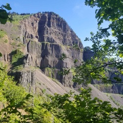
    Hiked up to Green Point Mountain summit on May 12, 2019 from the Herman Creek trailhead and continuing on #406 until forking off onto the Nick Eaton Trail #447. As was the case last year, much of the trail on Nick Eaton ridge is filled with dry needles, burnt bark, and downed limbs making the trail easy to lose if you're not focused. Once you hit the Gorton Creek trail #408, you enter the unburnt forest which has preserved much of the trail until you get to around 4,200' of elevation. At that point, it's snow up to the summit. The depth of the snow varies from 2'-3' all the way to the top - all of it a hard, rippled snow. There is no trace of a trail to be found, so have GPS ready if you plan to do this hike since it's roughly 2 miles of snow crushing to the top. You'll also encounter bear tracks along the way although I did not spot any black bear on this day's adventure. Most of the climb is gradual until you get to the final 100' climb where you'll need to just find the safest way up to the top. Once at the summit, it's nice and clear of snow since it's been exposed to the sun for some time now. The view was spectacular and all mountains in the area were clearly visible including Mt. Ranier. On the way down I completed the loop by taking the Herman Creek trail all the way back to the trailhead. Fortunately, going downhill in the snow wasn't too bad since the descent was gradual. After about three quarters of a mile down from the summit at the Wahtum Lake Road junction all snow was gone. The rest of the hike down included rushing creeks and waterfalls from the season's snow melt. Awesome hike which will give your legs a good workout, especially once you start up the Nick Eaton trail. Would give this hike 5 stars if it wasn't for the condition of the trail from Nick Eaton ridge to the summit. Still, if you have a GPS unit, this is definitely a hike to put on your list.
    ★ ★ ★ ★
    user_profile stars
    Christina Markin 7 years ago
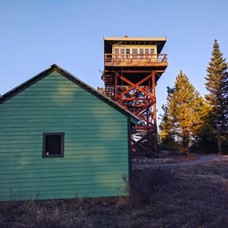
    Hiked 5/6/19 13.6 miles with 5249 elevation gain. Did a loop hike starting with Defiance trail, to Mt. Defiance summit, to Warren Lake, to Mitchel Point, to Starvation Ridge trail and back on Mt. Defiance. Took us over 14hrs to complete. I was the first car in the lot at Starvation Creek State Park at 4:15am. Mt. Defiance was a great steep switchback trail with some flat sections in the forrest up high. Lots of downed trees on the trail. There is snow right after the scree field trail junction which we opted out of and crossed the snow instead (we used our microspikes in the snow). 2 to 4ft of snow in places. 2 miles or more of snow. Views were amazing the day we went. Couple good camp spots at Warren Lake. Mitchell point had OK views. Starvation Trail was super hard with very few switchbacks, so you're almost always going straight down. Poison oak on the trail, so make sure you cover up your skin. Lots of beautiful flowers and amazing view points. Visited 12/8/18. Beautiful area to stop at for hiking, sightseeing and a great lunch spot with a couple picnic tables next to Viento falls. Paved trails look very new. Bathrooms were flushing toilets and very clean inside, but only have air dryers, no paper towels for drying your hands. I've seen this place a bunch of other times while visiting the gorge and have always wanted to stop by and check it out. I came here to hike mt defiance trail. The trailheads are easy to find. Mt defiance, starvation ridge and a couple others are on the 14 going west when you walk on the paved path. Starvation ridge from historic trail paved path is closed but you can reach it on mt defiance trail. I did not complete trails because there were creek crossings on both mt defiance and starvation ridge that had no bridges, I was wearing my summer hiking boots (not wanting to get them wet in the water), it was cold out and I was hiking alone. This area is a must stop if you have the time to check it out. I will definitely be back to hike again. Counted 4 waterfalls.
    ★ ★ ★ ★ ★

    user_profile stars
    Christina Markin 7 years, 1 month ago
    First one on the trail and in the parking lot at 7:05am on 12/24/18. Hiked 8.9 miles counterclockwise from Herman Creek to Gorton Creek to Nick Eaton trail and back to Herman Creek. ( I had a pre recorded map, very helpful to have.) I tried this trail a couple of years ago before I got into shape and I could not finish it, it was brutal and I was, barely move sore for days after. I've been hiking practically every weekend this year and I finally was able to finish this trail!!! I did this trail counterclockwise, starting with Gorton creek was long (when you get close to the top the snow begins and much of the flat trail on Nick Eaton is covered in snow, it was not icy, so no microspikes needed 12/24/18.), with lots of switchbacks and a creek crossing and on the way down on Nick Eaton trail was brutal, my toes were smashed against the tips of my boots with every step, there are steep switchbacks on the tail end for me of this hike. My feet were so sore when I got to the Herman Creek, Pct trail, otherwise I would have gone down to check out the Herman Creek Bridge (next time!). Finished the hike at 1pm and was hiking for around 6hrs. Most of the trail is really steep so be prepared! When I got back to my car there were 4 other cars in the lot. The parking lot holds 10 cars. You must have a NW forrest pass or pay $5 day use fee. There is a pay box here. The campground when I came here is closed. The bathroom is vaulted toilet and was clean when I got there in the am, but on the smelly side when I left in the PM. I saw 6 people on the trail and all were on my descent, so after 11:30am or so. All of this trail above the power line road was affected by the eagle creek fire.
    ★ ★ ★ ★ ★

    user_profile
    gregory simons 7 years, 1 month ago
    Beautiful hike and a new Gorge favorite with good views! Good steady elevation gain, proceeds through a beautiful burn. Go counterclockwise to do the steep on the uphill so the downhill isn't as hard on your knees
    ★ ★ ★ ★

    user_profile
    OldTri9516 7 years, 7 months ago
    We did this about a year after the fire at Eagle Creek and had a good look at the damage done as well as how the forest is recovering. The trails showed evidence of maintenance and there was only one small tree on the trail to go over. It was impressive how far up the tree the fire went yet how many of the larger trees survived.
    ★ ★ ★ ★

    user_profile
    Zukko17 6 months ago
    Eagle creek
    ★ ★ ★ ★

    user_profile
    HillyBay1809 8 months, 3 weeks ago
    목요일 Portland planet fitness
    ★ ★ ★ ★ ★

    user_profile
    Subbarao Mantha 10 months, 4 weeks ago
    Punch Bowl Falls via Eagle Creek Trail #440
    ★ ★ ★ ★ ★

    user_profile
    Kayleen Shiiba 11 months, 3 weeks ago
    Eagle Creek
    ★ ★ ★ ★ ★

    user_profile
    Prateek Kumar 11 months, 3 weeks ago
    Saturday Lunch Activity
    ★ ★ ★ ★ ★

    user_profile
    Tobias Pusch 1 year ago
    5/17-5/18/25 Backpacking Mt. Defiance camp at Warren Lake
    ★ ★ ★ ★ ★

    user_profile
    HighPeak8309 1 year ago
    Eagle Creek to Tunnel Falls
    ★ ★ ★ ★ ★

    user_profile
    Brad A 1 year ago
    Eagle Crk Camp Hike
    ★ ★ ★

    user_profile
    Taralynn Holly Rayburn 1 year, 1 month ago
    Sunday Morning Activity
    ★ ★ ★ ★ ★

    user_profile
    ToughBluff2340 1 year, 4 months ago
    Sunday Lunch Activity
    ★ ★ ★ ★

    user_profile
    markmccarty 2 years ago
    Mt Defiance Warren Lake Loop
    ★ ★ ★ ★

    user_profile
    SilentMound6664 2 years, 4 months ago
    mt defiance
    ★ ★ ★ ★ ★

    user_profile
    John Erickson 2 years, 7 months ago
    Punch Bowl Falls via Eagle Creek Trail #440
    ★

    user_profile
    matthew.correia1 2 years, 10 months ago
    Mt Defiance
    ★ ★ ★ ★ ★

    user_profile
    Kurt Brandemihl 2 years, 11 months ago
    Eagle Creek with Jessica
    ★ ★ ★ ★

    user_profile
    SafeLake1238 3 years ago
    Punch Bowl Falls via Eagle Creek Trail #440
    ★

    user_profile
    SpeedyFog2583 3 years ago
    Eagle Creek Trailhead to Twister Falls, Hood River County, OR, USA
    ★

    user_profile
    SlimReef1645 3 years ago
    Punch Bowl Falls via Eagle Creek Trail #440
    ★

    user_profile
    trekkeross 3 years ago
    Mt Defiance Jun 2022
    ★ ★ ★ ★ ★

    user_profile
    DawnTri9499 3 years ago
    Track (4/25/23, 07:47:44)
    ★ ★ ★ ★ ★

    user_profile
    SnowyHarbor2156 3 years, 2 months ago
    Eagle Creek to Twister falls and back
    ★ ★ ★ ★ ★

    user_profile
    CuteHarness8184 3 years, 3 months ago
    Track (1/22/23, 11:09:36AM)
    ★ ★ ★ ★ ★

    user_profile
    CuteHarness8184 3 years, 3 months ago
    Track (1/22/23, 11:09:36AM)
    ★ ★ ★ ★ ★

    user_profile
    LittlePond8698 3 years, 8 months ago
    Mount Defiance Loop
    ★

    user_profile
    ZealCanteen8811 3 years, 8 months ago
    Track (913/21, 12:24:20PM)
    ★ ★ ★ ★ ★

    user_profile
    ZippyYogaMat1176 3 years, 9 months ago
    Eagle Creek to Twister Falls w/ Dad
    ★ ★ ★ ★ ★

    user_profile
    GaleWood7848 3 years, 9 months ago
    Track (7/9/22, 9:17:16AM)
    ★ ★ ★ ★ ★

    user_profile
    MistyStar3476 3 years, 10 months ago
    Mt Defiance (7/23/22, 7:30:41AM)
    ★ ★ ★ ★

    user_profile stars
    Avalanche 3 years, 10 months ago
    Mount Defiance Loop
    ★ ★ ★ ★ ★

    user_profile
    GentleBrook1382 3 years, 11 months ago
    Track (6/18/22, 8:18:49AM)
    ★ ★ ★ ★ ★

    user_profile
    SweetZipline6776 3 years, 11 months ago
    Track (6/11/22, 10:58:37AM)
    ★ ★ ★ ★ ★

    user_profile
    Pavlos Papavasiliou 4 years ago
    Punch Bowl Falls via Eagle Creek Trail #440
    ★

    user_profile
    HotDune6323 4 years, 6 months ago
    Track (11/7/21, 09:39:8)
    ★ ★ ★ ★ ★

    user_profile
    Chris Duncan 4 years, 7 months ago
    Track (9/11/21, 11:06:46AM)
    ★ ★ ★ ★ ★

    user_profile
    JumpyShore3933 4 years, 8 months ago
    Chinidere Mountain Loop via Pacific Crest Trail
    ★ ★ ★ ★ ★

    user_profile
    HotSurf2691 4 years, 9 months ago
    Track (7/30/21, 6:30:52AM)
    ★ ★ ★ ★ ★

    user_profile
    Baker 4 years, 10 months ago
    Whatum Lake to North Lake
    ★ ★ ★ ★ ★

    user_profile
    MistyLowland9995 4 years, 11 months ago
    Track (5/15/21, 2:52:18PM)
    ★ ★ ★ ★ ★

    user_profile
    MistyLowland9995 4 years, 11 months ago
    Track (5/15/21, 2:52:18PM)
    ★ ★ ★ ★ ★

    user_profile
    MistyLowland9995 4 years, 11 months ago
    Track (5/15/21, 2:52:18PM)
    ★ ★ ★ ★ ★

    user_profile
    MistyLowland9995 5 years ago
    Track (5/15/21, 2:52:18PM)
    ★ ★ ★ ★ ★

    user_profile
    MistyLowland9995 5 years ago
    Track (5/15/21, 2:52:18PM)
    ★ ★ ★ ★ ★

    user_profile
    Danger722 5 years, 4 months ago
    Eagle Creek to Tunnel Falls 2020
    ★ ★ ★ ★ ★

    user_profile
    Tamara Ross 5 years, 5 months ago
    Mt Defiance
    ★ ★ ★ ★

    user_profile
    Chris Woods 5 years, 6 months ago
    Mount Defiance Loop
    ★ ★

    user_profile
    SlimLowland4860 5 years, 10 months ago
    Warren Lake
    ★ ★ ★ ★

    user_profile
    mega34bkw 5 years, 10 months ago
    Mount Defiance Loop
    ★ ★

    user_profile
    Aaron White 5 years, 10 months ago
    Green Mountain Trail
    ★ ★ ★ ★

    user_profile
    2pIOCVQ0 5 years, 11 months ago
    Chinidere Mountain Loop
    ★ ★ ★ ★ ★

    user_profile
    FrostyBike3117 5 years, 11 months ago
    Track (6/7/20, 09:25:34)
    ★ ★ ★ ★ ★

    user_profile
    GentleLowland1707 6 years, 10 months ago
    Track (7/18/19, 10:25:14AM)
    ★ ★ ★ ★ ★

    user_profile
    Kevin Marcan 6 years, 10 months ago
    Twister Falls via Eagle Creek Trail #440
    ★ ★ ★ ★

    user_profile
    HazyBike8744 6 years, 10 months ago
    Punch Bowl Falls via Eagle Creek Trail #440
    ★ ★ ★ ★

    user_profile
    Boomer Savanh 6 years, 11 months ago
    Tomlike Chindere Mt via Herman Creek and PCT
    ★ ★ ★ ★ ★

    user_profile
    SnowyPaddle1572 6 years, 11 months ago
    Defiance
    ★ ★ ★ ★ ★

    user_profile
    RareGlide6465 6 years, 11 months ago
    Mount Defiance Loop
    ★ ★ ★ ★ ★