This was a beautiful hike along the Schuangunk ridge line with 360 degree views of Minnewaska, Hudson Highlands and the Catskills. Long, but easy hike.
★
★
★
★
★

Beautiful views of Hudson Valley and Awosting Falls started from MSP lower lot.
★
★
★
★
★
Today was cool and with a few little showers and some misting. Bill and I took our time, butstill found this to be a very doable day hike. Biews were fairly good when the clouds and mist parted. Overall great birthday hike for me! We ran into Dan Pitt at the end of our hike out on the carriage round around Lake minnewaska. Nice surprise!
★
★
★
★

A very scenic loop, with some surprisingly rough stretches that benefit from solid hiking shoes.
★
★
★
★

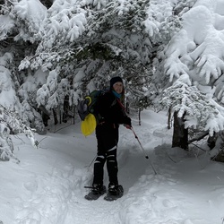
Out to Hamilton Point and down to Upper Awosting. Variable conditions. Mainly fast die to ice. Bery windy!
★
★
★
Nice hike for this time of winter. While the falls aren't gushing you may be able to catch a few ice spikes plunging into the frozen pool below. Second half of the path is closed due to the icy conditions. Either way nice jaunt for a short day walk.
★
★
★
★
★

This is a hike that basically encompasses an assortment of views from waterfalls to Mountain View’s to streams to old forests.
★
★
★
★

Nice diverse hike with some scrambling. Not challenging but still felt like a good day spent hiking.
★
★
★

A diverse and easy 1/2 day hike in the Minnewaska State Park / Mohonk Preserve area.
★
★
★
★

We hiked from sams point parking area to high point down to smileys carriage trail up to blue berry pickers trail back to high point and back to sams point parking area.
★
★
★
★
★
Sams point road out to high point and down to witch’s forest and back , saw two deer no other animals it was low 50s and over cast light wind.
★
★
★
★
★


 stars
stars