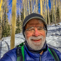
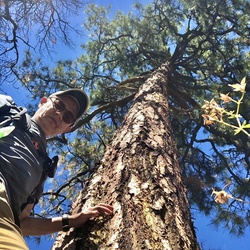
This track begins with ascent to Lake Peak. A poor trail leads beyond the peak to a saddle to the northeast. At the saddle the recorded track goes off trail, following deer tracks down through the trees to Nambe Lake. From the lake, numerous unmarked trails lead north and northwest down to the Windsor trail to complete an 8 mile loop. Because of the off-trail descent, this track is advanced.
In 2025, the section between the lake and Windsor trail deserves to be defined and cleaned up by a trail crew. It has eroded badly in spots and side trails have proliferated.
★
★
★
★

Excellent trail with great payoff at the end with interesting cave system. Not too strenuous, well marked and one water crossing.
★
★
★
★
★

Perfect hike for a couple hour adventure. Lots of shade. Smell the pine and juniper. See the aspen trees and leave flutter with the breeze.
Flowers
Evening Primrose
Bearlip Penstemon
Wild Bergamot
Achilea millefolium
★
★
★
★

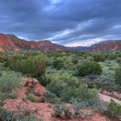
Green, lush, flowers trout stream. TH is from the Seven Sprimgs Fish Hatchery, north of Fenton Lake. With Carl, Connie, Michelle, Carolyn.
★
★
★
★
★

This track unfortunately shows the long "Official" route which is 3 miles longer than the privately maintained historic trail, which follows the creek instead of making the big switchback uphill. Most folks use this historic trail now, so it is well worn at the turn-off, and then it is better maintained than the official one for the rest of the way. SW Explorers will post this route soon here, with a loop back on the 271 trail for variety.
★
★
★
★

Out and back. Gorgeous green area with many wild purple and white iris fields next to the reservoir. Lots of deadfall trees, elev gain is very easy, trail well marked. At the Sign turn left on the way out and right on the way back
★
★
★
★
★


TH elevation: 10,242. Deceptions Peak elevation:12,345
High altitude hike through a forest to Deception Peak, which has 3 false summits before reaching the top. Many mushrooms in Early September.
★
★
★
★
★
Mitchell trail to Guaje Ridge trail is a good, solid hike. Past Guaje Ridge, the trail is difficult to follow due to thorny vegetation. Guaje Canyon Trail at the foot of the Mitchell trail requires using a rope to scale a rock wall over the Guaje reservoir dam.
★
★
★
A very long, non technical hike. Remember the long uphill on the way back.
★
★
★
★

Beautiful and moderately challenging hike up to a pristine mountain lake. A large section of the trail is not maintained by the forest service, but it is totally manageable aside from a few fallen trees. Started the hike at 8:30 am in early June when temps were around 50 degrees. Finished around 12:30 and temps had climbed to mid 70s, with lots of overhead sun. Incredible hike!
★
★
★
★
★


Pleasant hike along streams and through woods until last (western) half of Saddleback where views open up. There are 8 nice bridges across Tesuque Creek and no off-bridge stream crossings. On the day of our hike, March 1st, microspikes and poles were desirable and used constantly for snow and ice from the descending part of Juan back up to Saddleback.
★
★
★
Very strenuous hike…didn’t quite make it to the SF Baldy summit. But still an enjoyable hike. 😎
★
★
★
★

Good hike towards Santa Fe Baldy. Too late to make it to the summit. The trail up the NW face of Lake Peak does not exist 🤷♂️
★
★
★
★

Beautiful gigantic gorgeous Meadows. Nobody around. Lots of elk.
★
★
★
★
★

We(4 guys) do a backpacking trip at the end of every summer. This ranks as our favorite. It’s a difficult hike from the Santa Fe Ski area via the Windsor trail. We set up camp and then Summit Baldy in the morning. Surreal views from up top including Lake Katherine ( named by Oppenheimer). Of note, firewood is scarce in the Lake Katherine area. On weekdays in off season you’ll have it to yourself.
★
★
★
★
★
Good hike to Deception. Tried Lake, but no safe trail exists. Now I know not to hike Lake Peak again 👍
★
★
★
★
The beginning of this hike has a steep uphill which lasts until the wilderness area boundary. About a 25 minute hike. After that it is how much more gentle up and down to the meadow at the base of Santa Fe Baldy.
★
★
★
★


A really good ride. Beautiful, not to challenging, but enough to make it interesting
★
★
★
★
★
Good, direct hike with no snow until near the summit of Tesque Peak…had to turn back due to threat of thunderstorms.
★
★
★
★

Map follows most of the trail, but some are way off. Some trail dead end and must turn back. Lots of downed trees too. Chain saw is a must! Some trail have non-openable barbwire to keep cattle, as in no gate. This was done on a 64” wide 4x4 sport UTV.
★
★
★
★
★
Started on the pleasant and well-marked Chamisa Trail, then to the left on the Saddleback Trail to a viewpoint located a little bit beyond the end of a short spur trail at a prominent sharp left turn on the main trail. All of this was fairly easy walking with occasional nice views. Back at the intersection of the Saddleback and Chamisa trails, we decided to ascend the Galbaldon Trail to a 9,000+ foot peak that afforded a beautiful view to the east. This involved some bushwhacking, as treefall sometimes obscured the trail. We completed our return to the car by bushwhacking roughly south and southwest, following ridge lines most of the way. We roughly followed a dotted-line route marked on the Dharma “Santa Fe Explorer” NM04 map, 2021 edition. Occasionally we saw fragments of herd paths, but mostly this route required careful map-reading and GPS-following. Our track should help for the general route.
★
★
★
★
I don’t know where to start with this one. The hike itself when you get to the trail is nice. You’re following an ATV track I suspect is a boundary trail for the Forest Service. Slight uphill will gas you legs, but easy enough.
Lots of elk and deer tracks and we saw some turkeys. And if you’re a rock hound, it’s very cool. Beautiful quartz, granite, and a ton of fools gold all over the place.
The challenges in getting there, however, are worth a warning. VERY narrow dirt road to get there - truck or Jeep a must. There is no parking, just a pull-out big enough for a single vehicle. Then you have to hike to the trailhead across private property. The river is up and fast across the private road and you can’t get to the trailhead. We followed a track up and over steep hills that got us to the trail, but again, probably over private property. It’s a judgment call whether this is worth the effort.
★
★
★

A glorious walk through evergreens and golden aspens, just staying on the Forest Rd., #449. elevation 9950‘
★
★
★
★
This connector trail is a hidden gem in Diablo Canyon. The trail is difficult and little more than a goat path, but it takes you right to the top of the ridge.
We had to hunt around to find it at first, but the way out led straight back to the river bed with a good sized cairn to mark it.
★
★
★
★
★

First of two archeological hikes near Lindrith. A wonderful kiva was the highlight here.
★
★
★
A short hike to a fabulous remote cliff dwelling. We also explored further up the canyon.
★
★
★
★
A lovely hike through Aspen forests and meadows along beautiful Cave Creek up to a series of caves where the stream disappears into them.
★
★
★
Good hike. Well marked. We were going to down further to meet up with Windsor trail, but the north faces of the hills were icy and too steep to pass without spikes. A pair in front of us turned back too. Saddleback had some great views as a consolation prize.
★
★
★
★

We started this hike around 11 am, and finished the loop at 3: not bad for 9 miles hike!
It was hot despite last day of September!
Hike was great, beautiful rock formations, and view from Window Rock was breathtaking!
Little bit about the terrains: we were hiking mostly in sand, which is challenging! We’ve got bitten by ants, and I personally brought home wit me about 100 spiky dry thingies on my pants! So did my dog!
So, hike is not strenuous, but moderate, although we’ve got elevation gain about 1600F!
Next hike in this area would be around the end of October! Summers hikes over there are depleting, if you don’t drink enough water!
★
★
★
★
★
Amazing and easy hike through a wide arroyo, 6.25 miles out and back. Views are spectacular. 7 miles of rough dirt road to access. There was a Mustang parked next to us, but I wouldn’t recommend it.
★
★
★
★
★
Lovely flat, sunny hike for a cold day. Not as dramatic as some in the area, but when the valley opens up toward the Jemez, it’s quite lovely. 3 miles of ROUGH dirt road to get there.
★
★
★
Great hike! Downhill out, uphill back. Bridges over the creek crossings. Icy parts on the trail are a little treacherous.
★
★
★
★
This is a great trail to choose your own adventure. You can string multiple legs and loops together to create a wide range of distances. Easy going with only minor ups and downs. Busy trail with lots of foot and bike traffic. But that’s because it’s so close in to town. Great fall hike.
★
★
★
★
This is NOT a trail. Don’t know why it’s out there on multiple apps. You have to cross a fast-running stream to get started. Then you wander to an arroyo and follow it up, climbing up and over rock after rock. It’s not too bad going up or down, but it’s pretty much all scramble.
★
★
★
First time out this way. Good parking and facilities. Very busy. Lots of families and dogs. But this is a great hub for a lot of other hikes and the falls are beautiful
★
★
★
★

High meadows with lots of water and tons of wildflowers and mushrooms.
★
★
★
★
★


7/15/22
Great way to make a loop out of Aspen Peak. Followed old contingency fire containment lines down from the peak to the Trail 147. Requires some navigation skills / GPS, at least to stay on course from Aspen Peak to Tr 147. Also the first chunk of Tr 147 had thick blowdowns / dead wood.
★
★
★
★

I absolutely love this hike but there are a few spots where the downed trees are so bad you couldn’t navigate without a GPS. They also might cut your legs up, but I would still definitely recommend this trail to anyone interested in a moderate/hard overnight hike.
★
★
★
★
Beautiful trail. Pretty serious uphill for the first 1/4 to 1/2 mile. Uphill basically the entire way to the peak, 1.5 miles in. Well shaded. Lots of foot and bike traffic.
★
★
★
★
★

I did this hike in winter- March and it was muddy to start and became icy from time to time, but was mostly snow packed. Trax or spikes were necessary to keep from slipping. This is a beautiful hike any season of the year. It is steep, climbing almost 1000 ft in a mile and a half, starting at over 10,000 ft and climbing to over 11,000 ft. A favorite of locals.
★
★
★
★


Hiked from Aspen Vista to the service road where it meets the western boundary of the ski area. Crossed a blown off section of rock as we skied down to the saddle. Snow was quite heavy and tried to stick to our bases on this southern aspect at this elevation.
Snow was almost sugary, deep and lovely in the 1st aspen grove. A little slow given the mild slope angle.
Hiked up the service road to access the 2nd aspen grove and drop down to BigT campground. Lovely!
★
★
★
★


Worth seeing once, but the last ~30 miles are very slow due to rough roads and steep cliffs.
★
★
★


My understanding is that this is one of the few lakes in the area that you can reach in a half day’s round trip hike. With that in mind it’s perfect if you have limited time but are looking to get some exercise amidst spectacular scenery.
Would rate this a moderately difficult hike if you are in decent shape. This will be a difficult hike for some. Keep in mind you are hiking at 10,000 feet elevation and total elevation gain is about 2000 feet give or take. Air is thinner up here (At the risk of stating the obvious).
Trail begins with a steep .6-.8 mile climb. Go through the gate and from there it’s about 1.8 miles on a gentle descent to where you meet up with the trail to Nambe Lake. This next section is steep and rocky but not technical difficult. There are alternating steep and flat sections. As has been described elsewhere you will want to keep the stream within earshot. There are many trails crisscrossing this area but they all pretty much end at the lake as long as you stick near the stream. Recommend you download maps as cell service is spotty.
Spend some time at the lake. Have lunch and walk around. It’s a stunner.
★
★
★
★
★

Great hike from cabin to logging road via echo point trail. Great find!
★
★
★
★


Gorgeous, cool hike through a pine/aspen forest. The loop takes you to a stream & meadow at the end. Some fairly steep ascents with switchbacks but quite doable if you’re acclimated to the altitude.
★
★
★
★
★


This hike actually was 8 miles long: we started at Santa Fe Ski upper parking lot, through the service road to the towers, then we climb Deception Peak and came back through Ravens Ridge and Winsor trail. It was marvellous sunny June day, but still wind was strong and cold on the top.
We were 7 women, all experienced hikers, and this hike was absolutely awesome!
I loved hiking down through Ravens Ridge, but next time I’ll try to hike up: it would be a challenge, because it mostly steep.
Forest look old, mysterious, cozy and inviting!
★
★
★
★
★

Fun trail where we saw an elk and received some snow. Mostly easy with the trail after lunch providing a few challenges. Erica drove the section after lunch and did a great job. She learned how to switch the 4runner in and out of 4lo. Feels more comfortable driving off road after this experience.
★
★
★
★
This was my first time in this trail, when we’ve made it to Pacheco Canyon road. It was almost 2 miles from Big TESUQUE campground, going through the forest with moderate descent ups and down narrow trail.
To keep this hike moderate we turned back and made almost 4 miles all together.
★
★
★
★
★

Nice hike. Almost got hit by MB. Go right (east?) at the map and Schleppe up to the ridge a couple hundred feet higher for a view.
★
★
★
★

 stars
stars
Longer than I thought!! Fall colors were amazing on the way in; more shade and obscured views on the way out. Nice mountain views at the lake.
★
★
★

This track begins at the Jacks Creek trailhead climbing to Pecos Baldy Lake, follows the 12,000 ft ridge lines around the northern Pecos while allowing summiting Pecos Baldy, the Truchas Peaks, and Chimayoso. The track then descends to cross the Pecos River near it’s source and follows the river as it increases in size. The track leaves the Pecos River at Beatty’s Flats returning to the Jacks Creek trailhead. This track provides amazing views from the ridge lines, and picturesque views at Pecos Baldy Lake, Pecos Falls, Beatty’s Flats, and other points along the trail. Elliot Barker fans can also take the small side trip to Lost Bear Lake, the subject of one of the stories in his book Beatty’s Cabin. Depending on the season, other highlights are wildflowers, Bighorn sheep, and elk.
The track passes above the source of the Pecos River, a seep coming out of the side of a ridge line below the Skyline Trail. Interested parties can drop off the ridge line and follow the Pecos River from the source down to Beatty’s Flats
★
★
★
★
★

Great walk from the CG or picnic area. Starts in a pretty, open meadow then through an unlocked gate onto a gas pipeline road. Walk involves some moderate uphill hiking but nothing strenuous. Very pretty views from the top of the rise.
★
★
★
★
★

Wonderful hike! Beautiful area. Damian trail was tough! A bit hard to see in a couple places, thankfully marked every few yards with wooden markers
★
★
★
★
★

This hike was bomb! Very challenging. Have good hiking shoes and hiking poles would be helpful. I did it without but having them would have been nice. Amazing 360 degree views!! Wear a hat, bring plenty of water and a rain jacket or poncho just in case.
★
★
★
★
★
Great hike! I found a new route! I hiked the maintained trail down to the box, then followed the creek almost to the highway, then found a trail leading back up to East Fork of the Jemez (the trail I came in on)! Love when I discover new routes!
★
★
★
★
★

Very scenic hike to the San Antonio hot springs. Hike starts at the top of a ridge and descents down into a grass valley with a creek that Lara’s all the way to the hot springs.
★
★
★
★

No one was on the trail at 9am on Monday. Lots of cut timber parallel to trail but no active logging. Trail gets overgrown after a couple of miles so not great visually.
★

A couple of places where you need 4L. Don’t follow to Ashley Rd to far end as there’s a private gate that’s locked.
★
★
★
★

I always enjoy the lake. It is a beautiful setting at the base of Lake Peak. The hike is strenuous but not that long so well worth the effort.
★
★
★
★

Beautiful scenery, a small river by the trail and lots of aspens. We walked the entire trail total it said we went 4.62 miles. A suggestion would be to reach the fork in the trailhead and go right to begin with. That is hiking the trail counter clockwise. Would recommend this trail for
Viva New Mexico...
★
★
★
★

Beautiful and moderately challenging hike up to a pristine mountain lake. A large section of the trail is not maintained by the forest service, but it is totally manageable aside from a few fallen trees. Started the hike at 8:30 am in early June when temps were around 50 degrees. Finished around 12:30 and temps had climbed to mid 70s, with lots of overhead sun. Incredible hike!
★
★
★
★
★

Only accessible via private property ( I traveled with the owners)
★
★
★
★
★


The trail starts along FS road, and is a bit exposed to the sun. About 1.5 miles in, it starts to feel like a real hiking trail. Steep, but relatively easy hiking terrain. You’ll climb up to a ridge through pine forests.
★
★
★
★


Still a lot of snow 11000 feet plus. Switchbacks down to Katherine we’re completely covered in snow. Incredible hike, coming back to tackle Baldy next time!
★
★
★
★
★
Very nice, kinda tough, beautiful surroundings, great weather!
★
★
★
★
★


A midday hike looking for birds. Disappointingly few birds, but it was midday and still early in the year. Very good trail
★
★
★
 stars
stars
Super easy hike. Waterfall at 2 miles, can continue a few more miles if you want. In forest so good for hot days. No views.
★
★
★
Very nice hike, beautiful fall colors! Very good workout, lots of good climbs. Few creek crossings, got my feet a bit wet, no big deal. I was excited to enjoy a few segments of this hike that I’ve never been. It did get a bit confusing in a couple of places but that was mostly due to me not studying the route well enough! My bad! I was happy to get back to my car well before dark and safe!
★
★
★
★
★

The first 1/3 of a mile is steep but after that you can cruise. This is normally a great fall hike with lots of aspen and a good chance of hearing (and possibly seeing) elk. But today the leaves are mostly green and no signs of elk.
★
★
★
★
This is a very short but very steep climb thru aspen forest in the Sangres! Highly recommended if time is short.
★
★
★
★
★

 stars
stars
I hiked this trail with a group of teenage boys from church last night.
There is about 3 feet of snow. Winsor trail is really easy to hike because all of the traffic keeps the snow packed nicely. (Not icy at all.) After the turnoff to the Nambe Lake trail, though, we were walking through a foot of untouched snow. The depth of the snow combined with the steep grade was too much for some in our group. About a half mile from the lake, we backtracked to the clearing just above where the Nambe Creek meets the Winsor trail to camp for the night. Gorgeous hike and perfect winter conditions right now. We all had a great time.
★
★
★
★
★
stars
Beautiful trail (once you get past the fallen trees that have been decimated by drought, disease, or beetles). Don't count on any water to be available for filtering. I was up there on Labor Day and September 15th. On Labor Day, the stream was barely a trickle. Mid-September, the stream was mostly dry with occasional puddles. I was glad that we all brought sufficient water.
★
★
★
★


 stars
stars