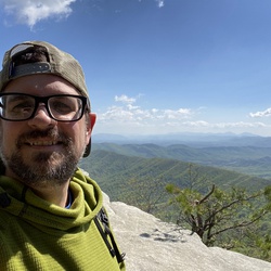
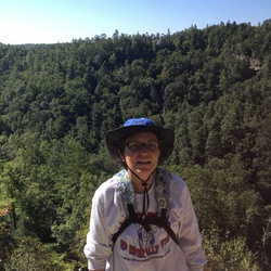
Moderately easy hike with mostly ridge walking. Spectacular views all along the trail. Weather was fantastic but about 34°F. Great hiking!
★
★
★
★
★

Lots of overgrowth and downfall on this section. Waterfalls were a trickle or non-existent this time of year (September). Really cool rock shelters and rock formations. Lots of spider webs on trail. Campsites were hard to find most of the time.
★
★
★
★

This was a great hike. The Double arch was ok but the view from the top was amazing Courthouse Rock was huge but the views from the ridge made it worth all the time. The best arch was the Star Gaze.
★
★
★
★
★


Lots of trees down, some trails closed until May 25. Had to go around several trees
★
★
★

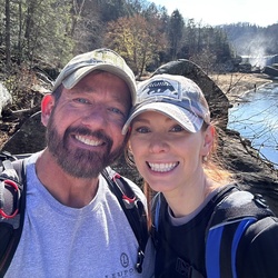
First time doing Indian Staircase and Cloud Splitter. Went with a group of varying ages. Was a perfect day to hike
★
★
★
★
★


This is my 1st hike in Kentucky and it was soo good! So much wildlife, amazing views, and places to pause and simply admire God’s handy work!
★
★
★
★
★

One of my favorite hikes yet, beautiful views. The elevation can get to you.
★
★
★
★
★

A pleasant 2 mile hike in and out. 94 stairs down to the bottom of arch, 94 stairs back up to the trail. No breeze at all on this one, and muggy.
★
★
★
★
Was a nice morning hike, no souls but is until we got to the 74 stairs to go back up!
★
★
★
★
★

The loop is mostly up hill and many of the main rock features suffer from graffiti. The forest is pretty, mostly young trees. you do feel secluded.
★
★

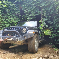
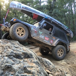
I recommend running Spaas into Pumpkin Hollow, or counter clockwise. Spaas has some tight spots, and Punkin has a challenging hill climb, especially if wet. There are also some deep ruts.
★
★
★


Dual sport riding at its best. Would not recommend large ADV bikes.
★
★
★
★
★

Decent hike. Better in winter. Vegetation covers most views. Elevation change significantly for beginners. Good for morning workout.
★
★

Relatively easy hike. A few trees down mid-trek in 2022. Mostly flat with a climb out. Several abandoned mines along the way, with beautiful rock faces that you will hike beside. Trail is clearly marked. Most of trail is in good to excellent condition where horses also use the area. Several places to get water out of the creek. Be careful not to get water out of the creek flowing from the mines that may contain sulfur.
★
★
★
★

Fav: up Carr hill , down powderhouse, take right to gladie creek to home
★
★
★
★
★

Very fun!
And so so pretty everywhere!
Easy but not bad at all!🤍🥾
★
★
★
★
★

Great easy hike with a waterfall and natural bridge. Could easily bring a lunch and picnic near either feature.
★
★
★
★
★

This was my first back country camping hike in the Red River Gorge. Great hike with Sally and got to see some of the Adventure racers on course.
★
★
★
★

Out and back - out to the center scramble, we did not go up to the half moon it was too risky for us.
★
★
★
★

A little over grown. Pretty easy hiking. Great scramble and look out at the point!
★
★
★
★


Level 4/5 (Advanced difficulty). Spotter required, highly recommend recovery gear, 33" M/T tires, rock sliders, limited or locking diffs and local knowledge. 4WD required.
Make sure to stop at Browns Corner Store- cheap and tasty lunch with friendly people.
★
★
★
★
★


m out of state , and hiked many other breathtaking hikes but I won’t compare them to this hike as them where not in Kentucky , with that being said I think this is very nice hike with some extra 3 miles that you can add and make it a 9 mile hike ( which actually was my favorite part of this hike with very nice views ) .
There are few amazing camp spots in this hike. I’m sure during the summer it is much prettier .
★
★
★
★
★
I’m out of state , and hiked many other breathtaking hikes but I won’t compare them to this hike as them where not in Kentucky , with that being said I think this is very nice hike with some extra 3 miles that you can add and make it a 9 mile hike ( which actually was my favorite part of this hike with very nice views ) .
There are few amazing camp spots in this hike. I’m sure during the summer it is much prettier .
★
★
★
★
★

Pretty easy hike along the river. It has a couple river crossings that required us to take off our socks and boots to get across. FYI the water is freezing in February!
★
★
★


This is a great hike. Indian Staircase is challenging but the views from the top are very rewarding.
★
★
★
★

Take the left at the intersection and do the courthouse loop first unless you want to face the constant uphill the other way. Elevation gain kicked our butts. Not much to look at down in the valley so you may want to consider the out and back on Auxier instead. The Auxier to Courthouse Rock was beautiful though, lots of look out areas and pretty spots for backcountry camping.
★
★
★

Tough and lives up to its name but worth every minute of pain with huge payoffs in views and scenery.
★
★
★
★
★

Nice hike don’t forget to pack some food when you go
★
★
★
★
★

I have seen people on Hansen’s Point for years from Chimney Rock, but even with a detailed map of Red River Gorge I did not know the trail to get out there. Thankfully after downloading the GAIA GPS app I did! I trekked out to Hansen’s Point and the view was AMAZING let me tell you!! SO worth the hike out and back!! I hope you enjoy it as much as I did!!
★
★
★
★
★

Hiked to n snow. Temp made it up to 44 degrees. Snow and ice falling off trees. Found small trickle of a waterfall on way back to car.
★
★
★
★

Intermediate hike with two great waterfalls and two shelters. Privy at Star Creek shelter.
★
★
★
★

This is an easy hike that’s doable for most anyone. Lots of scenery and a few waterfalls.
★
★
★
★
★

A solid, moderately challenging hike. Would have loved to push for a longer loop but we were running low on daylight. Past the arch, there wasn’t a soul on the trail in late February, despite the unseasonably warm weather. Looking forward to returning
★
★
★
★
★

Challenging trail. Nice single track sections linked with some gravel road and a little pavement. This is a section of the Sheltowee Trace Trail that permits motorcycles. Beautiful scenery.
★
★
★
★
★

I loved this hike. Backpacked into camp about 1.25 miles in along the river. It’s a day hike for most, but we’d completed other hikes earlier in the day.
★
★
★
★
★

Loved this hike, beautiful weather! Sheltowee Trace-Indian Staircase-Cloudsplitter-Suspension Bridge.
★
★
★
★
★

Very nice route. Not as many views as expected but still very pretty. This route will be strenuous for some people and is best for experienced hikers and proper water, gear etc. This hike would be best in early winter after leaf drop or in early spring before full leaf out to maximize views. Gray’s arch is spectacular but Hidden arch is very small and unimpressive. The out and back to Hidden Arch from the loop is a nice hike and not too strenuous. It’s a good side trip if you are out for the exercise.
★
★
★
★

This was a great trail for beginners and amateurs alike. great for dogs. Plenty of scenic views. Definitely coming back
★
★
★
★
★

This was a great hike. On the way out to yahoo falls the Sheltowee only has two campsites until alum ford. These were taken so We camped by river but were 100% confident it would not rain. Tough to get water must use river. No campsite on return by negro creek. My favorites views were lick creek falls and the yahoo falls.
★
★
★
★
★

The lake and surrounding area are beautiful, but this hike was pretty unremarkable. There are no good views of the lake anywhere from this part of the trail.
★
★


A few things about this hike that should be posted. First, it is a great hike with a well marked, well maintained trail and it is very beautiful. It has a rating of “easy” which might more appropriately be rated “moderate” for the north of 60 hikers due to the long descent and ascent. If you are wanting to see the arch you only get a brief glimpse of it from the loop itself unless you venture off on a side trail. We missed getting a look at the arch because we hiked it in July when trees were in full foliage. There is a beautiful stream about the halfway point which doesn’t show on the Gaia map- our dogs loved it! I Highly recommend this trail in Daniel Boone National Forest!
★
★
★
★
★
This hike has beautiful views and a great story behind it. However, it is a very steep hike so I would use caution and plan wisely unless you are sure of your fitness levels.
★
★
★
★

One of the best hikes in the state. A must do hike. Waterfalls and scenery
★
★
★
★
★


Distance was off. Gaia tracked me at 5.79 miles and just shy of 1400ft elevation change. It was a nice walk in the forest and I had a good time but other than a few beautiful overhanging rocks there weren’t too many sites. I have to imagine red river gorge has more scenic trails.
★
★

This is a moderate hike. You are in the gorge so you know you will have some climbs, but it is only around 800 ft. It features what you look for at RRG- arches, ridges, and flowing water. You get to see the variety of vegetation typical of the different levels of the gorge area. Along Auxier, you can get your fill of wild blueberries when in season!
★
★
★
★
★


Took us 4 hours, playing with the dog, taking pictures, plus two leisurely rest stops. MY GPS registered exactly 5.0 miles for the loop with minimal side hikes to the many views (we've done the Auxier Ridge hike many times). We've done the loop twice. The trail is in good shape for a marked trail in Red River Gorge (moderate to moderately high traffic). Where Trail 202 (Courthouse Rock Trail) departs the Auxier Ridge Trail, it is steep and eroded, but only for about 10 minutes. The trail is easy to follow and I would rate it moderate in difficulty. The views after the leaves drop are great. The hike through the valley is one of the nicer walks through the woods, with a few small creek crossings, and nice views upwards at monoliths and cliffs to add interest. The fall colors are very nice. The wildflowers in spring are not very abundant but the greenery and woods are second growth mature. Overall, we really enjoy doing this hike every couple of years.
★
★
★
★


 stars
stars