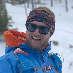
Hiked from the Losr Lake CG. Lots of up and down. Good view of the Castles to the right beyond the pass. Good wildflowers.
★
★
★
★



The route my group took was much shorter but also much steeper, there is a pond filled with trees right before the green lake so dont stop early
★
★
★
★
★



The approach hike is quite lovely, through a valley with numerous beaver ponds and lodges. We backpacked in 3 miles and camped on Friday afternoon, and got an early start at 6am to summit San Luis Peak, 3.5 miles further. On the way back, we explored a little along the ridge in the direction of 13er Baldy Alto. As weather was moving in, we did not summit that peak, but descended into the Stewart Creek Headbasin and continued back down the standard trail from there.
★
★
★
★
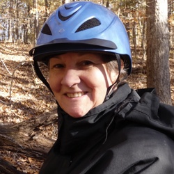
A nice quick ride down to the reservoir to water the horses.
★
★
★
★

Uber fantastic mountain and wildflower scenery. About 45 min. Drive east of Kebler Corner. Take a wildflower guide to help the blooms- an amazing variety!
★
★
★
★
★

Quiet isolated area with wildflowers in Aspen grove if there are no campers around.
★
★
★


Very poorly maintained trail. Lots of overgrowth and fallen tree debris make it nearly impossible to keep the trail.
★

Awesome hike near Creede, CO. Spectacular views and a reasonably easy hike to San Luis Pk summit. Have seen moose very close on this hike near San Luis Pass so be aware.
★
★
★
★
★

We followed this route up Castle Creek from Costo Lake. It was really slow, wet and bushwacky with downed timber until we got into the waterfall section before a really steep traverse above a steep face that we decided not to continue on because it was slow moving and we didn’t want to be in the drainage if the weather turned bad. I would maybe attempt again with better weather, but would probably go up the much faster adjacent drainage with a mapped trail instead.
★
★

Nice gradual hike to the saddle. Plenty of water on the way
★
★
★
★
★

We actually biked the loop which took about 4 1/2 hours and saw the most phenomenal views in Crested Butte!
★
★
★
★
★

We did this from Crested Butte to Aspen on July 15. We parked at copper creek trail head. Total distance was just over 17 miles. Left parking lot at 620 am and ended up at Maroon Bells shuttle around 430p. The river crossings slowed us down quite a bit. We stopped to switch out to water shoes where water was knee-deep 6 times. Only one of them was a bit tricky that was knee deep with fast moving water. We had equal number or more or river stream crossings where we could make it across without water topping over our boots. Once we went over the pass, there were a few easily navigable snow fields, but one sketchy area about 100 feet long that was luckily soft snow, but we were still glad we had our micro spikes and poles as it was definitely steep and a slip could have been ugly. The rest of the way down was rather uneventful except an area that had some massive downed trees over a short stretch. Had to go down hill on the first group and uphill on the second group to navigate. At the end end of the trail it is a bit of a painful uphill slog to get back to the shuttle pickup for Aspen so would be much easier to go down to East Maroon trailhead if you could get a ride from there. We were thinking of hiking back via West Maroon pass after a couple days in Aspen but not so sure now. Btw we only passed one hiker going the other direction to Crested Butte. Clearly not a lot of people have done this hike yet as trails a bit overgrown.
★
★
★
★

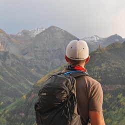
Round 2 of a week adventure on the CT with my girls. Most beautiful hike of your life.
★
★
★
★
★

Perfect fall hike, easy only 3 miles round trip. Views of the Aspen changing around Marcelina and Ruby peaks unparalleled. We do it every fall.
★
★
★
★
★

Pretty steep, got to 11000 feet and decided that was enough. Nice little brooks along trail. Only saw 2 other people
★
★
★

Solid lil one nighter backpacking trip. Plenty of water sources. Early June, was hard to find the trail in the snow during parts of that upper third trail. Felt kinda lost but kept an eye on Gaia and it was chill. All the private property signs were kind of a bummer.
★
★
★



Possibly saw bear, saw mom and baby moose
Met Dana it was her 50th bday
★
★
★
★
★


San Luis is one of the “easiest” 14ers to hike from the 2 standard trailheads. This route is much more challenging with the opportunity to bag 3 named 13ers, including a centennial 14er - Stewart Peak. Be prepared for a long day. Bring water and food to get you through it. And check weather, you don’t want to above tree line when an afternoon storm rolls in.
★
★
★
★
★


Awesome single track for dirt biking, rocks and roots abound and not for the faint of heart but the rewards are high if you decide to run this trail.
★
★
★
★
★

Great hike from town, beautiful wildflowers and tree cover/forest trail for most of the hike. Steep in sections, but overall not too bad. Be sure to go past the tree-filled mud pond near the top, the real prize is about 200 yards further up the trail. Keep an ear out for bikers coming back down the trail, the pitch means they will be moving fast.
★
★
★
★
★


Fantastic 20200704 hike! Beautiful high mountain lakes, would love to come back with the SUP and camp!!
★
★
★
★
★

Great loop. Various water locations for dogs. The Lake is beautiful and full of cutthroat trout. Quite a few mountain bikers and can have motorcycles on parts of the loop. Incline is mostly up to the lake and then moderate inclines but mostly traversing. Mosquitoes can be heavy if you stop. Flowers are impressive towards end of loop. Drop a car at the county shops trail head (end of loop) so you don’t have to walk an additional 1.5 miles back into town along highway.
★
★
★
★

This was an trail off of the road near Almont Co. Of 50. Trail sits on right hand side coming from Crested Butte. It does have a place to park and a ladder to cross. Nice short trail, family friendly. Went late August. Trail visible. But some parts grown a bit. East River flowing good. Enjoyed this hike will do it again.
★
★
★
★
★

Trail #836 is gentle grade to the junction of the Daisy Pass Trail. Plan on walking the first .8 of a mile up an old jeep road to the beginning of the Raggeds Wilderness. You come across plenty of water for filtering and currently the water crossings are passable without getting your boots wet. Most people hiking Trail #836 are headed to Blue Lake which a mile beyond the intersection.....
★
★
★
★
★