


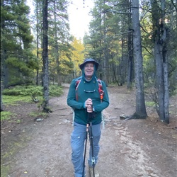
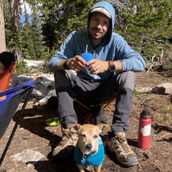
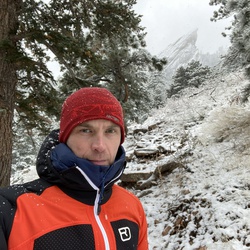
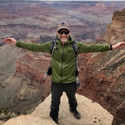
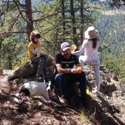
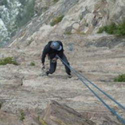
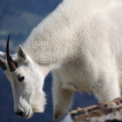
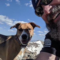
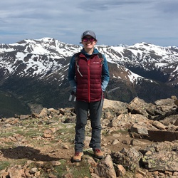
Our family really enjoyed this hike. It was beautiful in so many aspects. Personally, I was not fond of crossing St.Mary’s glacier. We did not have cramp ons and I would not do this again without them, particularly coming back down. We made it but it was nerve wracking. The glacier is bigger and steeper than you may think. But the views are absolutely spectacular.
★
★
★
★


later morning hike, didn't get to the TH till 9am. such a perfect day outside - sun was out, no clouds, a slight breeze and 55 degrees up at the Reservoir. conditions were super good for this time of year, at least half the trail is dried up! i did need my microsprikes though on one section of the hike (beginning of mile 2, downhill section).
i beat the crowds, as Echo Lake is pretty popular, but crossed paths with maybe 10 people on my way back down.
good hike!! Viva Cristo Rey! - Biz 5/3/25
★
★
★
★

Steep stretches of trail on the way up to the lake. Trail is well marked. Other hikers saw a moose but we just missed it.
★
★
★
★

Tough to get up early and start hiking in the dark when there’s snow on the ground, but no snow yet, got up at 430 and hit the trail at 5. Up and down by 9, great for a first 14er, this was my third and it felt the easiest. I’ve done Greys and Humboldt before this one.
★
★
★
★
★


Very scenic and wonderful views. Start is very steep, but a nice rest point at the top of the steep section. Poles recommended because of loose rocks underfoot the whole way up. Lots of cute little marmots! The way down was very sketchy, with lots of slipping down loose rocks. Hardest part of the hike. Overall, pleasant but challenging experience!
★
★
★
★
★


Bumpy rocky dirt road that only goes to the road change before a gate thanks to a development. 10+ camp sites. Couple dirt bike off shoots
★
★
★

This is one of my new top 5 hikes ever done, and I’ve hiked around quite a bit! After the first half mile you can’t hear the highway anymore and it is just magical, spectacular views all the way up. Peaceful forest to start, then out in the open tundra with the craziest wildflowers I’ve ever seen paired with insane mountain views and pika! The lake itself was gorgeous and I went for a super nice and refreshing swim. Great people on the trail too! Must do hike. Although the last half mile is straight up and will absolutely kick your butt.
★
★
★
★
★
Really muddy when you get on the trail. I getting around it in places. Beautiful though NO traction required.
★
★
★
★
★

Started early from Summit Lake and saw lots of wildlife. Spikes are recommended this time of year and an ice ax wouldn’t hurt. Gets too touristy for my taste later in the day and it’s a bummer to end up at the drive-up summit but still beautiful and fun.
★
★
★
★
Started early from Summit Lake and saw lots of wildlife. Spikes are recommended this time of year and an ice ax wouldn’t hurt. Gets too touristy for my taste later in the day and it’s a bummer to end up at the drive-up summit but still beautiful and fun.
★
★
★
★

This was an all Snow packed trail. We really needed micro spikes for both trip up on ice and down in slippry slush
★
★
★
★
★

Illegal entrance, but the back is good low angle. Need to approach from a different area Kingston pass.
★
★
★


Great hike- gps did not align with where trail
was showing on app & map . So I back tracked and descended more than I needed too. Still came within a 1/4 mile of Summit & had great views. Forest was really cool.
★
★
★
★
★

Beautiful views from arrival to summit! Many lakes in the area, big and small. High - very high traffic on narrow one and back path. Would be more than happy to only do the first leg of the hike! Second leg, heavy incline and rocky. Last leg to summit is all boulder climbing!
★
★
★
★
 stars
stars
This is a beautiful and fairly empty area of the Mt Evans Wilderness. Requires a hinting, fishing or SWA license to enter. The profile up and back is about the same, but easier going up the Beaver Meadows side first -- less steep. This trail hooks into most of the rest of the Mt Evans trails.
★
★
★
★
★

Great local loop in Mt Evans Wilderness. Not crowded. Mostly shaded with tree cover which makes it a great option when it is sunny and hot
★
★
★
★
Great views. Only do this on weekdays in the summer. The forest road was challenging for my 4x4 Dodge Durango, but crawling along worked fine while listening for undercarriage scrapes. Be done with hike by noon and bring all weather gear. Summit will be windy and cooler.
★
★
★
★
★

Gorgeous. Easy to access. Not too busy. Peaks are easy to hit from the trail, so it’s a great area if you’re still developing route-finding skills. You spend a lot of time listening to the mining equipment, but that fades when you get high enough up.
★
★
★
★

This was an amazing hike. Lush forest and superior wildflowers. The ditch creek crossing was reasonable but needs water shoes or bear foot.
★
★
★
★
★


 stars
stars
Great flowers today but starting to dry out up top in the meadows. The stream was flowing fast down the gulch
★
★
★
★
★

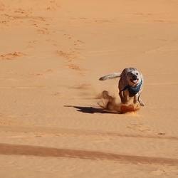
One of my favorite near Fraser, Colorado. No bikes allowed! Me and my dogs love it. Gradual up all the way out. Which means gradual down all the way back.
★
★
★
★
★

Gourd lake is beautiful and all the trails up there are pretty well maintained, great views hiking up the valley and around the river
★
★
★
★

Stunning views! I really enjoyed this walk, it wasn’t too hard getting there but it’s mostly downhill so bring a snack for energy to go back up!
★
★
★
★
★

15 miles up ~3,600 ft. And the best downhill of my life. Bikes are allowed here without reservations!
★
★
★
★
★

Great backcountry snow area. Great for snowshoes. Reliably has snow even during low snow winters.
★
★
★
★


A few areas where the trail was about ankle deep but most of it was very firm or a mix of dirt / packed snow. Spikes are perfect.
Left the trailhead at roughly 5am and landed on the false summit (.9 miles from the peak) right at first light. Arrived on the top of Sniktau just as the sun was rising.
Weather projection was spot on with roughly 10mph winds at the top. Got a little chilly but otherwise beautiful morning. One other person was there to begin a pre-dawn hike but they were headed for Grizzly Peak. We started running into people on our way down.
Trailhead: 5am
Total time round trip: 4 hours (that includes time at the top watching the sunrise and a stop to take pictures).
Be cautious.. there is a pretty solid cornice on the final approach to Sniktau but it’s very easily avoidable by staying to the left as you climb. Remember that they tend to break off much further back than people realize.
https://avalanche.org/avalanche-encyclopedia/cornice/
★
★
★
★

Fun first backcountry day of the 21/22 season. Went with Justin and Duncan. Went to winterpark then skied here. Beautiful ascent cuz sun was setting; a lil scary descent cuz it started getting dark.
Kinda weird conditions. Windy so there was a crusty layer. Deep powder
★
★
★
★

Excellent mostly-off-trail day-hike, with significant altitude gain. All above tree line. Amazing views. No other humans. Need high clearance vehicle to get to starting point, which is just a wide spot on the Jones Pass 4WD trail.
★
★
★
★


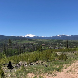
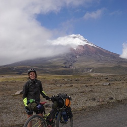
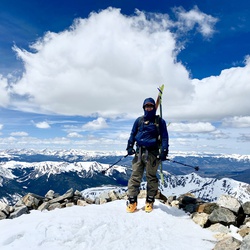
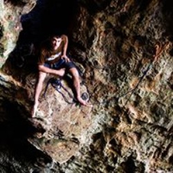
Trekking to the top of James Peak is always a breezy delight. First, one must navigate the St Mary’s Glacier now remnant snowfield with some scree, but at the top, the broad alpine tundra awaits.
There is an ATV corridor to navigate but once in the James Peak Wilderness Area, things get quieter. The trail is well-marked with many cairns. There are some great views of nearby mountains including Pikes Peak, Mount Evans, Square Top Mountain and Grays and Torreys Peaks.
From the summit, Grand County, Longs Peak, the Gore Range and Indian Peaks Wilderness Area come to view!
Because of the high length of alpine tundra, my only caution is being wary of thunderstorms. On this crisp and breezy autumn day, there was no such threat!
Bring $5 to park and get an early start!
★
★
★
★
★


Easy high-altitude hike. Go to Fourth of July trailhead. At first branch where there is a sign, turn right. Above tree line there is an unmarked left then unmarked right near the ridge. Bring rain gear. Have fun!
★
★
★
★
Unbelievable- would omit the first/last two moles tho and make it 12 round trip instead of 16.
★
★
★
★
★


A bucket list hike! But, if you’re not used to the thin air, take your time and stay hydrated. Hyperventilation and altitude sickness is a real possibility if you don’t. It is tough, but the reward is great.
★
★
★
★
★

Nice trail. Sufficiently high elevation that it dropped 20 or 25° off the temperature. Pretty steep start and steep right before you get to the lake otherwise nice and gradual. A big wide gorge made it open and airy but also pretty views. Trail continues after the lake and far fewer people
★
★
★
★

Relatively easy drive all the way to top. Lots of trails so can be confusing. 13,207 ft.
★
★
★
★


Fantastic trail with a couple steep climbs, definitely worth the effort once you’re at the top though!
★
★
★
★
★

630 am start. Plan to summit grizzly. Took cutoff route around Cupid. Had to bactracknaround snowfield on east side of cupid. Turned back at saddle between grizzly and cupid die tonoossible weather and unwilling dog
★
★
★
★
★

Hiked off trail to reach Prairie Peak. Fabulous views of the Gore Range, Ute Peak and beyond. Very steep - 1000’ vertical in one mile.
Best way is to head straight up from the trailhead toward the old fence posts I marked with red icons. The route goes through young aspen forest and low brush for for 200 yards up to a meadow that continues to the peak.
★
★
★
★
★
Enjoyed beautiful views as we hiked along the side of the mountain through the forest and meadows. There’s a meadow at the end with a nice view of the Gore Range. Wished we had insect repellent while we ate lunch there.
Wanted to find a way up to the peak without going through tree fall but couldn’t find it this time.
No one on the trail, note there’s no water for dogs.
★
★
★

Decided to hike Bard peak from the Democrat mountain Jeep trail, didn’t see a single person on a Saturday
★
★
★
★

The whole basin is charred from horizon to horizon. Nice here if you're fond of charcoal and dead trees.
★
★


This area is super safe and fun. Beginner stuff but safe for solo.
★
★
★
★
★

This is an easy skinning up to the chair lift (panoramic express ) of winter park, we did sone runs on the blues and come back to the hut.
★
★
★
★
 stars
stars

Great trail, last .7 miles to Summit lake is hard and footing is decent but you need to stay cautious.
★
★
★
★
★


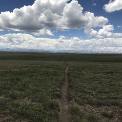
After 20 minutes you can't hear the highway. I saw deer and an ermine. Overall a decent 3 hour roundtrip hike. The trail goes past the lake to I don't know where.
★
★
★
★

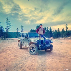
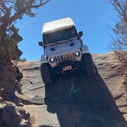
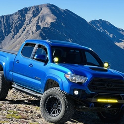
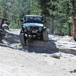
Hike? No I was four wheeling on a 4x4 trail. Moderate difficulty. Used a stock 2020 trd Off-road Tacoma. Cut a tire at the end. Some sections have very sharp rocks. I was on stock tires at 15psi. Didn’t need to use the locker. Just pick good lines. Made it home on the spare.
★
★
★
★

Vet very busy trail. My friend and I did it on Saturday and the 14er association counted 300 when we ask him. But it was very cold and windy. Please be safe hopping around on the rocks. Otherwise enjoy..
★
★
★
★
★

Fantastic out and back in Arapahoe National Forest and Never Summer Wilderness. Not crowded, not technical. Trailhead is a little tough to get to. We did it in a minivan and were a little worried but were fine. Imagine this hike is spectacular in July/August with wildflowers in bloom. Highly recommend.
★
★
★
★
★

Great hike A bit steep in the beginning and end. Weather changes quickly at this altitude. Beautiful flowers and amazing views Parking may be a bit of an issue. Busy trail but hikers spread out so no social distancing issues even during COVID19.
★
★
★
★

Busy Labor Day weekend. Had to park a mile below the trailhead which added some time and distance. Had Kai with me for his first 14er! We submitted Torrey’s first then Gray’s. Kai did really well. He was definitely thirsty at the end, but all in all he had a good hike.
★
★
★
★

Tried to do the aqueduct over to the Broome Hut ... pretty sketchy around the rock slide areas. Turned around and will try later from Second Creek to see where the impasse is from that side.
★
★
★
★
 stars
stars
Very crowded hike and parking/traffic becomes chaotic after 4 am. Hike was very challenging but rewarding with a great and mellow couple miles back to the parking lot.
★
★
★
★
★


 stars
stars
Kelso Ridge is really fun and challenging as long as you are comfortable with heights. Along the ridge you are exposed, have to do a few moves, and the rock is loose all over this trail and I would imagine it would be freaky if you were already nervous. We got started at 4:30am and I am thankful for that, the amount of people on the main trail is obscene. I was glad to be passing them on the way down opposed to fighting with them at the top.
The road to the trailhead is not that bad (not great by any means) but there is one section that stops most from getting to the top, it's steep, rocky, and rutted out. You need a car with decent clearance and 4wheel/all wheel drive to get to the trailhead, I managed to get my all wheel drive VW Toureg to the top. There is plenty of parking at the lower lot and along the road, but I did see some tools park basically in the road and another turd in front of a private driveway, so don't be that guy.
★
★
★
★
★

Great hike, we finished in 4 hours which included time at the lake. Also saw a moose, lots of birds, and of course chipmunks. The first mile you will still hear i-70 traffic noise but it goes away after that. Beautiful hike along the creek at times I would say more like a river/miniwaterfalls. It is a lot of steep incline but the trail is clearly marked and you don't do much scrambaling with the exception of navigating across some logs in washed out areas.
★
★
★
★
★

It’s a tough start but settled out. Beautiful view once you make it up top.
★
★
★
★
★


Backpacked this for a couple days with two buddies. Incredible spot to camp with great options for day hikes from camp around the area. Trail was mostly well maintained, but there were multiple trees that had to be crossed along the way.
Hike up was grueling. Long, hard, rocky paths with multiple sets of switchbacks. Very beautiful rewarding and remote area once you arrive, and that makes it very worth it.
At the fork will be your last chance to filter water for the next roughly 1.5-2 miles of steep trail so make sure to be well hydrated at this point.
The hike up took my group roughly 7 hours, under heavy loads of gear, and about 5 hours to get back down.
★
★
★
★


Sparsely populated after the lake. Have to either find a faint trail at times but mostly make your own. There are some guides online. Walked along the ridge line a bit. Great views, lots of Marmots running around on the rocks which was fun.
★
★
★
★
★
Arrived at 7:30 on Saturday. TH head Parking lot was full so had to park along side road about a 1/4 mile away.
Hike was a steady long gentle incline. Trail has several stream crossings with a couple of small waterfalls. Mirror Lake was crowded so I headed to the south side of Crater Lake. There is a 30 foot ledge that has a cabin remnants. I found a private location on lake with a views of the Crater Lake waterfall to the west and grand view of Lone Eagle Peak to the north.
In hindsight I wish I backpacked this trail during the week to enjoy its beauty. It’s crowded but not too bad because of its length.
★
★
★
★
★
Great hike, but very crowded (even on a Tuesday), which is why only 4 stars. Very well maintained and heavily trafficked trail. The actual difficulty isn't so bad if you don't have issues with the altitude. Get started early. Upper parking lot fils up very quickly. Consider driving up the night before and sleeping in your car or something if possible (might help with the altitude too). You will definitely need a 4WD to get to the upper parking lot, though. That road is a total pain in the ass.
★
★
★
★

Fantastic trail with a couple steep climbs, definitely worth the effort once you’re at the top though!
★
★
★
★
★


Really hard one
Some trail finding and 40% + grade down from Grizzly Peak, then from the saddle between Grizzly and Torrey, very loose scree up Torrey: 2 steps forward, one step sliding back down.
Great for trail running up to the bottom of Grizzly from Loveland Pass, then a bit too steep. Return trip, climbing back up to Grizzly from the saddle with Torrey is tough and steep and there really isn’t a trail, find your own best route. In the end, a very satisfying trip. Took me 7.5 hours including a couple of short tests.
★
★
★
★


Beautiful easy 14er hike. Extremely popular and busy however. We arrived at 5:30am and parking was already extending down the road to the trailhead and hundreds of people were on the trail. First mile or so is flat, then straight up for the rest of the hike. As an infrequent hiker it took about 2.5 hours to summit.
★
★
★
★
★
This trail is easy to moderate in just a few spots. No way would I call this 4x4 trail difficult
★
★
★
★
The first mile is difficult. Need a lifted vehicle/tires/lockers. After that it’s not very bad at all. Very scenic during the last part of September
★
★
★
★
★

Nice hike along the water. Not something that’s common in Colorado. We did not see another hiker even though this is one of the busiest weekends of the year up here.
★
★
★
★

Best jeeping trail I’ve ever been on. Not for the faint of heart. Amazing!!
★
★
★
★
★

Continuing up above the treeline is like stepping through a portal into a different world... breath taking and awe inspiring
★
★
★
★
★
Impassable at 39.81036, -105.66492 due to massive snow drifts. Lifted 4Runner, 33s aired down to ~12psi and no luck.
★
★
★
★

Very scenic hike. Saw a baby Moose by the lake on one hike. The trailhead isn’t marked real well and drove past it. The trail is pretty easy to follow except around some rocks near the end. Take the detour around the mid-point. I’m in average shape so the hike and elevation were a little strenuous.
★
★
★
★
★

In the spring snow. Water Board road (dirt) to winter end then off trail (snow) down to Corona Pass Rd (snow packed).
★
★
★
★

The backside of butler gulch was world class. It’s the best tour I’ve ever been on. We had the whole cirque to ourselves (Currey and Lisa Cornelius).
★
★
★
★
★

Awesome! Great views the entire way. Finished in 4.5 hours. Only ran into one other person the entire day,m on a weekend. A little bit of noise from the mine, but it didn’t detract from my enjoyment and the solitude more than made up for it.
★
★
★
★
★


Amazing. Beautiful waterfalls throughout the trail. Lush and green. Would highly recommend !
★
★
★
★
★

Nice, well maintained trail. Saw 3 moose and some deer! Started at 6:30 am and finished around 1 pm. Trail got busier after 11 am.
★
★
★
★

I don’t recommend this hike. Lots of better, prettier, more interesting trails to hike - felt like I wasted some time here. Not really sure why this trail is so highly rated.
★
★


Beautiful hike through a lush willow covered valley with a small stream crossing (was able to stay dry by rock hopping across). The terrain is easy to navigate and seasoned hikers won’t fine this to be challenging. The most challenging part of this hike is the altitude and last 50 vertical feet to the summit on rocky terrain.
This is a hike you want to do early in the morning in order to beat the crowds and afternoon storms.
★
★
★
★
★
Very scenic trail, especially through the Alpine Tundra and higher elevations. The view at 13K feet is amazing!
★
★
★
★
★

The wildflowers were spectacular for this hike, one of the top wildflower hikes in Boulder County. The mountain scenery views are awesome and Lake Dorothy is a magical place.
★
★
★
★
★

It was more than 400 ft ascent. More like 1000 as the first mile was not recorded and it was 1,000 ft. Great hike but didn’t make the lake itself. Storms rolled in.
★
★
★
★
★
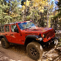
Great trail with medium difficulty. One bypass is a little more challenging. The lake and scenery at the top is incredible. It’s a “must ride” trial if you’re in the area. I’m in a fairly stock JKU Rubicon Recon and only kissed a few rocks on the more challenging by pass.
★
★
★
★
★

Very windy above treeline. Needed my smartwool layer the entire time. Beautiful views all around. The first mile is probably the most difficult. Once you get over the first hill of switchbacks, its gentle up and down. Stanley mountain doesn't have a sign, but there is a rock pile and pole on top of it to the left of the trail.
★
★
★
★
★

I did 4x4 driving in 2019 Memorial weekend, it was a fun trail to run, got various road condition. The closer to the Yankee hills, the harder it became. I didn’t make it to the top of the hill, it was still packed with 2ft snow and it was little late.
★
★
★
★
★


 stars
stars


 stars
stars


