The trail begins in a beautiful grove of mature trees. It crosses a wide river bed, meeting up with the PCT. We made it an out and back. Beautiful views down valley on the return
★
★
★
★

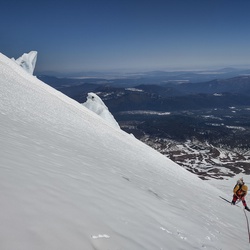
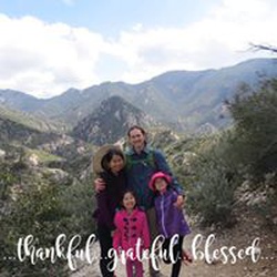
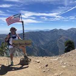
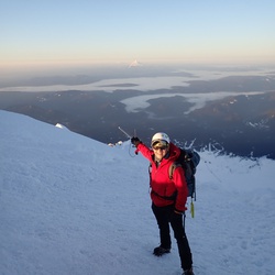
First time ever hiking Mt. Gorgonio. Im not that fit so this was the hardest hike ive ever done. But im excited for more
★
★
★
★
★

Nice hike. Good amount of work to get to dry lake. About 2k elevation gain but it’s mostly gradual. Great sites for tents up there. Spring was running medium full.
★
★
★
★

Big burn scar from fires over the past few years. really bad stretch of chaparral white thorn that’s brutal on the calves for miles
★
★
★
★

Great hike. Muddy in several places. Tons of water. Snow almost completely gone
★
★
★
★

Short hike but the plants and vistas are amazing. Much different than many desert hikes. Wear long pants, maybe take a pair of garden clippers to cut the cats claw. Also be prepared to get your feet wet if you want to go up the canyon all the way.
★
★
★
★

Solo day hiked Thurs 1/18/24 – Nice to finally make it to the Coon Creek Jumpoff area! Since Forest Road 1N02 is closed for winter, I used the Pacific Crest Trail from Rainbow Lane up to Wysup Peak and then down to the old Coon Creek log cabins that Charlie Tayles built in the early 1900’s. From there, I followed the older part of the 1N02 road that is now inaccessible by 4x4, blocked by some large fallen trees, rocks and brush but still has an animal use trail along it. Once the trail ended, it was a cross-country route along the eastern ridge separating Big and Little Morongo Canyons. First was the climb up Peak 8350 on good rock and then down and up Three Sisters and Three Sisters West peaks. Each of the three summits had great, long ranging views and little wind. Thanks to the 2015 Lake Fire, it was easy to find paths up the faces through the newer growth Manazanita and Ceanothus bushes with no bushwhacking required. Getting over/around the numerous blow downs was also not bad. Visiting the log cabins on the way back was interesting, especially the Tayles lodge cabin that is now the Coon Creek Group Campground. The Hilary storm washed out some impressively large sections of the 1N02 road east of the campground. Some ice and a lot of snow on the PCT up to Wysup from Hwy 38 but a dry trail down to Coon Creek. Brought but didn’t need micro spikes in spite of some stealthy ice. There are a few cairn marked segments between the peaks but constant navigation checks are necessary. Three Sisters West required some extra route navigation and scrambling on stable talus but made for the most fun on this trek. Logged 18.8 miles/4078 vertical ft. with Gaia _____________________________________________________________________________________________________________________________________________________________ Solo day hiked Weds 11/29/2023 – Started at Hwy 38 on the dirt road 1 mi south of Onyx Summit to access the PCT southward. While it was 19°F when starting, it was dry with no wind so not too bad. Couldn’t pass the private dog compound next to the PCT quietly in the dark so I just powered by it, glad to have a 16 ft high fence between us. Made it to the summit of Wysup Peak in time to see a nice sunrise with the last 1/8 mile or 200 meters being an easy, direct scramble. From there, it took frequent navigating to link several, faint use trails along the ridges and saddles to ascend/descend Peaks 8745, 8763, and 8868. Neat to see the huge Sierra Junipers that grow on these peaks with their redwood-like trunks. After descending 8868, I followed a well-defined track up Heart Bar Peak which was the most relaxing part of the hike. It’s an old access road now partly covered by some good size mountain mahogany trees. Took a slightly different route back to the PCT using a few steep pitched, washed out roads to keep things interesting. After getting back on the PCT, it was a straight forward northbound hike to the base of Onyx Peak with the dogs pacing the perimeter at the compound but a little quieter than earlier. From the base of Onyx Peak, I took the well-worn east gully route to the saddle ridge and then a direct N-NE ascent up to the summit. For me, this was a much better and more challenging route than trekking up the Pipes Canyon access road to the summit. After finding the survey benchmark on the east side of the northernmost antenna group (there are several fenced areas on the summit) and walking around the other antenna groups, I used the same route down to PCT and back to Hwy 38. Definitely a more scenic hike and better weather than what I was anticipating! Logged 18.7 miles/3587 vertical ft. with Gaia.
★
★
★
★
★

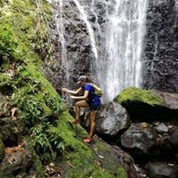
This is a nice and easy trail for any young adventurer. Brought my 4 1/2 year old daughter and she was keeping up with the adults. Water was low today but the falls were amazing. Make sure you check the weather, flash floods can occur. Would recommend as a day trip if you’re from Los Angeles or the OC.
★
★
★
★
★
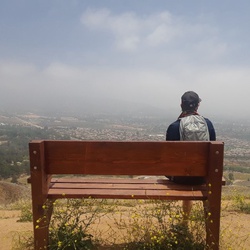
Solo day hiked Thurs 7/18/2024 - Started early to go up SB East & West peaks on a very picturesque day before hitting the very warm weather on the way down. All the usual, ephemeral water crossings are now dry but Limber Pine Spring is flowing very well with very cold water (6.1 miles from the Angelus Trailhead). Highly recommend hitting East Peak if you have enough time as the peninsular views of most of San Gorgonio are incredible. The trail section between the two peaks is also very scenic, especially looking north towards Seven Oaks & Big Bear Lake. Great views from the stone bench view point on the way down, shortly after passing the Survey Monument (good to see the monument still intact). Only met two people during the entire trek while heading down into the heat, but a nice cooling breeze really helped! Carried a 3L water bladder and 2 half liter reserve bottles but 2L is probably enough for most if filtering from the spring on an out and back trek. Logged 18.0 miles / 5008 vertical ft with Gaia ................................................................................................................................................................................. Solo hiked Fri 09/01/2023 – Angelus Oaks TH-San Bernardino West/East Pks-Anderson Pk-Alto Diablo Pk-Shields Peak-Gerhardt Pk. Early start with an electrical storm in the distance but dry with only a little wind. Great views off the first 4 peaks before the clouds moved in with a few sprinkles. Limber Pine Spring is still a mini waterfall and great place to filter some extra water on the way up. The San Bernardino Ridgeline is a scenic, beautiful hike in itself, much like Ten Thousand Foot Ridge. There are plenty of the original USFS carved tree blazes marking the ridge route but the trail path itself is well defined right now. Several fallen trees to navigate with a few small washout areas but nothing unsurmountable - unless you’re on horseback or leading stock. Most people would have a lot of fun scrambling up the Shields Peak rock pile – I certainly did. Was very luck with the weather today as the clouds didn’t roll in until after the fourth peak (Shields) and then there was a fine cooling mist all the way down with no bugs. Conversed with a lot of nice people on the way down including the trail runners, making it to the car just as the rain started (the day’s weather felt like it was timed as if would be on a movie set). Gerhardt Peak was an ant hill compared to the others but a new peak for me. Highly recommend this hike, even if the turnaround is SB Peak. Logged 24.1 miles/6118 vertical ft. with Gaia
★
★
★
★
★
Solo hiked Fri 08/25/2023 – Momyer Creek TH-Vivian Creek Tr-SG Mtn-Big Draw/Jepson Pks- Little Dobbs/Dobbs Pks-SB Pk Tr-Falls Creek Tr-Momyer Creek Tr. Bugs and bats in the dark on Vivian to make an interesting start. Nice to see High Creek Falls still roaring this late in summer with nice cold water upstream. Gusty on the ridge line but not bad on the summits with very nice weather/views. Spectacular views of Big Bear Lake, Dry Lake, San Jacinto Peak, Yucaipa Ridge and Lake Perris from Jepson and Little Dobbs were just a mentionable few. Going down the Falls Creek Trail was quite an adventure with a few jungle/oasis zones. The 3 lush green oasis areas were like being on a Hawaiian hike with many plant types, flowing strongly with cold water to filter while the White-Buck Thorn/Manzanita jungle zones were easily traversed but make it a “long pants only” trail. As others have said, there are several new blow downs across most of the trails, along with several new washout areas. They were all easy to deal, just requiring a little more care and effort to traverse (like being in the wilderness in general). Crossed Mill Creek easily on the Vivian start but it was not so easy to cross at the Momyer finish. Didn’t see anyone all day on any of the 4 trails I used. Now is a great time to hike these trails with lower fire danger, better weather and still-viable water sources. Trail crews have done a great job this year clearing blow downs and bush trimming but it’s definitely a game of “catch up” after an extraordinary winter and now Hilary. Logged 25.8 miles/6872 vertical ft. with Gaia
★
★
★
★
★

Started at 7:30am at the trailhead to beat the heat. It did get hot but wasn’t too bad in the morning. The first 3 miles are brutal because of elevation change and being exposed. There is decent coverage though too.
We got to camp at 11 and then just hung out at the river almost the entire day. We did a couple cold plunges as well.
Mosquitoes were annoying all day and would be interested in us but we both only got a couple bites. I did stay pretty covered up the entire time.
We met another hiker named Cory who was up here along and only on his second trip. We had dinner together and hung out for a couple hours.
★
★
★
★
★
Hiked Friday 06/09/2023 solo – Shields-Alto Diablo-Anderson peaks from Momyer Creek Trailhead. Wow! Very scenic, beautiful trail up to the SB Trail with great views the whole way. While the Buckthorn and Manzanita are dense in some stretches, it’s passable in pants and isn’t mile after mile. That said - thanks to everyone currently trimming it – very much appreciated. The sun cupped snowfields topside gave me more grief. There is still a lot of snow on the ridgeline here-more than the Charlton-Jepson-SG ridge line. Boots only to top ridge and then crampons for direct ascents. Decided to traverse the north slopes back from Alto Diablo as it was easier than going through the softening sun cupped snow (2 ft cup depth). The weather was great and the bugs took advantage of it but didn’t need my mosquito net, just repellent. Lots of Grape Soda Lupine and Whitethorn in full bloom right now. Had a hard time finding a place to cross the Mill Creek torrent in the evening but found a bridge downstream (34.090320N, 116.920135W) made of a dozen 4 inch logs to which I added a few more. Shields and Anderson Flats now have some dry ground to camp on. Logged 20.5 miles/6147 vertical ft. with Gaia
★
★
★
★
★
Hiked Tuesday 05/02/2023 solo – South Fork Trail to Dry Lake Trail, Lodgepole Trail to Fish Creek Saddle, Grinnell Mtn-Lake Peak summits. Started from SF Trailhead on dirt that made dust for the first time this year! Bare booted the entire way to Fish Creek Saddle on firm snow thanks to this week’s low pressure and an alpine start. Most of the fallen trees on SF Trail were smooth enough to hop/slide over easily with a full pack, the one exception being the tree at the Lost Creek Trail Junction that must be bypassed. This was also where the first real snow started. There were several muddy places on the trail and some stretches of 4-6 inch deep run off, all of which can still be bypassed if you’re in trail runners. That said, I was glad to be in Gore-Tex mountain boots, slogging down the middle. Dry Lake is really starting to melt so careful navigation along the shoreline, especially on the eastern side is necessary to avoid falling through the top snow layer. Used crampons for “walking up” the firm snow packs on Grinnell Mtn and Lake Peak. I stopped at Dry Lake on the way back for an hour to warm up some food/drinks and take in the awesome, clear views of the Front Range from Lake Peak to the Charltons. The South Fork River is really picking up momentum, winding its way under the snow from Fish Creek Saddle down through South Fork Meadows. Met a friendly group of people finishing a ski tour at SF Meadows on the way out. Just under 16 miles on a day with little wind, never unpacking my snow shoes. It’s been a great winter in S.G. – going up the couloirs this year was awesome! Logged 14.6 miles/3682 vertical ft. on Gaia.
★
★
★
★
★

Hiked Thurs 06/22/2023 solo – South Fork Trail to Dry Lake Trail to Lodgepole Trail to Fish Creek Saddle. Cross country route across six peaks on Ten Thousand Foot Ridge. As others have said, thanks to the trail crews that cleared the trees from the South Fork Trail – greatly appreciated. South Fork Meadows upper/lower log/rock water crossings are trustworthy. Several trees blocking the Dry Lake switchbacks take a little time to bypass. Great to see Dry Lake at capacity and very scenic right now. 10 Thousand Foot Ridge has some really neat tree/rock settings along the way but also massive timber piles in places that take some time to go over/around but added to the adventure. Going up and down the peaks involved linking the animal use trails together and many summit rock scrambles that were a lot of fun (all easy class 1). The constant views from the ridge line to the north and south were spectacular including the San Gorgonio and San Jacinto Ranges and well worth the effort. Still looks like spring along the way with the whitethorn, manzanita and wildflowers still blooming. Added a few more cairns to the Lodgepole Trail switchbacks which aren’t easy to spot (could use many more). Saw 1 bear and 2 coyotes early in the day. Putting on bug repellent before the hike worked well, never using my net. Plenty of water at Lodgepole Spring. Peaks - Lake, 10K, Carmen, USFS 10060, USGS 9971, USGS 9880. Logged 20.7 miles/4597 vertical ft. with Gaia ................................................................................................................................................. Hiked Tuesday 05/02/2023 solo – South Fork Trail to Dry Lake Trail, Lodgepole Trail to Fish Creek Saddle, Grinnell Mtn-Lake Peak summits. Started from SF Trailhead on dirt that made dust for the first time this year! Bare booted the entire way to Fish Creek Saddle on firm snow thanks to this week’s low pressure and an alpine start. Most of the fallen trees on SF Trail were smooth enough to hop/slide over easily with a full pack, the one exception being the tree at the Lost Creek Trail Junction that must be bypassed. This was also where the first real snow started. There were several muddy places on the trail and some stretches of 4-6 inch deep run off, all of which can still be bypassed if you’re in trail runners. That said, I was glad to be in Gore-Tex mountain boots, slogging down the middle. Dry Lake is really starting to melt so careful navigation along the shoreline, especially on the eastern side is necessary to avoid falling through the top snow layer. Used crampons for “walking up” the firm snow packs on Grinnell Mtn and Lake Peak. I stopped at Dry Lake on the way back for an hour to warm up some food/drinks and take in the awesome, clear views of the Front Range from Lake Peak to the Charltons. The South Fork River is really picking up momentum, winding its way under the snow from Fish Creek Saddle down through South Fork Meadows. Met a friendly group of people finishing a ski tour at SF Meadows on the way out. Just under 16 miles on a day with little wind, never unpacking my snow shoes. It’s been a great winter in S.G. – going up the couloirs this year was awesome! Logged 14.6 miles/3682 vertical ft. on Gaia.
.........................................................................................................................................................................................................................Hiked Friday 03/17/2023 –South Fork Trail to Dry Lake Trail, Lodgepole Trail to Fish Creek Saddle, N-NW ascent of Lake Peak. Started early to get the best snow of the day but the rain formed a 1-2 inch crust over a softened base. Used snow shoes from Dry Lake up to Fish Creek Saddle/Lake Peak. Didn’t bother with crampons as there was no ice and snow too soft to set points in. Not the same spoiling 1 finger/pencil hard snow from before the closure as I post holed 4 inches on long tail snow shoes for 90 percent of the trek. There was loose powder above 10K ft. It was a great work out and a beautiful day with the view of Jepson Bowl from Lake Peak worth the climb. Nice to get the closure over with while there’s still snow to travel in. Didn’t encounter any sizeable wind slabs on my way up, but there were a few slopes with pin wheeling and several inches of crust with short crack forming. Never had any falling rime ice hit my helmet but heard some sizeable pieces hit the ground. Made stops at Dry Lake and South Fork Meadow on the way down to take in the views with the wind almost non-existent all day. A fun but strenuous day with the weather not as cold as expected. Logged 13.2 miles/3337 vertical ft. on Gaia.
★
★
★
★
★
Solo day hiked 6/12/25 – the 3 saints over the last 3 weeks, San Jacinto-Antonio-Gorgonio in great weather. Zahniser-San Gorgonio-Jepson-Little Charlton-Charlton peaks on this loop. Went up really early on the Dry Lake Trail to just before Mineshaft Saddle before following Zahniser Peak’s NW ridge line to the summit for the sunrise which was well worth it. After signing the register, I headed down to the Sky High Trail for the scenic uphill trek around the north, east and south sides of San G. One of the highlights of taking Sky High are the great views of Dragon’s Head, Bighorn Peak and the Tarn. It’s been a while since I’ve climbed the northwest chutes of Dragon’s Head or stood in the middle of the Tarn (highly recommend) so I’ll have to put it on “the list.” After leaving the San Gorgonio summit, I took the SB Peak Trail northwest to the base of the Big Draw boulder stack (SE side of Jepson) before starting the cross country ridge run/climb for the other peaks. This part of the trek was the most fun, staying on or as close to the rocks on the north (Jepson Bowl) side of the ridge with great views the entire way. After reaching the Charlton summit and putting a new, bagged register in the beat up ammo box (on its side with no lid), I descended the talus field on the NW side to Dollar Saddle. Taking a WNW line down would have been on more stable ground but what fun would that have been? From here, I took the South Fork Trail back to South Fork Meadows and filtered a nice cold liter from the creek. Had my permit checked here by a friendly ranger before having a lengthy conversation about the San Gorgonio, the eastern Sierra and fly fishing. He did mention that there was a black bear with her two cubs at the far side of Horse Meadow which would have been nice to see as I’ve not seen a bear in San Gorgonio for years. Only a few fellow hikers on the last stretch before reaching a very empty parking lot. I brought a 3 L bladder and a 1 liter bottle for the loop which was ample, the liter from the creek being a luxury for mixing energy/electrolytes. You can carry less and filter from Dry Lake, Lodgepole Spring or Dollar Lake/Spring. I didn’t take the Dollar Lake Spur but a SGWA report from two weeks ago said the spring was flowing well. Much thanks to the trail crews for the deadfall removal and cutbacks on the South Fork and Dry Lake trails – best condition in years! Logged 20.8 mi /33.5 km & 5106 ft / 1556.3 m with Gaia
★
★
★
★
★
Hiked Thurs 06/22/2023 solo – South Fork Trail to Dry Lake Trail to Lodgepole Trail to Fish Creek Saddle. Cross country route across six peaks on Ten Thousand Foot Ridge. As others have said, thanks to the trail crews that cleared the trees from the South Fork Trail – greatly appreciated. South Fork Meadows upper/lower log/rock water crossings are trustworthy. Several trees blocking the Dry Lake switchbacks take a little time to bypass. Great to see Dry Lake at capacity and very scenic right now. 10 Thousand Foot Ridge has some really neat tree/rock settings along the way but also massive timber piles in places that take some time to go over/around but added to the adventure. Going up and down the peaks involved linking the animal use trails together and many summit rock scrambles that were a lot of fun (all easy class 1). The constant views from the ridge line to the north and south were spectacular including the San Gorgonio and San Jacinto Ranges and well worth the effort. Still looks like spring along the way with the whitethorn, manzanita and wildflowers still blooming. Added a few more cairns to the Lodgepole Trail switchbacks which aren’t easy to spot (could use many more). Saw 1 bear and 2 coyotes early in the day. Putting on bug repellent before the hike worked well, never using my net. Plenty of water at Lodgepole Spring. Peaks - Lake, 10K, Carmen, USFS 10060, USGS 9971, USGS 9880. Logged 20.7 miles/4597 vertical ft. with Gaia............................................................................................................................................................. Hiked Tuesday 05/02/2023 solo – South Fork Trail to Dry Lake Trail, Lodgepole Trail to Fish Creek Saddle, Grinnell Mtn-Lake Peak summits. Started from SF Trailhead on dirt that made dust for the first time this year! Bare booted the entire way to Fish Creek Saddle on firm snow thanks to this week’s low pressure and an alpine start. Most of the fallen trees on SF Trail were smooth enough to hop/slide over easily with a full pack, the one exception being the tree at the Lost Creek Trail Junction that must be bypassed. This was also where the first real snow started. There were several muddy places on the trail and some stretches of 4-6 inch deep run off, all of which can still be bypassed if you’re in trail runners. That said, I was glad to be in Gore-Tex mountain boots, slogging down the middle. Dry Lake is really starting to melt so careful navigation along the shoreline, especially on the eastern side is necessary to avoid falling through the top snow layer. Used crampons for “walking up” the firm snow packs on Grinnell Mtn and Lake Peak. I stopped at Dry Lake on the way back for an hour to warm up some food/drinks and take in the awesome, clear views of the Front Range from Lake Peak to the Charltons. The South Fork River is really picking up momentum, winding its way under the snow from Fish Creek Saddle down through South Fork Meadows. Met a friendly group of people finishing a ski tour at SF Meadows on the way out. Just under 16 miles on a day with little wind, never unpacking my snow shoes. It’s been a great winter in S.G. – going up the couloirs this year was awesome! Logged 14.6 miles/3682 vertical ft. on Gaia ......................................................................................................................................................................................................................................................................................................
Day hiked solo Friday 03/17/2023 –South Fork Trail to Dry Lake Trail, Lodgepole Trail to Fish Creek Saddle, N-NW ascent of Lake Peak. Started early to get the best snow of the day but the rain formed a 1-2 inch crust over a softened base. Used snow shoes from Dry Lake up to Fish Creek Saddle/Lake Peak. Didn’t bother with crampons as there was no ice and snow too soft to set points in. Not the same spoiling 1 finger/pencil hard snow from before the closure as I post holed 4 inches on long tail snow shoes for 90 percent of the trek. There was loose powder above 10K ft. It was a great work out and a beautiful day with the view of Jepson Bowl from Lake Peak worth the climb. Nice to get the closure over with while there’s still snow to travel in. Didn’t encounter any sizeable wind slabs on my way up, but there were a few slopes with pin wheeling and several inches of crust with short crack forming. Never had any falling rime ice hit my helmet but heard some sizeable pieces hit the ground. Made stops at Dry Lake and South Fork Meadow on the way down to take in the views with the wind almost non-existent all day. A fun but strenuous day with the weather not as cold as expected. Logged 13.2 miles/3337 vertical ft. on Gaia
....................................................................................................................................................................................................................................................................................................................................................................................................................................................................................................................................................................................................................................................................Day hiked solo on 12/22/22 – Very nice snow and weather conditions with little wind. Went out on South Fork Trail with micro spikes to Dry Lake via winter route. Nice postcard view of Dry Lake covered in untouched snow. Put on snowshoes and went up to the base of San Gorgonio Mountain. Switched to crampons and ice axe to survey climb northern chute. Resumed the hike by traversing over and down to Mineshaft Saddle and then up Zahniser Peak. Switched back to snow shoes to try Fish Creek Trail but snow was too deep. Headed back down to Dry Lake with excellent powder conditions and then almost all the way back to the South Fork Trailhead on snow shoes before boots only. Was a spectacular day to enjoy the SG backcountry. Tracked 14.3 hiking miles and 3560 feet.
★
★
★
★
★
Solo hikes Jan 15 2026 - It was the last day of the week to head up to San Jacinto Peak in nice weather before the stronger winds were forecast. Going up Deer Springs early was cold enough for heavier gloves but the tradeoffs were great snow and the ice sculpted trees/understory. Heavier gloves but no traction aids all the way up with consistent snow coverage from just before Little Round Valley to the peak. Some areas of ice and flowing/standing water on the upper Deer Springs Trail but easy to bypass. Views off the summit were impressive, especially of Coachella Valley and San Gorgonio Mountain which looked heavily snow-capped. With absolutely no wind on the summit, it was hard to believe that gales were forecasted to start up in the late evening. After a small break, the only other hiker I’d see on the upper trails appeared on the summit and I was pleasantly surprised to see that it was “Maria”, someone I’ve crossed paths with a handful of times over the last year on different SoCal peaks. After one last look at how much snow I would be dealing with on San Gorgonio next week, I spiked up for the Peak Trail descent as the cloud ceiling started dropping down. The east side was considerably warmer than Deer Springs but there were still occasional snowflakes starting to fall instead of rain. Wellman’s Cienega was flowing well between the icicles, providing for fast water filtering. Once on the Pacific Crest Trail, I was surprised to find it untracked all the way to Strawberry Junction. It was also interesting to see Strawberry Creek flowing across the PCT which I’ve seldom seen. After removing micro spikes here and heading down, the weather warmed up considerably but the rain held off. Recommend checking out the San Jacinto Trail Report (https://sanjacjon.com/) before heading out for up to date conditions as Jon King still hikes this area daily. Logged 18.4 mi /29.6 km & 5166 ft / 1574.6 m with Gaia
★
★
★
★
★
Solo hiked Fri 08/25/2023 – Momyer Creek TH-Vivian Creek Tr-SG Mtn-Big Draw/Jepson Pks- Little Dobbs/Dobbs Pks-SB Pk Tr-Falls Creek Tr-Momyer Creek Tr. Bugs and bats in the dark on Vivian to make an interesting start. Nice to see High Creek Falls still roaring this late in summer with nice cold water upstream. Gusty on the ridge line but not bad on the summits with very nice weather/views. Spectacular views of Big Bear Lake, Dry Lake, San Jacinto Peak, Yucaipa Ridge and Lake Perris from Jepson and Little Dobbs were just a mentionable few. Going down the Falls Creek Trail was quite an adventure with a few jungle/oasis zones. The 3 lush green oasis areas were like being on a Hawaiian hike with many plant types, flowing strongly with cold water to filter while the White-Buck Thorn/Manzanita jungle zones were easily traversed but make it a “long pants only” trail. As others have said, there are several new blow downs across most of the trails, along with several new washout areas. They were all easy to deal, just requiring a little more care and effort to traverse (like being in the wilderness in general). Crossed Mill Creek easily on the Vivian start but it was not so easy to cross at the Momyer finish. Didn’t see anyone all day on any of the 4 trails I used. Now is a great time to hike these trails with lower fire danger, better weather and still-viable water sources. Trail crews have done a great job this year clearing blow downs and bush trimming but it’s definitely a game of “catch up” after an extraordinary winter and now Hilary. Logged 25.8 miles/6872 vertical ft. with Gaia ______________________________________________________________________________________________________________________ Hiked 12/15/22 - Vivian gives you a solid cardio workout for the first mile with the snow stepping it up a bit. No tracks on trail after halfway camp but I was able to pick up the trail to high camp with very little GPS help. 8-10 inch post holing on the slope traverses with the snow firm but soft enough to cake my spikes so I switched to snow shoes for the last 1/2 mile up and then the first 3-1/2 miles down. Snow turning to slush in the afternoon on the last 1/2 mile down. Weather was nice with little wind and clear skies for most of the day before the clouds descended. Logged 12.2 miles/3262 feet.
★
★
★
★
Hiked 11/17/2022. Got an early start at South Fork Trail head with micro spikes and some ice. Snow was light until about the 4 mile mark when post holing started and I switched to snow shoes. Last switch back to saddle northwest of Charlton was snow sluffed and then iced over so I used my ice axe with snow shoes to get to the saddle. Would recommend a safer south east alternate snow path instead. Dollar Saddle was very icy but no wind and none of the 4 trails visible. San Bernardino Peak Trail past Dollar Saddle requires GPS/UTM map to follow because of snow covering. Switched to crampons/ice axe to climb Charlton Peak from NW side but the ice chewed up time and I hit my turn around short of the summit. Lots of fallen trees on South Fork Trail but easy to get over/around even with snow shoes. Weather was perfect and no wind which was amazing. Didn’t see anyone all day, even with perfect weather - lot's of fun on SF Trail with snow shoes
★
★
★
★
Solo day hiked 6/19/25 – Clockwise loop up the Forsee Creek Trail, east on the San Bernardino (SB) Peak Divide Trail to Shields Flat, then reversing to head west across Shields-Anderson-SB East & SB peaks and down the John’s Meadow Trail at the “wheelbarrow junction” for the return to Forsee Creek TH. The lower Forsee trail was in better shape than I had expected while the upper has visibly recovered very little since I hiked it shortly after the 2020 El Dorado Fire. However, several Lodgepole and Limber Pine saplings are growing just inside the burn area so the soil recovery must be progressing. It reminds me of watching South Fork recover over the last decade from the 2015 Lake Fire – a decades vs years process, especially for the trees. Once above Trail Fork Springs on the Anderson Spur to SB Peak Trail, it was back to a nice forest with the Shields and Anderson Flat campgrounds in great shape with nice and spacious campsite areas. I turned around at Shields Flat and found the use trail that headed west up the ridge to the “fun to climb” talus stack which forms the top of Shields Peak. After descending the NW side on a use trail that rejoined the SB Peak Trail, I headed west to the cairned start of the Anderson summit trail on the left, following it to the top. Even though Anderson is a nicely wooded summit, it still has a great northern view toward Big Bear Lake, although a little hazy on this trek. Heading down the NW side of Anderson for a minute put me back on the SB Peak Trail heading west toward San Bernardino Peak East (which is just off the trail). SB East has a nice eastern ridge view to San Gorgonio Mtn and far reaching southern views overlooking Mill Creek, Forest Falls and the valleys. After continuing on and then up SB Peak, the views became very hazy. Stopped by the Henry Washington Survey Monument on the way down to Limber Pine Spring which was flowing nicely, and then down to the start of the John’s Meadow Trail at the wheelbarrow junction. The first quarter mile of John’s required continuous route finding but the rest was quite intuitive as it still is a reasonably defined contour trail that is more like a use trail than a trace trail, IMHO (I find cross country treks/Sierra approaches offer the next level of adventure/excitement versus maintained/curated trails if you’re willing to plan/map the route beforehand). Surprisingly, there were several strong flowing water sources on this route in small, oasis like settings (marked on my gpx route). After stopping for a trailside lunch on the way down, I came across a doe with her very small fawn (less than two feet high) which was a nice but very short encounter as they sprinted up the canyon. It’s been a few years since I’ve taken John’s Meadow and I had a great time! Highly recommend this clockwise loop. Logged 19.4 mi /31.2 km & 4752 ft / 1448.4 m with Gaia
★
★
★
★
★
Solo hiked Jan 29 2026 - Pretty warm for an alpine start which had me overheating in a hard shell but my hoping for a cool down by the time I reached Limber Pine Bench was granted. Put on micro spikes 1/8 mile before Limber Pine once the ice was harder to bypass. Shortly after heading east from Limber Pine, the switchbacks toward Limber Pine Spring disappeared so it made sense to take a direct northwest ascent to see if the upper trail was viable and as luck would have it, it was usable. The snow provided great purchase with just micro spikes, allowing for a direct line up with no traversing. From here, I followed the trail to the normal place where the switchbacks going up to the Washington Survey Marker would start but they were drifted over. Since there is a nice northwest gully at the same location that leads up to the San Bernardino Peak ridgeline, I started going up it still wearing spikes but with a helmet and axe. For the top third of the ascent, I switched to crampons as the snow became noticeably harder and those pesky shiny patches appeared. That said, the purchase was still excellent and the pick still sank 100 percent and held full load when tested so it was still the most enjoyable part of the trek. Once on the peak, it was amazing to see how much snow is still up there. I went a little further east on the ridgeline with the thought of going out to SB east but it looked like it would take more time than I had. Nice day with no wind but a little hazy. The snow was still good enough on the way down for direct walk downs with crampons, even more enjoyable than the ascent. Whistled past the burned tree graveyard to avoid becoming a statistic and never saw anyone else which is a first for this trail. Found the glove I had dropped in the dark to cap off a nice day. Logged 14.2 mi /22.9 km & 4686 ft / 1428.3 m with Gaia
★
★
★
★
★
Backpacking group of 3 Tues 7/2/2024 – Started on the earlier side to beat the heat and patiently allow for a slower group pace. Considering the last 5 years, the SF Trail is in the best shape it's been in during this time with only 1-2 blow downs left for removal (compared to 35 in 2023). Much thanks to the trail crews responsible, especially SGWA. Cutback work is also evident with only a few areas still slightly overgrown. SF water flow at SF/Dry Lake Jct flowing very strong for filtering right next to trail. Not much mud on the trail this year, all of which is easily side stepped. Dollar Lake was a nice but long stop with Dollar Spring flowing very well. Found pristine snow (soft, clean & red algae free) on the NW slope of SG after summiting and melted/filtered 3 extra liters for camping. Dry Lake View Camp was a nice stay with spectacular views of Jepson Bowl, Dry Lake and SG-Jepson-Grinnell summits. Met some very nice fellow backpackers that made it even more enjoyable (there were only 2 groups/5 of us total camped here). We were lucky this time in having low W to E winds but there are bivouac sheltered sites for the typically higher saddle winds so plan accordingly. We pitched tents on the exposed saddle using some of the abundant, loose 8-10 inch rocks on all stakes, building a small wind buffering wall with logs on the west side which worked well. Everyone had a great time in spite of the July bug fest which required repellent but no head nets. For anyone practicing a "climb high-sleep lower" acclimatization regimen, this camp is perfect as you can summit SG at 11505 and then sleep here at 10500 - that magic 1000 ft difference at respectable altitude! Logged 13.7 miles / 4863 vertical ft with Gaia ........................................................................................................................................................................................ Solo hiked Fri 08/04/2023 – Same peaks-new route. Early start on the South Fork-Dry Lake trails to Dry Lake and Mineshaft Saddle. Up Zahniser Peak, out Sky High trail to the C-47 Memorial crash site and up to San Gorgonio summit. Descent to the Big Draw rock pile and then returning via the San Bernardino Peak – South Fork Trails. A few side excursions - south face direct ascent of Jepson, west face direct ascent of Charlton, out and back to Red Rock Flat from Dollar Lake Saddle. Another day of great summer weather in SG with a cooling breeze. Wanted to get some mileage on a loop I’ve never done and this was a good one. Dry Lake is still very picturesque these days and worth the hike in itself. Still one last snow patch on the Sky High route that others have mentioned, S-SW of summit (near the awesome view of Dragon’s Head). Depending on time of day, you can navigate it easily with bare boot step kicks or take the high and dry scramble around it. Self-arrest with a shortened trekking pole will not work here with a short and possibly deadly runout on to the rocks. Scrambling up Jepson linking use trail segments with the rocks was a blast, especially after climbing the ice and snow chutes from Jepson Bowl all winter. Tried to first ascend Charlton with from the east but the Chinquapin/Whitethorn thickets had no use trails through. Ended up going down the SB trail closer to Dollar Saddle and going up the west side which was a good rock scramble. Upper South Fork Trail is very scenic in the afternoon and a great way to come down. A few blowdowns left to hop but not too bad. Thanks again to the trail crews for all of the spring-summer tree removal/cutbacks. Having hopped 35 trees on a day hike in the dead of winter here, I have to say it’s nice. Logged 23.7 miles/5701 vertical ft. with Gaia ......................................................................................................................................................................................................... Hiked Weds 05/10/2023 solo – Out on South Fork Trail to Dry Lake Trail to Dry Lake with bare boots. All fallen trees easy to get around even with a full pack but some of the water crossings at South Fork Meadows take a little work. The Dry Lake thaw is really picking up and the lake level is higher than I’ve seen in the past. Climbed the North Chute to San Gorgonio Summit (axes/ crampons) with firm snow and smaller ice zones. Since it was still on the early side with good snow and not very windy, I skipped the chute down climb and took the scenic ridge route back across Big Draw, Jepson, Little Charlton and Charlton peaks. Decided to make a straight descent down Dollar Couloir since the snow was good enough for the late day elevator ride down to Dollar Lake (empty). From there, I completed the loop back to South Fork Meadows. Knowing that the snow is rapidly disappearing and this was probably the last chance to climb it, I made a long day of it and it was definitely worth it. Lots of deer on the way out as the sun went down. Didn’t bring/need snowshoes and was in a T-shirt for most of the afternoon. The kind of day that makes you remember why you hike. Logged 15.7 miles/5000 vertical ft. with Gaia.___________________________________________________________________________________________________________________________________________________________________________________Hiked Hiked Friday 03/17/2023 –South Fork Trail to Dry Lake Trail, Lodgepole Trail to Fish Creek Saddle, N-NW ascent of Lake Peak. Started early to get the best snow of the day but the rain formed a 1-2 inch crust over a softened base. Used snow shoes from Dry Lake up to Fish Creek Saddle/Lake Peak. Didn’t bother with crampons as there was no ice and snow too soft to set points in. Not the same spoiling 1 finger/pencil hard snow from before the closure as I post holed 4 inches on long tail snow shoes for 90 percent of the trek. There was loose powder above 10K ft. It was a great work out and a beautiful day with the view of Jepson Bowl from Lake Peak worth the climb. Nice to get the closure over with while there’s still snow to travel in. Didn’t encounter any sizeable wind slabs on my way up, but there were a few slopes with pin wheeling and several inches of crust with short crack forming. Never had any falling rime ice hit my helmet but heard some sizeable pieces hit the ground. Made stops at Dry Lake and South Fork Meadow on the way down to take in the views with the wind almost non-existent all day. A fun but strenuous day with the weather not as cold as expected. Logged 13.2 miles/3337 vertical ft. on Gaia...................................................................................................................................................................................................
Hiked Friday 02/17/2023 – South Fork Trail to Dry Lake Trail, south-southwest gully from Dry Lake to Jepson Bowl. Snowshoes were perfect for the snow on the Dry Lake winter trail and trip to Jepson Bowl. Climbed the Big Draw Couloir to the Jepson ridge line and then up Jepson and Big Draw Peaks. Vistas from both peaks were far reaching in spite of a few clouds, definitely worth the climb. The top of the Couloir had a steep faced wind slab for the climb out but the snow on the ascent was mostly pencil hard and free of exposed ice, perfect for crampon front pointing and axe protection. The snow on the ridgeline to Jepson was stable, soft over packed powder with some exposed ice but turning to solid surface ice on the way to Big Draw Peak and San Gorgonio. Wanted to spend a half hour to go up the last bit of San Gorgonio Mountain but my turn around time and the increasing wind speed sent me down-climbing the chute. Glad to get this hike/climb in before next week’s storm. Wanted to climb Jepson NE chute but the ice was gleaming and plentiful when looking up from the base. This was the third week of great snow and good weather, making it yet another enjoyable day in the SG backcountry. Logged a little over 14 miles and 4335 vertical ft by Gaia...................................................................................................................................................................
10/11/22 Hike - Trail is in good shape except for standing water on lower part near Horse Meadows after brief rain and a few easily navigated fallen trees previously mentioned. Didn't see anyone from trailhead to S.G. summit all day. Awesome vista points especially above 10,000 ft. Dry on the way up with snow pellets,rain, and infrequent lightning on way down. If you do hike this route in the rain, the lower trail forces you through standing/flowing water so waterproof boots are the way to go. My GPS trackers averaged the out and back distance as 19.6 miles Was a fun, scenic and adventurous hike.
★
★
★
★
★
Perfect weather, great trail conditions. Wore pants and gators expecting brush and my usual snake friends but both were absent. Still one of the most scenic trails in San Gorgonio, Now is the time to do this hike before the weather changes. Only saw one person all day on the way down (started at 5:30 am). All water crossings easy for anyone. Watch Cris Hazzard's Hiking Guy video on YouTube to prep and you will avoid a few wrong turns at junctions. This trail is like being on the John Muir Trail including the waterfalls near Dobbs Cabin
★
★
★
★
★

July 23rd - cloudy most of the way up kept us cool - still warm and a wonderful summit to old gray back - what an adventure....
★
★
★
★
★

If you enjoy a Sufferfest hike, with amazing views this is it. It’s approximately 18 miles with 5k ft elevation gain. This is a great training hike for Whitney or other long treks.
★
★
★
★
★


Arrived on a Sunday at 6:15am and there were still a few parking spots left. Vault toilets at the parking lot. Bugs weren’t too bad, but were more plentiful in the afternoon. Took me 10 hours to complete with all my stops and at moderate pace.
★
★
★
★
To start, you definitely need a high clearance vehicle to get to the trailhead. I mean, if you’re mad at your car you could try it, but don’t be surprised if after the beating it takes getting in it decides to quit or get stuck somewhere!
This is a long hike, with almost constant sun exposure and high elevation, you start at about 8100ft and end at 11500, but all things considered, it’s not that hard. Lots of burn scars from recent year’s fires, but still a beautiful hike with lots of wildflowers and wildlife. A couple very small stream crossings in the beginning, but not anything you should depend on for water as it’s too early in the hike. Farthest stream was less than 3 miles from the trailhead.
You will not encounter many people on this trail, but will encounter groups at the summit coming up from the other trails. So if you enjoy the solitude, this is a great hike! I did this on a Saturday morning and saw 6 people the whole way up. There were dozens at the top and more streaming in constantly from the other side. On my way back down I did not see another person until the end of m hike. If that’s still too many people for you, try this hike mid week and you’ll likely have it all to yourself!
★
★
★
★
★


Beware of possible mountain lions and trail conditions! We diverted down this route yesterday after trail (lack of) and snow conditions along the ridge stopped us from descending down to foresee creek via Anderson peak from San Bernardino mountain.
Unfortunately we got to the summit late which meant we were forced to go down this section in the dark. For the most part the trail is in better condition than the other side of the mountain, however it is extremely overgrown and some times challenging to find the trail..
However what we were not prepared for was the multiple possible mountain lion sightings. In our headlamps we came head to head with a very large animal with big eyes and moved like a cat, which we’re pretty sure was a mountain lion. Not long after we saw another smaller one cross the trail which was possibly a cub or bob cat. And finally further down the trail we saw another two large ones, which looked like mountain lions. They watched us then ran away after we made ourselves very loud and big. Please be careful!
★
Would not recommend this hike currently.
We started yesterday morning at 8am anti-clockwise following the reopening of the mountain. The first part of the trail up to the fork from angelus oaks was very difficult as the trail was in very bad condition and non existent for large chunks. It was all very badly burnt.
We didn’t want to go back down that way so we had come up so we contiunued upward hoping the trail would get better.. it didn’t. The snow and lack of trail made it very hard and we made it to the summit late. By the time we were up there it was 5pm. The ridge trail was impossible to find because of snow and so after some scrambling towards east San Bernardino peak and the light fading we decided to divert down the other side of the mountain on the Momyer creek trail. We do not know the conditions of the descent on the second half of the loop after Anderson peak but if it’s anything like the way up, would not recommend it. We also encountered possible mountain lions on the momyer creek trail. Be careful and atleast wait till summer!
★

Pretty short hike less than a mile but very much worth it. Especially in the summer heat, the water will feel great.
★
★
★
★
★

This was an excellent trail to the top of the highest peak in Southern California! The trail was easy to follow, with ample signage at all forks in the trail. The beginning of the hike certainly caught our attention as it is a steep, unforgiving mile before entering the San Gorgonio Wilderness. A steady climb from there passes three campgrounds along the way as we ascended towards the summit. Water was readily available at High Creek Camp, where we chose to fill up during our descent. Be sure to always filter your water. We begun the hike around 5:30am and summited just after 10am. It is certainly important to note that the summit is only half way! We completed our descent at 3pm and passed three uniformed rangers along the way down.
★
★
★
★
★

As we made our way up from an eastern approach we climbed to some spectacular views of snow covered San Gorgonio. The trail is well marked, with good footing and lined with spring wildflowers, but has a short steep ascent and descent.
★
★
★
★


Drove in about two miles. Parked at the gate and hiked in two miles to the restrooms before the Pacific Crest Trail. Really nice adventure walk. Easy mostly flat road. Great for all ages, even wheel chairs.
★
★
★
★
★

A simple, non challenging hike with beautiful riparian environment. It was a couple days after the rain, ground was firm, trees and brush smelled fresh and delightful. This will be a favorite as seasons change, the flora and fauna are amazing for being in desert. A must visit.
★
★
★
★
★


Major Bucket List hike accomplished. I chickened out and climbed the tallest mountain in SoCal from the easier of the two ascents. The Vivian Creek Trail is longer steeper and harder. That is not to say this was easy by any means.
★
★
★
★
★
It’s a cool hike, a longer day hike so get there early if you don’t plan on camping. It’s pretty fun particuarly closer to the top. Would’ve done SanBernardino East as well as the view from there is probably even better if my party had not objected.
Water is running well in the little creak above Limber Pine campground, today July 30.
★
★
★
★
★
 stars
stars
The highest summit in Southern California a brutal hike, but great training for higher peaks. Just a relentless uphill slog, one that is seemingly endless on the way down. I’ve done San Gorgonio twice from the Vivian Creek trailhead and I’d say the total hike from the parking lot is about 18 miles round trip. The trailhead is actually 1/2 mile up a dirt road from the parking lot. There are several water sources on the mountain, depending on time of year, so bring a filter if you want to refill. Otherwise bring at least 3 liters of water per person. Give yourself an early start, no later than 6:30 am, and remember to bring an Adventure Pass for the parking lot.
★
★
★
★
★

It’s 18 miles total but the long trail makes gradual climb fun!
The first three miles have plenty of shades but after that it’s pretty much exposed. Bring more than 3 quarts of water if you don’t want to collect and filter stream water near the top.
1/2 mile dirt road to trail parking lot was full of jagged edge rocks. My sedan clearance was fine. Small parking lot so be there early.
It took me 6:00 hours ascending and 3:20 hours descending.
★
★
★
★
The incline is gradual. Among the highest peaks in So Cal I feel that this was an easier hike over all. Awesome views of Baldy, Gorgonio and Jacinto.
★
★
★
★

This forest road takes you passed the trailhead for Aspen Grove and to the trailhead for Fish Creek Meadow. The whole area is pretty badly burned from a fire that raged through the mountain a while back. The road is a bumpy dirt road that sometimes is wide enough for only one car. Beautiful views of the mountain range and lots of wildflowers and new growth post-wildfire. The hike to Fish Creek Meadow is between 1-1.5 miles. You cross a couple of streams along the way. You can also connect to the Aspen Grove Trail.
★
★
★
★

Definitely gorgeous! After being quarantined for months, this hike was tough! The altitude got me pretty good at the top. This hike is not for the beginner. Camping at Limber Pines provided amazing views of sunset, the stars, the city, and the sunrise.
★
★
★
★
★
 stars
stars
For a 19 mile hike that ascends 5,500 feet, it feels unaccountably pleasant. Ok. Ok. Ok. The first mile is punishing. And there are some sections there at the end that remind one this isn’t a gimme. But, get there at 6:30, throw back some pre-workout, sip on some protein powder during, and you’re good. I did the hike on a Wednesday and finding a parking spot wasn’t an issue. Even though it was 93 degrees in LA, I was cold at the start of the hike. Light pants and a long sleeve cool max shirt over a T for the ascent. T and shorts for the descent. Choose a day where the weather report has the wind under 10mph. You’ll be happy for that. Oh, and you need an Adventure Pass to park.
★
★
★
★
The weather was perfect for this hike. A bit chilly at first, but by the time we got up to the peak it was cold and windy at 1 p.m.
The first mile could be considered a gate keeper, as it can lead you to think that the hike will be brutal for the remainder of the trail. Also the last mile could be daunting, but one foot in front of the other gets the job done.
★
★
★
★
★

Really great hike that definitely gives you a challenge on the uphill.
★
★
★
★

vivian parking lot closed (covid?) so add another mile to the round trip. we got to lot at 0600 and there were four legal spots left. halfway camp is really third way to summit. took is almost 6 hours to summit including a few breaks. couple guys passed us and brisk hike made it in just under 4hours. if camping plan on halfway camp since high camp (which is more like halfway up) only has 3 to four spots and was full (Saturday). trail was clean but we picked up two water bottles along the way and there was a cigarette butt in the rocks at the peak.
my knees are killing me as the super steep part of Vivian from the river to halfways really a challenge on the way down for this 55uear old. took us almost 12 hours for the round trip. felt good to soak knees in the cold water at the bottom
★
★
★
★
★

This hike was pleasant and the lake was just about full. Trail was in good shape with only a few trees across the trail and most of them had walk arounds.
Worth a hike for sure
★
★
★
★
★
We started at Onyx Summit and hiked down to Wysup Peak, names after George Wysup a Sierra Club member who passed on. We made the Peak with a short off trail section, then we went further down to Coon Creek Cabin. From there we returned on different trail for a short ways, reconnected with the PCT and headed back the way we came.
★
★
★
★
★
My favorite desert hike, with water crossings at the beginning and a place to sit and have lunch or a snack by the water next to the Red Dome. We’ve done this multiple times, and with facility closures (including the parking lot here), we had to park on the road at the last river crossing and hike from there, but there were no crowds and we loved it.
★
★
★
★

Great hike- did this in mid October, ample water in all three creeks and the cedar seep. The fall colors were amazing, watch your step on the trail as the millions of acorns were like walking on rollers. Thank you to the hiker who left a note about the wasp nest- we both still got stung, not badly. Both Dobbs and awger has great sites for overnighting.
★
★
★
★
★

Hiked Aspen Grove trail today, September 30, 2019. Access road is still closed, hiked moderate uphill section along the road (clear) 1.3 mi to the trailhead. Trail is very easy gradual ups and downs. Area recovering after 2015 fire, lots of standing black trunks. Some scattered wildflowers. Small slow-moving creek crossing, easy to step on rocks, no wet feet. Dog splashed around a little. Evidence the creek is bigger, possibly impassable, when there’s more rain/snow. Aspens, about 4-8 ft tall, are starting to turn yellow. Few downed trees. Saw woodpeckers and hawks. No bugs, 70*. Trail is soft dirt and scattered rocks, pup did not need boots.
★
★
★
★
★

Nice like ride up Canyon House Road. A lot of views of the low Desert and Mission Creek
★
★
★
★
★


 stars
stars


 stars
stars


 stars
stars