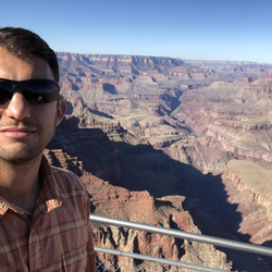
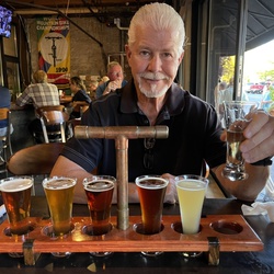
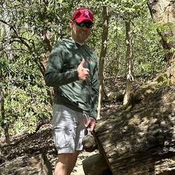
What an amazing hike! Woke up at 530 AM to drive over and got back to Sedona around 10 PM after dinner and beer (Dark
Sky Brewery) in Flagstaff. Started at 930 AM and finished at 430 PM. Took a break partway down the South Kaibab and stopped for lunch halfway across the Tonto Trail.
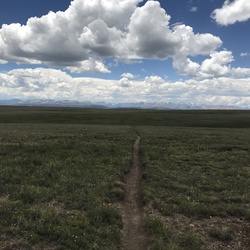
I prefer the views on the South Kaibab Trail to those on the Bright Angel Trail. South Kaibab feels more open whereas Bright Angel is switchbacks inside of a side canyon, which cuts off how widely you can see the rest of the canyon.
Temperatures at the top were in the 30’s, but I warmed up pretty quickly on the hike down once the sun reached the inside of the canyon.
Talked with a dad and two of his sons in their 20s on the hike down. They were from Flagstaff and did bikepacking. The dad was doing the AZ in 2027 and one son was going to do the Divide Trail from Canada to Mexico.
Slightly overpacked water (2.5 L bladder plus 1 L bottle) just in case the water at Havasupi campground (around mile 9) was off (even though it said it was on online). I drank a couple chips of water before getting on the shuttle (and more on my drive over), so I was already well hydrated before starting. Only drank 1.5 L by the time I got to Havasupi campground, but better safe than sorry.
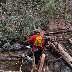
There was a little water flowing at two spots along the Tonto Trail.
I thought my right Achilles/plantar started tightening up with about 3 miles left to go on the hike up. I altered my stride some to compensate, which slowed me down. At the top I felt fine, so not sure if it was just in my mind and was overly cautious.
★
★
★
★
★

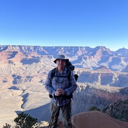
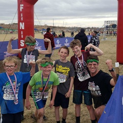
South Kiabab to North Kiabab. From the Vistor center. Finished 9:48
★
★
★
★
★


Solo backpacked Tues 2/18/25 – Started really early down the icy South Kaibab Trail with more than half a moon shining down from a clear star-filled sky. The ice and snow disappeared after 15 minutes, right before I met up with 2 bighorn ewes taking a more direct route down. Thankfully for us humans, the trail was in good shape all the way down to the river, although still a constant orthopedic workout with the numerous log and stone steps. After going through the tunnel and crossing the Kaibab suspension Bridge, I was really looking forward to the uphill climb on the North Kaibab Trail. I took a break at the Phantom Boat Beach water station and was glad to find it in working order for filling up later on the return trip. Just before it was light enough to turn off my headlamp, I met up with the first people of the day at Phantom Ranch, the trans-canyon water pipeline crew and then a ranger. While Phantom Ranch was closed to the public, it was housing the crew and the trail detoured around a temporary pipe-filled construction yard. After the ranger checked my permit and answered a few questions, I was on my way, soon passing several mule deer that seemed to be waiting for breakfast near the kitchen facility. From here to Cottonwood Campground, the trail wound its way north through Phantom Canyon, alongside Bright Angel Creek, crossing it several times via steel mule bridges. This trail segment is a low-pitched, steady climb with the towering walls and rock formations offering a steady change in scenery with the sound of a well flowing creek for most of the way. After the trail passes the Ribbon Falls junctions, it meanders a bit to prolong the last stretch before the Cottonwood trees at the camp come into view. The campsites at Cottonwood were nice, each one having at least two fairly level tent pads, a picnic table and food storage box. As others have said, the easiest place to filter water from Bright Angel Creek is just behind the ranger station which the trail passes first before the numbered campsites. The bathroom facility across from the ranger station was one of the cleanest I’ve used on any trail. Headed back to my campsite after filtering water, I met the only other person coming in to Cottonwood for the night (there was already one other party in a group campsite. Nice views of Oza Butte, and Bright Angel-Manzanita points from the campground. Always thankful for great weather and this trip had it for the duration. Logged 15.1 miles / 1851 ft ascent, 5012 ft descent with Gaia ................................................................................................................................................................................... Solo backpacked Weds 2/19/25 – Started really early on the North Kaibab Trail with a spectacular star-filled sky, hoping to see the sunrise from the North Rim while trekking on firm snow and it worked out nicely. Another treat was moonlit Roaring Springs cascading down the canyon wall, just after the Manzanita Rest Area (water was on). There were several icy trail sections with significant exposure (dark abysses) on the way up that required a little extra focus but no real snow cover until reaching the Supai Tunnel. From here, the snow steadily deepened but remained firm, making for an enjoyable hike through it. With a few 100 vertical feet to go to reach the North Rim, cold wind gusts started blowing across the switchbacks, decreasing the wind chill so much that I had to stop and put on a second jacket and heavier weight gloves before continuing. Shortly after this, I was able to see a nice sunrise from the Coconino Overlook before finishing the final switchbacks leading to the North Kaibab Trailhead kiosks. The North Rim was quite a contrast to the South with a deep blanket of snow covering the roads and trees and very quiet with only the normal sounds of a forest. After a short break, I headed back down past the horseshoe post, stopping at Coconino a second time to enjoy one of the best views on the North Kaibab Trail. While heading back down to Cottonwood Camp, it warmed up quickly to a very pleasant temperature with no wind and sunny skies. Aside from the interesting landscapes and rock formations, it was neat to see the remnants of the 1935 Trans-Canyon Telephone lines and poles paralleling the trail and Bright Angel Creek. Just before arriving back at Cottonwood Camp, there is a nice, distant view of the South Rim to remind you of the uphill climb out that awaits! There was still plenty of time left in the day for a nice lunch and climbing around the Manzanita Point area. Later, while I was eating dinner, the deer moved into camp to forage in the revegetation project area for a while, simply ignoring the “keep out” signs while a few well fed Kaibab squirrels kept a close eye on my food. Another great day in the canyon. Logged 14.3 miles / 4308 ft ascent, 4306 ft descent with Gaia .................................................................................................................................................................................................................................. Solo backpacked Thurs 2/20/25 – For no particular reason, the climb back to the South Rim seemed easier than anticipated. I was in no hurry to leave the canyon but I was well rested and psyched up to see the Colorado River and South Kaibab in daylight since I had descended that part of the route in total darkness. My goal was to reach Phantom Ranch at day break but I arrived half an hour early so I stopped at the Phantom Boat Beach water station and had some food. After taking a few pictures of the Kaibab Suspension Bridge and the Bright Angel Pueblo site, I crossed the bridge and started the climb out. While I was viewing the river, a helicopter came around the river bend, flying just high enough to clear Silver Bridge before landing at Phantom Ranch which must have been very scenic ride up the river for everyone aboard on such a nice morning. Twenty minutes into the South Kaibab trail climb, the views of the canyon and the river really started to open up in spectacular fashion. Most of the temples, mesas and buttes had picture perfect morning lighting to warrant constant picture taking. Right before reaching The Tipoff, I spotted and climbed up to a cross on a sub peak just off the trail that was made from a 1935 Trans-Canyon Telephone pole. There were no identifying markers or signs regarding its significance so it remains a mystery. The panoramic views from The Tipoff, Skeleton Point, Cedar Ridge and Ooh-Ah Point were really far reaching in such great weather. Once at Cedar Ridge, I started meeting up with hiking groups coming down with several stopping to ask about the trip. A little further up, people started warmly congratulating me before asking about distances and destinations, something that I don’t often experience which was really nice. It’s the sort of thing that truly restores your faith in humanity these days. After reaching the South Kaibab Trailhead just before noon, it was hard to believe the trek was over but then I knew I would be back shortly for the Escalante Route! Logged 14.6 miles / 4862 ft ascent, 1714 ft descent with Gaia
★
★
★
★
★


This route crosses fenced private land (the Lauzon homestead). I doubt anyone has hiked it within the last decade or more. If you're on foot or on a bike, there's better and more direct routes to Bass Trailhead
★

Started about 630 6:46. Got to phantom in 3-3 1/2 hours. Spent 30-40 minutes there. Ate lunch. Got to south rim about 3. Last 3 miles tough. Last 1 1:2 miles tired and difficult. Would enjoy more with overnight at phantom.
★
★
★
★
★

Our team of 10 headed down from the north rim before camping at Cottonwood and Bright Angel campground. Two nights, three days, and one 5am start! An epic week with incredible women.
★
★
★
★
★

Amazing hike! Come prepared! It can be deadly if you you are poorly prepared.
★
★
★
★
★

Started at 3 am with 3 layers and wool cap. That lasted for about an hour, then went to one layer (short sleeve white t-shirt (quick drying)). Got water at Havasupai Camp site. At Phantom Ranch by 7:45 am. Services start at 8 am. Upclimb to North Rim started at 8:15. Made it quickly past the Box before heat hit. But at about noon heat got intense. Water at Cottonwood, but not at Manzanita. Glad I got 4 liters at Cottonwood. Rest of ascent was brutal hot. One more water area at Supai. GET water! Maybe 2 liters for rest of hike. Trail Angels from Canada gave us ride to lodge (Canadians are so cool). Epic. Exhausted. Exhilarated.
★
★
★
★
★


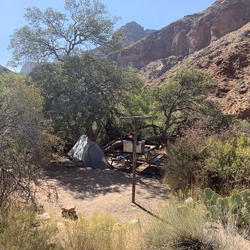
Absolutely awesome, and nobody’s around. And yet, it’s a picnic area, fire pit, bathrooms, trash containers and it’s very clean.
★
★
★
★
★


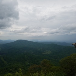
Hiking the rim and upper regions akin to cloud walking -with downward views for miles
★
★
★
★

We hiked down south kaibab to bright Angel campground and back up the bright angel. 16.3 miles. Highly recommend going all the way down to see and cross the Colorado river. It took us 7 hours and 25 minutes of actual moving time and this was on 5/28.
★
★
★
★
★

Did this at the end of April 2023. Rugged trail which is pretty technical in spots. Overall very rewarding hike. Stayed at Cardenas Creek, Papago beach, Hance creek.
★
★
★
★
★

Great second day hike along rim after yesterday’s grueling hike Ü
★
★
★
★
★

It was a good hike, we made it out to the rapids, but the trails where not very well mark on my way back, but overall it was a pretty fun hike!
★
★
★
This hike was really challenging and full of cacti, but I really enjoyed the views of the Colorado river, Hermit rapids, and Granite rapids, I would definitely hike again!
★
★
★
★

Epic hike. No issue with ice. Water only available at Indian Garden on after river on Bright Angel.
★
★
★
★
★

It was a cold morning to start in darkness under headlamp. Little icy the first 3 miles but micro spikes made it no worries. It’s a beautiful hike all the way down to the river with great views and terrain. The temperature drops as you approach the river the last mile. The walk to the bridge along the river is awesome with different plants and the coldness of the river. There’s a nice camp on the north side of the river to take a break before the return. The walk back to the rim can be exhausting after walking 9 1/2 miles down hill then making the turn to 9 1/2 all uphill.
★
★
★
★
★

Beautiful country. Lots of waterfalls & features. Lots of restrooms & water, with trail snacks for sale. Or fully prepared meals at Phantom Ranch only with cabin & only by reservation.
★
★
★
★
★

Hiked the hardest trail on the south rim with T O’Bryant, Tyler and Stephanie Kelce, Kyle and Carter Canalichio, and Kim Deane.
We had a long first day down to Hermit Creek. Woke up early the next day and hiked down to the Colorado and back - which was probably my favorite part of the whole trip. Then we hiked across to Boucher Creek where we had a cozy campsite for six tents. The next day we made two significant climbs up the canyon walls and camped under Yuma Point. And then woke up early once again and trekked back across to Hermit trail and fought the wind up to the trailhead.
★
★
★
★
★

Easy for the whole family and it only takes a few minutes. The “lake” is a true Arizona lake (a depression with no water). The cabin is slightly bigger than an outhouse but still worth a walk just to get out and see the area off the road. There is some overgrown catclaw so watch the kids so they don’t get scratched up.
★
★
★
★
Easy hike most of the way and worth the view of you are in the area or are hiking the rainbow trail. Otherwise I would not drive all the way out just for this hike. There is one spot where you have to scramble up/down some boulders to continue the trail.
★
★
★
★

This hike is spectacular. This is a 37 km grind. Getting to the bottom of the canyon may feel like you are half way home, but then the work begins with a 4,000 ft climb to the south rim. Park service has done a great job with water stations every 10 kms
★
★
★
★
★


This hike has everything: woods, wildflowers and sweeping vistas. No major hills to deal with. We went halfway, about 2 miles and turned around as we didn’t have the time for the full trail. Will definitely do that next time.
★
★
★
★
★


This was one of the strenuous hikes J have done. Two things made it hard. First you go down and then going up. Second is the heat towards the last 3 miles or so. It was quite a challenge and I am glad I was able to finish it.
★
★
★
★
★

Excellent hike. Arrived via the orange bus from the Grand Canyon welcome center. Hiked from the start of the Kaibab trail head to Skelton point (approx 3 miles down and 3 back up). Prepare your self and bring water, snacks and SUNSCREEN. A hiking pole would be very handy as well. Crowd thins out after Ooh Ahh point.
★
★
★
★
★

As epic as it gets. Ran the flats and downhill and hiked back up. Done in November, water and nutrition was no problem! So so so epic.
★
★
★
★
★


Relatively easy hike to a seeping spring on a cliff side, adding a rough extension about as far as you might go. Roughly across a crevasse from Cape Royal overlook.
★
★
★
★
Fire road from outside Grand Canyon National Park to Point Sublime. Beautiful scenery and not steep.
★
★
★
★
★
As epic as it gets. Ran the flats and downhill and hiked back up. Done in November, water and nutrition was no problem! So so so epic.
★
★
★
★
★
I've done this as a two day backpack and dayhiked it as well. Bring a ton of water. There is zero water out there in the 15 miles to Cape Solitude. Bring a headlamp and extra batteries. When I dayhiked it I did almost 5 hours in the dark. Without a GPS track to follow I wouldn't have made it out as the trail gets really obscure and even with a headlamp it would have been tough to stay on track without a GPS. It's hot out there even when the temps are in the 60s. There is zero shade. You've got to really want to get to Cape Solitude to travel on this route. It's definitely rarely used. I've never seen another soul out there. There aren't a ton of great views and the terrain becomes very tedious for hours on end. Be 100% sure that you know what you are getting into before embarking on this trip.
★
★
★
★

Epic hike - South Kaibab down & bright Angel up - So much beauty! Recommend you b super fit & have good quads cuz otherwise the downhill will murder yer knees - the 4.5 miles of switch backs from Indian Garden up to Bright Angel TH was a never-ending intensely awesome grind - Bring a headlamp or start early - definitely doable in one day if you have a good pace and are deliciously stubborn.
★
★
★
★
★


Extreme satisfaction, hiking from the North Rim to the South Rim. Three days and two nights. Camped at Cottonwood the Bright Angel. The evening rain made for a cool transit of the canyon. The hike from Indian Garden to the South Rim was the most challenging after the 3 mile rest area. Overall, an excellent experience that I would like to repeat.
★
★
★
★
★

Paved trail the whole way, but it brought you to the edge of the Grand Canyon.
★
★
★

El viaje de regreso es bastante agotador. Pero vale la pena
★
★
★
★
★

It gets hot near the rim. Leroy, my dog, started showing signs of heat distress. He has no hair, so I doused him in water, and that did it.
The hike is nice. Not to much up and down, by Colorado standards. You also get to see part of the Canyon other people don’t.
★
★
★
★
★
It gets hot near the rim. Leroy, my dog, started showing signs of heat distress. He has no hair, so I doused him in water, and that did it.
The hike is nice. Not to much up and down, by Colorado standards. You also get to see part of the Canyon other people don’t.
★
★
★
★
★

What a cool hike. This was my first time out to the Grand Canyon and it was an amazing first experience. I don’t hike too often but my friend who is and I did fine. We brought just the right amount of food for the trip, which was two granola bars and a bag of trail mix. We did eat a massive breakfast though. I wouldn’t recommend this for everyone’s first time but with dedication it’s possible. Big hats are the way to go.
★
★
★
★
★

Hiking this famous trail is Epic in its own right .
To experience it when you are 78 years old is
Quite another feat checked off the bucket list!!
★
★
★
★
★
The Kaibab trail is famous for its spectacular views into the abyss of the Grand Canyon. I handled it much better than I thought. I even saw people in their 80’s on the trail. I am only 77, so come give it a try!!
★
★
★
★

I am so lucky to have completed this epic hike and share the experience with my wife and kids.
★
★
★
★
★
Going down is no problem, but don’t be deceived - coming back out is tough. The views along the way are spectacular. Once at Skeleton Point, go a few yards off to the left to get some glimpses of the Colorado River. Get an early start, especially on a hot day. And as everyone says, bring a LOT of water.
★
★
★
★
★

Rim to River to Rim. Now doing the same with a beer in the bar
★
★
★
★
★

 stars
stars
This is a fun 10 mile out and back hike. Widforss Point is a beautiful overlook across the Grand Canyon. The trail is an easy hike with minimal elevation gain and loss of 300ft. Evidence of bison are present all along the trail.
★
★
★
★
★


This was a fairly elementary hike. Less variability in the scenery than South Kaibab. Nice to have restrooms and water along the way.
★
★
★
★
★

S. Kaibab to Cedar Ridge. Very nice. Warm in the sun. Nice people.
★
★
★
★

Did this with Kayenta and Nicoya. Camped at bright angel campground
★
★
★
★
★

From second camp on the Clear Creek Trail to Bright Angel Trailhead. Planned third camp in Indian Garden but opted out when I was there. Still loads of time to hike out.
★
★
★
★
★
Backpack down to Phantom Ranch along the South Kaibab Trail which follows a ridge and then up to Clear Creek Trail and follow it to the first camp
★
★
★
★
★

We decided to go down Kaibab and up Bright Angel. Going all the way to Bright Angel campground was a waste of time and effort so we decided to take West Tonto and cut across the valley. It was beautiful and that stretch has some of our favorite scenery. There wasn’t another person on the trail the entire 8+ miles. There was plenty of time to take photos of the views without people interrupting. I’d definitely recommend this to experienced hikers who miss small foot trails.
★
★
★
★
★

Down Kaibab to Phantom Ranch and up Bright Angel to South Rim - a classic canyon hike doable by mere mortals...
★
★
★
★
★
When down Kaibab and our Bright Angel with a night at Phantom Ranch. Great trip.
★
★
★
★
★
Took South Kaibab down and Bright Angel up. It was so gorgeous. Bright Angel was much prettier. It took us 9 hours to do the whole thing, but I am an experienced hiker. I DO NOT recommend doing it all in one day, even though it can be done. By the end, it felt like my legs would quit on me. The last 4.5 miles up Bright Angel were extremely difficult. Despite all of that, I still think it was worth all of the pain, even if I can barely walk.
★
★
★
★
A great hike that ends in a great campsite with a panoramic view of the Colorado River gorge. Easy walk from the overlook to the campsite.
★
★
★
★
★
Trail is completely overgrown with large bushes that have big sharp thorns. Nearly impassable without a suit of armor.
★
A great hike that ends in a great campsite with a panoramic view of the Colorado River gorge. Easy walk from the overlook to the campsite.
★
★
★
★
★
Trail is completely overgrown with large bushes that have big sharp thorns. Nearly impassable without a suit of armor.
★

This trail has so much variety with amazing views that I did it twice and skipped Bright Angel. This one was good for the whole family which ranged from 10 to 64, and 2 of the adults had mild walking pains but still finished this, albeit at a very slow pace.
Try to get out before 9 am to enjoy the shade of the eastern cliffs above you!
★
★
★
★
★

Hiked on September 10, 2019. Beautiful green water in the Colorado River. Not too hot this time of year. We brought long sleeve shirts, but didn’t need them.
★
★
★
★
★
This is a long a difficult hike. Hiking the Grand Canyon rim-to-rim in a single day is grueling. Be prepared. The small deviation to visit ribbon falls is well worth it - it is a must-see feature along your way.
★
★
★
★
★

Great place to camp. Enjoyed the Grand Canyon without seeing anyone else. Plan on two hours driving out to the point.
★
★
★
★

An ill-advised way to measure physical conditioning and test high heat response is to undertake this short but difficult hike on an extreme heat warning day such as I did.
The purpose was to determine what kind of trouble I’d get myself in should I attempt rim to river during peak afternoon heat. It served me well in that regard in that I learned to carry twice as many electrolytes than planned and to absolutely sit my bottom in the shade between 11-4, unless I really, really want to needlessly suffer and risk heat related issues. This trial run kept the following trail safe and pleasant.
This hike itself is steep and the view at Skeleton Point is rewarding. If you’re a 44 year old male carrying 30 extra pounds of soft tissue and in moderate to decent cardiovascular shape, expect a grueling hike out.
★
★
★
★
As seen by the recorded path, this was clearly one of the more adventurous and mysterious paths on the Bright Angel Trail! But besides this app making a mess of the journey, this was easily my favorite and most rewarding hike in memory. I trekked it solo as a 44 year old male carrying 30 lbs of extra cargo (aka, fat), following the advice of rangers to avoid hiking during the hottest hours of the day - mostly (I hiked up to 11:30 AM and resumed between 3:00-3:30).
I hadn’t really started training for the hike until a couple months before, which was more like testing my fitness and preparation, so I paced myself to minimize fatigue and impact on my joints. As a result, the hike was pleasant, if not long.
Started at 04:30 and was down to the Colorado around 09:15. Soaked my feet in the river and took in a sandwich before heading up to Indian Gardens to sit out the overhead sun. Landed at IG around 11:30, where I hydrated, took a pleasant nap and talked with fellow hikers from around the world.
I grew restless and hit the trail for the remaining 4.8 miles some time between 15:00-15:30. I paced myself to keep my heart rate in a moderate zone, taking a break at 3-mile rest house, and finished the hike just before 19:00.
I can’t emphasize enough how important it is to have some level of preparation. Listen to all the advice about how to safely complete the hike and you’ll have a truly incredible experience.
★
★
★
★
★
Trail is completely overgrown with large bushes that have big sharp thorns. Nearly impassable without a suit of armor.
★
A great hike that ends in a great campsite with a panoramic view of the Colorado River gorge. Easy walk from the overlook to the campsite.
★
★
★
★
★


Phenomenal hike, beats the heck out of your knees and feet with the constant downhill but worth it, great views.
★
★
★
★
★
 stars
stars
I believe this is a moderate hike as anyone in decent physical condition should be able to do it. There were lots of kids and older people on the trail, one of them me (69). it's only about 1 mile down to Ooh Aah Point which has amazing views. Then another 0.6 to Cedar Ridge where the views aren't as good but still worth the short hike down to it. Took me about 35 minutes to get to Cedar Ridge including stops along the way. About 45 minutes on the return as i was moving pretty quickly.
The views all along the hike are wonderful so i highly recommend this short hike.
★
★
★
★
★
 stars
stars
Beatiful trail. I met this trail at Hance Rapids (from Escalante Route). The hike up Hance Creek canyon was beautiful and memorable. Hance Creek makes a great place to camp. The creek is pretty small, but reliable. There is a lot of space for camping. There were two other groups while I was there (eight other people) and I was able to keep my distance from them.
The hike up past Page Springs is less challenging than I was expecting after hearing it described with so many superlatives and expletives. It's uphill, but not treacherous. I didn't think it was any harder than the climb up Grand View from Horseshoe Mesa.
★
★
★
★
11/10/18 First half of Rim to River to Rim Via Bright Angel Trail. Sunny skies, cool temps, perfect trail and not a lot of traffic. The views from Bright Angel Trail are amazing. Start before dawn. As the sun rises the beautiful views open up. If you can deal with 20 degree weather at the start (layers) I believe this is the time to attempt longer hikes in the canyon.
★
★
★
★
★

This was Day 4 of my trip and the hike from Red Canyon at the river to the Grandview Trail trailhead was great. The first section on the New Hance Trail was fairly easy with lots of views and and sparse wildflowers this time of year. The first 2 miles were along the Colorado and offered views of the vast expense of the inner canyon 360 degrees. The next 4 miles were and easy loop around washes. I reached the beautiful Hance campground at 11am and ate a nice big lunch and replenished my water for the hike up to Horseshoe Mesa. This was all uphill with a scramble around the old mine. the elevation change was from 3800' to 6700'. Once I arrived on the Mesa, I started to run into a few hikers and backpackers on their way down.
★
★
★
★
★

hiked on 10/17/18 (Phantom Ranch- Bright Angel TH)- section of trail with creek water crossing it (between Indian Gardens and Devils Corkscrew). Saw conservation/ranger group heading down to repair this (hopefully it is resolved). no problems hiking through this section though. otherwise great trail conditions. some foliage changes noted.
★
★
★
★
★