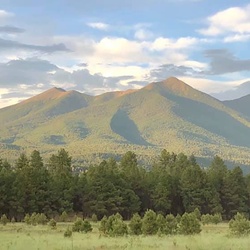
Easiest of the Campbell Mesa trails, and the closest to “civilization.” Trains rumble nearby and both I-40 and Route 66 pass just to the north. Despite this, there are signs of elk and opportunities to see hawks, ospreys and turkey vultures in the snags overhead. It’s a pretty place with views of Mt. Elden.
★
★
★
★
This easy hike is a good one for those adjusting to the 7,000’ elevation. Elk tracks. Ospreys overhead. Unfortunately, very smoky air from the Pocket Fire halfway to Sedona.
★
★
★
★

Okay. Will be nicer after trail recovers from mess left by recent forest thinning. A few technical sections. This ride was harder than expected. It is best done as a shuttle.
★
★
★

Very tough trail. Steep and rocky.
I got caught by rain and hail before I reached the top. Constant thunder convinced me to go back.
Be aware that much of the trail is also the drainage gully.
Got down off the mountain right as the first heavy storm of the year hit.
Recommend taking external battery charger for your phone. It’s a long hike and the trail is occasionally not well marked.
★
★
★
★
Beautiful views to the north, east and south from the top of the hill.
★
★
★
★
★
Good smooth trail. Not much wind in the canyon. Don’t do it on a real hot day.
★
★
★
★
★
A rough drive to get there, but a beautiful view from the cave and more views from the top.
★
★
★
★
★
Outer Rim would be a good biker trail. Legend-Airy Trail is rougher and far more technical. Good views north and west.
★
★
★
★

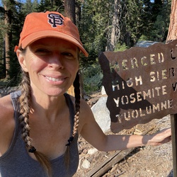
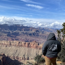
This is a beautiful area to hike, with a variety of terrain, from relatively smooth, tree covered mesa, to rock hopping and bouldering in the numerous canyons and drainages. There are numerous examples of Native American rock art in the canyons. Driving here requires about 16 miles of travel on relatively well maintained dirt or gravel roads, at least the way we navigated.
★
★
★
★


This trail is super fun and would be challenging for beginners.
★
★
★
★
★

This was absolute torture. Beautiful views but the elevation gain is nuts.
★

A relatively easy hike in most places. Good view both north and south.
★
★
★
★
Parking at Sunset Park is a great option; generally plenty of parking spots with a bonus of having restrooms. From the park it’s about .25 miles (all uphill) to the Airport Loop Trail. We hiked the loop trail anti-clockwise to the Tabletop Tr, then down to the Ridge Tr, eventually linking to the Carroll Canyon Tr, then Bandit Tr back to Airport and Sunset. If you’re an aviation buff, you will have nice views of arriving and departing aircraft at Sedona Airport. Views of the red rocks to the south and west are spectacular, as is the view of Thunder Mountain to the north.
★
★
★
★
Carrol Canyon is much deeper than I thought it was. Good, easy hike.
★
★
★
★

Amazing to see the cliff dwelling up above the trail! Hard to imagine it being built. Learned that the darker colored material is a reconstruction and the lighter color is original.
★
★
★
★
Fun to see and learn about the unique water source and how the early people used it for irrigation. Also cool to see the cliff dwellings overlooking the water. It started raining partway through, so I had to hurry back to the car.
★
★
★
Was luck to hike this when there was water in and flowing between the pools leftover from yesterday’s rain and snow. The pools were nice, but nothing amazing. The hike up to Brin’s Mesa and the first part of that trail had nice views of Mount Wilson to the east, which was made even nicer by the light snow covering on the mountain. The higher portion of the trail still had some snow and ice left over from yesterday, so the going was a little slower. Missed the shuttle bus by about 10 minutes, so I had to walk back along the road to the parking lot.
★
★
★
Best part about this hike was the subway cave. Very unique, and my favorite cave that I saw this week in Sedona. First mile or so of the hike were hiking next to a resort, which was not ideal. Last mile was nice and quiet, had some snow along the trail, and opened up suddenly to a beautiful view of the surrounding canyon and high rock walls. The scramble up the rocks to the cave was a little difficult and scary, but I’m glad I did it. Went down a different way so I did not have to slide down the rock face.
★
★
★
★
Short hike for sunset on my last day in Sedona. Great panoramic views from the top. Watched the sun set in the west, but the colors looking east were beautiful; blue and shades of purple and pink over the red rocks. Definitely would like to come back and do the full loop.
★
★
★
★
Short trail but nice views from the top. Appreciated the information sign about the sitting landscape.
★
★
★
Short trail at the base of Sunset Crater. Included some information signs along the way.
★
★
★
★
Short trail through volcanic lava flow with good views of Sunset Crater in the distance
★
★
★
Hike was good but not spectacular considering the area. Out Maine it’s just that I hiked this the day after the Grand Canyon. Trail follows the creek and crosses back and forth. The creek has carved out a canyon, so you walk under the tall walls on either side. Wore my boots for the water crossings, but thankfully was pretty easy to cross using rocks and downed trees. Had the trail mostly to myself on the way out, which was quiet and peaceful with the water flowing. Mix of evergreen and trees that have dropped their leaves. Would be pretty in the fall with the leaves changing.
★
★
★
Fairly easy hike with many good views. Added some fun with a scramble up to the saddle near Christianity Spire near Chicken Point. Was able to see the Chapel of the Holy Cross from the top of the scramble. Done off the trail was near the 4x4 route, so it was fun to watch them drive. One of the Pink Jeep Tour drivers I met was from Elkhart, IN!
★
★
★
★
The Hangover Trail portion of this hike was amazing and why this is rated as 5 stars. Expansive views and a fun hike that was slightly exposed along the cliff face. Beautiful views of Sedona and Wilson Mountain. The other portions of the trail were good too and had good views of Painted Dome and Teapot.
★
★
★
★
★
Map shows the seldom used alternate trail dead-ending. It does not. It merges with Ridge Trail in Carrol Canyon.
★
★
★
★
Not a great hike. It’s really just a short scramble over the canyon ledge. But the scenery and the petroglyphs are fantastic.
★
★
★
★
★
Beautiful weather for a hike in red rock country.The views were amazing and the weather conditions were fantastic.
★
★
★
★

This is a great hike to build cardio. It is heavily used and can be very crowded on weekends. The view at the saddle is fantastic. The trail is very rocky and clogged with roots. Going down is very difficult and not good for troubled knees. It is almost entirely shaded. I didn’t travel onto the peak from the saddle. The views aren’t worth climbing over all those rocks. It is easy to loose the trail in that area, but you won’t get lost, because it is all open.
★
★
★
★
Very steep climb with loose shale for the last few hundred feet, but worth the climb.
★
★
★
★
Brins Trail is very steep but the views are magnificent. If I did this loop again I would do it the opposite direction.
★
★
★
★
★

Moderate difficulty at some points, otherwise easy. Lots of shade along Oak Creek.
★
★
★
★
★

Absolutely gorgeous. Started at Brins Mesa Trailhead climbing through a beautiful Sedona Forest(my friend referred to it as a Sedona botanical garden 🤣). Then you walk along a beautiful Mesa, few people, just lovely with great views. And so it goes…
★
★
★
★
★

Start off in paid parking area. Beautiful hike along creek, still running in October, there is a creek crossing. Easy up to the flat lower vortex area, but difficult red rock scramble to ridge at top, stunning views.
★
★
★
★
★
The trails from Cultural Park are well groomed and often smoother than most. Dry Creek was flooded only yesterday. Still lots of standing water.
★
★
★
★
Circle the base of Cathedral Rock, and climb the south slopes circling around to the Vortex at the saddle. Beautiful views.
★
★
★
★
★


Good hike for a sunny day. Lots of shade.
Tough getting close to canyon walls due to undergrowth.
★
★
★
★
Fools Trail is a bit rough, both up and down, but good views at the top.
★
★
★
★
Incredible views. No lines for photos in the summer.
Hundreds of people in line during the winter.
★
★
★
★
★
Good hike on a lot of smooth ground, with some rough sections. Occasional good views of the cliffs.
★
★
★
★
Beautiful views from the top of Anaconda Trail. Dawa is mostly flat dirt, for easy walking.
★
★
★
★
★
Shade in many parts of the hike along the dry creek. Good for mountain bikes.
Eastern unnamed trail not recommended for hikers. Loose shale and poorly marked.
Take Snake Trail instead.
★
★
★
★
★
The climb to the top can be challenging at a few points, but the view from the top is worth it.
If you climb early in the morning, you may run into Mr E, a local wise man.
★
★
★
★
★


Breathtaking views, out of this world scenery and not too difficult of a hike. The crystal clear water was a healing spring was out of this world. 10 out of 10
★
★
★
★
★

This is a nice easy backpacking trip in the trees near Pine, AZ. There are some spots near the Rim Road that you can stash water. Depending on the time of year water may be scarce.
★
★
★
★

Glorious hike along shady creek. Mostly fairly flat with many river crossings which are easy when the water level is low. A hiking pole is a great help for those crossings!
★
★
★
★
★

Beautiful forest… heard something growling in the woods.
Take a stick … people with dogs are hiking. Picked up dog poop in plastic bags honestly tourists just let the dogs poop.
★
★
★
★
★


Moderate 4.58 2alk around the outside loop. Turn right after crossing the river for the best views. Well worth the time!
★
★
★
★
★

It was a medium skill level. Will definitely warm you up. When you begin from the parking lot near Schnebly Hill, you're in the sun majority of the time. The very end takes you to beautiful Oak Creek near the steel Midgley bridge. Outdoor temp was about 64 degrees fareinheight. Perfect temperature for shorts and a t-shirt. Bring water.
★
★
★
★
★


Easy loop trail to stretch legs after a long car ride. Picturesque red rocks.
★
★
★
Nice morning hike through Dead Horse Ranch SP. The day started rather chilly, but warmed quickly as the sun rose higher overhead.
★
★
★
★

Nice trail run. Mostly flat to mild hills. Trail a little rocky in spots.
★
★
★
★
★
 stars
stars
Nice hike and views. Both hikers and mountain bikers use loop trail.
★
★
★
★
★

Was scary and very edgy with exposure and loose rocks for awhile
★
★
★
★

This was by far the worst hike I’ve taken in Arizona. Trail is recently changed poorly marked and not documented. There was zero trail etiquette and a handful of elderly “rangers” hanging out doing nothing. I would never recommend this hike.
★


Fun and beautiful kayak to overnight campsite. Very peaceful. Water level is very low. So getting to campsite requires climbing up t about 40’
★
★
★
★

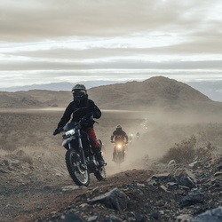
The roads were awesome, great scenery, all the riders were respectful. Overall awesome ride to Tbar ranch!
★
★
★
★
★
Hike was pretty. Doesn’t feel super remote. Creek at the end was clear, cool and refreshing. Ocotillo fields galore beauty.
★
★
★
★

Great trail, but mileage listed is incorrect. It's also considered a "difficult" trail. It's about 4 miles to Vultee Arch from Sterling Pass Trailhead on 89A.
★
★
★
★
★
Mostly on Forest Service Roads. Easy to follow. Nice views looking back towards Jenga Rock.
★
★
★
★

This is a beautiful area, relatively level, lightly wooded with large trees and grazing cattle. However, the trail is an ATV route and it is extremely rocky. The rocks were big making the trail difficult. Whatever the difficulty level, add 1 level. Whenever I looked around to see the scenery, a 6” or larger protrusion caught my toe. As a prior motorcycle racer it was way too rough to be fun. So go figure.
★
★
★


Inaccurate route name, it doesn't take you to the crash site. I did manage to find the crash site after bushwhacking probably half an hour. Looking around at the crash site, I couldn't see a path-like way back to the main trail. It was just bushwhacking back to the trail.
★
★

This was a great trail with lots of chances to see wildlife at the right times. It was quite secluded in spots but campers were common along the segment FR700 especially.
★
★
★
★
★


Went hiking with Trevor Aeschleman and David Roman. It rained on us or snowed on us all day and we ended up bailing into Mormon Lake instead of fishing on the north end of the lake.
★
★
★
★
★
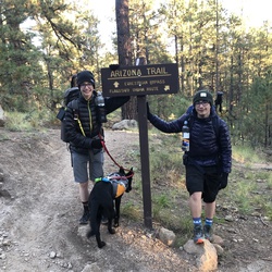
Trevor Aeschleman and David Roman and Josh Schiffer. First day of our three day hike to do 45 miles on sections 28 and 29 of the Arizona Trail. Pretty rolling hills the whole day and two different storms rolled in with hail and snow.
★
★
★
★
★

Great hike. Scenic. Trail is better view than road. Caves were great and easier to get in than advertised. Sinkhole is awesome inspiring.
★
★
★
★
★
Great hike with really nice views at the top but there are a couple of parts that are really hard so don’t understand the “easy” rating. Plenty of people chose not to keep going.
★
★
★
★
★

We followed the main trail until the “End of Trail” sign on a tree where there’s a pile of giant boulders and a tall red rock pillar. Then, we continued on a steep used trail that followed the side of the rock wall that ended on a steep slab under a perch. The view was worth the effort. I wouldn’t recommend anyone without rock scrambling experience beyond the used trail beyond the “End of Trail” sign
★
★
★
★
★


Very scenic hike. Don’t get over eager there are at least 6 peaks to tame before the summit.
★
★
★
★
★

Absolutely beautiful. While it does run along a new resort for a little while, the trail is partially shaded and gorgeous. Don’t miss going up to Subway Caves at the top-find the scramble thru the trees up instead of up the Subway. Caves are worth it!
Vortex at base is stunning also.
★
★
★
★
★
Loved this loop, very quiet and beautiful. Easy hike with maybe 5% scrambling. While mountain bikes are allowed, I didn’t see any. Suggest going counterclockwise from trailhead. The northern portion is cooler and shadier, and would have been a welcome finish instead of start.
★
★
★
★
★
Gorgeous views and the Bridge is wider than you think. Go early bc it’s a hot hike without a 4x4. Scramble up to top, but it’s worth it.
★
★
★
★
★
HOT! Fully exposed with tons of families and mountain bikers for a portion. While easy to hike, not my favorite.
★
★
★

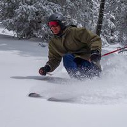
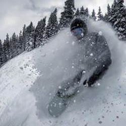
Had an amazing day of skiing at Flagstaff Nordic Center! Lots of snow and sunshine. Beautiful 🤩
★
★
★
★
★
Great views everywhere you look. This series of trails is relatively easy, with just a few moderate sections. It was not especially busy the day we were out hiking; mid-week in January.
★
★
★
★
★

What an awesome hike! Challenge enough, beautiful views, interesting sights. Highly recommend!
★
★
★
★
★

We saw a lot of bear scat, largest pinion trees/forests I have ever seen, and beautiful manzanita. We basically followed a ravine that had beautiful rock walls.
★
★
★
★
★
This is an excellent workout that provides awesome views of the Sedona vicinity and Red Rock Wilderness areas. From the “End of Trail”, you can look north to the San Francisco Peaks, east to the Oak Creek Canyon region, south to Doe Mountain and west to Cottonwood, Clarkdale, Jerome and Mingus Mountain.
★
★
★
★

I love this hike because the solitude is wonderful. I used to hike with my dog Beau, once upon a time!
★
★
★
★
★


It’s not easy! I have been on tougher trails than this, but only a few. This is definitely a hard trail.
But don’t take my word for it. Look at the sign in the photo with two black diamonds on it…
★
★
★
★
★

Good hike. Amazing views! Not too much elevation. Lots of people. Take the shuttle as parking is limited.
★
★
★
★

Humphrey’s Peak is a great hike. The biggest challenge for me was the altitude. Trail descriptions say it’s anywhere from eight to ten miles round trip. It’s longer. This one kicking my butt. Well worth it!
★
★
★
★
★

Great hike on the Loop. Aspens lost their leaves already however the trail was absolutely beautiful and the fall colors were really showing. Very little people on the trails this time of year.
★
★
★
★
★
Great time and place, especially for nudists/naturists!
★
★
★
Great easy, short trail for beginners. Flat, well maintained trail. Beautiful views and scenery. Great spot to go birding. I love to have a picnic inside the volcano
★
★
★
★
★

Beautiful, albeit, rocky ski trails in the woods. Goshawk to Lava Loop
★
★
★
★

Busy today, but a very nice day to be out. A bit windy at the final couple hundred yards as always, but at least it was possible to stand up today - which isn’t always the case. The last mile to the summit is very steep and rocky, and it’s super dry so the footing on the sandy soil is not ideal in several spots. I am not really a pole user, but given the wind and the dryness I think it would make for a much nicer experience at this point in the season.
★
★
★
★
★


Fay Canton was my first hike in Sedona. I didn’t know where to go and found it on a random drive. My daughter and I rushed up the trail as sunset was getting close and it was an exhilarating but easy hike with some nice views once you climb up a ways.
★
★
★
★


Great hike and a short distance. Plenty of parking especially being the first ones there at 5am. Recommend this hike.
★
★
★
★
★

Absolutely gorgeous forest and Arizona Trail riding. Jed chased a Javelina it was very surprising and cool to watch.
★
★
★
★
★
Absolutely gorgeous forest and Arizona Trail riding. Jed chased a Javelina it was very surprising and cool to watch.
★
★
★
★
★

It’s a great view, well worth the effort. It’s not as long as the description, we clocked it at 1.3 miles round trip and just under 600 ft of elevation gain. However, the rock section is pretty aggressive, I hesitate to call it easy. I’ve done Boulder scrambles that are easier. Still a great hike!
★
★
★
★

Good ride, let’s of water in the creek. Medium paced, 2-3 hour ride. Can take different route for longer ride.
87 to west on 142 road
★
★
★
★
★

It’s a slow climb at first and steepens under the mesa. Beautiful views on top of mesa. Soldiers cave is just below on the left. Great hike!
★
★
★
★
★

This was a beautiful easy hike. We actually went out to an overlook and came back.
★
★
★
★
★

This is an easy 2 mile hike. On a forest service Road with some awesome views in a semi circle from north west to south east. It ends at a dry pond with a lot of deer tracks and some healthy, happy, juniper trees. It was the end of April and there may be
water in the pond at another time, but maybe not because it seems like the drainage to the pond was diverted around it. Nonetheless, it was a beautiful hike on a closed to motorized travel forest service road.
★
★
★
★

This rocky peak offers fantastic views on Verde Valley and Sedona with snow-capped Humphrey Peak in the distance. The 2 miles follows a very rocky extreme off-road path for OHVs but the view rewards and outshines a bit tedious approach. Great half marathon distance from Turkey Creek parking lot.
★
★
★
★
Lots steps but great for our two boys and wife. Lots of rich historical information on the well maintained trail.
★
★
★
★
★

A favorite hike in Sedona. It’s beautiful and adventurous! Amazing scenery and varied terrain.
★
★
★
★
★

This area has beautiful views of the San Francisco Peaks and Kendrick. We got a good early start 8:00 am from home. Upon arrival 18 degrees at about 9:00 am and 33 degrees at about 11:30 when we left. Lots of evidence of wildlife and very few people.
★
★
★
★
★

Great hike in beautiful Sedona. Intermittent streams, lots of steps, go early to avoid crowds.
★
★
★
★
★

Moderate hike, lots of water crossings and mud the day after a good rain.
★
★
★
★
★

Amazing views! Even with the weather, every member of our group agreed it was worth it.
★
★
★
★
★


Nice hike. Would do it again. Trail is very well maintained. Lots of interesting sights.
★
★
★

Nice smooth trail. Exposed - would not be fun on a hot day. Disappointed in the best view of the rabbit ears. Was hoping to get/feel closer.
★
★
★

Well maintained trail, good mix of dirt path and large rocks to maneuver. Beautiful scenic landscapes. Mud and snow covered a large section of the trail. Make sure to have gps activated on map as the trails are not marked. With the snow the trails weren’t clear. We initially missed the turn to the cave but backtracked pretty quick. Then a downed tree and another well worn path took us off course again. Without gps this would have been almost impossible to navigate given the conditions. Multiple separate groups of hikers dealt with the same issue. Once at the cave the views are worth the hike. There were roughly 10 other groups when we were there not overcrowded and everyone was considerate and friendly. You can climb the steep rock in the middle to get into the cave or hike around the left side and up and around the ledge into the mouth of the cage.
★
★
★
★
★

Pretty cool hike out to some cliff jumps river goes a long way back!
★
★
★
★
★

This is my second time doing this hike. First time in the winter. Started at 10:30 made it back to the main road before dark Great views.
Trail was easy to find. Covered in snow most of the time and fresh deeper snow at the top. Did not need to use crampons. However, good hiking shoes are recommended. Altitude is probably the biggest challenge especially for those of us who live down in the valley
★
★
★
★
★

Great! Nice mix of views and twisting through scrubby forest. Devils Bridge was crowded but worth the climb, otherwise not too many people on the Brins Mesa and Chuckwagon trails. Had a near encounter with a carnivore (mountain lion?) on Brins Mesa, so keep an eye out.
★
★
★
★

Great hike but the route underestimated the degree of climb at end. The wait line to get photo of bridge was 40 min. Weather was great
★
★
★
★
★
The day was fantastic! Clear skies and 70 degree temps. The trails pretty clear markings but a few confounding places. One husband wife group took the wrong turn and went on a two hour detour. (funny conversation) We had Gaia so, it was very clear where to go ! Thanks
★
★
★
★
★

Coming down Elden lookout, tried linking up to a couple of other trails but bad trail conditions(washout and or downed trees)prevented that. Walked down forest road before connecting to another trail to finish up at Buffalo Park
★
★
★
★

Best in Sedona. Stunning panoramic views and less people so it was incredible
★
★
★
★
★

This is a point overlooking Oak Creek Canyon. Could be good for a tent camping. Rough road in with beautiful views
★
★
★
★
★


Beautiful scenery, took hike after rain the night before which moderated the temperature
★
★
★
★
★

This is a fun, but challenging hike due to the elevation changes. It’s a steep, narrow, and rocky trail. Fantastic views and great shade throughout the majority of the hike. This is the quiet road less traveled to Vultee Arch. One you will not regret taking!
★
★
★
★


Steady, but not steep uphill with a good bit of shade. Spectacular views.
★
★
★
★
★

This was single track riding all around and up to the top of wing mountain. Awesome ride, very technical but worth it. Steep inclines so make sure you’re prepared to get loose!
★
★
★
★
★


Fun hike, just get to the parking area early! We took Chuckwagon Trail up to where it meets Dry Creek keep road and followed the road up to Devil’s Bridge Trail. We came back Chuckwagon Trail to avoid the 4wheel drive activity and the crowds heading to the trailhead. Early start is key!
★
★
★
★


Washboard roads, and lots of dust but well worth the view and privacy.
★
★
★
★

Incredible views along Little Bear overlooking Flagstaff.
★
★
★
★
★

Great early morning hike! Was able to fit in Soldiers Pass cave, Devil’s Kitchen and a nice view of the Coffee Pot.
★
★
★
★
★

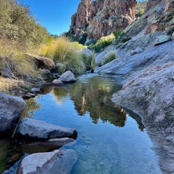
Looking for a place to get our feet wet and avoid the crowds. Chris at the Visitor Center told us about this place and he was spot on. Ate lunch, kicked back, spoke little, and finally decided that life had to be lived again.
★
★
★
★


No one else on the trail today. Trail is clear and tread is in good shape. Rocky near Marshall Lake
★
★
★
★

Nice ride with Sue. Went by wash where they found the dead man marked w green ribbons. Out to left around mts and back. Two steep hills with volcanic rock. Tough so only walk even tho they want to run. Very slippery for horses. Find alternatives.
★
★
★
★

Nice trail, thru woods and along dry bed. I was confused a couple places and got off trail. Beautiful location and scenery. Fairly easy trail. Big parking lot was full by 10a.
★
★
★
★
Nice trail, thru woods and along dry bed. I was confused a couple places and got off trail. Beautiful location and scenery. Fairly easy trail. Big parking lot was full by 10a.
★
★
★
★

Super crowded!! This is the most people I have ever seen on one trail. It was cool to see but had I known how crowded—I would have rather done something else.
★
★
★
★


Beautiful hike I got started in the early morning and it was a good choice the crowds get their early might have been the 5th person up to the summit I got started around 8 AM
★
★
★
★
Took Cibola pass trail to Soldier Pass trail and did the caves and then we explored around and cut over to Brins Mesa Trail and did the entire Brins Mesa Trail and then we explored up a large wash that somewhat parallels the latter part of Brins Mesa Trail just before the parking lot. The wash required lots of boulder hopping. We were hoping to get up to the Cliffs but it was further than we expected.
★
★
★
★
★

Incredible beauty. Not just at the look out but all along views as the trail is majority climbing side hill with open views of rock and river. Multiple eco systems. Yucca, sugar bush, agave, sonora oak. Excellent desert habitat for rare gartersnake and other desert creatures. At times it felt like a raked botanical garden. After reaching the saddle a pinion forest and then a glorious overlook with large boulders perfect for resting on. Up hill all the way, we gained 2,500 feet. Lots of loose rock. Never scramble steep but always a climb. It was a fabulous work out. I wouldn’t take someone in poor condition or someone without a love for exertion and rocks. Got up the next morning and wanted to do it again.
★
★
★
★
★


Incredibly beautiful. Easy trail. Well trafficked. Beware steeper slab (but still doable without rope) to get up the Bell Tower
★
★
★
★
★


Hiking up the Cathedral Rocks is liking ascending Angels Landing without chains.
★
★
★
★
★

Combined these two loops into a bit of a long day. Many parts were great, others were just sort of busy "along the road" types.
★
★
★
★
Did this again after a decade, still great! Follow the guidance to go counter clockwise around hangover (against the bikes) and it's no problem.
★
★
★
★
★


We were on Horses, this was a very rocky. One section was along the side of the mountain with several ledges so we did lead the horses for a little over a half mile. For hiking it’s great but not for the average trail horse. We ride a lot of trails like this but with the path only being 3 feet wide at times I didn’t want to chance it climbing up or down three ft drops. Crack Rock was special, a great swimming hole.
★
★
★

This is a shorter, but still very beautiful and adequately challenging path to Dane Springs by Dane cabin via the U-Bar and Barbershop trails. Plenty of ups and downs, and just gorgeous green meadows, fern gullies, and pine forest.
★
★
★
★
★
Incredibly beautiful. Easy trail. Well trafficked. Beware steeper slab (but still doable without rope) to get up the Bell Tower
★
★
★
★
★
Incredibly beautiful. Easy trail. Well trafficked. Beware steeper slab (but still doable without rope) to get up the Bell Tower
★
★
★
★
★
Incredibly beautiful. Easy trail. Well trafficked. Beware steeper slab (but still doable without rope) to get up the Bell Tower
★
★
★
★
★


Was a great 2 night backpacking trip.
You can do it faster, no problem.
When you find water, fill up.
★
★
★
★
★
Brin’s Mesa with the girls of yellow flowers at this time is pretty spectacular! I much prefer the hike up from Jordan trail head. The trail down soldiers pass is rocky and lose comparatively.
★
★
★
★
★


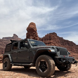
Amazing opportunities for boondocking. Also don’t need a 4x4 on most trails. But especially not the main trails.
Sedona is spectacular. !!
★
★
★
★
★
Best in Sedona. Stunning panoramic views and less people so it was incredible
★
★
★
★
★

Interagency pass not accepted here. Not sure why since it appears to be USFS administered.
★
Hike with Steve. Longest hike I’ve done so far and it was gorgeous!
★
★
★
★
★


First time to devil’s bridge. Perfect weather, very short line for photos on the bridge. Nice views from the top, but boring-ish walk on dry creek rd to the trailhead.
★
★
★
★
★
First time to devil’s bridge. Perfect weather, very short line for photos on the bridge. Nice views from the top, but boring-ish walk on dry creek rd to the trailhead.
★
★
★
★
★
Perfect 2 mile highly scenic trail. Nice shady sections as well as open sections of trail.
★
★
★
★
★


This was a great hike! They called it Clover Creek, but the sign called it something else.
Higher clearance vehicle was needed today.
Lots of parking at the trailhead. Mostly flat hike, many small creek crossings. Gorgeous hike!
★
★
★
★
★
I did this hike a decade ago and it has always sat in my memory as one of my favorite Sedona hikes. I did a quick hike up to the edge of the mess tonight for a refresher and can confirm it’s a great hike still. Starts off as a great warm up, wide path and a gentle incline for about the first mile. It then stepped into a meandering staircase climb to the base of the Mesa in the last half mile. The scenery is stunning. Great views west to steamboat rock and the fin, and easy to morning glory spire, the mitten and Brin’s Butte. To the north you look into the canyon bounding Willson mountain. At the Mesa you get views further north and west and, heck, 360 degrees all around. The return trip down hill has bites off uptown Sedona and the formations to the south including snoopy rock and bell rock in the distance. Hard to beat!
★
★
★
★
★

Ride toward Marshall Lake. Climb to top of Mesa and race home since Irma is having trouble with wound vac.
★
★
★
★
★

There is no such thing as a bad hike or mountain biking experience when you are in Sedona, Arizona. This loop as for mountain bikers of all experience levels.
★
★
★
★
★
Hike to discover a new sustainable route for the AZT on Anderson Mesa. Hike with Matt and Zach. Great views of Lake Mary below the Mesa.
★
★
★
★
★


Beautiful trail. The top above the tree line is no joke. It was a difficult hike at the altitude but definitely worth it! Gaia helped me stay on track.
★
★
★
★
★


Great hike, nice well maintained trail and some beautiful views.
★
★
★
★
★

Nice hike. A lot more greenery today over the last time I hiked (about 8 yrs ago). Too bad the resort just keeps growing and growing.
★
★
★


Great loop trail and easy for entire family. We extended by doubling back on some of the connector cross cut trails.
★
★
★
★
★


Extremely popular hike in Sedona. If you’d like to park you need to arrive EARLY because the lot at the Back O Beyond trailhead is very small. We parked at the church across the street from the entrance to Back O Beyond road and walked down, as did many others.
The trail was very crowded and we often had to stop at narrow parts where traffic was one-way. The trail was super well-maintained and we enjoyed the scramble parts.
The views were incredible and even at 12p it wasn’t too hot. Very little shade though so be prepared for direct sunlight.
★
★
★
★
★

Major mud fest in spring. Enjoyable in the canyon. Deep sloppy mud on the first ridge.
★
★

Scenery is awesome. Very steep (stair-like) near bridge. Loooong line for photo on bridge, so we skipped that.
★
★
★
★
★


The hike follows a closed road up to the tower. It is very easy and a beautiful walk. The view from the top is good but some lower spots actually have better views. If the tower is open it has a slightly better view over the trees.
★
★
★


This is for much of the time just a dirt road but it does get you some beautiful views and you have a chance to get up close to some of the red rocks.
★
★
★
★


D&K Headed out the west and up the little arroyo after the rocky hill, then up on the single track trail. Followed it til we hit a fence with no gate, but there is a trail on the other side. We had been there before, but turned around today, followed the single track to an old 2 Track and down into the wash and back. Good rock practice for the horses,
★
★
★
With Julianne and Julie Errend. Nice mellow ride, just followed the wash til we couldn’t go any further, cut up the side and bushwhacked to the White Hills trail and followed it back to the cattle tanks. One gate to go through, but the gate to the culvert was open.
★
★
★
★

easy till last 1/3 mi. elevation gain but nit bad. wasn’t that spectacular
★
★
★

Epic hike. Beautiful sites all along the way! Would 100% recommend this hike. We went into the cave as well which was super awesome! I’d say it’s a moderate hike based on the ending section of you choose to head to the cave.
★
★
★
★
★
Somewhat of a rough road at the end getting to the TH. Steep downhill first (and last) but otherwise fairly level and pretty. Not all along the creek, but partly. At the end is a swimming hole and really neat part of the trail, there is supposed to be a mine there and Indian ruins on the other side but we did not see them
★
★
★
★
★
Nice arroyos but they end. Can get out in some places, but generally easier to back track
★
★
★
One of the nicest trails in the area. Not rocky for most of the trail, great views, nice scenery through arroyos and across the ridge. A few short steep downhills and a couple narrow spots on the edge of canyon where the footing was soft but no problems.
★
★
★
★
★

This continuation of the Transept Trail is not heavily used and well worth doing.
★
★
★
★

Devils bridge and Vultee arch trails. Mostly easy with some off camber roads and some rocks.
★
★
★
★
★


Simple hike back to a beautiful cave dwelling and overlook of the valley
★
★
★
★
★

This is an easy enjoyable hike close to my house. It’s my go-to for a morning walk.
★
★
★

This was a Sunday and lots of people out target shooting. Once out of the initial arroyo it was better but on the way back someone was shooting where we had ridden out. Found a Jeep trail , a less used one that went through the wash and was pretty nice.
★
★
★
★
This is a beautiful trail that is very scenic. I saved it because this is a trail that has good camping spots on it. It is just a dirt road it’s nothing technical.
★
★
I was unable to complete this trail because it was closed due to snow. I could’ve done the entire trail but I haven’t found the time to come back and finish it up. The trail is just really bumpy with the occasional pink Jeep flying by. At least the trail has a nice scenic overlook of Sedona.
★
★
★

A really nice beautiful hike. It has a steep incline but it has spectacular views when you get to the top. There is a few people when you go but it is to be expected when you hike in Sedona.
★
★
★
★

Crowded and easy hike with good views. Not as special as some other nearby hikes.
★
★
★
★
Best hike I’ve done all year, no exaggeration. I’ve done almost 50 hikes this year. Do this hike.
★
★
★
★
★
With Bonnie, Marilyn and Dave. Tried to find the stage stop, which we did but couldn’t find a good way across rocky Dry Beaverhead Creek
Tried to find a longer loop around and we’re not quite successful. Very rocky invoices and a couple of steep sections but all in all very good trail
★
★
★
★
★
Lovely ride! Cows, hikers and some shooting across Beaverhead Flat. Rocky for the horses but they managed fine. Lovely views of Sedona and VOC as well as to the south.
★
★
★
★
★
Easy hike through the Junipers to a cutout in the rocks called the Birthing Cave. The cave itself is more of a cutout rather than the cave but it photographs well. This is a busy place and finding parking can be difficult on busy days.
★
★
★
★
This is a difficult trail with quite a bit of up hill. Great views across most of Sedona as you make your way to the top.
★
★
★
★
★

Good distance and elevation. Scenic views of Chicken Point and Broken Arrow. Negatives are traffic and walking through Chapel Neighborhood.
★
★
★
★

Good views, a nice mix of flat and challenging terrain. Nice hike for beginners and those with more experience. The views are terrific toward the end. Lots of bikes so be aware if you are hiking.
★
★
★
★


A nice brisk, gentle climb to a beautiful vantage point. Perfect for an early morning hike to warm up.
★
★
★
★
Very steep hiking with incredible views. Bring plenty of water, pack a lunch. Wear proper shoes and layer clothing. Anticipate a 4.5 + hour hike, so start early. (Snakes are common during summer months).
★
★
★
★
★

We did this as a bike ride and definitly amazing! You go through all the different terrains it's a intermediate level,but we are begeners and it was fine. Highly recommend not a lot of people think we saw two other bikers and a small hiking group and that's all. If your in sedona do it
★
★
★
★
★
Went with Bonnie and Marilyn, Dave came too. Surprised there was still some snow! 64 degrees and wi day but not a problem in the trees. Easy trail other than a few rocky areas, several gates to go through. No views but pretty in the ponderosas. Could possibly make some loops with the roads. In places got off the trail a bit, have to pay attention to the rock piles and cairns as it’s not well marked in some places. Nice ride tho!
★
★
★
★
★
Great hike for views of Sedona and Wilson Mountain. It combines Cibola, Jordan, Soldier Pass and then Brins Mesa for the loop.
★
★
★
★
Bit of a hard ride, rocky and steep in places, though you can zig zag up or down in most places. The wash is really pretty tho, at the end you have to turn around cuz there is no way up or out.
★
★
★
From the Pit, up the wash and through the culvert under the road. New area to explore! Wide wash, not too deep and not too rocky. Some roads run out of the wash and we road to the main road, Granada Wash Rd. Would like to find a loop!
★
★
★
★
★
Great ride on a sunny early November afternoon. Nice footing, beautiful trails!
★
★
★
★
★
Nice hike early in the morning. Limited parking. Can be a long wait to take your pic at the top.
★
★
★
★


Fairly easy trail. Start early to have trail to your self and to get done before the sun crests the mountains.
★
★
★
★
This was a very technical ride for the decent down to Rabbit Ears. We did need the GPS to stay on the trail
★
★
★
★
★

Fairly easy hike along forest Service roads with a bit of bushwhacking across a dry creek and up the other side. Lots of beautiful desert scenery, wildlife and flora. Pack lots of water and be prepared for dust and cacti. OHVs do pass by occasionally.
★
★
★
★
★
Forest road with softball size plus rocks covering the road. Not difficult but dusty and bumpy! Rated 1.5
★
★
★


Beautiful hiking trail in typical spectacular Sedona landscape. But quite busy.
★
★
★
★
★

Dusty, which is expected in this area. But, last 2/3 of the drive are very washed out now and rocky. Any stock 4x4 can make the trip, but expect a lot of bumps and slow travel.
Pretty landscape of the cedars and high grasslands.
★
★
★

Awesome trail, very rocky for most parts. Need about 10” travel/clearance. Great views. We took the XP from the trail head parking lot to I17 and back in about 2hrs.
★
★
★
★
★

Super fun hike! Started out early in the morning, finished in the afternoon. My 6 year old brother did it along with my dad and a friend.
★
★
★
★

This is a easy trail. Any 2wd vehicle with a little bit of ground clearance can handle it. Lots of scenic views and a few dispersed camping locations along the way.
★
★
★
★
★

Very beautiful easy hike with many water crossings. Saw a Red Start (bird).
★
★
★
★
★

Cool feature to hike to but when we went it was like waiting for a ride at Disneyland. Very busy and a line of people waiting to take a picture with the arch
★
★
★

Flow single to rocky single for about 12 miles. A little road hopping to more single track that was rocky.
★
★
★
★
★

This is a very nice mountain. The views are amazing. The trail was very dusty but overall very easy to follow. Roundtrip mileage on my Gaia trip was 9.9 miles. My GPS watch showed 10.5 miles. I would do it again but would start earlier than our 7:30 am start to avoid the crowds. We climbed the mountain on a Monday.
★
★
★
★
An incredibly beautiful trail - as though it were manicured especially for hikers. We did Humphrey’s yesterday, and this was a perfect follow-on day. A little over 10 miles at a leisurely pace. There are nice views and the aspen groves are really impressive. I would imagine they are spectacular in the Fall.
★
★
★
★
★
Beautiful hike - gorgeous day and a well marked trail even above timber line where it is mostly rock. The wind was diabolical for the last few hundred yards, so check the weather. Also bring a jacket - it was in the 40s with 60+ MPH gusts on top.
★
★
★
★
★
Beautiful day and very nice hike. Highly recommended. The road is a little rough and narrow but manageable with a little care.
★
★
★
★
★

Not easy to find. Not what we expected. Very busy, basically a bumpy dirt road. Lake was pretty dried up.
★
★
★

Great place for moderate to light wheeling just down this trail! Great camp!
★
★
★
★

We had an amazing backpack. Started from General Springs Cabin. Stayed on the Fred Hought Trail to Pinchot Cabin. That was at about 8 miles. Only one pretty good climb in this section. Do beware the crossing at FR 95 is severely washed out. It is passable but takes a little route finding. At Pinchot Cabin we went on the U-bar trail. We had the goal of spending the night at Dane Springs. This was 14.5 miles in and many descents and climbs later. A super long day but a good water source and some good campsites. The next morning we hiked the 12 miles back to General Springs Trail. We past a couple beautiful meadows has some big climbs again. Once you meet up with FR 300 you can walk the road back or follow General Crooks Trail. It can be a little hard to follow at times. We walked the road. At this point we were tired of rocky trails and cherished the more even surface.
★
★
★
★
★

Very easy hike unless you split off for the archway. Very shady and cool especially at 5:30.
★
★
★
★

Great hike with awesome views. Lots of foot traffic. Everyone we encountered was friendly and at the bridge itself everyone took turns taking pictures. If you are going in the middle of the day, like we did, there are plenty shade opportunities to take a break a long the way. Watch out for the off-road vehicles if you are hiking from the parking lot.
★
★
★
★

This hike has everything! You will need a 4x4 to get to the Trailhead, as the 4 mile road back to it is rough. There was nobody else here at all. The hike has an elevation gain of 530’, and has sand, slick rock, riparian forest, washes, and of course the arch! Early morning or later evening would be the best times to hike. When we finished it was 102 at the Trailhead, but we finished at noon. Our 6 year old finished with no trouble, but remember to bring lots of water!
★
★
★
★
★
This is what I would consider a rock crawling trail. There is only a few spots on the trail where I scrap the back of the truck. I still haven’t attempted the devils staircase yet and I’m not sure I will because It seems to dangerous to me. There is also a lot of other people on the trail which makes the rating of this trail low.
★
★
★
Steep grind of a hike. Good leg workout for sure. Bring more water than you think you’ll need. Even if it’s cool, a couple of hours of hard breathing on the ascent will get you dehydrated.
★
★
★
★

Probably my most favorite hike in Sedona for sunsets despite the crowds. Once you reach the top you can hike to the left and follow the trail to the vortex. On the way down there is an unmarked trail that brings you to the west face. Both detours had 0 people despite the top being crowded! The sunset colors are amazing from both places and the red rocks truly glow!
★
★
★
★
★
Crowded!! We started later in the afternoon, but still a lot of people (we passed by the trailhead early morning and it was a lot worse).
★
★
★
★
Beautiful wooded trail with a couple of nice vistas. There are definitely some steep spots, and a fairly long stretch with loose gravel and a steep pitch that is a little tedious to navigate. Definitely would recommend.
★
★
★
★

Road is terrible. Mostly washboard all the way. Views at the end are soectacular
★
★
★

For dirt biking know what you are getting in to. Most of the trails are SUPER rocky. Not my(or family) style of riding. Might try some other trails another day but if they are like this one we are out. The camping area and solitude are wonderful though. Saw some big elk.
★
★
Really enjoyed this relatively easy backpack trip. The temps were pleasant, we saw elk and bear and had plentiful water. Enjoyed camping on the rim as well as in the pines. I tend to like first and last days to be shorter hike days since there’s usually a drive involved. So we did four mile days in the first and last days with a twelve mile day in the middle. It was perfect mileage on fairly flat terrain.
★
★
★
★
★


Easy 3 miles hike round trip. You get to walk inside a volcano that erupted 740,000 years ago.
★
★
★
★

Moderate difficulty uphill rocky climb. Good boots and walking stick helps. Partly shaded Best time early am.
★
★
★
★
★

Pretty ride, lots of burned forest. Very easy. Says no street vehicles, but high clearance would work
★
★
★
Beautiful views. Actual trail into Smiley has some pretty rocky washes. Recommend high clearance, not advisable for regular SUVs
★
★
★
★

Try t t t r go teed Gc gettingh yew yyy hiaEuuu u Asa you hit t sawing aww we e it as guy ug aww guy was G ytt
★
★
★
Awesome Trail ! Rock climbing, views, great ladder drop. Watch for pink jeeps a lot of them.
★
★
★
★
★
Rocky,but not especially difficult. The scenery is epic. Watch for pink jeeps,
★
★
★
★
★

It is an amazing hike. The cave is a must do. Look for the “wilderness path” sign.
★
★
★
★
★
This is a great hike. Has some shade and is a good climb up the mountain. Great views from the top.
★
★
★
★
★

Left 9 am for a little warm by the end. We crossed oak creek twice, rock jumping got a little wet! Really nice hike very diverse and beautiful scenery
★
★
★
★
★


This is by far my favorite Sedona trail. There are 13 creek crossings until the end of the formal trail. After that, you can continue up the creek bed if you are willing to wade into the water to barely knee height. So worth it to continue on for at least 0.5 miles. Easy, minimal challenges aside from shallow creek crossings and climbing over a few fallen trees. It’s easy to miss creek crossing points, but you figure it out quickly when the trail runs out. Shaded throughout. During COVID on a weekday we saw very few people on the trail (arrived in the parking lot around 9:15 AM). Needed a light jacket for the first 30 minutes because of the breeze and cool water.
★
★
★
★
★
Easy, short, partially shaded. Last .1 into the cave is very steep and slippery. Cave is worth it though! Watch for the “wilderness” sign to turn to the right off of soldier pass trial. It’s about .7 miles past 7 pools. Great panorama before the steep climb towards the cave.
★
★
★
★
Beautiful views hiking in of cathedral rock and more, great areas to relax around the creek. 7:30 start was perfect to avoid the small crowds. Slippery in some areas, partially shaded, some bugs near the creek. Easy rating.
★
★
★
★
★


This is a great trail you will work for your views of amazing Sedona. Started at 5:30 am temps 60 degrees. With little to no shade, I would suggest an early start. You will have a few knee-high step-ups and some scamble but all it worth it so many photo opportunities.
★
★
★
★
★

Great hike. Pretty easy. Best if there’s water in the creek. Fun pool at the end.
★
★
★
★
Yes 4 hard climbs. The wild flowers this time of year were amazing. We started at 8:30 I would start as early as possible to avoid crowds and heat. Took around 4 hours with rest and snacks. Great views the entire time!
★
★
★
★
★
Started 8:15 should have started 7 got hot. Took 4 hours 15 minutes with tests and snacks. Flowers this time of year wet beautiful. Four hard climbs, challenging
★
★
★
★
★

Buena ruta hermosa me encanto tienes que experimentarlo para que entiendas bello.😻
★
★
★
★
★
 stars
stars
Beautiful hike. Great sections of exposed slick rock with views of Sedona and Wilson Mountain as well as sections through groves of Juniper trees. 4WD high clearance vehicle required to get to the trailhead.
★
★
★
★
★

Easy walk. Unusual high water due to spring rains and snowmelt. As
★
★
★
★

Great hike, mostly rolling ups and down, decent climb up to the cave. Moderately busy. Beautiful day 2-28-20. We were able to park in the parking lot but only 15 spots. Trail was well marked!
★
★
★
★

This was the most scenic hike I’ve been on so far in Sedona. Several people recommended we go. But it is a long hike with a few steep climbs.
★
★
★
★
★
Bear Mountain Trail is a great hike with some serious elevation gain and not much shade; ie lots of exposure. The views on the trail are amazing especially as you climb to the higher areas including the summit. - On this day we diverted to a less traveled side trail towards Fay Canyon and joined the old route to Bear Mt. eventually rejoining the current trail about 0.5 miles from the summit.
★
★
★
★
Lots of High Desert scenery and an amazing view of Cathedral Rock!
★
★
★
★
The only reason this is difficult is bc of the stairs and TRAFFIC from the mainstream Jeep tours.
★
★
★
★
★
Watch the water level going to the other side but it’s worth the risk.
★
★
★
★
★
Tried to do Hangover Trail clockwise with my Golden Retriever. Once we got up to the slick rock above the Pass, it was too steep for her to scramble up. Still was a fantastic hike with views to live for!
★
★
★
★
Serious climbing but amazing views all the way up and a spectacular panorama at the top!
Bring LOTS of water!
★
★
★
★
★

Great winter hike. No shade but lots of climbing and amazing scenery. Although short - allow at least 3.5 hrs. Trailhead says allow 5
★
★
★
★
★
Great hike when there is snowmelt in the late winter. Beaver creek running is a site to see.
★
★
★
★
★
Great winter hike. No shade but lots of climbing and amazing scenery. Although short - allow at least 3.5 hrs. Trailhead says allow 5
★
★
★
★
★
Great hike when there is snowmelt in the late winter. Beaver creek running is a site to see.
★
★
★
★
★


Snow adds some challenges, but this is a must do for any serious Arizona hiker!!! Great accomplishment to cross off the tick list
★
★
★
★
★

Great hike. Slow steady incline up mountain. View are worth the hike. Majority of the trail is on a rock creek bed.
★
★
★
★
You can’t see it from the start but this hike takes you up 4 peaks, each getting higher and higher. Great views at the end.
★
★
★
★
★

Good easy hike for families w kids.. Lots of great views of the red mountains..
look out for Moutain bikers!
★
★
★
★


My “exercise hike”. I do this one at least once a week. VERY heavily trafficked in tourist season.
Bring plenty of water for this one in the summer.
There are few places to hide from the sun. Paramedics hang out in the parking lot with IV bags for those who don’t heed the signs to stay hydrated.
★
★
★
A wonderful trail that starts with flat ground and delightful soft sand. The path to the Arch trail is somewhat difficult to locate, so keep your eyes open.
Scaling the rocky path to the Arch on warm days can lead to Snake encounters, stay vigilant.
Beneath the Arch is a large collection of rocks, which is the remains of a Ruin. Pottery shards are abundant.
★
★
★
★
★
Rather steep ascent, but plenty of opportunities to stop along the way to permit other hikers to pass on the narrow trail.
Views at the top are spectacular and you can see the entire valley to the West, (and East).
Very heavily populated trail in tourist season.
★
★
★
★


This is a great loop trail that hits the must-see attractions on Soldier’s Pass, but it has the advantages of abundant parking and outstanding views from Brin’s Mesa (exceeding any of the views on Soldier’s Pass IMO). This loop included a stop at the arches/cave as well.
★
★
★
★
★

The north side is really great, do it first. South side is just ok.
★
★
★
★


This trail hike takes you to the summit of AZ. The views are great but the trail is ruff with rocks & tree roots better in winter with snow coverage.
★
★
★


Very satisfying hike. Up a short trail to the foot of the rock and then a moderate climb up the rock. Great views on the way up. Minimal shade opportunities on the way up but the peak was cool and a great place to recharge for the descent.
★
★
★
★
★
Fantastic Hike!!! Views are amazing and interesting vantage points along most of the trail!!!
★
★
★
★
★

This is a great Jeep trail incredible scenery but a very rough trail to drive,, even aired down to 12 psi.
★
★
★
★

A very nice morning hike. It is forest road to the top, but it is well maintained and easy to walk. Despite not being a proper trail, I found it very pleasant and got a good workout from the climb. Amazing views of the inner basin, sunset crater, and the lava flows.
★
★
★
★

Great trails in Flagstaff. These trails are great for hiking, biking. Plenty of signs and lots of options.
★
★
★
★

My favorite hike in Sedona, never fails to impress!
Our little Zion.
★
★
★
★
★
 stars
stars
Great easy hike to a phenomenal end point, the largest natural sandstone arch in Cocinino NF. The trail starts off of Long Canyon Road a little north of the usual starting spot for Devil's Bridge. That little drive provides more abundant parking. The trail is mainly flat, winding through the forest in and out of shade until it reached Vultee Road where the 4wd people can start the hike. After that, be perpared for a lot of company as it winds uphill gently to the base of the arch. There's a 100 yd side trail to the left that leads underneath the arch which is pretty cool in itself. Going back to the junction, there are some medium challenging steps (but steps!) that carry you to the viewing spot for the arch. On the Sunday before Memorial day there were about 30 people waiting in line for the admittedly cool photo opportunity. Wait or not, then retrace your steps back to the 4wd parking and then cross the road and take the marked path back to your car. Easy 4+ mile hike with only 500 feet gain. The only challenge is the steps which are pretty easy, but made harder by the crown ascending/descending.
★
★
★
★
stars
Starts with a shaded stroll along a creek to world class scramble around wonderful mesas. This trail has everything including challenging that fear of heights as you mount the shoulder of the mesa with drops all around. I liked doing this clockwise as the bikes do it counterclockwise; it also put the hairiest exposures on the uphill which is a bit easier for those who are height-challenged.
★
★
★
★
★
stars
Fun little hike to a wonderful natural bridge. Easy, flatish hike from the paved road. At the end there are some exciting steps up the hillside to add that frisson of fear. The only drawback was the crowd at the top waiting to take pictures. Just more reason to come back when there aren’t so many people.
★
★
★
★

Short, steep ascent. Marvelous slab area just before the Summit. Awesome workout that fits inside an hour.
360 degree view of the Red Rock Loop.
Not the best hike in the world, but certainly worth a quick climb.
★
★
★
★
This hike is a great workout with rewarding views at the top. With good visibility, you can see the San Francisco Peaks to the north; the red rocks of Sedona to the east & south; and Mingus Mt., Cottonwood & Jerome to the west.
★
★
★
★
★


2019-03-13
Great hike. The views keep getting better the higher you climb. My total travel Tim was about 4 hours, with about 1 hour of rests/photos/food. Left the trailhead at 1pm, back by 6pm.
There was light snow at the top, a nice way to cap the trail.
The trail is quite a scramble, so if that’s not your thing maybe do a different one. But the effort involved is totally worth it for the views.
★
★
★
★
★


Good quicker elevation gain workout. Nice vistas as long as you like seeing city and mining operations also. Time is closer to 2.5-3 hours. We do 6-15 mile hikes with 1500-3500' elevation gains regularly, did it in 75 degrees starting in the sun, transitioning to overcast and sprinkles for the last 1.5 miles, passing several groups and not being passed by any. There are a lot of sections with large steps so small kids will be taxed.
★
★
★
★


 stars
stars