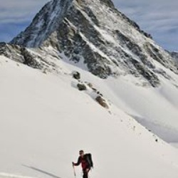
Long tour. About 2.5 hours to Baker Col, side hill on sastrugi snd wind crust, long & hot skin up the Wapta (saw 4 other groups). The snow in the shooting gallery was fine but the long flat seemed interminable on my very tired legs!
★
★
★
★
★

Nice winter walk. Glad we had our poles and walking cleats on for the ice and snow.
★
★
★
★
 stars
stars
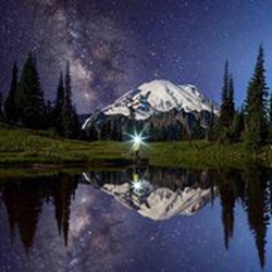
Nice flat walk - easy. Great spot for aurora/milky way photos at night in the summer.
★
★
★
★
stars
Beautiful hike up through Wonder Pass but very steep after the lake and for the switchbacks up the pass. For a much easier option of getting to Mt. Assiniboine take Assiniboine Pass. You can walk to Wonder Pass as a day hike if you have an extra day up there and avoid the steep climb or desent!
★
★
★
★
★

Very nice hike with well maintained, wide trail and spectacular views. I walked from downtown to trailhead, not too far, to avoid limited parking at trailhead
★
★
★
★
★

A nice treed approach for the first couple of hours. Then it’s a scree infused grind for the next 2-3 hours. Careful on the way down as the scree can be slippery. Bring at least 2 litres of water. Great views from the top
★
★
★
★

The first bit of the hike is through the trees so the views aren’t great but you do about half the elevation. Then you get to the rocky part and you can see but start going a lot more vertical! Pay attention to the orange paint on the rocks for the trails and enjoy one of the best views you’ll get over the Bow Valley and Banff
★
★
★
★
★

This was not an easy hike it rained nonstop. The climb was gruelling but when you finally arrive in the pass you realize why you did. It reminiscent of Frotos walk through Middle Earth. Epic views and memories abound.
★
★
★
★
★

The hike from Skoki Lodge to Hidden Lake has easily landed in my top 3 for backcountry days. It has everything: forested hiking, hiking along a creek with wide open views, multiple lakes, multiple waterfalls, and an amazing “scramble” up along a waterfall. The views above the two lakes (before the pass) are 9/10 and we had the upper lake to ourselves for lunch. The pass is short but grueling, although you’re rewarded with wildflowers and larches as you climb. The view from the pass is spectacular, and there is an easy further ascent you can do to Packers Peak (roughly 75-100m gain over maybe 750m)
★
★
★
★
★

Beautiful views. Moderately hard hike. Elevation is main challenge if a flatlander
★
★
★
★
Beautiful views. Moderately hard hike. Elevation is main challenge if a flatlander
★
★
★
★
Beautiful views. Moderately hard hike. Elevation is main challenge if a flatlander
★
★
★
★

Great hike, very nice view of Bow Lake at the end. In mid day in the summer, lots of mosquitos, take spray or be early.
★
★
★
★
★

The hike up to the lake and Sentinel Pass is well kept and well traveled. It is quite steep and I wouldn't recommend it for people with injured or damaged legs.
There are a few pastures where the trees begin to thin out, surrounded by mountain peaks and blue skies. The views from the top are worth every step. Take gloves so you can throw a snowball or two!
★
★
★
★
★


Sept 2024, Using the trail network shown on Gaia, my wife and I planned a one-way hike from Moraine Lake to Lake Louise via Sentinel Pass. We took a shuttle to Moraine Lake and started our hike just after sunrise. Up to Sentinel Pass, it was a moderate hike with spectacular scenery and followed the Gaia path. However, once at Sentinel Pass the trail seemed to disappear. There was no signage indicating the continuation of the trail and just rocks where the trail should have been. Then we noticed people scrambling down those rocks and realized that the trail had been wiped out by a rockslide. We continued down the rocks and progress was slow (I broke a hiking pole while descending the rocks). It took an extra 1-1/2 hours to reach a point where the trail was not covered (probably 1.5 km from Sentinel Pass if the trail had not been damaged). The remainder of the hike was enjoyable, and we reached Lake Louise later than planned, but before our daily parking pass expired. We noted that Parks Canada had great signage along the trail, except for the top of Sentinel Pass. Had we known the conditions we would have brought heavier gloves for the rocky descent or perhaps planned an alternate hike. I'm glad we started early and planned for a full day of hiking.
★
★
★
★
★

Great morning hike up to BOOM LAKE. Great morning with no wind. Small layer of fresh snow. Beautiful lake hike.
★
★
★
★
★

Great trail along the river with amazing waterfalls and beautiful ink-pots at the end. Approximately 7.5mi and 1500ft ascent.
★
★
★
★

We recently spent the night at Mystic Junction campsite and can only say that the trail to the campsite was filled with bear scatter and bear foot prints. The nigh of our stay we had a big grizzly enter the campsite (we were the only guests), pass by our tent and fortunately leave. He didn't seem interested in us as we backed away to let him pass, but I assume it could have ended in a different way if he had been unpleased to find us there. I would avoid this trail and campsite, as it's grizzly's turf and stick to more frequented routes, or at least approach in bigger groups in the knowledge there might be multiple bears active in that area.
★
★

AUG 01 2024
Hiking Adventure, Day 2 🥾🩵🏞️
Lake Louise
We got up super early and left Canmore, AB in hopes to find one of the few parking spots available at Lake Louise located in Banff National Park. We arrived just after 7:45am to find only a few spots left. Whew!
What a total unexpected experience this day was. Words I kept telling the family and myself, “Keep going, we’re almost there!”
Mirror Lake via Lake Agnes Trail
Lake Agnes Tea House —> Big Beehive Trail
Big Beehive Trail —> Highline Trail
Highline Trail —> Plain of Six Glaciers Tea House
POSGTH —> Plain of Six Glaciers (which only Trey walked the very steep & narrow path to the actual viewpoint. The rest of us too nervous to make the final approx .15 mile journey and back)
Plain of Six Glaciers —> Lake Louise/Fairview Hotel
We were able to see Lake Louise from many different elevations and angles throughout this entire hike. Breathtaking!
I don’t know how we made this hike other than “Keep going, we’re almost there!” 😵🥵 I had no idea where we were going and my kilometers to miles math, let’s just say, nonexistent! 😂😅
Total Hike ~ 12.51MI
Hike Elevation Gain ~ 2,724FT
Disclaimer: We aren’t hikers and we did not prepare ourselves extensively for this trip! No hiking gear, hiking boots or shoes, normal backpacks, no camelbacks, last minute purchase of a single pair of trekking poles, etc.
We all went in with the mindset, short, easy hikes but the adrenaline kicked in and we took a different approach! Totally here for it! 🥾🩵🏞️ 10/10 Recommend!
★
★
★
★
★

The walk to Bourgeau Lake offers a some views as you approach the lake, but the hike gets much better beyond the lake. Harvey pass has amazing views which continue as you ascend Mount Bourgeau. The ascent is not very strenuous, just uphill slogging. Lots of wildlife and not many people. Took 8.5 hours
★
★
★
★
★

Beautiful views of Vista Lake and Arnica Lake. Small trout in both lakes. Trail is in excellent shape. Can continue to Twin Lakes and beyond.
★
★
★
★
★

 stars
stars
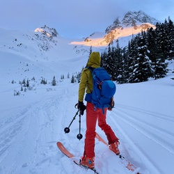
Difficult trail to ski tour up to Bow Hut. People often come here as their first hut trip, however there are a number of hazards both on the approach (maneuvering around open creek water, avalanche hazard, significant approach with a heavy backpack), and skiing around the hut. Skiing up from the hut is on glaciers and therefore crevasse rescue and glacier travel training is highly recommended.
★
★
★

Very popular hike with wonderful views. Mirror lake is a nice spot to stop for a rest on your way up. The tea house prefers cash but will take cards for an extra fee.
★
★
★
★
★


Steep sections with loose rock but incredibly beautiful. Worth the effort.
★
★
★
★
★


Trail itself is all roots and mud but the lake at the end is worth it. Overall not a difficult hike but slow due to navigating puddles of water etc. Paddling on the lake is easily 5/5! The views from the other end of the lake are amazing.
★
★
★
Trail itself is all roots and mud but the lake at the end is worth it. Overall not a difficult hike but slow due to navigating puddles of water etc. Paddling on the lake is easily 5/5! The views from the other end of the lake are amazing.
★
★
★
Trail itself is all roots and mud but the lake at the end is worth it. Overall not a difficult hike but slow due to navigating puddles of water etc. Paddling on the lake is easily 5/5! The views from the other end of the lake are amazing.
★
★
★

Nice loop trail. Hiking lakeside on the way back avoids steeper switchbacks on the way up.
★
★
★
★

Beautiful Hike! Once you get over the beehive after visiting Lake Agnes tea-house it’s all downhill or flat for the last part including to and back from the plain of the six glaciers tea house.
★
★
★
★
★

This short trail is steep and narrow but the view of the triple waterfall at the end is worth it and the view out the Bow Valley is spectacular too.
★
★
★

Second time taking this trail. First was in 2017. The last quarter mile of scree scrambling is absolute hell but the view is so worth it. Incredible views of glaciers and glacial lakes below.
★
★
★
★
★

940 metres of altitude gain in around 4 km of climbing from shadow lodge. What’s not to like? Your lungs may not like it but the panorama forms the top is outstanding!
★
★
★
★
★

Great views on way up but a slog for lakes that are not particularly unique. Will not hike this trail again.
★
★
★


This is listed as a winter snowshoe trail but when we went in early April, it was mixed dry / mud / ice and ice cleats were helpful. The views over the lake were amazing with a layer of water on the ice.
★
★
★
★
★
The description says out and back but this is a loop around the lake. Some icy sections still present but easy to manage with spikes. The north side skirts the lake across a side slope. The south side is through the forest. Flowers and berries were just starting to appear. Some side trails were temporarily closed.
★
★
★
★


Despite the 5km approach to the zone, this valley offers a wild variety of terrain for riders of all skill levels!
★
★
★
★

Easy-moderate and wide trail up to lake, then steeper and some scree towards Harvey Pass. Go early for parking. Mt Bourgeau within reach if you start early and conditions are good in early fall
★
★
★
★
★


This is a very nice hike leading to meadows that are full of flowers in July.
It is also an intermediate ski touring route altho route finding is necessary if there are no new ski tracks.
★
★
★
★
This is a steep trail thru the woods to a very scenic lake surrounded by huge mountains.
★
★
★
★


The most scenic ride in Canada. Wide shoulders and large mountains
★
★
★
★
★


Great bike and hike. Nice combo. We cycled from the train station. Saw a fox Marmots. 9.6 k hike to the bowl and 26k cycle.
★
★
★
★

The first 3km try to murder your legs. You must have hiking boots. It’s a bush whack hike, no clear trail. Beautiful vistas 365 degrees around you. Some minor Boulder climbing and possibly of walking through snow.
★
★
★
★
★


Was my first snowshoeing experience with our AST-1 guide name Simon. Learned about the terrain and avalanche safety. Was a great hike and found some sweet powder runs on the way down. Hiked the last 15 minutes to the parking lot.
★
★
★
★

Trail leads to huge meadows and open larch forest. Obvious trail continues to the pass. An excellent advanced ski touring trail in the winter, with route finding necessary in the open meadows.
★
★
★
★
★
Easy, safe, and very scenic road trip through the mountains. Good chance of seeing wildlife.
★
★
★
★
★

The climb up the north side gives great views of terrain on the north side Mt. Whymper. Try to use slide paths to gaim elevation. It is Steep climbing through forests. At col veer right rather than getting drawn down tight steep canyon.
★
★

Nice little hike before hitting the road home. In summer, you can take the steep little path past the viewpoint, and switchback down to the lake trail. In winter, it will be more enjoyable with spikes and maybe poles, especially when there’s fresh snow. The trail to the viewpoint (but not beyond) is also a good beginner snowshoe trail.
★
★
★
★

This is a super interesting way of getting up Redoubt, and cuts a lot of time off the approach if coming from Lake Louise. The route follows a creek to start, then goes into a cirque. The scrambling is overall good, with some scree bashing, but a lot of 3rd class on decent rock to the ridge. The summit block can be climbed by a weakness to the left. A worthwhile route for sure.
★
★
★
★
★


Nice and easy hike in the winter, though I snowshoed in, there were cross country ski trails too. It can be a little challenging at times to find your way in winter as due to fresh snow tray can get hidden very easily, and second half of this trail is by the creek, so vigilant of that. Otherwise I definitely recommend this to anyone, though I did this solo, as I’m a solo hiker, I would recommend at two people to at least keep track of the route
★
★
★
★
★
stars
This is the easiest way into Lake Magog campground from bryant creek (mt. shark trailhead). Not as pretty as wonder pass but still beautiful. Be aware there are two Assiniboine pass routes - the horse trail is open year round and can be used to hike on, the hiking trail is closed at times for grizzly protection.
★
★
★
★
★

Awesome views of Banff and the surrounding mountains. A must do.
★
★
★
★
★


I’ve been to two places in the world where I’m constantly turning back to look at views I’ve already seen and just can’t get enough of: the Grand Canyon, and Larch Valley in full fall colour with a fresh dusting of snow on the Ten Peaks. The reveal into Paradise Valley as you reach Sentinel Pass is breathtaking. Absolutely spectacular!
★
★
★
★
★

FOUND CELL PHONE!
I found a Samsung cell phone on Sentinel Ridge on Monday, September 21, 2020. If you lost yours, please contact me with identifying characteristics of the phone so I can get it back to you. It’s locked and on airplane mode so unfortunately I’m not able to see notifications, contacts, provider, etc.
★
★
★
★
★

Probably the best trail for effort vs. reward. From the parking lot the trail climbs up through a series of switchbacks which are not too steep. There were short muddy sections on the trail, mainly in the lower part of the trail where the trees block the sun. As you make your way up please avoid the many social trails/short-cuts and stay on the main trail in order to protect the vegetation.
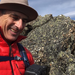
Once you climb above the tree line, keep your eyes open and examine the large boulders on the trail, you should see some fossils on them.
If you go early in the morning, the lake at the footsteps of the Saskatchewan Glacier will not be in the shade and will show its color. If you will go in the afternoon then the mountains to the east will have a better light.
★
★
★
★
★

Not a lot of views but a very chill way to get up to the lodge.
★
★
★
★

It was pretty busy for the first 5 Kms but after the tea house, traffic died right down.
★
★
★
★
Beautiful hike with amazing lake and mountain scenery
★
★
★
★
★
Mt. Bourgeau is a classic hike in Banff with amazing scenery all along the route and stunning 360 views from the summit. It’s an easy trail from parking lot to the summit, but a long day though... our GPS said 25.29 km round trip with elevation gain of 1534 meters. Would definitely do this one again... in fact, can’t believe in all our years of hiking it’s our first time there!
★
★
★
★
★

Counter clockwise makes to somewhat exposed section an easier up hill climb. Great views of Spray lake on the way back down. Lots of boulders on back side of the summit ridge to navigate but all manageable for our group of “50 something” hikers.
★
★
★
★
★
I would class this as a moderate hike for the most part with stunning views at every turn. This trail has it all...alpine meadows, beautiful Larch trees, lakes and vistas of the Ten Peaks as well as Mount Temple and Pinnacle. Reach the top of the pass and you are rewarded with views over Paradise Valley as well as Grand Sentinel. Awesome!
★
★
★
★
★

No one around. Beautiful views once you conquer the scree scramble. No real trails and a lot of bouldering for the lake to lake segment. The gps is accurate and best to follow it or it gets gnarley pretty fast.
★
★
★
★
★

Started at 08:00. Follow a steady incline up the river valley until you pass a large gully. The challenges start here as you abruptly travel up the ridge until the summit. Last mile or so is very loose scree, not dangerous, just slow going and tedious. Took us 4.5 to summit. Bring lots of water as there is no place to make water along the hike. Brought 6 litres between two people and we were very happy to have all of it.
★
★
★
★
★
For the most part, I would rate this as a moderate hike. The steep climb over loose soil before the final ascent to Devil’s Thumb was the most difficult part of this trail and trekking poles and good boots certainly ease the climb. The views from the top of Devil’s Thumb are stunning. Being able to take in a 360 degree vista that includes Lake Agnes, Lake Louise and up the Plain of the Six Glaciers valley is inspiring. Go early to beat the masses and you may have the peak and the views all to yourself, like I did 😁.
★
★
★
★
★

This was my first overnight hike. Was the perfect beginner backpacking trip. Took just over 3 hours with lots of stops. Approx 1 km in there is a bridge, about 2 KMS in there are some chairs overlooking the river valley. A while further you will have some creek crossings that you can refill water at. Outhouse and picnic tables make this ideal. Lots of tent spots with views of the beautiful lake. It was very overcast and a bit rainy but so worth it.
★
★
★
★
★

Kelly went over the handlebars on the back trail from the hot springs to the Spray trail.
★
★
★
★

Have done this 3 times. Don't go in June if you want to get to the top. Snow up the ramp and heavy cornices on the summit ridge.
★
★
★
★
★


What a stunningly gorgeous hike. Definitely easy/moderate with the Tea House to look forward to near the end. Hiked to the end and sat on loose rocks waiting for ice slides - saw two in 30 minutes - awesome! Saw actual glaciers and now have an understanding of their former power and how diminished they have become. A must see.
★
★
★
★
★

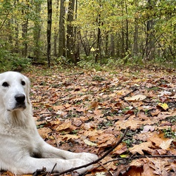
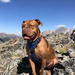
Views and fotis knows what Brittany spaniels and Nova Scotia duck rolling retrievers are.
★
★
★

The trail was not muddy even the rain just stopped before the hike. Great view on top of the mountain.
★
★
★
★

This is Hike is adventure galore from start to end. Finding the trail on the ledge can be tough. From the summit you can the ice fields on the mountains for miles around.
★
★
★
★
★


Beautiful hike, views of lake Louise on one side and gnarly snow-capped spires on the right. We kept a quick pace, 3:45 round trip. Would highly recommend!
★
★
★
★
★

Did this last year at the end of June the weekend before it was officially open. I would really recommend doing this in a couple of days, we powered it out in 1 and were definitely wiped at the end of things. It's 27.5km to the campground, and carrying all of your stuff it's fairly intense.
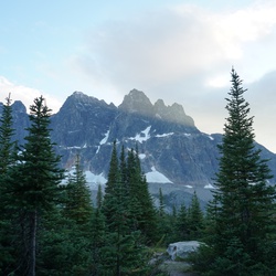
That being said the hike other than distance is very easy and pleasant. The views along the way are stunning, and the lake at the end is seriously beautiful. Waking up every morning to Assiniboine towering overhead is great.
★
★
★
★
★
Great little hike, trail wasn’t to busy and not to far out of town.
★
★
★
★

Great hike with nice view on Banff and the Bow River on the way up to Cory Pass. We attempted the summit to Mt Edit before to get to the pass but it was very difficult to find the way so we had to head back to the Cory Pass trail. Fantastic view from the pass and nice bay down through the moraine in between Mt Edit and Mt Louis.
★
★
★
★
★