meta

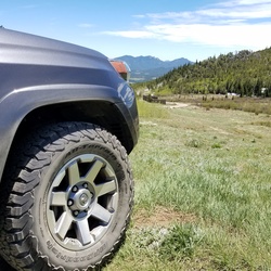
Chicken Corners via Lockhart Basin Road

based on 155 tracks & routes #42 hike out of 163 in
21.0 mi
Distance
11 hrs 30 min
Time
terrain
830 ft
Elev Gain

Overview

This is a difficult one way trail in Bears Ears National Monument.

This trail goes by Colorado River.


This is an alternate route for Anticline Overlook via Lockhart Basin Road and Kane Creek Road.


Sights to See


    Rate this Hike

    user_profile
    3 years ago
    ★ ★ ★ ★


Public Tracks

user_profile
rayrokni 6 months, 2 weeks ago
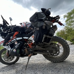
Hurrah pass & chicken corner
Easy trails. Fantastic views. Sandy in places. I did it on a ktm 890 adventure r.
user_profile
colintdean 5 years, 7 months ago
Chicken Corners Route
Planned route for Chicken Corners weekend of Sept 28-30, 2018
user_profile
colintdean 5 years, 7 months ago
Chicken Corners Route
Planned route for Chicken Corners weekend of Sept 28-30, 2018
user_profile
kcocco 6 months, 2 weeks ago
user_profile
Tom 8 months ago
user_profile
robsinkewich 1 year, 5 months ago
user_profile
tjbeckler 2 years, 1 month ago
user_profile
brockbaze 3 years, 5 months ago
user_profile
1051125156 3 years, 7 months ago
user_profile
rob.rossbach 3 years, 7 months ago
user_profile
cheeser 3 years, 8 months ago
user_profile
telemrk89 4 years, 3 months ago
user_profile
mikedkane 4 years, 7 months ago
user_profile
Eric Steele 7 years, 11 months ago
user_profile
heloboy 8 years ago