Augspurger Mountain via Augspurger Trail
6.0 mi
Distance
2 hrs 30 min
Time
terrain
3,526 ft
Elev Gain
Overview
This is a difficult one way trail to Augspurger Mountain in Washington.
This trail goes by Grant Lake and Columbia River.
Getting Started
Start on trail to the right of the more wide Dog Mountain trailhead. This trail is single track. In .73 miles in there is an old loggers trail junction (overgrown) 3.5 miles in is the Augspurger/ Dog mountain trail junction, go straight. Signs are pretty straightforward and there are blue trail markers on the trees. Powerline roads area is the only area you would need a map.
Taking Children
I would not recommend this trail for inexperienced children as the trail is overgrown in multiple areas, steep and a lot of obstacles on trail. As well as long.
Sights to See
Rate this Hike
★★★★★
 stars
stars
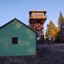
4/30/19 It's 3:39am and I am the first car in the lot! This is my first time ever hiking or stopping here. There are two handicap parking spots. The parking lot is riddled with large potholes so take care with your vehicle. There are locked vaulted toilets 100 yards up the dog mountain trail. They were pretty smelly when I got there downward in the am. There is a picnic table. You need a Northwest forrest pass, america the beautiful pass or there is a self service pay station here for $5.00. I hiked 11.95 miles 4387ft elevation gain in 8hrs 9 minutes total time, 6hrs 44 mins moving time. Augspurger trail to Augspurger Ridge to Dog Mountain and down more difficult trail on dog, started at 3:59:30 AM. Augspurger is a beautiful trail (way more easy going and gradual than the more difficult trail on Dog Mountain) mostly forrested and well maintained till you get to the dog mountain trail junction. There was a trail junction on Augspurger at .73 miles in for an Old Loggers Trail that looked overgrown. When you hike down to the valley before the powerlines, expect bushwacking and there are lots of obstacles on the trail. A section of the hike is on powerline roads and can be confusing to navigate, if you do not have a map. There are trail markers on the actual augspurger trails and great signs to point you in the right direction minus the powerline roads junction. I stopped on Augspurger Ridge, great views of the gorge here (I liked it better than Dog, because no one else was up there). This was at 5.13 miles in. I continued on for a bit, but the trail was really overgrown beyond the ridge to the summit, so I decided to save that for another day. On the way back headed up Dog Mountain trail via Augsburger. (very nice trail in the forrest till you are at the ridge on the side of Dog mountain.) Small trails on the ridge. The true lookout didn't have much of a view, but the first lookout has beautiful safe seating and spacious. Take care on your steps down from here. The dirt on the trail is slick. If you prefer a gradual descent and are using a map take the long way down dog (the difficult trail). Unbeknowst to me I took the more difficult trail down (there are no signs on top that tell you, which trail is more hard.) The more difficult trail is 2.98 brutally steep miles. The dirt is slippery until you get to the forrest. From the time I started to 10am (10am I was on dog mountain trail via augspurger) I saw nor heard no one on the trail for the first 6hrs of my hike. An almost full parking lot on a Tuesday early afternoon I think most cars were carrying a car load, because I saw and stopped for a ton of people and dogs on the way down. A couple of trail junctions on the more difficult dog trail. Saw very little trash on trail and about half of the dogs I saw were leashed. Very small sporadic wild flower sightings. Lots of trillium in the forrests. If you are coming to dog at this time of year for wildflowers, I think it is still too early. Come here for a great thigh burning workout. A couple of areas on highway 14 for road work one right in front of dog mountain trailhead takes highway down to one lane so expect some waiting. Another at beacon rock area, all on my way out. Saw two police cruisers speed checking highway 14, one at North Bonnevile on the straight part. One closer to Washougal, WA. Also saw no rattlers and had no Ticks on myself at the end of the day. Didn't see any children on the trail and wouldn't recommend this hike for children unless they are experienced. Lots of bugs in the more lush areas where you can tell there is underground water running.
★
★
★
★
★