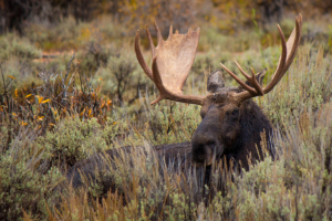
Montana Moose 390
32.4%
Public Land
519,426
acres
9,458 / 3,789ft
Min/Max Elevation
Montana 390 - Unit Overview
Unit 390 for moose covers approximately 519,426 acres, and some of this unit is comprised of public land. The dominant land cover for Unit 390 is evergreen forest. From September through December, this unit receives an average of 1.08 inches of precipitation a month and the heaviest rainfall is in September. Temperatures during hunting seasons typically range from 21°F to 51°F.
Species
Moose
Average Temperature
Average Precipitation
Montana Hunting Maps App
Download today, and you can record, track, and navigate for free.
