Outside+ brings you all of the world’s best exploration maps plus a deep catalog of outdoor content to fuel your adventures. Outside+ gives members best-in-class storytelling, online outdoor education courses, gear and trip reviews, premier film and tv content, and more.
Get Outside+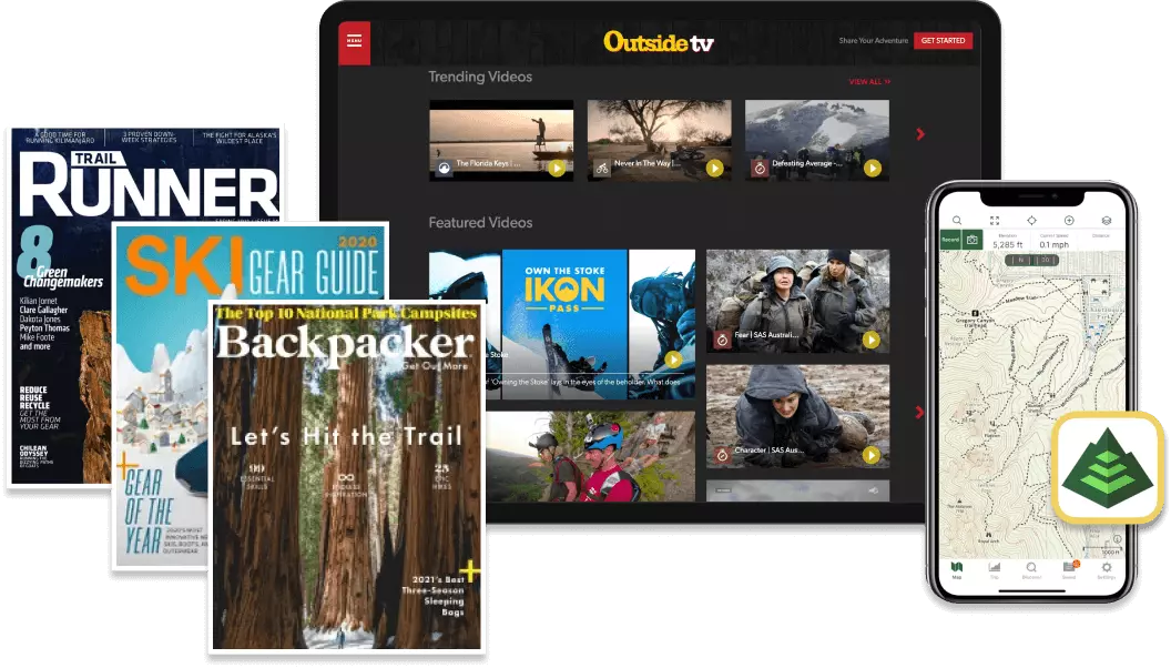
Try the Best Free Hiking Maps App
Download today, and you can record, track, and navigate for free.
