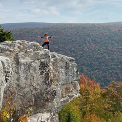
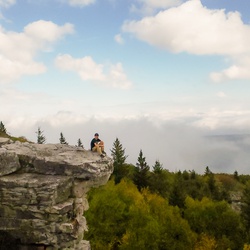
The trail features significant elevation changes with ample switchbacks to ease approach. The hike rewards with excellent views of surrounding area. I returned on the cliff climb approach, which was almost directly downhill. Would not recommend without trekking poles.
★
★
★
★
★


Final ascent to haystack knob, there is no trail to the top so don’t look for one. Follow the railroad grade until you hit one of the two plastic signs or see a red marker on the left. One you hit these go straight up the mountain until you hit a meadow, follow the trail there u til you hit the road, then follow road until you see a shale hillside, ascend this shale section to the top of haystack knob, a gorgeous campsite and 360 views is well worth it.
★
★
★
★
★
North/middle fork trail ends at two really cool dispersed campsites! Rolling hills and access to a small creek at the camps! These trails are primitive so expect mud and if it’s been rainy a few creek crossings…otherwise a nice little hike.
★
★
★
★
North/middle fork trail ends at two really cool dispersed campsites! Rolling hills and access to a small creek at the camps! These trails are primitive so expect mud and if it’s been rainy a few creek crossings…otherwise a nice little hike.
★
★
★
★

Beautiful hike. Took us about 5.5hrs with a dog. We had a stop at the top for lunch with a view!
★
★
★
★
★

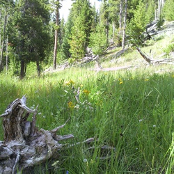
Gentle walk with mostly grassy trail. A little soggy from recent rain. Would be glorious when goldenrod is blooming or for a snowshoe hike.
★
★
★
★

Great local roads, good restaurants in Lewisburg, especially Stardust Cafe.
★
★
★
★
★


First solo backpacking trip. Couldn’t have asked for better weather in the Sods. The dregs of the hurricane made things extra muddy but that’s par for the course. Everyone starts at Bear Rocks but I began at Red Creek. This means more gnarly climbing right away but less of a mass of people to content with. The cherry on top is jumping in the creek right before the end!
★
★
★
★
★

The northwest section of this route is very rugged, muddy, and difficult to traverse...even for ATVs or off-road vehicles. Be prepared to get stuck in mud or to bottom out on the rock climb sections. It's insane to get through, but so much fun!
★
★
★

There's a couple of 3ft deep river crossings at the back end of the loop. Plenty of places to resupply water along the trail. Lots of elevation gain. Beautiful views.
★
★
★
★


Great hike! The waterfalls at the start are gorgeous and balanced rock is cool. Only downside is the trail was quite muddy almost like a swamp at times.
★
★
★
★


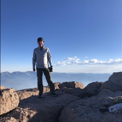
The best 360 degree view when you get to the top. They say it’s Almost Heaven but up there it is Heaven.
★
★
★
★
★


Mostly through the woods on decent but not terribly exciting trails. Breathed Mt trails has some small meadows that are nice. Totally in the woods on Red Creek trail (the creek itself is a few hundred feet below and audible but rarely visible. Rocky Point trail is named appropriately; not one you d ever hike for itself but just to get access to Lions Head. Several informal access trails to get up to Lions Head; take one of the ones closer to Big Stonecoal intersection. the eastern most one is a boulder scramble. Very good views on LH but i prefer the views across the valley from Rohrbaugh Cliffs. Very nice waterfall on Big Stonecoal just west of intersection with Rocky Point trail. Big Stonecoal trail is nicer woods trail with an unexpected beaver pond enveloping the trail near the summmit. Accessed via former FS80 on the west side in canaan valley wildlife refuge.
★
★
★

Views were incredible off of hidden passage trail. Two campsites off that trail. I’d suggest that you just do an in and out using South Prong to Hidden Passage (visit Hiking Upward for a map and info) and don’t do this loop. While the Canyon Rim Trail has a few visas, the entire trail is basically either a grove of rhododendrons overgrown or large boulders. It is very slow going and difficult. Tee Pee, the connector between Canyon Rim and Roaring Plains Trail, is either overgrown rhododendrons, large boulders, or bogs. I’d hate to see this entire loop if it had rained in the past two weeks. Boars Nest is a very rough descent, a lot of elevation very quickly. Total mileage is 16.3 miles, my phone died at 15.51 miles so there’s a gap missing at the end of this trek.
★
★
★
Views were incredible off of hidden passage trail. Two campsites off that trail. I’d suggest that you just do an in and out using South Prong to Hidden Passage (visit Hiking Upward for a map and info) and don’t do this loop. While the Canyon Rim Trail has a few visas, the entire trail is basically either a grove of rhododendrons overgrown or large boulders. It is very slow going and difficult. Tee Pee, the connector between Canyon Rim and Roaring Plains Trail, is either overgrown rhododendrons, large boulders, or bogs. I’d hate to see this entire loop if it had rained in the past two weeks. More importantly, out of everything, this loop was a total of 16.3 miles, not 12 miles.
★
★

Dolly Sods never fails to amaze. We hiked Red Creek Trail from the SW trailhead with a loop that included Big and Little Stonecoal in mind. It was a little bit too early in the season for the loop. When we saw the creek crossing we decided to proceed upstream on Red Creek Trail to its intersection with Fisher Spring Creek trail. Beautiful views and nobody on the trail all day! We had lunch near the confluence of Red and Fisher creeks and returned via the same route. The dogs got a bit wet crossing the tributaries, but we stayed mostly dry. A wonderful 7-ish miler.
★
★
★
★
★

Muddy and beautiful! The view on the west side over Red Creek is amazing.
★
★
★
★
★

Difficult hike with no apparent fresh water source. Amazing views and light traffic make the steep climbs and sketchy overgrown sections of the trail worth it. I did this as an out and back so total distance would have been a little over 15 miles in two days.
★
★
★
★

Fun and engaging terrain on this trail without as much water as the Otter Creek main valley. Forest is quite nice. Would recommend as part of a loop or out and back.
★
★
★
★
★


Great day hike sandwiched between backpacking into Judy Springs camping area at Spruce Knob National Recreation Area. Hike up to highest point in the state of WV for lunch and then down to Seneca Falls before returning to the campsite.
★
★
★
★
★

Loved this hike. It takes you over a mountain, down a railroad track, and out to a beautiful waterfall.
★
★
★
★
★


Beautiful hike we followed from all trails.
Kind of crappy portion on the road which can be easily avoided by staying on yellow birch trail.
Elakala trail -> balanced rock trail -> red spruce trail -> right onto yellow birch trail -> vista to falls -> Canaan loop road -> right yellow birch trail -> back to beginning
★
★
★
★

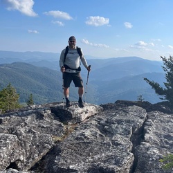
Seneca rocks is beautiful! We hiked up the back off Roy Gap Rd and down the front. An excellent circuit, though the hike up the back was very steep and rocky. We hiked with kids age 7-13.
★
★
★
★
★

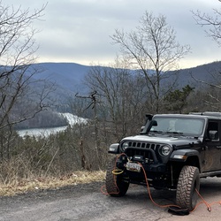
Great scenic drive. There isn’t any technical off roading. A typical vehicle can handle it. Beautiful drive though. Some roads off of it have the gate up but one was open and it got a little rougher but I didn’t get to check the whole thing out. There could be possibilities other times of the year if the gates are open. I was here in November. There are numerous camping spots to pull off for free
★
★
★
★

Overall a really fun hike. Some parts are a bit overgrown and muddy.
★
★
★
★

This is trail’s incline is grueling but if you can make it to the top then the view is worth it. The trip back down was a fraction of the time it took to get up there. If you’re up for it go past the ‘danger’ signs at the observation deck for an even better but dangerous view.
★
★
★
★
★


This hike is vigorous and enjoyable, steep in some stretches but not too severe. Lots of friendly families getting exercise like you. Path is very well tended and easy to follow. When you get to the top you can’t really see the great rocks above unless you go up passed the warning sign about 15 people dying over the past years.
★
★
★
★

This was an 8 mile hike Very nice trail. Many switch backs to choose from little muddy in some areas
★
★
★
★
★

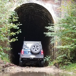
4x4 off-road trail. Most stock 4x4 should be able to make it through.
★
★
★
★

We hiled this backward according to this listing, as we started our trip at the top of the mountain. Pretty nice hike for our final leg of a 3 day trip. Not too difficult, mostly downhill (again, because we came from the opposite direction), and still enough beautiful scenery to keep you happy along the way. Soggy, muddy, and wet in a lot of places. But that is to be expected this time of year. Take your time hopping from rock to rick and you'll be fine. Trekking poles definitely help.
★
★
★
★


 stars
stars