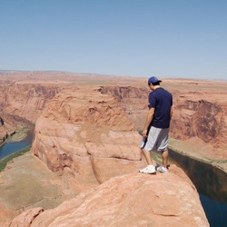
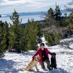
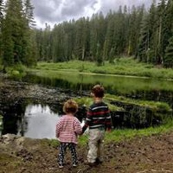
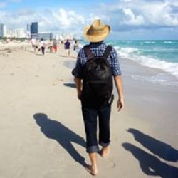
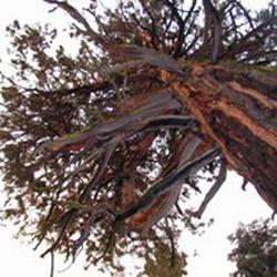
Miley and Snickers ran off and it cost me about 45 minutes had to turn back beautiful view
★
★
★
★
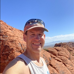
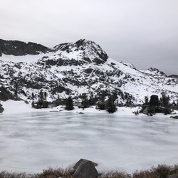
Perfect temps. Left at 9:40 from Rose parking lot. Probably went faster than I should have up to the saddle staying with a young couple who was running up to Rose.
Never felt great on this run. Tripped several times. Didn’t feel high energy. Legs really started to ache for the last 10 miles. Just wasn’t a great day.
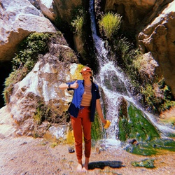
Colors were beautiful tho. Late change this year. Still a lot of green. Not peaked yet. Maybe in another week.
★
★
★
★
★
Perfect temps. Left at 9:40 from Rose parking lot. Probably went faster than I should have up to the saddle staying with a young couple who was running up to Rose.
Never felt great on this run. Tripped several times. Didn’t feel high energy. Legs really started to ache for the last 10 miles. Just wasn’t a great day.
Colors were beautiful tho. Late change this year. Still a lot of green. Not peaked yet. Maybe in another week.
★
★
★
★
★

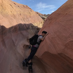
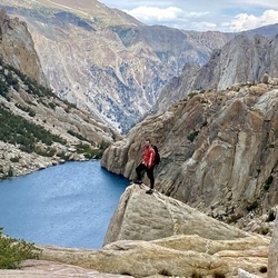
The almost 4 mile approach on the PCT is lovely and rolling hills with little gain (felt the gain most on way out)
The chute is obvious on the far right side of Reynolds ((NE)) the gully is loose choss rock so staggering with your partner is smart to avoid rollers.
We gained the saddle and stayed high, traversing the West face of the summit. Once traversed you gain a view of a low angle volcanic slab that is a no fall zone but wide and chill to summit. Don’t pull on any rock, trust in the feet. Super fun Sierra scramble with some exposure for this area of the mountains. Felt more like the Eastern Sierra with some technical involvement rather than just a slog or hike.
★
★
★
★

One of my favorite horseback riding trails. Not difficult at all.
★
★
★
★
★

I began this hike from my campsite following the paved bat trail to its end, then continued on the unofficial trail up the drainage until it petered out. I continued upward cross-country until I reached Bristlecone Trail. I followed it south for a short way thinking I would come to a sign saying the trail is closed. Looking downslope I could see a favorite site of mine for camping/picnicking and so left the trail again to reach it more quickly. After a short break I found the trail again and headed back north. I missed the junction for the old trail that heads higher into the bristlecone zone, so I continued to the junction with the Bonanza Trail, which makes a steady climb to the old and now unofficial Bristlecone Trail, where I would have come to if I had not missed the trail junction earlier. I hiked south through the bristlecones for a while until I reached the distance I calculated would be 7.62 miles if I began my return hike to my campsite and turned around and retraced my steps back to the junction with Bonanza Trail. Back on the Lower Bristlecone Trail I headed down to my campsite. Soon I came to a large sign stating the trail was closed! I had been hiking in the forbidden zone all day! The rest of the hike was easy down the old road and within an hour or so I was back at camp. But my total mileage was 9.44, not 7.62! Oops!
★
★
★

This loop is an absolute Jarbidge classic! Consider starting at Slide Creek Trailhead, walk over to the Hummingbird Springs Trailhead and into the Wilderness. I went over 4th of July weekend and there was good water coming out Hummingbird Springs about 2.5-3 miles down the trail. Cottonwood Creek appeared to have a good amount of water flowing another 1-2 miles down the trail also. I had a bunch of small water sources along God’s Pocket Peak Trail but not sure how reliable any of the other water sources are. Plenty of water once you go over the passes at Mary’s River Peak and hit Emerald Lake. This trail goes from aspen meadows, high craggy mountains, Emerald Lake (good Brook trout fishing), and down into a desert canyon before climbing back out Slide Creek. Red band trout fishing excellent along East Fork Jarbidge River. Slide Creek Trail is a very well designed trail so it isn’t as much of a chore coming out as one might think.
★
★
★
★
★

Very nice walk with streams on side and beautiful views into woods and of mountains. Dogs can be off leash part of the time. Plan to do multiple times. Allow 1 hour from campsite. Mosquitos were not an issue this morning.
★
★
★
★
Didn’t care for hike. Mosquitos were thick. Trail is not near water and all views are behind you. Water crossings were many wet feet. Area recently cleared and lots of wood piles. Lake not visible often. Walk back on road was annoying. Trail is rough. Would not do again.
★


Beautiful views and wild flowers, exposed trail initially, would avoid in hot weather
★
★
★
★
★

Narrow and rocky path and no tree cover so wear your sunscreen! Overall a nice hike with few people and a stunning waterfall!
★
★
★
★

Great day hike! Easy graded terrain, plenty of switchbacks, lots of flowing water. Well maintained, with the exception of a large tree fallen across the trail in the first half mile. It did it in a little over two hours going at a steady pace of a little under 3mph. Highly recommend for a day hike in the Reno area!
★
★
★
★
★

Eagle’s Nest Trail has fabulous snow mountain and lush green valley view.
★
★
★
★

Great fall hike, two gorgeous lakes a short distance apart on a well-marked trail.
★
★
★
★

This is a beautiful diverse 4wheel drive trail through a pine forest and aspens groves offering beautiful fall cover. It takes you to the top of Mt Patterson at 11,675 feet. Amazing views throughout the entire trail.
★
★
★
★
★

My fave hike of all in this area. Great training grounds for Mt Rose Summit.
★
★
★
★
★


Really fun and exhilarating climb to Ruby Dome! Beautiful views and an epic summit block. Definitely a hike you want to be prepared for and research beforehand. There is exposure of steep slabs depending on what route you take to ascend the west ridge. I recommend this for anyone looking for an adventure
★
★
★
★
★

Very Sandy and extremely down low. Horse riders had never seen a biker here before.
Great horse trails I’m sure. Lots of dogs and hikers shlogging thru the sand.
★
★

This hike was amazing! Views, views, and more views! The road up to the trailhead does require a high clearance vehicle. There is no snow on the trail at all. YES like everyone says do the trail CLOCKWISE! You do need trek poles coming down Job’s Sister! Glad I had mine and my knee braces! So happy I can say I have officially done the Tahoe Triple Crown!!
★
★
★
★
★

Got rained out 30 min from peak. Lightning caused us to turn around.
★
★
★
★


Great hike to train on, rapid ascend with a few flat breaks here and there.
★
★
★
★
★

If someone reads this in the next few days, please bring up new US flag! It is in terrible condition.
Epic views, long, steep in parts but not insane. Not for beginners but rewarding. Can't believe there is still snow in August!! Not walking through any snow though.
★
★
★
★
★

Always a great hike, even on one of the hottest days in history. Get up there early and it’s amazing! Still a tiny bit of snow and tons of flowers at the lower elevations
★
★
★
★
★

Amazing hike to Big Falls. Not sure I got to the actual falls, but I ended at waterfall about 20ft high. Maybe this is the place! A lot of water during my trip in early July. Some tricky spots to navigate along the water runoff.
★
★
★
★
★

Snow melt has made the falls spectacular. Super hike and not too long. Enjoy!!
★
★
★
★
★


This is a very challenging hike, start to finish. For anyone who has hiked San Gorgonio in Southern California, it’s very similar, especially to the Fish Creek trail, but much easier to get to and a little bit harder. (This trail climbs a few hundred feet higher over a few less miles)
Fall colors on the lower part, which is shaded most of the time. Lots of wildlife, including a few horses. The upper parts, including Griffith Peak, are almost entirely exposed, so take sun protection. It was pretty cool, but I still went through 3 liters of water and could have drank more. If it was hot, more water would have definitely been required, but there are some springs up there.
From the top you have unobstructed views for hundreds of miles in all directions! Though I didn’t do it for time reasons, you could also add Mummy Mountain and bag three peaks if you wanted, but that one is a very technical and difficult climb. I don’t know if I would have been physically able to add that one, but it’s an option if you’re doing the south and north loops instead of an out and back as I did.
★
★
★
★
★
Insane ridge riding - maxing out what the bikes can do at elevation!
★
★
★
★
★

Spectacular wildflowers August 1. Great views the whole way up. The elevation is a steady gain the whole way. Cute small waterfall and bridge at halfway point. The lake itself is small but pretty, and plenty of area to explore at the top.
★
★
★
★
★


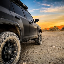
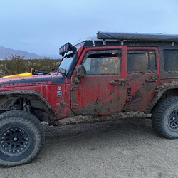
This was a great drive with lots of diverse scenery. Not to difficult overall a 4 or 5. High clearance a must.
★
★
★
★
Nice trail don’t follow signs to Secret Lake take meadow r
Trail (low route)
★
★
★
★
Very remote, only come out here with a high clearance vehicle. Lonely, beautiful, good camping at the trail head.
★
★
★
★
★

Big loop with lots to see! Begins or ends with a few highway miles but then a great variety of open desert, hill climbs, narrow canyons, abandoned mines and ranch houses and even an airport in the middle of nowhere! Pack a lunch and a lot of water!
★
★
★
★
★


Nice place to fish, camp, ride olde rodes (ADV) to cut through or make some loops
★
★
★
★
★

Spectacular trail with spectacular views. Hard to describe how beautiful driving through these canyons and streambeds is. If you’re driving through Austin with a 4 x 4 you have to hit this area just as a quick detour. It only took me about an hour or so to cross the entire mountain range with my RAV4
★
★
★
★
★


Not very technical but fairly strenuous. A great training trail. The last 1.5 miles were cold, windy and still covered with a bit of snow. Bring gloves, handwarmers and a windbreaker with a hood (in early May anyway).
★
★
★
★
★


Good spot to escape the heat and do some camping in the trees.
★
★
★
★

This is a fun trail. But you must know how to navigate small rocks and washed out trails. Know how to use 4 wheel low to make it easier. Great views and some cool hidden stuff you need to find on your own.
★
★
★
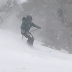
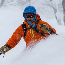
Beautiful day. Firm but edgeable on the way up. Super soft perfect on the way down.
Parked at Red Lake. Skinned across the lake then walked across the road.
With Nigel Mary Chris Colleen
★
★
★
★
★

Lots of deep snow. Most trails are completely covered but Cathedral Rock trail is visible until the end where you get stuck and have to turn around. Expect ankle to knee deep steps without snowshoes.
★
★
★
★
Really great weather especially for December. But we need precipitation! So this area will be closed once we get enough snow. Be pretty next spring
★
★
★
★


Great hunting, apparently, if not for the absence of deer. Plenty of hunters though! Not me. The route I took was missing a trail possibly a third of the way, particularly Whitecliff trail and silver creek trail I believe. Still, absolutely beautiful. Whitecliff lake is stunning, and Llewelyn Falls was quite pleasant. Furthermore, although the trail was gone for much of it, the actual hiking was fun.
★
★
★
★

This is an easy 3-day trip. Trucks can drive into Leavitt Lake, but there was plenty of privacy.
Curious why there is no shown trail connecting the trail across upper West Walker. The waterfall along the PCT is a good target.
★
★
★


One of my favorite hikes yet. It was hot sometimes. Temperature low 80s or upper 70’s. Breeze off Tahoe was nice
★
★
★
★
★

Good trail with several waterfalls along Thomas Creek. Two more waterfalls at the headwall at the end of the canyon.
★
★
★
★
★


Risue Road has not yet melted out for the season. Patches were snowy enough that it did not feel safe to drive them, so I turned around.
★
★
★


Fun hike in the snow with beautiful views. We couldn't get to the trailhead parking area as the last bit of road was closed, which added 2 miles. If you go in winter, be very careful at the falls. I was caught in a sudden icefall and while my injury was mild, the next person may not be so lucky. Would definitely do it again though!
★
★
★
★

Beautiful Fall hike. Gentle hike with a few ups and downs. Lakes and peaks
★
★
★
★
★

There’s real wilderness feel here, not much of a maintained trail but useable because of enough foot traffic on it.
★
★
★
★
★

This is an easy up and back along Thomas creek. It is especially pretty in the fall. It is about 2 miles to reach the bridge as a turn around point. You can go back or go to the cut off and head up to dry pond or continue to the upper Thomas trail.
★
★
★
★

The word Easy is relative lmao
But it is an easy to follow path if that’s what this means
★
★
★
★
★

We took Jeeps on this trail and it was nice. Not hard at all and did not require 4WD. Any SUV could likely do this trail.
★
★
★

Second time reaching the top in 2 weeks. First time was from the south side and second time was coming from the north. You can make better time going up the north side and I found it to be easier and more enjoyable with better views, however, you can make better time coming down the south. North side is slightly shorter mileage wise but overall the total time is about the same. If I were to pick between the two next time, I would go up the north side.
★
★
★
★
I ran this September 6 from Mt Rose Summit to the Brockway TH. Smokey in lower elevations but better once up on TRT. Hazy views but spectacular of Lake Tahoe. An easy hour plus run to Relay Oeak then a screamin downhill on perfectly pitched trail. In mid eighties with hazy smoke/cloud cover. This was a shuttle and one of my favorite runs on the TRT. Recommend doing this in July or August when the wild flowers are peaking.
★
★
★
★
★

We extended the loop we did last time. Easy trail to hike. Trekking poles not required. The pause stopped time at the end was a little long because I forgot to stop the hike while we were relaxing at the picnic tables.
★
★
★
★

A good hike to beat the desert heat an hour away. Went in mid June there was no spring or water to see but did see lots of butterflies. Did this hike with a 5 year old in 2 hours.
★
★
★
Dusty road hike wit great views. Driving the dirt roads is fun.
★
★
★

The hike is easy, (after the initial short uphill section) the views of both sides of the valley cliffs are the best
★
★
★
★
★

There’s beauty to be seen and experienced in every direction. The PCT goes right by the lakes and hikers come and go daily. Some overlanders come thru for a night or a few days. Come here mid week if possible, as it gets busier on the weekends.
★
★
★
★
★
This is a nice trail for elevation gain. We hiked with some inexperienced hikers and some more experienced. Going up the loop the trail is wide and we’ll used. Coming back down the way we did is much narrower. We saw 5 deer, heard birdsong and more chipmunks than I could count. The time of the hike was long because of our newbies. An experienced group could do it much faster.
★
★
★
★

Great trail right alongside the creek & shady until switchbacks. Great view of Mt Rose summit and ski hill. Downfall was the last mile on the road back to the car.
★
★
★
★
★


This was a great side by side drive. Really enjoyed the forest and the lake.
★
★
★
★
★
Great hike to the summit of Mt Charleston. Take plenty of water (I had 6 liters and ran out at the end) as there are no water sources. Not for the occasional hiker.
★
★
★
★
★
Trial start to Class 4 hike/scramble (elevation starts at ~8000 ft) to three repels (in water this time of year) in Mt. Charleston. Beautiful all around.
★
★
★
★
★

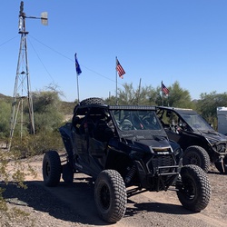
Rode Lt Dans Poker run with my brother and Cliff Cook and RPS PERFORMANCE today. Wilson Canyon, beautiful day! My brother is a complete badass.....first ride in a year and we rocked 97 miles in the desert!
★
★
★
★
★

After 7 tries to make it to the top, I finally did it an boy did it feel good. Thanks Lord for giving me the strength and perseverance at almost 60 to do this
★
★
★
★
★
 stars
stars
We love this loop. I definitely enjoy starting at the Lower parking and ending with the downhill walk back to the car along the road. Still some ice/snow along the Upper trail, but absolutely passable without equipment.
★
★
★
★
★
Best hike in the area .... snow and a waterfall in the spring
★
★
★
★
★

After 7 tries I finally made it to the top!!! I found out a couple years later that I have diabetes and the reason I always got dizzy near the top was probably low glucose levels.
★
★
★
★
★
This is a popular loop for hikers, bikers, and occasionally horses. The 1000 feet of elevation gain is rather gradual up to Dry Pond with several switch backs. The views are nice. Dry Pond is a meadow that is basically, dry. So don’t go for the pond. Go for Thomas and Whites Creeks. They provide beautiful scenery along the lower trails. To make it a loop you do have to hike along Timberline road to connect the two trail heads. Some may choose to do point to point with two cars to avoid the walk along the road.
★
★
★
★

Great family hike. There was still a lot of color in the quaking aspens, though it appears to be going away fast.
★
★
★
★

The hike was great. You’ll get to get out of the Vegas heat when you reach the trail head. About a 20* difference than the Strip. Don’t expect too much of a waterfall. The “falls” was more like a stream. It was incline going all the way up to the falls. Some parts of the trail needs to be touched up but other than that great hike. I brought along my 9year old Miniature Dachshund and he made it up there worth no problems. Difficulty: Moderate
★
★
★
★

Popular area to hike.
This is just a mileage from the junction of Fletcher Peak Trailhead to to the start of the North Loop Trailhead.
★
★
★
Great drive with many off shoot roads that could be a potential hike in solitude during the week. Weekends are busy. Crystal Peak Mine is a place to take kids where they can dig for crystals. There is also a dirt road that joins Dog Valley Road at the top before dropping down to Verdi & this road connects to the Reservoir.
★
★
★
★

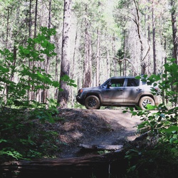
We were Jeeping the OHV forest trails. Not a person in sight. I started Recording to soon. The treck really started at sweet water creek. Most divers tie yet.
★
★
★
★
★
Great hike through the trees on a section of the PCT. lots of streams and 6 lakes for doggies. Met several through hikers. Not a lot of altitude change.
★
★
★
★
★
I have often hiked the Jones Creek trail, but only to the summit. Yesterday I completed the Jones/White Creek Loop. I climbed the Jones Creek side then came down Whites Creek. You will pass through Aspen glades, cedar and pine forests. Lots of wild flowers. White Creek is running fast now with the snow melt but is passable crossing the log bridges. I would suggest the use of trekking poles.
★
★
★
★
★

Took my 3 1/2 year old and 5 year hiking up to the waterfall (around 8280ft). They did great and didn’t need to be carried. Just make sure you bring plenty of water, snacks, and take breaks and they’ll make it no problem.
★
★
★
★
★

Nice hike. The 1st mike is pretty flat and exposed to the sun but once you get to the 1st hill it starts going towards a pass. About 3,000 foot elevation gain which gives great views of the valley.
★
★
★
★
No snow on the Jones creek side of the loop. Wild flowers just starting to bloom.
★
★
★
★

Beautiful day for a solo hike. Water is really flowing in the creeks!
★
★
★
★

I consider this hike to be more of a moderate hike. Did it on Wednesday and it was awesome. About half way up there is an avalanche that has taken out some of the trail. If your capable you can traverse up the avalanche diagonally about 50 yards and find the trail again. Someone has marked it with rocks. The view at the top is well worth the work to get there
★
★
★
★
★

Dry pond trail loop. Snow is gone, trail is in great condition!
★
★
★
★


 stars
stars


 stars
stars


 stars
stars