
Beautiful run. You have to cut through a ranch, so ask permission to go.
★
★
★
★
★


Nice hike and good trail. Great views up at the top and some nice rock formations to block the wind.
★
★
★
★
★


Great trail and easy backpacking trip to get away. Blue lake had plenty of spots to camp, although it was busy. Plenty of water sources and great views of crazy peak and granite peak.
★
★
★
★
★

One of my favorite xc ski courses when I just want to punch out some K, or distance, or whatever the preferred nomenclature.
★
★
★
★
★

Hard but fun, pretty mellow until Blackmore lake, then it steps up pretty quick into steeper terrain, you climb the steepest getting onto Blackmore ridge then it’s a boot back to summit from there
★
★
★
★
★

Steep incline pretty much the whole way. Going down was a breeze. Pretty rocky though
★
★
★
★
★

Took about two hours getting up and an hour coming back on this scenic Bridger mountain. The saddle and peak offer amazing views. If you have binoculars you’ll spot goats all around.
Do yourself a favor and jump into Fairy lake, which is immediately next to the trailhead, and soak out the soreness. Bring some water shoes to the lake as the shallows are rocky.
★
★
★
★
★

One of the few single track trails in this area. Fun. So glad it is here!
★
★
★
★
★


Beautiful hike even if it was raining at times. 10 mile drive in on Storm Castle Road. Road was in very good condition.
Hiked with Andrea and Cathy W.
★
★
★
★
★

Very pretty lake in a neat little basin-ish area close to the peaks nearby.
★
★
★

Awesome trail. Steady incline but not overwhelming until the last mile or so before Mirror lake. Then it’s quite the climb. Lots of shade on the trail and the lake was so peaceful. Not a ton of spots but enough to accommodate a few groups.
★
★
★
★
★

!If you are looking to get to Windy Pass Cabin , there are MUCH easier ways to get there (ie windy pass trailhead out of Portal Creek drainage)!
If you are looking for a fantastic 8 mile hike, it is lovely, but beware of cruel switchbacks and overgrown and flooded trails!
★
★
★
★
★
It’s a hard backpacking trip, but the views, campsites, fun with friends, nature left us wanting more. We saw no bears, but did see some bear scat- so do bring your bear spray.
★
★
★
★
★

Nice moderate hike. Some areas pretty muddy and lots of creek crossings on the 44 section with limited logs/stepping stones but we were always able to find a way across.
★
★
★
★
★

Jed, Omar, Pagel… 2-3 feet of fresh. Borderline too much snow. Sick meadows 12 mile trail in to the zone
★
★
★
★
★

Stunning views of major peaks, classic alpine lakes -- worth the grunt up "Heartbreak Hill", the headwall up from the Zimmer Creek. One moonlit night by Lower Aero, a Mountain Goat came right up to our tent door to check us out. Another time, trout were leaping out of the stream between Upper and Lower.TAKE CARE on the rock band down to Lower: we had to hike out in the dark to get EMT's up to a guy who compound fractured his leg. He was downclimbing the rock band to the lake, foolishly facing outwards; his pack caught on the rock, sent him tumbling. He leg caught in the bergschrund near the base while his body kept going down the snowfield. It was bloody ugly. We splinted his leg w/ fly rod cases and sleeping pads. He was LifeFlighted next morning to Billings.
★
★
★
★
★


Easy and straightforward path to hike to Wolverine bowl. Mix of sun and shade. Follows the official trail before breaking off on a climbers trails just before reaching a creek. If you get wet feet, you’ve gone to far.
★
★
★
★
★


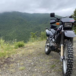
Easy loose rocks to shake the rust off a new dirt bike or first ride of a season
★
★
★
★
★

From the summit use this route down. It stays on the ridge proper for a bit (lots of exposure, views, and almost knife edge) and then descends the main gulley down. 3rd class or lower for most of it. Perhaps a touch of 4th?
★
★
★
★
★
Mtb to Ross pass and then hike to reach the North Face of Ross Peak. The off trail hike is gentle and easy way to reach the climbing and offers nice views through the meadows.
★
★
★
★
★
This is a great hike! We hiked the trail counterclockwise. From the parking lot, the trail had a slight climb before descending down to the creek. We followed trail 44 along Lost Creek to the trail junction with 450 making a loop back to the parking lot. The hike involved two creek crossing without bridges or adequate stepping stones for the still high water flow. After the final creek crossing, the trail curved left and began following a ridge that included amazing views of the Absoraka range including Livingston Peak. The trail ascended through lush fields of wildflowers including balsamroot, lupine, sticky geranium, and scarlet paintbrush. Flowers were in peak bloom the first week of July. Great mix of views and habitats.
★
★
★
★
★

Beautiful views, but a steep hike. Snow covered large portions of alpine sections, but the ridge was clear!
★
★
★
★
★

Was a great trail ride with entertaining guides. Guide found former bosses wallet with stack of bills in it finders keepers!!
★
★
★
★
★

Beautiful hike that meanders about 1.4 miles through various terrain. Crawl over and under logs, cross streams, and scramble up rocky slopes still partially covered with some snow and ice (in Mid May!) to get to a pretty waterfall.
★
★
★
★
★

Gorgeous hike. Lack on snow in late November was good. Still ice in shaded parts but no yaktrax needed. Absolutely worth the howling wind this time of year.
★
★
★
★
★

Biggest reward for not too much effort. Did it back in July 2015 during my first Montana visit. One of the best day hikes ever. The cirque valley on the way up is so peaceful, and once you get up on the ridge you start seeing mountain goats. The summit is not too far up after that.
★
★
★
★
★

Always fun. Make sure to go past the lane at the top and keep climbing. I have not yet gone to the saddle but hope to next time.
★
★
★
★
★

Gorgeous hike. Lack on snow in late November was good. Still ice in shaded parts but no yaktrax needed. Absolutely worth the howling wind this time of year.
★
★
★
★
★

The first parking lot for Garnet Mt offers a trail thats both shaded and sunny. Lots of gorgeous views across the Gallatin canyon and fall foliage was at its peak!
★
★
★
★

Think we stopped a bit early on the climb. First 1.5 miles is a bit rough. Past the scree fields is nice.
★
★
★

Sacajawea Pass, great short hike with big rewards. Great for a pit stop to summit Sacajawea Peak or Pom peak.
★
★
★
★
★


The trail starts off easy for the first 6 miles. There’s a stop at a little cabin and after that pause the challenging part of the trail take place. Almost any car could make it up the first 6 miles, but after that four-wheel-drive is recommended for the remainder of the journey. There’s some gorgeous views that overlooks the mountains. Some of the photos contain the smoke yeah if you see through it, the natural beauty will come alive. The trail takes several hours. There are not many places to pause but take the moment you have and enjoy them.
★
★
★
★
★


This hike goes through a burn from 2007. Little regrowth. Interesting. Water high. Flowers ok but not great. Spruce doug fir. Lodge pole good mtn bike ride
★
★
★
This hike goes through a burn from 2007. Little regrowth. Interesting. Water high. Flowers ok but not great. Spruce doug fir. Lodge pole good mtn bike ride
★
★
★

Really beautiful area with easy access for beginners and some more advanced scrambles and rock climbing for those looking to challenge themselves. Lots of foto opportunities and crags and caves for those willing to explore.
★
★
★
★
★

This is a great spot. Lots of bang for the buck.
Relatively easy depending on the time of the year. Even late April there was snow on the top. Made a little bit difficult and extremely muddy. Don’t think you’re going up there with 8 ounces of water be prepared for winter conditions and bring the 10 essentials.
★
★
★
★
★


 stars
stars
Grotto Falls is a fabulous hike in Hyalite. The fresh snowfall made for a fun day with the kids.
★
★
★
★
★
 stars
stars
Went all the way up to the rock cairn, about 3.25 miles in. The trail was manageable with just micro spikes, but along the face the snow drifts were a little deep, and this was the best turn-around spot.
★
★
★
★
★

A guide took me and a few others on a trip up into the backcountry on sleds. Great ride that wasn’t too technical for someone from Florida with almost zero experience. I did see some incredible scenery and there were plenty of other trails we passed that were more technical.
★
★
★
★
★


Started track 45 minutes, .5 - .75 miles, and about 600’ up into hike. Detoured up Ellie Creek to avoid bull moose on ridge trail. Stopped many times to cut deadfall.
★
★
★
★
★


Great scenery all the way in. Moderate intensity. In early August, the wildflowers are out of this world. Please stay on the trail and do not cut straight up the hill.
★
★
★
★
★

Started the run in the morning fog. As it lifted there were scenic views of the surrounding mountains and Hebgan Lake. Nice views for an area with an over abundance of lodge pole and flat straight roads
★
★
★
★


What was once a nice quiet hike has turned into a zoo. The trail is littered with dog poo bags and actually reeks of dog urine. Popularity comes with a cost and in this case a once nice hike has been ruined.
★


Great first hike for someone new to being in an alpine environment, and also a fun hike for more experienced hikers. This was my fiancé’s first “big peak” and we had a great time!
★
★
★
★
★

Great trail. The road to the north trailhead is rough and need high clearance to get up it. Most of the elevation is in the last mile or so. Not many places to fill up water. Just a small creek at top that I would not rely on through summer.
★
★
★
★


Trail is well maintained. About a 2000 foot elevation gain over the course of four miles. The last mile and a half are pretty steep by not hard.
★
★
★
★
★


Mid May has too much snow pack in too many areas that make it too treacherous to qualify this as an “easy” or even “moderate” hike. This hike is TREACHEROUS at least with the snow pack in mid-May.
★
★
★
Hiked in mid-May. Lots of snow pack still on last 60% of trail. The final 1/4 of the trail...nearest the dam site... was not “easy”... it was not “moderate”... it wasn’t even “difficult” it was TREACHEROUS! Like stare down a rock-laden cliff at the last moments of your life as you hang in peril hoping the snow pack 8” wide “trail” you’ve got won’t give way and end your life.
★
★
★
Midday, middle of May, beautiful landscape, roaring Rock Creek.. spring flowers. Keep an eye out for bears! Party of two- each of us wearing bear bells- no trouble.
★
★
★
★

Great ski resort. Lots of mountain to ski and explore. A few rocks in different places higher up on the mountain but overall real fun.
Know your skill set and know where you’re going.
★
★
★
★
★

A very beautiful and relaxing 4 mile out and back to a serene saddle. I’m assuming you can go further, but I had to make it to dinner. Enjoyed a nice rest on some rocks about 3.5 miles up.
★
★
★

Great trail, awesome views. Trail is very rocky and is a steady climb from start to finish. The lake at the top is worth the trip.
★
★
★
★
Pretty great hike if you are looking for a short afternoon activity. Trail No. 44 is nicely shaded and goes along a creek, and Trail No. 450 gives you some great views and plenty of sunshine.
★
★
★

Great long hike three passes going over great veiws few people. Hike from Mary lake to crow is brutal as it is bushwhacking and boulder hoping no trail only experienced people should try this total Miles was 28.5 as my phone didn’t pick up couple spots. Fishing fun at all lakes.
★
★
★
★


Great hike to a beautiful lake, but it’s 3300 feet of elevation gain over five miles. Next time I’ll camp there for a night or two.
★
★
★
★

Very nice hike scenic and lots of wild flowers. Good trail conditions too.
★
★
★
★
★

Great hike-spots where it is rocky but a good hike for most hikers. About a 4 mile hike from top of chairlift down.
★
★
★
★
★

Fun up hill hike. Followed a trail to 7000ft then bushwhacked up to 7200 and back home.
★
★
★
★


 stars
stars


 stars
stars


