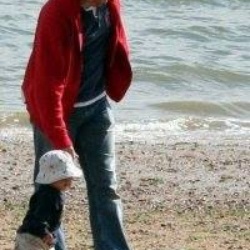
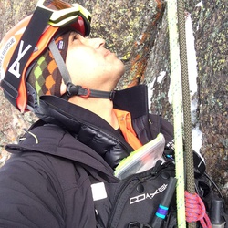
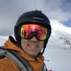
It was an awesome ride. We went late in the evening though, which made it tough coming back, but the lights worked really good. It was a little rocky towards the top, but it was a great ride next time we want to do it early in the day.
★
★
★
★
★

Camped at one of the Eagle Lakes on the first night and the spent the day driving up to Signal Peak which is harder than before. Came back down to camp next to Yerba Buena River. Also did some night trail riding.
★
★
★
★
★

C home
lol. No l a g!m. ‘
P.
G xpzqzj. 9,/‘ pm l’mm +. C y no l. 9 o momo
没’. M p. P. M. Mom @ &@
‘Mm¥ m
★

This is a great Moto trail. I hiked it to check it out because I heard it was really really tough. There are two sections that are challenging, but the rest of the trail is epic. Definitely need your A game!
★
★
★
★
★


Fabulous day riding with old friends and a wide open road! I’ll be taking this trip again sometime.
★
★
★
★
★


This is a great horseback ride to a lovely little lake. The views are fabulous and there were well spaces water sources along the way. Oh and every horses dream- lots of green grass
★
★
★
★

It was a nice hike, easy elevation nice trail. Lots of people lots of dogs and lots of noise from I 80 all the way to the lake. Probably a nice day on a weekday.
★
★
★

Hiked this on 12/28/23. It was pretty much packed snow the first two thirds of the way and snowshoes were not needed (but microspikes and trekking poles kept the slippage to a minimum). The snow was not particular deep, either.
Once you turn off the road to the Castle Peak trail you will likely soon want snowshoes with heel lifts. The way becomes increasingly steep and its difficult to find the right path to the top. There is one stretch that is steep enough to slide but I didn't see any avalanche run out areas (I could have missed them)
But once you do you are rewarded with some great views (and a lot of wind). We did not make it to Castle Peak itself, judging the finally bit of path there to be a touch too difficult and maybe a bit risky
There were not a lot of other snowshoers, skiers or snowboarders along the way, but there were a few.
Coming down was a bit of a challenge with lots of sliding falls (trekking poles with snowbaskets really helped) until the slope eased a bit.
New storms coming this weekend so conditions will likely be a lot different in a few days.
★
★
★
★


Great ride! Grunt climb up 1,600ft straight up but worth it on the downhill.
★
★
★
★
★

Warm day temps
East northeast winds.
North side hard but good south side perfect corn
★
★
★
★
★

We attempted the trail (from the bottom) with horses and although they were surefooted and sensible, this trail is too bouldery to safely take horses on. Ended up abandoning the hike-a-ride after less than half a mile (and had a hard job getting the horses down again). Very sad because it looked beautiful. May attempt to get there via the Salmon Lake trailhead another day (or just come back and hike it on foot :) ).
★
★
★
★
★

This was spectacular! The expansive views from the high ridge were beautiful and slightly exhilarating if you have any (even irrational) discomfort with heights. The wildflowers were profuse and vibrant and a constant source of delight.
★
★
★
★
★
Spectacular!! Being so high and on a ridge was thrilling. I was anxious about potentially having to traverse a snow field but I only crossed snow a few times and the patches were small. The wildflowers were in full bloom and spanned huge fields. Long!
★
★
★
★
★

Drive from Meadow Lake to Jackson Meadow Reservoir is very rough. I have a 2” Dobinsons IMS lift on 33’s on my Sequoia with full skids and rock rails and I’m surprised I made it. The rear diff skid has a few new hits. Outside of Meadow to Jackson the roads are fine.
★
★
★
★
★

Lots of steep climbs, some on loose scree, through woods, meadows, and open granite hillsides. The views are worth it!
★
★
★
★
★

I love this section of the Tahoe Rim Trail. This year the section from the border of the granite chief wilderness and the Tahoe Forest down to the peak 2 miles above Barker Pass Road and was very snowy on June 7. I would not have wanted to do it under a time constraint.
★
★
★
★
Very pretty hike through granite and forest land, over exposed saddles and ending in a rocky overlook. The trail is great. Today there was a good amount of snow covering about 40% of the trail. I lost the trail a few times, but not for long. Cold! I was glad to have layers and gloves.
★
★
★
★
★

Excellent training hike. 1900 feet of ascent. Dirt road and overland hiking.
★
★
★
★
★

Motorcycle ride to the Placer Co Big Trees grove. Amazing ride along Mosquito Ridge Road and beautiful hike in the grove. Hidden treasure!
★
★
★
★
★
Frog Lake exit up by Castle Peak then down a nice face and then through the Castle Peak highway (which sucks).
★
★
★
★
Day one of a 4 day hut trip. Entered by Castle Peak and did the north side to get to Frog Lake. Then did a quick lap on a south slope.
★
★
★
★

This is a great place to ride for a good workout! It’s often said riding 50 miles here is like riding 80 miles anywhere else. Constant switchbacks.
★
★
★
★
★


I hiked this trail on July 4, 2021. Trail has a suspension bridge over the North Fork of the American River and then runs along the River upstream. Ascent is 1,700 feet not 1,017 feet. I would recommend going in spring, fall, or early morning in summer to avoid ascent from bottom of the canyon to trailhead on south facing slope during hot part of the day.
★
★
★

Travelled to High Loch Leven L from Big Bend trailhead 7-21 to 7-23. Trail is good but rocky. Hike is harder than the 4 miles (8 RT) advertised. Lakes are beautiful and VERY swimmable (warmest water I’ve felt in the Sierras). Very few bugs. Light crowds (High LL Lk probably can handle about 6 groups with reasonable privacy. Best campsites on SE side. No bear issues while we were there.
★
★
★
★
★
Awesome hike to the summit of the Buttes. Steep, but it’s a great reward.
★
★
★
★
★


Great Lakes. This time of year, there is still a ton of snow run off. The trail is often under water so plan to take extra time. Snow also forced a couple go around a near the summit
★
★
★
I love being in the woods. The trail is in not maintained, but can still be found. You just have to watch where your going.
★
★
★
★
★
Although, we enjoyed the hike, the information is very misleading and this hike is not considered a moderate but in fact it is difficult! The loop was not 7.48 miles, it was actually 10.93 miles and took us 8.5 hrs to complete. If you plan to hike this in may be prepared for snow as we encountered for almost half the hike. I wouldn’t recommend to bringing children on this hike, our 8 yr couldn’t finish and I had to carry our child for the last 1-1.5 mile.
★
★
★

This was a a great winter hike with snowshoes. Snow was good above 5k elevation and the view was incredible at the top
★
★
★
★
★

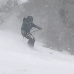
Came into the Signal Peak trail from the Cisco Grove exit. Went in about 4 miles and turned around because of the storm. VERY icy in multiple places. Controlled slides to make it down safely. Looking forward to trying it again!
★
★
★
★

Love Castle Peak, but the north chutes looked like frozen crust today, so we bailed.
★
★
★
★


I left late and did not hike up to the third Lochleven lake. The lower and middle lakes were beautiful with many people fishing. The weather was excellent - clear skies, a gentle breeze and temps in the low 70s.
★
★
★
★

Loved this nice 7-8 mile (out and back total) hike to the rocky overlook of Frog’s Lake.
★
★
★
★
★

My favorite of hikes. 4wheeling to ridge! Trailhead starts at ridge. Not for low clearance or long wheel base vehicles. Views are amazing even with a little smoke .
★
★
★
★
★


 stars
stars
Hot and crowded at this time of year, but the lake at the top of the trail was the perfect temperature for swimming.
★
★
★
★

 stars
stars
It’s a really popular hike with lots of trail traffic. The alpine lakes at the top are worth it. Pretty hot at this time of year, but the temperature of the lake water was perfect.
★
★
★
★
 stars
stars
Wonderful hike. The well used trail displayed abundant wildflowers. Can park .1 mile closer down gravel road to trailhead.
★
★
★
★
★

Well marked trails several lakes and not any people. I hiked this loop midweek.
★
★
★
★
★

Currently closed for the entirety of the 2020 season. Access to the road ends right at Lake Valley Reservoir. Only current way to access Loch Leven Lakes currently is from the trailhead at Big Bend Fire Station.
★
★
★

This was an out-and-back on the PCT to the Peter Grubb Hut, on the flanks of picturesque Castle Peak.
★
★
★
★
★
 stars
stars
A graded ascent all along, with easy switchbacks. The use trail to the summit was only marked by a duck - there used to be a sign and it was was not there in June 2020. The scramble is straighforward, and not too much flat space on top. On June 20, the ranges to the south and south-west were still nicely snowy. There were many snow patches on the trails, all easily passable. Lots of running water in the mid-hike.
★
★
★
★
★
Having intended to take the Hell Hole trail, I was disappointed by ongoing construction on the dam, so I decided to try the Greyhorse trail nearby. Knowing nothing about this trail, I was able to pull up topo and the General direction.
I proceeded to ascend the canyon, never seeing much of a trail, or having confidence that I was following anything but bear trails. (Turned our that’s exactly what I was doing.) I struggled for 3 1/2 hours to keep on the general route and make my way up to the ridge above. In that time I ascended about 1,500 ft in only about two miles of travel.
I have this route a two star rather than just one because the vistas on top of the ridge are breathtaking. To the East, the entirety of Granite Chief scrolls 1000’ down into the canyon and back up to the Pacific Crest Trail beyond. To the west, hills and canyons leading into Hell Hole and the rubicon river headwaters.
★
★
Having intended to take the Hell Hole trail, I was disappointed by ongoing construction on the dam, so I decided to try the Greyhorse trail nearby. Knowing nothing about this trail, I was able to pull up topo and the general direction.
I proceeded to ascend the canyon, never seeing much of a trail, or having confidence that I was following anything but bear trails. (Turned out that’s exactly what I was doing.) I struggled for 3 1/2 hours to keep on the general route and make my way up to the ridge above. In that time I ascended about 1,400 ft in only about two miles of travel.
I gave this route a two star rather than just one because the vistas on top of the ridge are breathtaking. To the East, the entirety of Granite Chief scrolls 1000’ down into the canyon and back up to the Pacific Crest Trail beyond. To the west, hills and canyons leading into Hell Hole and the rubicon river headwaters.
★
★
Awesome views! Snow I shaded areas. Very few people past castle pass and peak. Heavy traffic below castle pass to the peak.
★
★
★
★
★
Easy hike to pools. A lot of snakes at spillway crossings. Very beautiful!
★
★
★
★
★

This is a fun snow run in the winter. The snow can get deep so DO NOT DRIVE ALONE! We drive this trip every year with our Jeep club.
★
★
★
This is a great drive and 4wd is not needed. Plenty of great views along the way. Groundhog Rock was a cool little excursion as well.
★
★
★
★
Lots of water still in lacy creek, not safe to cross. I saw geese, a bald eagle, and two sand hill cranes.
★
★
★
The buttercup flowers in the meadow were amazing. Camis Lilies not in bloom yet. Kinda popular trail some people walking in the sensitive meadow areas.
★
★
★
★
It was a beautiful day today. I passed passed 12 people total. 4 couples, one family, and one lone hiker. The trail was only a little muddy sometimes. The views from the ridge were amazing.
★
★
★
★

This is a road not a trail, but it has a nice steady incline with several vertical rise spots that are challenging.
★
★
★
★

Great hike!! Moderate difficulty. Quiet. No one else on the trail.
★
★
★
★
★
Great hike!! Moderate difficulty. Quiet. No one else on the trail.
★
★
★
★
★
Great hike!! Moderate difficulty. Quiet. No one else on the trail.
★
★
★
★
★

This hike was very beautiful. It gives you a great workout and the result at the top is fantastic!! I highly recommend!!
★
★
★
★
★
Hike was amazing. No trail for the most part. Old Jeep road about the first 1/4 mile then granite with some evidence of people path and some rock stacks.
★
★
★
★
★
Road to Andersson mine is fun. But can’t drive all the way to fordyce lake, it is gated
★
★
★
★
It’s a nice hike & doable for most folks. Dusty in the fall & I have found that this TH is best for getting to lower Loch Leven Lake as it’s TH is very steep, rocky, tree roots, wash outs, etc. caveat is drive out to TH from Yuba Gap. Google doesn’t take you to far enough. It’s about 7.5 miles from the Yuba Gap exit/I80 to Salmon Lake TH. Close to 5.5 miles of it is unpaved. I have a 4-Runner so no problem & I saw a Crosstrek, Highlander & a few other cars at TH so…
Go .3 mi south from Yuba Gap exit, turn right toward Lodgepole campground. At about 1.1 mi further go left on road 19 (unpaved). Drive 4 miles & go left on 38 (I never saw a sign). In about 2 more miles there will be a TH. You must pass Huysink Lake 0.5 mi. TH on left & about 4 parking spaces next to it. Loch Leven & Salmon Lake trails intersect. From that point Lower Loch Leven is only about a mile or so further & better for swimming. Hikers don’t like to swim with the catfish in Salmon Lake & there are a lot of them-small ones however.
★
★
★
★
One of my favorite roads to drive my Jeep when it opens August 1. Not to hard but fun and very beautiful. I love to hike to Tinker Knob from the ridge.
★
★
★
★
★

This is a must do. North to South. Have plan to bailout to the east if you encounter lightning.
★
★
★
★
★


Good views of desolation wilderness,granite chief wilderness, and lake tahoe. Mostly easy fire roads with some fun ohv jeep roads.
★
★
★
Wonderful moderately difficult hike in the Sierra which which is largely in a moderately dense pine forest passing through some small creeks that are easy to cross and then ascends in the last mile above the treeline for the ascent to Castle Peak which is fairly steep and covered with sand and scree near the top. Trrekking poles are helpful here The snow was almost completely gone, mosquitoes were bad in the lower elevations and the wildflowers were incredible, likely near their peak.
★
★
★
★
★
Gentle hike on and off the PCT with great wildflower views. Drive to the Barker Pass trailhead for and extra gentle hike experience. Be prepared for mosquitos in some spots, and snow to mid summer possible. ATV and OHV trails in some spots but we didn’t see any vehicles on the trail this day.
★
★
★
★
★


 stars
stars


 stars
stars