United States
›
California
›
Sierra Azul Open Space Preserve

Best Hiking Trails in Sierra Azul Open Space Preserve

43 reviews


link Copy Link email Email directions Driving Directions

Seasonal Popularity

Overview

Sierra Azul Open Space Preserve is a protected area in California.


Resources

  • openspace.org
  • wikipedia

Land Info

  • Trail Access: Bicycle, Horse

  • Hiking Trails (18)
  • Reviews (43)
  1. 1
    Kennedy Trail (trailhead to Priest Rock Trail junction)
    ★ ★ ★ ★ ★ MODERATE 7.3 mi
  2. 2
    Saint Josephs Hill Loop via Priest Rock Trail
    ★ ★ ★ ★ ★ MODERATE 7.6 mi
  3. 3
    Mount Umunhum Trail (from Bald Mountain parking)
    ★ ★ ★ ★ ★ MODERATE 8.0 mi
  4. 4
    Kennedy Trail from Kennedy Lane in Los Gatos to Lime Kiln Trailhead and back
    ★ ★ ★ ★ ★ DIFFICULT 10.8 mi
  5. 5
    Saint Josephs Hill Loop via Priest Rock Trail and Limekiln Trail
    ★ ★ ★ ★ ★ MODERATE 4.8 mi
  6. 6
    Los Gatos to Almaden Quicksilver
    ★ ★ ★ ★ ★ DIFFICULT 20.4 mi
  7. 7
    Mount Umunhum Summit from Hicks Road
    ★ ★ ★ ★ DIFFICULT 16.2 mi
  8. 8
    Saint Josephs Hill Loop via Kennedy Trail
    ★ ★ ★ ★ DIFFICULT 19.6 mi
  9. 9
    Priest Rock Trail
    ★ ★ ★ EASY 1.4 mi
  10. 10
    Saint Josephs Hill via Limekiln Trail
    ★ ★ EASY 2.0 mi
    user_profile
    NobleZipline9451 4 months, 1 week ago
    Mt Umunhum Hike
    I was expecting this hike to be more exposed, but it was shady most of the way. Awesome scenery!
    ★ ★ ★ ★ ★

    user_profile
    ChillyLedge1173 3 years, 3 months ago
    Full Mount Umamhum
    Lots of people but still good…. Quite shady so good for summer. Great views.
    ★ ★ ★ ★ ★

    user_profile
    LushForest6574 3 years, 6 months ago
    Guadalupe Creek Overlook via Mount Umunhum Trail
    This is a very well maintained and pretty easy hike with amazing views in all directions from the summit, so you have to start early cause it gets crowded. The gate at Hicks Rd opens at 7, so you can’t really start before that, but by 8am Friday morning, the parking by Bald Mountain was almost half full. When we ended our hike a little after 11, the parking was completely filled and cars were parked along the road. 
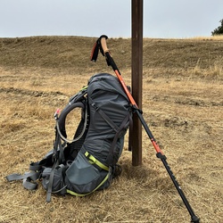
There is no water on the trail, so make sure to carry enough, especially on a hot day. Bathrooms are open at all parking lots, including at the summit.
    ★ ★ ★ ★

    user_profile
    SageCanyon5313 5 years, 1 month ago
    Guadalupe Creek Overlook via Mount Umunhum Trail
    The views are wonderful and the weather was perfect - foggy and cool when I started off in the morning, but it cleared up as I got near the summit. The trail was very well-maintained. Lots of people out but it didn't seem crowded. Interesting exhibits up at the top about the history of the radar station and especially the indigenous peoples of the mountain and their cultures. First time up here and I will be back!
    ★ ★ ★ ★ ★

    user_profile
    Cole Fenger 5 years, 6 months ago
    Mt. Umunhum - Base of Sierra Azul to Summit
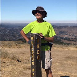
    Intermediate hike from the bottom parking lot at the Sierra Azul entrance to the Radar building at the summit. The way out is gradual fire road uphill with a few steep sections. Once you’re at the top be sure to grab some pictures before heading back the way you came. It’s recommended to arrive early so you can grab a parking spot at the small lot at the entrance. The final section to the summit is a popular tourist spot so be prepared for some crowds that hiked the final section or even drove the whole way to the top.
    ★ ★ ★ ★

    user_profile stars
    Allen B 6 years ago
    Mt. El Sombroso Loop via Woods Trail
    This is a pleasant hike. As of two days ago, the streams were still running and there were a couple of sections where the sound of water created a nice atmosphere. The trail is in great shape, not too dusty. There are some wildflowers in bloom, but not a lot.
    ★ ★ ★ ★

    user_profile
    Tom Margolis 6 years, 1 month ago
    Guadalupe Creek Overlook via Mount Umunhum Trail
    Lot of beautiful views. Not much of a vertical gain but good length. Great workout.
    ★ ★ ★ ★ ★

    user_profile stars
    Jacob Tsabar 7 years, 4 months ago
    After a few days since the last rains, and higher than normal temperatures, the trails are just about dried out. No wildflowers are seen yet along this trail. Climbing the trails to the Priest Rock junction and then many up and down slopes to the Lime Kiln junction. A very good workout hike.
    ★ ★ ★ ★ ★

    user_profile stars
    Allen B 7 years, 4 months ago
    I've hiked this trail four times so far, the latest time in January 2019. This time I arrived at the parking lot at 9:20 a.m. and there were already quite a few cars, about half full. I think it must be pretty busy on a weekend day, especially with good weather. There had been heavy rain two days earlier, with lighter rain the day before, and the trail was in great shape. There were a few spots where water was still draining across the path, but only one area that could be considered muddy, and it was easy to step carefully around it. The path, being new, is a uniform width with room for two people to walk side-by-side. The incline is fairly steady until the stairs at the top and pretty easy for anyone in decent shape. There's a lot of shade along the way, with oak, bay, and madrone trees lining the paths. The park recently released a phone app (get to it from the [park website](https://www.openspace.org/mount-umunhum-sierra-azul)) which has information about the site. The app is designed to be used at the summit, but I listened to it on the way down—either way, I'd recommend it (did you know the Radar antenna rotated every 12 seconds and resulted in an audible beep on radios and TVs in the Valleywhen it was pointed in that direction?) The final segment ​to the summit was closed due to work being done on the tower at the top. The trail is routed through a picnic/interpretive exhibit area, then through the upper parking lot, then to the stairs to the summit. Round trip was just over 2 hours (walking at a pretty good pace) and I had the summit all to myself. An interesting tidbit for this particular day: there was a man in the summit parking lot creating huge bubbles—it was quite a show, especially when the bubbles caught a breeze and sailed up into the sky!
    ★ ★ ★ ★ ★

    user_profile
    ClassyRappel1512 7 years, 5 months ago
    A few good vistas, nice oak grove about half way up. Difficult hike, constant uphill grade
    ★ ★ ★

    user_profile stars
    Allen B 7 years, 7 months ago
    I hiked this at the end of summer. Started out at 7:30 a.m. on a 50ºF morning but there was a warm breeze flowing downhill that made things more comfortable getting started. The walk along the Woods Trail is an easy stretch on a well-maintained, mostly wooded, service road. There's a pretty steep hill when turning on Barlow Road, but it's not that long and once you reach the new Mt. Umunhum Trail the rest of the hike is fairly gently sloped. The entire trip is on easy to hike trails, a little dusty late in the season, primarily tree-covered with occasional views of the valley. Lots of coyote scat on the trail, a few deer in the woods, and while I've seen a bobcat in the past on Barlow Road, there wasn't much wildlife this time. Great view from the summit—as usual—although the air quailty wasn't great for distances and there was a landscaping crew watering plants using an annoying compressor for their hose. My phone tracked 16.8 miles and 2,573' ascent.
    ★ ★ ★ ★

    user_profile
    Honglei 5 months, 2 weeks ago
    Wood trail out
    ★ ★ ★ ★ ★

    user_profile
    Charanjit Dhaliwal 1 year, 4 months ago
    Parking to Bald Mountain
    ★ ★ ★ ★ ★

    user_profile
    ClearCanteen4818 2 years, 1 month ago
    Track (2/28/24, 9:39:34AM)
    ★ ★

    user_profile
    WiseYogaMat9152 2 years, 3 months ago
    Track (2/24/24, 6:02:10AM)
    ★ ★ ★ ★ ★

    user_profile
    LushForest6574 2 years, 4 months ago
    Umunhum (2/1/24, 8:28:48AM)
    ★ ★ ★ ★

    user_profile
    ChillySkis6263 3 years ago
    My umhunum from bald Mtn parking
    ★ ★ ★ ★

    user_profile
    LushForest6574 3 years, 5 months ago
    Guadalupe Creek Overlook via Mount Umunhum Trail and Woods Trail
    ★ ★ ★ ★

    user_profile
    SlimPeak6050 3 years, 9 months ago
    Mount Umunhum Trail, Santa Clara County, CA, USA
    ★ ★ ★ ★

    user_profile
    schoenie1964 4 years ago
    Track (5/16/22, 10:04:14)
    ★ ★ ★ ★ ★

    user_profile
    Taotao Wang 4 years, 1 month ago
    Track (4/23/22, 8:34:33AM)
    ★ ★ ★ ★ ★

    user_profile
    kkhare 4 years, 3 months ago
    Mt Um + Bald Mountain
    ★ ★ ★ ★ ★

    user_profile
    FaintBoulder2813 4 years, 4 months ago
    Mt. Umunhum
    ★ ★ ★ ★ ★

    user_profile
    Walter 4 years, 4 months ago
    Sierra Azul - Missing most of uphill
    ★ ★ ★ ★

    user_profile
    HotBeach1888 5 years ago
    Track (2/15/21, 12:21:56PM)
    ★ ★ ★ ★ ★

    user_profile
    QxUn5p1 5 years ago
    Woods Trail to Barlow Trail - Sierra Azul
    ★ ★ ★

    user_profile
    BusyAurora6488 5 years, 1 month ago
    My Um from parking lot
    ★ ★ ★ ★

    user_profile
    BumpySpruce2243 5 years, 3 months ago
    My Umunhum Peak from Bald Mountain
    ★ ★ ★ ★ ★

    user_profile
    PeachyWBottle2165 5 years, 4 months ago
    Bald Mountain
    ★

    user_profile
    RichBinos4320 5 years, 5 months ago
    Mt. El Sombroso
    ★ ★ ★ ★ ★

    user_profile
    jennkeohane 5 years, 5 months ago
    Jaques Ridge parking area, Santa Clara County to 10000 Alma Bridge Road, Los Gatos, CA, USA
    ★ ★ ★ ★

    user_profile
    Rick 5 years, 6 months ago
    Mount Umunhum (11/26/20, 11:00:30AM)
    ★ ★ ★ ★ ★

    user_profile
    HotBeach1888 5 years, 6 months ago
    Mount Umunhum Trail to Almaden Air Force Station (historical), Santa Clara County, CA, USA
    ★ ★ ★ ★ ★

    user_profile
    Luis 5 years, 6 months ago
    Mt. El Sombroso Loop via Woods Trail
    ★

    user_profile
    bnaden 5 years, 8 months ago
    Track (5/13/20, 7:18:28AM)
    ★ ★ ★ ★ ★

    user_profile
    Jec Ballou 5 years, 10 months ago
    Mt Umunhum
    ★ ★ ★ ★ ★

    user_profile
    StillThicket7992 6 years ago
    Track (5/29/20).
    ★ ★ ★ ★ ★

    user_profile
    Mike Mo 6 years ago
    Guadalupe Creek Overlook via Mount Umunhum Trail
    ★

    user_profile
    BusyAurora6488 6 years ago
    Summit Mt Umunhum
    ★ ★ ★ ★ ★

    user_profile stars
    Allen B 6 years, 4 months ago
    Guadalupe Creek Overlook Loop via Mount Umunhum Trail
    ★ ★ ★ ★ ★

    user_profile
    WarmHail9610 6 years, 5 months ago
    Track (1/1/20, 2:11:15PM)
    ★ ★ ★ ★ ★

    user_profile
    Jeffrey Frenster 6 years, 9 months ago
    Guadalupe Creek Overlook via Mount Umunhum Trail and Woods Trail
    ★ ★ ★ ★

    user_profile
    Jeffrey Frenster 6 years, 10 months ago
    Guadalupe Creek Overlook via Mount Umunhum Trail
    ★ ★ ★ ★