meta

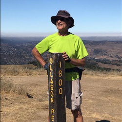
Mount Umunhum Summit from Hicks Road

based on 90 tracks & routes #7 hike out of 21 in
16.2 mi
Distance
7 hrs 24 min
Time
terrain
2,169 ft
Elev Gain

Overview

This is a moderate out and back trail to the summit of Mt. Umunhum with Guadalupe Creek Overlook along the way in Sierra Azul Open Space Preserve. The first half consits of well-maintained service roads, the second half is the new Mt. Unumhum hiking trail. Mountain bikes are allowed on both. There's a lot of tree cover along the way, with views of Santa Clara Valley from time-to-time. Great 360º view at the top.
There is no water available on this trail, so be sure to bring enough, especially on hot days. There are seasonal creeks you can filter, but these are not dependable water sources most of the year.

Getting Started

There's a parking lot for Sierra Azul Open Space on Mt. Umunum Road at Hicks Road. Restroom facilities. Trail starts at coordinates 37.175360, -121.864280.

Taking Children

Easy enough trail for all ages, the distance is the biggest factor in making this difficult for children.


    Rate this Hike

    user_profile stars
    5 years, 6 months ago
    I hiked this at the end of summer. Started out at 7:30 a.m. on a 50ºF morning but there was a warm breeze flowing downhill that made things more comfortable getting started. The walk along the Woods Trail is an easy stretch on a well-maintained, mostly wooded, service road. There's a pretty steep hill when turning on Barlow Road, but it's not that long and once you reach the new Mt. Umunhum Trail the rest of the hike is fairly gently sloped. The entire trip is on easy to hike trails, a little dusty late in the season, primarily tree-covered with occasional views of the valley. Lots of coyote scat on the trail, a few deer in the woods, and while I've seen a bobcat in the past on Barlow Road, there wasn't much wildlife this time. Great view from the summit—as usual—although the air quailty wasn't great for distances and there was a landscaping crew watering plants using an annoying compressor for their hose. My phone tracked 16.8 miles and 2,573' ascent.
    ★ ★ ★ ★

    user_profile
    1 year, 4 months ago
    ★ ★ ★ ★

    user_profile
    4 years, 7 months ago
    ★ ★ ★ ★


Public Tracks

user_profile
MR94 1 week, 5 days ago
user_profile
clusterflux 3 years, 6 months ago
user_profile
jec 3 years, 9 months ago
user_profile
ks4012013 4 years, 2 months ago
user_profile
rogersgh 4 years, 7 months ago
user_profile
sirus6 4 years, 9 months ago
user_profile stars
Allenb 4 years, 10 months ago
user_profile
4danil 5 years, 5 months ago
user_profile stars
Allenb 5 years, 6 months ago
user_profile
Shurik 5 years, 6 months ago
user_profile
Shurik 5 years, 7 months ago
user_profile
Jeffrey Frenster 5 years, 9 months ago
user_profile
billandlisa2 5 years, 11 months ago
user_profile stars
Jacob 5 years, 11 months ago
user_profile stars
Jacob 5 years, 11 months ago
user_profile
sfnicolas 6 years, 5 months ago
user_profile stars
Allenb 6 years, 6 months ago