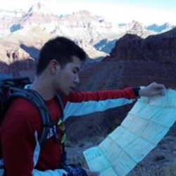
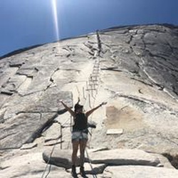
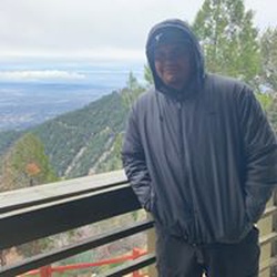
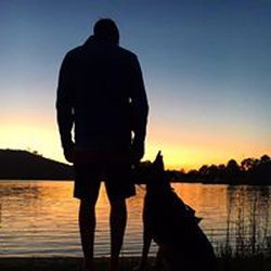
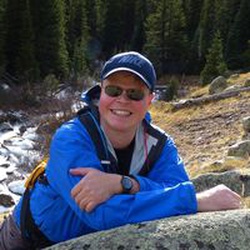
Rae Lakes loop was a stunning 3 night backpack. The weather and sun exposure was the biggest downfall, we were told we had a heat wave. Expected much cooler temps at 10K ft of elevation, but we guessed it was 80-90 Fahrenheit the week of August 10th 2025. Overall, fantastic hike….prepare for the sun and heat.
★
★
★
★
★

Utterly gorgeous morning hike after camping at Potwisha Campground
★
★
★
★
★

This is not a trip for newcomers. A very beautiful but challenging section of the Sierras. My group was going against the direction of PCT’ers of which we met many on our journey. I highly recommend this trail, but maybe a month later in the season to allow more snow to melt on Forrester pass.
★
★
★
★
★

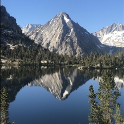
Glorious day hike to gorgeous granite lake … it was somewhat circular, but we much preferred the return route via the Watch Tower!
★
★
★
★
★

Solo hike over 5 days in mid September 2024 - first night at Upper Paradise Valley -- established sites were way too close to the trail and to each other. I tramped off trail for a while to find something secluded but then couldn't have a fire. The river is especially pretty here with beautiful pools for swimming. Fishing was great.
Second night at Arrowhead Lake - this day was a bit of a slog uphill after the bridge. Nuts to butts on the JMT here - very busy part of the trail. The hike along Woods Creek is very pretty and gentle; once over the bridge and heading south it gets a bit steeper. I was racing rain and was happy to get to Arrowhead before the rain got too bad. I definitely recommend Arrowhead over Dollar. Pretty sites at Arrowhead and fishing once again amazing.
I only hiked about a mile the third day - I wanted to maximize my time in the valley and enjoy some time relaxing. Hiked just the bit to Middle Rae and scored the best site on the lake early in the am after the people before me moved on. Absolutely gorgeous lake with incredible views, especially at sunset and sunrise. Fishing incredible again - for a while I'd catch a fish every cast for a stretch of ~20 casts or so. Those fish are hungry!!
I got an early start the next morning to get over Glen Pass before it got too hot. It's a push but really not bad at all. The switchbacks are fairly gentle. After the tarns, you'll have 29 switchbacks to the top. No sweat!
Once over, it's quite literally all downhill from there. The climb down is steep, but once past Charlotte, the climb down to Vidette Meadows is even steeper. Glad I wasn't going the other way. I camped at Junction Meadows - once again they've packed all the established sites right next to each other. It's very pretty but I wish they had spread the campsites around a bit. The river here (Bubbs) wasn't quite as good for fishing and swimming was a bit tougher as the river is faster without the nice deep quiet pools of Woods Creek.
The last day I did the ~8 miles (easy fast downhill) to the car. Easy hike and got to my car in just over 3.5 hours.
No bears, great weather, amazing fishing, all good. My only complaint is that the established campsites are too dang close to the trail and to each other.
But amazing loop nonetheless.
★
★
★
★
★

Great hike uphill to heather lake with a nice cold plunge reward
★
★
★
★
★


Solo day hiked Fri 10/27/2023 – Early start with the moon at 98% full power and a lot of howls and movement in the bushes (made me think of “Night at the Museum”). Veered directly west off the BP Trail halfway between Saddlerock & Bishop Lakes and skirted the north shore of Bishop Lake. Picked up a use trail just before the surveyor’s cabin and followed it SSW as it climbed to the base of the east face of Mt. No Goode without having to bushwhack along the way. Decided to climb the vertical headwall south of No Goode for extra fun to get up on the ridge-line and catch the warmth of the sun when it eventually rose up over Mt. Agassiz. It was a cold start to this hike with 2 Merino base layers, soft shell and hand warmers in mid wt. gloves but warm after 15 minutes of moving. The talus was surprisingly stable going up to and along the ridge-line, a welcome break compared to recent weeks ascending the chutes of Agassiz and Picture Puzzle. Great fun on the ridge from Mt. No-Goode to Goode Pass and Mt. Goode including going up and down the high points in between (not really false summits). The views from both summit pairs were fantastic as the cloud line remained high enough to get a 360° panorama of all the prominent peaks. Down climbed the larger rocks heading SE until picking up the SE use trail which I followed all the way back to the BP Trail, although it disappeared at times in the meadow grass when approaching the lakes. Easy to avoid the snow but I insisted on crossing the NE chute before the base and found it to be very firm for mid-day. A few of the shallower streams were frozen over and some slippery slabs/rocks with the ice forming thicker verglas layers but the afternoon still brought T shirt weather with it. A really fun class 2/3 route where you can add class 4 on the west ridge side if you get bored. BP Trail itself is very scenic (in the daylight) and now is a great time to see the fall colors before the snow comes. Just bring extra layers and warm gloves for the morning! Logged 11.8 miles/3569 vertical ft. with Gaia ____________________________________________________________________________________________________________________________________________ Solo day hiked Fri 10/20/2023 – Spent the night at Forks campground and was lucky enough to see the Orionid meteor shower. Early hike out to Ruwau Lake and then up the north face of Picture Puzzle. Went too far west and was climbing class 4 too early so back east (towards Cloudripper) and up the bigger north chute talus field to the right of the snow. Crossed to the left side of the chute near the top of the ridge and ran into a flock of mountain chickadees picking through the snow. The talus was fun to climb but more unstable than even Agassiz with some of the largest boulders frequently moving in spite of careful hold placement/testing. The few sliding scree sections were ridiculous to cross but the snow was good and the ice not too bad. Took the ledges around the pinnacles and climbed up the last one just north of the summit notch. Descended down to the NE couloir /notch after trying a few different routes and took off my pack for the last summit climb. Found 2 great chimneys that started from a point 30 feet down the notch’s west chute to start up the real summit which was a much easier ascent than what it looked like from the notch. Views from the summit were spectacular with the wind just starting up. Summit register was an empty water bottle with a note pad and a golf tee but no pen. The down climb was long and uneventful until a 3 x 4 boulder dislodged and rolled about 50 feet downward which added some real excitement and had me snugging my helmet straps. Got back to Ruwau Lake and hiked up Chocolate Peak which was well worth the views from the top. Took the Chocolate Lakes Loop back to Bishop Pass to finish off another day of awesome hiking/climbing weather. Highly recommend Picture Puzzle for the scramble/climb/views and Chocolate Peaks for the hike/views. Logged 10.5 miles/4103 vertical ft. with Gaia _________________________________________________________________________________________________________________________________________ Solo hiked Thurs 10/5/2023 – Plenty of shooting stars on the way to Agassiz with a bright moon. Early start snow climbing the first 1500 ft. of Mt. Agassiz R/H west chute with axe and crampons until the snow wouldn’t hold. Then on to the SW rocks/slabs to the summit which was great fun and fast, good holds even with some ice and more snow from last week than I planned on. Spent an hour taking in the incredible views from the summit before heading down. Since the snow in the chute was unstable/unconsolidated with a few 1 foot diameter pinwheels mid slope and the warming weather, I decided not to descend on it. And so the rock down climbing trek began with choosing the steepest slope to right of the chute to try and make it down faster (larger down steps). It was fun for the first 1000 feet but just tiring for the last 1000. I would recommend waiting for either winter climbing snow or dry rocks as the snow and ice on the rocks dragged out a simple down climb. Couldn't resist trying to glissade the last 200 feet but the snow was too soft. Went out south past Bishop Pass to a Dusy Basin overlook to recover with an 1-1/2 hour lunchbreak before heading down to Bull Lake for another stop to enjoy perfect October weather for a bit. Longer day than I planned on but really enjoyed the trail on the way out. If you decide to go up the Agassiz, it needs a new summit canister as the current one is a cracked plastic container that was full of snow. I let the note pad dry for an hour before putting it in a few vented zip lock bags I had but the canister is useless. Logged 13.7 miles/4139 vertical ft. with Gaia
★
★
★
★
★

Incredible hike. Great views and lakes.
Great alpine views considering how relatively easy access it is to get in from a distance perspective. Usually you have to trek in many more miles to be rewarded with the scenery this hike has.
★
★
★
★
★


Well marked and maintained Trail even through the KNP fire scar. The last mile or so is a slog be prepared. Beautiful lakes well worth the trek.
★
★
★
★
★

Hiked up to junction meadows saw 2 bears. Set up camp in rain second night. Made the decision to turn around day 3 and hike out. Met lots of nice backpackers.
★
★
★
★
★

Cool casual hike super easy trail to follow and worth the view,seen a fawn and mule train on the way up,rain and Thunder o my return which I liked 🙂 fun hike
★
★
★
★

Very nice trail, loved it! Moderate ascent and beautiful lakes. Tip: Take the walk to the last lake too and jump in!
★
★
★
★
★


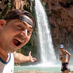
Great trail! Sandy, not too much elevation gain, beautiful views of the canyon, and an amazing falls at the end. Very peaceful. Saw a small black bear and her two cubs.
★
★
★
★
Trail is not maintained. Lots of fallen trees across the trail. Not fun to jump over w backpack.
★
★
The views are beautiful but this is a grueling hike. It is up hill all the way, so be prepared to be a lot slower than on normal hikes, especially as you reach the point to climb to Kearsarg Pass.
★
★
Excellent Hike easy to follow and stunning vistas from start to finish if weather conditions are positive,plenty of water, creek crossing galore all doable not as much flow as previous years,GWD,Hamilton,Precipice,K Gap,Arroyo,Kern,etc all great to see,bear box’s,water,tree cover etc all great only pain is the Mosquitoes.don’t over pack your load 25,30lb backpack works, enjoy
★
★
★
★
★
This was a steady climb through the trees until we reached the watchtower. The watchtower is a stunning view point and great rest stop. After that the trail is along a granite slope with constant stunning views! The steady ascent made it feel less tiring than expected but now that I’m at Pear Lake I can tell that I’m very tired.
★
★
★
★
★

Nice hike not a lot of technical hiking. Bears often in the area in the meadows in spring.
★
★
★
★
Very challenging: smoky air, hot, terrain and altitude. We had a bright full moon, only bugs were annoying knats ! We found good camp sites, respectful people. Most sections had water to filter. Signs everywhere about active, sneaky bears,. Saw and heard about bears but no issues. We used a bearacaide and carried nothing smelly outside the can. Leave no trace!!!! My first solo backpack down. Beautiful vistas, lakes and mountains.
★
★
★
★
★

After Alta meadows it is all bushwhacking of trail. While chasing the single tree on ridge line you will pass two chutes and turn left on third shoot. On ridge you can see jagged rock pullers. On right just below jagged rocks is moose lake.
★
★
★


Great hike through mature pine forests, Sequoia groves, and high alpine meadows. However trying to connect the Alta Meadows Trail via Moose Lake to Pear Lake is ill advised due to significant bouldering required past the end of the Alta Meadows Trail.
Beautiful ideal if views from Alta Meadow East to Mount Whitney, and Southeast down the Kiaweha River valley to the foothills and Central Valley beyond.
Hiked with Brian Mahler on this trip in June 2021. Pleasant weather and plenty of water sources.
★
★
★
★

This hike is semi demanding. Climbing nearly the entire time but the Redwoods and Sequoias along the way are spectacular. The path is well defined and easy to navigate.
★
★
★
★
★
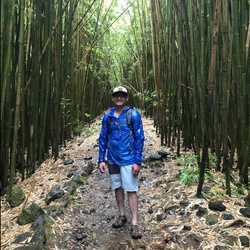
For deep canyons and mountain streams, this was one of the most beautiful hikes I have ever seen.
★
★
★
★
★

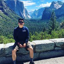
Light trail that leads to an awesome camping spot that overlooks The Valley.
★
★
★
★
 stars
stars
See my description above. Great moderate hike to an Alpine Lake.
★
★
★
★

Awesome hike, we just hike it on July 16. What an amazing place. Bring plenty of water or water filter.
★
★
★
★
★

 stars
stars

A 5day father/offspring challenging route turned into a 4day (when 3rd hiker opted out); then we sped up and pulled successively high mileage days of 11, 16, 20, and 20.
In retro, last nite at Tyndall Cr (or atop Shepherd given stellar weather) or Anvil Camp would be wiser moves.
When you’re worn out — rest — don’t speed up unless you’re crazy.
★
★
★
★
 stars
stars