Bishop Pass
11.9 mi
Distance
6 hrs 8 min
Time
terrain
3,235 ft
Elev Gain
Overview
This is a difficult one way trail in Kings Canyon National Park.
This trail goes by Spearhead Lake, Timberline Tarns, and Bishop Pass.
Rate this Hike
★★★★★

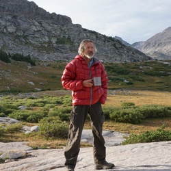
Solo day hiked Fri 10/27/2023 – Early start with the moon at 98% full power and a lot of howls and movement in the bushes (made me think of “Night at the Museum”). Veered directly west off the BP Trail halfway between Saddlerock & Bishop Lakes and skirted the north shore of Bishop Lake. Picked up a use trail just before the surveyor’s cabin and followed it SSW as it climbed to the base of the east face of Mt. No Goode without having to bushwhack along the way. Decided to climb the vertical headwall south of No Goode for extra fun to get up on the ridge-line and catch the warmth of the sun when it eventually rose up over Mt. Agassiz. It was a cold start to this hike with 2 Merino base layers, soft shell and hand warmers in mid wt. gloves but warm after 15 minutes of moving. The talus was surprisingly stable going up to and along the ridge-line, a welcome break compared to recent weeks ascending the chutes of Agassiz and Picture Puzzle. Great fun on the ridge from Mt. No-Goode to Goode Pass and Mt. Goode including going up and down the high points in between (not really false summits). The views from both summit pairs were fantastic as the cloud line remained high enough to get a 360° panorama of all the prominent peaks. Down climbed the larger rocks heading SE until picking up the SE use trail which I followed all the way back to the BP Trail, although it disappeared at times in the meadow grass when approaching the lakes. Easy to avoid the snow but I insisted on crossing the NE chute before the base and found it to be very firm for mid-day. A few of the shallower streams were frozen over and some slippery slabs/rocks with the ice forming thicker verglas layers but the afternoon still brought T shirt weather with it. A really fun class 2/3 route where you can add class 4 on the west ridge side if you get bored. BP Trail itself is very scenic (in the daylight) and now is a great time to see the fall colors before the snow comes. Just bring extra layers and warm gloves for the morning! Logged 11.8 miles/3569 vertical ft. with Gaia ____________________________________________________________________________________________________________________________________________ Solo day hiked Fri 10/20/2023 – Spent the night at Forks campground and was lucky enough to see the Orionid meteor shower. Early hike out to Ruwau Lake and then up the north face of Picture Puzzle. Went too far west and was climbing class 4 too early so back east (towards Cloudripper) and up the bigger north chute talus field to the right of the snow. Crossed to the left side of the chute near the top of the ridge and ran into a flock of mountain chickadees picking through the snow. The talus was fun to climb but more unstable than even Agassiz with some of the largest boulders frequently moving in spite of careful hold placement/testing. The few sliding scree sections were ridiculous to cross but the snow was good and the ice not too bad. Took the ledges around the pinnacles and climbed up the last one just north of the summit notch. Descended down to the NE couloir /notch after trying a few different routes and took off my pack for the last summit climb. Found 2 great chimneys that started from a point 30 feet down the notch’s west chute to start up the real summit which was a much easier ascent than what it looked like from the notch. Views from the summit were spectacular with the wind just starting up. Summit register was an empty water bottle with a note pad and a golf tee but no pen. The down climb was long and uneventful until a 3 x 4 boulder dislodged and rolled about 50 feet downward which added some real excitement and had me snugging my helmet straps. Got back to Ruwau Lake and hiked up Chocolate Peak which was well worth the views from the top. Took the Chocolate Lakes Loop back to Bishop Pass to finish off another day of awesome hiking/climbing weather. Highly recommend Picture Puzzle for the scramble/climb/views and Chocolate Peaks for the hike/views. Logged 10.5 miles/4103 vertical ft. with Gaia _________________________________________________________________________________________________________________________________________ Solo hiked Thurs 10/5/2023 – Plenty of shooting stars on the way to Agassiz with a bright moon. Early start snow climbing the first 1500 ft. of Mt. Agassiz R/H west chute with axe and crampons until the snow wouldn’t hold. Then on to the SW rocks/slabs to the summit which was great fun and fast, good holds even with some ice and more snow from last week than I planned on. Spent an hour taking in the incredible views from the summit before heading down. Since the snow in the chute was unstable/unconsolidated with a few 1 foot diameter pinwheels mid slope and the warming weather, I decided not to descend on it. And so the rock down climbing trek began with choosing the steepest slope to right of the chute to try and make it down faster (larger down steps). It was fun for the first 1000 feet but just tiring for the last 1000. I would recommend waiting for either winter climbing snow or dry rocks as the snow and ice on the rocks dragged out a simple down climb. Couldn't resist trying to glissade the last 200 feet but the snow was too soft. Went out south past Bishop Pass to a Dusy Basin overlook to recover with an 1-1/2 hour lunchbreak before heading down to Bull Lake for another stop to enjoy perfect October weather for a bit. Longer day than I planned on but really enjoyed the trail on the way out. If you decide to go up the Agassiz, it needs a new summit canister as the current one is a cracked plastic container that was full of snow. I let the note pad dry for an hour before putting it in a few vented zip lock bags I had but the canister is useless. Logged 13.7 miles/4139 vertical ft. with Gaia
★
★
★
★
★


Public Tracks


 stars
stars

 stars
stars